Warford Hall Drive
Alderley Edge, SK9, SK9 7TR
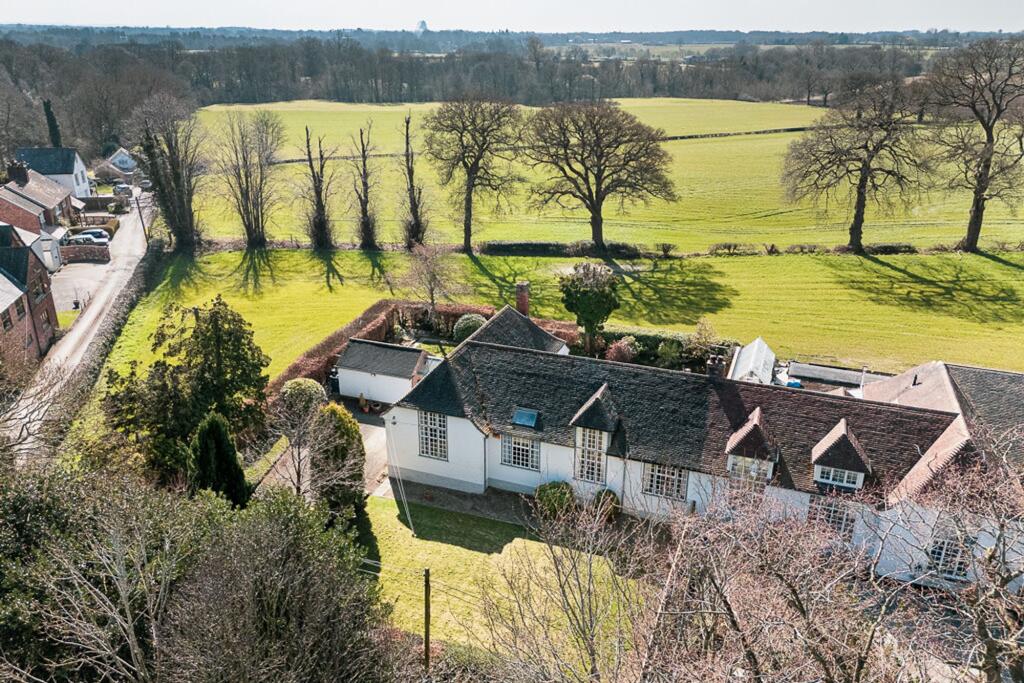
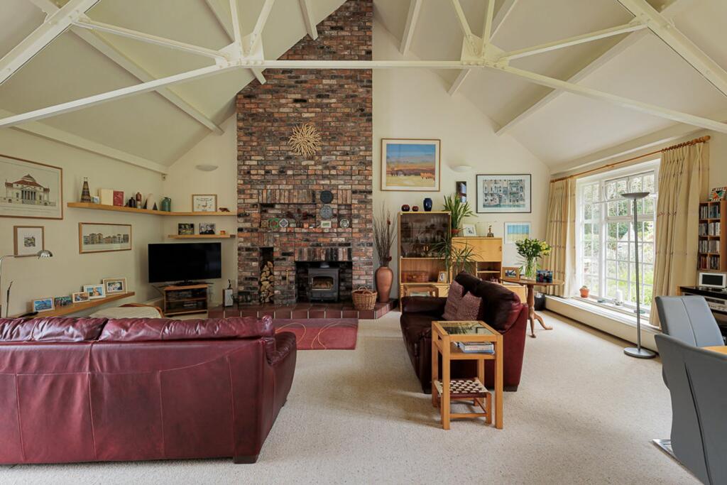
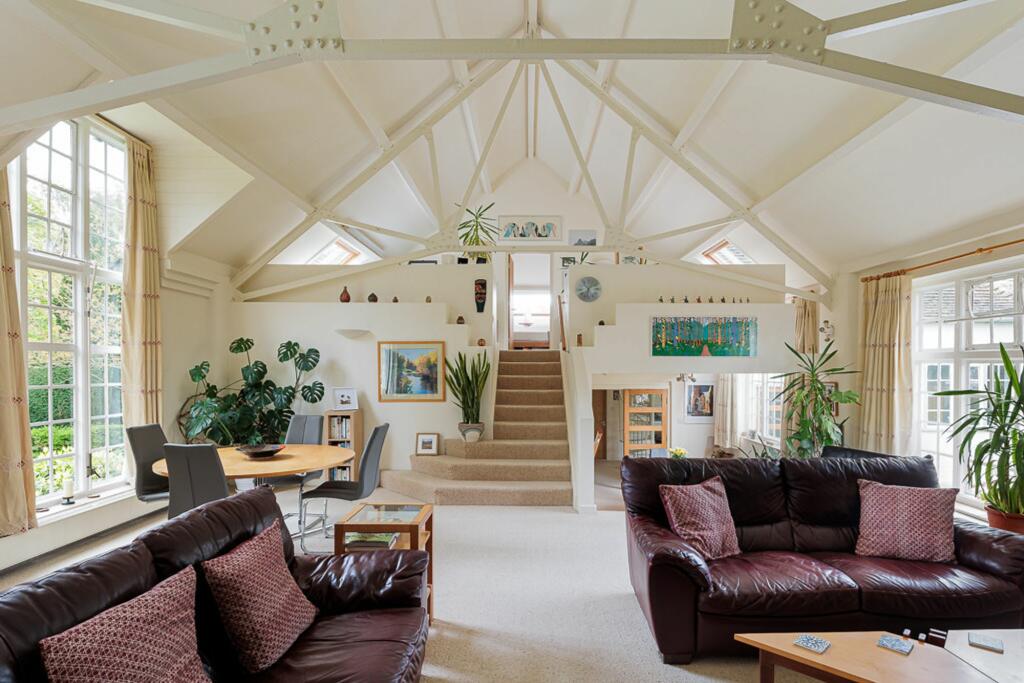
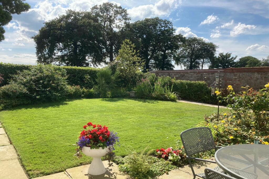
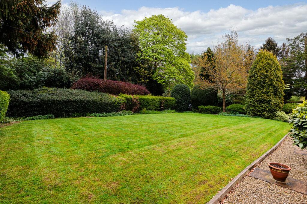
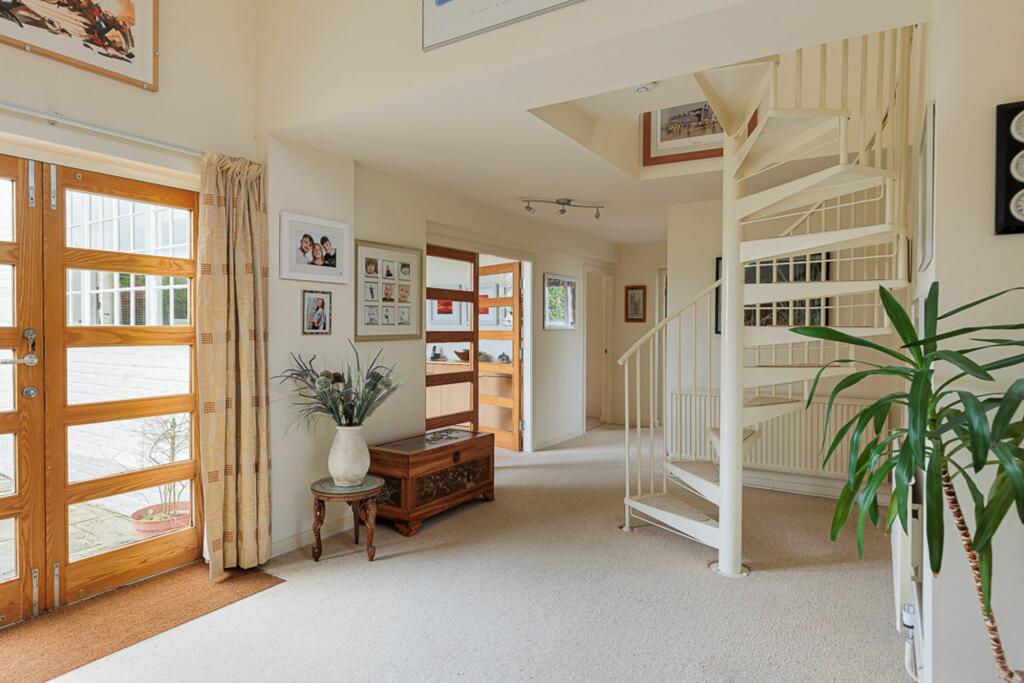
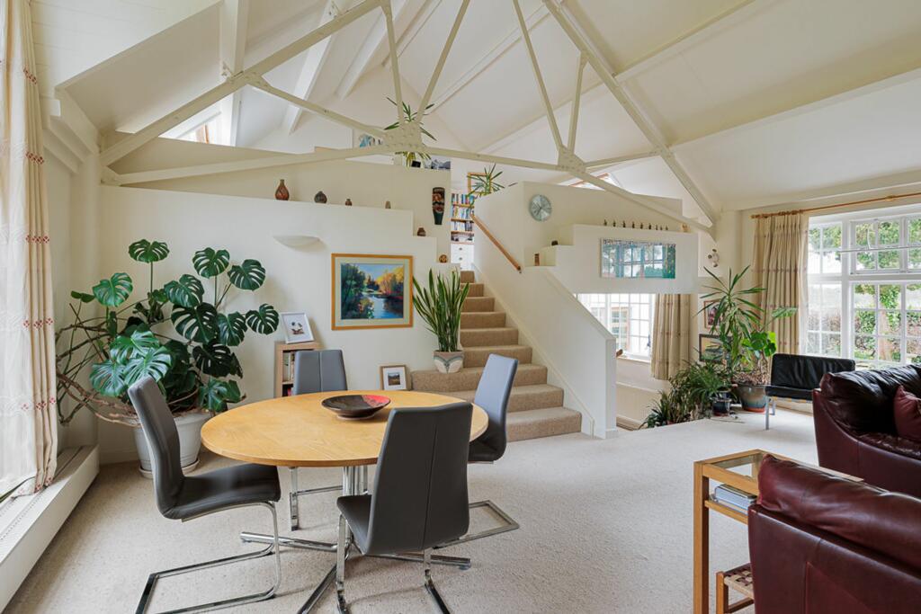
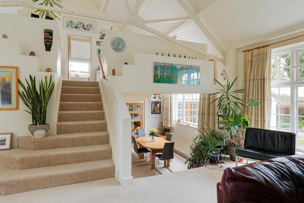
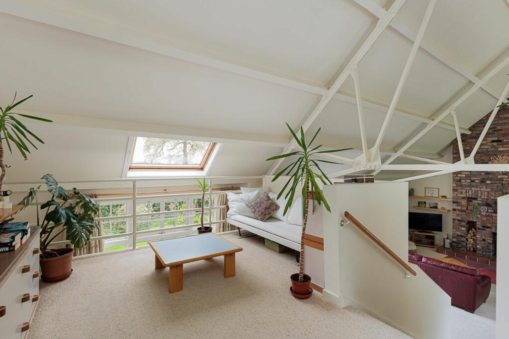
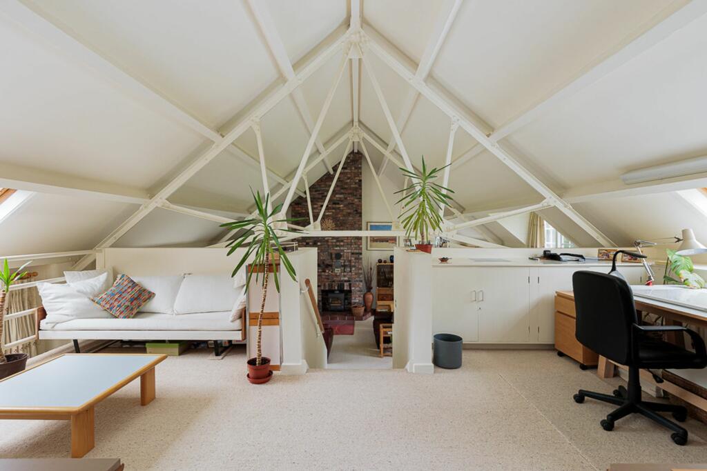
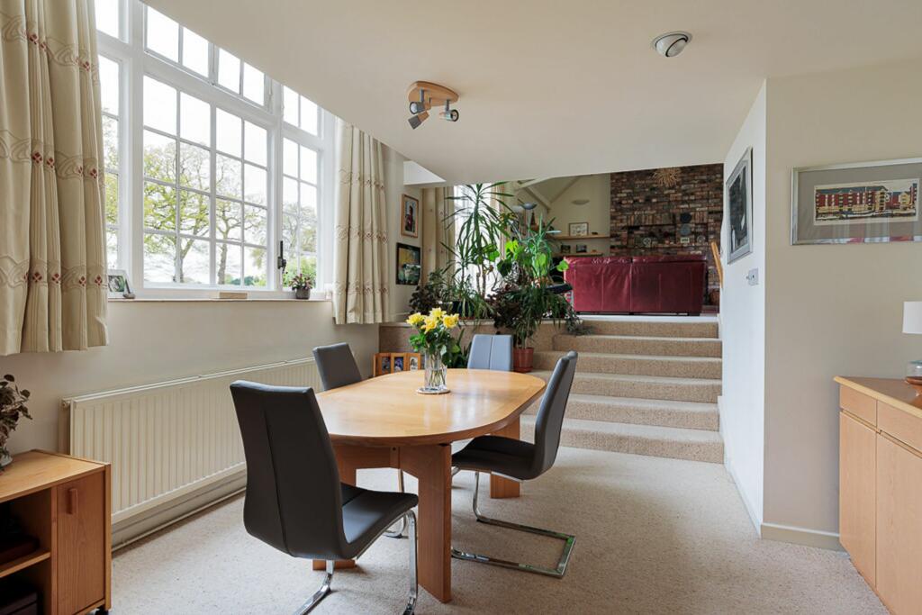
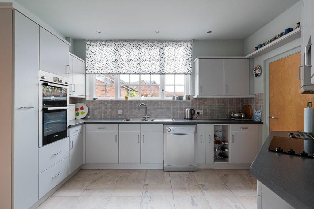
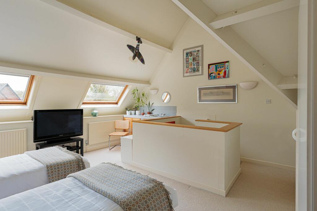
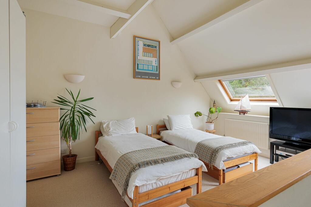
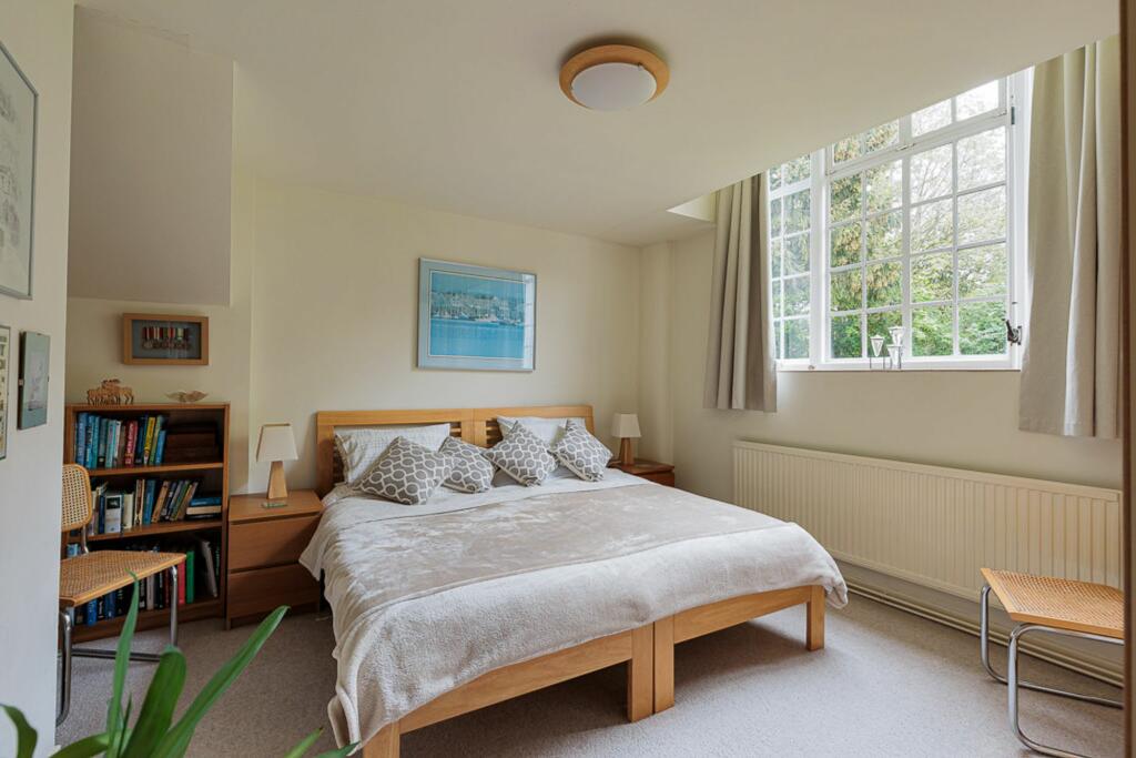
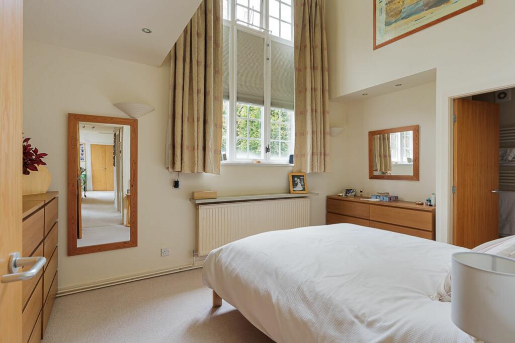
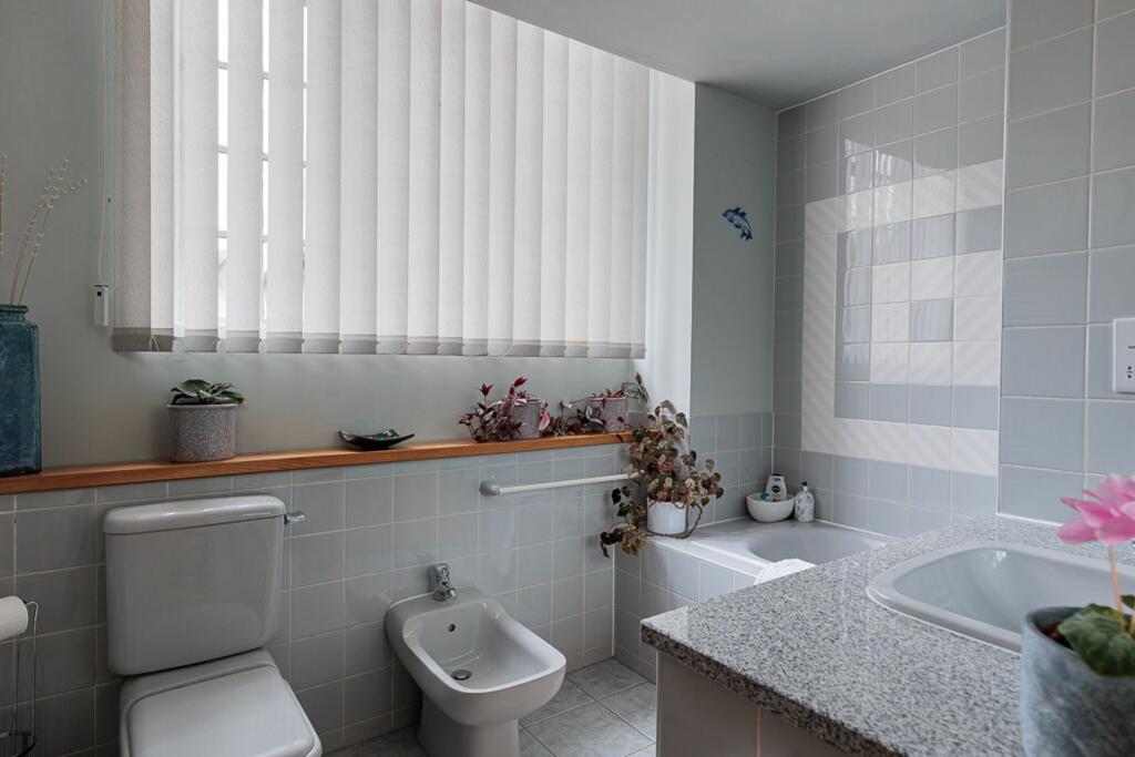
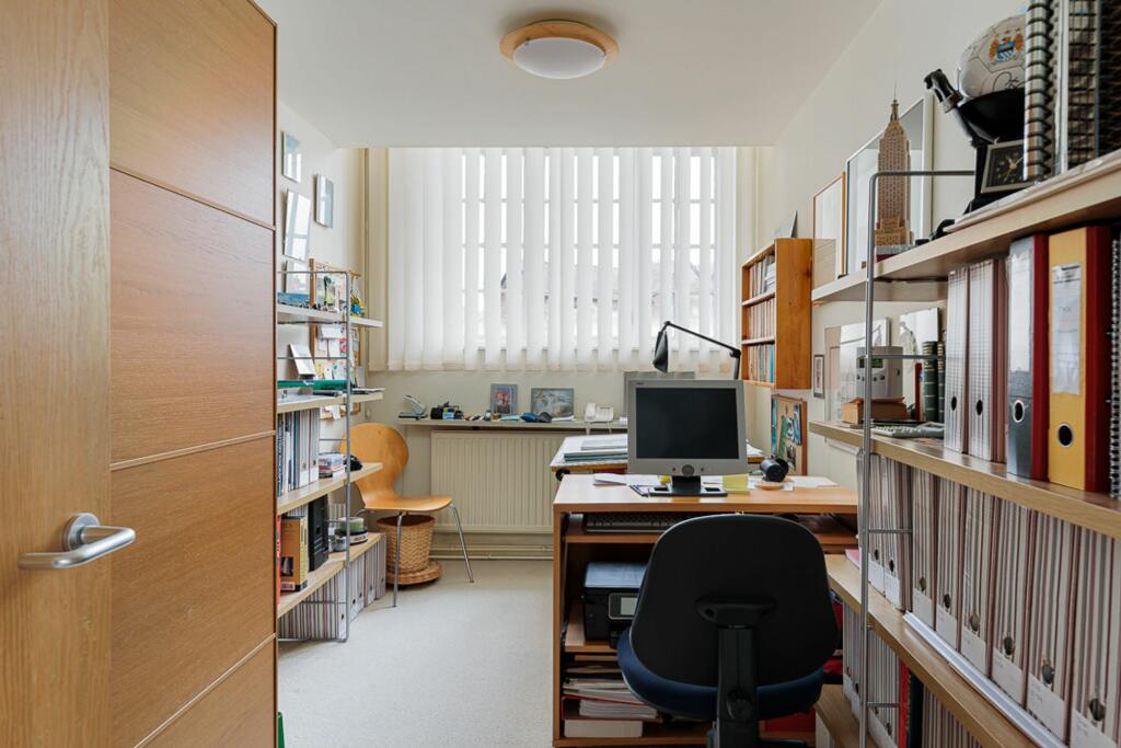
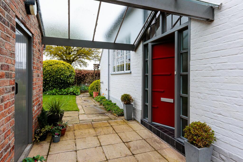
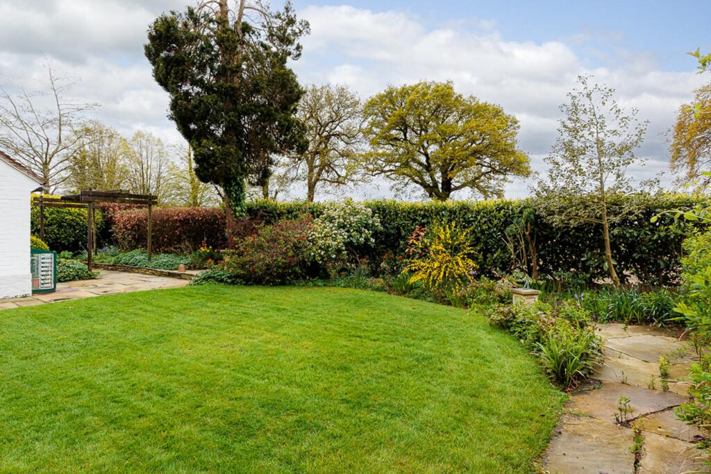
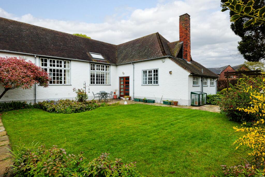
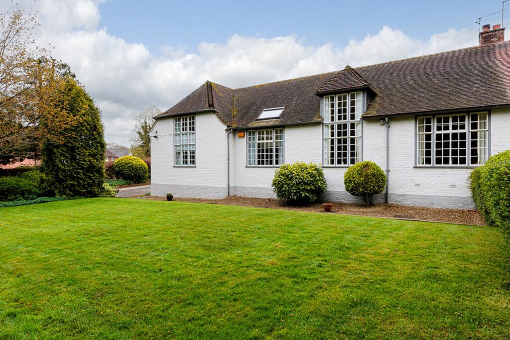
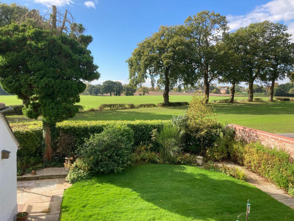
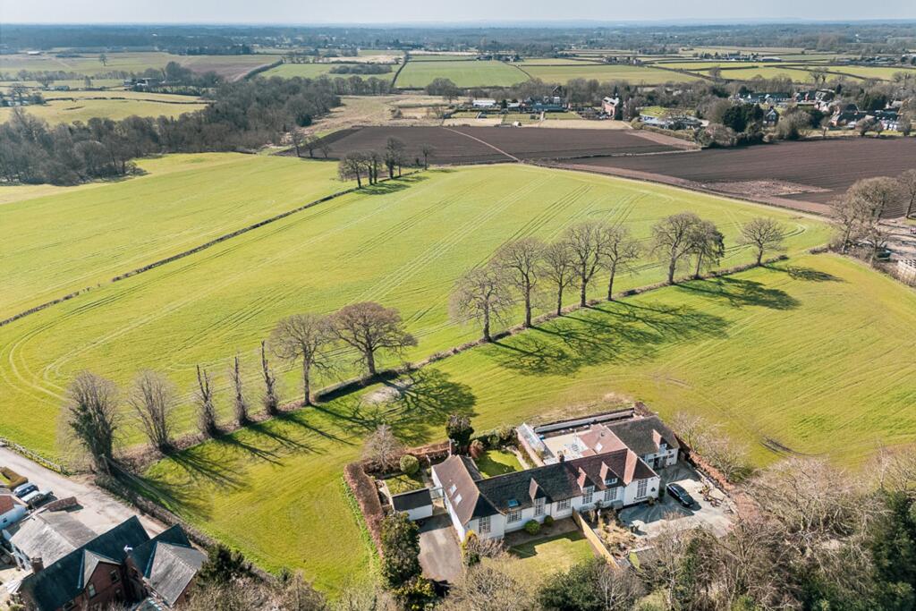
Photo 1 Photo 2 Photo 3 Photo 4 Photo 5 Photo 6 Photo 7 Photo 8 Photo 9 Photo 10 Photo 11 Photo 12 Photo 13 Photo 14 Photo 15 Photo 16 Photo 17 Photo 18 Photo 19 Photo 20 Photo 21 Photo 22 Photo 23 Photo 24
/ 24
Property details
Tenure
FREEHOLD
Council tax band
F
Local average
£478,220 (+108.1%)
Deprivation
Decile 9 (28,188 of 33,755)
Street crime
2 incidents within 1 mile (Apr 2026)
Key features
- Wonderfully light and spacious accommodation with great flexibility and potential
- More than 2400 square feet of accommodation with potential for extension, subject to planning
- A substantial plot with a selection of mature foliage and stunning far-reaching views
- Semi-rural feeling location just five minutes from Alderley Edge and 10 minutes from Knutsford
- Four generously proportioned bedrooms and two bathrooms with good flexibility
- An unique semi-detached home, formerly a school house believed to be built in the late 1930's
Additional details
- Parking
- Driveway
- Garden
- Private garden
- Restrictions
- No
- Rights of way
- No
- Flooded in last 5 years
- No
- Flood defences
- No
Description
The expansive plot is adorned with a variety of mature foliage, creating a tranquil oasis that offers stunning far-reaching views, making it easy to unwind in style. There is ample room for outdoor gatherings, children's play, or simply enjoying the fresh air in total privacy. The surrounding landscape offers a peaceful retreat from the hustle and bustle of every-day life, making it an ideal spot to enjoy leisurely strolls or al fresco dining with loved ones. The close proximity to the vibrant communities of Alderley Edge and Knutsford ensures convenient access to a range of amenities, restaurants, and shops, while also offering a serene escape from urban life. With its unique blend of character, space, and potential, this captivating home is a rare find that promises a truly exceptional living experience for those with discerning taste.
EPC Rating: E
Listed by
Knutsford
Stuart Rushton & Co
Reference: 147322898
EPC ratings on this postcode
We don't have a matched EPC for this property yet. Below are efficiency scores and details for other addresses on this postcode.
| Address | Current | Potential | Floor area | Age band | Type |
|---|---|---|---|---|---|
| 2 Warford Hall Drive | 57 | 106 | 91 m² | England and Wales: 1930-1949 | House |
| 2 Warford Hall Drive, ALDERLEY EDGE | 57 | 106 | 91 m² | England and Wales: 1930-1949 | Detached |
| Ashby House, Warford Hall Drive | 66 | 74 | 274 m² | England and Wales: 1900-1929 | House |
| Ashby House, Warford Hall Drive, ALDERLEY EDGE | 66 | 74 | 274 m² | England and Wales: 1900-1929 | Detached |
| Greencote, Warford Hall Drive | 56 | 61 | 318 m² | England and Wales: 1930-1949 | House |
| Jutland Cottage, Warford Hall Drive | 63 | 65 | 107 m² | England and Wales: 1996-2002 | House |
| Kintsugi, Warford Hall Drive, ALDERLEY EDGE | 66 | 76 | 321 m² | England and Wales: 1930-1949 | Detached |
| Marion Brook House, Warford Hall Drive | 62 | 88 | 276 m² | England and Wales: 1900-1929 | House |
| Marion Brook House, Warford Hall Drive | 58 | 78 | 276 m² | England and Wales: 1900-1929 | House |
| Marion Brook House, Warford Hall Drive | 65 | 77 | 276 m² | England and Wales: 1900-1929 | House |
| Marion Brook House, Warford Hall Drive | 62 | 88 | 276 m² | England and Wales: 1900-1929 | House |
| Marion Brook House, Warford Hall Drive | 58 | 78 | 276 m² | England and Wales: 1900-1929 | House |
| Marion Brook House, Warford Hall Drive, ALDERLEY EDGE | 58 | 78 | 276 m² | England and Wales: 1900-1929 | Detached |
| Marion Brook House, Warford Hall Drive, ALDERLEY EDGE | 62 | 88 | 276 m² | England and Wales: 1900-1929 | Detached |
| Marion Brook House, Warford Hall Drive, ALDERLEY EDGE | 62 | 88 | 276 m² | England and Wales: 1900-1929 | Detached |
Flood risk
Zone: 1
Risk: Low
Job (default Low)
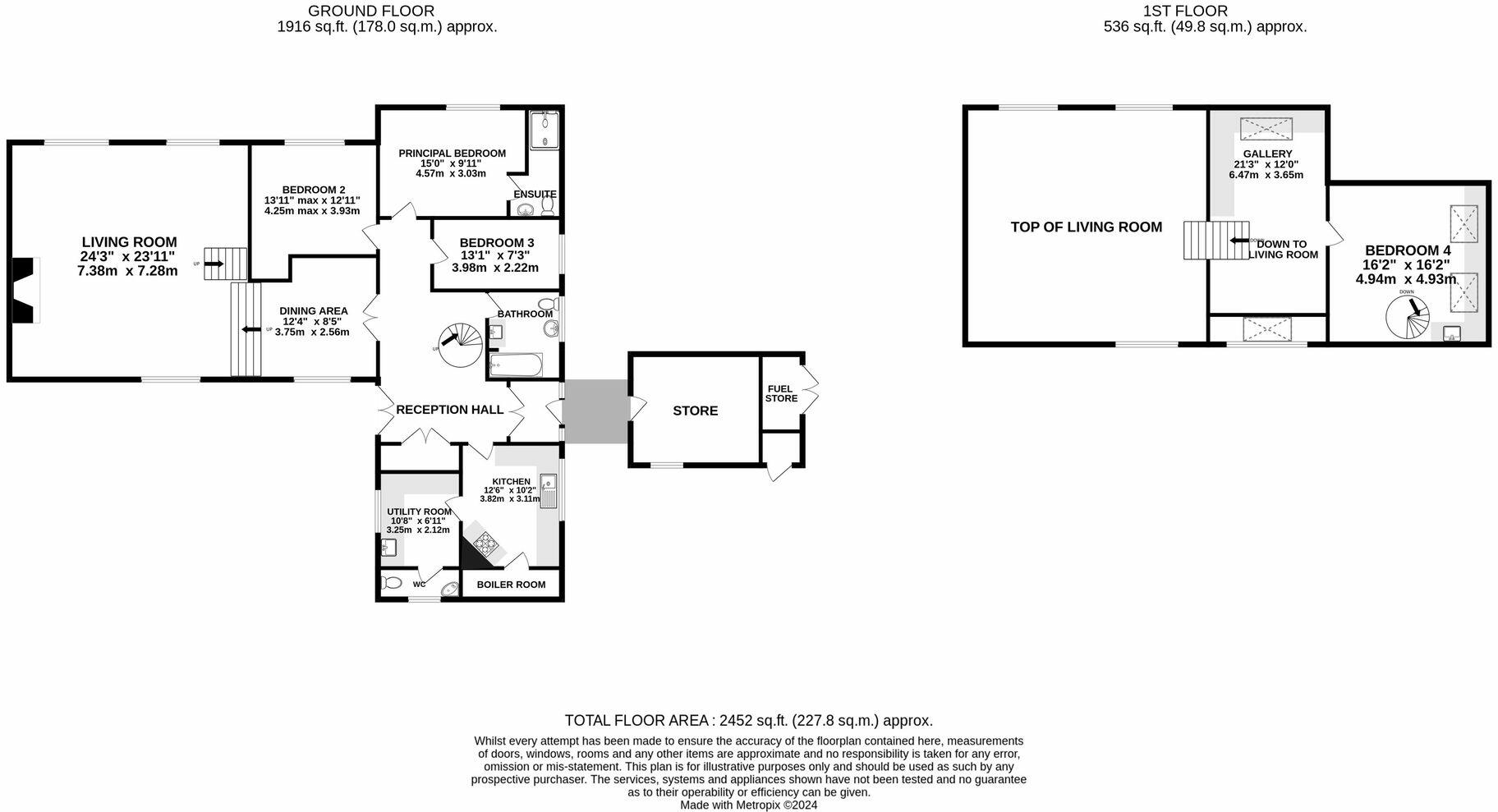
Floorplans
All
Price history
| Event | Date | Price | % change |
|---|---|---|---|
| Listed for sale | — | £995,000 | — |
Source: HM Land Registry Price Paid Data. Crown copyright.
Sold Comparables
Same street and nearby sales within 0.25 miles (last 5 years). Data from Land Registry Price Paid.
| Address | Price | Date | Type |
|---|---|---|---|
| Same street WOODSIDE COTTAGE WARFORD HALL DRIVE, ALDERLEY EDGE, CHESHIRE EAST, SK9 7TR | £850,000 | 03/10/2025 | Semi-detached |
| Same street MERRYFORD WARFORD HALL DRIVE, ALDERLEY EDGE, CHESHIRE EAST, SK9 7TR | £1,350,000 | 30/10/2023 | Semi-detached |
Street average: £1,100,000 (2 sales)
Capital growth trend
Land Registry outcode average: last 12 months vs 5y and 10y ago (from sold prices).
House Price Index (HM Land Registry — official index, not sold-price averages): Cheshire East. Series: Semi-detached. As of March 2026.
Rental Range
Estimated market rent for Cheshire East. Low = conservative, Realistic = average, Optimistic = best case.
Based on Local Authority from postcode lookup → Cheshire East.
LHA (30th percentile) floor for West Pennine: £760/mo (Apr 2025 – Mar 2026)
Location
Address
Warford Hall Drive
Nearby
Nearest stations, universities and amenities (distance from property).
| Type | Name | Distance |
|---|---|---|
| Hospital | Soss Moss Hospital | 0.4 miles |
| Bus stop | Great Warford, Ancoats Lane / Buttermere Drive | 0.6 miles |
| Bus stop | Chelford, Dixon Drive / Wheat Moss | 0.8 miles |
| Shop | The Village Salon | 1.1 miles |
| Shop | A. J. Boon traditional family butcher | 1.1 miles |
| Train station | Chelford | 1.1 miles |
| Train station | Alderley Edge | 2.1 miles |
| Hospital | The Wilmslow Hospital | 3.2 miles |
| University | Fallowfield Reception and Richmond Amenities Building | 11.3 miles |
| University | University of Manchester Fallowfield Campus | 11.3 miles |
Street-level crime
| Category | Count |
|---|---|
| Burglary | 1 |
| Violence and sexual offences | 1 |
| Total incidents | 2 |
Within 1 mile during Apr 2026. Source: data.police.uk (England & Wales).
Schools nearby
Nearest open schools with Ofsted ratings (England). Closed schools are not shown. Data from Get Information about Schools and Ofsted.
| Name | Type | Distance | Ofsted |
|---|---|---|---|
| David Lewis School | Other | 0.4 miles | Good — 12 Jan 2015 |
| The David Lewis Centre | Other | 0.4 miles | — (No rating) |
| Chelford CofE Primary School | Primary | 1.0 miles | Good — 30 Nov 2023 |
| Nether Alderley Primary School | Primary | 1.7 miles | Good — 1 May 2012 |
| The Ryleys School | Other | 1.8 miles | — (No rating) |
Rental Comparables
Loading rental comparables for this postcode. Refresh in a few minutes.
Rent-driven metrics
Based on Area rent estimate.
- Rent ratio — Monthly rent ÷ purchase price (1% rule). 1%+ = strong, 0.8–1% = okay, <0.8% = weak for cashflow.
- Max investor price — Rent ÷ 0.8%; the price at which rent would be 0.8% of price (Stoke-style target).
- Target investor price — Rent ÷ 1%; the price at which rent would be 1% of price (strong cashflow band).
- Gross yield — Annual rent as % of purchase price (no costs).
Enter House Number
Enter the house number to help us retrieve more accurate pricing history and property data.
Please log in to submit or correct the house number for this listing.
Log in to continue