Windlehurst Road
Marple, SK6 7HH
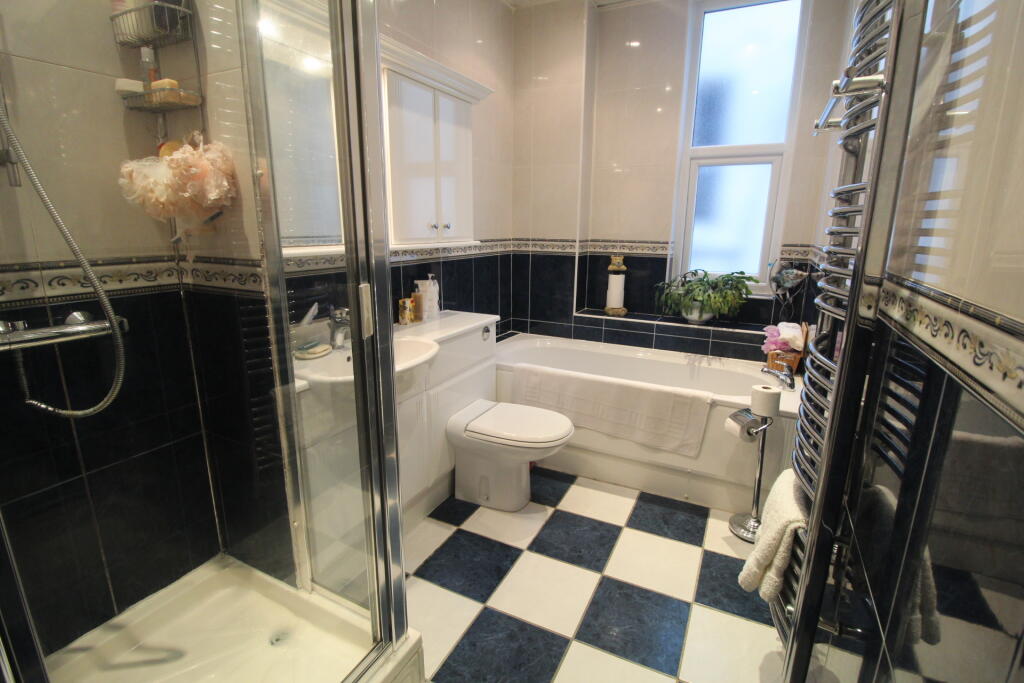
Property details
Tenure
FREEHOLD
Council tax band
D
Local average
£323,868 (+15.8%)
Deprivation
Decile 8 (26,242 of 33,755)
Street crime
0 incidents within 1 mile (Apr 2026)
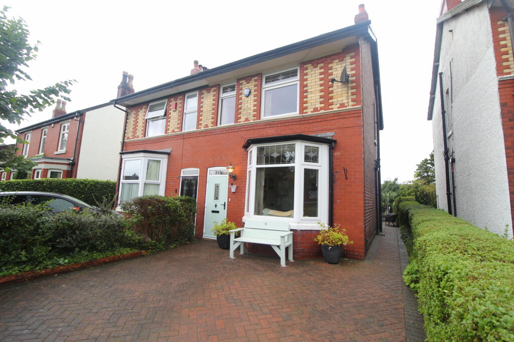
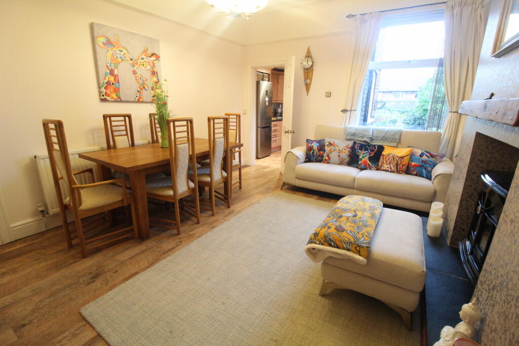
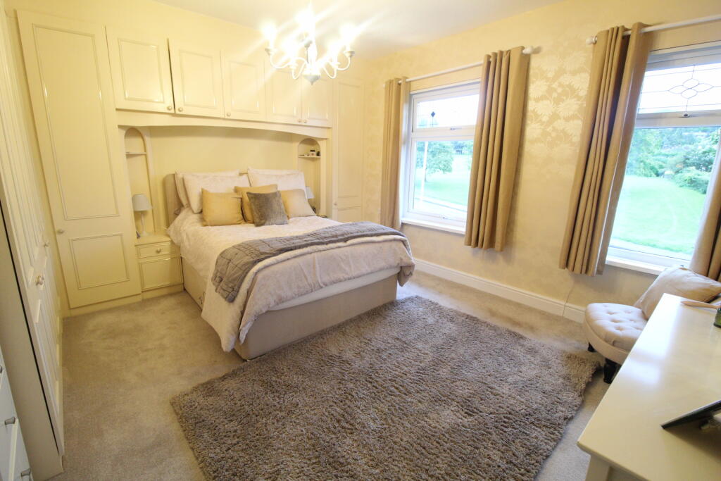
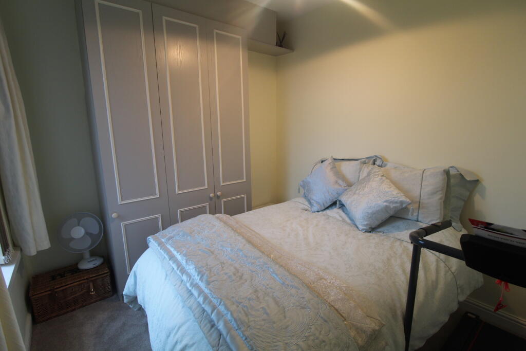
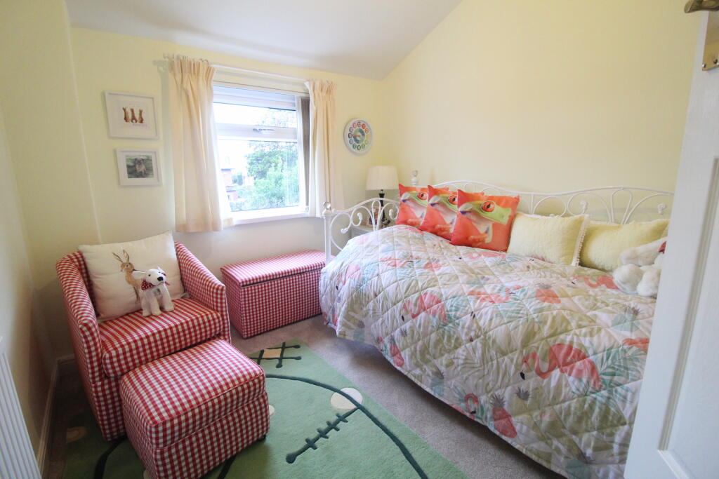
Key features
- Bay fronted period property
- Three bedroom semi detached
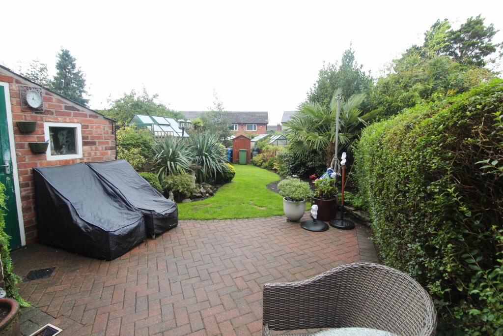
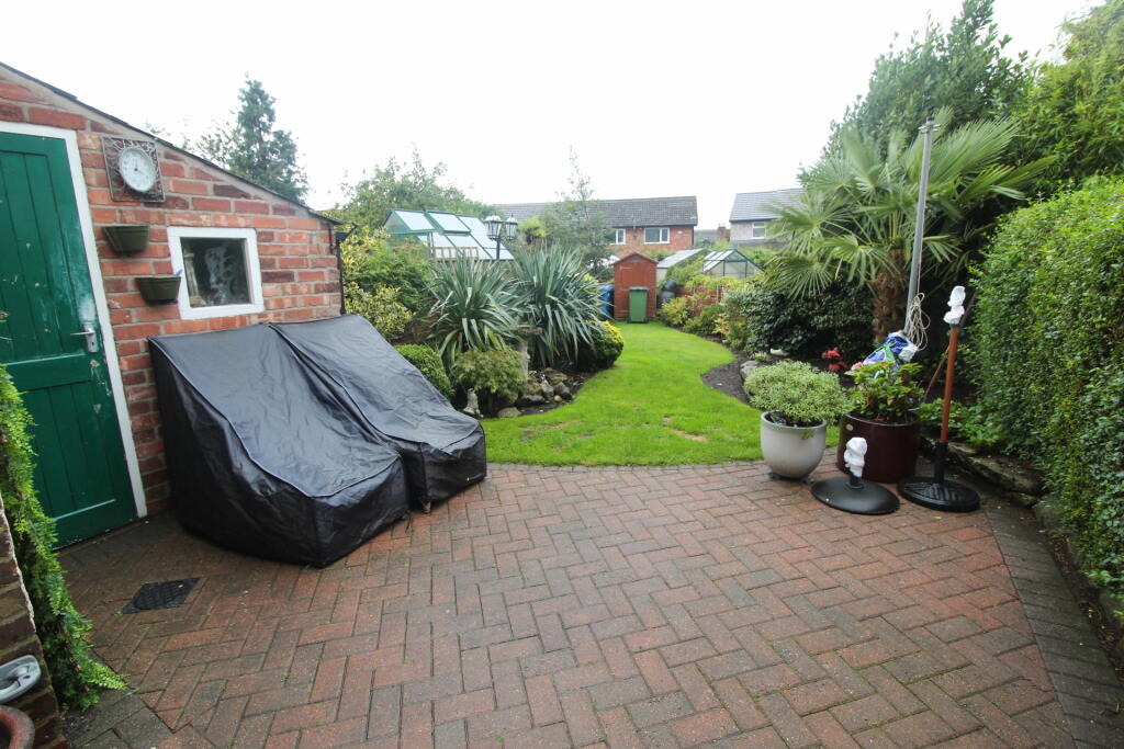
- Driveway parking and picturesque gardens
- Three double bedrooms
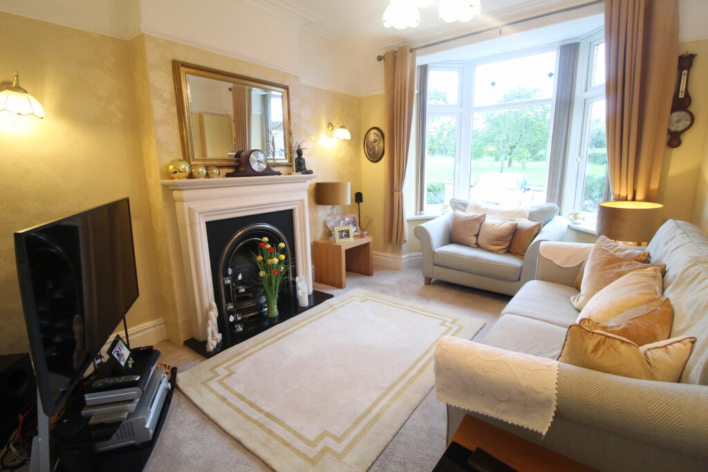
- Two separate reception rooms
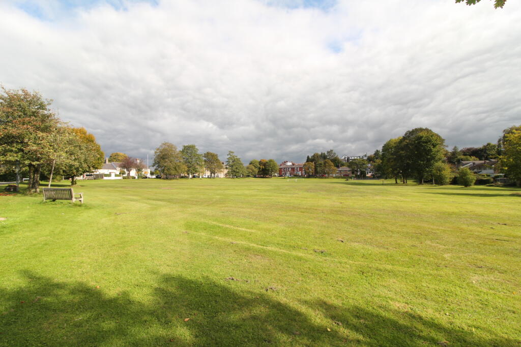
- Stunning location over looking The Green
Additional details
- Parking
- Off street
- Garden
- Front garden, Back garden
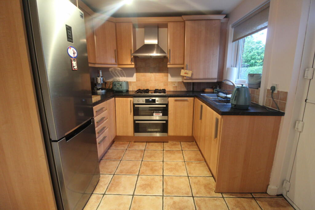
Description
Hawk Green is historically named after the large Green, a superb space for pets and children which is located immediately across the road, a mere stones throw from your front door. A real blessing to have such a vast and expansive area to play on, that you don't have to maintain.
Immediate viewing essential.
Listed by
Marple
Edward Mellor Ltd
Reference: 174296453
EPC ratings on this postcode
We don't have a matched EPC for this property yet. Below are efficiency scores and details for other addresses on this postcode.
| Address | Current | Potential | Floor area | Age band | Type |
|---|---|---|---|---|---|
| 311, Windlehurst Road, Marple, STOCKPORT | 83 | 89 | 204 m² | — | Detached |
| 313 WINDLEHURST ROAD, MARPLE, STOCKPORT | 66 | 78 | 131 m² | England and Wales: 1983-1990 | Detached |
| 317 Windlehurst Road, Marple, STOCKPORT | 63 | 80 | 98 m² | England and Wales: 1900-1929 | Detached |
| 319 Windlehurst Road, Marple, STOCKPORT | 65 | 88 | 90 m² | England and Wales: 1930-1949 | Detached |
| 323 Windlehurst Road, Marple, STOCKPORT | 45 | 76 | 96 m² | England and Wales: 1900-1929 | Detached |
| 325 Windlehurst Road, Marple, STOCKPORT | 65 | 82 | 91 m² | England and Wales: 1930-1949 | Detached |
| 327, Windlehurst Road, Marple, STOCKPORT | 63 | 82 | 91 m² | England and Wales: 1900-1929 | Detached |
Flood risk
Zone: 1
Risk: Low
Job (default Low)
Floorplans
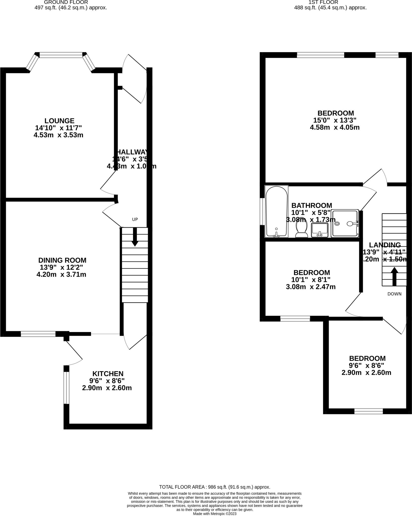
319windlehurstroad-High.jpg
EPC Graphs

EPC
Price history
| Event | Date | Price | % change |
|---|---|---|---|
| Listed for sale | — | £375,000 | — |
Source: HM Land Registry Price Paid Data. Crown copyright.
Sold Comparables
Same street and nearby sales within 0.25 miles (last 5 years). Data from Land Registry Price Paid.
| Address | Price | Date | Type |
|---|---|---|---|
| 28 BRIARWOOD CRESCENT, MARPLE, STOCKPORT, GREATER MANCHESTER, SK6 7LL | £310,000 | 19/12/2025 | Semi-detached |
| 31 BARNSFOLD ROAD, MARPLE, STOCKPORT, GREATER MANCHESTER, SK6 7JB | £460,000 | 19/12/2025 | Semi-detached |
| 11 BARNSFOLD ROAD, MARPLE, STOCKPORT, GREATER MANCHESTER, SK6 7JB | £467,500 | 12/11/2025 | Semi-detached |
| 3 DIAMOND TERRACE, MARPLE, STOCKPORT, GREATER MANCHESTER, SK6 7JL | £380,000 | 06/09/2022 | Semi-detached |
| 2 KESTREL CLOSE, MARPLE, STOCKPORT, GREATER MANCHESTER, SK6 7JS | £385,000 | 14/07/2022 | Semi-detached |
| 299 WINDLEHURST ROAD, MARPLE, STOCKPORT, GREATER MANCHESTER, SK6 7HZ | £375,000 | 14/01/2022 | Semi-detached |
| Same street 313 WINDLEHURST ROAD, MARPLE, STOCKPORT, GREATER MANCHESTER, SK6 7HH | £420,000 | 19/11/2021 | Detached |
| 55 BRIARWOOD CRESCENT, MARPLE, STOCKPORT, GREATER MANCHESTER, SK6 7LL | £256,000 | 10/09/2021 | Semi-detached |
| 27 SHEPLEY LANE, MARPLE, STOCKPORT, GREATER MANCHESTER, SK6 7JN | £380,000 | 06/09/2021 | Semi-detached |
Street average: £420,000 (1 sale)
Area average: £376,688 (8 sales)
Capital growth trend
Land Registry outcode average: last 12 months vs 5y and 10y ago (from sold prices).
House Price Index (HM Land Registry — official index, not sold-price averages): Stockport. Series: Semi-detached. As of March 2026.
Rental Range
Estimated market rent for Stockport. Low = conservative, Realistic = average, Optimistic = best case.
Based on Local Authority from postcode lookup → Stockport.
LHA (30th percentile) floor for Oldham & Rochdale: £693/mo (Apr 2025 – Mar 2026)
Location
Address
Windlehurst Road
Nearby
Nearest stations, universities and amenities (distance from property).
| Type | Name | Distance |
|---|---|---|
| Bus stop | Hawk Green, Windlehurst Road / near Hawk Green | 0.0 miles |
| Bus stop | Hawk Green, Windlehurst Road / at Hawk Green | 0.1 miles |
| Shop | Londis | 0.1 miles |
| Shop | Co-op | 0.8 miles |
| Train station | Rose Hill Marple | 1.1 miles |
| Train station | Strines | 1.3 miles |
| Hospital | Park Lodge Independent Hospital | 2.6 miles |
| Hospital | The Meadows | 2.7 miles |
| University | UK Management College | 7.5 miles |
| University | University of Manchester Fallowfield Campus | 7.5 miles |
Street-level crime
| Category | Count |
|---|---|
| Total incidents | 0 |
Within 1 mile during Apr 2026. Source: data.police.uk (England & Wales).
Schools nearby
Nearest open schools with Ofsted ratings (England). Closed schools are not shown. Data from Get Information about Schools and Ofsted.
| Name | Type | Distance | Ofsted |
|---|---|---|---|
| Windlehurst School | Other | 0.2 miles | Good — 28 Apr 2022 |
| All Saints Church of England Primary School Marple | Primary | 0.7 miles | Good — 28 Mar 2014 |
| Acorns School | Other | 0.7 miles | Good — 28 Apr 2022 |
| High Lane Primary School | Primary | 1.1 miles | Good — 27 Jan 2014 |
| Rose Hill Primary School | Primary | 1.2 miles | Good — 15 Dec 2022 |
Rental Comparables
Loading rental comparables for this postcode. Refresh in a few minutes.
Rent-driven metrics
Based on Area rent estimate.
- Rent ratio — Monthly rent ÷ purchase price (1% rule). 1%+ = strong, 0.8–1% = okay, <0.8% = weak for cashflow.
- Max investor price — Rent ÷ 0.8%; the price at which rent would be 0.8% of price (Stoke-style target).
- Target investor price — Rent ÷ 1%; the price at which rent would be 1% of price (strong cashflow band).
- Gross yield — Annual rent as % of purchase price (no costs).
Enter House Number
Enter the house number to help us retrieve more accurate pricing history and property data.
Please log in to submit or correct the house number for this listing.
Log in to continue