217 WATERLOO ROAD
STOKE-ON-TRENT, STOKE-ON-TRENT, STOKE-ON-TRENT ST6 2HS
£425 pcm
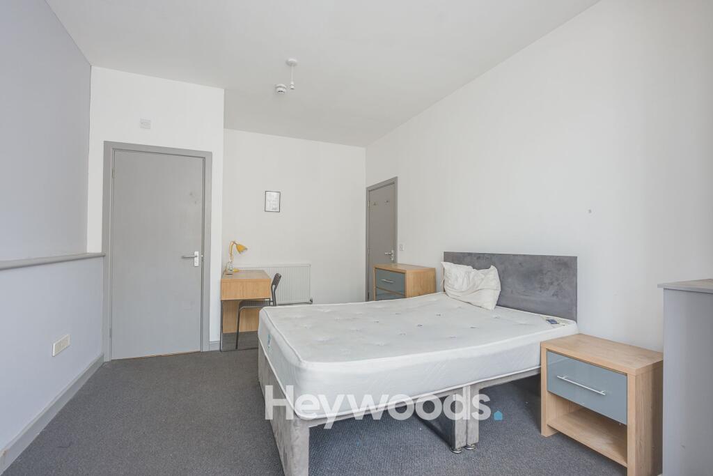
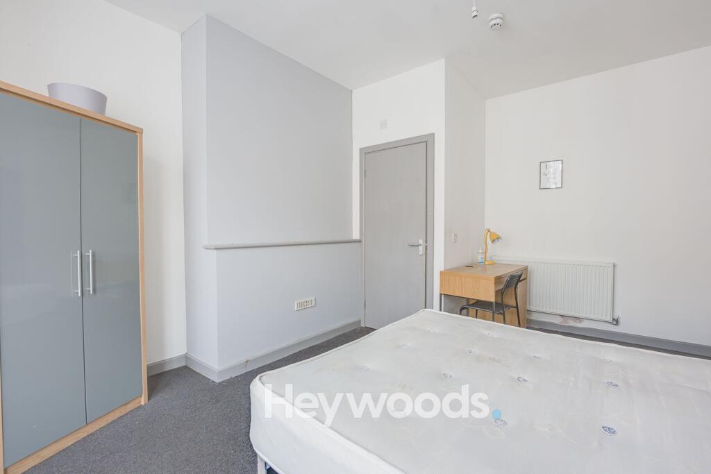
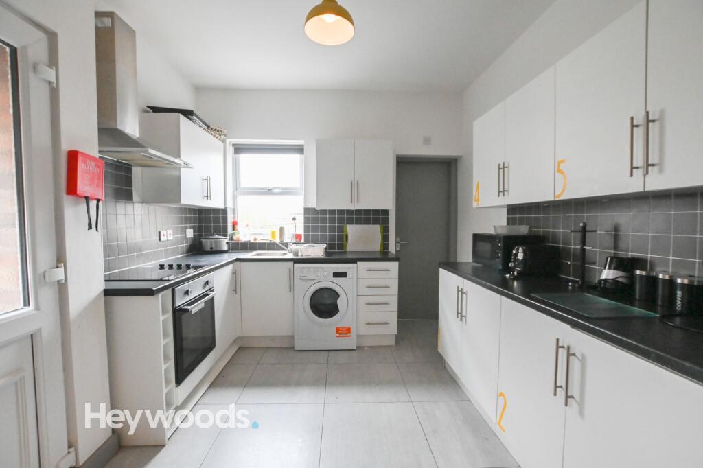
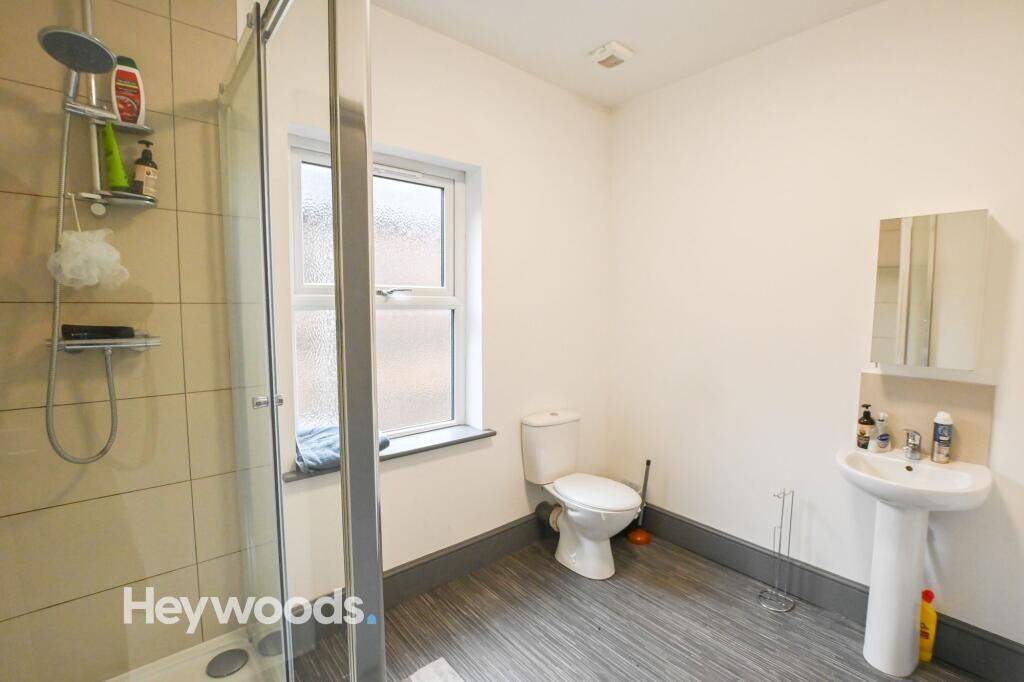
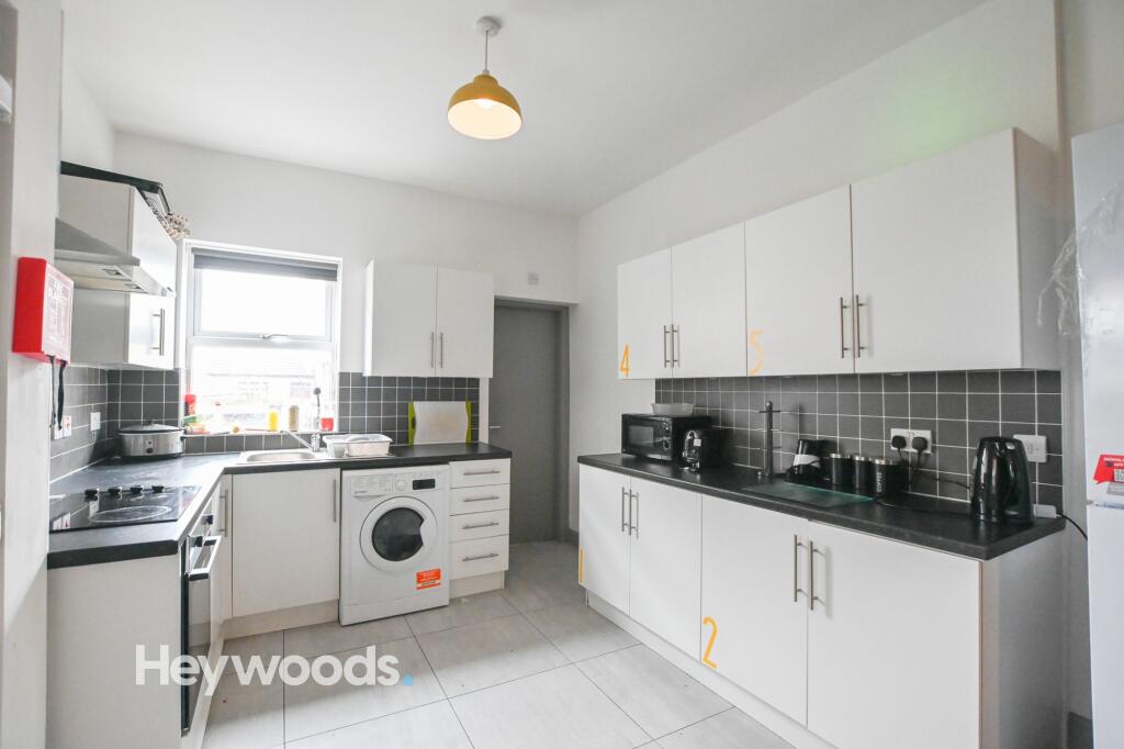
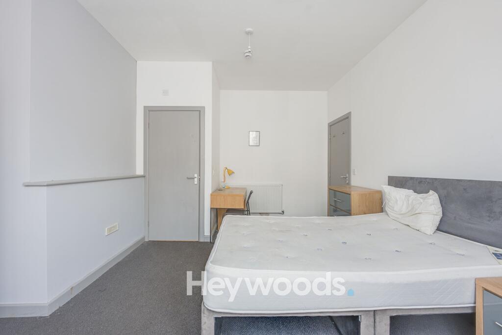
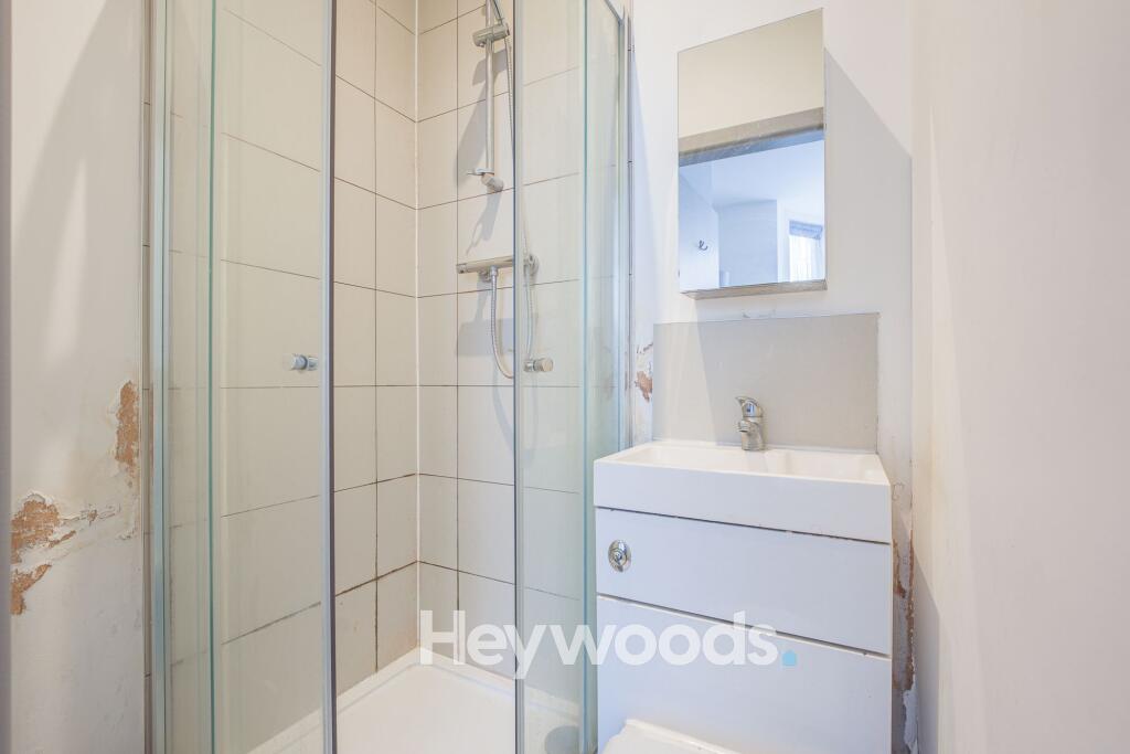
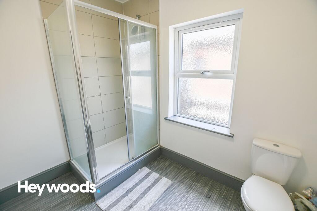
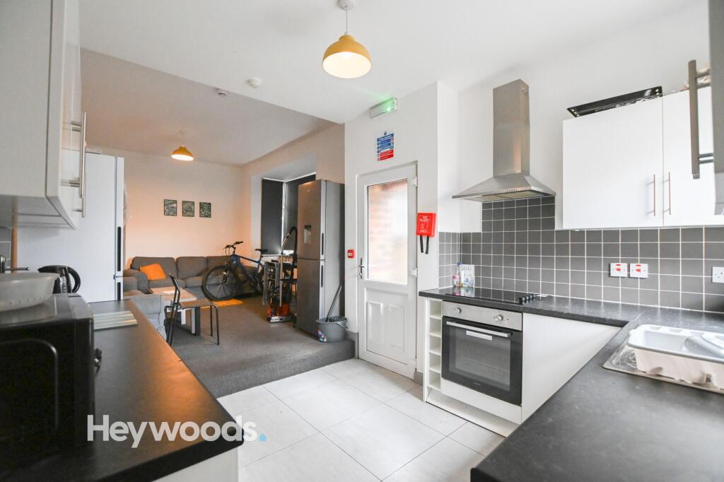
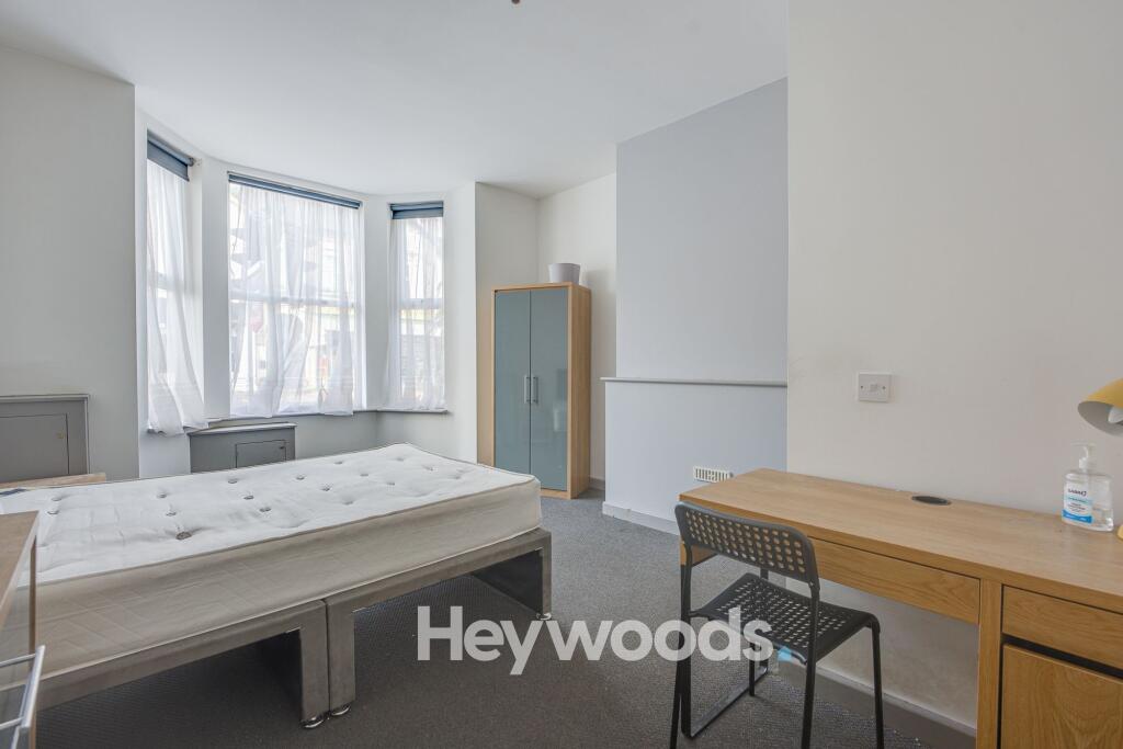
Photo 1 Photo 2 Photo 3 Photo 4 Photo 5 Photo 6 Photo 7 Photo 8 Photo 9 Photo 10
/ 10
Property details
Floor area
187 m²
Council tax band
B
EPC rating
E
Year built
England and Wales: 1900-1929
Deprivation
Decile 1 (1,186 of 33,755)
Street crime
541 incidents within 1 mile (Aug 2026)
Key features
- Spacious Double Room
- Ground Floor
- En-Suite
- Well Equipped Communal Kitchen
Additional details
- Restrictions
- No
- Rights of way
- No
- Flooded in last 5 years
- No
- Flood defences
- No
Description
This spacious ground-floor double bedroom is situated at the front of the property and benefits from its own private en-suite, offering an excellent balance of privacy and comfortable shared living.
The communal areas include a cosy living room with ample seating, a dining area, and a modern, well-equipped kitchen with appliances and storage space for all residents. There is also an additional bathroom located on the ground floor, just off the kitchen and dining area, as well as a shower room on the first floor.
The rent is inclusive of household bills, including Wi-Fi, Council Tax, Gas, Electricity and Water.
An ideal choice for anyone looking for comfortable, convenient and hassle-free shared accommodation close to Hanley town centre.
Listed by
Newcastle-under-Lyme
Heywoods
Reference: 93747810
EPC Rating & Upgrade Cost
Current rating: E
Potential rating: C
Inspection date: 26/04/2019
Expiry date: 25/04/2029
Current heating cost: £1,963/year
Potential heating cost: £1,117/year
Est. upgrade cost to C: £25,500
Recommendations
- Internal or external wall insulation (£4,000 - £14,000)
- Floor insulation (solid floor) (£4,000 - £6,000)
- Solar water heating (£4,000 - £6,000)
- Solar photovoltaic panels, 2.5 kWp (£5,000 - £8,000)
Flood risk
Zone: 1
Risk: Low
Job (default Low)
Registered land (INSPIRE)
This location falls inside an HM Land Registry INSPIRE registered freehold polygon.
Plot: ~352 m² (0.09 acres)
Source: HM Land Registry INSPIRE Index Polygons.
Company ownership
Registered legal owner is a company.
Company: A C WEN COMPANY LTD (12960482)
Rental Range
Estimated market rent for Stoke-on-Trent. Low = conservative, Realistic = average, Optimistic = best case.
Based on Local Authority from postcode lookup → Stoke-on-Trent.
LHA (30th percentile) floor for Staffordshire North: £424/mo (Apr 2025 – Mar 2026)
Location
Nearby
Nearest stations, universities and amenities (distance from property).
| Type | Name | Distance |
|---|---|---|
| Bus stop | Cobridge Barracks | 0.0 miles |
| Shop | Costcutter | 0.1 miles |
| Bus stop | Unknown | 0.2 miles |
| Shop | Freshways | 0.2 miles |
| Train station | Longport | 1.2 miles |
| Hospital | Haywood Hospital Walk-in Centre | 1.3 miles |
| Train station | Stoke-on-Trent | 2.1 miles |
| Hospital | Royal Stoke University Hospital | 2.6 miles |
| University | Keele University | 4.2 miles |
| University | Buxton & Leek College | 8.4 miles |
Street-level crime
| Category | Count |
|---|---|
| Violence and sexual offences | 160 |
| Anti-social behaviour | 123 |
| Public order | 45 |
| Criminal damage and arson | 43 |
| Other theft | 39 |
| Shoplifting | 34 |
| Vehicle crime | 30 |
| Burglary | 25 |
| Drugs | 10 |
| Robbery | 10 |
| Possession of weapons | 8 |
| Other crime | 6 |
| Bicycle theft | 5 |
| Theft from the person | 3 |
| Total incidents | 541 |
Within 1 mile during Aug 2026. Source: data.police.uk (England & Wales).
Schools nearby
Nearest open schools with Ofsted ratings (England). Closed schools are not shown. Data from Get Information about Schools and Ofsted.
| Name | Type | Distance | Ofsted |
|---|---|---|---|
| St Peter's Catholic Academy | Primary | 0.2 miles | — (Inspected (no overall grade)) |
| North Road Academy | Other | 0.3 miles | Requires improvement — 2 Apr 2023 |
| Forest Park Primary School | Primary | 0.4 miles | Good — 4 Jul 2013 |
| Sneyd Academy | Primary | 0.6 miles | Good — 1 Aug 2023 |
| The Valiant School | Other | 0.8 miles | — (No rating) |
Rental Comparables
Residential lets from OpenRent and Rightmove for the area (same bedroom count). Use to validate rent estimates. Student lets are excluded.
| Title | Rent | Beds | Distance | As seen on |
|---|---|---|---|---|
| Waterloo Road, Stoke On Trent, ST6 | £425/mo | 1 | 0 miles | Rightmove |
| 1 Bed Flat, Burslem, ST6 | £575/mo | 1 | 0.26 miles | OpenRent |
| North Road, Stoke-On-Trent, ST6 | £425/mo | 1 | 0.28 miles | Rightmove |
| Forest Edge, Sneyd Street | £775/mo | 1 | 0.43 miles | Rightmove |
| Adkins Street,Sneyd Green, Stoke-on-Trent | £575/mo | 1 | 0.45 miles | Rightmove |
| Waterloo Road, Stoke-on-Trent, Staffordshire, ST6 | £625/mo | 1 | 0.52 miles | Rightmove |
| Lingard Street, Burslem, Stoke-on-Trent, ST6 | £750/mo | — | 0.58 miles | Rightmove |
| Moorland Road, Stoke-on-Trent | £695/mo | 1 | 0.6 miles | Rightmove |
| Molly Lees, Baddeley Street | £600/mo | 1 | 0.75 miles | Rightmove |
| Molly Lees, Baddeley Street | £650/mo | 1 | 0.75 miles | Rightmove |
| Dartmouth Street, Stoke-on-Trent, ST6 | £450/mo | 1 | 0.76 miles | Rightmove |
| Leonard Street, Burslem | £625/mo | 1 | 0.85 miles | Rightmove |
| High Lane, Burslem, Stoke on Trent | £585/mo | — | 0.86 miles | Rightmove |
| High Lane, Burslem, Stoke on Trent | £495/mo | — | 0.86 miles | Rightmove |
| High Lane, Burslem, Stoke on Trent | £635/mo | — | 0.86 miles | Rightmove |
| Kinver Street, Stoke-on-Trent, Staffordshire, ST6 | £695/mo | 1 | 0.98 miles | Rightmove |
| High Street, Stoke on trent | £595/mo | 1 | 1.6 miles | Rightmove |
| High Street, Stoke-on-Trent, ST6 | £595/mo | 1 | 1.6 miles | Rightmove |
| The Boulevard, Stoke-on-Trent, ST6 | £595/mo | — | 1.61 miles | Rightmove |
| High St, Stoke-On-Trent, ST6 | £650/mo | 1 | 1.81 miles | Rightmove |
Average rent: £601/mo (20 listings)