BASEMENT FLAT
79 PERHAM ROAD, LONDON, LONDON, GREATER LONDON W14 9SP
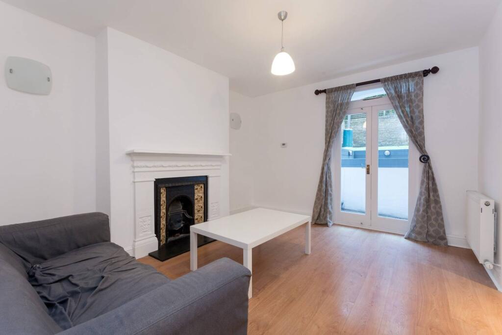
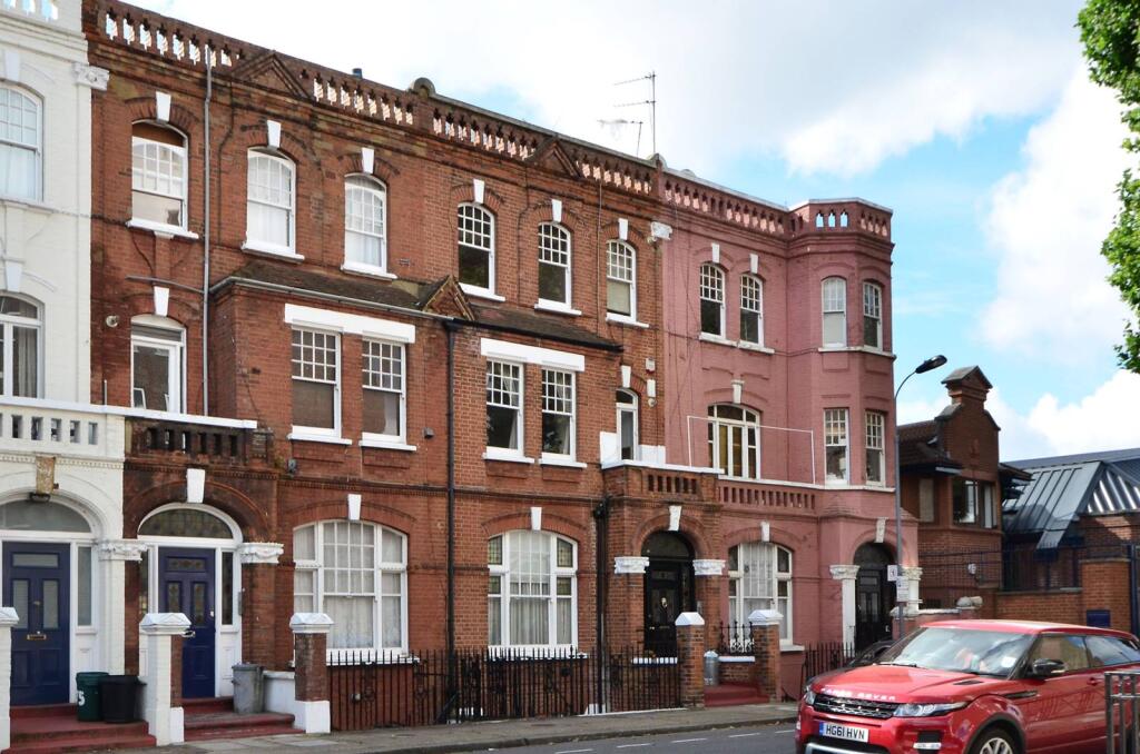
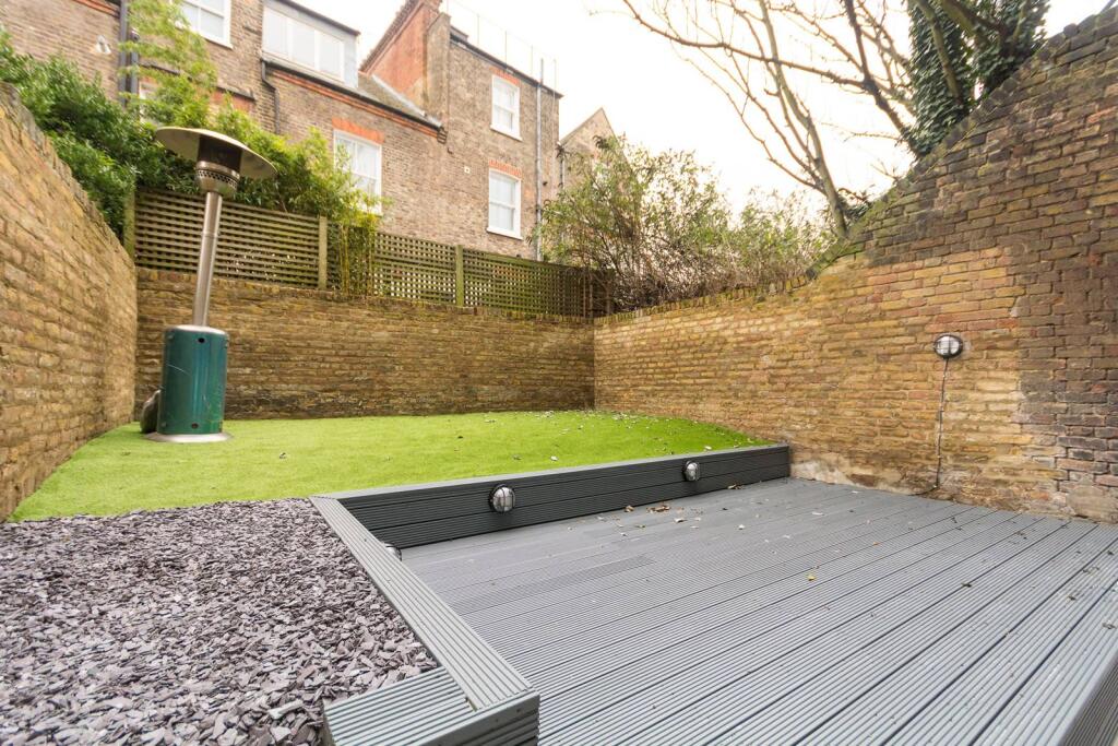
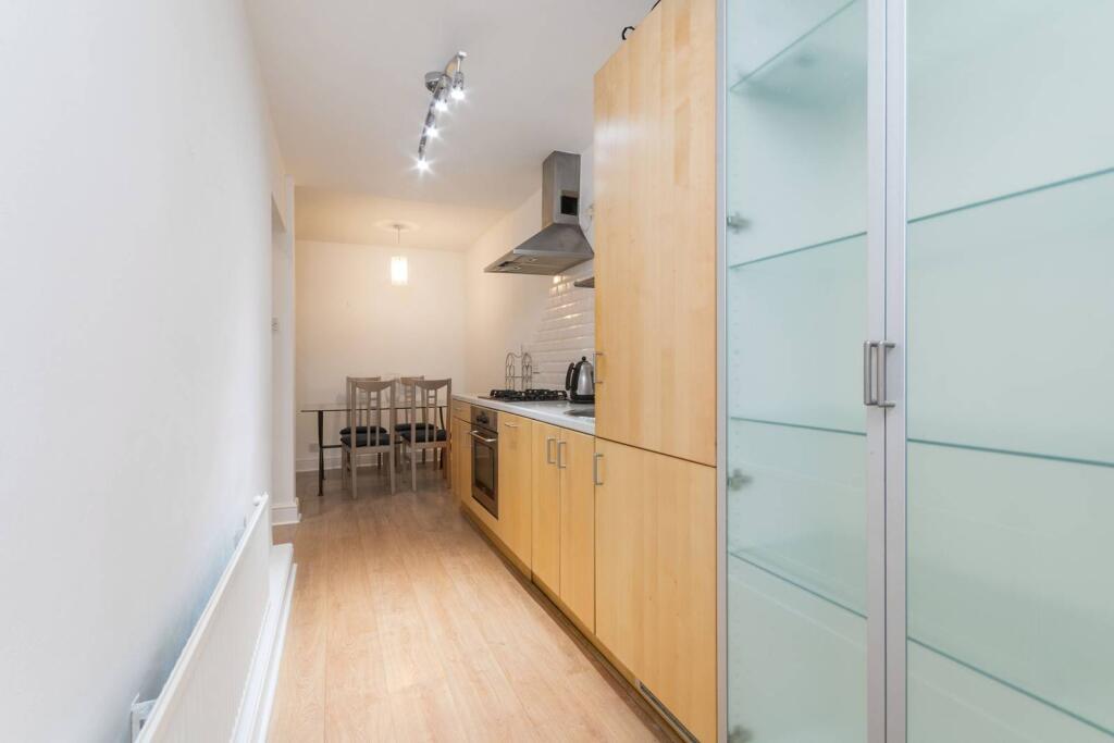
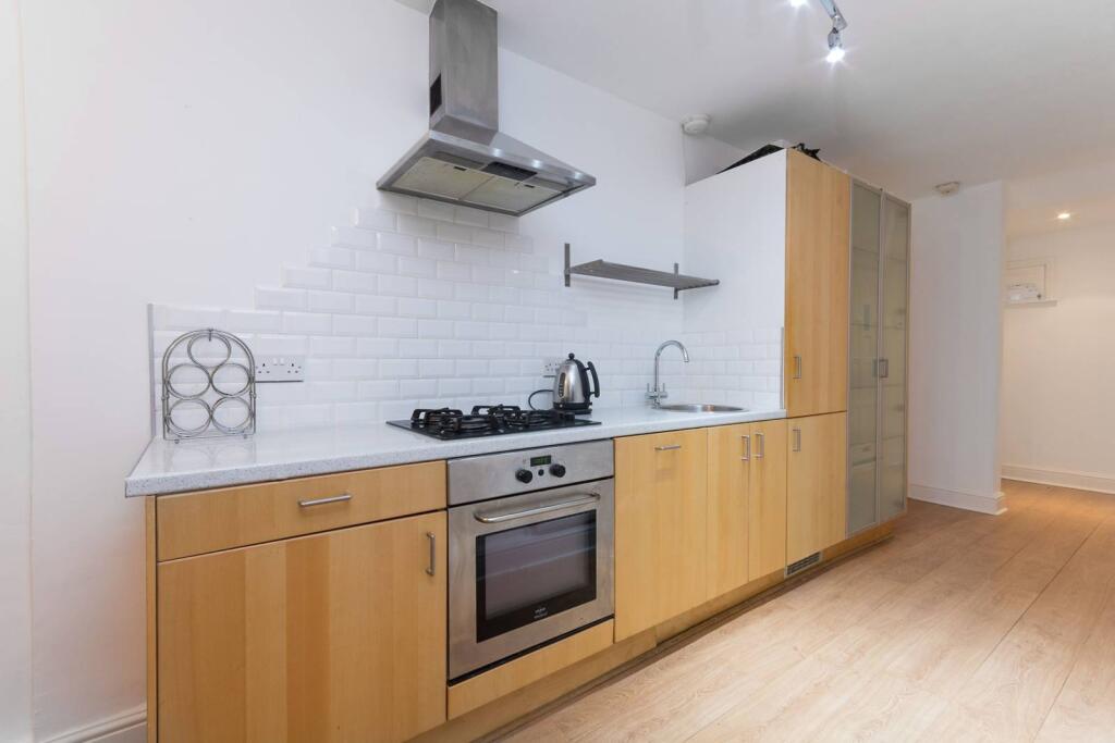
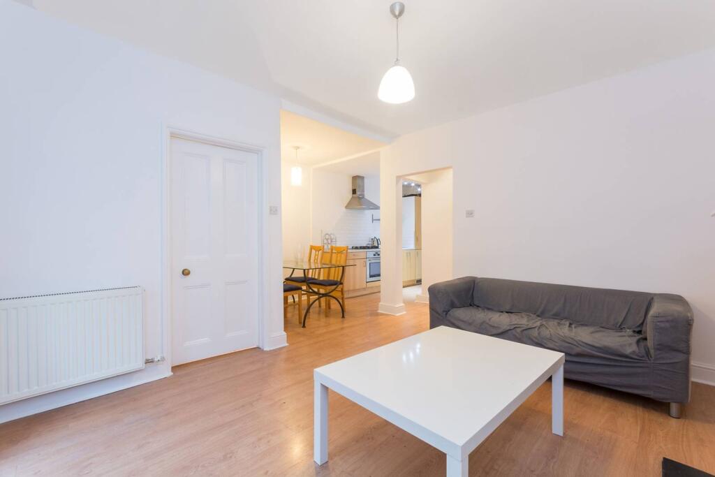
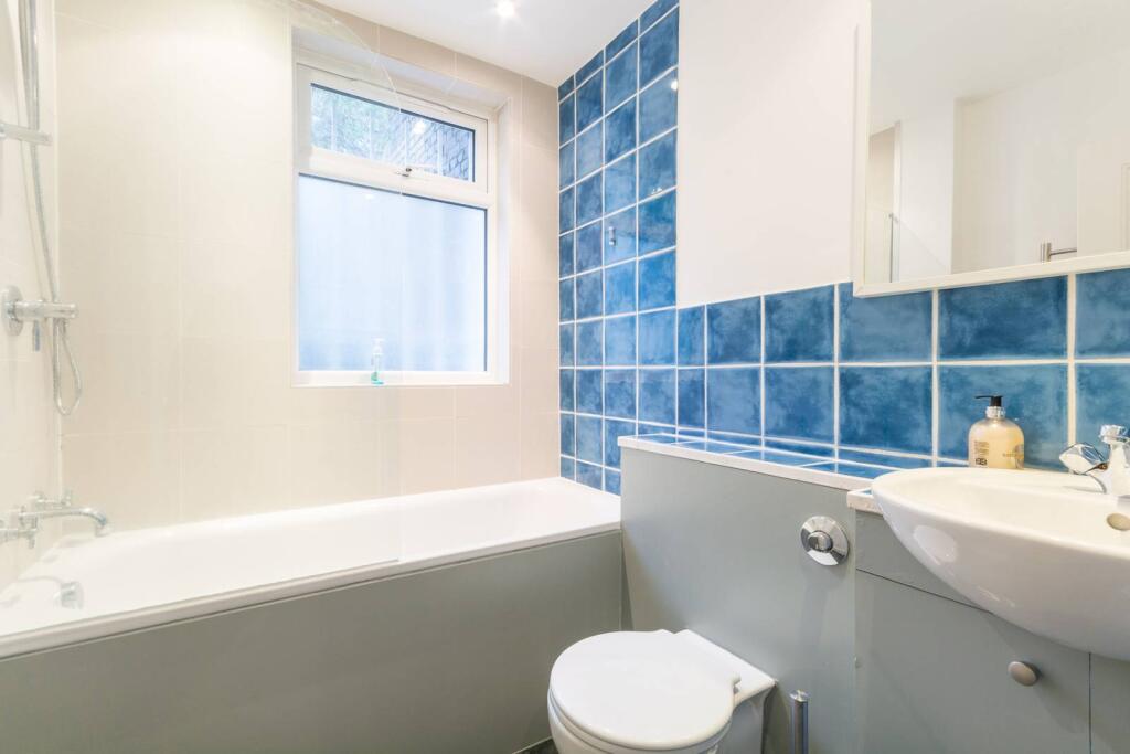
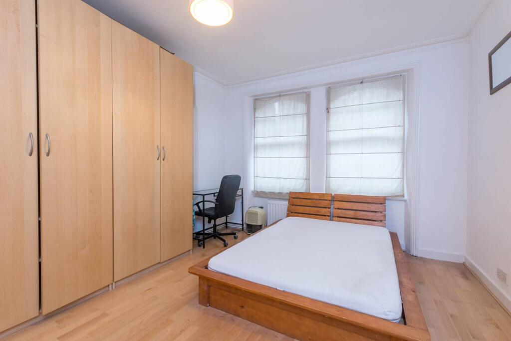
Photo 1 Photo 2 Photo 3 Photo 4 Photo 5 Photo 6 Photo 7 Photo 8
/ 8
Property details
Floor area
43 m²
Deprivation
Decile 8 (24,084 of 33,755)
Street crime
1242 incidents within 1 mile (Apr 2026)
Key features
- Spacious 1 bedroom lower ground floor flat
- Good sized reception room with space to dine
- Fantastic split level garden
- Modern bathroom
- Large double bedroom with storage
- Quiet location in Barons Court
- Available with Zero Deposit
Additional details
- Garden
- Rear garden, Back garden
Description
Perham Road is well served by the local shops of Barons Court, while Fulham is within easy reach offering a great selection of bars and restaurants.
Please use the reference FULM0212481 when contacting Foxtons.
Listed by
Fulham Broadway
Foxtons
Reference: 174901529
EPC Rating & Upgrade Cost
Fetching EPC data… Refresh this page in a moment.
Flood risk
Zone: 1
Risk: Low
Job (default Low)
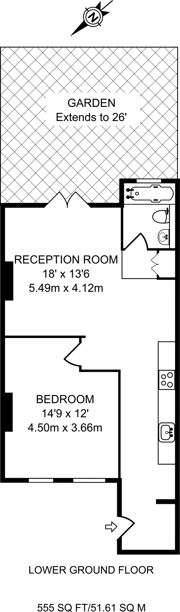
Floorplans

Floorplan area for info only, not for £/sq. ft valuation

Floorplan 2
Floorplan area for info only, not for £/sq. ft valuation
Company ownership
Registered legal owner is a company.
Rental Range
Estimated market rent for Hammersmith and Fulham. Low = conservative, Realistic = average, Optimistic = best case.
Based on Local Authority from postcode lookup → Hammersmith and Fulham.
LHA (30th percentile) floor for Stevenage & North Herts: £773/mo (Apr 2025 – Mar 2026)
Location
Nearby
Nearest stations, universities and amenities (distance from property).
| Type | Name | Distance |
|---|---|---|
| Shop | Body Lounge Spa | 0.2 miles |
| Shop | A-List Hair & Beaty | 0.2 miles |
| Bus stop | West Kensington Station | 0.2 miles |
| Bus stop | West Kensington Estate | 0.2 miles |
| Train station | West Kensington | 0.3 miles |
| Train station | Barons Court | 0.3 miles |
| University | BIMM Institute London | 0.8 miles |
| University | National Heart and Lung Institute | 1.7 miles |
| Hospital | Bridge Lane Health Centre | 2.1 miles |
| Hospital | The Portland Hospital | 3.7 miles |
Street-level crime
| Category | Count |
|---|---|
| Violence and sexual offences | 305 |
| Anti-social behaviour | 298 |
| Shoplifting | 96 |
| Other theft | 86 |
| Public order | 86 |
| Vehicle crime | 80 |
| Drugs | 63 |
| Burglary | 58 |
| Criminal damage and arson | 54 |
| Bicycle theft | 36 |
| Theft from the person | 35 |
| Robbery | 20 |
| Other crime | 15 |
| Possession of weapons | 10 |
| Total incidents | 1242 |
Within 1 mile during Apr 2026. Source: data.police.uk (England & Wales).
Schools nearby
Nearest open schools with Ofsted ratings (England). Closed schools are not shown. Data from Get Information about Schools and Ofsted.
| Name | Type | Distance | Ofsted |
|---|---|---|---|
| The Fulham Prep School Ltd | Other | 0.1 miles | Good — 8 Jul 2020 |
| St Augustine's RC Primary School | Primary | 0.2 miles | Good — 9 Dec 2021 |
| Normand Croft Community School for Early Years and Primary Education | Primary | 0.3 miles | Good — 9 May 2019 |
| BeyondAutism Post-19 | Other | 0.3 miles | — (No rating) |
| Sir John Lillie Primary School | Primary | 0.3 miles | Good — 26 May 2016 |
Rental Comparables
Rental listings exist nearby, but none matched the 1-bedroom count for this property.