FLAT 3
1 PARK AVENUE, LIVERPOOL, MOSSLEY HILL, MERSEYSIDE L18 8BT

Property details
Deprivation
Decile 10 (30,468 of 33,755)
Street crime
270 incidents within 1 mile (Apr 2026)
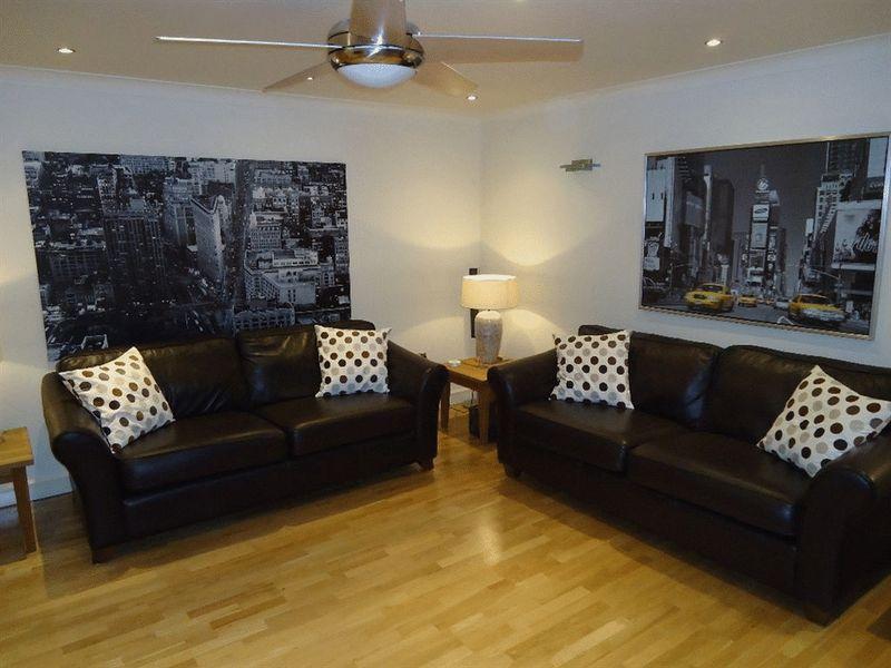
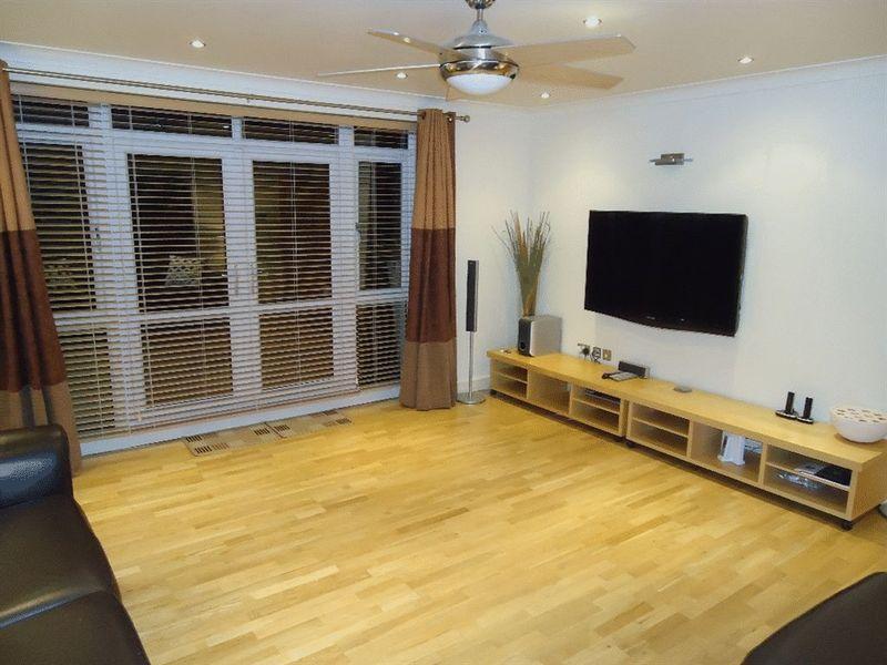
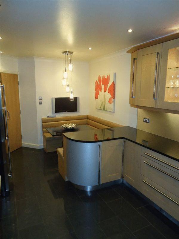
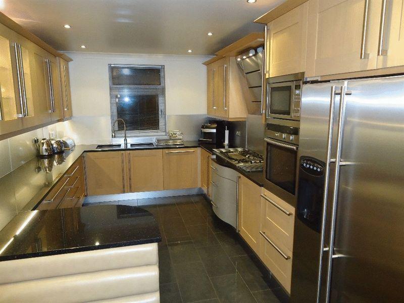
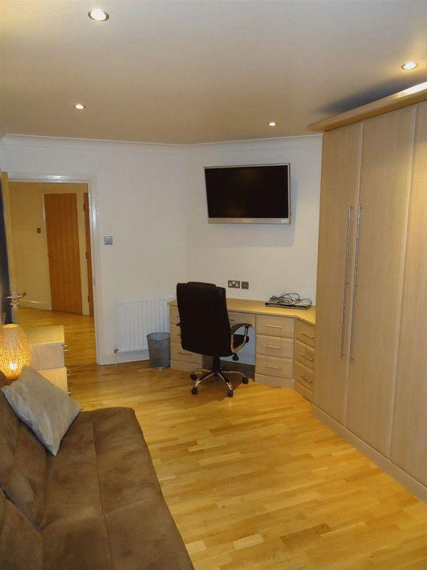
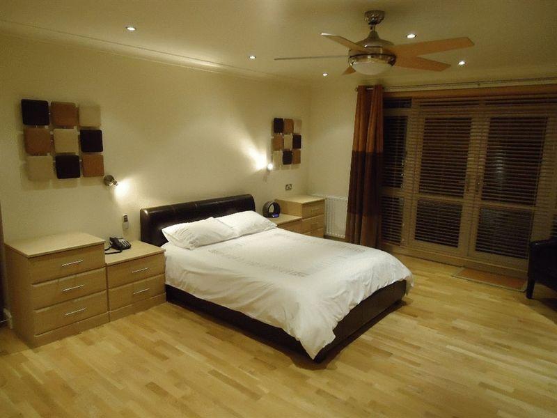
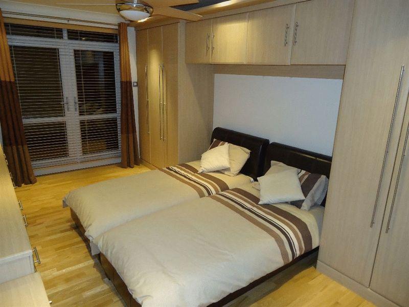
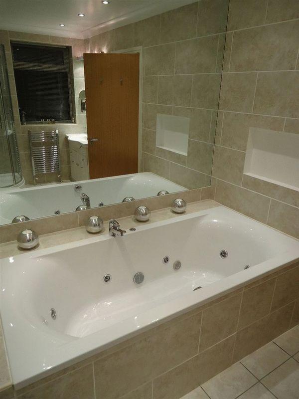
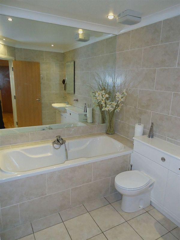
Key features
- Off road parking
- Jacuzzi
- Luxury Apartment
- Sought after area
- Gated community
Additional details
- Parking
- Yes
Description
Listed by
Liverpool
Marshallets Limited
Reference: 42552647
EPC Rating & Upgrade Cost
Fetching EPC data… Refresh this page in a moment.
Flood risk
Zone: 1
Risk: Low
Job (default Low)
EPC Graphs
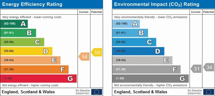
Energy Perform...
Company ownership
Registered legal owner is a company.
Rental Range
Estimated market rent for Liverpool. Low = conservative, Realistic = average, Optimistic = best case.
Based on Local Authority from postcode lookup → Liverpool.
LHA (30th percentile) floor for Greater Liverpool: £648/mo (Apr 2025 – Mar 2026)
Location
Nearby
Nearest stations, universities and amenities (distance from property).
| Type | Name | Distance |
|---|---|---|
| Bus stop | MOSSLEY HILL HOSPITAL/PARK AVENUE | 0.1 miles |
| Bus stop | QUEENS DVE/SCHOOL SERVICES | 0.1 miles |
| Shop | Linda's Nail Bar | 0.3 miles |
| Shop | Unknown | 0.3 miles |
| Train station | Mossley Hill | 0.4 miles |
| Hospital | Greenbank Drive Surgery | 0.7 miles |
| Train station | West Allerton | 1.0 miles |
| Hospital | Rathbone Hospital | 2.0 miles |
| University | University of Liverpool | 2.5 miles |
Street-level crime
| Category | Count |
|---|---|
| Violence and sexual offences | 100 |
| Anti-social behaviour | 34 |
| Criminal damage and arson | 28 |
| Vehicle crime | 22 |
| Public order | 21 |
| Other theft | 14 |
| Shoplifting | 14 |
| Burglary | 13 |
| Drugs | 10 |
| Other crime | 5 |
| Robbery | 5 |
| Possession of weapons | 2 |
| Bicycle theft | 1 |
| Theft from the person | 1 |
| Total incidents | 270 |
Within 1 mile during Apr 2026. Source: data.police.uk (England & Wales).
Schools nearby
Nearest open schools with Ofsted ratings (England). Closed schools are not shown. Data from Get Information about Schools and Ofsted.
| Name | Type | Distance | Ofsted |
|---|---|---|---|
| Liverpool College | Other | 0.1 miles | Outstanding — 11 Dec 2019 |
| St Anthony of Padua Catholic Primary School | Primary | 0.3 miles | Good — 2 Apr 2014 |
| Dovedale Community Primary School | Primary | 0.5 miles | Good — 16 Apr 2018 |
| Greenbank Primary School | Primary | 0.7 miles | Good — 11 Sep 2024 |
| Sudley Primary School | Primary | 0.7 miles | — (No rating) |
Rental Comparables
Residential lets from OpenRent and Rightmove for the area (same bedroom count). Use to validate rent estimates. Student lets are excluded.
| Title | Rent | Beds | Distance | As seen on |
|---|---|---|---|---|
| 3 Bed Terraced House, Elmsdale Road, L18 | £1,399/mo | 3 | 0.74 miles | OpenRent |
Average rent: £1,399/mo (1 listing)