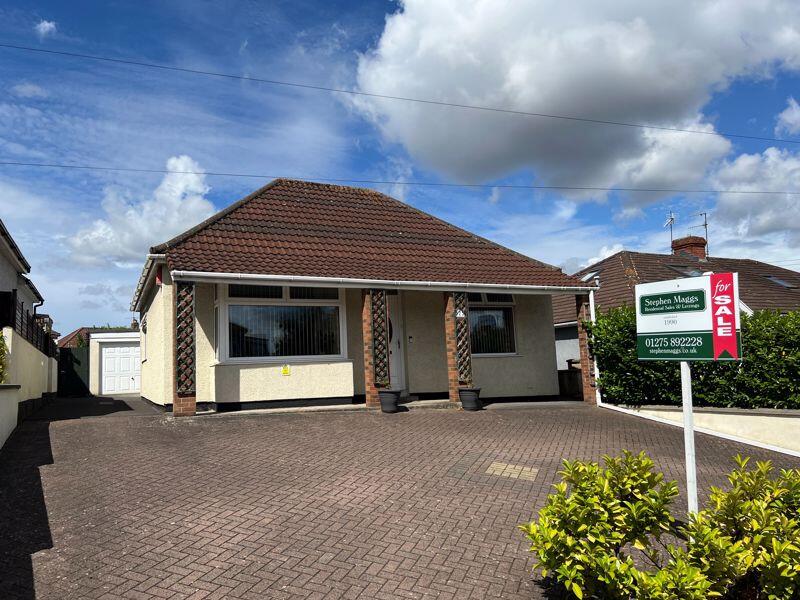
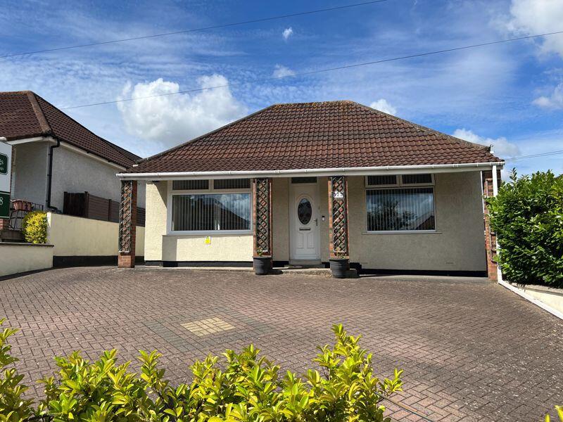
525 WELLS ROAD
BRISTOL, CITY OF BRISTOL BS14 9AL
£450,000
Property details
Tenure
FREEHOLD
Floor area
99 m²
Council tax band
D
EPC rating
D
Year built
England and Wales: 1930-1949
Last sold
£435,000 Feb 2026
Price per m²
£4,545/m²
Local average
£449,500 (+0.1%)
Deprivation
Decile 7 (20,263 of 33,755)
Street crime
360 incidents within 1 mile (Apr 2026)
Key features
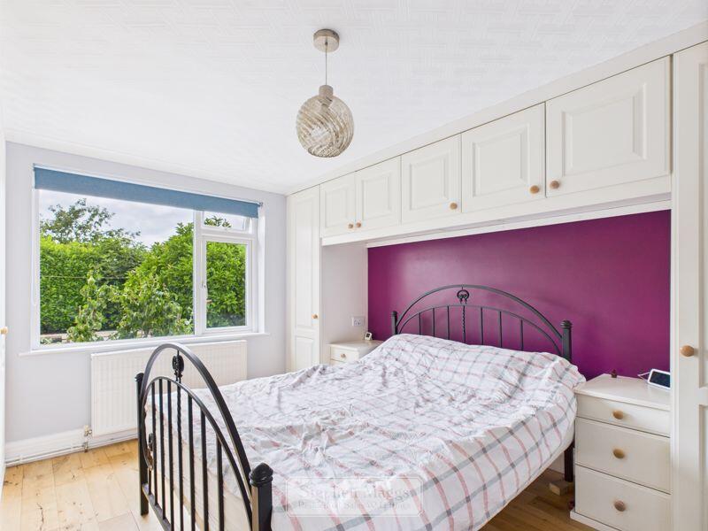
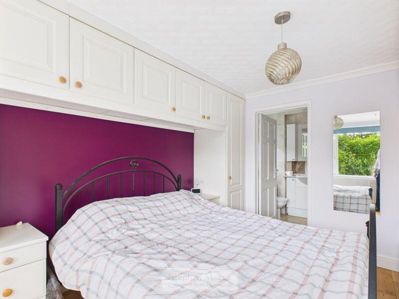
- Two double bedrooms (master en-suite)
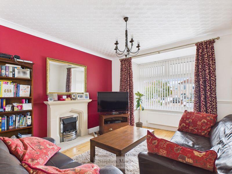
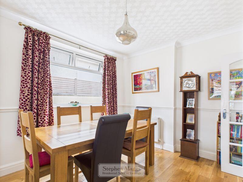
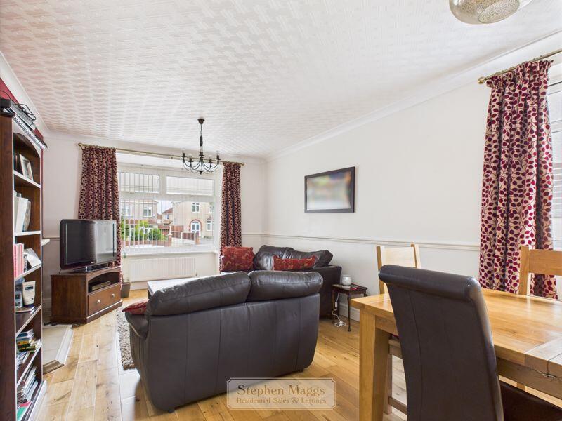
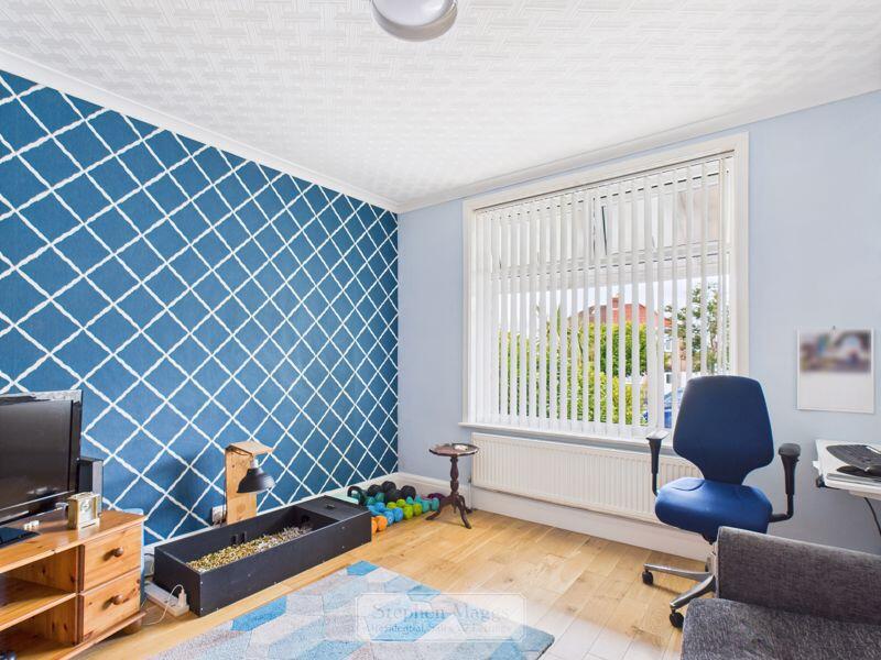
- Large living/dining room
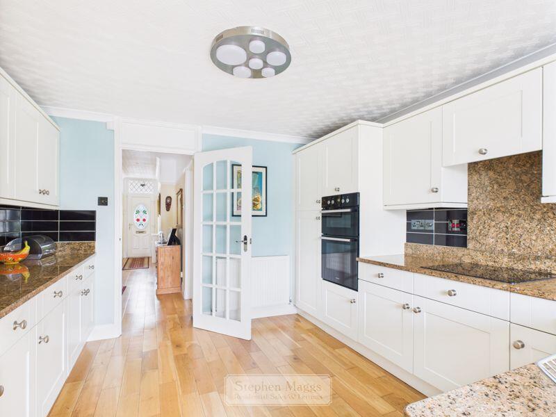
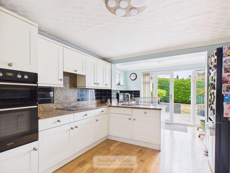
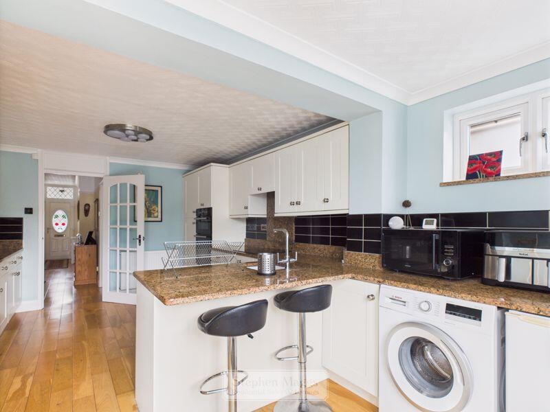
- Generous kitchen
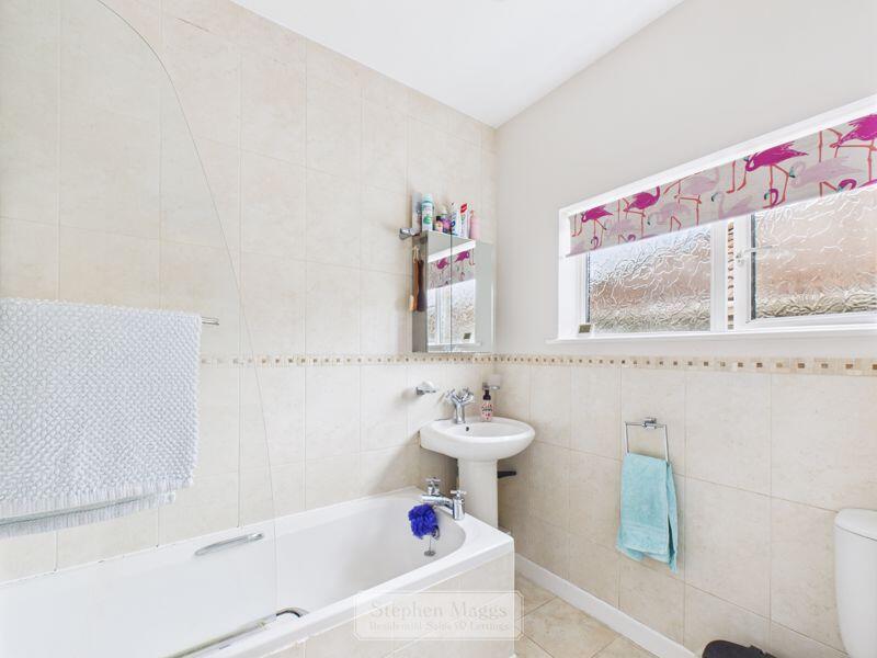
- Bathroom
- Gas central heating & double glazing
- Garage & parking
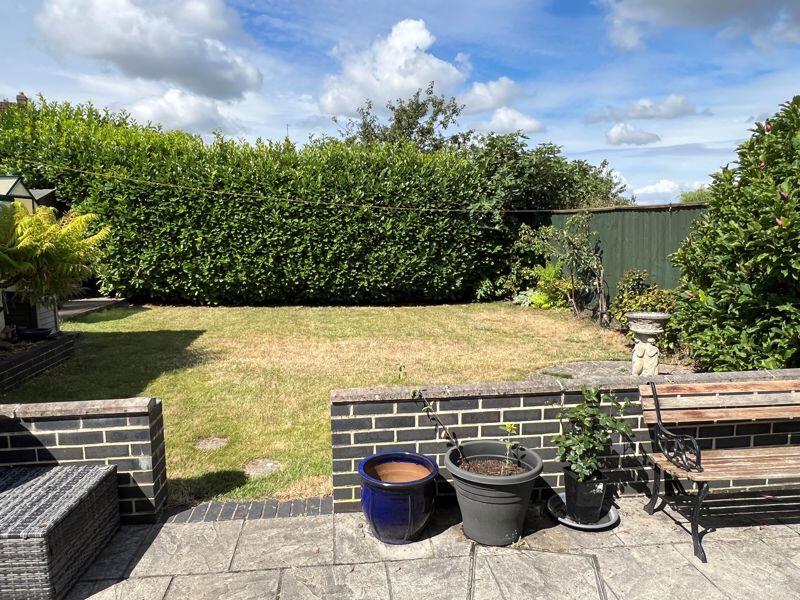
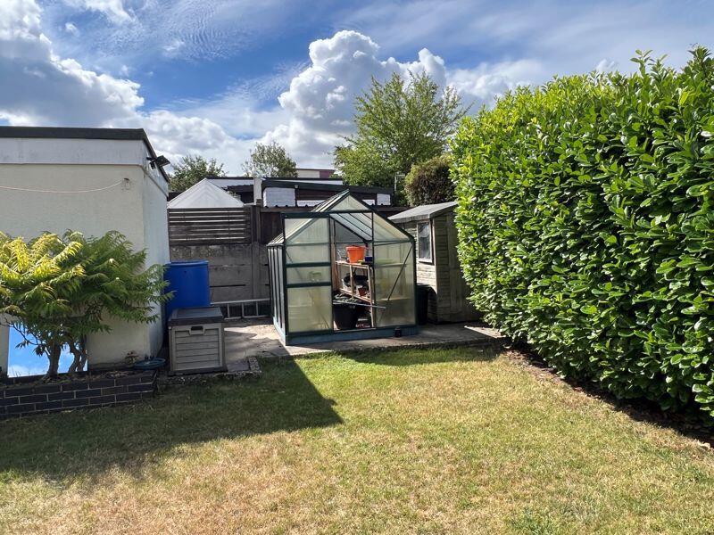
- West facing rear garden
- Council tax band: D
- EPC Rating: D
Additional details
- Parking
- Yes
- Garden
- Yes
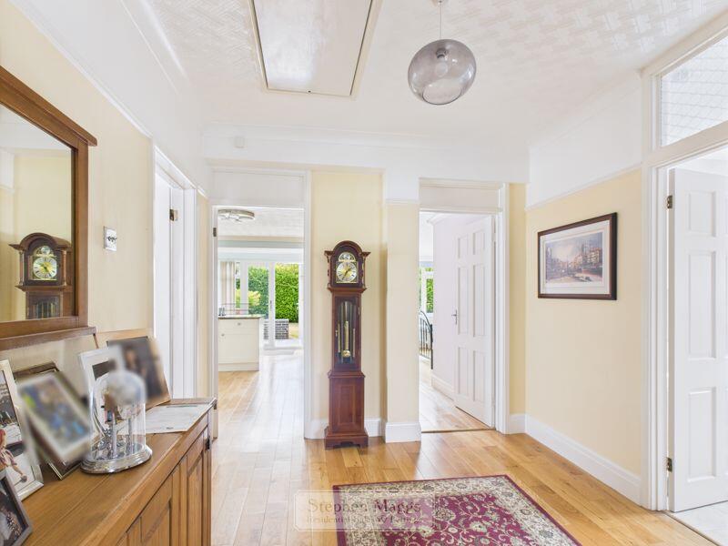
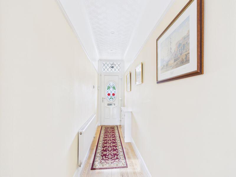
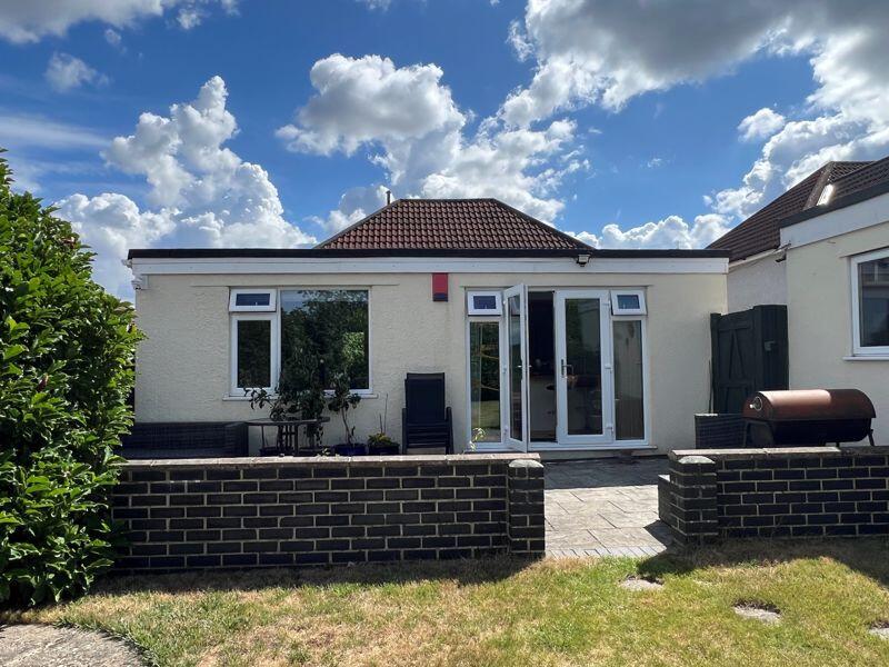
Description
Listed by
Whitchurch
Stephen Maggs Estate Agents LTD
Reference: 164750258
EPC Rating & Upgrade Cost
Current rating: D
Potential rating: B
Inspection date: 18/07/2025
Expiry date: 17/07/2035
Current heating cost: £1,239/year
Potential heating cost: £794/year
Est. upgrade cost to C: £35,500
Recommendations
- Flat roof or sloping ceiling insulation (£900 - £1,200)
- Cavity wall insulation (£900 - £1,500)
- 50 mm internal or external wall insulation (£7,500 - £11,000)
- Floor insulation (suspended floor) (£5,000 - £10,000)
- Floor insulation (solid floor) (£5,000 - £10,000)
- Solar photovoltaic panels, 2.5 kWp (£8,000 - £10,000)
Flood risk
Zone: 1
Risk: Low
Job (default Low)
Floorplans
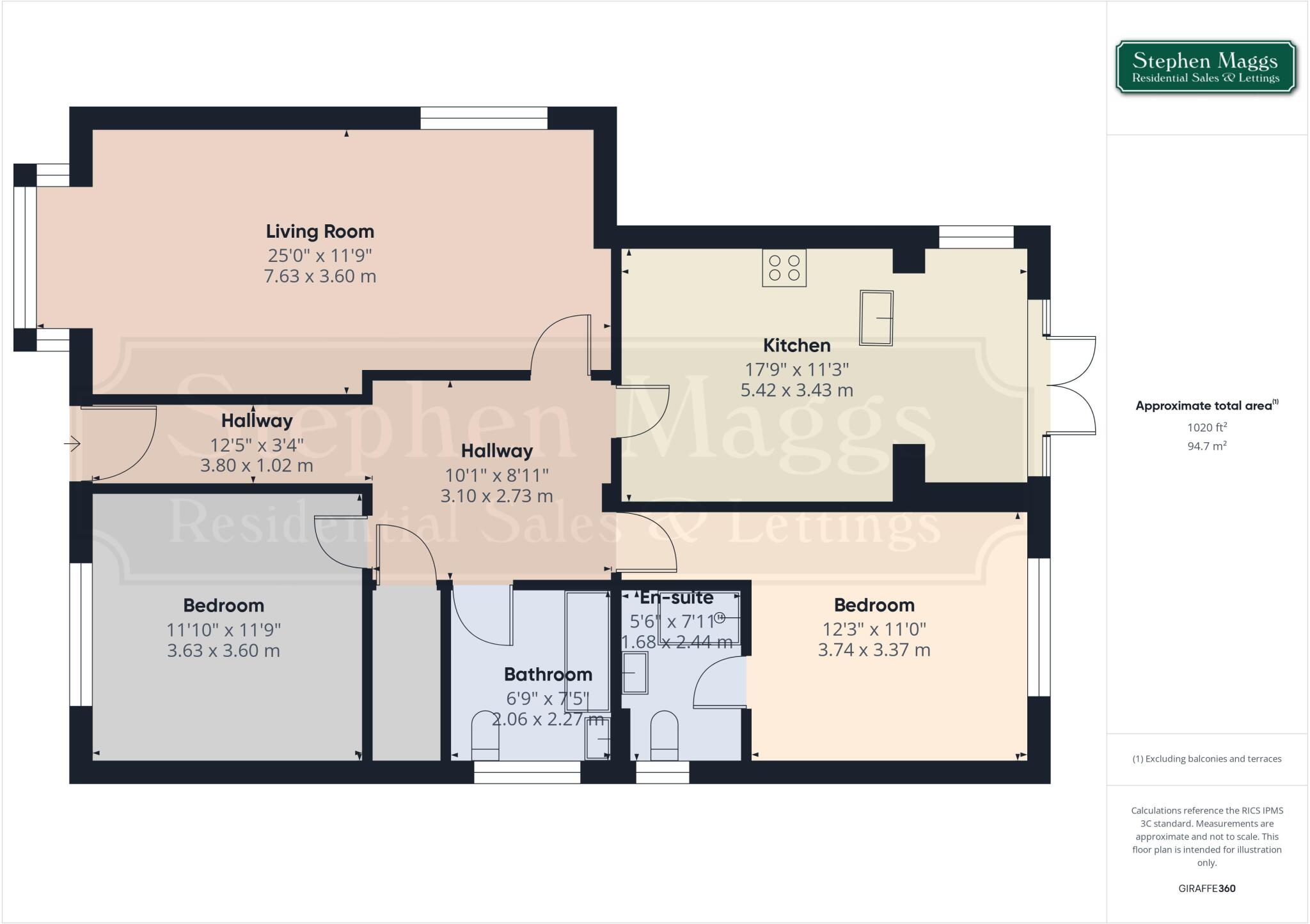
Floorplan 1
EPC Graphs

Energy Performance Certificate
FENSA Certificates
This property has 1 FENSA certificate(s) on record, indicating window/door installations by FENSA-approved installers.
FENSA Certificate #6903334
Property Details
Street: 525 Wells Road
Town: BRISTOL
Postcode: BS14 9AL
Installation Details
Items: 1 window and 2 doors
Certificate Issued: 19/10/2009
Work Completed: 05/10/2009
This certificate data was retrieved from FENSA's database
What is FENSA? FENSA (Fenestration Self-Assessment Scheme) is a government-authorised scheme that monitors building regulation compliance for replacement windows and doors. Certificates indicate that work was completed by FENSA-approved installers.
Price history
295% since 1999
| Event | Date | Price | % change |
|---|---|---|---|
| Sold | 03/02/2026 (4 months ago) | £435,000 | +40.3% |
| Sold | 28/09/2015 (10 years ago) | £310,000 | +26.5% |
| Sold | 01/11/2010 (15 years ago) | £245,000 | +6.5% |
| Sold | 08/07/2009 (16 years ago) | £229,995 | +109.1% |
| Sold | 29/09/1999 (26 years ago) | £110,000 | — |
Source: HM Land Registry Price Paid Data. Crown copyright.
Sold Comparables
Same street and nearby sales within 0.25 miles (last 5 years). Data from Land Registry Price Paid.
| Address | Price | Date | Type |
|---|---|---|---|
| 538 WELLS ROAD, BRISTOL, CITY OF BRISTOL, BS14 9AN | £350,000 | 29/07/2022 | Detached |
| 33 JOHN HALL CLOSE, BRISTOL, CITY OF BRISTOL, BS14 9JY | £445,000 | 25/07/2022 | Detached |
| 33 JOHN HALL CLOSE, BRISTOL, CITY OF BRISTOL, BS14 9JY | £425,000 | 11/07/2022 | Detached |
| Same street 517 WELLS ROAD, BRISTOL, CITY OF BRISTOL, BS14 9AL | £275,000 | 17/06/2022 | Terraced |
| 34 JOHN HALL CLOSE, BRISTOL, CITY OF BRISTOL, BS14 9JY | £460,000 | 09/06/2022 | Detached |
| 15 PONSFORD ROAD, BRISTOL, CITY OF BRISTOL, BS4 2US | £330,000 | 04/03/2022 | Detached |
| 31 JOHN HALL CLOSE, BRISTOL, CITY OF BRISTOL, BS14 9JY | £456,000 | 25/02/2022 | Detached |
| 562 WELLS ROAD, BRISTOL, CITY OF BRISTOL, BS14 9BB | £458,500 | 09/02/2022 | Detached |
| Same street 545 WELLS ROAD, BRISTOL, CITY OF BRISTOL, BS14 9AL | £325,000 | 29/10/2021 | Terraced |
| 1 PONSFORD ROAD, BRISTOL, CITY OF BRISTOL, BS4 2US | £200,000 | 24/09/2021 | Detached |
| 520 WELLS ROAD, BRISTOL, CITY OF BRISTOL, BS14 9AN | £445,000 | 30/06/2021 | Detached |
Street average: £300,000 (2 sales)
Area average: £396,611 (9 sales)
Capital growth trend
Land Registry outcode average: last 12 months vs 5y and 10y ago (from sold prices).
House Price Index (HM Land Registry — official index, not sold-price averages): City of Bristol. Series: Detached. As of March 2026.
Rental Range
Estimated market rent for Bristol, City of. Low = conservative, Realistic = average, Optimistic = best case.
Based on Local Authority from postcode lookup → Bristol, City of.
LHA (30th percentile) floor for Bristol: £1,092/mo (Apr 2025 – Mar 2026)
Location
Nearby
Nearest stations, universities and amenities (distance from property).
| Type | Name | Distance |
|---|---|---|
| Bus stop | Beryl Grove | 0.1 miles |
| Bus stop | Wootton Park | 0.1 miles |
| Shop | Craig's hair | 0.4 miles |
| Shop | Greenslade Locksmith | 0.7 miles |
| Train station | Bedminster | 1.7 miles |
| Train station | Bristol Temple Meads | 1.8 miles |
| University | Bristol Digital Futures Institute | 1.9 miles |
| University | dBs Institute Bristol Campus | 2.1 miles |
| Hospital | South West Regional Laboratories | 2.9 miles |
| Hospital | Spire Bristol | 4.0 miles |
Street-level crime
| Category | Count |
|---|---|
| Violence and sexual offences | 159 |
| Anti-social behaviour | 47 |
| Public order | 30 |
| Vehicle crime | 29 |
| Other theft | 27 |
| Criminal damage and arson | 25 |
| Burglary | 15 |
| Shoplifting | 13 |
| Drugs | 5 |
| Robbery | 4 |
| Other crime | 3 |
| Theft from the person | 2 |
| Possession of weapons | 1 |
| Total incidents | 360 |
Within 1 mile during Apr 2026. Source: data.police.uk (England & Wales).
Schools nearby
Nearest open schools with Ofsted ratings (England). Closed schools are not shown. Data from Get Information about Schools and Ofsted.
| Name | Type | Distance | Ofsted |
|---|---|---|---|
| West Town Lane Academy | Primary | 0.3 miles | Good — 18 Mar 2019 |
| Oasis Academy John Williams | Secondary | 0.4 miles | Good — 8 Nov 2023 |
| Oasis Academy New Oak | Primary | 0.4 miles | Good — 26 May 2022 |
| Oasis Academy Daventry Road | Secondary | 0.4 miles | — (No rating) |
| St Bernadette Catholic Voluntary Aided Primary School | Primary | 0.6 miles | Good — 27 Jun 2013 |
Rental Comparables
Residential lets from OpenRent and Rightmove for the area (same bedroom count). Use to validate rent estimates. Student lets are excluded.
| Title | Rent | Beds | Distance | As seen on |
|---|---|---|---|---|
| 2 Bed Terraced House, Manor House Lane, BS14 | £2,500/mo | 2 | 0.76 miles | OpenRent |
| 2 Bed Flat, Wells Road, BS14 | £1,000/mo | 2 | 0.76 miles | OpenRent |
| 2 Bed Detached House, Manor House Lane, BS14 | £3,000/mo | 2 | 0.78 miles | OpenRent |
Average rent: £2,167/mo (3 listings)
Rent-driven metrics
Based on OpenRent comparables.
- This street — Gross yield for this street only (Land Registry sales + rental comparables, same postcode + street).
- Rent ratio — Monthly rent ÷ purchase price (1% rule). 1%+ = strong, 0.8–1% = okay, <0.8% = weak for cashflow.
- Max investor price — Rent ÷ 0.8%; the price at which rent would be 0.8% of price (Stoke-style target).
- Target investor price — Rent ÷ 1%; the price at which rent would be 1% of price (strong cashflow band).
- Gross yield — Annual rent as % of purchase price (no costs).
- Cost-to-rent — Price ÷ annual rent (from OpenRent comparables). Under 14× = strong, 14–16× = acceptable, 17×+ = compressed.
- Cashflow — Rent minus mortgage, 10% maintenance, £25/mo compliance. Assumes 75% LTV, 3.95% APR (5yr fixed), 25yr term.
- ROI — Annual profit ÷ cash in (deposit + 4% purchase costs).