22 MARSDEN ROAD
LONDON, GREATER LONDON N9 0SL
£1,100 pcm

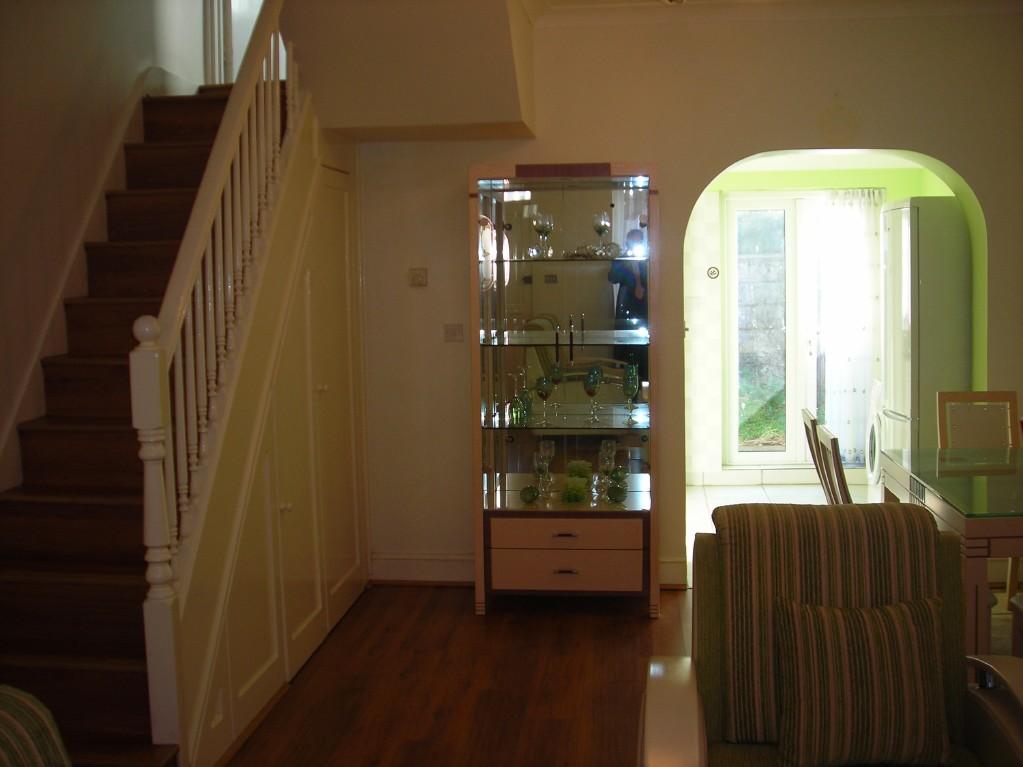
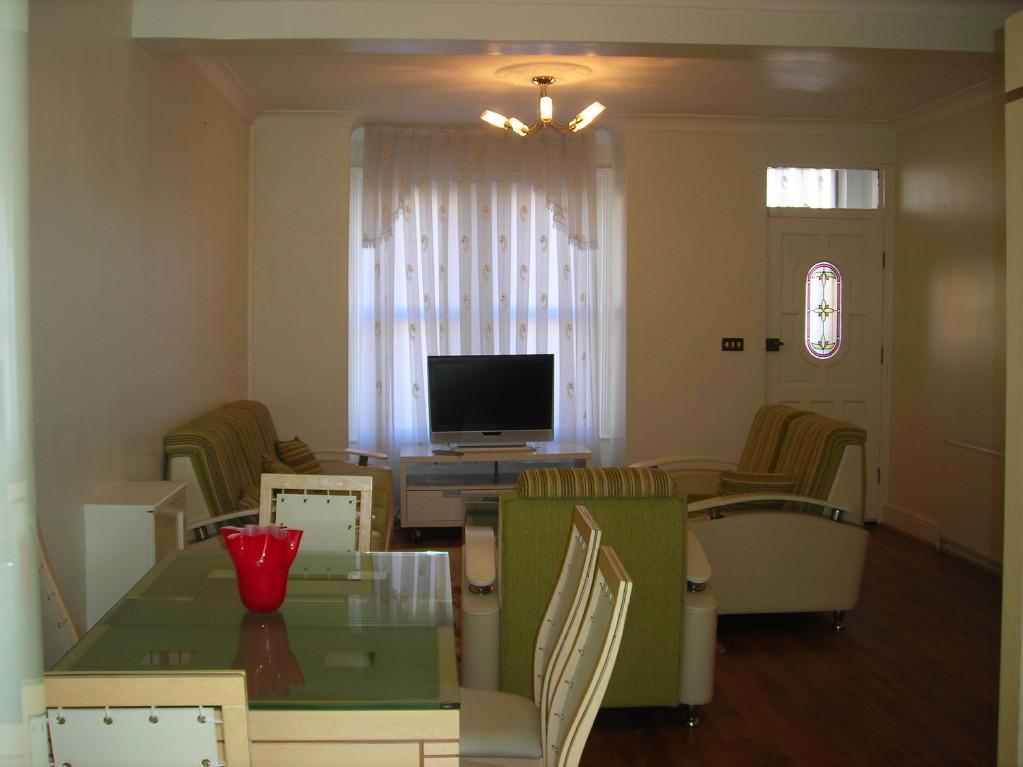
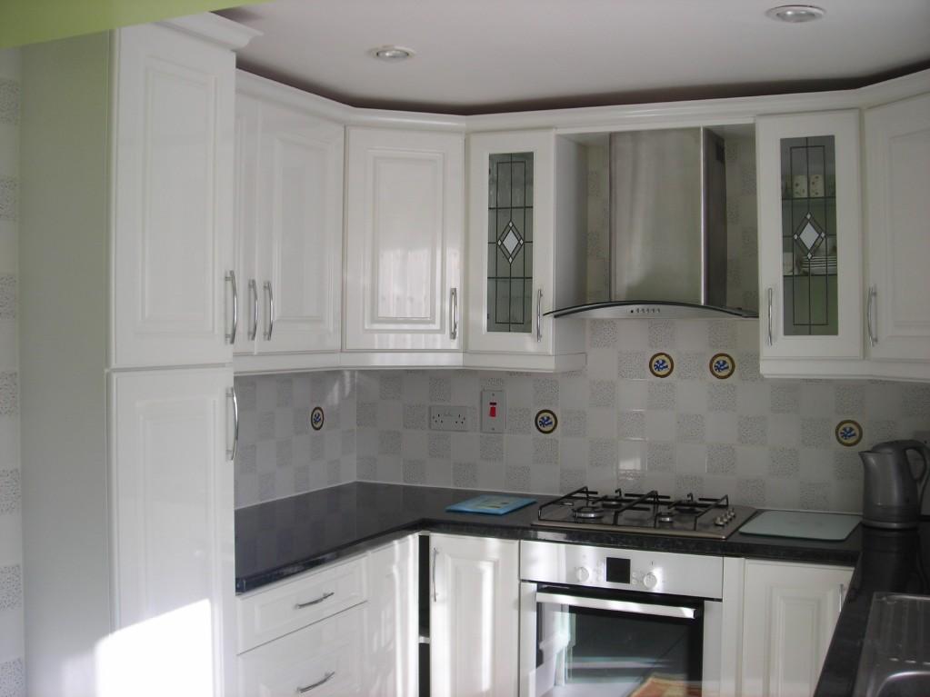
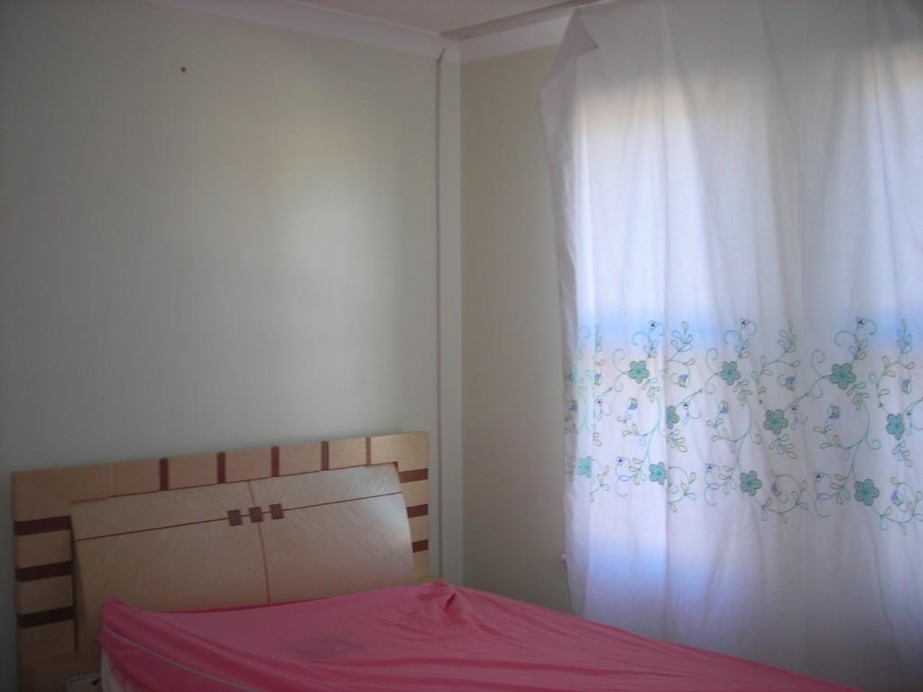
Photo 1 Photo 2 Photo 3 Photo 4 Photo 5
/ 5
Property details
Floor area
81 m²
EPC rating
D
Year built
England and Wales: 1930-1949
Deprivation
Decile 1 (2,734 of 33,755)
Street crime
761 incidents within 1 mile (Apr 2026)
Key features
- Two Bedrooms
- Mid-Terraced House
- Furnished or Unfurnished
- Close to Edmonton Green
- Available soon
Description
Listed by
London
Andrew Stevens
Reference: 24945248
EPC Rating & Upgrade Cost
Current rating: D
Potential rating: B
Inspection date: 02/03/2019
Expiry date: 01/03/2029
Current heating cost: £450/year
Potential heating cost: £369/year
Recommendations
- 50 mm internal or external wall insulation (14,000)
- Floor insulation (suspended floor) (1,200)
- Low energy lighting for all fixed outlets (40)
- Solar water heating (6,000)
- Solar photovoltaic panels, 2.5 kWp (8,000)
Flood risk
Zone: 1
Risk: Low
Job (default Low)
Rental Range
Estimated market rent for Enfield. Low = conservative, Realistic = average, Optimistic = best case.
Based on Local Authority from postcode lookup → Enfield.
LHA (30th percentile) floor for Huntingdon: £793/mo (Apr 2025 – Mar 2026)
Location
Nearby
Nearest stations, universities and amenities (distance from property).
| Type | Name | Distance |
|---|---|---|
| Bus stop | Hail & Ride Marsden Road | 0.0 miles |
| Shop | Iceland | 0.1 miles |
| Shop | Boots | 0.1 miles |
| Train station | Edmonton Green | 0.3 miles |
| Train station | Silver Street | 0.9 miles |
| Hospital | North London Hospice Winchmore Hill | 1.6 miles |
| Hospital | Priory Hospital | 2.8 miles |
| University | University of Portsmouth Walthamstow Campus | 3.4 miles |
| University | Arden University Stratford Campus | 6.1 miles |
Street-level crime
| Category | Count |
|---|---|
| Violence and sexual offences | 213 |
| Anti-social behaviour | 134 |
| Vehicle crime | 82 |
| Drugs | 51 |
| Other theft | 51 |
| Criminal damage and arson | 48 |
| Public order | 38 |
| Shoplifting | 38 |
| Burglary | 32 |
| Theft from the person | 31 |
| Robbery | 16 |
| Other crime | 11 |
| Bicycle theft | 8 |
| Possession of weapons | 8 |
| Total incidents | 761 |
Within 1 mile during Apr 2026. Source: data.police.uk (England & Wales).
Schools nearby
Nearest open schools with Ofsted ratings (England). Closed schools are not shown. Data from Get Information about Schools and Ofsted.
| Name | Type | Distance | Ofsted |
|---|---|---|---|
| Alternative Centre of Education | Other | 0.2 miles | Good — 11 Oct 2021 |
| St Edmund's Catholic Primary School | Primary | 0.2 miles | Good — 19 Jul 2017 |
| Phoenix Academy | Other | 0.2 miles | Good — 21 Sep 2022 |
| Eldon Primary School | Primary | 0.4 miles | Good — 8 May 2022 |
| Houndsfield Primary School | Primary | 0.6 miles | Good — 19 Jul 2023 |
Rental Comparables
Residential lets from OpenRent and Rightmove for the area (same bedroom count). Use to validate rent estimates. Student lets are excluded.
| Title | Rent | Beds | Distance | As seen on |
|---|---|---|---|---|
| 2 Bed Flat, Beamish Road, N9 | £1,850/mo | 2 | 0.29 miles | OpenRent |
| 2 Bed Flat, Winchester Road, N9 | £1,700/mo | 2 | 0.4 miles | OpenRent |
| 2 Bed Flat, Church Lane, N9 | £2,700/mo | 2 | 0.47 miles | OpenRent |
| 2 Bed Semi-Detached House, Woodlands Road, N9 | £2,300/mo | 2 | 0.47 miles | OpenRent |
Average rent: £2,138/mo (4 listings)