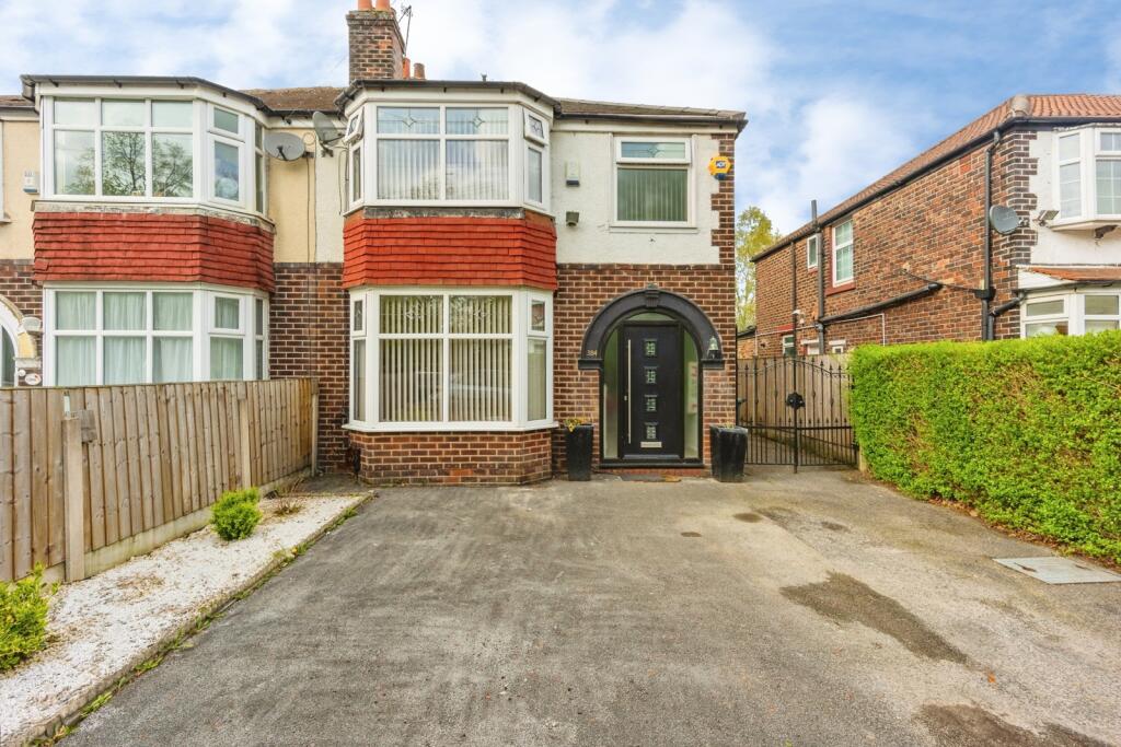
384 MAULDETH ROAD WEST
MANCHESTER, CHORLTON CUM HARDY, GREATER MANCHESTER M21 7RB

Property details
Tenure
FREEHOLD
Floor area
114 m²
Council tax band
C
EPC rating
E
Year built
England and Wales: 1930-1949
Last sold
£270,000 Mar 2018
Price per m²
£3,728/m²
Local average
£541,306 (-21.5%)
Deprivation
Decile 3 (6,931 of 33,755)
Street crime
0 incidents within 1 mile (Mar 2026)
Additional details
- Parking
- Yes
- Garden
- Yes
Description
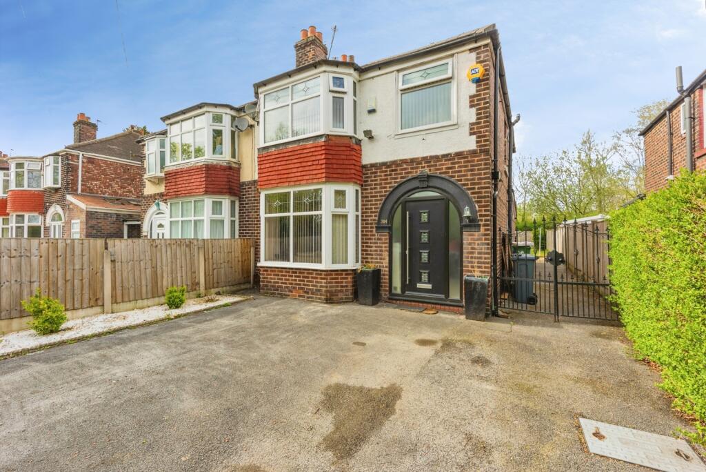
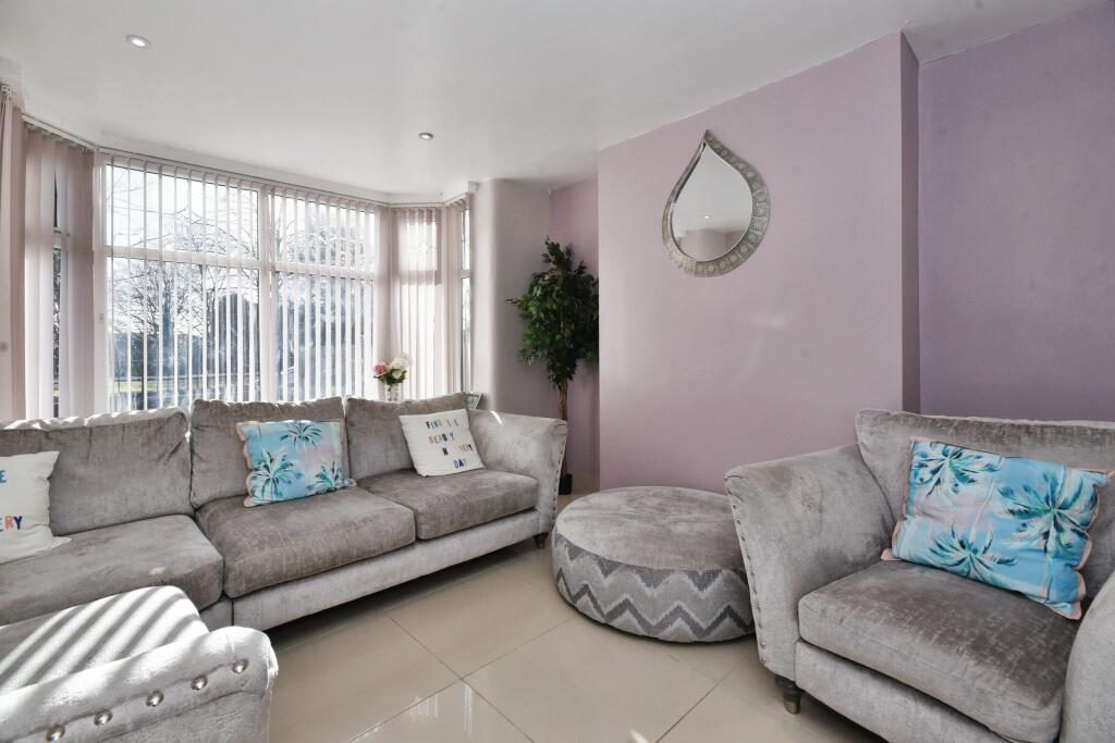
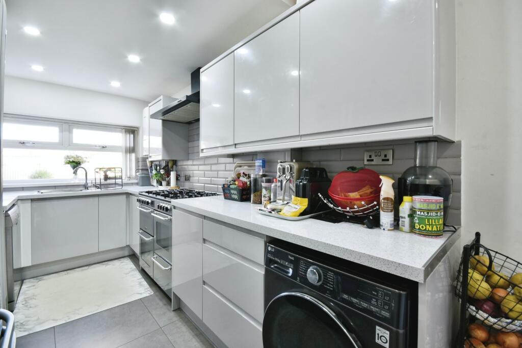
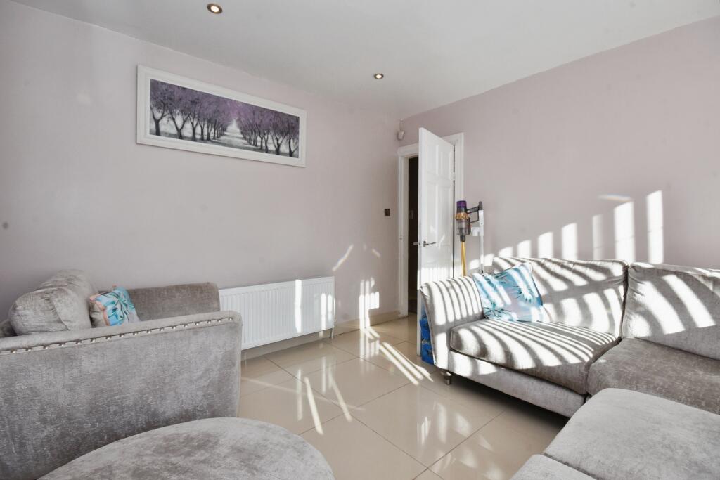
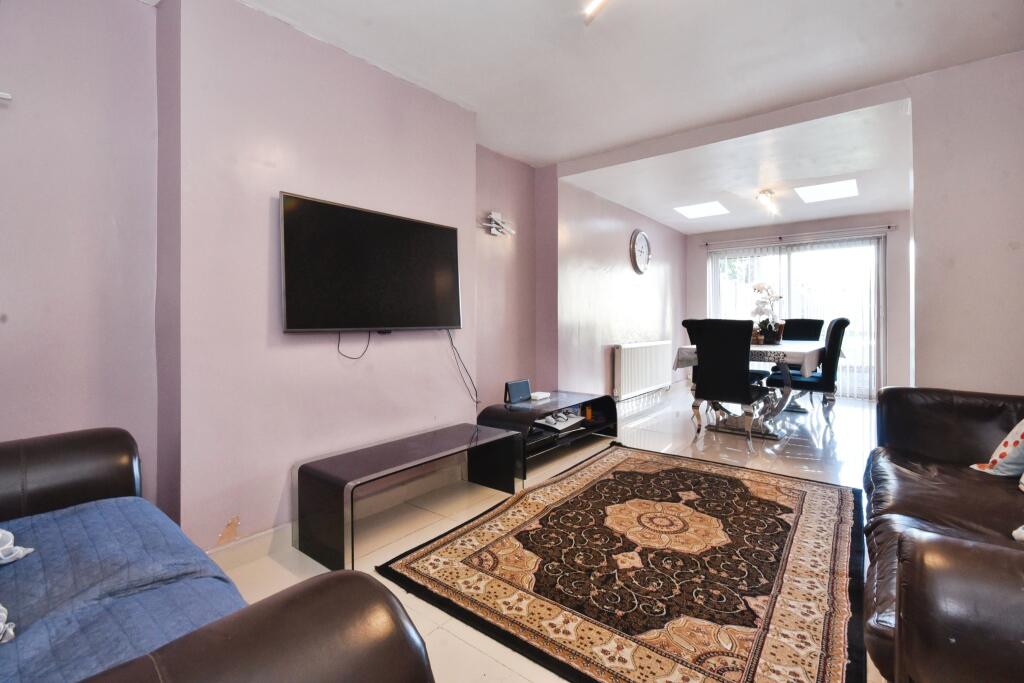
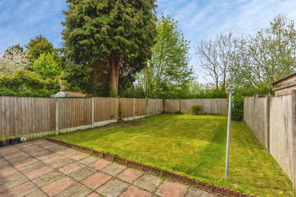
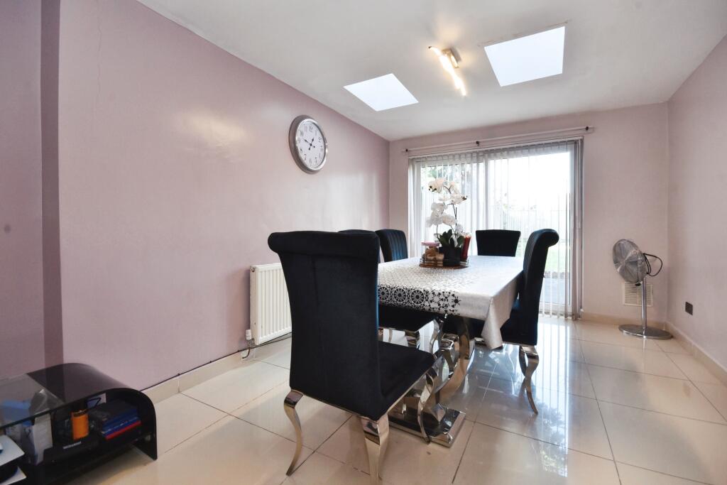
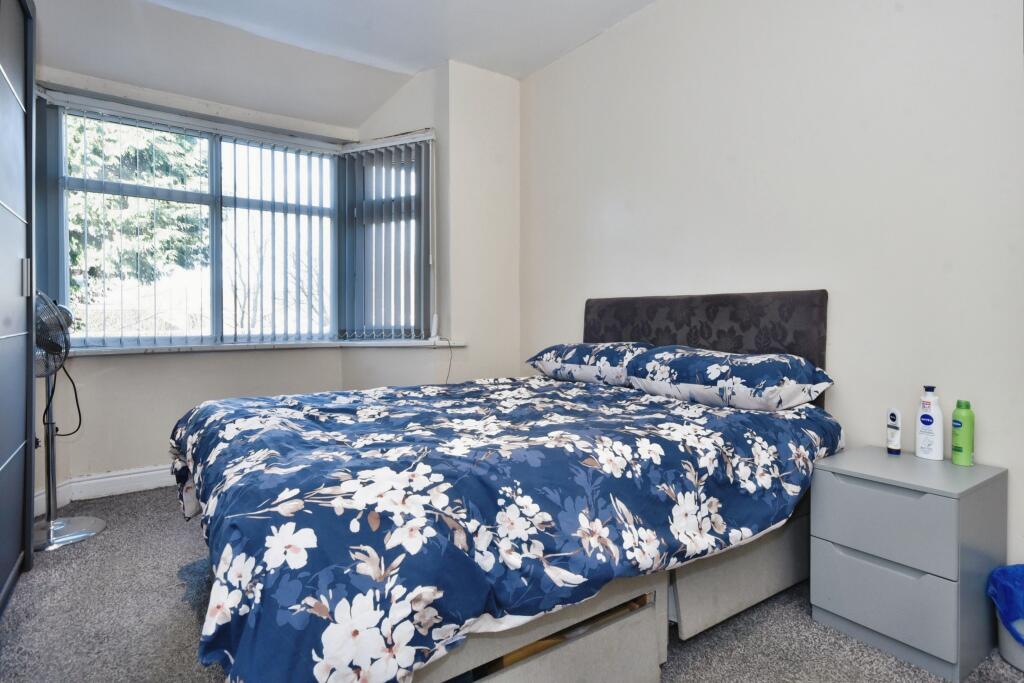
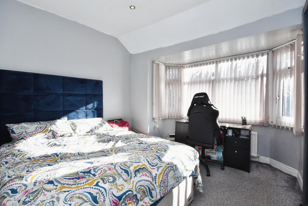
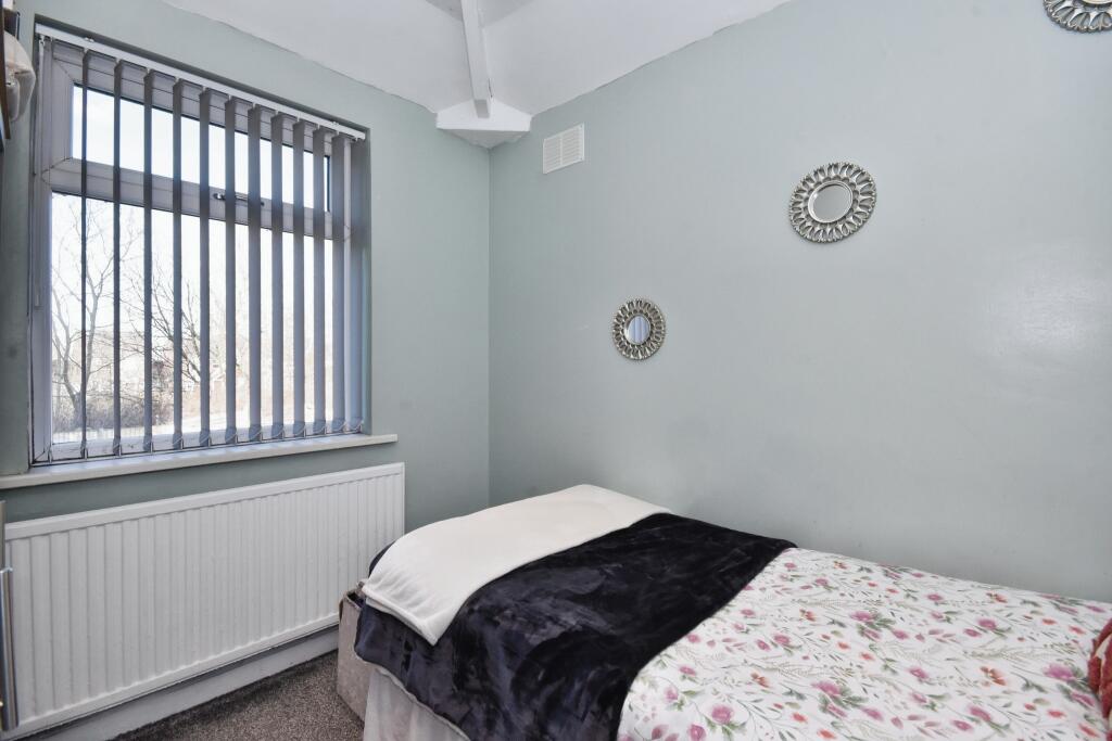
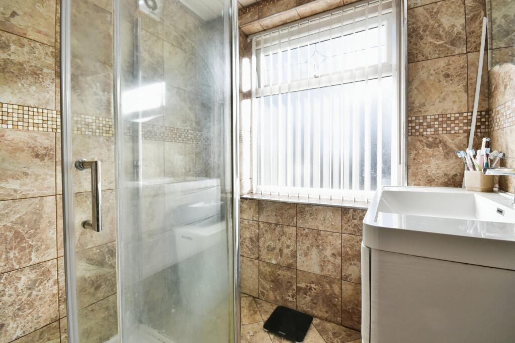
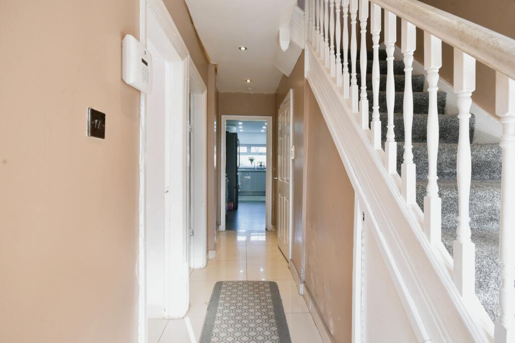
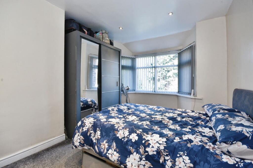
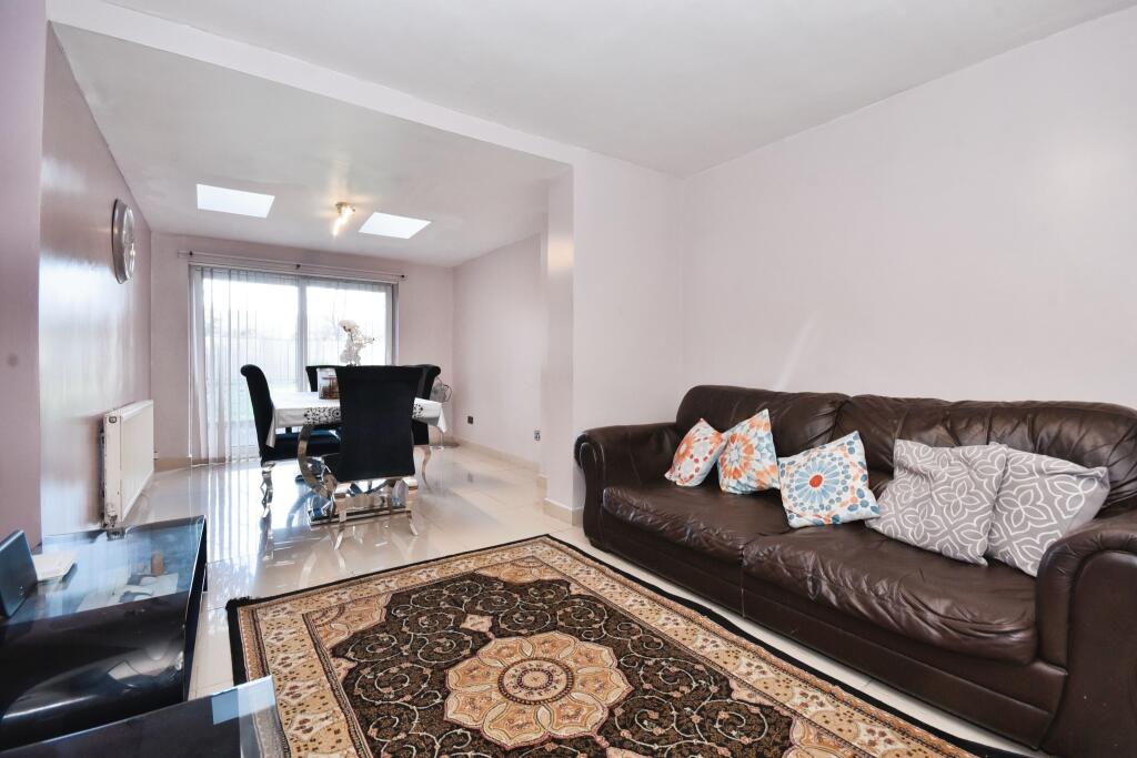
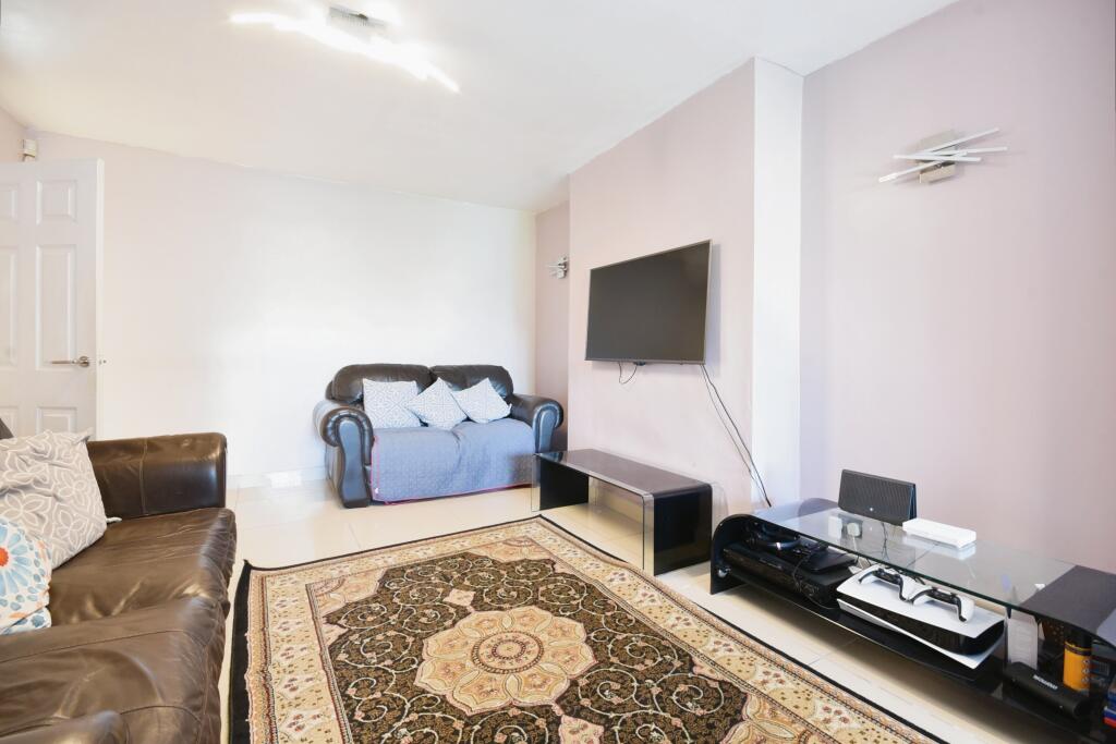
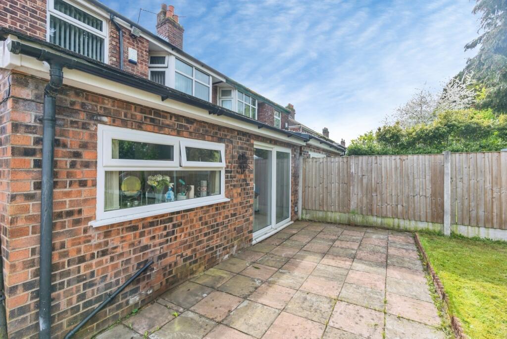
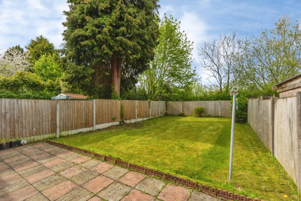
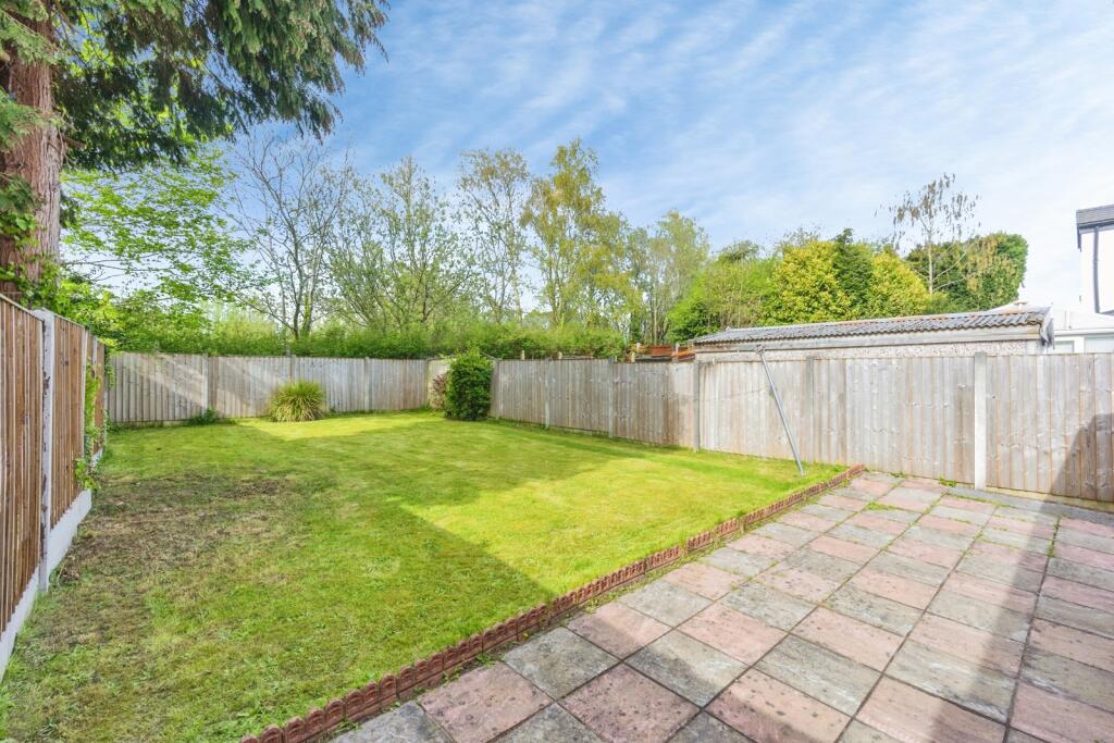
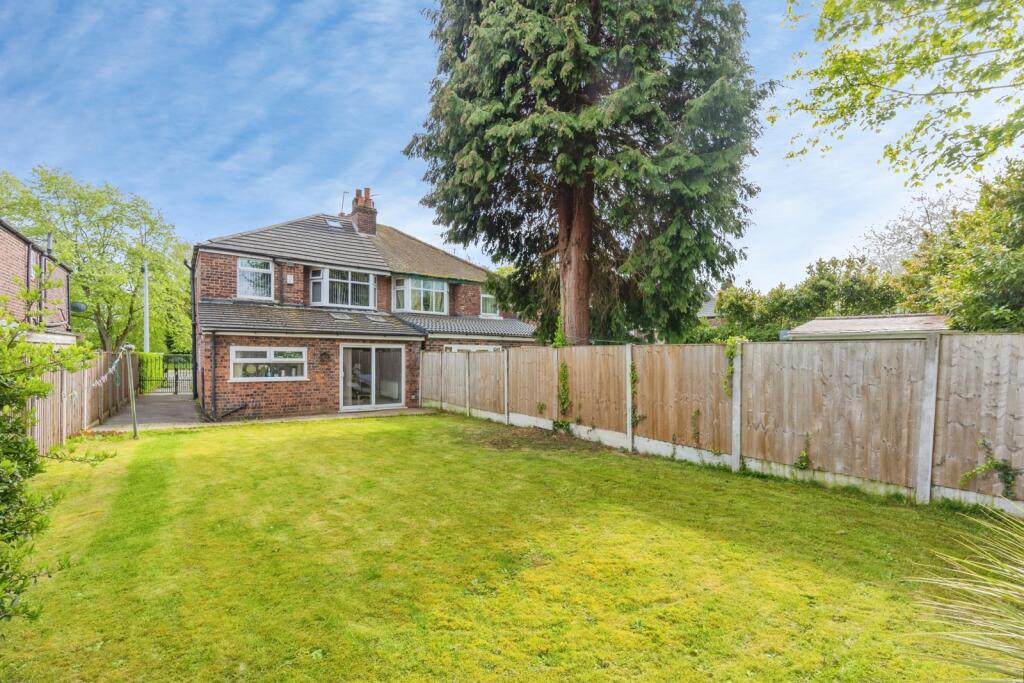
In brief, the accommodation consists of a welcoming entrance hallway, a downstairs shower room, a spacious family room with a box bay window to the front, a through lounge/dining area with access out into the rear enclosed lawned garden and a stylish fitted kitchen. To the first floor the landing reveals three good sized bedrooms, shower room and separate W.C completes this delightful home. The property benefits from; A Worcester boiler, a generous driveway providing off-road parking and a private enclosed large rear lawned garden.
Externally - To the front aspect there is a low-level brick boundary wall, pedestrian gate, driveway providing convenient off-road parking, mature hedgerow to the neighbouring property and side access through double gates leading to the rear garden. To the rear aspect there is generous garden with patio and lawned area enclosed by timber fencing to the neighbouring properties.
Please call our sales team today to arrange your viewing and make this delightful house your home!
Listed by
Chorlton
Countrywide UK Sales - Connells
Reference: 158099504
EPC Rating & Upgrade Cost
Current rating: E
Potential rating: B
Inspection date: 12/01/2018
Current heating cost: £1,023/year
Potential heating cost: £565/year
Est. upgrade cost to C: £16,790
Recommendations
- Increase loft insulation to 270 mm (£100 - £350)
- Cavity wall insulation (£500 - £1,500)
- Floor insulation (suspended floor) (£800 - £1,200)
- Low energy lighting for all fixed outlets (£65)
- Upgrade heating controls (£350 - £450)
- Replace boiler with new condensing boiler (£2,200 - £3,000)
- Solar water heating (£4,000 - £6,000)
- Solar photovoltaic panels, 2.5 kWp (£5,000 - £8,000)
Flood risk
Zone: 1
Risk: Low
Job (default Low)
Floorplans
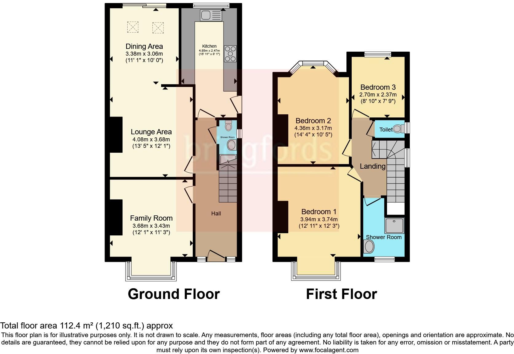
FLOOR-PLAN
EPC Graphs
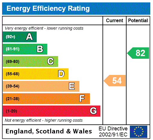
EPC Rating Graph
Price history
54% since 2002
| Event | Date | Price | % change |
|---|---|---|---|
| Listed for sale | — | £425,000 | +57.4% |
| Sold | 28/03/2018 (8 years ago) | £270,000 | +90.1% |
| Sold | 10/09/2003 (22 years ago) | £142,000 | -18.9% |
| Sold | 02/08/2002 (23 years ago) | £175,000 | — |
Source: HM Land Registry Price Paid Data. Crown copyright.
Sold Comparables
Same street and nearby sales within 0.25 miles (last 5 years). Data from Land Registry Price Paid.
| Address | Price | Date | Type |
|---|---|---|---|
| 19 ST AUSTELL ROAD, MANCHESTER, GREATER MANCHESTER, M16 8WQ | £575,000 | 16/12/2025 | Semi-detached |
| 13 DALMORTON ROAD, MANCHESTER, GREATER MANCHESTER, M21 0YQ | £520,000 | 27/10/2023 | Semi-detached |
| 9 DALMORTON ROAD, MANCHESTER, GREATER MANCHESTER, M21 0YQ | £300,000 | 23/05/2023 | Semi-detached |
| 280 WITHINGTON ROAD, CHORLTON CUM HARDY, MANCHESTER, GREATER MANCHESTER, M21 0XZ | £480,500 | 25/11/2022 | Semi-detached |
| 5A ST AUSTELL ROAD, MANCHESTER, GREATER MANCHESTER, M16 8WQ | £90,000 | 02/11/2022 | Semi-detached |
| 61 CAISTOR CLOSE, MANCHESTER, GREATER MANCHESTER, M16 8NW | £310,000 | 30/09/2022 | Semi-detached |
| 11 ST AUSTELL ROAD, MANCHESTER, GREATER MANCHESTER, M16 8WQ | £450,000 | 13/07/2022 | Semi-detached |
| 35 ATHOL ROAD, MANCHESTER, GREATER MANCHESTER, M16 8QW | £340,000 | 12/07/2022 | Semi-detached |
| 7 DALMORTON ROAD, MANCHESTER, GREATER MANCHESTER, M21 0YQ | £402,500 | 17/06/2022 | Semi-detached |
| 15 ATHOL ROAD, MANCHESTER, GREATER MANCHESTER, M16 8QW | £340,000 | 10/06/2022 | Semi-detached |
| 12 DALMORTON ROAD, MANCHESTER, GREATER MANCHESTER, M21 0YQ | £575,000 | 19/05/2022 | Semi-detached |
| 24 BLAIR ROAD, MANCHESTER, GREATER MANCHESTER, M16 8NS | £150,000 | 06/05/2022 | Semi-detached |
| 408 MAULDETH ROAD WEST, CHORLTON CUM HARDY, MANCHESTER, GREATER MANCHESTER, M21 7RA | £391,000 | 04/05/2022 | Semi-detached |
| 101 ALEXANDRA ROAD SOUTH, MANCHESTER, GREATER MANCHESTER, M16 8NX | £300,000 | 08/04/2022 | Semi-detached |
| 17 EGERTON ROAD SOUTH, MANCHESTER, GREATER MANCHESTER, M21 0YP | £410,000 | 07/01/2022 | Semi-detached |
| 17 ATHOL ROAD, MANCHESTER, GREATER MANCHESTER, M16 8QW | £400,000 | 17/12/2021 | Semi-detached |
| 1 WARDLEY AVENUE, MANCHESTER, GREATER MANCHESTER, M16 8WX | £510,000 | 16/12/2021 | Semi-detached |
| Same street 372 MAULDETH ROAD WEST, CHORLTON CUM HARDY, MANCHESTER, GREATER MANCHESTER, M21 7RB | £370,000 | 13/12/2021 | Semi-detached |
| 2A ATHOL ROAD, MANCHESTER, GREATER MANCHESTER, M16 8QN | £260,000 | 19/11/2021 | Semi-detached |
| 106 ALEXANDRA ROAD SOUTH, MANCHESTER, GREATER MANCHESTER, M16 8WU | £160,000 | 10/11/2021 | Semi-detached |
| 119 KINGSBROOK ROAD, MANCHESTER, GREATER MANCHESTER, M16 8NY | £348,000 | 30/06/2021 | Semi-detached |
Street average: £370,000 (1 sale)
Area average: £365,600 (20 sales)
Capital growth trend
Land Registry outcode average: last 12 months vs 5y and 10y ago (from sold prices).
House Price Index (HM Land Registry — official index, not sold-price averages): Manchester. Series: Semi-detached. As of February 2026.
Rental Range
Estimated market rent for Manchester. Low = conservative, Realistic = average, Optimistic = best case.
Based on Local Authority from postcode lookup → Manchester.
LHA (30th percentile) floor for West Pennine: £504/mo (Apr 2025 – Mar 2026)
Location
Nearby
Nearest stations, universities and amenities (distance from property).
| Type | Name | Distance |
|---|---|---|
| Bus stop | Chorlton, Mauldeth Road West / outside Hough End Centre | 0.0 miles |
| Bus stop | Chorlton, Mauldeth Road West / opposite Hough End Centre | 0.1 miles |
| Shop | Unknown | 0.1 miles |
| Shop | Kane Funeral Services | 0.4 miles |
| Hospital | Spire Manchester Hospital | 1.0 miles |
| Hospital | Withington Community Hospital | 1.0 miles |
| University | University of Manchester | 1.3 miles |
| University | Fallowfield Reception and Richmond Amenities Building | 1.7 miles |
| Train station | Mauldeth Road | 1.9 miles |
| Train station | Burnage | 2.0 miles |
Street-level crime
| Category | Count |
|---|---|
| Total incidents | 0 |
Within 1 mile during Mar 2026. Source: data.police.uk (England & Wales).
Schools nearby
Nearest open schools with Ofsted ratings (England). Closed schools are not shown. Data from Get Information about Schools and Ofsted.
| Name | Type | Distance | Ofsted |
|---|---|---|---|
| CHS South | Secondary | 0.3 miles | Good — 13 Feb 2023 |
| Whalley Range 11-18 High School | Secondary | 0.4 miles | Good — 12 Nov 2012 |
| Kassim Darwish Grammar School for Boys | Other | 0.4 miles | — (No rating) |
| Chorlton High School | Secondary | 0.5 miles | Good — 10 Oct 2011 |
| William Hulme's Grammar School | Other | 0.5 miles | Good — 9 Jun 2019 |
Rental Comparables
Loading rental comparables for this postcode. Refresh in a few minutes.
Rent-driven metrics
Based on Area rent estimate.
- Rent ratio — Monthly rent ÷ purchase price (1% rule). 1%+ = strong, 0.8–1% = okay, <0.8% = weak for cashflow.
- Max investor price — Rent ÷ 0.8%; the price at which rent would be 0.8% of price (Stoke-style target).
- Target investor price — Rent ÷ 1%; the price at which rent would be 1% of price (strong cashflow band).
- Gross yield — Annual rent as % of purchase price (no costs).