13 SALTWOOD AVENUE
WORCESTER, BERKELEY ALFORD, WORCESTERSHIRE WR4 0JP
£850 pcm
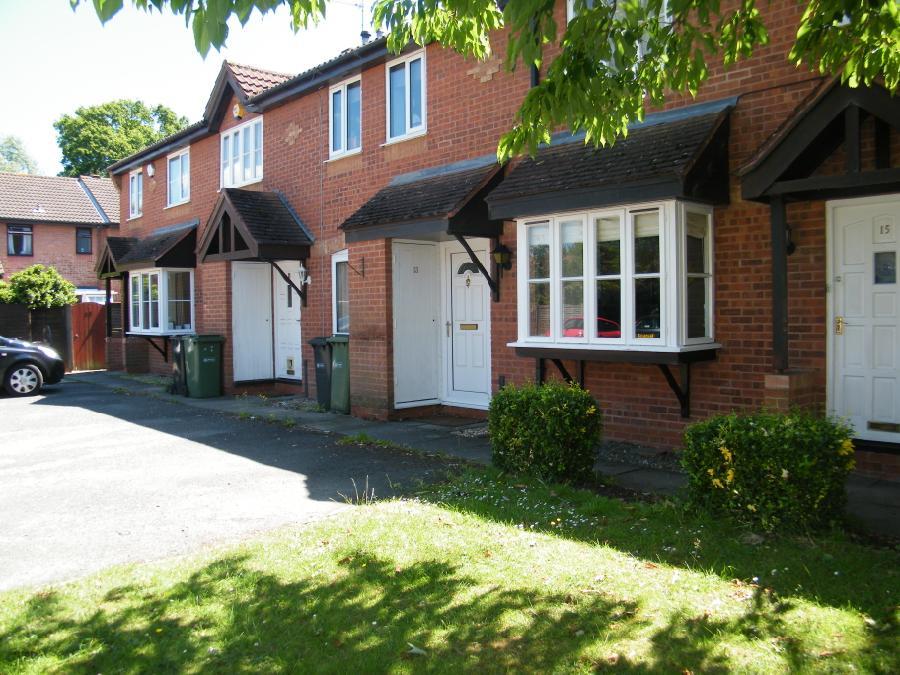
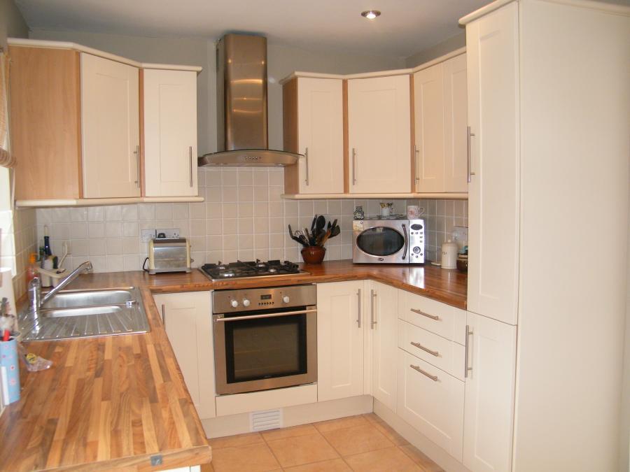
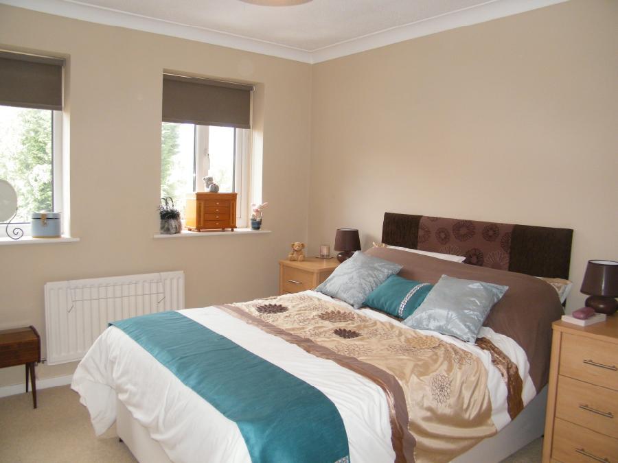
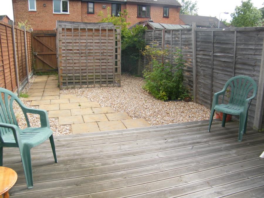
Photo 1 Photo 2 Photo 3 Photo 4
/ 4
Property details
Floor area
56 m²
EPC rating
D
Deprivation
Decile 9 (27,676 of 33,755)
Street crime
158 incidents within 1 mile (May 2026)
Key features
- Available: End of September
- Two Bedrooms
- Mid Terrace House
- Lounge
- Fitted Kitchen
- Bathroom With Shower
- Zero deposit option
- Enclosed Rear Garden
- Allocated Parking
- Unfurnished
Additional details
- Parking
- Yes
- Garden
- Yes
Description
A well presented, two bedroom property situated in the popular area of Warndon Villages offering great transport links to the M5 and city centre. The property is accessed via a small entrance porch leading into a light and airy lounge which gives access to a modern kitchen offering high and low level fitted units. The kitchen benefits from sliding patio doors that lead out onto a low maintenance rear garden. Stairs from the lounge lead to a double master bedroom with ample storage. The second bedroom and family bathroom are at the rear of the property. The property has allocated parking.
Unfortunately pets are NOT considered for this property. non smokers. unfurnished. EPC rating C.
Please note all offers are subject to satisfactory references and contract.
Council tax band : B Council Tax Band: Holding Deposit: £196.00
Listed by
Worcester
Countrywide UK Lettings - Connells
Reference: 126648872
EPC Rating & Upgrade Cost
Current rating: D
Potential rating: B
Inspection date: 15/10/2024
Expiry date: 14/10/2034
Est. upgrade cost to C: £15,350
Recommendations
- Party wall insulation (£300 - £600)
- Floor insulation (solid floor) (£4,000 - £6,000)
- Upgrade heating controls (£350 - £450)
- Solar water heating (£4,000 - £6,000)
- Solar photovoltaic panels, 2.5 kWp (£3,500 - £5,500)
Flood risk
Zone: 1
Risk: Low
Job (default Low)
Floorplans
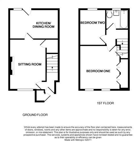
Floorplan 1
EPC Graphs
EPC Image
Rental Range
Estimated market rent for Worcester. Low = conservative, Realistic = average, Optimistic = best case.
Based on Local Authority from postcode lookup → Worcester.
LHA (30th percentile) floor for Worcester South: £698/mo (Apr 2025 – Mar 2026)
Location
Nearby
Nearest stations, universities and amenities (distance from property).
| Type | Name | Distance |
|---|---|---|
| Bus stop | Saltwood Avenue | 0.1 miles |
| Bus stop | Tamworth Avenue | 0.1 miles |
| Shop | Rybrook BMW | 0.4 miles |
| Hospital | Worcestershire Royal Hospital | 1.1 miles |
| Train station | Worcester Shrub Hill | 1.7 miles |
| Train station | Worcester Foregate Street | 2.1 miles |
| University | Jenny Lind Building | 2.2 miles |
| University | University of Worcester, City Campus | 2.3 miles |
| Hospital | Spire Southbank Hospital | 2.5 miles |
Street-level crime
| Category | Count |
|---|---|
| Violence and sexual offences | 78 |
| Public order | 17 |
| Criminal damage and arson | 14 |
| Other theft | 11 |
| Vehicle crime | 11 |
| Burglary | 7 |
| Shoplifting | 7 |
| Drugs | 6 |
| Possession of weapons | 3 |
| Robbery | 3 |
| Other crime | 1 |
| Total incidents | 158 |
Within 1 mile during May 2026. Source: data.police.uk (England & Wales).
Schools nearby
Nearest open schools with Ofsted ratings (England). Closed schools are not shown. Data from Get Information about Schools and Ofsted.
| Name | Type | Distance | Ofsted |
|---|---|---|---|
| St Joseph's Catholic Primary School | Primary | 0.4 miles | Good — 6 Feb 2013 |
| Oasis Academy Warndon | Primary | 0.5 miles | Outstanding — 23 Jan 2023 |
| The Lyppard Grange Primary School | Primary | 0.5 miles | Good — 30 Apr 2014 |
| The Aspire Academy | Other | 0.7 miles | Good — 6 Jun 2017 |
| Carnforth School | Primary | 0.7 miles | Good — 10 Feb 2022 |
Rental Comparables
Rental listings exist nearby, but none matched the 2-bedroom count for this property.