61 LINCOLN AVENUE
NEWCASTLE, STAFFORDSHIRE ST5 3BA
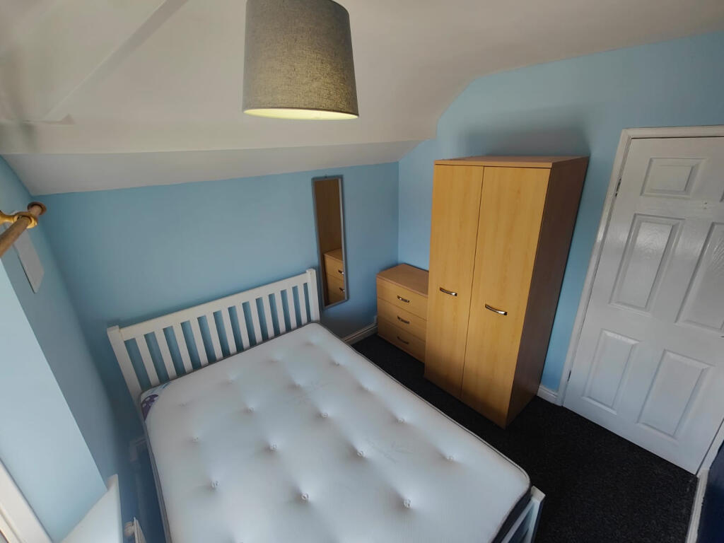
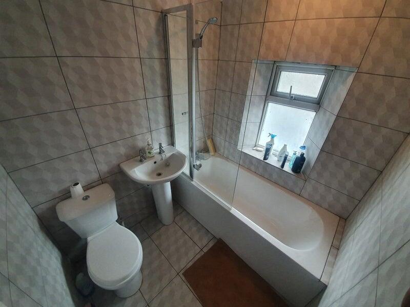
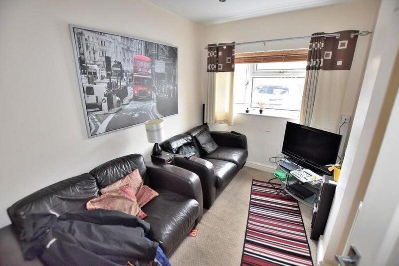
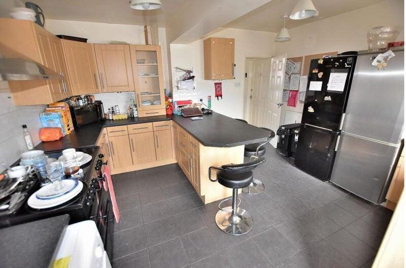
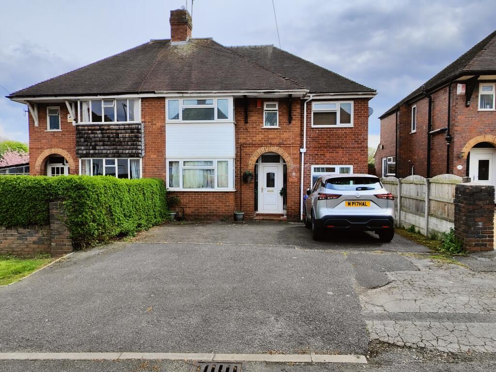
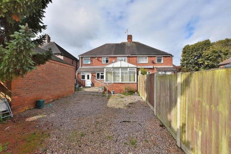
Photo 1 Photo 2 Photo 3 Photo 4 Photo 5 Photo 6
/ 6
Property details
Floor area
124 m²
Council tax band
C
Last sold
£204,000 Dec 2010
Local average
£455,953 (-99.9%)
Deprivation
Decile 9 (29,306 of 33,755)
Street crime
263 incidents within 1 mile (Apr 2026)
Key features
- Room to let
- Inclusive of utility bills
Description
Take a look at this room to let in a shared accommodation property.
Having access to all communal facilities, a good size private room, this opportunity will fit a plethora of potential tenants!
The property boasts a contemporary, fitted kitchen and spacious communal reception rooms, perfect for relaxing or socialising. All bills are included in the rent, providing a hassle-free living experience. Ideal for professionals or students seeking a comfortable and convenient home.
The property is also situated in a highly convenient location, so make your enquiry today! Council Tax Band: C Holding Deposit: £113.00
Listed by
Newcastle Under Lyme
Countrywide UK Lettings - Connells
Reference: 171744332
EPC Rating & Upgrade Cost
Fetching EPC data… Refresh this page in a moment.
Flood risk
Zone: 1
Risk: Low
Job (default Low)
EPC Graphs
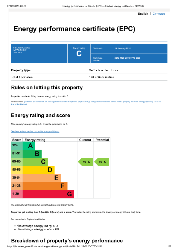
EPC Image
Price history
13% since 2010
| Event | Date | Price | % change |
|---|---|---|---|
| Sold | 23/11/2021 (4 years ago) | £230,000 | +12.7% |
| Sold | 21/12/2010 (15 years ago) | £204,000 | — |
Source: HM Land Registry Price Paid Data. Crown copyright.
Sold Comparables
Same street and nearby sales within 0.25 miles (last 5 years). Data from Land Registry Price Paid.
| Address | Price | Date | Type |
|---|---|---|---|
| Same street 33 LINCOLN AVENUE, NEWCASTLE, NEWCASTLE-UNDER-LYME, STAFFORDSHIRE, ST5 3BA | £235,000 | 14/03/2025 | Semi-detached |
| Same street 63 LINCOLN AVENUE, NEWCASTLE, NEWCASTLE-UNDER-LYME, STAFFORDSHIRE, ST5 3BA | £230,000 | 25/06/2024 | Semi-detached |
| Same street 65 LINCOLN AVENUE, NEWCASTLE, NEWCASTLE-UNDER-LYME, STAFFORDSHIRE, ST5 3BA | £248,000 | 07/06/2024 | Semi-detached |
| Same street 17 LINCOLN AVENUE, NEWCASTLE, NEWCASTLE-UNDER-LYME, STAFFORDSHIRE, ST5 3BA | £246,000 | 20/10/2023 | Semi-detached |
| 35 KENTMERE PLACE, NEWCASTLE, NEWCASTLE-UNDER-LYME, STAFFORDSHIRE, ST5 3QL | £172,000 | 12/08/2022 | Other |
| 93 CLAYTON ROAD, NEWCASTLE, NEWCASTLE-UNDER-LYME, STAFFORDSHIRE, ST5 3NE | £345,000 | 30/03/2022 | Other |
| Same street 41 LINCOLN AVENUE, NEWCASTLE, NEWCASTLE-UNDER-LYME, STAFFORDSHIRE, ST5 3BA | £225,000 | 27/08/2021 | Semi-detached |
Street average: £236,800 (5 sales)
Area average: £258,500 (2 sales)
Capital growth trend
Land Registry outcode average: last 12 months vs 5y and 10y ago (from sold prices).
House Price Index (HM Land Registry — official index, not sold-price averages): Newcastle-under-Lyme. Series: All dwelling types. As of March 2026.
Company ownership
Registered legal owner is a company.
Company: PAHAL PROPERTIES LTD (13477517)
Rental Range
Estimated market rent for Newcastle-under-Lyme. Low = conservative, Realistic = average, Optimistic = best case.
Based on Local Authority from postcode lookup → Newcastle-under-Lyme.
LHA (30th percentile) floor for Staffordshire North: £424/mo (Apr 2025 – Mar 2026)
Location
Nearby
Nearest stations, universities and amenities (distance from property).
| Type | Name | Distance |
|---|---|---|
| Bus stop | Milborne Drive | 0.1 miles |
| Bus stop | Milbourne Drive | 0.1 miles |
| Shop | Co-op Food | 0.1 miles |
| Shop | Pinkstones | 0.4 miles |
| Hospital | Royal Stoke University Hospital | 0.5 miles |
| Hospital | Harplands Hospital | 0.5 miles |
| Train station | Stoke-on-Trent | 1.8 miles |
| University | University of Staffordshire Stoke Campus | 1.9 miles |
| University | Keele University | 2.1 miles |
| Train station | Trentham Leisure | 2.7 miles |
Street-level crime
| Category | Count |
|---|---|
| Violence and sexual offences | 85 |
| Anti-social behaviour | 50 |
| Public order | 24 |
| Criminal damage and arson | 22 |
| Shoplifting | 20 |
| Other theft | 14 |
| Burglary | 12 |
| Drugs | 11 |
| Other crime | 10 |
| Vehicle crime | 5 |
| Robbery | 4 |
| Possession of weapons | 3 |
| Theft from the person | 3 |
| Total incidents | 263 |
Within 1 mile during Apr 2026. Source: data.police.uk (England & Wales).
Schools nearby
Nearest open schools with Ofsted ratings (England). Closed schools are not shown. Data from Get Information about Schools and Ofsted.
| Name | Type | Distance | Ofsted |
|---|---|---|---|
| Coppice Academy | Other | 0.4 miles | Good — 6 Mar 2014 |
| Langdale Primary School | Primary | 0.4 miles | Good — 15 Sep 2024 |
| St John's CofE (A) Primary School | Primary | 0.5 miles | Requires improvement — 14 Jun 2023 |
| Co-op Academy Friarswood | Primary | 0.6 miles | Good — 8 Mar 2013 |
| Our Lady and St Werburgh's Catholic Primary School | Primary | 0.6 miles | Good — 11 Apr 2014 |
Rental Comparables
Residential lets from OpenRent and Rightmove for the area (same bedroom count). Use to validate rent estimates. Student lets are excluded.
Average rent: £631/mo (36 listings)
Rent-driven metrics
Based on OpenRent comparables.
- Rent ratio — Monthly rent ÷ purchase price (1% rule). 1%+ = strong, 0.8–1% = okay, <0.8% = weak for cashflow.
- Max investor price — Rent ÷ 0.8%; the price at which rent would be 0.8% of price (Stoke-style target).
- Target investor price — Rent ÷ 1%; the price at which rent would be 1% of price (strong cashflow band).
- Gross yield — Annual rent as % of purchase price (no costs).
- Cost-to-rent — Price ÷ annual rent (from OpenRent comparables). Under 14× = strong, 14–16× = acceptable, 17×+ = compressed.
- Cashflow — Rent minus mortgage, 10% maintenance, £25/mo compliance. Assumes 75% LTV, 3.95% APR (5yr fixed), 25yr term.
- ROI — Annual profit ÷ cash in (deposit + 4% purchase costs).