Flat 74
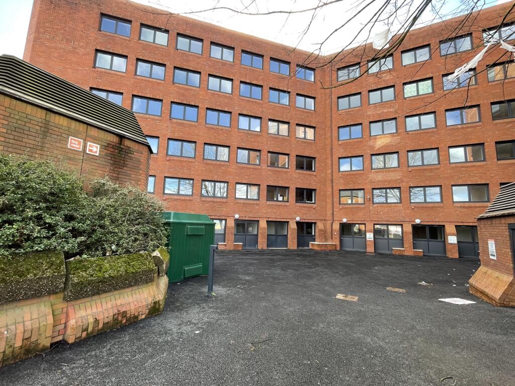
TELECOM HOUSE, CHURCH STREET, WOLVERHAMPTON, WEST MIDLANDS WV2 4AY
£725 pcm
Property details
Floor area
43 m²
Street crime
618 incidents within 1 mile (Apr 2026)
Key features
- RECENTLY REFURBISHED
- GOOD TRANSPORT LINKS
- WOLVERHAMPTON TOWN CENTRE
- EPC: D
- CT: TBC
- CALL CONNELLS WOLVERHAMPTON
Description
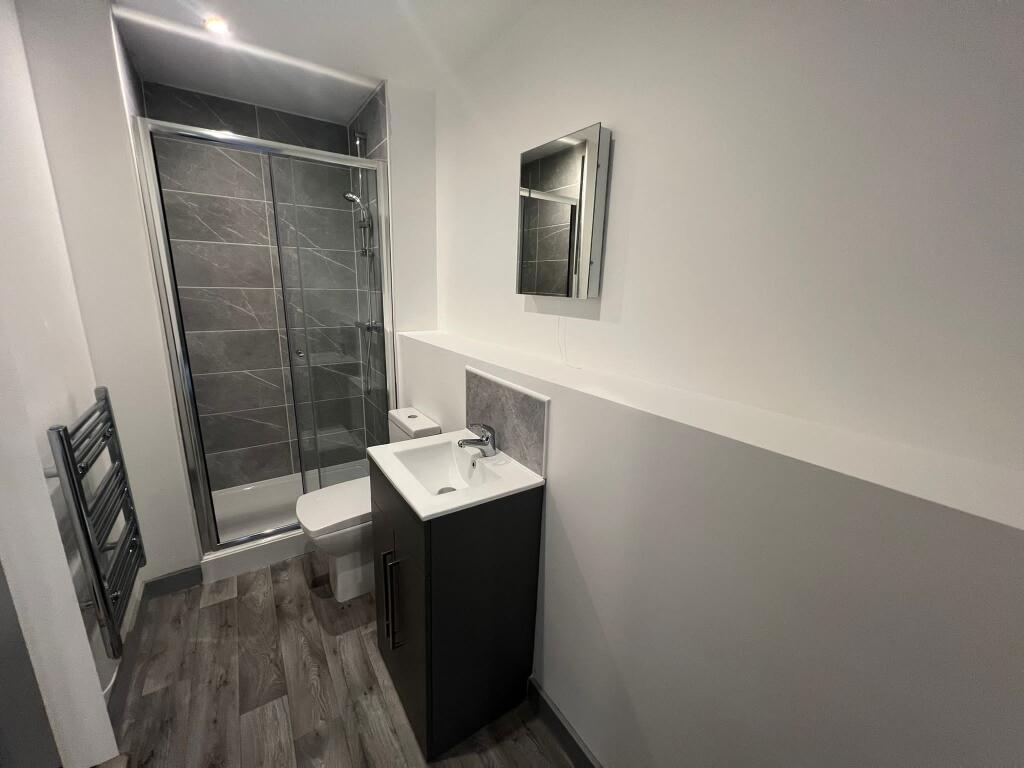
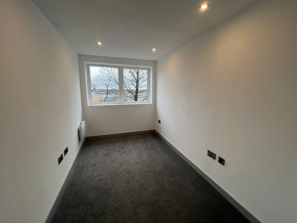
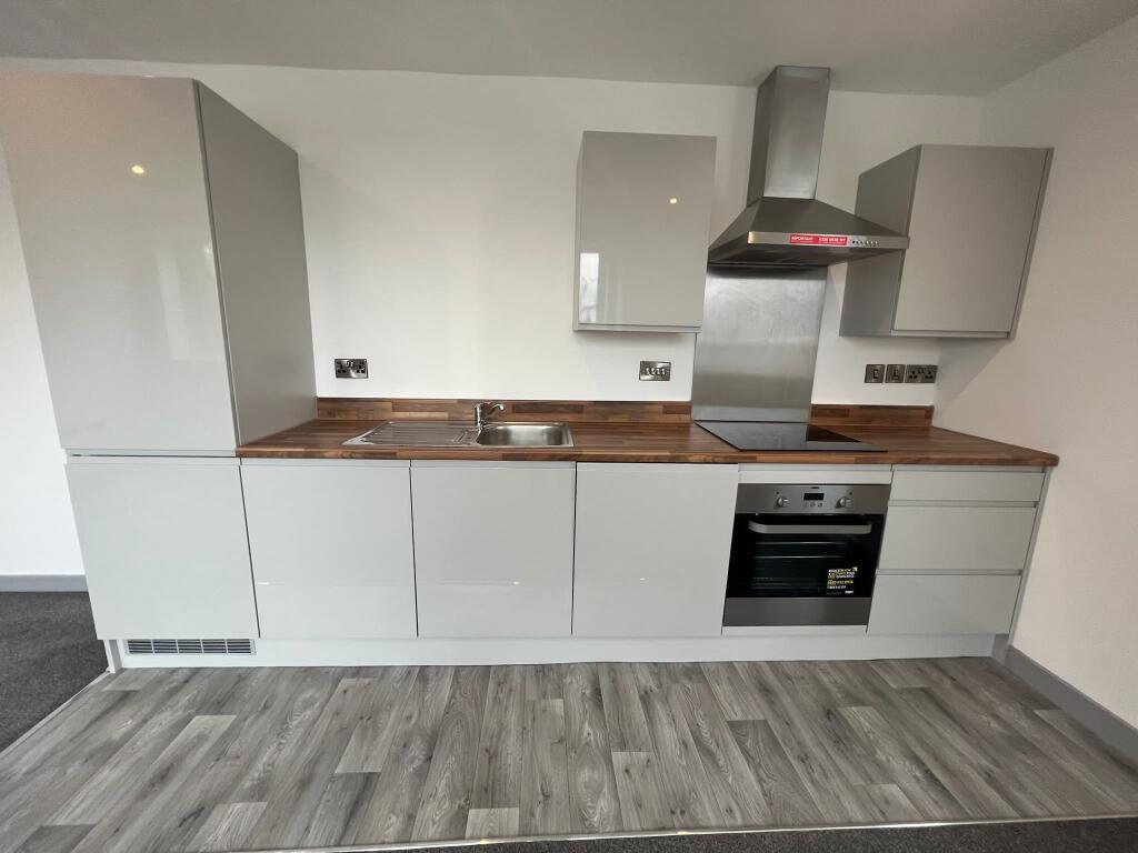
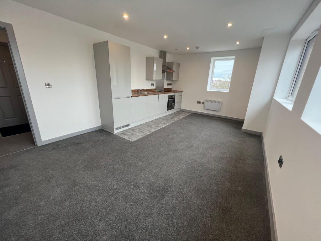
Located on a popular apartment block on Church street in the Wolverhampton centre, this 1 bedroom property has been newly renovated throughout and compromises an entrance hallway, open plan lounge/kitchen with in built appliances, shower room and double bedroom.
EPC - D
Call Connells Wolverhampton on to book your viewing! Council Tax Band: Holding Deposit: £167.00
Listed by
Wolverhampton
Connells
Reference: 174241850
EPC ratings on this postcode
We don't have a matched EPC for this property yet. Below are efficiency scores and details for other addresses on this postcode.
| Address | Current | Potential | Floor area | Age band | Type |
|---|---|---|---|---|---|
| Flat 74, Telecom House, Church Street, WOLVERHAMPTON | 71 | 71 | 43 m² | — | Flat |
Flood risk
Zone: 2
Risk: In flood risk area
Environment Agency Flood Risk Areas (APSFR)
Rental Range
Estimated market rent for Wolverhampton. Low = conservative, Realistic = average, Optimistic = best case.
Based on Local Authority from postcode lookup → Wolverhampton.
LHA (30th percentile) floor for Black Country: £494/mo (Apr 2025 – Mar 2026)
Location
Address
Ring Road St. Johns
Nearby
Nearest stations, universities and amenities (distance from property).
| Type | Name | Distance |
|---|---|---|
| Bus stop | CJ | 0.1 miles |
| Bus stop | CH | 0.1 miles |
| Shop | Unknown | 0.1 miles |
| Shop | Homebase Garden Centre | 0.1 miles |
| University | University of Wolverhampton Wulfruna Campus | 0.5 miles |
| University | University of Wolverhampton | 0.6 miles |
| Hospital | West Park Hospital | 0.6 miles |
| Train station | Wolverhampton | 0.7 miles |
| Hospital | Compton Hospice | 1.7 miles |
| Train station | Coseley | 3.1 miles |
Street-level crime
| Category | Count |
|---|---|
| Violence and sexual offences | 270 |
| Shoplifting | 76 |
| Criminal damage and arson | 56 |
| Other theft | 39 |
| Public order | 36 |
| Drugs | 32 |
| Vehicle crime | 25 |
| Anti-social behaviour | 24 |
| Burglary | 18 |
| Possession of weapons | 16 |
| Robbery | 9 |
| Other crime | 7 |
| Theft from the person | 6 |
| Bicycle theft | 4 |
| Total incidents | 618 |
Within 1 mile during Apr 2026. Source: data.police.uk (England & Wales).
Schools nearby
Nearest open schools with Ofsted ratings (England). Closed schools are not shown. Data from Get Information about Schools and Ofsted.
| Name | Type | Distance | Ofsted |
|---|---|---|---|
| Progress Schools - Wolverhampton | Other | 0.1 miles | Good — 8 Feb 2024 |
| Graiseley Primary School | Primary | 0.3 miles | Requires improvement — 23 Jun 2024 |
| Nishkam Primary School Wolverhampton | Primary | 0.4 miles | Good — 8 Mar 2020 |
| University of Wolverhampton | Other | 0.5 miles | — (No rating) |
| SS. Mary and John's Catholic Primary Academy | Primary | 0.6 miles | Good — 9 Jun 2024 |
Rental Comparables
Residential lets from OpenRent and Rightmove for the area (same bedroom count). Use to validate rent estimates. Student lets are excluded.
| Title | Rent | Beds | Distance | As seen on |
|---|---|---|---|---|
| 1 Bed Flat, Park Crescent, WV1 | £1,900/mo | 1 | 0.48 miles | OpenRent |
Average rent: £1,900/mo (1 listing)
Enter House Number
Enter the house number to help us retrieve more accurate pricing history and property data.
Please log in to submit or correct the house number for this listing.
Log in to continue