Hartshill Road
Stoke on Trent, ST4 7NR
Property details
Council tax band
A
Deprivation
Decile 6 (18,288 of 33,755)
Street crime
421 incidents within 1 mile (Apr 2026)
Additional details
- Electricity
- Mains supply
- Water
- Mains supply
- Sewerage
- Mains supply
- Heating
- Gas central
- Parking
- No parking
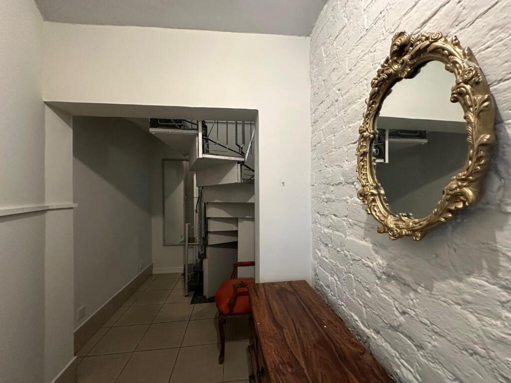
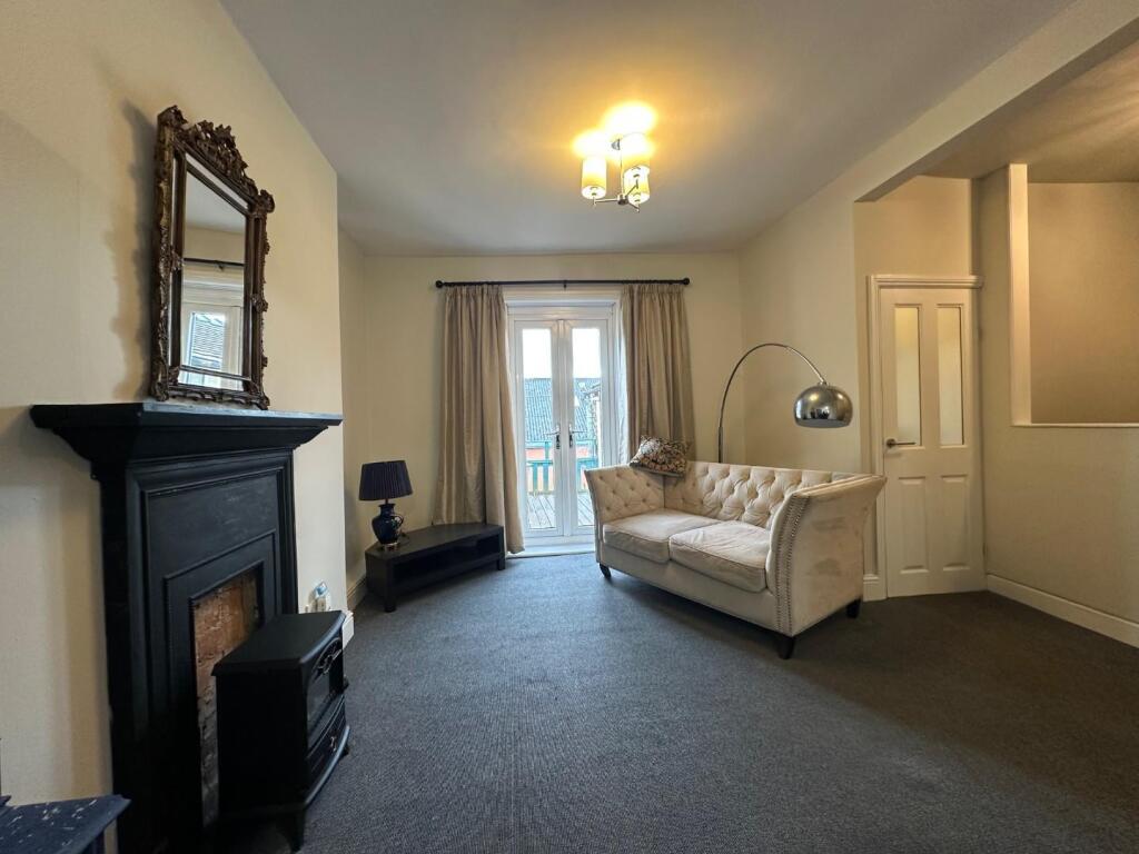
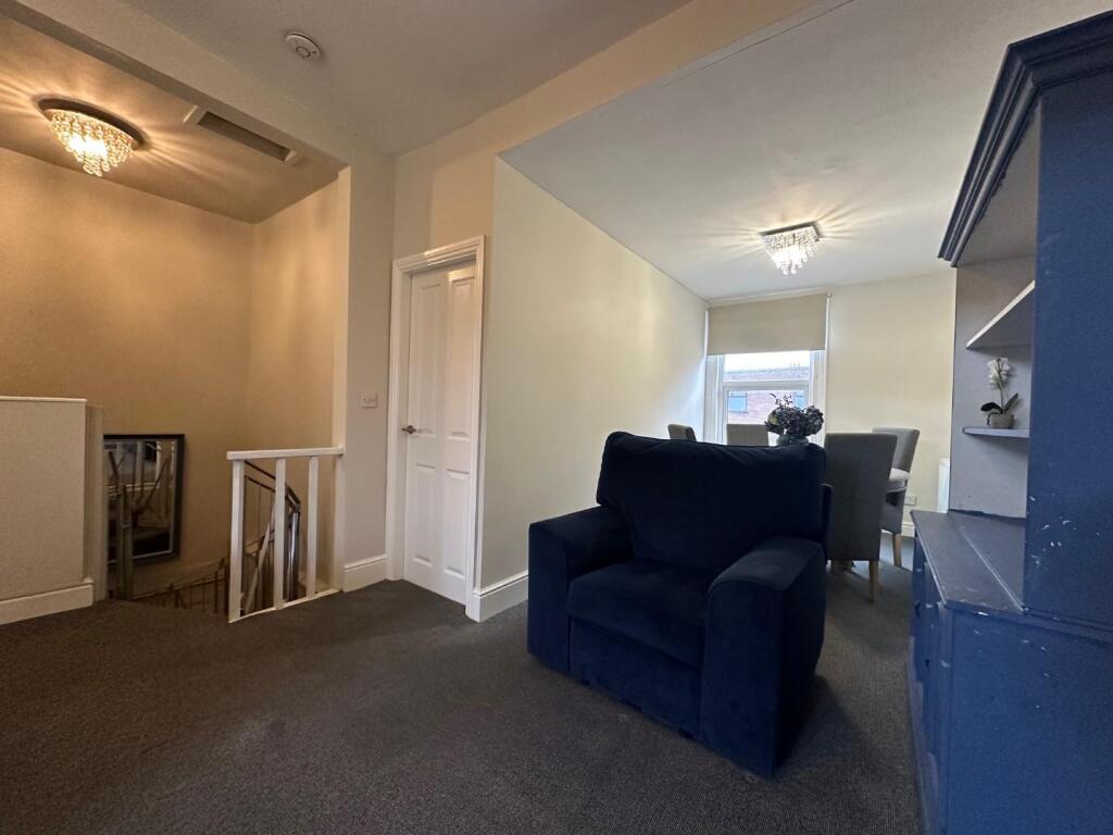
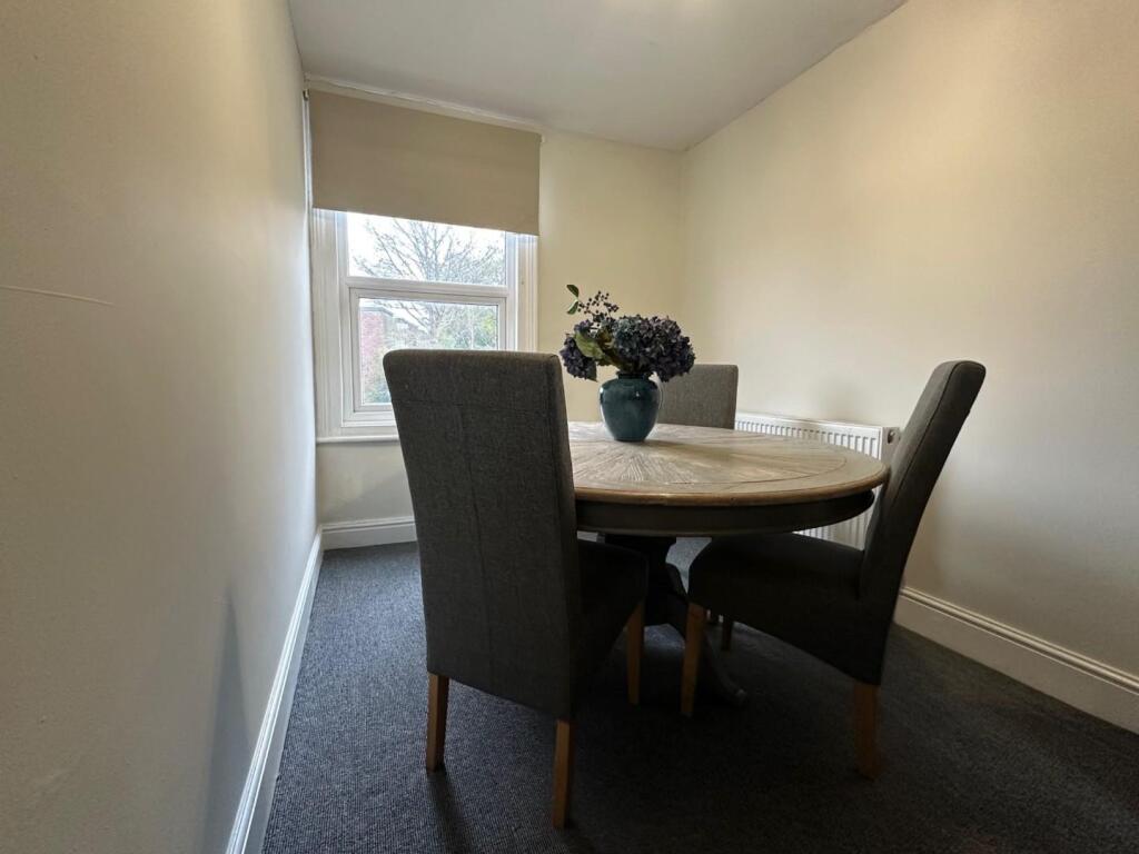
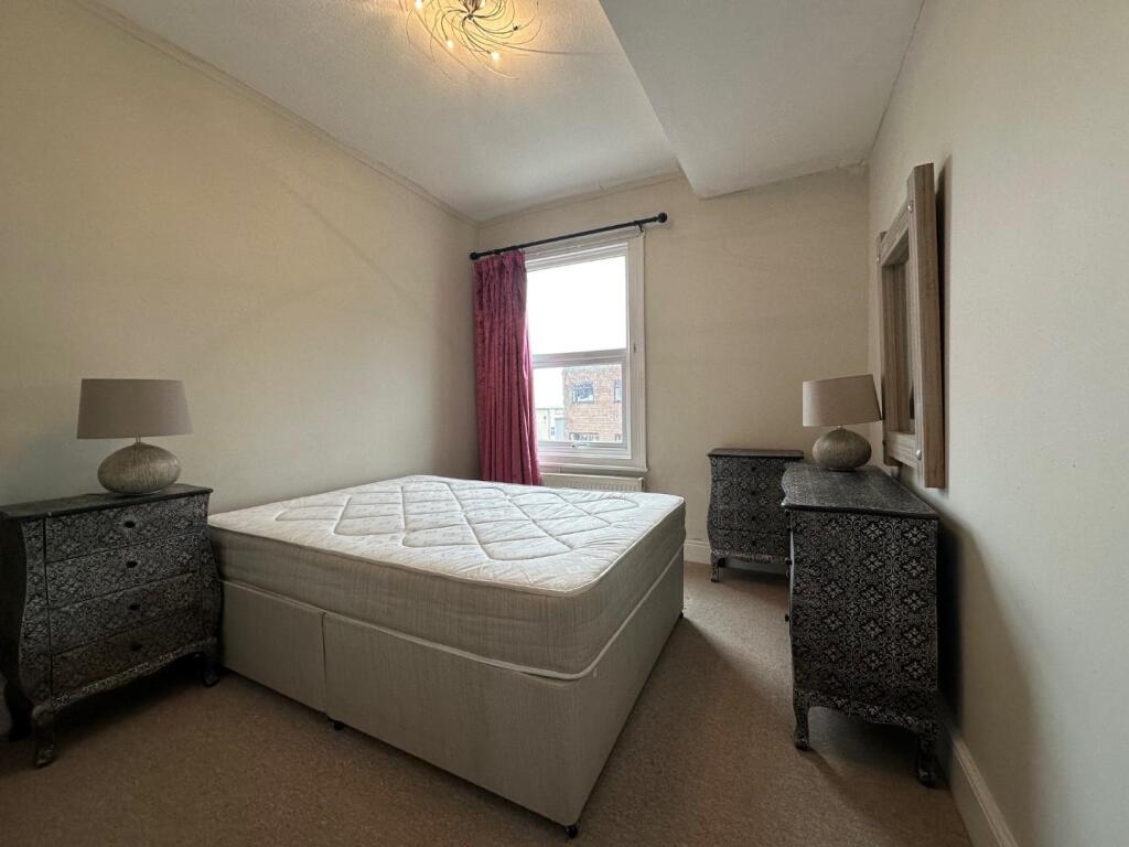
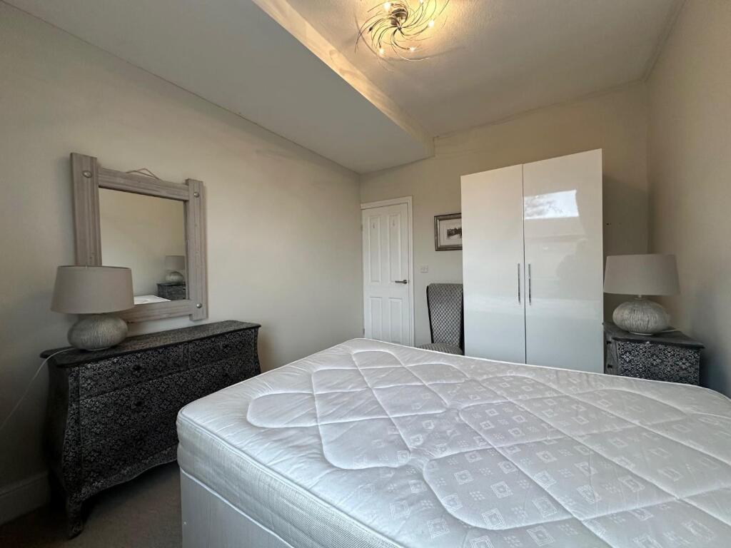
Description
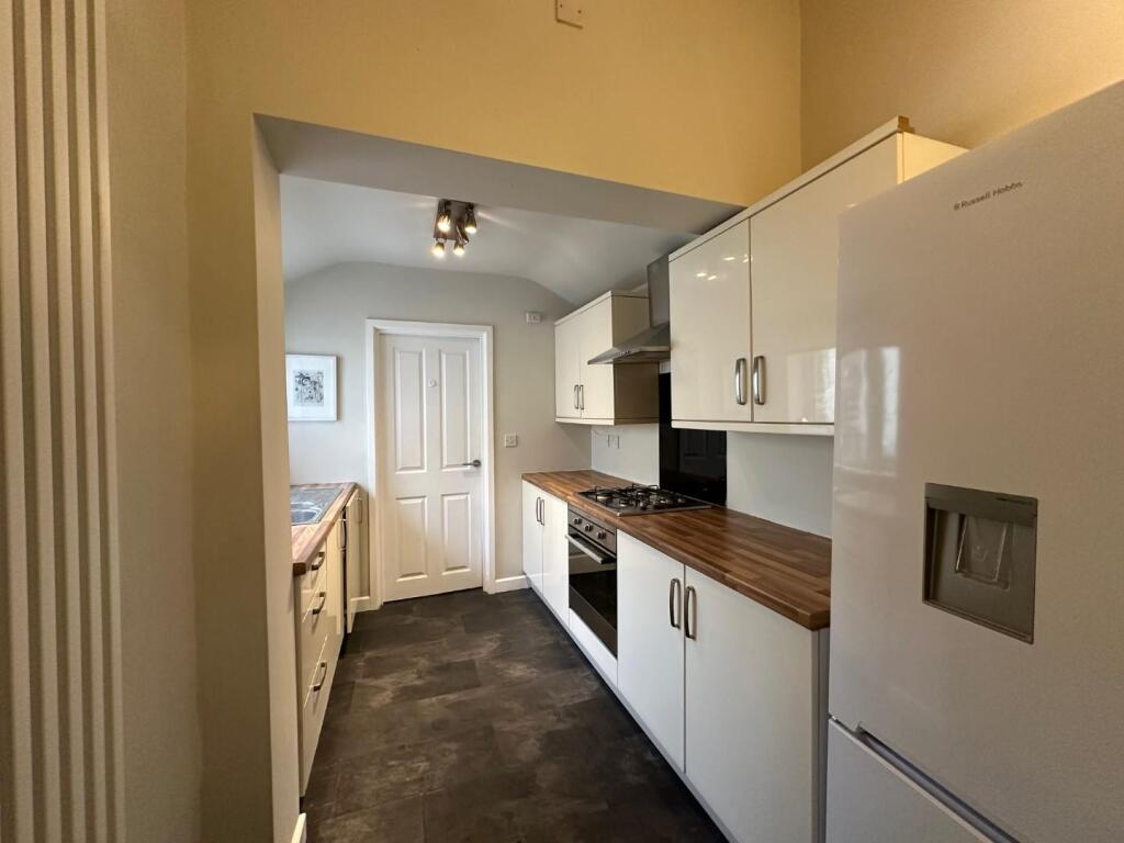
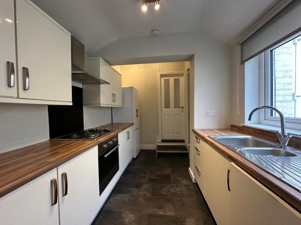
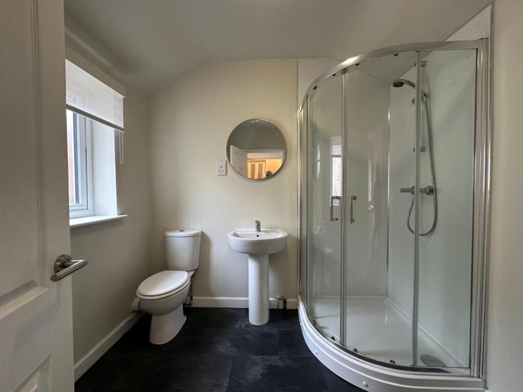
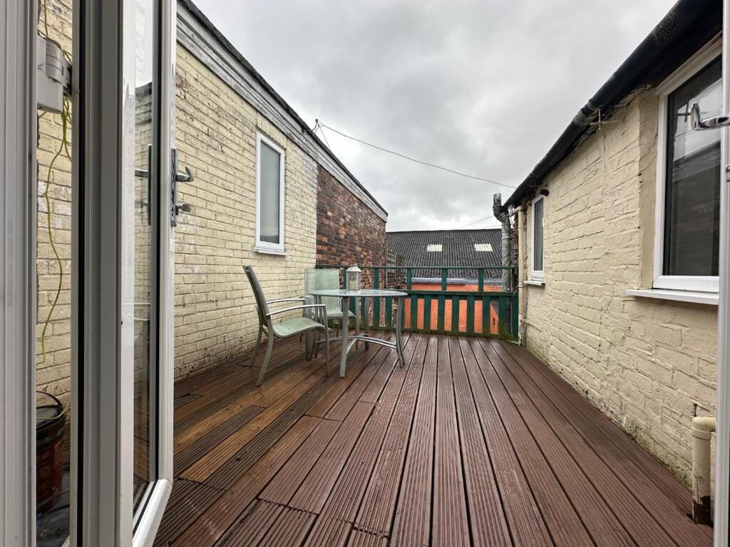
Briefly comprising of open plan living/ dining room with patio doors to exterior timber deck seating area, fitted kitchen with electric oven and hob, fridge/ freezer & integrated washing machine, shower room with fitted shower cubicle and large double bedroom. The property benefits from gas central heating and upvc double glazing throughout.
Exterior: timber deck seating area.
Rent excludes utilities and is Council Tax Band A.
Listed by
Nantwich
Wright Lettings and Management
Reference: 172448636
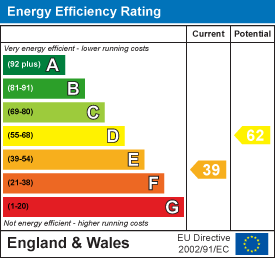
EPC Rating & Upgrade Cost
Fetching EPC data… Refresh this page in a moment.
Flood risk
Zone: 1
Risk: Low
Job (default Low)
EPC Graphs
EE Rating
Rental Range
Estimated market rent for Stoke-on-Trent. Low = conservative, Realistic = average, Optimistic = best case.
Based on Local Authority from postcode lookup → Stoke-on-Trent.
LHA (30th percentile) floor for Staffordshire North: £424/mo (Apr 2025 – Mar 2026)
Location
Address
318 Hartshill Road
Nearby
Nearest stations, universities and amenities (distance from property).
| Type | Name | Distance |
|---|---|---|
| Bus stop | Hartshill Road, opposite Holy Trinity Church | 0.0 miles |
| Shop | E2 Lighting | 0.0 miles |
| Shop | Terry's Textiles | 0.0 miles |
| Bus stop | Holy Trinity Church | 0.1 miles |
| Hospital | North Staffordshire Hospital | 0.1 miles |
| Hospital | Hartshill Medical Centre | 0.4 miles |
| Train station | Stoke-on-Trent | 0.9 miles |
| University | University of Staffordshire Stoke Campus | 0.9 miles |
| Train station | Longport | 2.4 miles |
Street-level crime
| Category | Count |
|---|---|
| Violence and sexual offences | 127 |
| Anti-social behaviour | 72 |
| Public order | 46 |
| Criminal damage and arson | 36 |
| Shoplifting | 30 |
| Drugs | 27 |
| Burglary | 20 |
| Other theft | 20 |
| Vehicle crime | 14 |
| Other crime | 13 |
| Possession of weapons | 7 |
| Robbery | 4 |
| Theft from the person | 3 |
| Bicycle theft | 2 |
| Total incidents | 421 |
Within 1 mile during Apr 2026. Source: data.police.uk (England & Wales).
Schools nearby
Nearest open schools with Ofsted ratings (England). Closed schools are not shown. Data from Get Information about Schools and Ofsted.
| Name | Type | Distance | Ofsted |
|---|---|---|---|
| St Thomas Aquinas Catholic Primary School | Primary | 0.3 miles | Good — 15 Jan 2023 |
| The Willows Primary School | Primary | 0.4 miles | Good — 14 Dec 2010 |
| Harpfield Primary Academy | Primary | 0.5 miles | Good — 10 Feb 2015 |
| Thistley Hough Academy | Secondary | 0.6 miles | Good — 26 Apr 2017 |
| Newcastle-under-Lyme School | Other | 0.6 miles | — (No rating) |
Rental Comparables
Residential lets from OpenRent and Rightmove for the area (same bedroom count). Use to validate rent estimates. Student lets are excluded.
Average rent: £620/mo (45 listings)