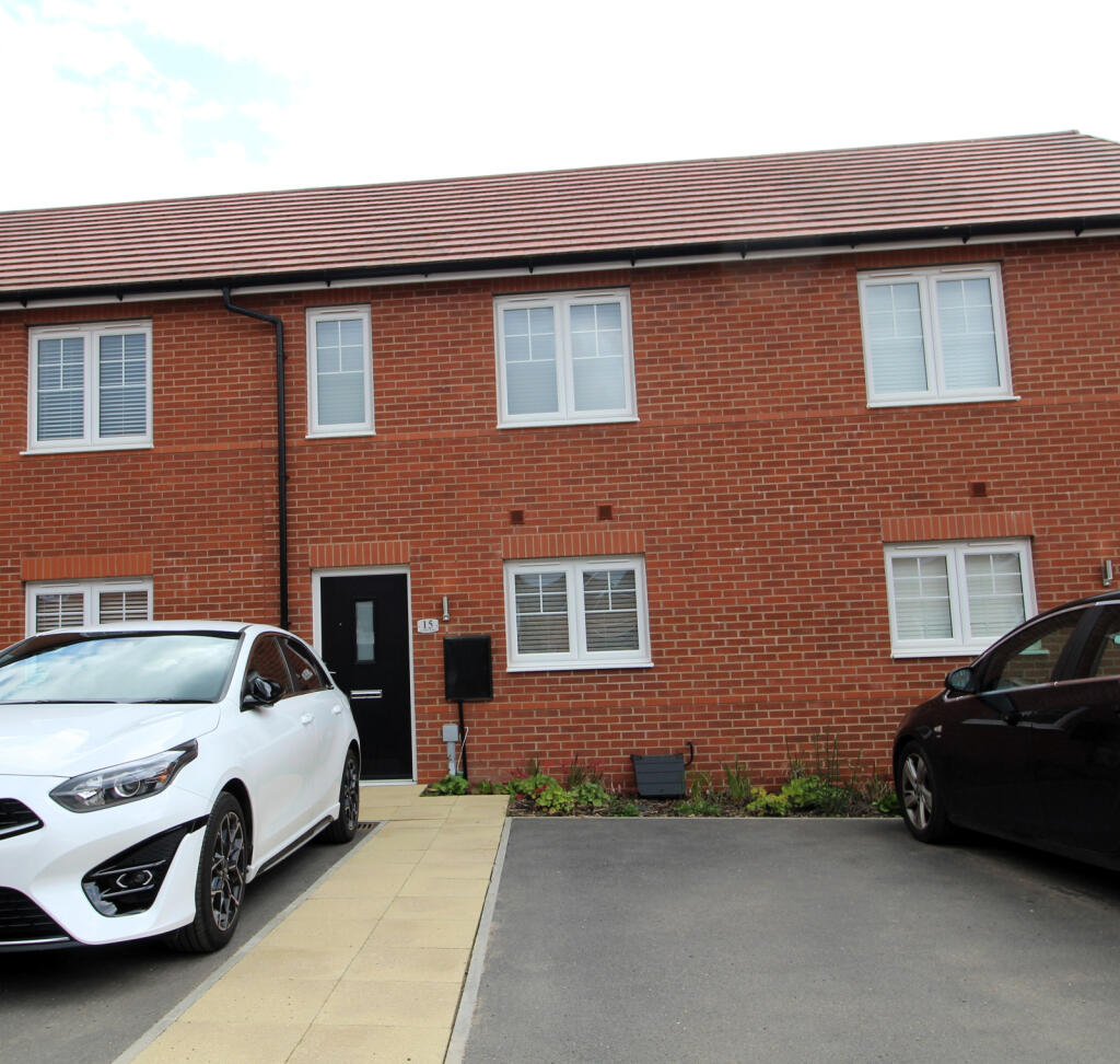
15 COBALT LANE
SWADLINCOTE, NEWHALL, DERBYSHIRE DE11 0FW
£895 pcm
Property details
Floor area
61 m²
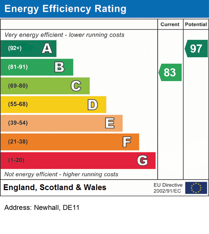
EPC rating
B
Deprivation
Decile 3 (7,362 of 33,755)
Street crime
175 incidents within 1 mile (Apr 2026)
Key features
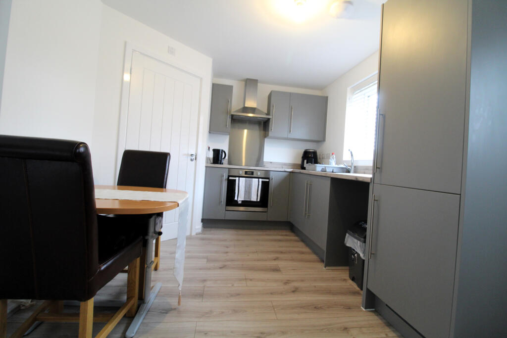
- Kitchen-Diner
- Garden
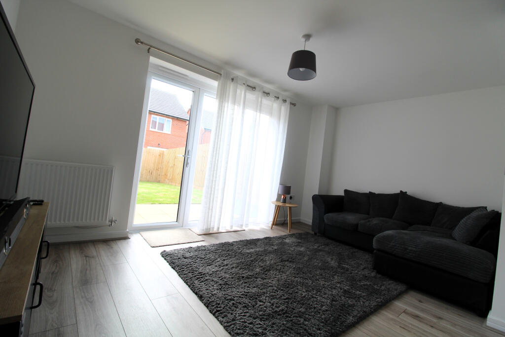
- Open Plan Lounge
- Full Double Glazing
Additional details
- Parking
- Off street
- Garden
- Yes
Description
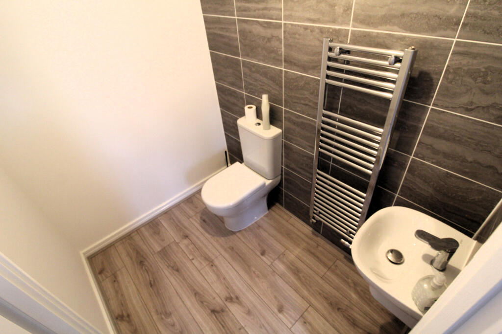
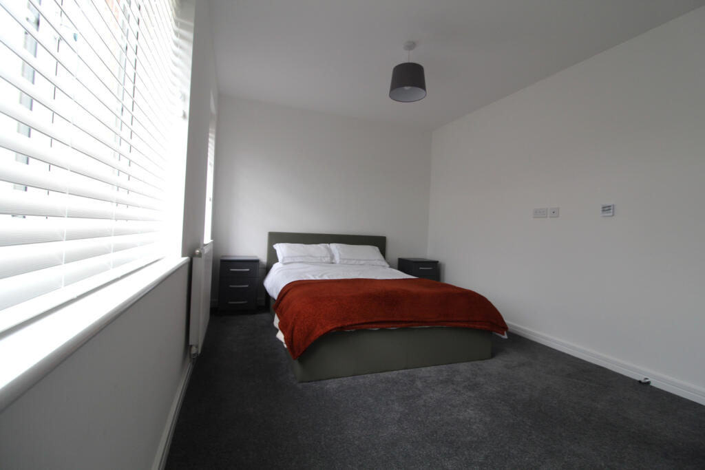
Ground floor: kitchen diner with w/c off, living room with french doors to the enclosed rear garden.
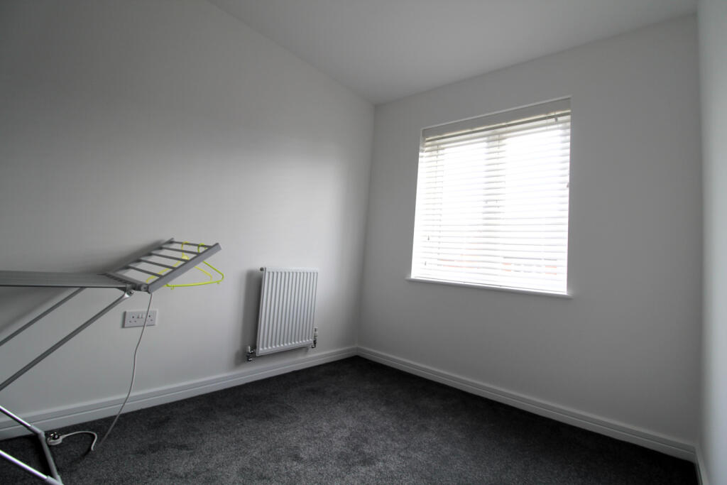
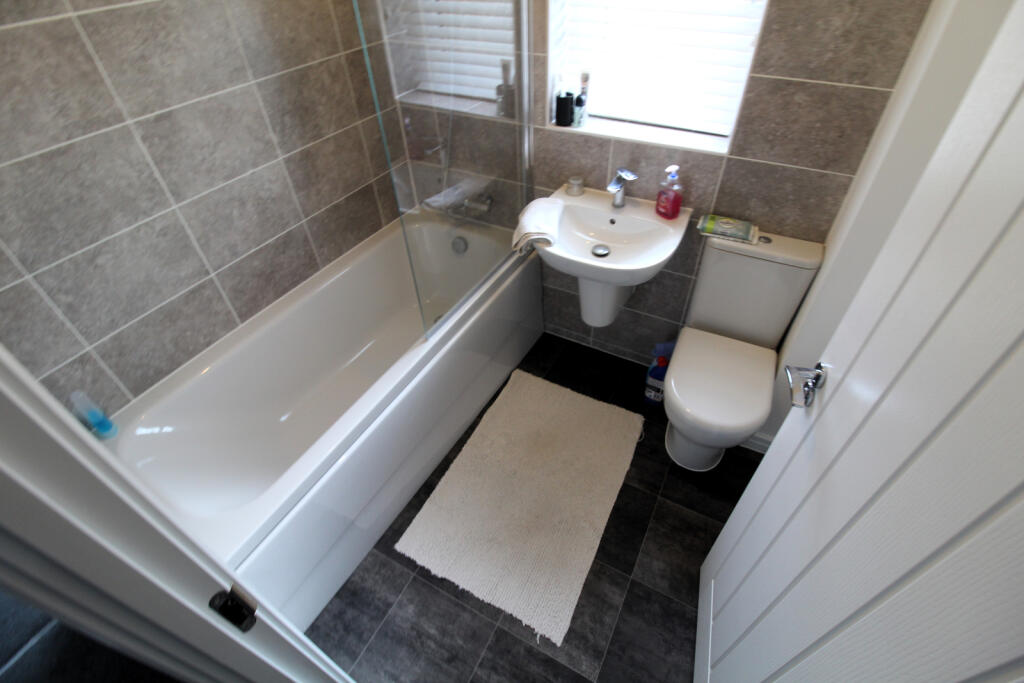
First floor: Two bedrooms and family bathroom
At the front of the property there are two parking spaces
Listed by
Swadlincote
Elton Properties Lettings Ltd
Reference: 162854258
EPC Rating & Upgrade Cost
Current rating: B
Potential rating: A
Inspection date: 26/10/2023
Expiry date: 25/10/2033
Current heating cost: £354/year
Potential heating cost: £354/year
Est. upgrade cost to C: £9,500
Recommendations
- Solar water heating (£4,000 - £6,000)
- Solar photovoltaic panels, 2.5 kWp (£3,500 - £5,500)
Flood risk
Zone: 1
Risk: Low
Job (default Low)
EPC Graphs
EPC
Rental Range
Estimated market rent for South Derbyshire. Low = conservative, Realistic = average, Optimistic = best case.
Based on Local Authority from postcode lookup → South Derbyshire.
LHA (30th percentile) floor for Eastern Staffordshire: £598/mo (Apr 2025 – Mar 2026)
Location
Nearby
Nearest stations, universities and amenities (distance from property).
| Type | Name | Distance |
|---|---|---|
| Bus stop | Meadow View Road | 0.2 miles |
| Shop | Blooming Marvels Garden Centre and Cafe | 0.4 miles |
| Shop | Travis Perkins | 0.4 miles |
| Train station | Discovery Station | 2.8 miles |
| Train station | Waterside Station | 2.9 miles |
| Hospital | Queen's Hospital | 4.4 miles |
| Hospital | Outwood Site | 4.6 miles |
| University | Agard Court | 11.0 miles |
| University | Derby Law School | 11.0 miles |
Street-level crime
| Category | Count |
|---|---|
| Violence and sexual offences | 76 |
| Anti-social behaviour | 20 |
| Public order | 19 |
| Shoplifting | 17 |
| Criminal damage and arson | 13 |
| Burglary | 9 |
| Other theft | 9 |
| Drugs | 3 |
| Other crime | 3 |
| Vehicle crime | 2 |
| Bicycle theft | 1 |
| Possession of weapons | 1 |
| Robbery | 1 |
| Theft from the person | 1 |
| Total incidents | 175 |
Within 1 mile during Apr 2026. Source: data.police.uk (England & Wales).
Schools nearby
Nearest open schools with Ofsted ratings (England). Closed schools are not shown. Data from Get Information about Schools and Ofsted.
| Name | Type | Distance | Ofsted |
|---|---|---|---|
| Fairmeadows Foundation Primary School | Primary | 0.3 miles | Good — 11 Nov 2019 |
| The Pingle Academy | Secondary | 0.5 miles | Good — 23 Nov 2021 |
| Esteem South Academy | Other | 0.6 miles | Good — 8 Mar 2023 |
| Newhall Junior School | Primary | 0.7 miles | Requires improvement — 27 Jan 2022 |
| Newhall Infant School | Primary | 0.7 miles | Good — 18 Dec 2013 |
Rental Comparables
Residential lets from OpenRent and Rightmove for the area (same bedroom count). Use to validate rent estimates. Student lets are excluded.
| Title | Rent | Beds | Distance | As seen on |
|---|---|---|---|---|
| 2 Bed Semi-Detached House, Swans Rest, DE11 | £850/mo | 2 | 0.47 miles | OpenRent |
| 2 Bed Semi-Detached House, Parliament Street, DE11 | £750/mo | 2 | 0.53 miles | OpenRent |
| 2 Bed Terraced House, Parliament St, DE11 | £750/mo | 2 | 0.53 miles | OpenRent |
| 2 Bed Terraced House, Bretby Road, DE11 | £800/mo | 2 | 0.75 miles | OpenRent |
Average rent: £788/mo (4 listings)