Homestead Court
Stafford, Staffordshire, ST16, ST16 3HU
£280,000
Property details
Tenure
FREEHOLD
Council tax band
C
Local average
£324,731 (-13.8%)
Deprivation
Decile 9 (27,828 of 33,755)
Street crime
170 incidents within 1 mile (Apr 2026)
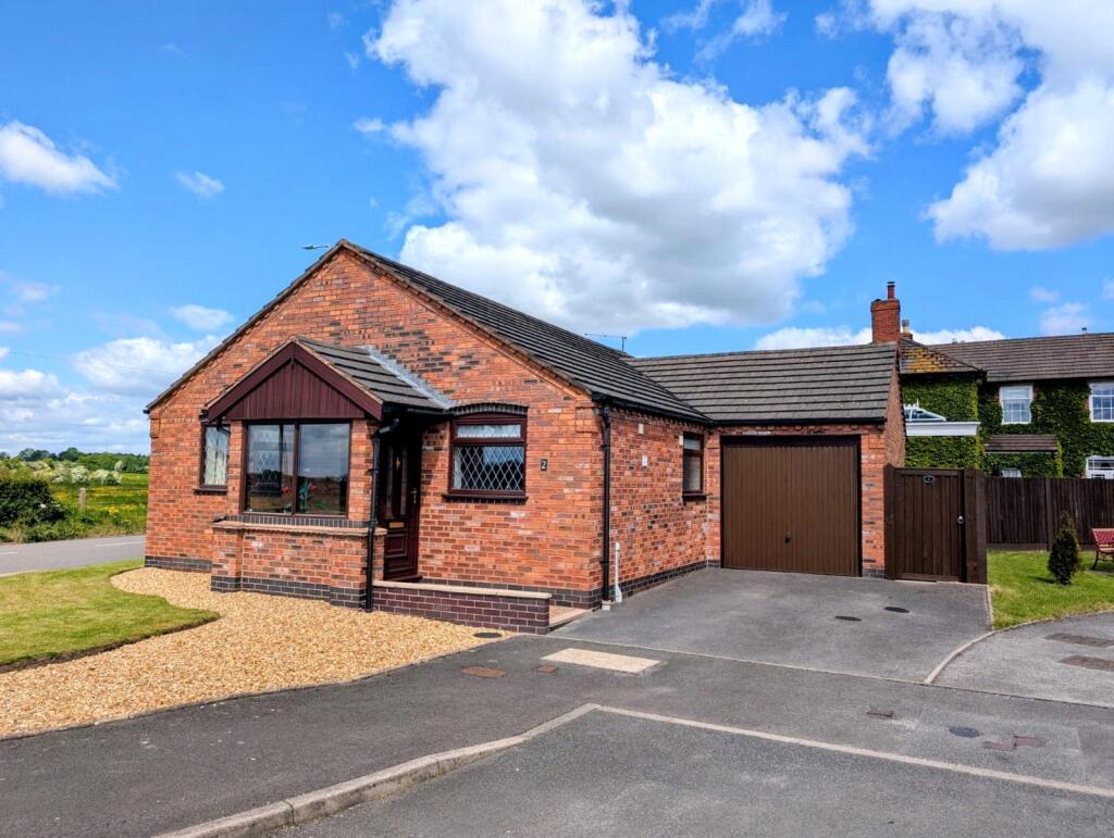
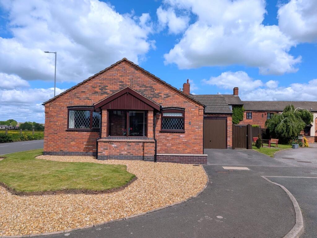
Key features
- > - Chain Free
- > - Detached
- > - 2 Bedroom
- > - Off Street Parking and Garage
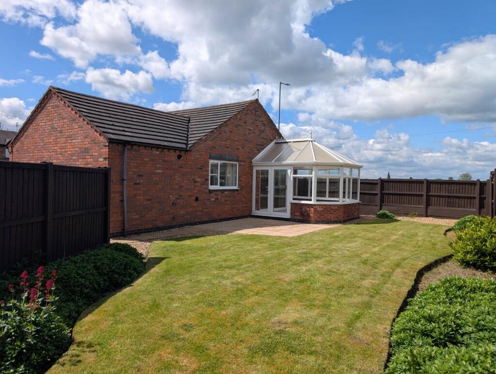
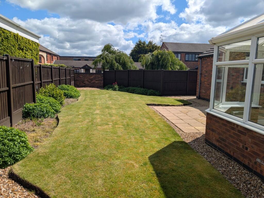
- > - Rear and Front Gardens
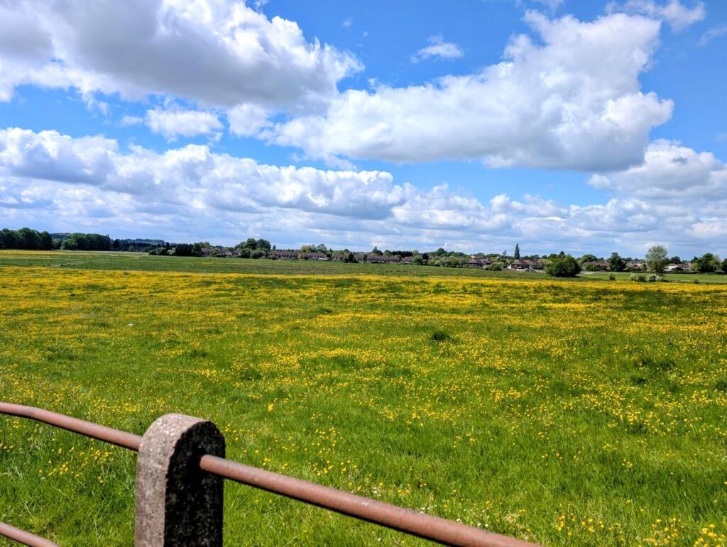
- > - Field Views
Additional details
- Parking
- Garage, Driveway
- Garden
- Yes
Description
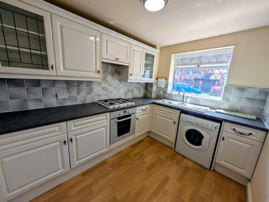
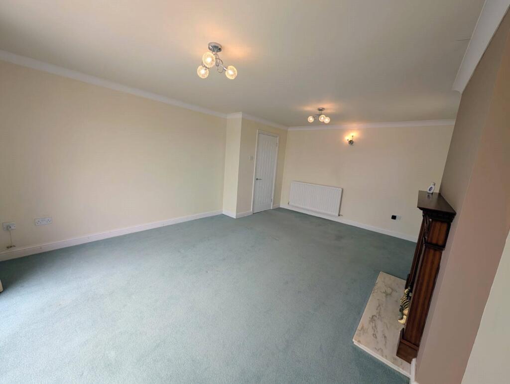
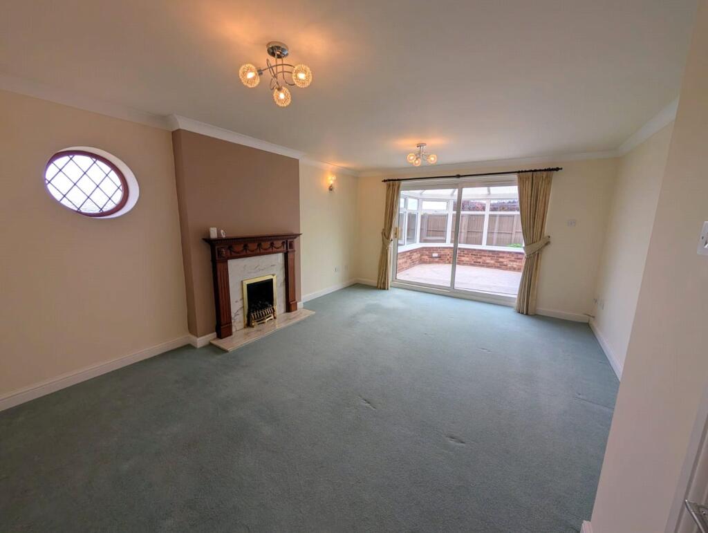
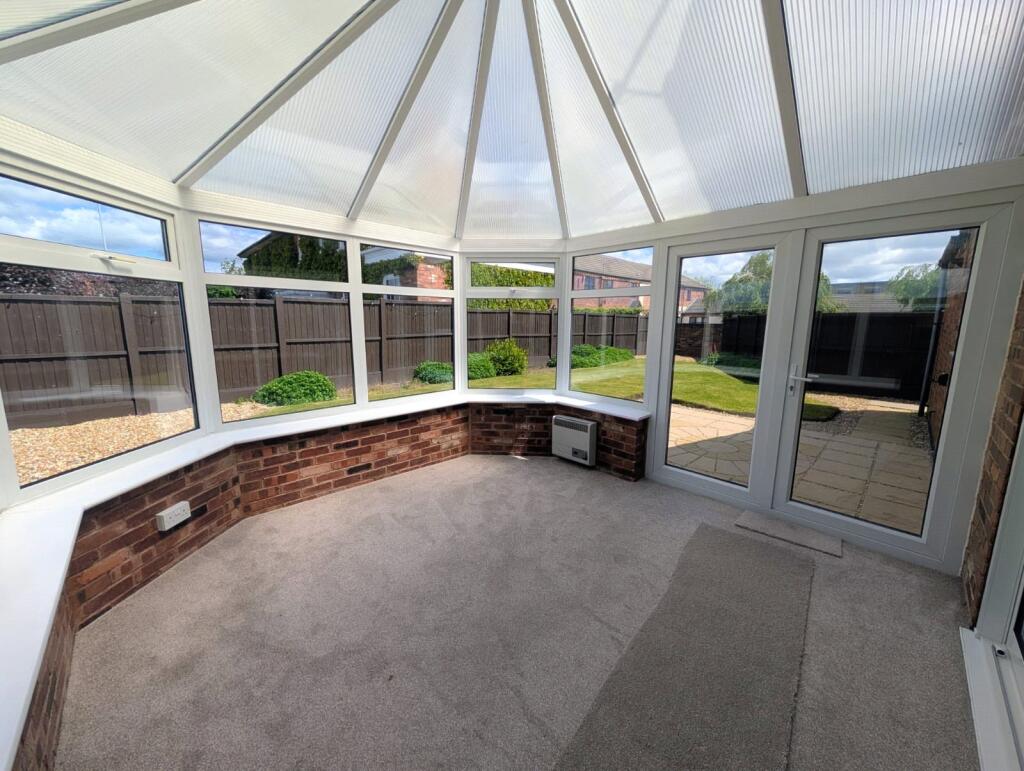
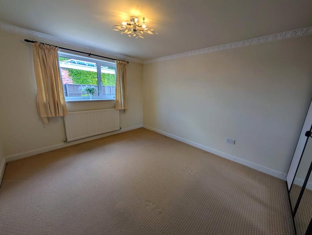
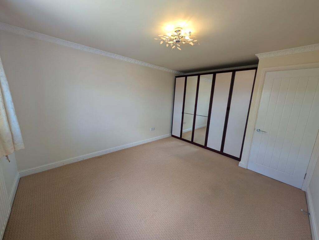
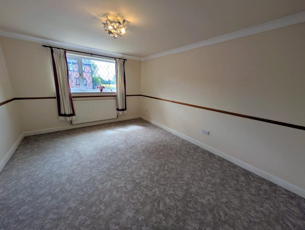
This charming two-bedroom home offers well-balanced accommodation throughout, featuring a fitted kitchen positioned to the front aspect, a bright and welcoming lounge with direct access into the adjoining conservatory, creating an ideal space for relaxing while overlooking the garden.
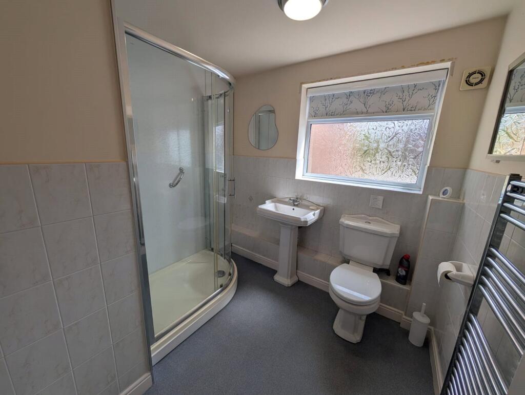
The property further benefits from two bedrooms and a modern shower room, making it perfectly suited for those seeking single-storey living in a peaceful setting. Outside, the home enjoys a private driveway providing off-road parking, together with a garage and enclosed garden space.
Combining individuality, scenic surroundings and practical accommodation, this unique bungalow presents an excellent opportunity for downsizers, retirees or buyers looking for a home with character and potential.
Listed by
Stafford
Countrywide UK Sales - Connells
Reference: 88619676
EPC ratings on this postcode
We don't have a matched EPC for this property yet. Below are efficiency scores and details for other addresses on this postcode.
| Address | Current | Potential | Floor area | Age band | Type |
|---|---|---|---|---|---|
| 12, Homestead Court, STAFFORD | 69 | 86 | 59 m² | England and Wales: 1996-2002 | Detached |
| 16, Homestead Court, STAFFORD | 61 | 81 | 87 m² | England and Wales: 1991-1995 | Detached |
| 2 Homestead Court, STAFFORD | 75 | 81 | 69 m² | England and Wales: 2003-2006 | Detached |
| 5, Homestead Court, STAFFORD | 52 | 72 | 113 m² | England and Wales: before 1900 | Terraced |
| First Floor Flat, 9 Homestead Court, STAFFORD | 69 | 76 | 56 m² | England and Wales: 1983-1990 | Flat |
| Ground Floor Flat, 10, Homestead Court, STAFFORD | 63 | 73 | 54 m² | England and Wales: 1983-1990 | Flat |
| Ground Floor Flat, 7, Homestead Court, STAFFORD | 67 | 76 | 55 m² | England and Wales: 1983-1990 | Flat |
Flood risk
Zone: 1
Risk: Low
Job (default Low)
Floorplans
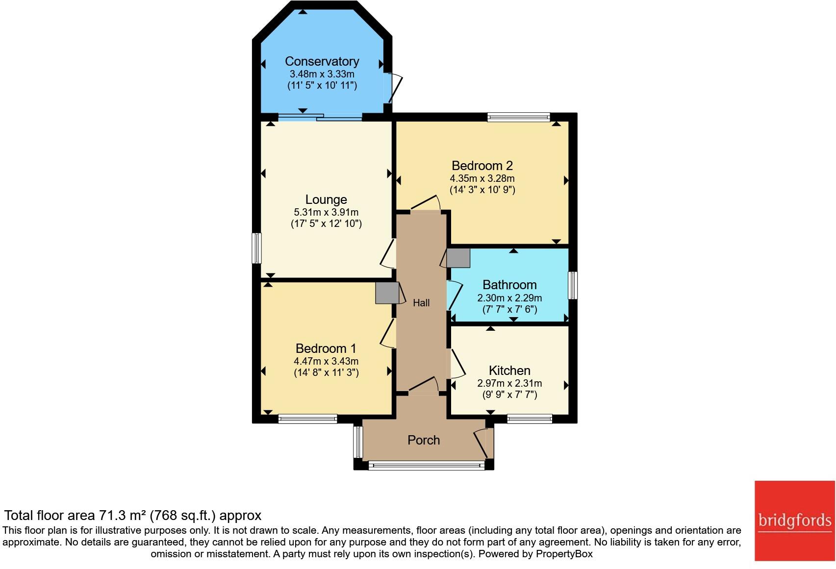
Floorplan
Price history
| Event | Date | Price | % change |
|---|---|---|---|
| Listed for sale | — | £280,000 | — |
Source: HM Land Registry Price Paid Data. Crown copyright.
Sold Comparables
Same street and nearby sales within 0.25 miles (last 5 years). Data from Land Registry Price Paid.
| Address | Price | Date | Type |
|---|---|---|---|
| Same street 16 HOMESTEAD COURT, STAFFORD, STAFFORDSHIRE, ST16 3HU | £280,000 | 29/09/2023 | Detached |
Street average: £280,000 (1 sale)
Capital growth trend
Land Registry outcode average: last 12 months vs 5y and 10y ago (from sold prices).
House Price Index (HM Land Registry — official index, not sold-price averages): Stafford. Series: Detached. As of March 2026.
Rental Range
Estimated market rent for Stafford. Low = conservative, Realistic = average, Optimistic = best case.
Based on Local Authority from postcode lookup → Stafford.
LHA (30th percentile) floor for Mid Staffs: £623/mo (Apr 2025 – Mar 2026)
Location
Address
Homestead Court
Nearby
Nearest stations, universities and amenities (distance from property).
| Type | Name | Distance |
|---|---|---|
| Bus stop | St Albans Road | 0.1 miles |
| Shop | Katherine House Hospice Big Shop | 0.2 miles |
| Shop | Parkside Stores | 0.5 miles |
| Hospital | County Hospital | 1.3 miles |
| Train station | Stafford | 1.5 miles |
| University | Staffordshire University Blackheath Lane Site | 2.0 miles |
| Hospital | Rowley Hall Hospital | 2.1 miles |
| Train station | Amerton Station | 4.7 miles |
Street-level crime
| Category | Count |
|---|---|
| Violence and sexual offences | 72 |
| Anti-social behaviour | 29 |
| Other theft | 12 |
| Shoplifting | 11 |
| Burglary | 9 |
| Criminal damage and arson | 9 |
| Public order | 9 |
| Other crime | 8 |
| Vehicle crime | 5 |
| Bicycle theft | 3 |
| Drugs | 3 |
| Total incidents | 170 |
Within 1 mile during Apr 2026. Source: data.police.uk (England & Wales).
Schools nearby
Nearest open schools with Ofsted ratings (England). Closed schools are not shown. Data from Get Information about Schools and Ofsted.
| Name | Type | Distance | Ofsted |
|---|---|---|---|
| Parkside Primary School | Primary | 0.4 miles | Good — 27 Sep 2022 |
| Sir Graham Balfour High School | Secondary | 0.4 miles | Good — 6 Jun 2014 |
| Tillington Manor Primary School | Primary | 0.6 miles | Requires improvement — 12 Jun 2023 |
| St Patrick's Catholic Primary School | Primary | 0.7 miles | Good — 21 Nov 2022 |
| John Wheeldon Primary Academy | Primary | 0.7 miles | Good — 8 Oct 2019 |
Rental Comparables
Rental comparables are temporarily unavailable while listing-site fetches are paused. Try again later.
Rent-driven metrics
Based on Area rent estimate.
- Rent ratio — Monthly rent ÷ purchase price (1% rule). 1%+ = strong, 0.8–1% = okay, <0.8% = weak for cashflow.
- Max investor price — Rent ÷ 0.8%; the price at which rent would be 0.8% of price (Stoke-style target).
- Target investor price — Rent ÷ 1%; the price at which rent would be 1% of price (strong cashflow band).
- Gross yield — Annual rent as % of purchase price (no costs).
Enter House Number
Enter the house number to help us retrieve more accurate pricing history and property data.
Please log in to submit or correct the house number for this listing.
Log in to continue