FLAT 1
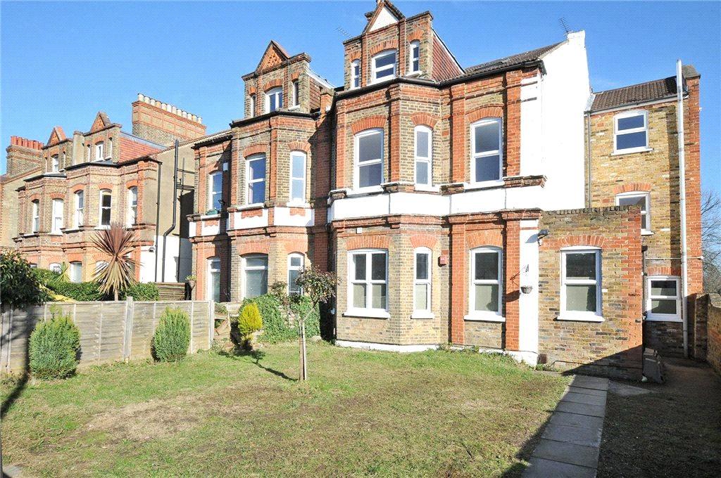
46 NEWLANDS PARK, LONDON, GREATER LONDON SE26 5NE
£895 pcm
Property details
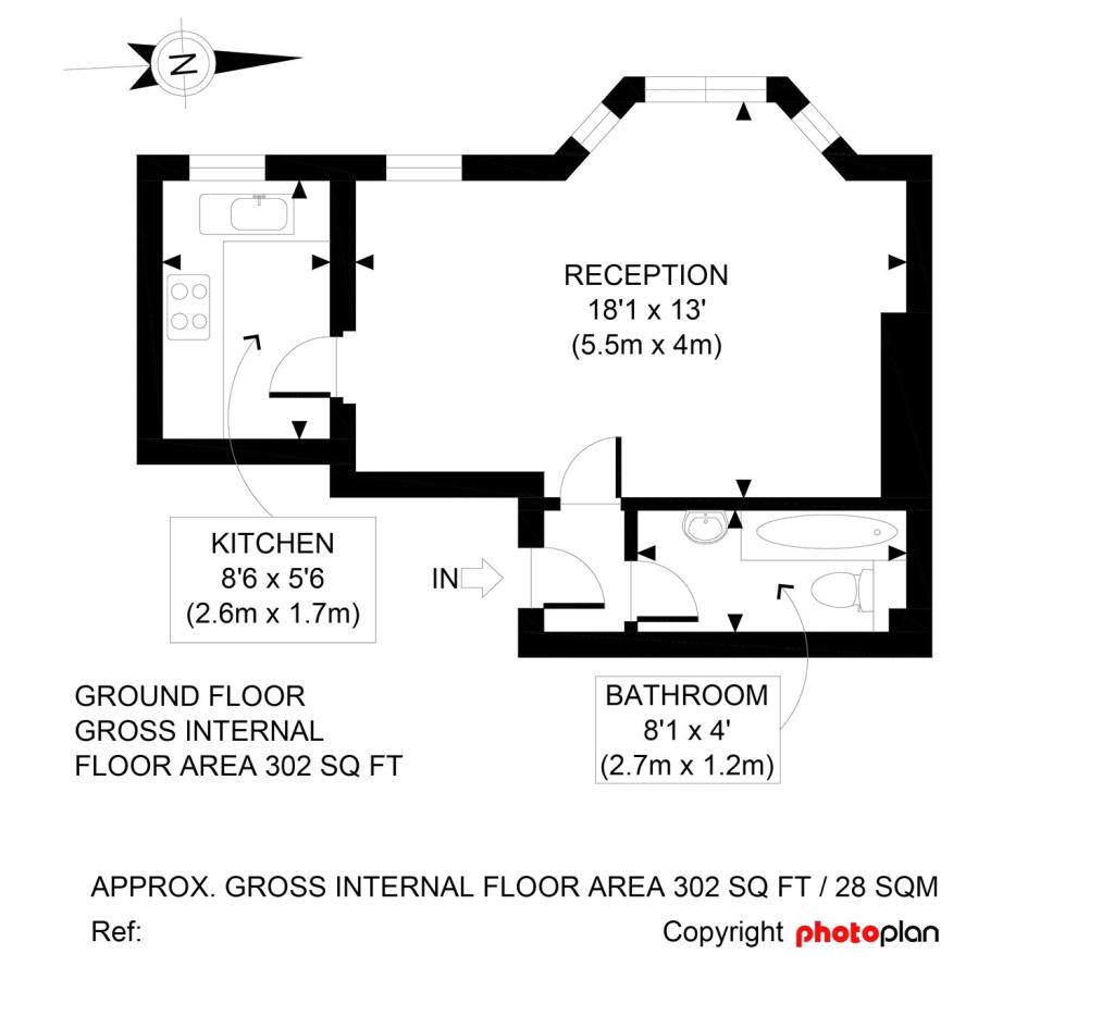
Floor area
29 m²
Year built
England and Wales: 1900-1929
Deprivation
Decile 5 (13,684 of 33,755)
Street crime
481 incidents within 1 mile (Apr 2026)
Key features
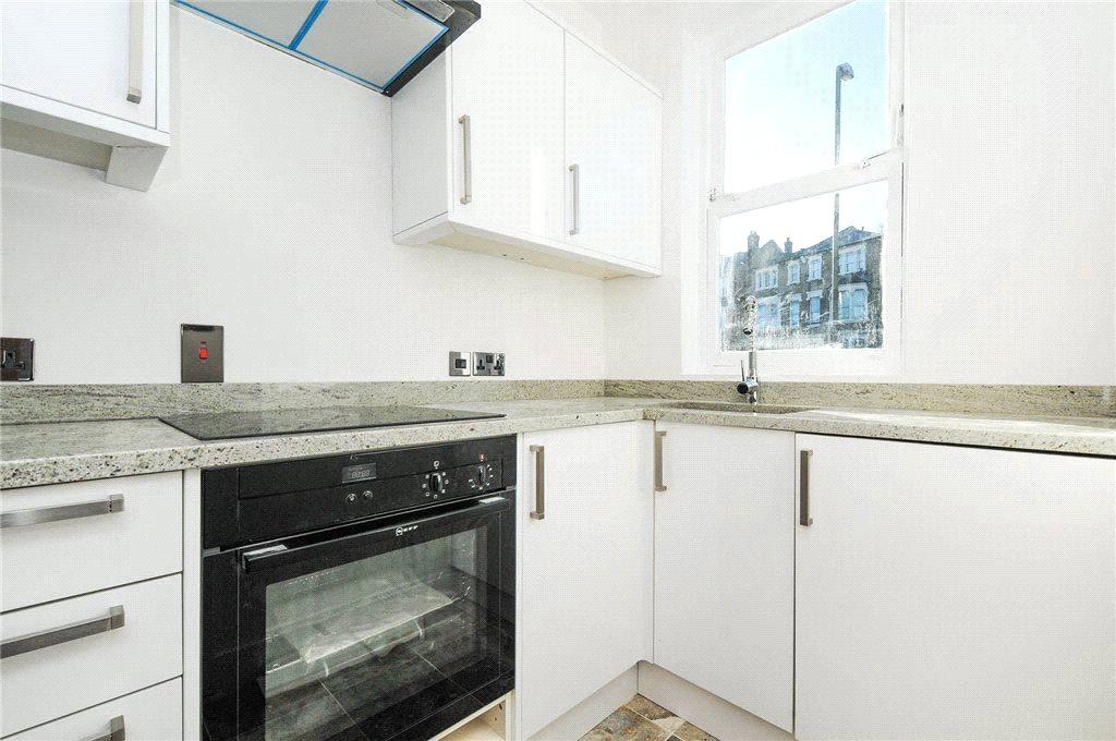
- Modern Fitted Kitchen
- Freshly Redecorated
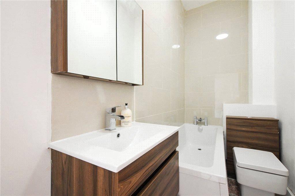
- Newly Fitted Bathroom
- Gas Central Heating
- Double Glazing
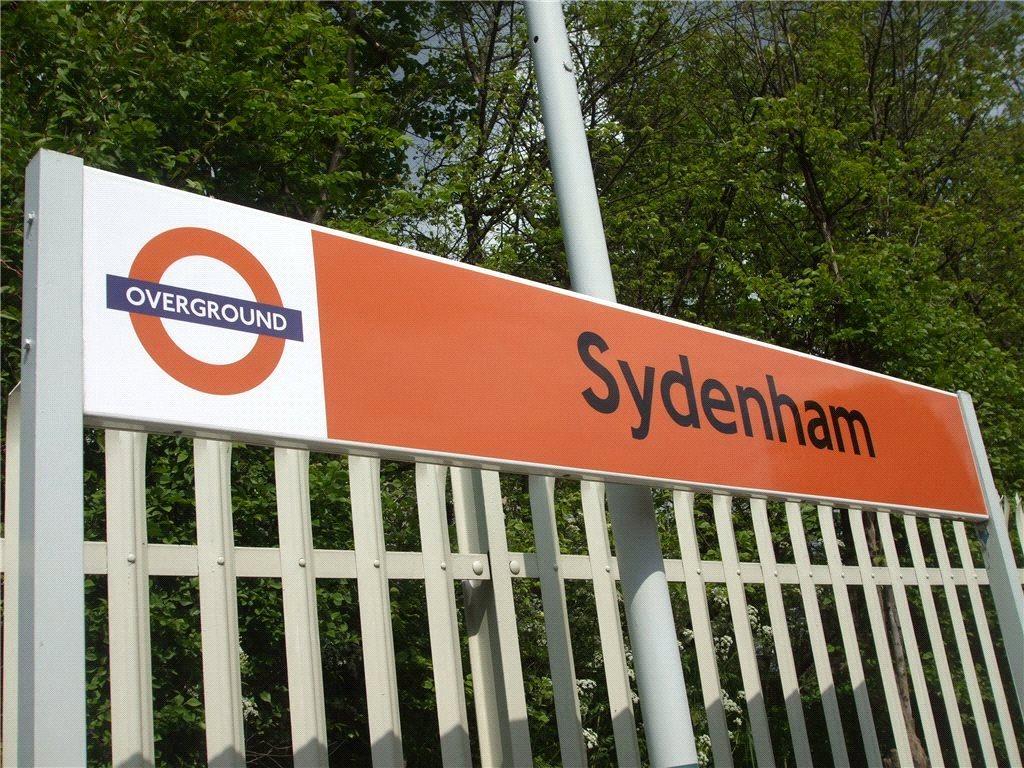
- Close to Two Stations
Description
Superbly Finished Studio Apartment Located within only 0.3 Miles of Sydenham and Penge East Stations Benefiting from a Newly Fitted Modern Kitchen & Bathroom plus Decorated in Neutral Tones Throughout.
*Needs to be Viewed to be Fully Appreciated*
Newly Fitted Bathroom
Close to Two Stations
Modern Fitted Kitchen
Freshly Redecorated
Gas Central Heating
Double Glazing
Please request a copy of our Tenant Guidance Notes that outline the procedures and costs relating to completing a typical tenancy with us
Listed by
Catford - Lettings
Robinson Jackson
Reference: 58135397
EPC Rating & Upgrade Cost
Fetching EPC data… Refresh this page in a moment.
Flood risk
Zone: 1
Risk: Low
Job (default Low)
EPC Graphs
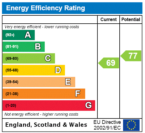
EPC Rating Graph
Company ownership
Registered legal owner is a company.
Rental Range
Estimated market rent for Lewisham. Low = conservative, Realistic = average, Optimistic = best case.
Based on Local Authority from postcode lookup → Lewisham.
LHA (30th percentile) floor for Huntingdon: Apr 2025 – Mar 2026
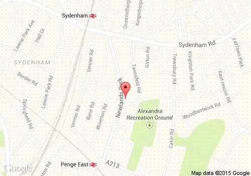
Location
Nearby
Nearest stations, universities and amenities (distance from property).
| Type | Name | Distance |
|---|---|---|
| Bus stop | Studland Road | 0.0 miles |
| Shop | Twice Sweet & Wine | 0.2 miles |
| Shop | Sunlight Furniture | 0.2 miles |
| Train station | Penge East | 0.3 miles |
| Train station | Sydenham | 0.4 miles |
| Hospital | Sloane Hospital | 2.3 miles |
| Hospital | British Home & Hospital for Incurables | 2.4 miles |
| University | University of Greenwich | 4.6 miles |
| University | University of Wales Trinity Saint David London Campus | 4.7 miles |
Street-level crime
| Category | Count |
|---|---|
| Violence and sexual offences | 112 |
| Anti-social behaviour | 97 |
| Vehicle crime | 60 |
| Shoplifting | 50 |
| Criminal damage and arson | 38 |
| Other theft | 31 |
| Public order | 26 |
| Robbery | 18 |
| Burglary | 17 |
| Theft from the person | 12 |
| Drugs | 10 |
| Other crime | 4 |
| Bicycle theft | 3 |
| Possession of weapons | 3 |
| Total incidents | 481 |
Within 1 mile during Apr 2026. Source: data.police.uk (England & Wales).
Schools nearby
Nearest open schools with Ofsted ratings (England). Closed schools are not shown. Data from Get Information about Schools and Ofsted.
| Name | Type | Distance | Ofsted |
|---|---|---|---|
| Alexandra Junior School | Primary | 0.3 miles | Good — 6 Dec 2012 |
| Our Lady and St Philip Neri Catholic Primary School | Primary | 0.5 miles | Good — 2 Mar 2015 |
| St John's Church of England Primary School | Primary | 0.6 miles | — (Inspected (no overall grade)) |
| Harris Primary Academy Crystal Palace | Primary | 0.6 miles | Good — 21 May 2015 |
| St Bartholomews's Church of England Primary School | Primary | 0.6 miles | Good — 28 Sep 2023 |
Rental Comparables
Residential lets from OpenRent and Rightmove for the area. Bedroom counts vary — use the Beds column to compare like-for-like lets. Student lets are excluded.
| Title | Rent | Beds | Distance | As seen on |
|---|---|---|---|---|
| 2 Bed Flat, Newlands Park, SE26 | £2,200/mo | 2 | 0.02 miles | OpenRent |
| 5 Bed Semi-Detached House, Trewsbury Road, SE26 | £4,500/mo | 5 | 0.21 miles | OpenRent |
| 2 Bed Flat, Bayes Close, SE26 | £1,700/mo | 2 | 0.25 miles | OpenRent |
| 2 Bed Terraced House, Niederwald Road, SE26 | £2,500/mo | 2 | 0.6 miles | OpenRent |
Average rent: £2,725/mo (4 listings)