Flat 38
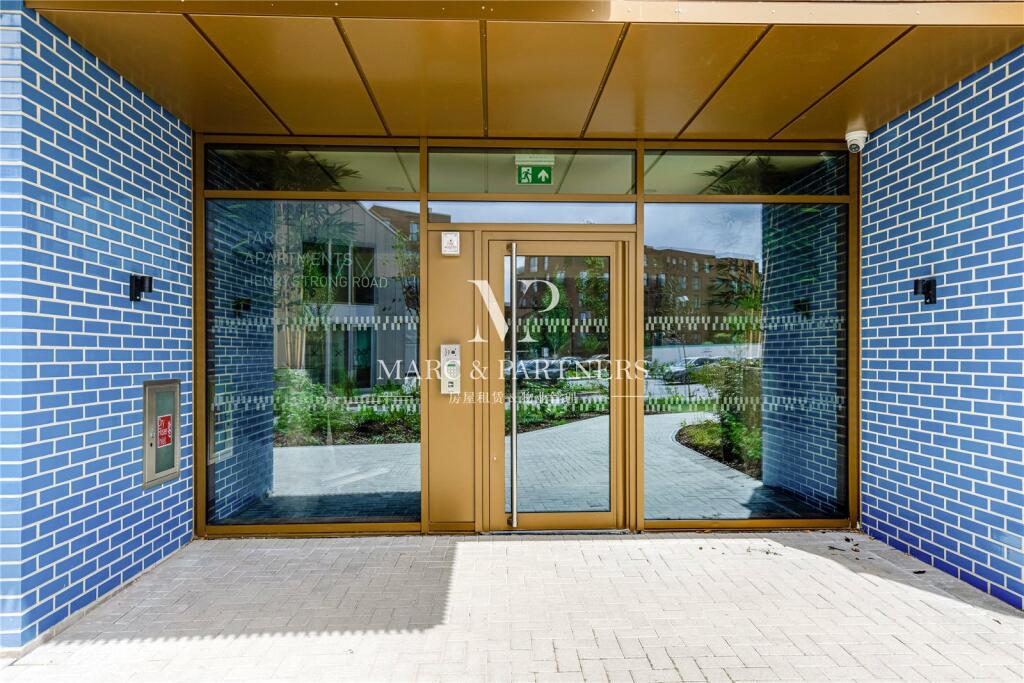
TARO APARTMENTS, HENRY STRONG ROAD, HARROW, GREATER LONDON HA1 4BF
£1,800 pcm
Property details
Floor area
41 m²
Council tax band
TBC
Deprivation
Decile 6 (17,886 of 33,755)
Street crime
550 incidents within 1 mile (Apr 2026)
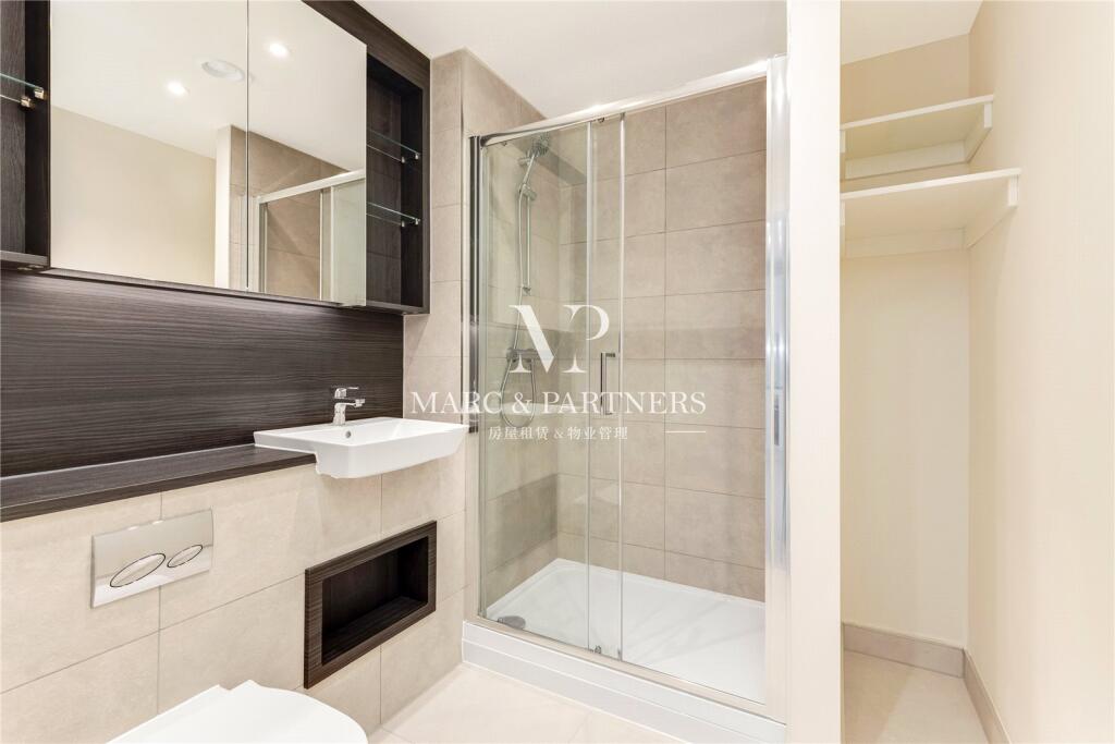
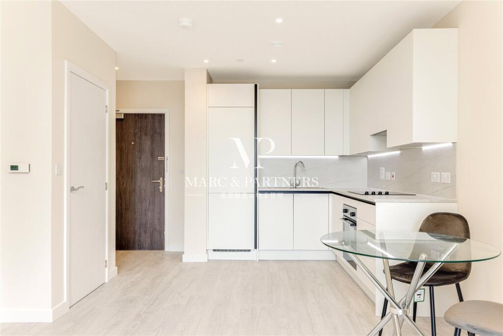
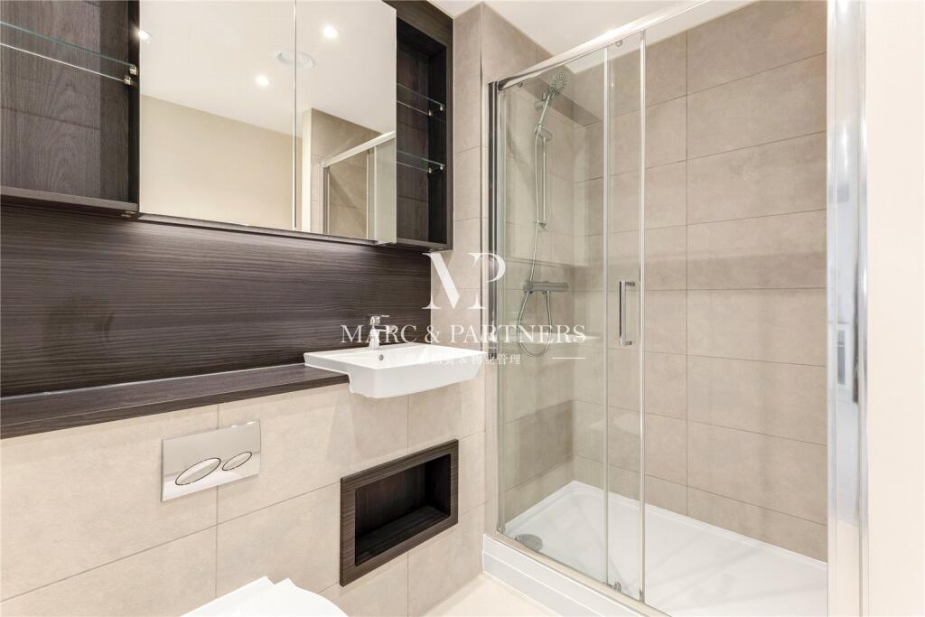
Key features
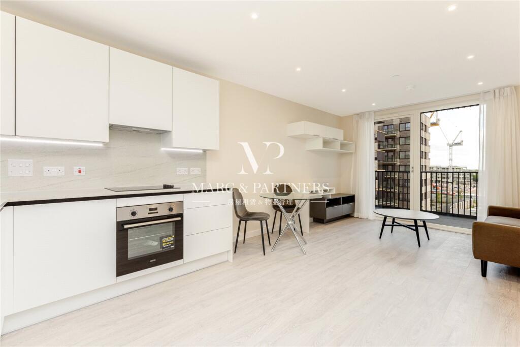
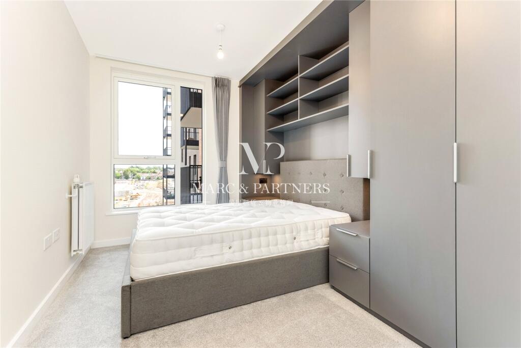
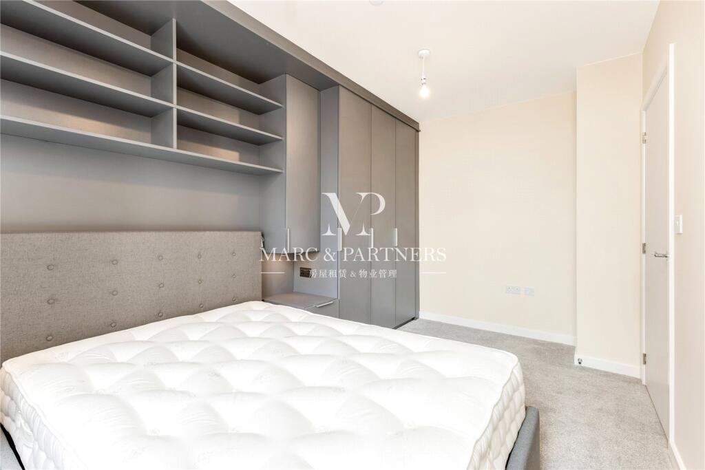
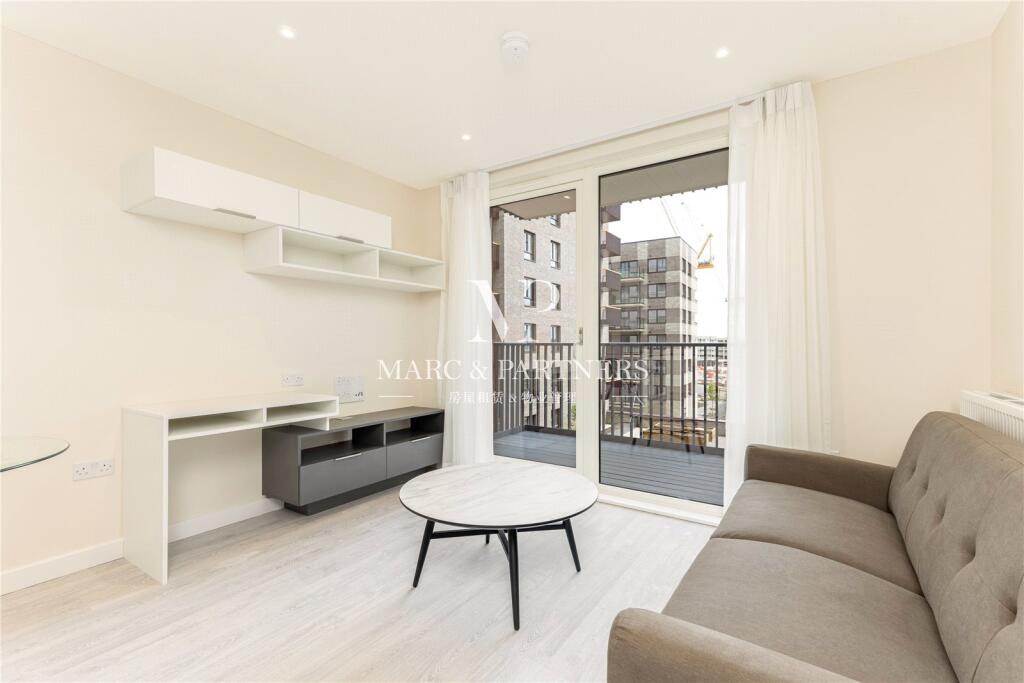
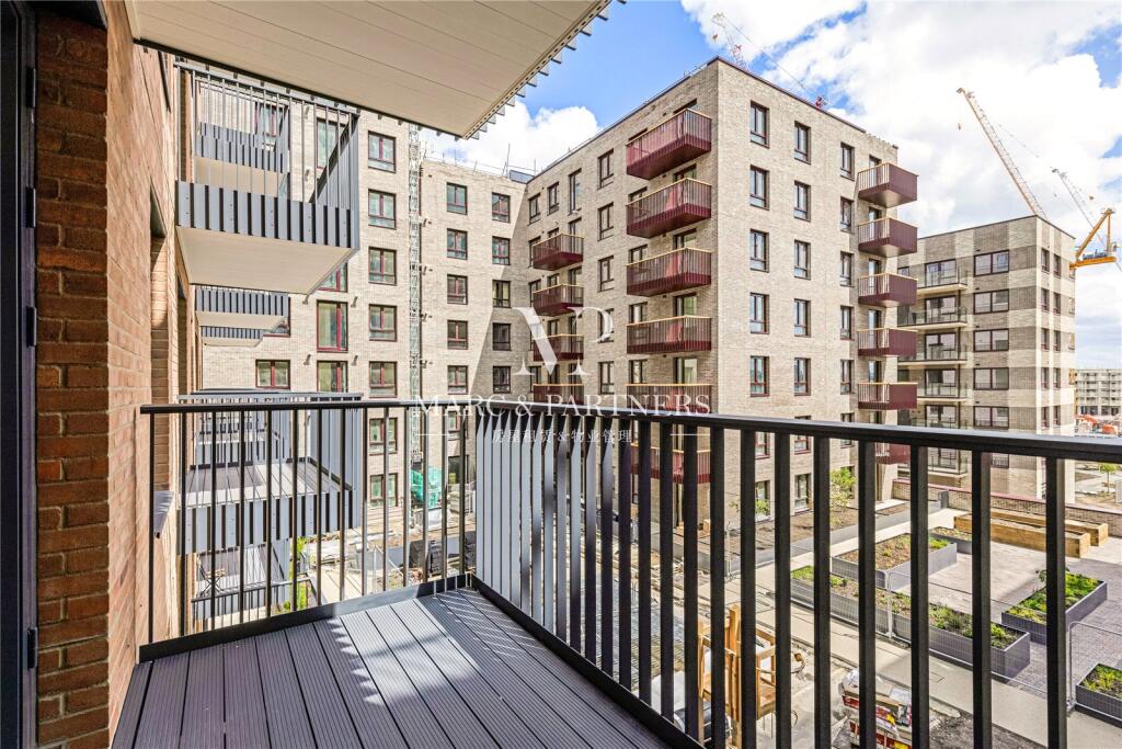
- Private Balcony
- Built in Wardrobes
- Spacious Storage Space
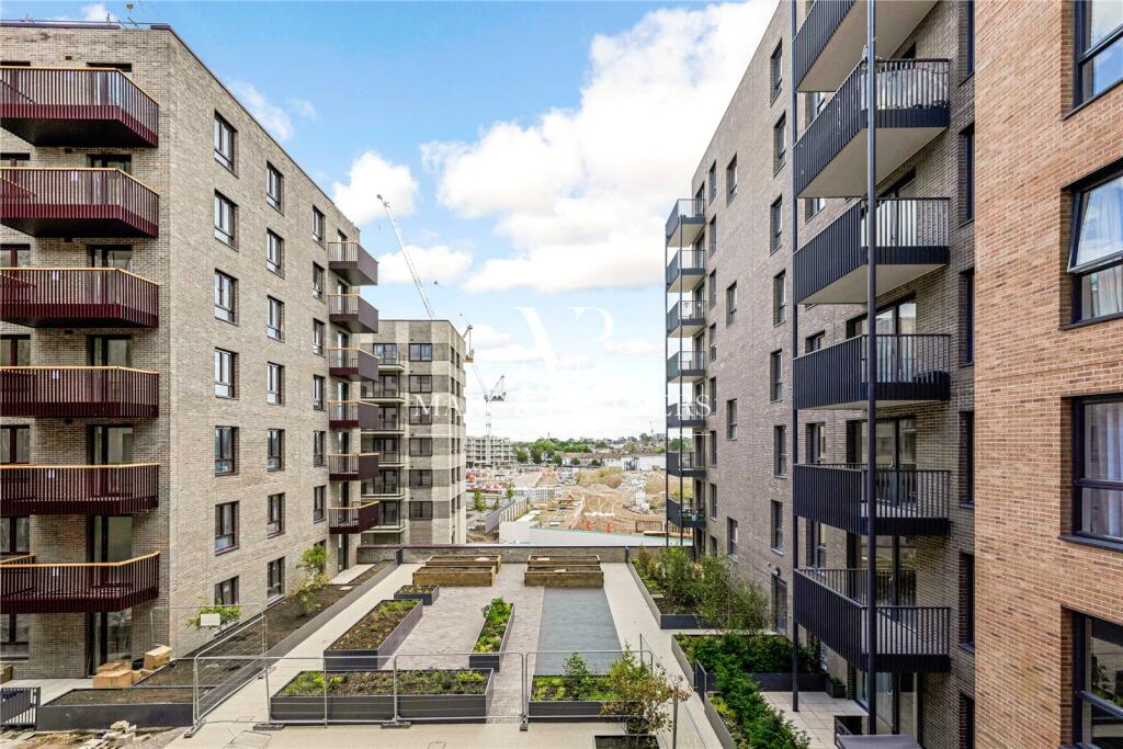
- Planned Gym, Café, Supermarket and School
- Fast Transport to Central London
- Local schools nearby
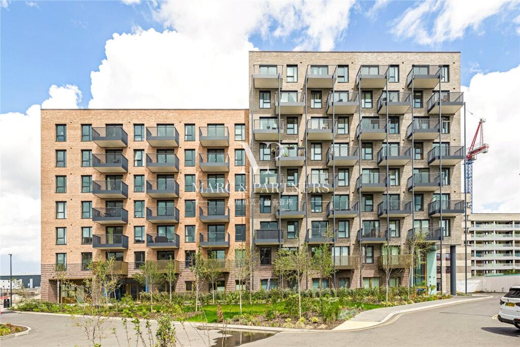
- Pictures were taken 1 year ago. Construction may change.
- Please enquiry for viewings.
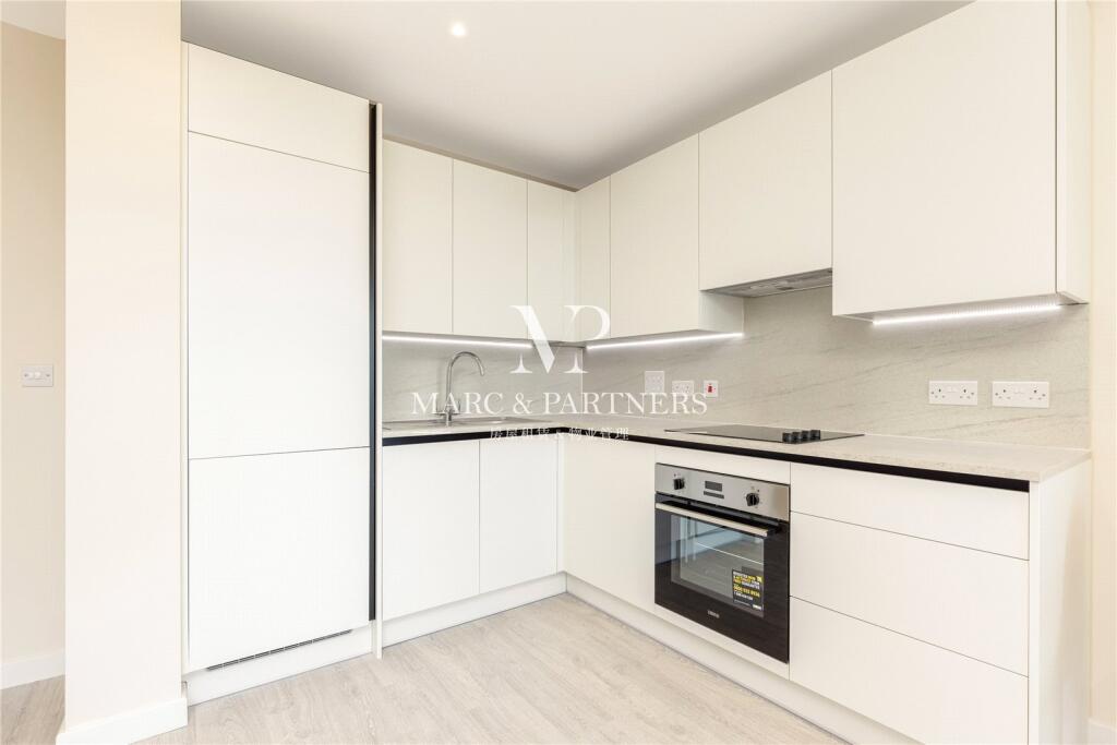
Description
The flat is in heart of Eastman Village, a new community in the heart of Harrow, building on the 150 year legacy of the iconic former Kodak factory.
Now as part of a regeneration programme by Harrow Council, Eastman Village will provide over 2,000 new homes, a gym, Sainsbury's Local supermarket, school, café, restaurant and flexible office spaces.
With an outstanding range of schools in the area including world renowned Harrow School and nearby attractions for the kids to enjoy - Eastman Village is the ideal location for your family to make memories that will last a lifetime.
Listed by
Mayfair
Marc and Partners
Reference: 165428036
EPC ratings on this postcode
We don't have a matched EPC for this property yet. Below are efficiency scores and details for other addresses on this postcode.
| Address | Current | Potential | Floor area | Age band | Type |
|---|---|---|---|---|---|
| Flat 1, Taro Apartments, Henry Strong Road, HARROW | 83 | 83 | 38 m² | — | Flat |
| Flat 10, Taro Apartments, Henry Strong Road, Harrow | 85 | 85 | 65 m² | — | Flat |
| Flat 11, Taro Apartments, Henry Strong Road, Harrow | 83 | 83 | 38 m² | — | Flat |
| Flat 12, Taro Apartments, Henry Strong Road, Harrow | 83 | 83 | 38 m² | — | Flat |
| Flat 13, Taro Apartments, Henry Strong Road, Harrow | 83 | 83 | 38 m² | — | Flat |
| Flat 14, Taro Apartments, Henry Strong Road, Harrow | 83 | 83 | 41 m² | — | Flat |
| Flat 15, Taro Apartments, Henry Strong Road, Harrow | 85 | 85 | 66 m² | — | Flat |
| Flat 16, Taro Apartments, Henry Strong Road, Harrow | 84 | 84 | 38 m² | — | Flat |
| Flat 17, Taro Apartments, Henry Strong Road, Harrow | 84 | 84 | 38 m² | — | Flat |
| Flat 18, Taro Apartments, Henry Strong Road, Harrow | 84 | 84 | 38 m² | — | Flat |
| Flat 19, Taro Apartments, Henry Strong Road, Harrow | 85 | 85 | 60 m² | — | Flat |
| Flat 2, Taro Apartments, Henry Strong Road, Harrow | 83 | 83 | 38 m² | — | Flat |
| Flat 20, Taro Apartments, Henry Strong Road, Harrow | 86 | 86 | 66 m² | — | Flat |
| Flat 21, Taro Apartments, Henry Strong Road, Harrow | 86 | 86 | 66 m² | — | Flat |
| Flat 22, Taro Apartments, Henry Strong Road, Harrow | 86 | 98 | 65 m² | — | Terraced |
Flood risk
Zone: 1
Risk: Low
Job (default Low)
Floorplans
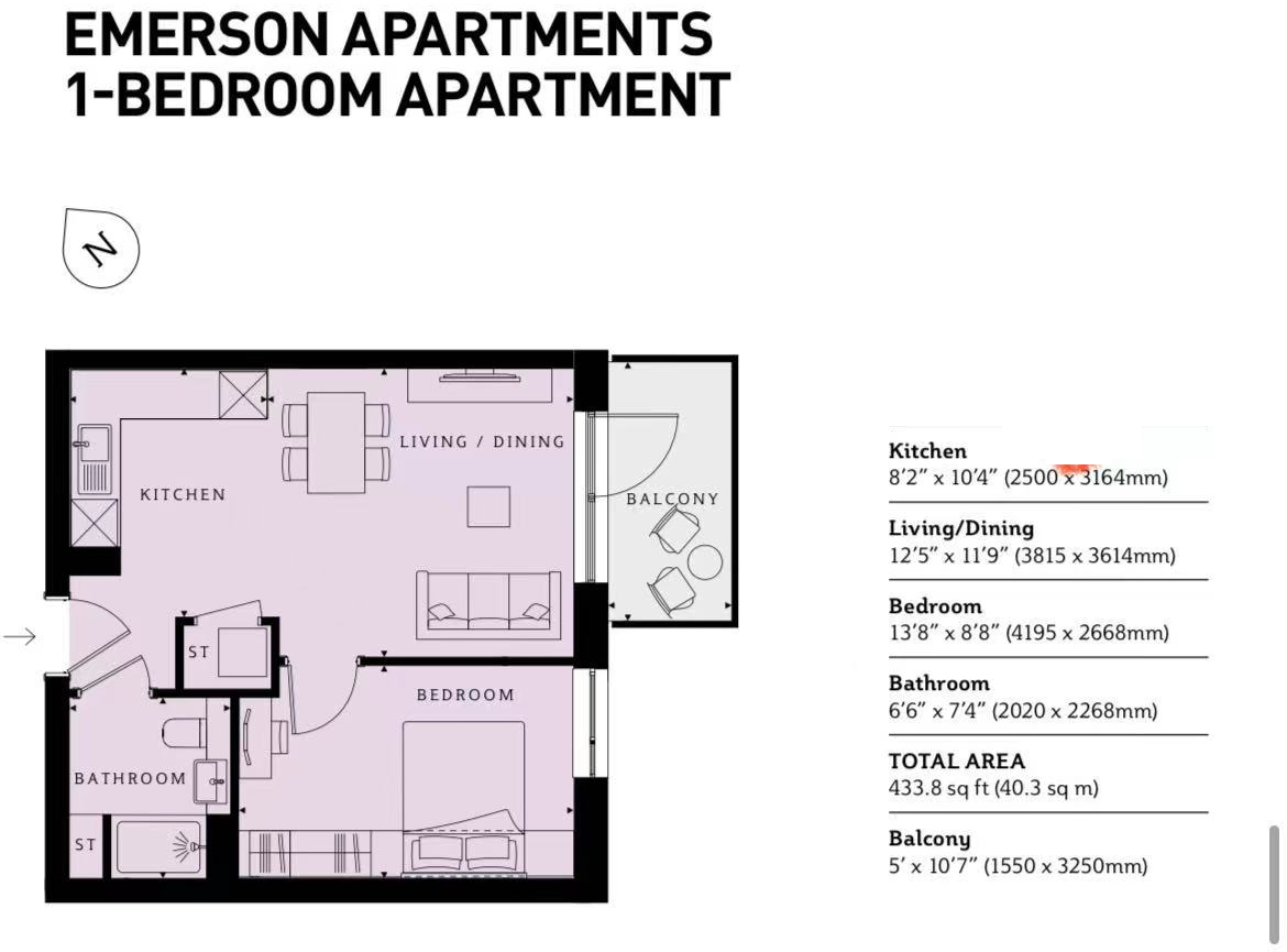
Floorplan
EPC Graphs
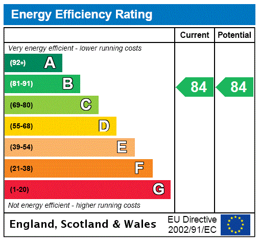
EPC Rating Graph
Rental Range
Estimated market rent for Harrow. Low = conservative, Realistic = average, Optimistic = best case.
Based on Local Authority from postcode lookup → Harrow.
LHA (30th percentile) floor for North West London: £1,097/mo (Apr 2025 – Mar 2026)
Location
Address
Hargrave Drive
Nearby
Nearest stations, universities and amenities (distance from property).
| Type | Name | Distance |
|---|---|---|
| Shop | CEF | 0.1 miles |
| Bus stop | Headstone Drive | 0.1 miles |
| Bus stop | Harrow View | 0.1 miles |
| Shop | Unknown | 0.2 miles |
| Train station | Harrow & Wealdstone | 0.5 miles |
| Train station | Headstone Lane | 0.7 miles |
| University | Westminster University, Harrow Campus | 1.6 miles |
| Hospital | Northwick Park Hospital | 1.7 miles |
| Hospital | St Mark's | 1.7 miles |
| University | John Scales Centre for Biomedical Engineering | 2.9 miles |
Street-level crime
| Category | Count |
|---|---|
| Violence and sexual offences | 155 |
| Anti-social behaviour | 139 |
| Shoplifting | 45 |
| Vehicle crime | 41 |
| Other theft | 33 |
| Theft from the person | 31 |
| Criminal damage and arson | 27 |
| Public order | 22 |
| Drugs | 20 |
| Burglary | 14 |
| Robbery | 13 |
| Other crime | 5 |
| Bicycle theft | 4 |
| Possession of weapons | 1 |
| Total incidents | 550 |
Within 1 mile during Apr 2026. Source: data.police.uk (England & Wales).
Schools nearby
Nearest open schools with Ofsted ratings (England). Closed schools are not shown. Data from Get Information about Schools and Ofsted.
| Name | Type | Distance | Ofsted |
|---|---|---|---|
| Harrow Collegiate | Other | 0.3 miles | — (No rating) |
| Whitefriars School | Other | 0.3 miles | Good — 16 May 2024 |
| Marlborough Primary School | Primary | 0.4 miles | Good — 13 Nov 2023 |
| Salvatorian Roman Catholic College | Secondary | 0.5 miles | Good — 27 Feb 2017 |
| The Sacred Heart Language College | Secondary | 0.5 miles | — (Inspected (no overall grade)) |
Rental Comparables
Residential lets from OpenRent and Rightmove for the area (same bedroom count). Use to validate rent estimates. Student lets are excluded.
| Title | Rent | Beds | Distance | As seen on |
|---|---|---|---|---|
| 1 Bed Flat, Queens House, HA1 | £1,650/mo | 1 | 1.01 miles | OpenRent |
| 1 Bed Flat, Alpha Court, HA1 | £1,600/mo | 1 | 1.06 miles | OpenRent |
Average rent: £1,625/mo (2 listings)
Enter House Number
Enter the house number to help us retrieve more accurate pricing history and property data.
Please log in to submit or correct the house number for this listing.
Log in to continue