Ollerbarrow Road
Hale, Altrincham, WA15, WA15 9PW
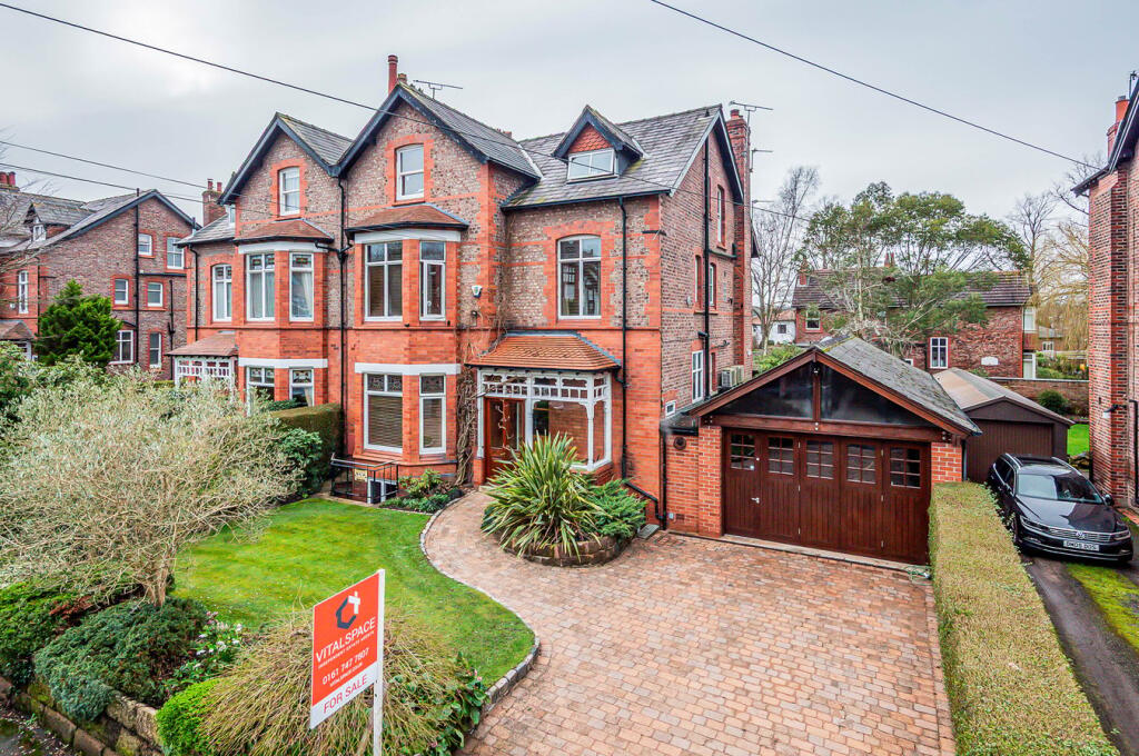
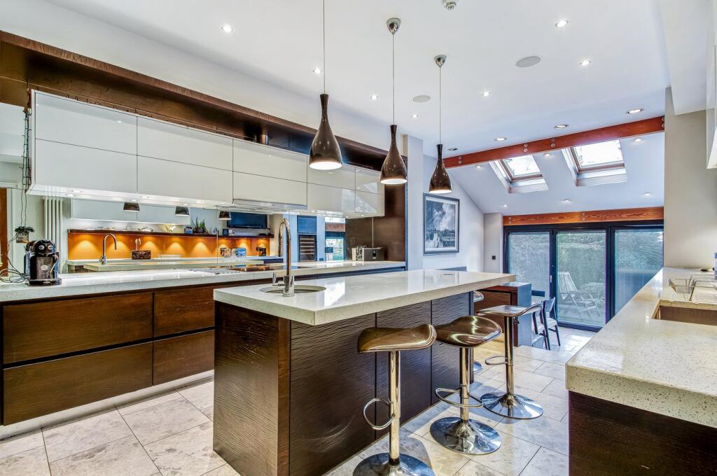
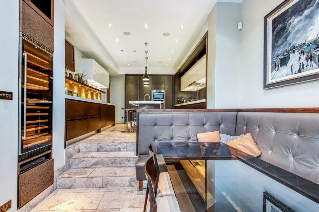
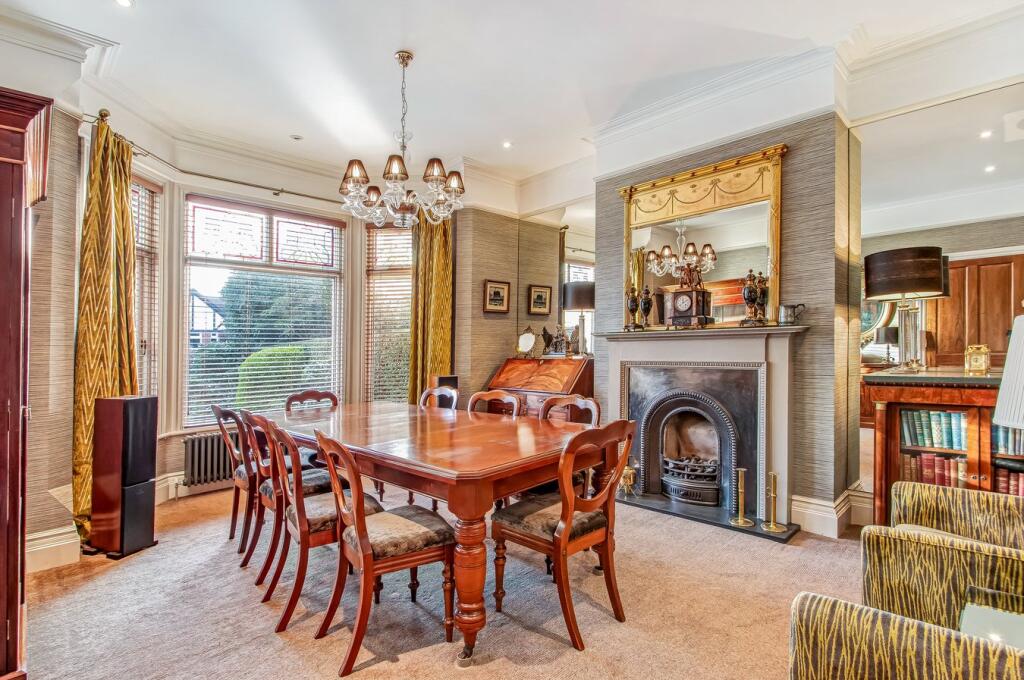
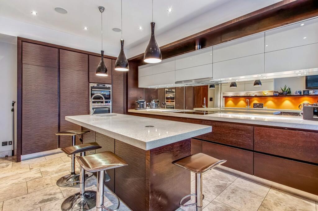
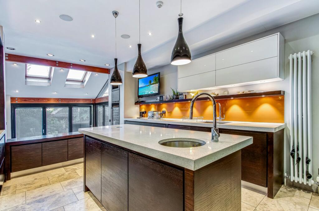
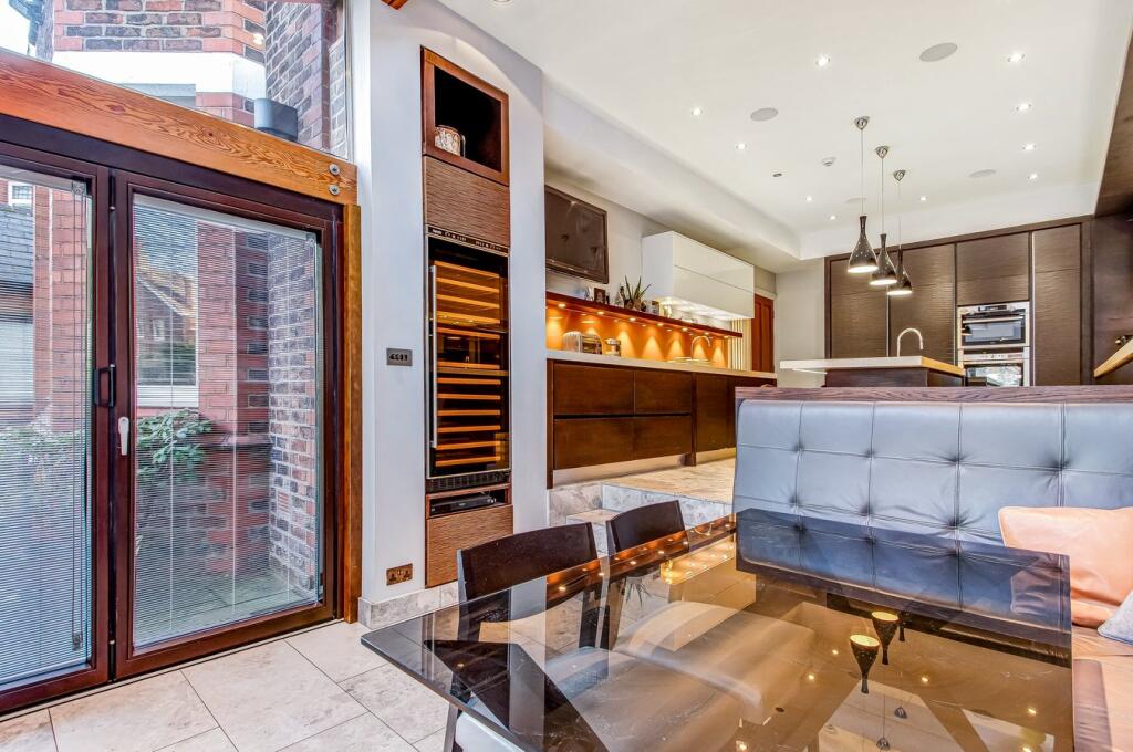
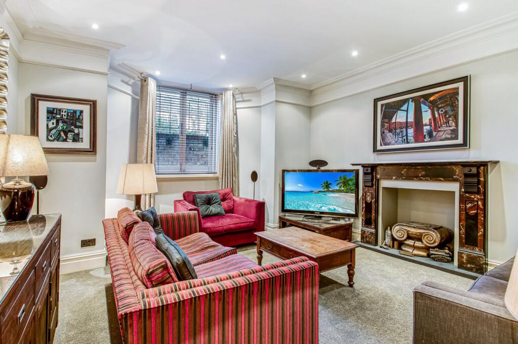
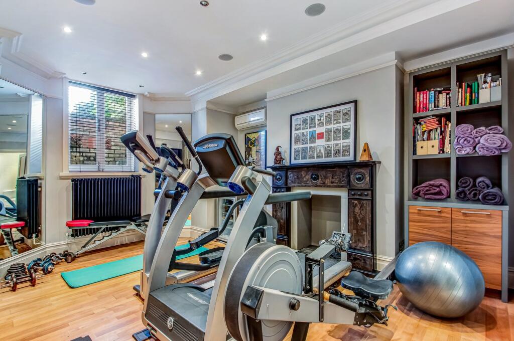
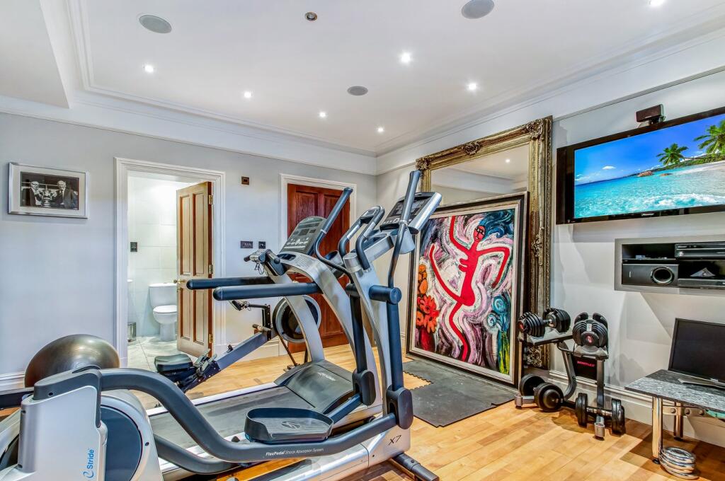
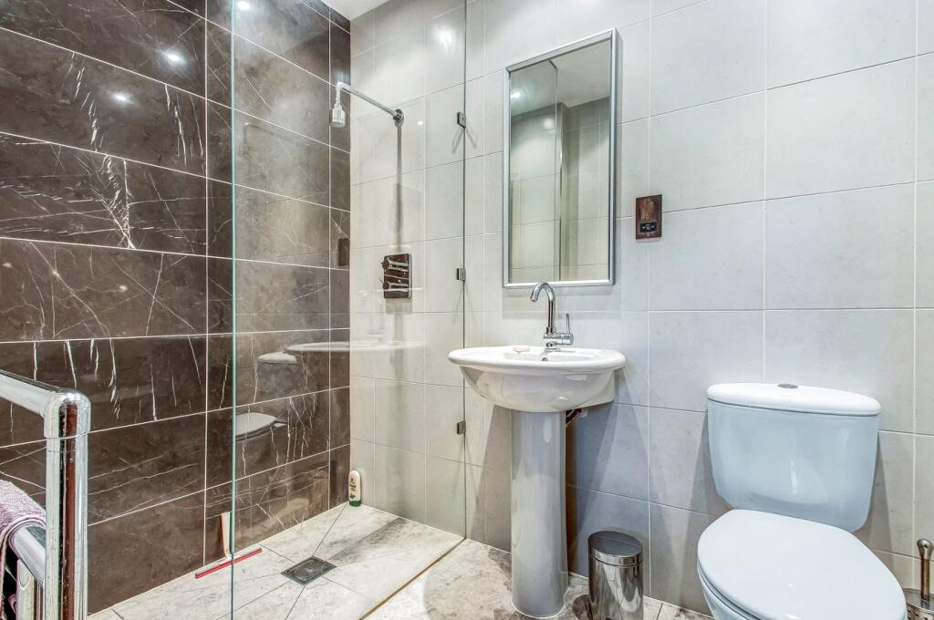
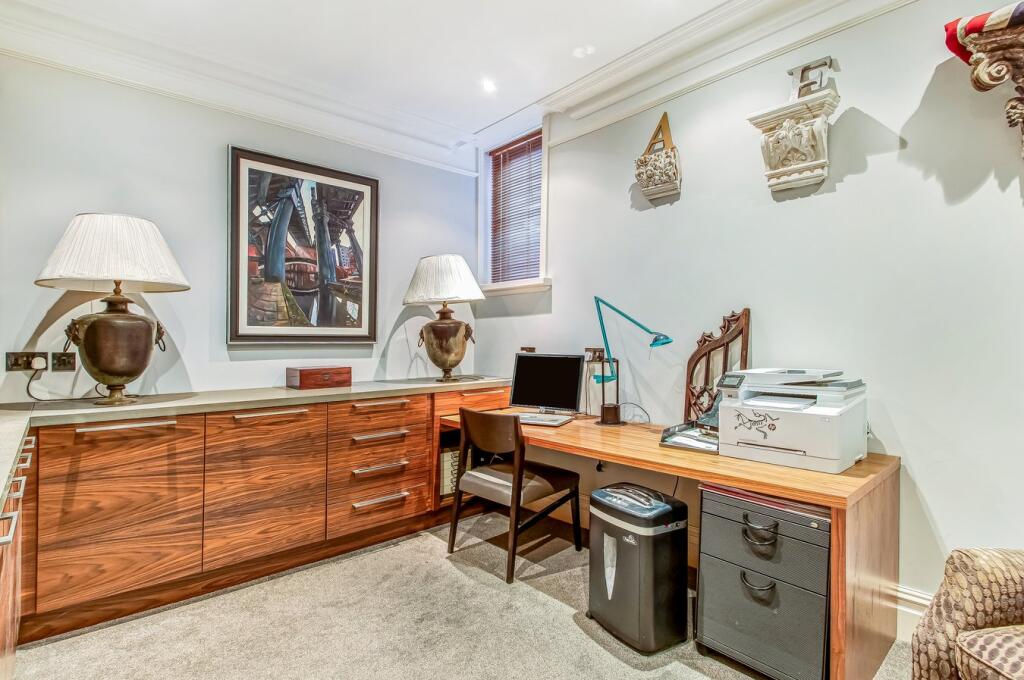
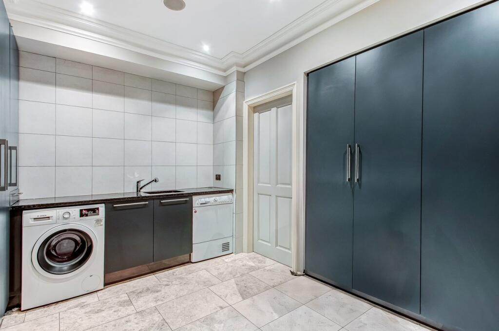
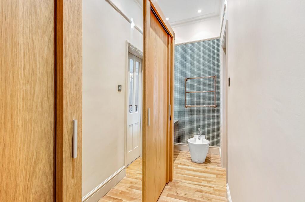
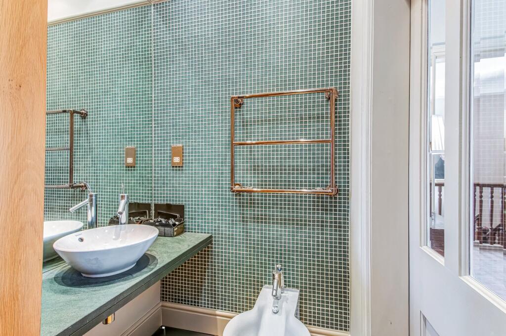
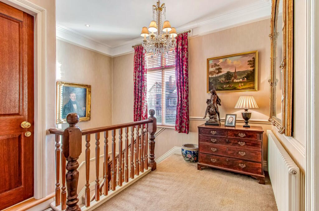
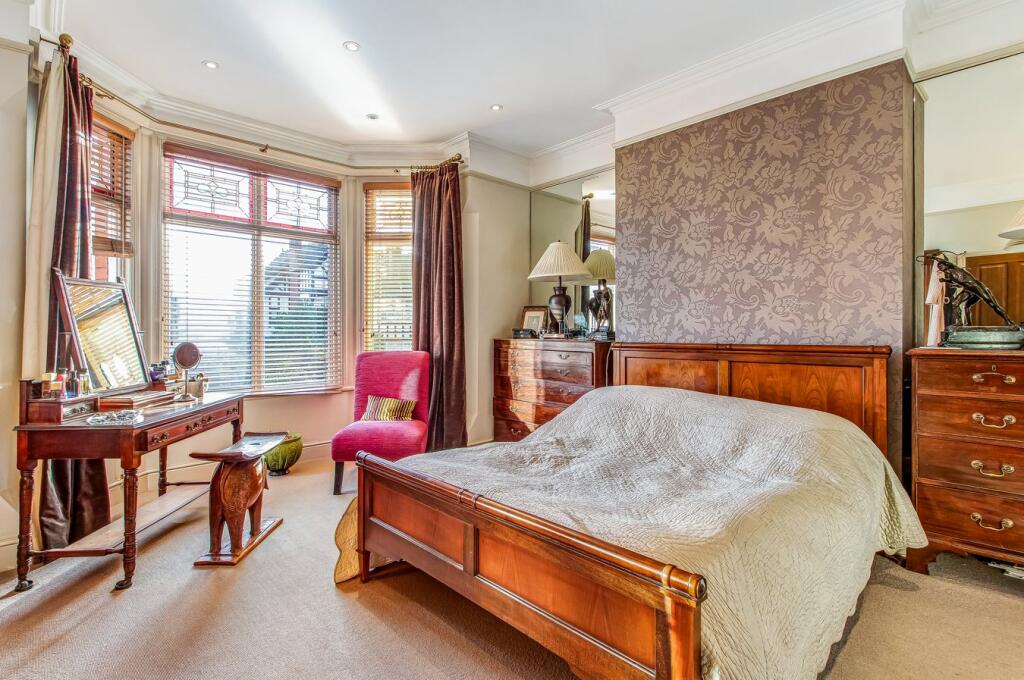
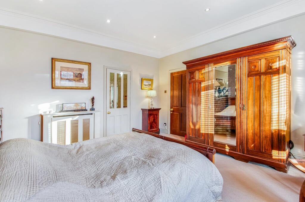
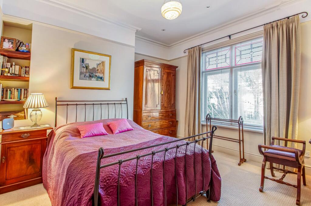
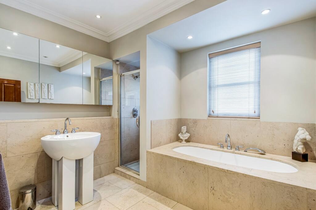
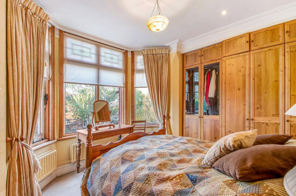
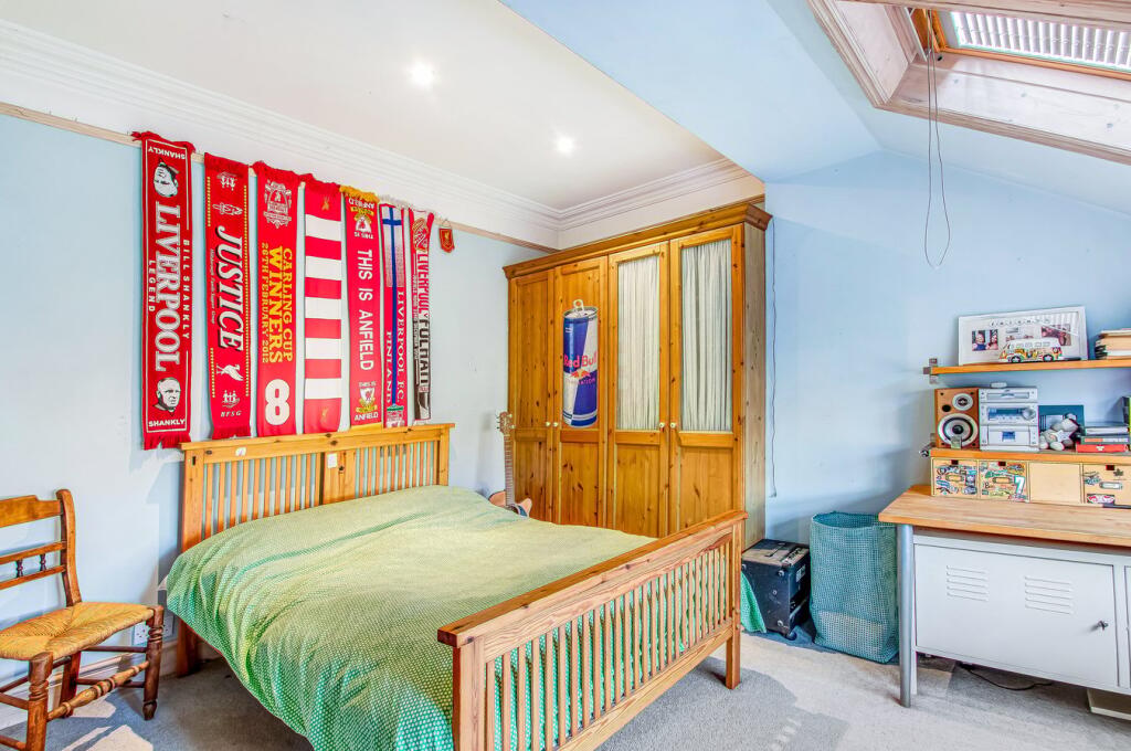
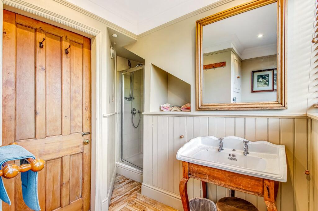
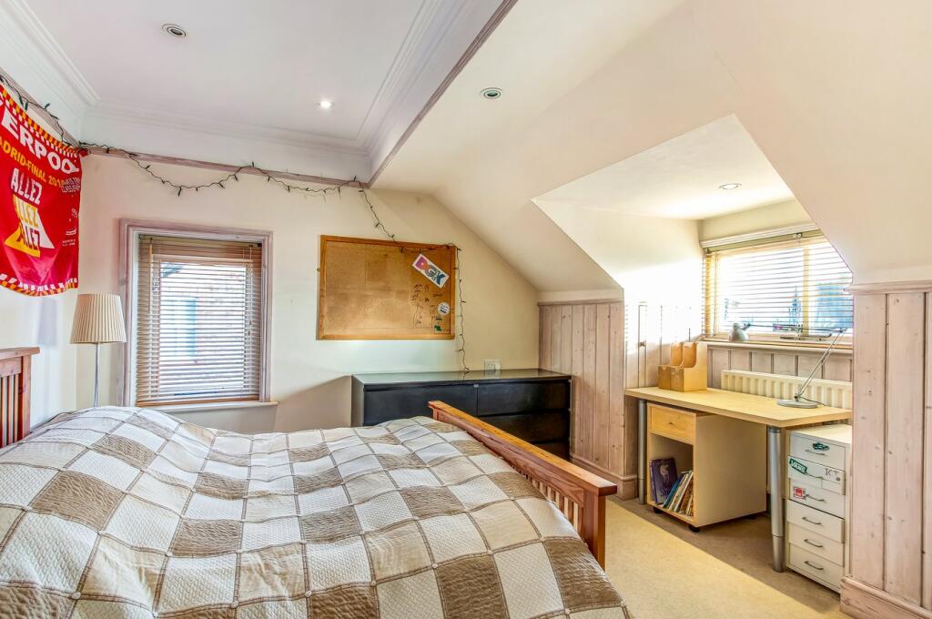
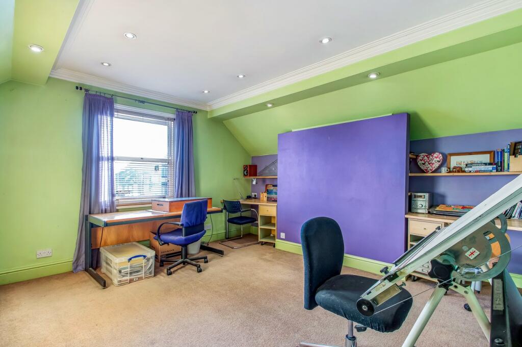
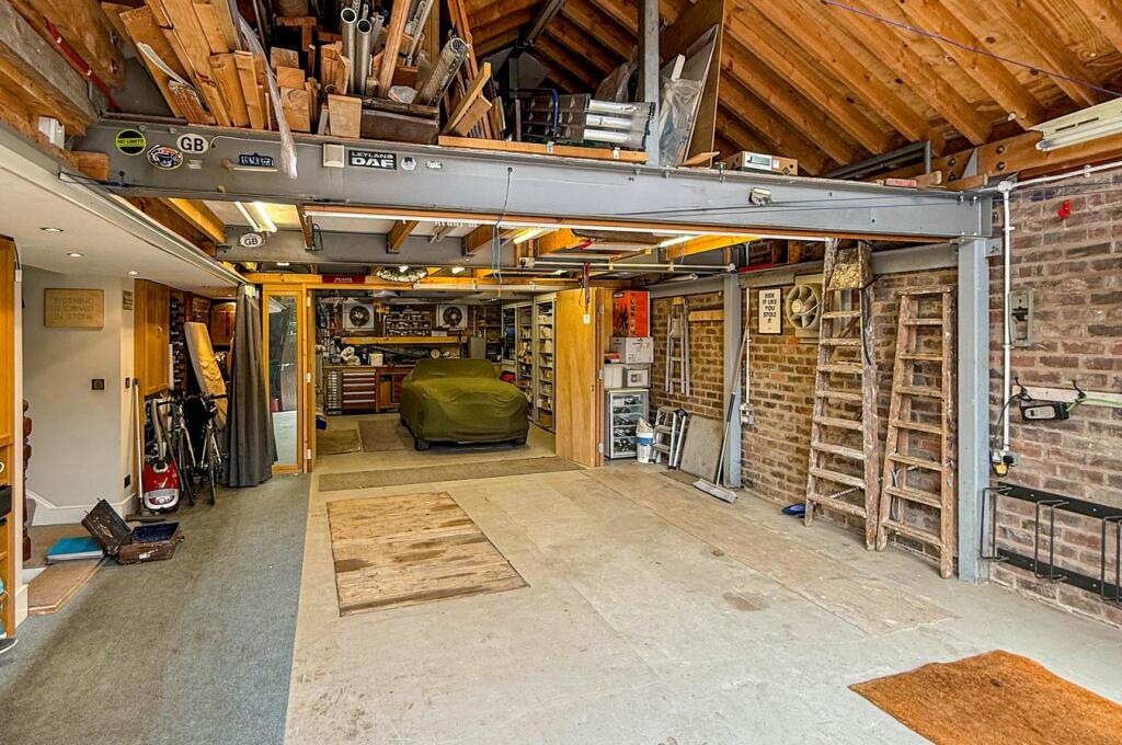
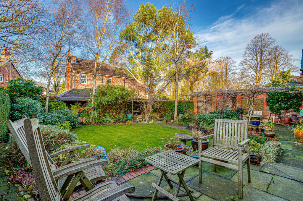
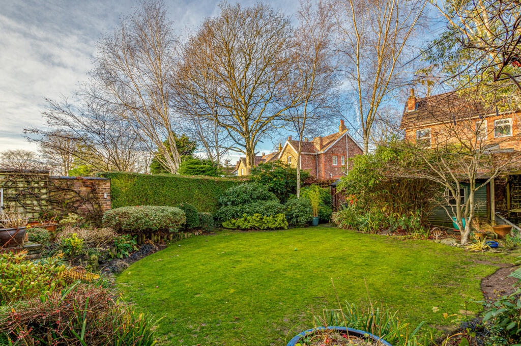
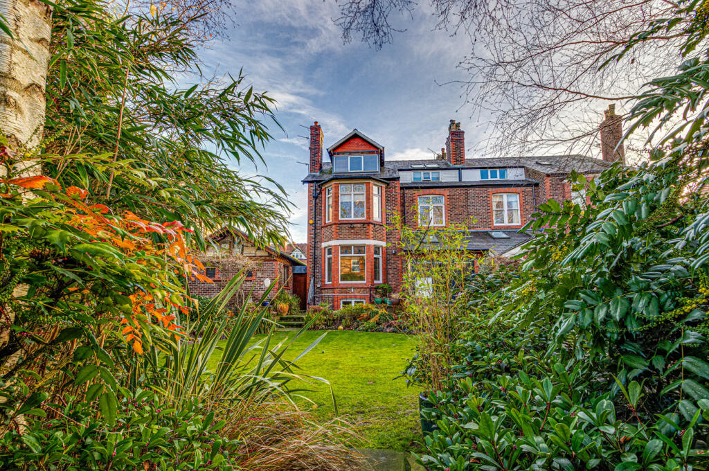
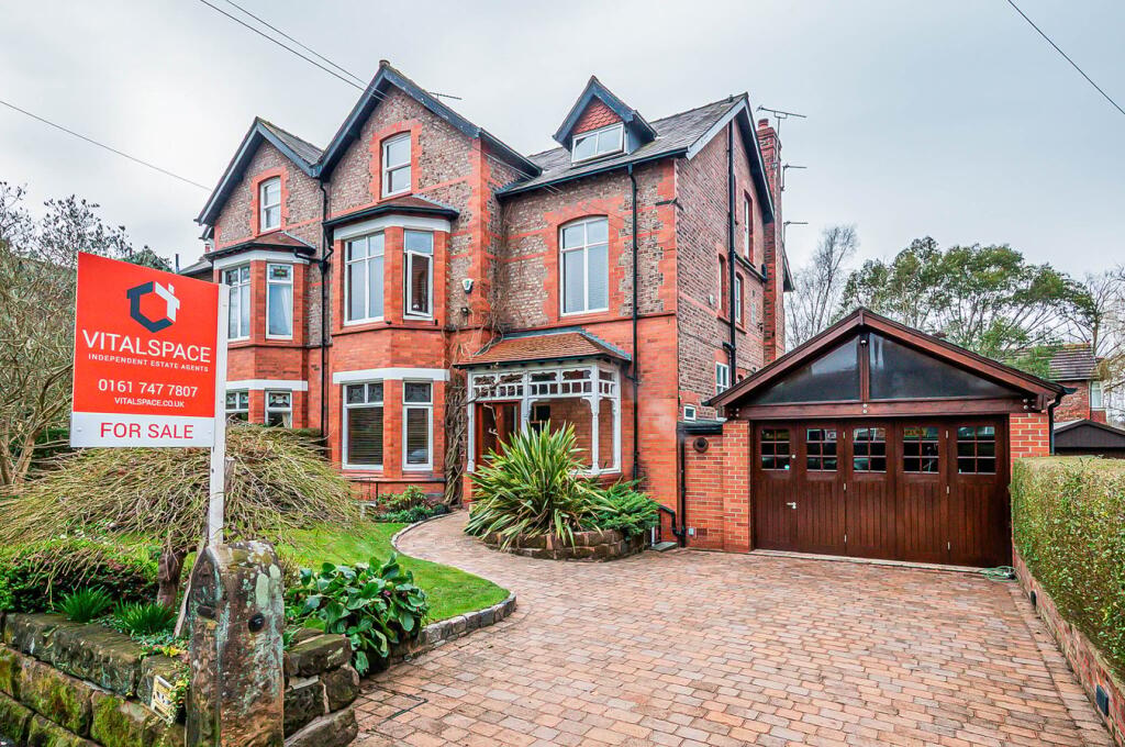
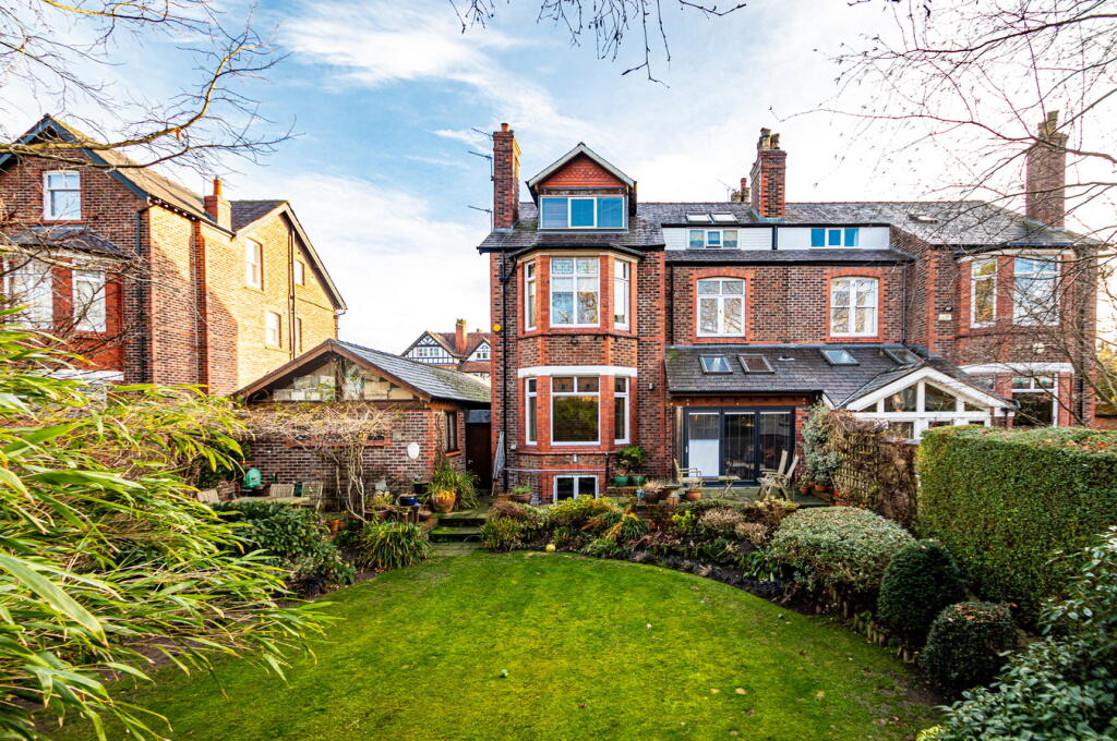
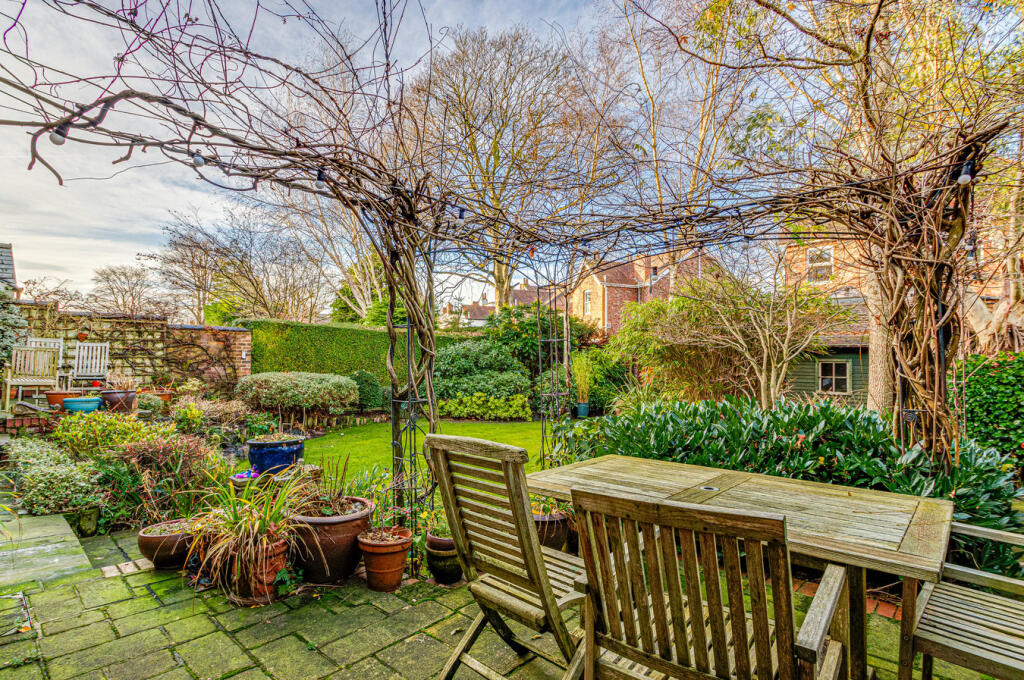
Photo 1 Photo 2 Photo 3 Photo 4 Photo 5 Photo 6 Photo 7 Photo 8 Photo 9 Photo 10 Photo 11 Photo 12 Photo 13 Photo 14 Photo 15 Photo 16 Photo 17 Photo 18 Photo 19 Photo 20 Photo 21 Photo 22 Photo 23 Photo 24 Photo 25 Photo 26 Photo 27 Photo 28 Photo 29 Photo 30 Photo 31 Photo 32 Photo 33
/ 33
Property details
Tenure
FREEHOLD
Floor area
441 m²
Council tax band
G
Local average
£550,451 (+199.8%)
Deprivation
Decile 9 (27,745 of 33,755)
Street crime
0 incidents within 1 mile (May 2026)
Key features
- Six double bedrooms
- Victorian semi detached
- 396 Sq M / 4262 Sq ft
- Stunning landscaped gardens
- Arranged over four floors
- Walking Distance To Hale Village
- Catchment for the areas finest schools
- Professionally converted cellars
- Six car brick garage
- Open plan breakfast kitchen
Additional details
- Electricity
- Mains supply
- Water
- Mains supply
- Sewerage
- Mains supply
- Heating
- Gas central
- Parking
- Yes
- Garden
- Yes
- Listed property
- No
- Restrictions
- No
- Required access
- No
- Rights of way
- No
- Flooded in last 5 years
- No
- Flood defences
- No
Description
Listed by
South Manchester
VitalSpace
Reference: 88554441
EPC Rating & Upgrade Cost
Fetching EPC data… Refresh this page in a moment.
Flood risk
Zone: 1
Risk: Low
Job (default Low)
Floorplans
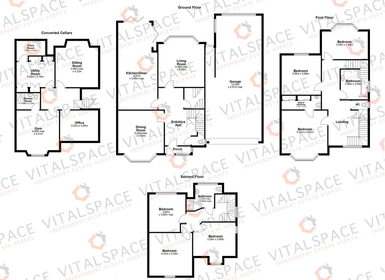
Floorplan 1
Price history
443% since 1996
| Event | Date | Price | % change |
|---|---|---|---|
| Listed for sale | — | £1,650,000 | +32% |
| Sold | 03/06/2016 (10 years ago) | £1,250,000 | +8.7% |
| Sold | 17/07/2008 (18 years ago) | £1,150,000 | +400% |
| Sold | 18/07/1996 (30 years ago) | £230,000 | — |
Source: HM Land Registry Price Paid Data. Crown copyright.
Sold Comparables
Same street and nearby sales within 0.25 miles (last 5 years). Data from Land Registry Price Paid.
| Address | Price | Date | Type |
|---|---|---|---|
| 70 LEIGH ROAD, HALE, ALTRINCHAM, TRAFFORD, GREATER MANCHESTER, WA15 9BD | £900,000 | 09/10/2023 | Semi-detached |
| 15 QUEENS ROAD, HALE, ALTRINCHAM, TRAFFORD, GREATER MANCHESTER, WA15 9HF | £1,285,000 | 27/09/2023 | Semi-detached |
| 101 HALE ROAD, HALE, ALTRINCHAM, TRAFFORD, GREATER MANCHESTER, WA15 9HL | £675,000 | 26/09/2023 | Semi-detached |
| 26 OLLERBARROW ROAD, HALE, ALTRINCHAM, TRAFFORD, GREATER MANCHESTER, WA15 9PP | £1,300,000 | 31/08/2023 | Semi-detached |
| 44 LEIGH ROAD, HALE, ALTRINCHAM, TRAFFORD, GREATER MANCHESTER, WA15 9BD | £930,000 | 23/08/2023 | Semi-detached |
| 27 OLLERBARROW ROAD, HALE, ALTRINCHAM, TRAFFORD, GREATER MANCHESTER, WA15 9PP | £1,432,500 | 01/11/2022 | Semi-detached |
| 57 WESTGATE, HALE, ALTRINCHAM, TRAFFORD, GREATER MANCHESTER, WA15 9BA | £1,350,000 | 16/09/2022 | Semi-detached |
| 4 LEICESTER ROAD, HALE, ALTRINCHAM, TRAFFORD, GREATER MANCHESTER, WA15 9PR | £1,435,000 | 10/08/2022 | Semi-detached |
| 34 OLLERBARROW ROAD, HALE, ALTRINCHAM, TRAFFORD, GREATER MANCHESTER, WA15 9PP | £1,399,950 | 18/03/2022 | Semi-detached |
| 61 WESTGATE, HALE, ALTRINCHAM, TRAFFORD, GREATER MANCHESTER, WA15 9BA | £937,000 | 25/02/2022 | Semi-detached |
| 26 BROOMFIELD LANE, HALE, ALTRINCHAM, TRAFFORD, GREATER MANCHESTER, WA15 9AU | £995,000 | 30/11/2021 | Semi-detached |
Area average: £1,149,041 (11 sales)
Capital growth trend
Land Registry outcode average: last 12 months vs 5y and 10y ago (from sold prices).
House Price Index (HM Land Registry — official index, not sold-price averages): Trafford. Series: Semi-detached. As of April 2026.
Rental Range
Estimated market rent for Trafford. Low = conservative, Realistic = average, Optimistic = best case.
Based on Local Authority from postcode lookup → Trafford.
LHA (30th percentile) floor for North Cumbria: Apr 2025 – Mar 2026
Location
Address
14 Ollerbarrow Road
Nearby
Nearest stations, universities and amenities (distance from property).
| Type | Name | Distance |
|---|---|---|
| Bus stop | Hale, Hale Road / near Broomfield Lane | 0.1 miles |
| Bus stop | Hale, Hale Road / near Queens Road | 0.1 miles |
| Shop | Tesco Express | 0.3 miles |
| Shop | Hill's Bakery | 0.3 miles |
| Train station | Hale | 0.3 miles |
| Hospital | Altrincham Hospital | 0.6 miles |
| Train station | Altrincham | 0.6 miles |
| Hospital | Altrincham Health and Wellbeing Centre | 0.7 miles |
| University | University Academy 92 | 5.9 miles |
| University | University of Salford | 6.7 miles |
Street-level crime
| Category | Count |
|---|---|
| Total incidents | 0 |
Within 1 mile during May 2026. Source: data.police.uk (England & Wales).
Schools nearby
Nearest open schools with Ofsted ratings (England). Closed schools are not shown. Data from Get Information about Schools and Ofsted.
| Name | Type | Distance | Ofsted |
|---|---|---|---|
| Hale Preparatory School | Other | 0.1 miles | — (No rating) |
| Stamford Park Primary School | Primary | 0.2 miles | Good — 16 May 2024 |
| Altrincham Grammar School for Boys | Secondary | 0.5 miles | Outstanding — 10 Nov 2022 |
| Bowdon Preparatory School for Girls | Other | 0.5 miles | — (No rating) |
| Blessed Thomas Holford Catholic College | Secondary | 0.6 miles | Requires improvement — 9 Jan 2023 |
Rental Comparables
Residential lets from OpenRent and Rightmove for the area. Bedroom counts vary — use the Beds column to compare like-for-like lets. Student lets are excluded.
| Title | Rent | Beds | Distance | As seen on |
|---|---|---|---|---|
| 4 Bed Terraced House, Westgate, WA15 | £3,200/mo | 4 | 0.21 miles | OpenRent |
| 3 Bed Detached House, Sandileigh Drive, WA15 | £7,500/mo | 3 | 0.3 miles | OpenRent |
| 2 Bed Terraced House, Ashfield Rd, WA14 | £1,850/mo | 2 | 0.37 miles | OpenRent |
| 3 Bed End Terrace, Moss Lane, WA15 | £1,550/mo | 3 | 0.5 miles | OpenRent |
| 2 Bed Flat, Denmark Street, WA14 | £1,350/mo | 2 | 0.53 miles | OpenRent |
| 2 Bed Flat, Railway Street, WA14 | £5,450/mo | 2 | 0.6 miles | OpenRent |
| 2 Bed Flat, Stamfgrd New Road, WA14 | £1,295/mo | 2 | 0.62 miles | OpenRent |
| 2 Bed Flat, Stamford New Road, WA14 | £1,200/mo | 2 | 0.62 miles | OpenRent |
| 2 Bed Flat, Stamford House, WA14 | £1,300/mo | 2 | 0.62 miles | OpenRent |
| 1 Bed Flat, Stamford New Road, WA14 | £975/mo | 1 | 0.63 miles | OpenRent |
| 2 Bed Flat, Great Oak Drive, WA15 | £1,450/mo | 2 | 0.63 miles | OpenRent |
| 1 Bed Flat, The Causeway, WA14 | £975/mo | 1 | 0.64 miles | OpenRent |
| 2 Bed Flat, Bowdon, WA14 | £1,800/mo | 2 | 0.64 miles | OpenRent |
| 2 Bed Flat, Regent Road, WA14 | £1,245/mo | 2 | 0.66 miles | OpenRent |
| 4 Bed Semi-Detached House, Avon Road, WA15 | £7,000/mo | 4 | 0.66 miles | OpenRent |
| 2 Bed Flat, Kingsway, WA14 | £1,350/mo | 2 | 0.75 miles | OpenRent |
| 1 Bed Flat, Woodlands Road, WA14 | £950/mo | 1 | 0.86 miles | OpenRent |
| 2 Bed Flat, Suffolk Road, WA14 | £1,450/mo | 2 | 1.21 miles | OpenRent |
Average rent: £2,327/mo (18 listings)
Rent-driven metrics
Based on OpenRent comparables.
- Rent ratio — Monthly rent ÷ purchase price (1% rule). 1%+ = strong, 0.8–1% = okay, <0.8% = weak for cashflow.
- Max investor price — Rent ÷ 0.8%; the price at which rent would be 0.8% of price (Stoke-style target).
- Target investor price — Rent ÷ 1%; the price at which rent would be 1% of price (strong cashflow band).
- Gross yield — Annual rent as % of purchase price (no costs).
- Cost-to-rent — Price ÷ annual rent (from OpenRent comparables). Under 14× = strong, 14–16× = acceptable, 17×+ = compressed.
- Cashflow — Rent minus mortgage, 10% maintenance, £25/mo compliance. Assumes 75% LTV, 3.95% APR (5yr fixed), 25yr term.
- ROI — Annual profit ÷ cash in (deposit + 4% purchase costs).