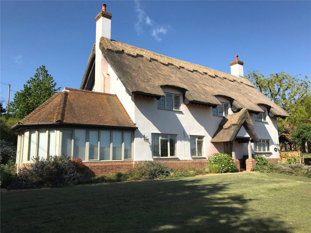
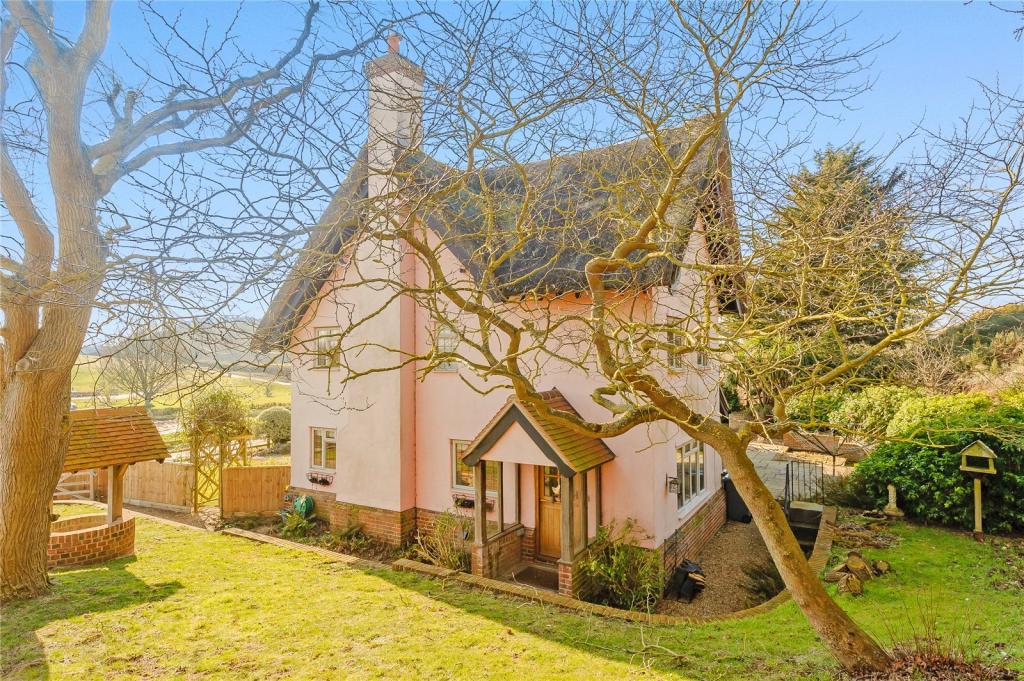
The White House
FERRY ROAD, WOODBRIDGE, SUDBOURNE, SUFFOLK IP12 2BQ
Property details
Tenure
FREEHOLD
Last sold
£770,000 Oct 2019
Local average
£638,859 (+24.4%)
Deprivation
Decile 5 (13,849 of 33,755)
Street crime
1 incident within 1 mile (Mar 2026)
Key features
- Reception hall
- Sitting & Garden rooms
- Kitchen/breakfast room, Utility room,
- Cloakroom
- 2 bedrooms with ensuite, 2 Additional bedrooms
- Family bathroom
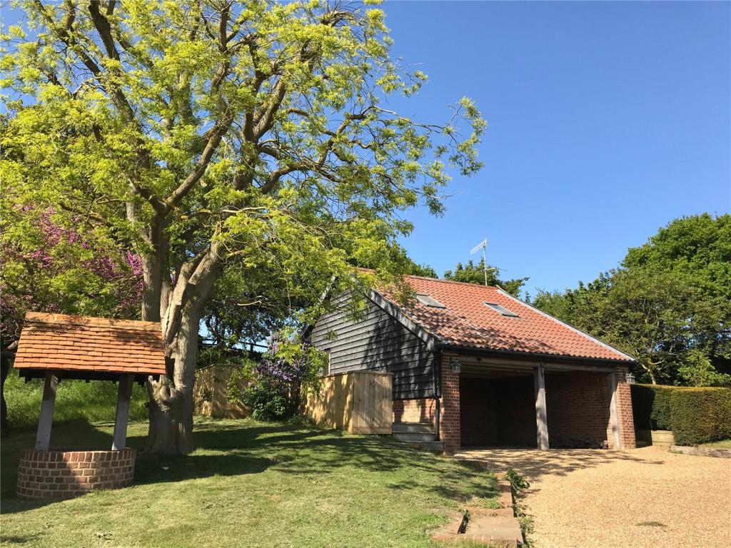
- Cart Lodge for 2 cars with Annexe over (1 bedroom, kitchen and bathroom)
- Gardens
Additional details
- Parking
- Yes
- Garden
- Yes
Description
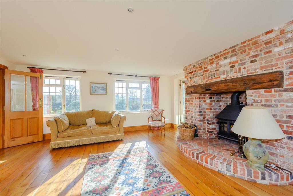
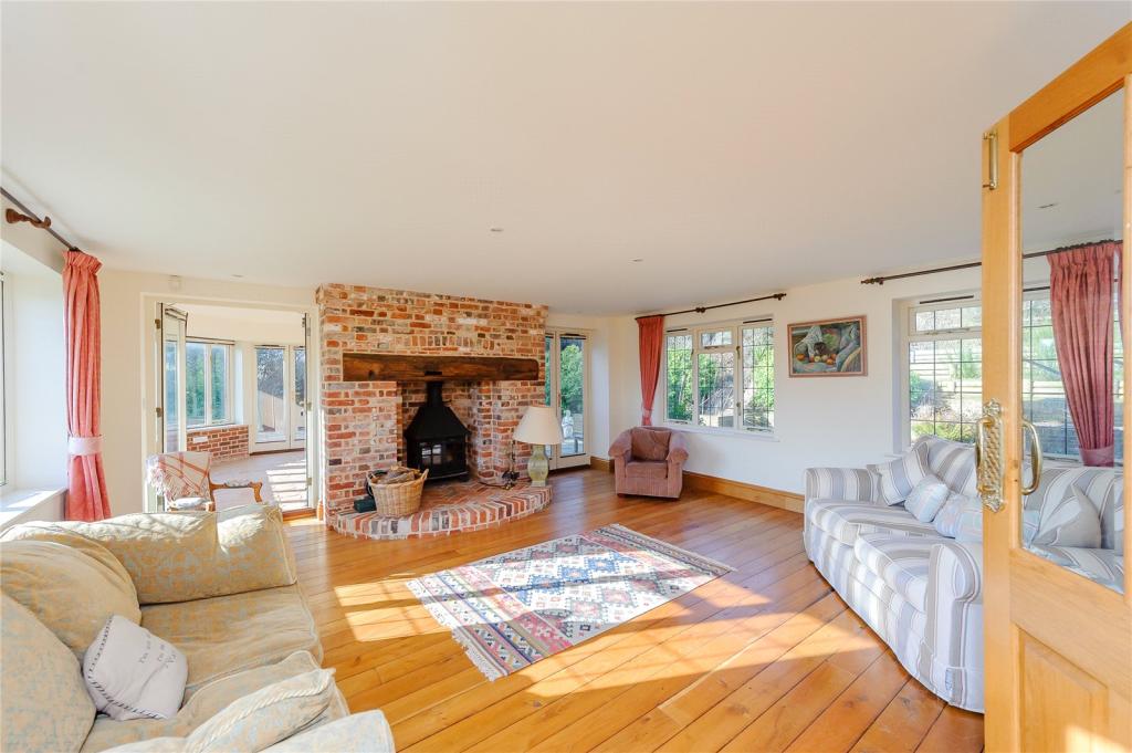
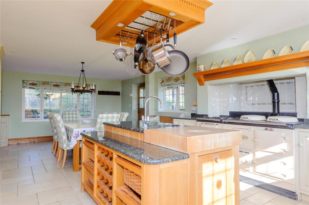
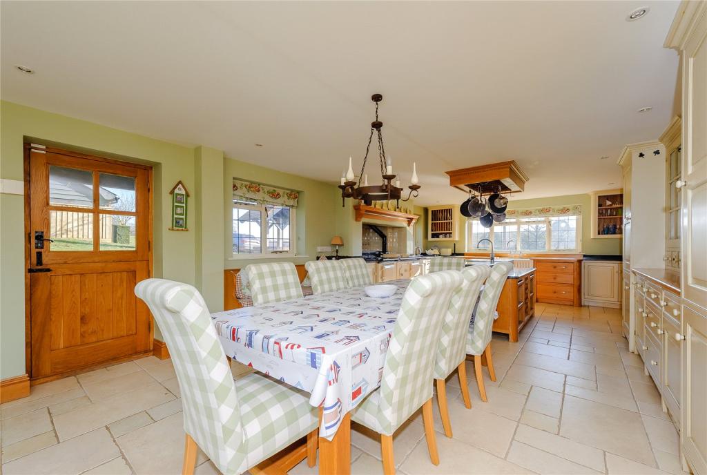
The accommodation flows from a bright reception hall into a large sitting room with triple aspect windows, providing a light and airy atmosphere. The beautiful feature fireplace provides a focal point for the room which could easily accommodate multiple sofas and chairs. Leading on from this is the garden room with large windows, providing beautiful views over the gardens and beyond. At the other end of the house is the spacious kitchen/breakfast room, which boasts excellent storage, large central island, oil fired Aga and electric companion, triple aspect windows and room for a good-sized dining table. A utility room can be found just off the kitchen and a cloakroom completes the ground floor.
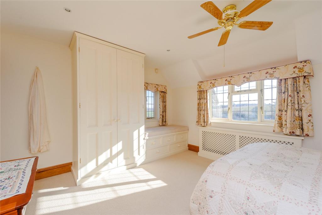
On the first floor are four bedrooms, the master bedroom includes double aspect windows, fitted storage and a contemporary en suite bathroom. A further bedroom also includes an en suite whilst the two other bedrooms share a well-appointed bathroom with bath, shower, basin and WC.
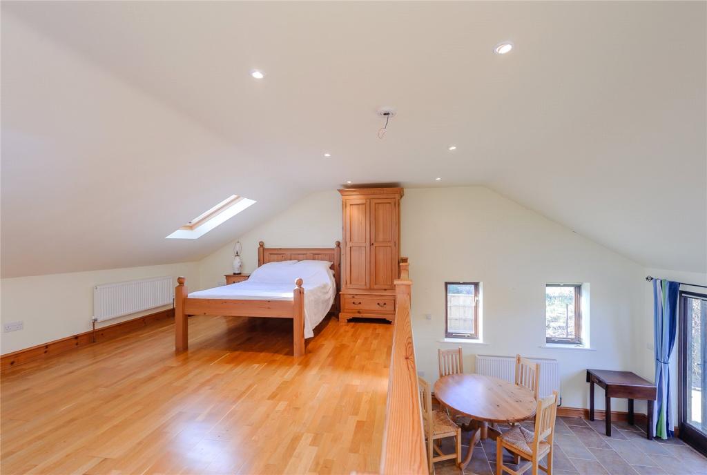
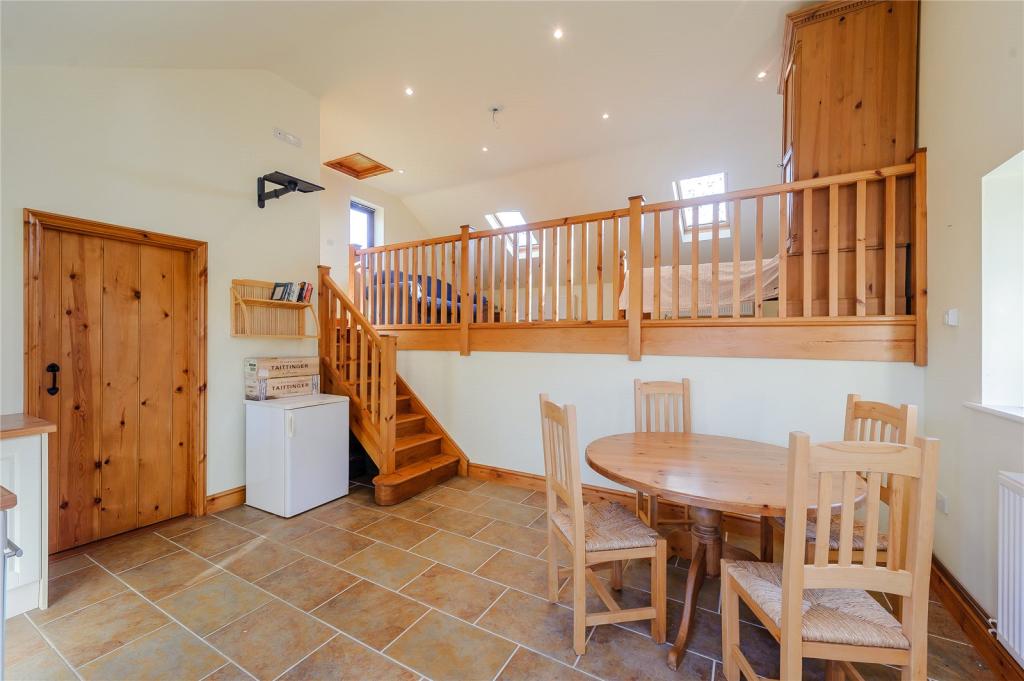
An annexe can be found above the cart lodge and consists of a bright and spacious bedroom, a kitchen and a shower room.
Local Authority: Suffolk Coastal District Council
Services: Mains water and electricity. Private drainage. Oil fired heating
Council Tax: Band F, Council tax for 2017/2018: £2192.19 per annum
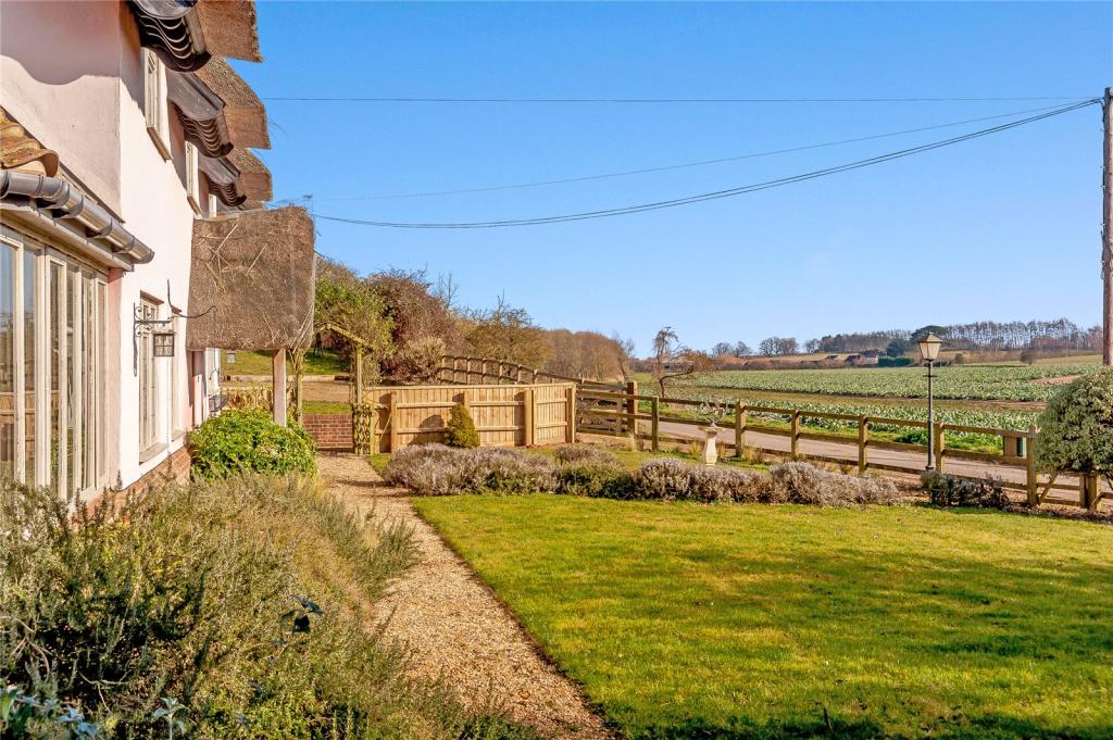
The White House sits in the stunning Suffolk countryside, in the attractive village of Sudbourne. The village of Orford is around 5 minutes away by car, and boasts amenities such as shops, renowned bakery, restaurants and public houses. The beautiful town of Woodbridge is also nearby and the town of Aldeburgh on the coast is also in the vicinity, each provides a wider selection of restaurants and amenities. The railway station at Saxmundham provides connecting services to London Liverpool Street station via Ipswich.
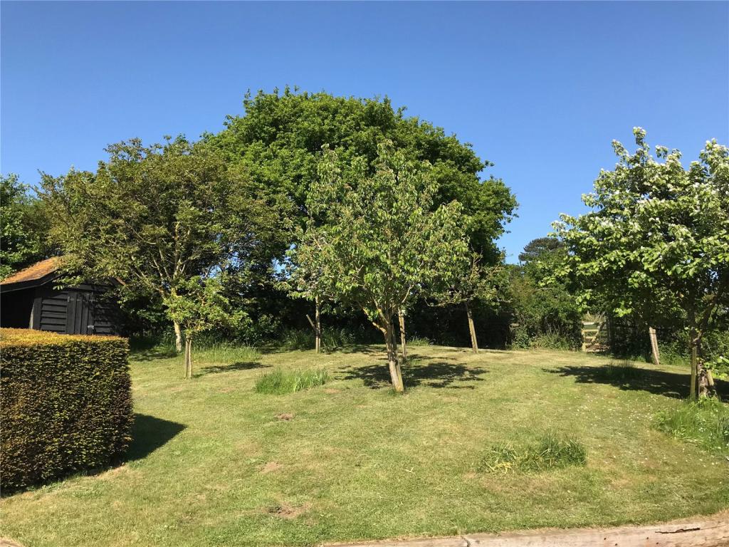
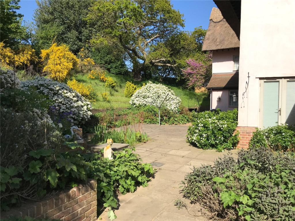
The White House sits in a quiet rural setting approached via a driveway, which leads up to the ample off-road parking. A cart lodge to the side of the property provides further parking for two vehicles. To the front is an attractive garden which is largely laid to lawn with flowers, hedges and shrubs. To the rear is a patio area, which could be accessed via the kitchen/breakfast room and could be ideal for outside dining or entertaining. Beyond this is an attractive grassed area with mature trees and shrubs. The gardens offer wonderful views over the surrounding countryside.
Listed by
Suffolk
BNP Paribas - Strutt & Parker
Reference: 64420918
EPC ratings on this postcode
We don't have a matched EPC for this property yet. Below are efficiency scores and details for other addresses on this postcode.
| Address | Current | Potential | Floor area | Age band | Type |
|---|---|---|---|---|---|
| 1 Airey Cottages, Ferry Road, Sudbourne, WOODBRIDGE | 44 | 86 | 88 m² | England and Wales: 1930-1949 | Detached |
| 1 Cragpit Cottages, Ferry Road, Sudbourne, WOODBRIDGE | 51 | 107 | 81 m² | England and Wales: before 1900 | Detached |
| 2 Airey Cottages, Ferry Road, Sudbourne, WOODBRIDGE | 53 | 76 | 85 m² | England and Wales: 1950-1966 | Detached |
| 2 Cragpit Cottages, Ferry Road, Sudbourne, WOODBRIDGE | 52 | 77 | 60 m² | England and Wales: before 1900 | Detached |
| 2 Cragpit Cottages, Ferry Road, Sudbourne, WOODBRIDGE | 47 | 85 | 72 m² | England and Wales: before 1900 | Detached |
| Marshlands, Ferry Road, Sudbourne, WOODBRIDGE | 79 | 86 | 306 m² | England and Wales: 2007-2011 | Detached |
| The Firs, Ferry Road, Sudbourne, WOODBRIDGE | 47 | 87 | 245 m² | England and Wales: before 1900 | Detached |
| The Oaks, Ferry Road, Sudbourne, WOODBRIDGE | 64 | 89 | 157 m² | England and Wales: 1996-2002 | Detached |
Flood risk
Zone: 1
Risk: Low
Job (default Low)
Floorplans
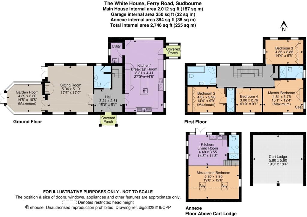
Floorplan
EPC Graphs
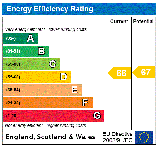
EPC Rating Graph
Price history
| Event | Date | Price | % change |
|---|---|---|---|
| Sold | 24/10/2019 (6 years ago) | £770,000 | — |
Source: HM Land Registry Price Paid Data. Crown copyright.
Sold Comparables
Same street and nearby sales within 0.25 miles (last 5 years). Data from Land Registry Price Paid.
| Address | Price | Date | Type |
|---|---|---|---|
| Same street AIREY COTTAGES 1 FERRY ROAD, SUDBOURNE, WOODBRIDGE, EAST SUFFOLK, SUFFOLK, IP12 2BQ | £800,000 | 13/10/2023 | Other |
Street average: £800,000 (1 sale)
Capital growth trend
Land Registry outcode average: last 12 months vs 5y and 10y ago (from sold prices).
House Price Index (HM Land Registry — official index, not sold-price averages): East Suffolk. Series: Detached. As of March 2026.
Rental Range
Estimated market rent for East Suffolk. Low = conservative, Realistic = average, Optimistic = best case.
Based on Local Authority from postcode lookup → East Suffolk.
LHA (30th percentile) floor for Ipswich: £1,097/mo (Apr 2025 – Mar 2026)
Location
Address
Ferry Road
Nearby
Nearest stations, universities and amenities (distance from property).
| Type | Name | Distance |
|---|---|---|
| Bus stop | School Lane | 0.9 miles |
| Bus stop | Stanney House Farm | 1.2 miles |
| Shop | Potkins Craft Centre | 1.9 miles |
| Shop | Orford General Store | 2.1 miles |
| Hospital | Aldeburgh Community Hospital | 2.8 miles |
| Train station | Wickham Market | 6.5 miles |
| Train station | Saxmundham | 6.7 miles |
| University | University of Suffolk (DigiTech Centre) | 11.9 miles |
Street-level crime
| Category | Count |
|---|---|
| Violence and sexual offences | 1 |
| Total incidents | 1 |
Within 1 mile during Mar 2026. Source: data.police.uk (England & Wales).
Schools nearby
Nearest open schools with Ofsted ratings (England). Closed schools are not shown. Data from Get Information about Schools and Ofsted.
| Name | Type | Distance | Ofsted |
|---|---|---|---|
| Orford Church of England Primary School and Nursery | Primary | 2.0 miles | Good — 4 Jul 2023 |
| Aldeburgh Primary School | Primary | 2.8 miles | Good — 20 May 2020 |
| Snape Primary School | Primary | 3.8 miles | Good — 4 Jun 2018 |
| Coldfair Green Community Primary School | Primary | 4.6 miles | Good — 13 Sep 2023 |
Rental Comparables
Loading rental comparables for this postcode. Refresh in a few minutes.
Rent-driven metrics
Based on Area rent estimate.
- Rent ratio — Monthly rent ÷ purchase price (1% rule). 1%+ = strong, 0.8–1% = okay, <0.8% = weak for cashflow.
- Max investor price — Rent ÷ 0.8%; the price at which rent would be 0.8% of price (Stoke-style target).
- Target investor price — Rent ÷ 1%; the price at which rent would be 1% of price (strong cashflow band).
- Gross yield — Annual rent as % of purchase price (no costs).
Enter House Number
Enter the house number to help us retrieve more accurate pricing history and property data.
Please log in to submit or correct the house number for this listing.
Log in to continue