Milehouse Lane Newcastle
ST5 9JZ
£750 pcm
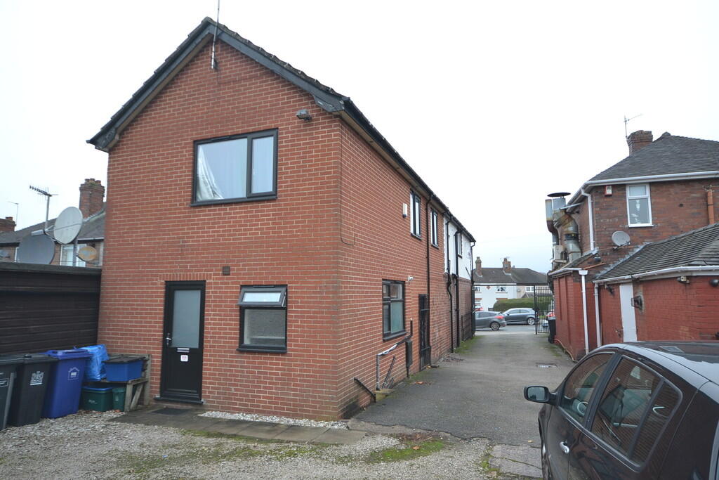

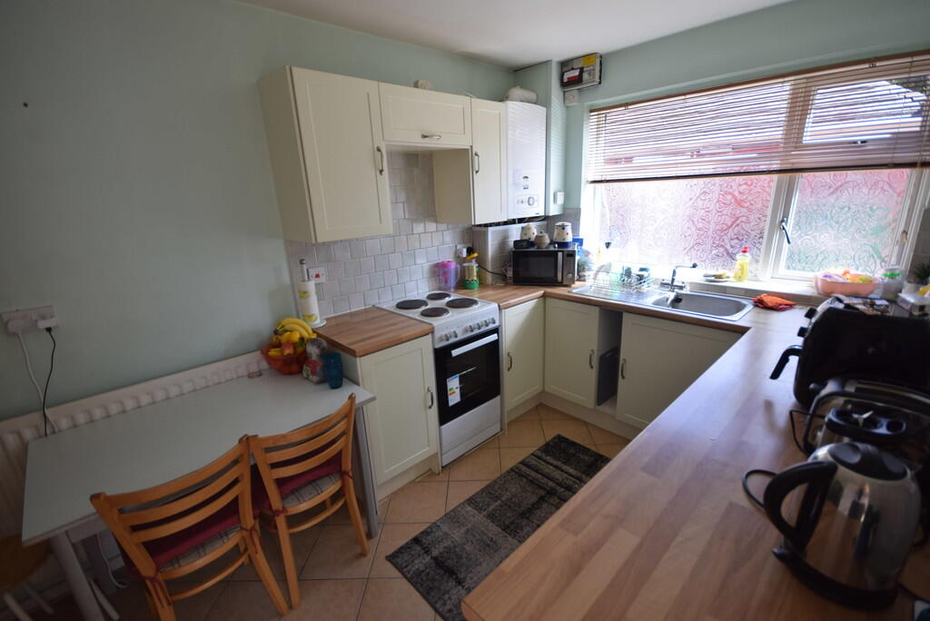
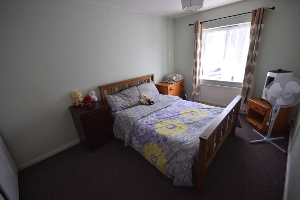
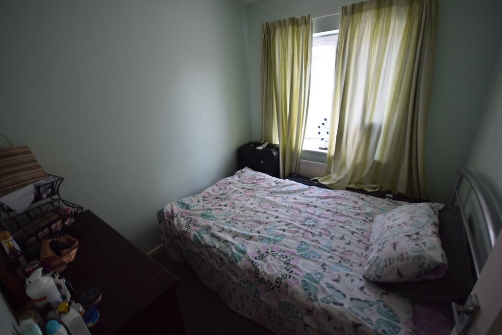
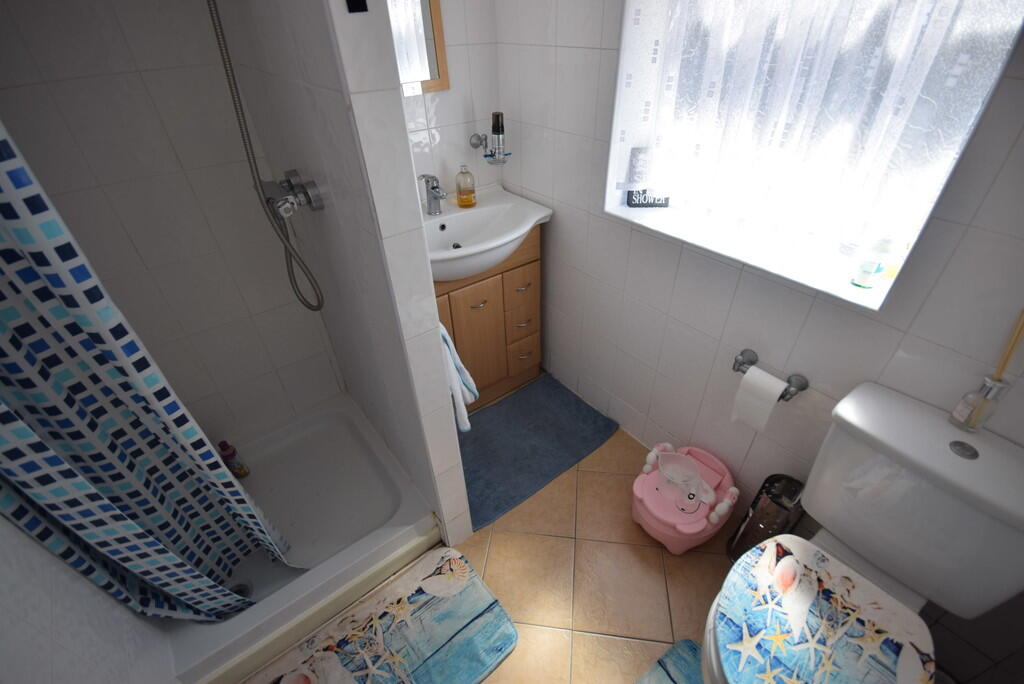
Photo 1 Photo 2 Photo 3 Photo 4 Photo 5 Photo 6
/ 6
Property details
Council tax band
A
Deprivation
Decile 5 (15,295 of 33,755)
Street crime
264 incidents within 1 mile (May 2026)
Key features
- Furnished Apartment
- Two Bedrooms
- Lounge
- Kitchen/Breakfast room
- Gas Central Heating
- Shower Room
- Council Tax Band - A
- Close to Local Amenities
- Parking to Rear
Additional details
- Heating
- Gas central
- Parking
- Off street
Description
ENTRANCE HALL Tiled flooring, wall mounted radiator.
SHOWER ROOM White suite comprising of WC, wash hand basin with vanity unit below, shower. Heated towel rail, tiled floor, UPVC obscure Double Glazed window.
KITCHEN Fitted kitchen comprising of a range of base units with worktops over, wall unite, free standing electric cooker, table and chairs, UPVC Double Glazed window, under stairs storage cupboard.
STAIRS Carpeted flooring.
LIVING ROOM Carpeted flooring, wall mounted radiator, UPVC Double Glazed window. Various items of furniture.
BEDROOM ONE Double bedroom with carpeted flooring, UPVC Double Glazed window, wall mounted radiator, various items of furniture.
BEDROOM TWO ** Double bedroom with carpeted flooring, UPVC Double Glazed window, wall mounted radiator, various items of furniture.
Listed by
Stoke On Trent
The Property Franchise Group
Reference: 89232927
EPC Rating & Upgrade Cost
Fetching EPC data… Refresh this page in a moment.
Flood risk
Zone: 1
Risk: Low
Job (default Low)
EPC Graphs
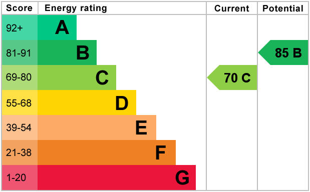
EPC 1
Rental Range
Estimated market rent for Newcastle-under-Lyme. Low = conservative, Realistic = average, Optimistic = best case.
Based on Local Authority from postcode lookup → Newcastle-under-Lyme.
LHA (30th percentile) floor for Staffordshire North: £479/mo (Apr 2025 – Mar 2026)
Location
Address
57 Milehouse Lane
Nearby
Nearest stations, universities and amenities (distance from property).
| Type | Name | Distance |
|---|---|---|
| Bus stop | Shops | 0.1 miles |
| Shop | Betd | 0.6 miles |
| Shop | Argos | 0.7 miles |
| Train station | Longport | 1.3 miles |
| Train station | Silverdale | 1.5 miles |
| Hospital | Royal Stoke University Hospital | 1.7 miles |
| University | Keele University | 2.4 miles |
| Hospital | North Staffordshire Nuffield Hospital | 2.6 miles |
| University | University of Buckingham Crewe Campus | 9.2 miles |
Street-level crime
| Category | Count |
|---|---|
| Violence and sexual offences | 100 |
| Anti-social behaviour | 53 |
| Shoplifting | 23 |
| Public order | 19 |
| Criminal damage and arson | 15 |
| Other theft | 15 |
| Drugs | 13 |
| Vehicle crime | 9 |
| Burglary | 7 |
| Bicycle theft | 3 |
| Other crime | 3 |
| Robbery | 2 |
| Possession of weapons | 1 |
| Theft from the person | 1 |
| Total incidents | 264 |
Within 1 mile during May 2026. Source: data.police.uk (England & Wales).
Schools nearby
Nearest open schools with Ofsted ratings (England). Closed schools are not shown. Data from Get Information about Schools and Ofsted.
| Name | Type | Distance | Ofsted |
|---|---|---|---|
| Merryfields School | Other | 0.2 miles | Good — 30 Apr 2014 |
| Hempstalls Primary School | Primary | 0.3 miles | — (Inspected (no overall grade)) |
| The Orme Academy | Secondary | 0.4 miles | Good — 9 Jul 2024 |
| St John Fisher Catholic College | Secondary | 0.7 miles | Requires improvement — 5 Mar 2024 |
| St Margaret's CofE (VC) Junior School | Primary | 0.7 miles | Good — 1 May 2014 |
Rental Comparables
Residential lets from OpenRent and Rightmove for the area (same bedroom count). Use to validate rent estimates. Student lets are excluded.
Average rent: £928/mo (52 listings)