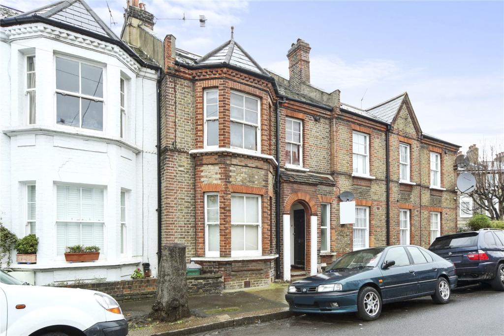
6 INGELOW ROAD
LONDON, GREATER LONDON SW8 3QA
£1,625 pcm
Property details
Floor area
50 m²
Deprivation
Decile 5 (15,805 of 33,755)
Street crime
1081 incidents within 1 mile (Apr 2026)
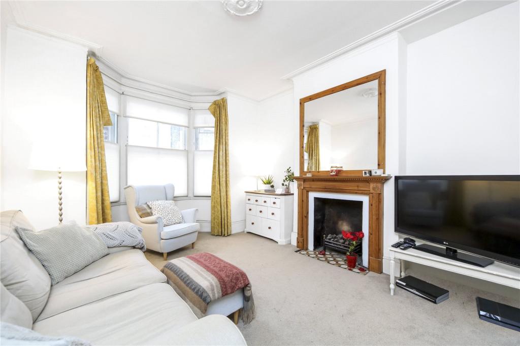
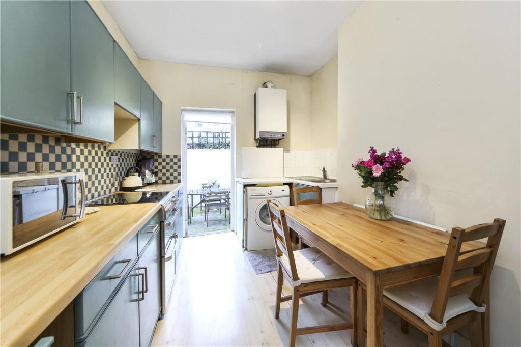
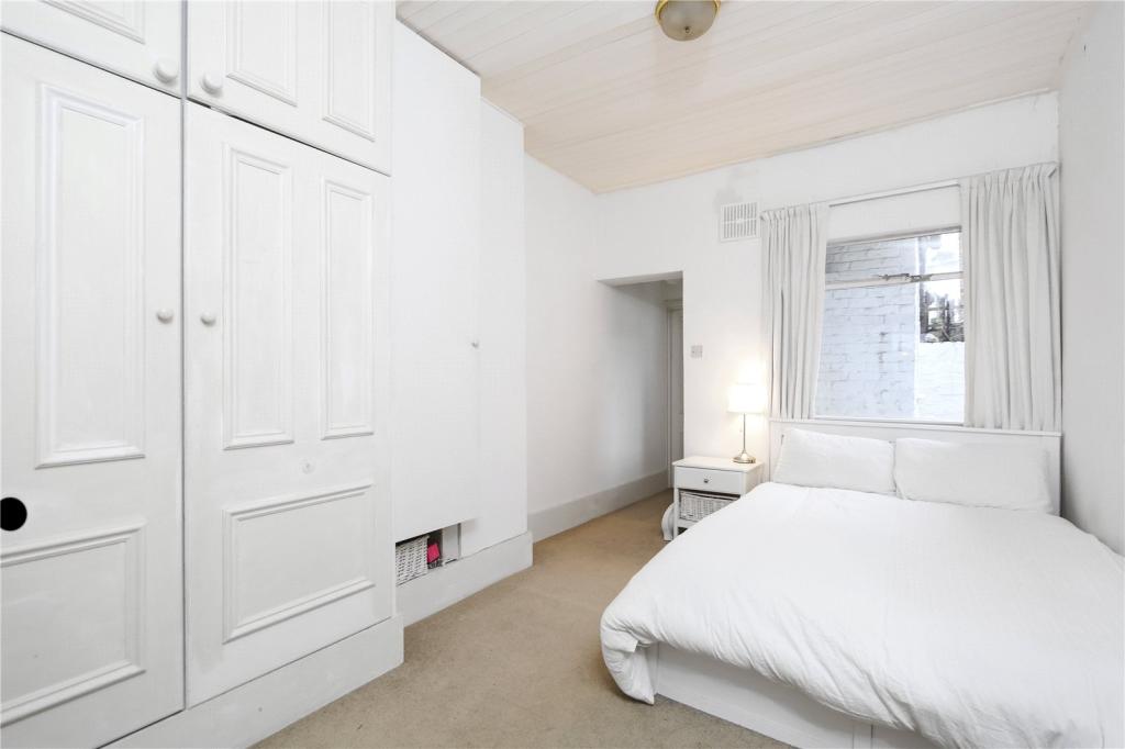
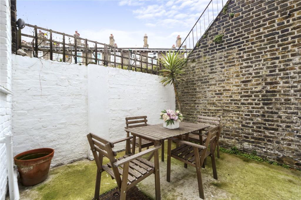
Key features
- 1 Bathroom
- 1 Bedroom
- 1 Reception Room
- Flat/Apartment
- Garden
- Long let
Additional details
- Garden
- Yes
Description
Located in the heart of the conservation area, Ingelow Road is ideally located for the shops bars and restaurants of both Clapham, Queenstown Road and lavender hill, as well as the transport links nearby with access to Waterloo and Victoria via Queenstown Road, Wandsworth Road and Battersea Park overland stations.
Listed by
Clapham
Dexters
Reference: 57708706
EPC Rating & Upgrade Cost
Fetching EPC data… Refresh this page in a moment.
Flood risk
Zone: 1
Risk: Low
Job (default Low)
EPC Graphs
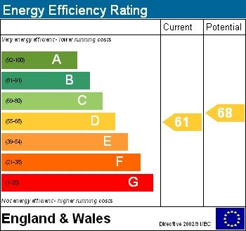
EPC Graph (EE)
Company ownership
Registered legal owner is a company.
Company: FERNVIEW ESTATES LIMITED
Rental Range
Estimated market rent for Wandsworth. Low = conservative, Realistic = average, Optimistic = best case.
Based on Local Authority from postcode lookup → Wandsworth.
LHA (30th percentile) floor for Stevenage & North Herts: £773/mo (Apr 2025 – Mar 2026)
Location
Nearby
Nearest stations, universities and amenities (distance from property).
| Type | Name | Distance |
|---|---|---|
| Bus stop | Prairie Street | 0.1 miles |
| Shop | Queenstown Express | 0.1 miles |
| Shop | Bowloom Limited | 0.1 miles |
| Train station | Queenstown Road | 0.3 miles |
| Train station | Battersea Park | 0.5 miles |
| Hospital | Bridge Lane Health Centre | 0.7 miles |
| University | National Heart and Lung Institute | 1.4 miles |
| University | University of Wales Trinity Saint David London Campus | 1.9 miles |
| Hospital | King's College Hospital Emergency Department | 2.5 miles |
Street-level crime
| Category | Count |
|---|---|
| Anti-social behaviour | 255 |
| Violence and sexual offences | 200 |
| Shoplifting | 116 |
| Theft from the person | 106 |
| Other theft | 86 |
| Vehicle crime | 72 |
| Burglary | 58 |
| Robbery | 39 |
| Bicycle theft | 37 |
| Public order | 36 |
| Criminal damage and arson | 34 |
| Drugs | 29 |
| Other crime | 8 |
| Possession of weapons | 5 |
| Total incidents | 1081 |
Within 1 mile during Apr 2026. Source: data.police.uk (England & Wales).
Schools nearby
Nearest open schools with Ofsted ratings (England). Closed schools are not shown. Data from Get Information about Schools and Ofsted.
| Name | Type | Distance | Ofsted |
|---|---|---|---|
| John Burns Primary School | Primary | 0.2 miles | Good — 6 Feb 2018 |
| Heathbrook Primary School | Primary | 0.3 miles | Good — 13 Jun 2016 |
| Chesterton Primary School | Primary | 0.3 miles | Outstanding — 6 Feb 2023 |
| Shaftesbury Park Primary School | Primary | 0.4 miles | Good — 29 Nov 2013 |
| Harris Academy Battersea | Secondary | 0.4 miles | Outstanding — 12 Mar 2018 |
Rental Comparables
Residential lets from OpenRent and Rightmove for the area (same bedroom count). Use to validate rent estimates. Student lets are excluded.
| Title | Rent | Beds | Distance | As seen on |
|---|---|---|---|---|
| Bondway, London | £3,683/mo | 1 | 1.43 miles | Rightmove |
Average rent: £3,683/mo (1 listing)