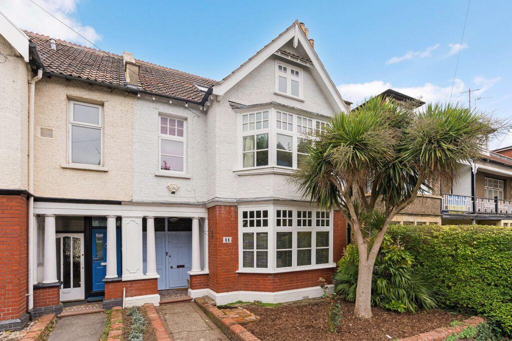
88 CRANBROOK ROAD
BRISTOL, CITY OF BRISTOL BS6 7DB
Property details
Tenure
FREEHOLD
Floor area
176 m²
Council tax band
E
EPC rating
D
Year built
England and Wales: 1900-1929
Last sold
£450,000 Mar 2013
Price per m²
£4,972/m²
Local average
£657,504 (+33.1%)
Deprivation
Decile 10 (32,903 of 33,755)
Street crime
645 incidents within 1 mile (Mar 2026)
Key features
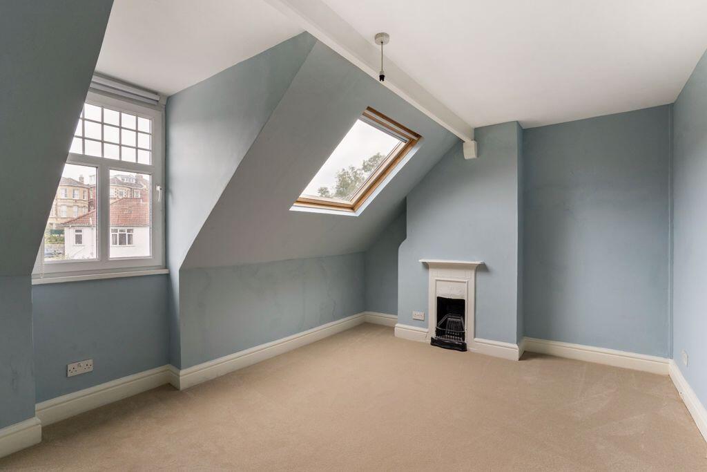
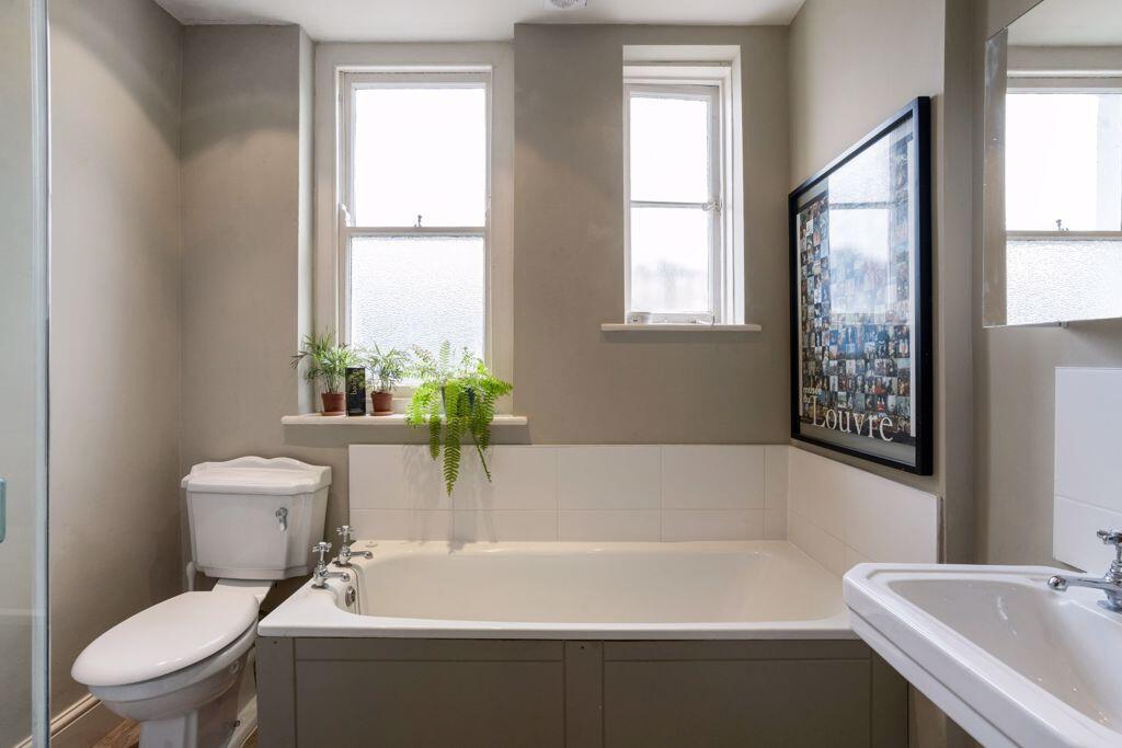
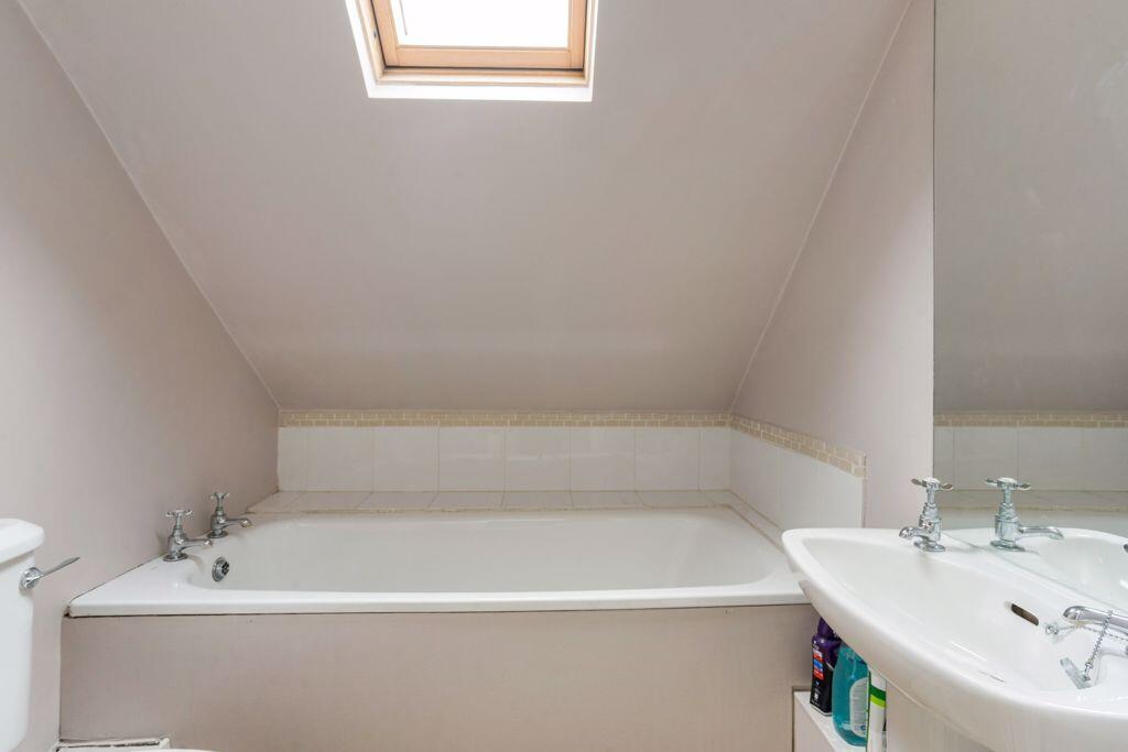
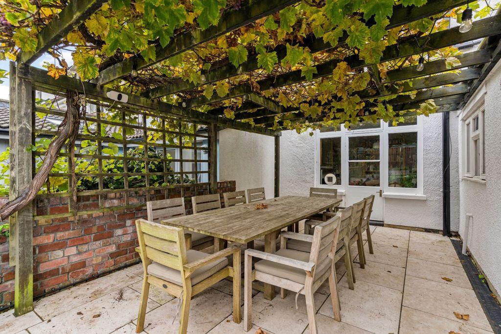
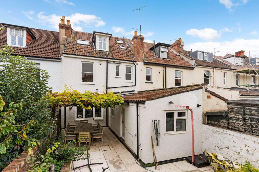
- An exceedingly spacious Edwardian period family home
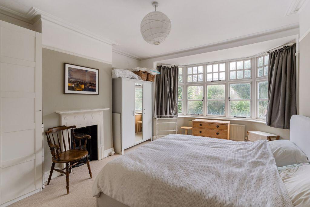
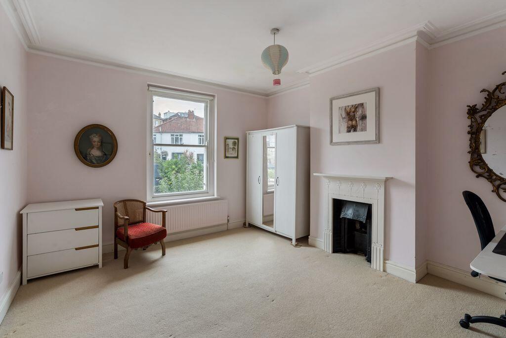
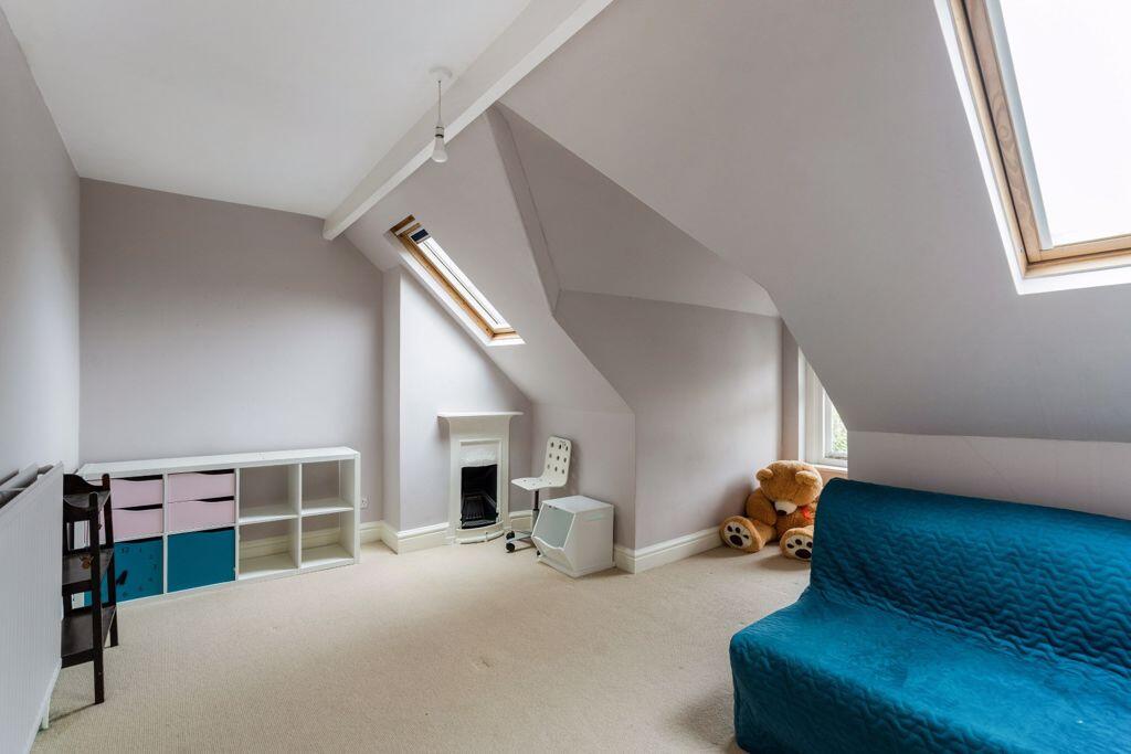
- 5 bedrooms (four doubles and a single)
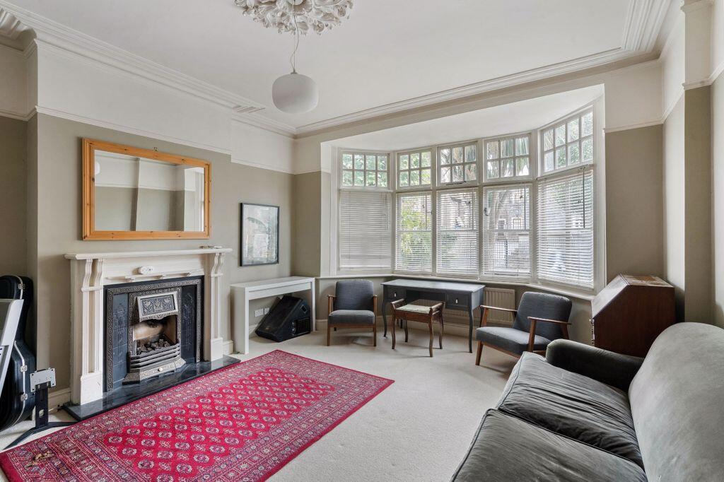
- Bay fronted sitting room
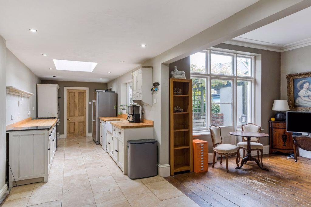
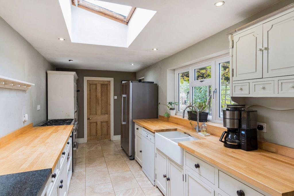
- Kitchen/breakfast room with wide wall opening to family room
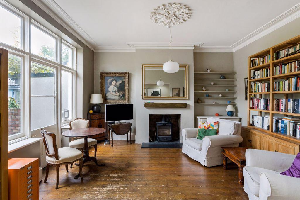
- Circa 1,875 sq. ft of accommodation over three floors
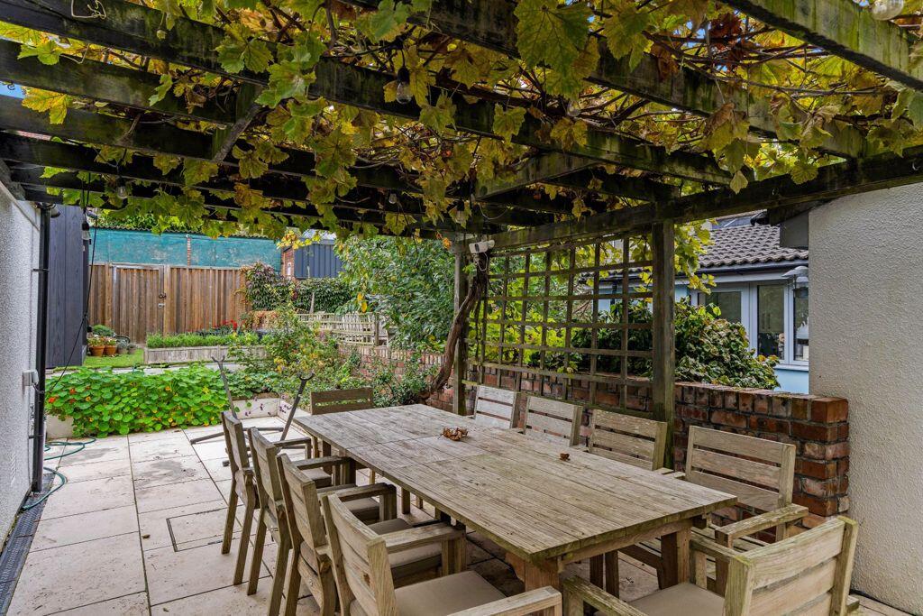
- Front courtyard
- Good sized rear garden
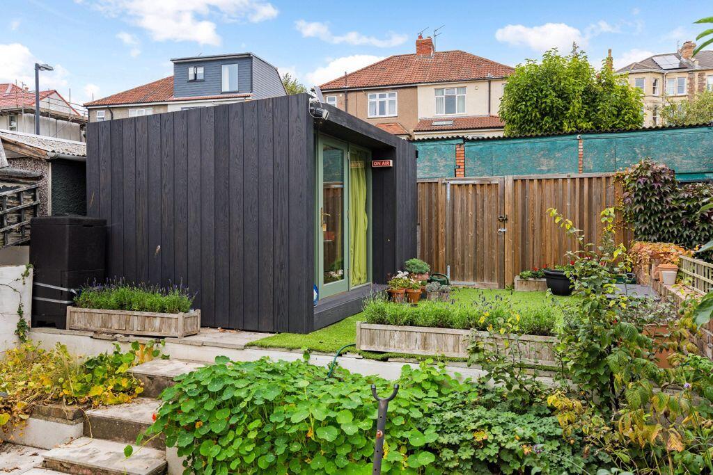
- Acoustic garden office/studio with sedum roof
- A superb family home in a great location for families
- To be sold with no onward chain
Additional details
- Garden
- Yes
Description
Listed by
Bristol
Richard Harding Estate Agents Ltd
Reference: 168123452
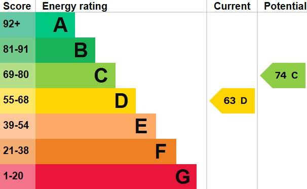
EPC Rating & Upgrade Cost
Current rating: D
Potential rating: C
Inspection date: 09/10/2025
Current heating cost: £1,857/year
Potential heating cost: £1,335/year
Est. upgrade cost to C: £26,800
Recommendations
- Room-in-roof insulation (£900 - £1,200)
- 50 mm internal or external wall insulation (£7,500 - £11,000)
- Floor insulation (suspended floor) (£5,000 - £10,000)
- Solar photovoltaic panels, 2.5 kWp (£8,000 - £10,000)
Flood risk
Zone: 1
Risk: Low
Job (default Low)
Floorplans
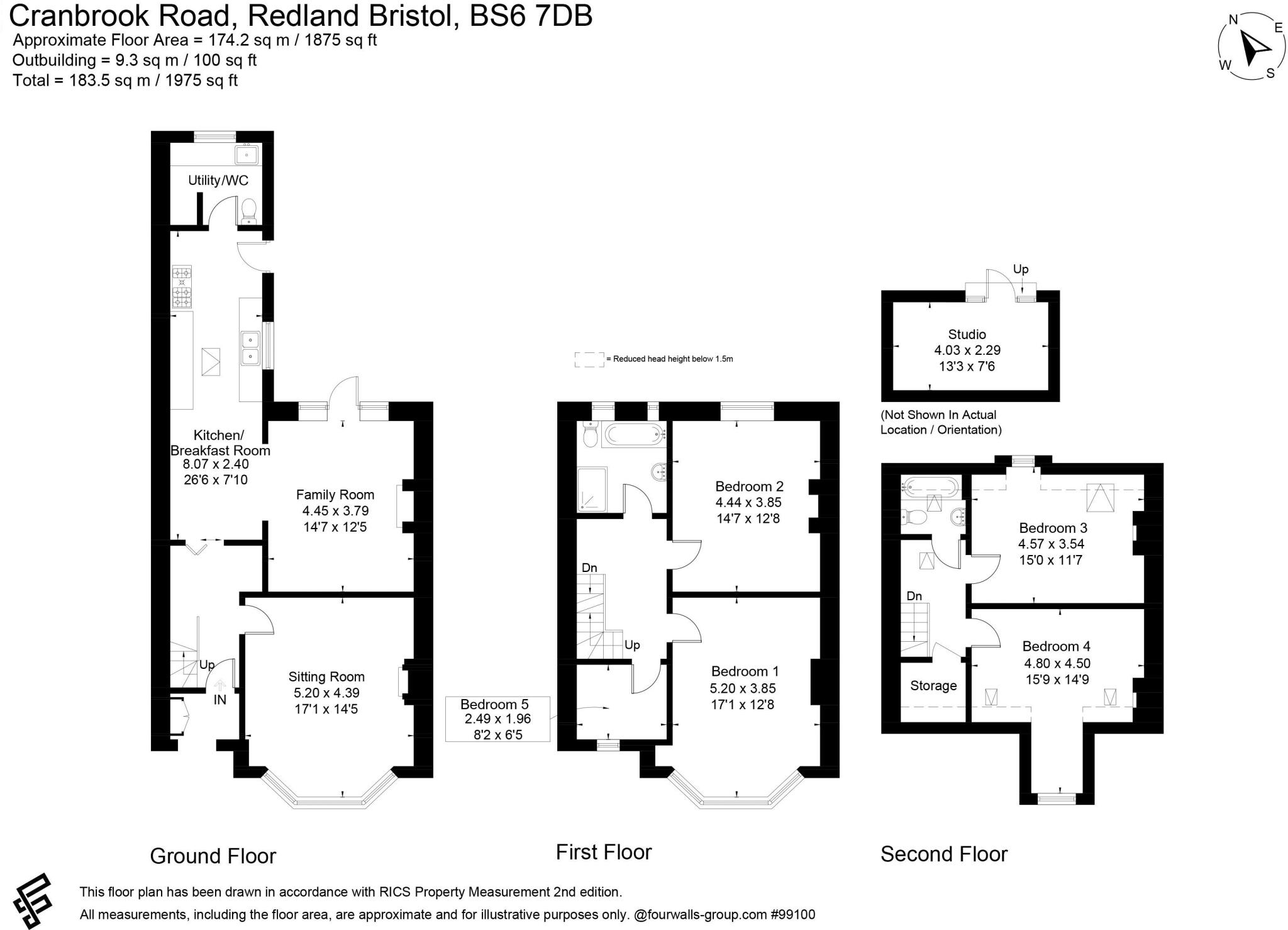
Floorplan 1
EPC Graphs
Energy Performance Graph
FENSA Certificates
This property has 1 FENSA certificate(s) on record, indicating window/door installations by FENSA-approved installers.
FENSA Certificate #1380902
Property Details
Street: 88 Cranbrook Road
Town: Bristol
Postcode: BS6 7DB
Installation Details
Items: 1 window
Certificate Issued: 12/01/2004
Work Completed: 14/12/2003
This certificate data was retrieved from FENSA's database
What is FENSA? FENSA (Fenestration Self-Assessment Scheme) is a government-authorised scheme that monitors building regulation compliance for replacement windows and doors. Certificates indicate that work was completed by FENSA-approved installers.
Price history
181% since 1999
| Event | Date | Price | % change |
|---|---|---|---|
| Sold | 26/03/2013 (13 years ago) | £450,000 | +181.3% |
| Sold | 28/05/1999 (27 years ago) | £160,000 | — |
Source: HM Land Registry Price Paid Data. Crown copyright.
Sold Comparables
Same street and nearby sales within 0.25 miles (last 5 years). Data from Land Registry Price Paid.
| Address | Price | Date | Type |
|---|---|---|---|
| 29 JULIUS ROAD, BRISTOL, CITY OF BRISTOL, BS7 8EU | £1,393,800 | 25/11/2025 | Terraced |
| 92 CRANBROOK ROAD, BRISTOL, CITY OF BRISTOL, BS6 7DB | £849,000 | 29/05/2025 | Terraced |
| 58 SALISBURY ROAD, REDLAND, BRISTOL, CITY OF BRISTOL, BS6 7AT | £614,500 | 27/11/2023 | Terraced |
| 102 CRANBROOK ROAD, BRISTOL, CITY OF BRISTOL, BS6 7DB | £856,076 | 16/11/2023 | Terraced |
| 20 CLAREMONT AVENUE, BRISTOL, CITY OF BRISTOL, BS7 8JE | £870,000 | 20/07/2023 | Terraced |
| 20 CLAREMONT AVENUE, BRISTOL, CITY OF BRISTOL, BS7 8JE | £870,000 | 20/07/2023 | Terraced |
| 47 ELTON ROAD, BISHOPSTON, BRISTOL, CITY OF BRISTOL, BS7 8DG | £610,000 | 30/06/2023 | Terraced |
| 16 CLAREMONT AVENUE, BRISTOL, CITY OF BRISTOL, BS7 8JE | £835,000 | 19/01/2023 | Terraced |
| 82 CRANBROOK ROAD, BRISTOL, CITY OF BRISTOL, BS6 7DB | £875,000 | 15/12/2022 | Terraced |
| 6 CLARETON VILLAS, BRISTOL, CITY OF BRISTOL, BS7 8DJ | £610,000 | 13/10/2022 | Terraced |
| 90 CRANBROOK ROAD, BRISTOL, CITY OF BRISTOL, BS6 7DB | £391,000 | 30/09/2022 | Terraced |
| 3 CLARETON VILLAS, BRISTOL, CITY OF BRISTOL, BS7 8DJ | £750,000 | 08/09/2022 | Terraced |
| 69 ELTON ROAD, BISHOPSTON, BRISTOL, CITY OF BRISTOL, BS7 8DG | £665,000 | 24/08/2022 | Terraced |
| 67 ELTON ROAD, BISHOPSTON, BRISTOL, CITY OF BRISTOL, BS7 8DG | £595,000 | 24/08/2022 | Terraced |
| 55 ELTON ROAD, BISHOPSTON, BRISTOL, CITY OF BRISTOL, BS7 8DG | £685,000 | 04/08/2022 | Terraced |
| 62 SALISBURY ROAD, REDLAND, BRISTOL, CITY OF BRISTOL, BS6 7AT | £530,000 | 06/07/2022 | Terraced |
| 7 THE CLOISTERS, BRISTOL, CITY OF BRISTOL, BS6 7DJ | £905,602 | 18/05/2022 | Terraced |
| 18 CLARE AVENUE, BRISTOL, CITY OF BRISTOL, BS7 8JF | £745,000 | 25/02/2022 | Terraced |
| 73 ELTON ROAD, BISHOPSTON, BRISTOL, CITY OF BRISTOL, BS7 8DG | £660,000 | 20/10/2021 | Terraced |
| 55 SALISBURY ROAD, REDLAND, BRISTOL, CITY OF BRISTOL, BS6 7AS | £1,190,000 | 29/06/2021 | Terraced |
Area average: £774,999 (20 sales)
Capital growth trend
Land Registry outcode average: last 12 months vs 5y and 10y ago (from sold prices).
House Price Index (HM Land Registry — official index, not sold-price averages): City of Bristol. Series: Terraced. As of March 2026.
Rental Range
Estimated market rent for Bristol, City of. Low = conservative, Realistic = average, Optimistic = best case.
Based on Local Authority from postcode lookup → Bristol, City of.
LHA (30th percentile) floor for Gloucester: £1,197/mo (Apr 2025 – Mar 2026)
Location
Nearby
Nearest stations, universities and amenities (distance from property).
| Type | Name | Distance |
|---|---|---|
| Bus stop | Kersteman Road | 0.0 miles |
| Shop | Kersteman Road Garage | 0.0 miles |
| Shop | Artizann Hair Studio | 0.3 miles |
| Train station | Redland | 0.4 miles |
| Train station | Montpelier | 0.6 miles |
| University | University of the West of England | 0.7 miles |
| Hospital | Spire Bristol | 0.7 miles |
| University | City of Bristol College Ashley Down Centre | 0.7 miles |
| Hospital | South West Regional Laboratories | 0.9 miles |
Street-level crime
| Category | Count |
|---|---|
| Violence and sexual offences | 180 |
| Vehicle crime | 92 |
| Anti-social behaviour | 67 |
| Burglary | 52 |
| Public order | 52 |
| Shoplifting | 52 |
| Criminal damage and arson | 46 |
| Other theft | 37 |
| Bicycle theft | 17 |
| Robbery | 15 |
| Other crime | 14 |
| Drugs | 11 |
| Possession of weapons | 6 |
| Theft from the person | 4 |
| Total incidents | 645 |
Within 1 mile during Mar 2026. Source: data.police.uk (England & Wales).
Schools nearby
Nearest open schools with Ofsted ratings (England). Closed schools are not shown. Data from Get Information about Schools and Ofsted.
| Name | Type | Distance | Ofsted |
|---|---|---|---|
| Redland Green School | Secondary | 0.2 miles | Good — 23 Jan 2024 |
| St Bonaventure's Catholic Primary School | Primary | 0.3 miles | Good — 4 Jul 2013 |
| Bishop Road Primary School | Primary | 0.5 miles | Outstanding — 12 Dec 2023 |
| Cotham Gardens Primary School | Primary | 0.5 miles | — (Inspected (no overall grade)) |
| E-Act Montpelier High School | Secondary | 0.5 miles | Inadequate — 16 Jun 2022 |
Rental Comparables
Residential lets from OpenRent and Rightmove for the area (same bedroom count). Use to validate rent estimates. Student lets are excluded.
| Title | Rent | Beds | Distance | As seen on |
|---|---|---|---|---|
| 5 Bed Maisonette, Cranbrook Road, BS6 | £4,000/mo | 5 | 0.07 miles | OpenRent |
Average rent: £4,000/mo (1 listing)
Rent-driven metrics
Based on OpenRent comparables.
- Rent ratio — Monthly rent ÷ purchase price (1% rule). 1%+ = strong, 0.8–1% = okay, <0.8% = weak for cashflow.
- Max investor price — Rent ÷ 0.8%; the price at which rent would be 0.8% of price (Stoke-style target).
- Target investor price — Rent ÷ 1%; the price at which rent would be 1% of price (strong cashflow band).
- Gross yield — Annual rent as % of purchase price (no costs).
- Cost-to-rent — Price ÷ annual rent (from OpenRent comparables). Under 14× = strong, 14–16× = acceptable, 17×+ = compressed.
- Cashflow — Rent minus mortgage, 10% maintenance, £25/mo compliance. Assumes 75% LTV, 3.95% APR (5yr fixed), 25yr term.
- ROI — Annual profit ÷ cash in (deposit + 4% purchase costs).