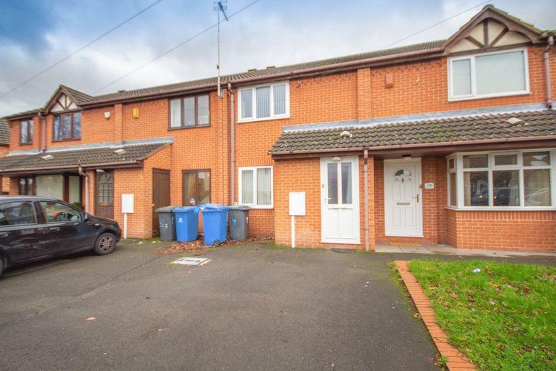
7 HILLCREST ROAD
DERBY, CITY OF DERBY DE21 6FJ
£600 pcm
Property details
Floor area
67 m²
Deprivation
Decile 4 (13,244 of 33,755)
Street crime
344 incidents within 1 mile (Apr 2026)
Key features
- AVAILABLE END OF JUNE
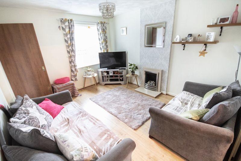
- UNFURNISHED
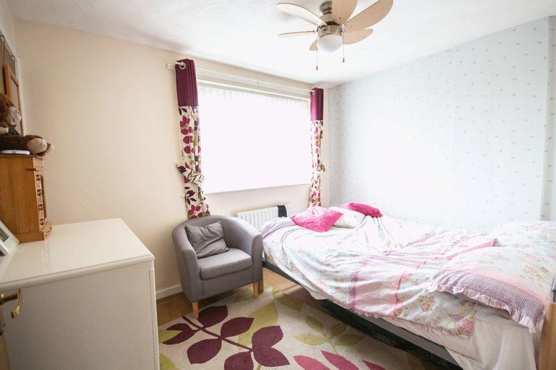
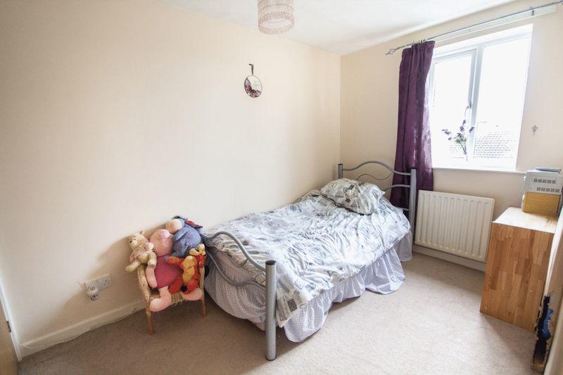
- TWO BEDROOMS
- DRIVEWAY PARKING
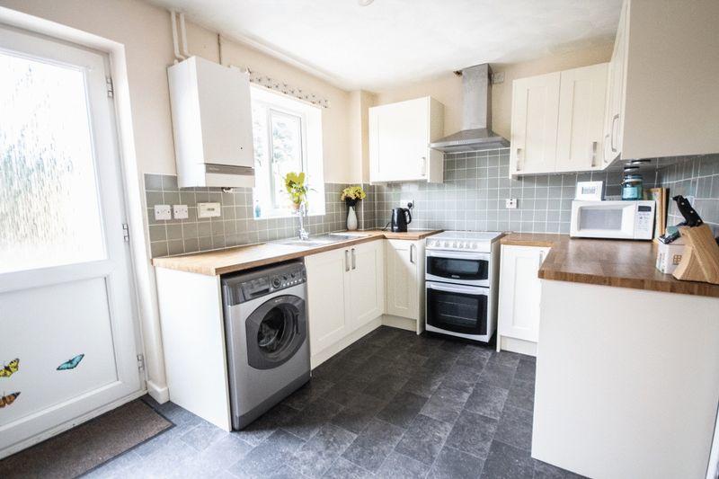
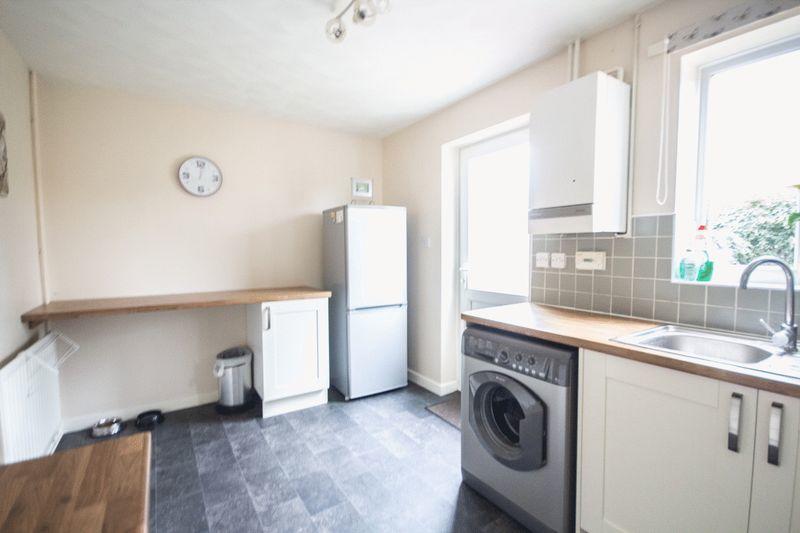
- MODERN FITTED KITCHEN
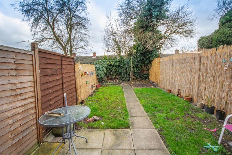
- ENCLOSED REAR GARDEN
Additional details
- Parking
- Yes
- Garden
- Yes
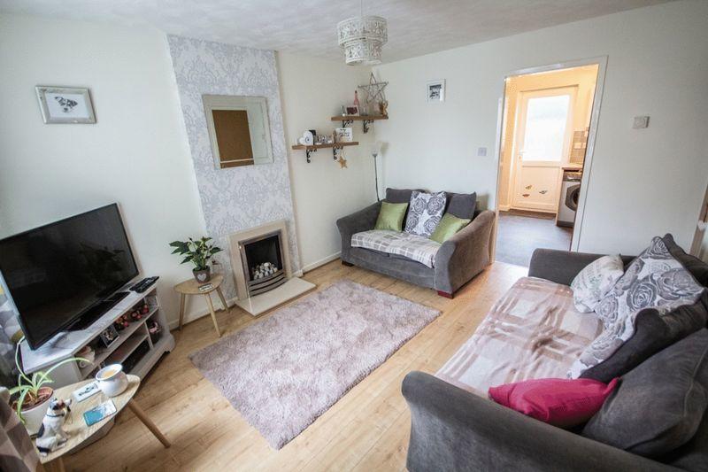
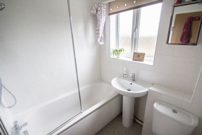
Description
Listed by
Chellaston
Hannells Estate Agents
Reference: 107329619
EPC Rating & Upgrade Cost
Fetching EPC data… Refresh this page in a moment.
Flood risk
Zone: 1
Risk: Low
Job (default Low)
Floorplans
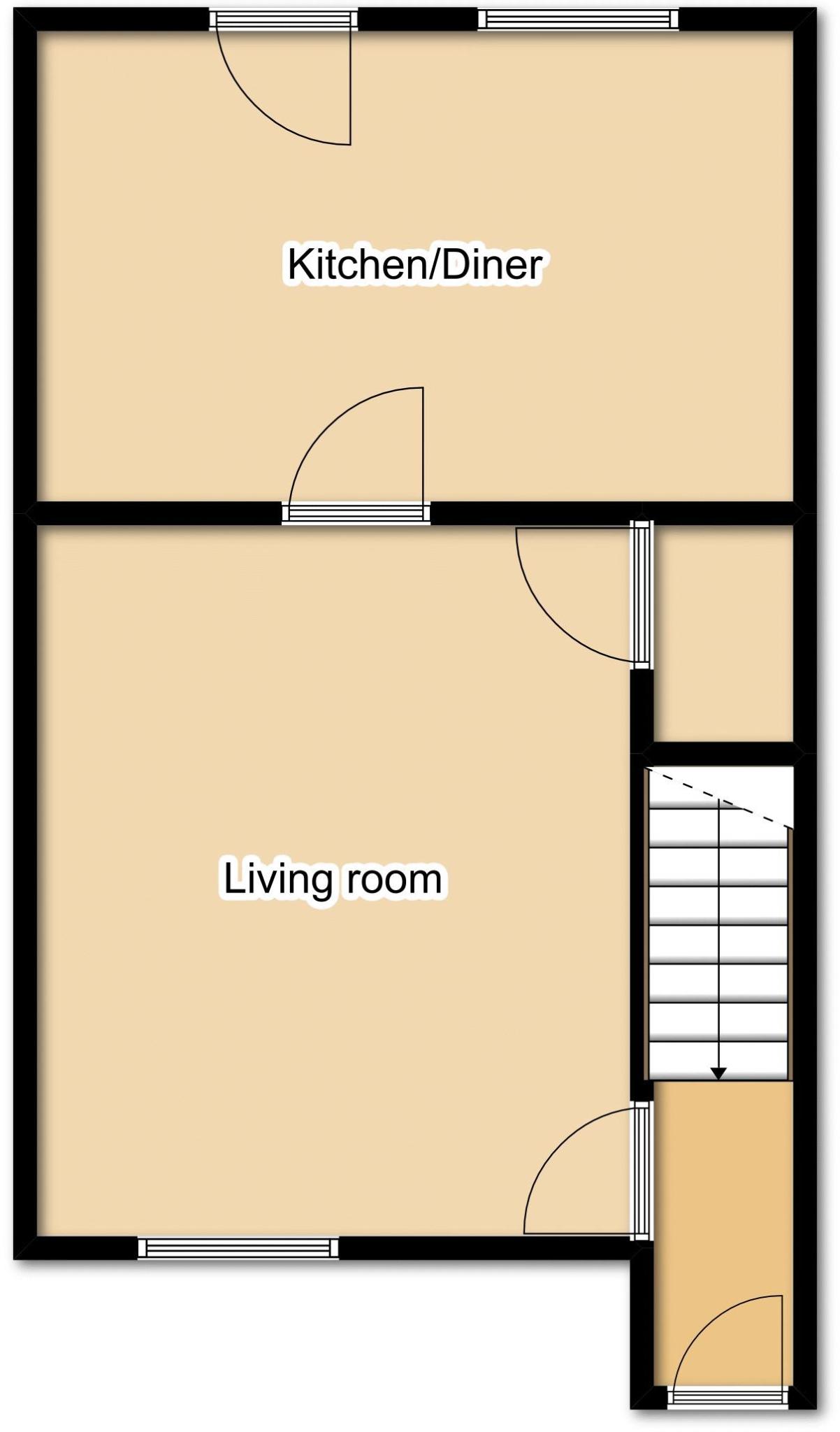
Floorplan 1
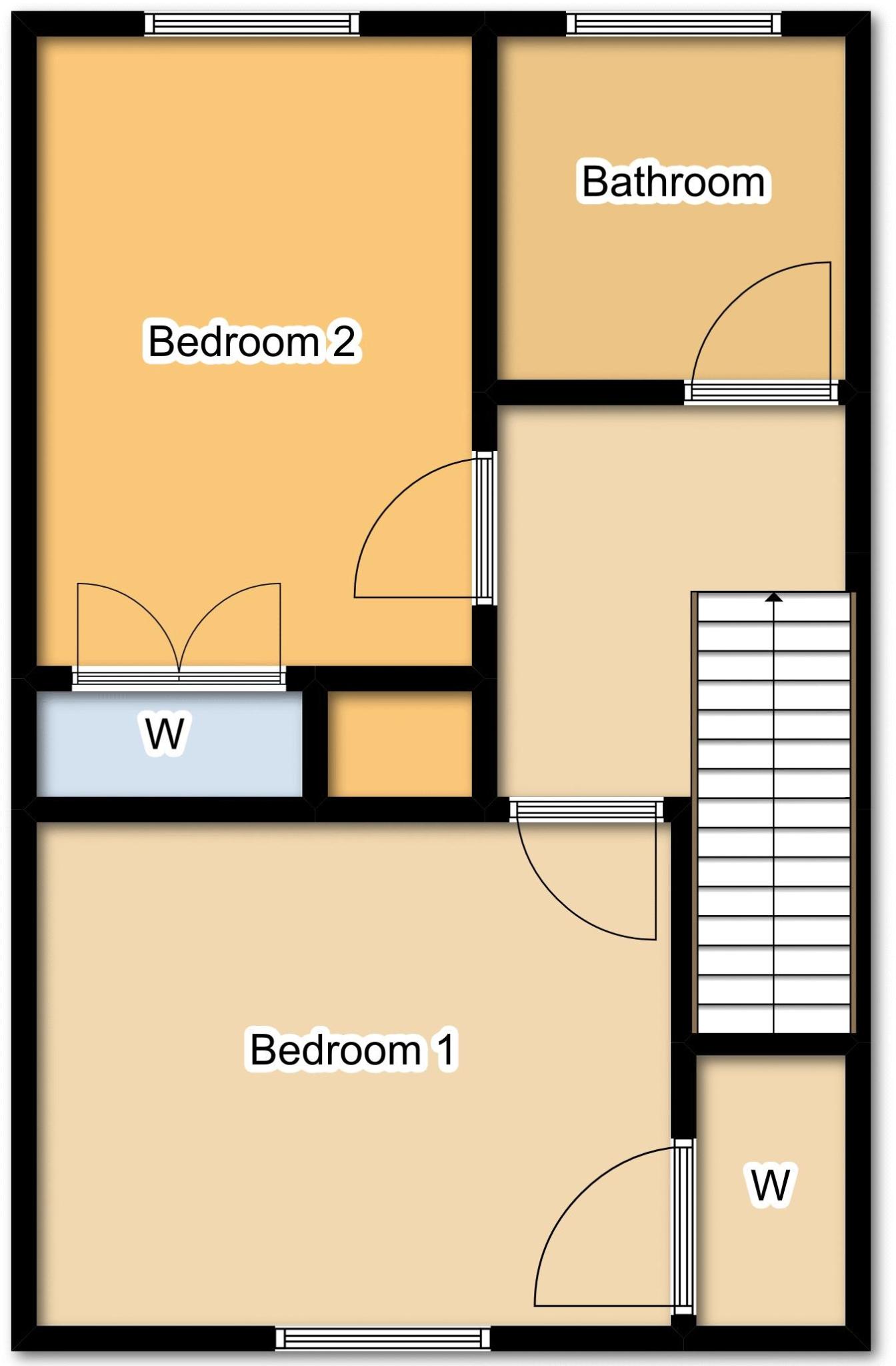
Floorplan 2
EPC Graphs
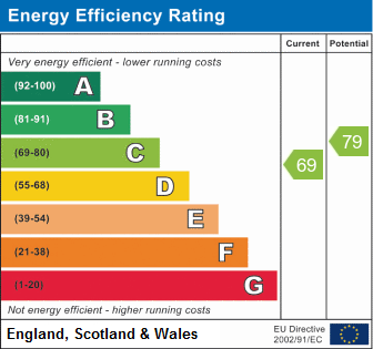
Energy Perform...

FULL EPC
Rental Range
Estimated market rent for Derby. Low = conservative, Realistic = average, Optimistic = best case.
Based on Local Authority from postcode lookup → Derby.
LHA (30th percentile) floor for Derby: £593/mo (Apr 2025 – Mar 2026)
Location
Nearby
Nearest stations, universities and amenities (distance from property).
| Type | Name | Distance |
|---|---|---|
| Shop | Coral | 0.1 miles |
| Shop | Haircraft Two | 0.1 miles |
| Bus stop | Blue Boy | 0.1 miles |
| Train station | Derby | 1.0 miles |
| Hospital | Florence Nightingale Community Hospital | 1.3 miles |
| Hospital | Cygnet Hospital Derby | 1.6 miles |
| University | University of Derby | 2.0 miles |
| Train station | Spondon | 2.1 miles |
Street-level crime
| Category | Count |
|---|---|
| Violence and sexual offences | 132 |
| Public order | 41 |
| Criminal damage and arson | 37 |
| Anti-social behaviour | 32 |
| Drugs | 22 |
| Other theft | 19 |
| Shoplifting | 18 |
| Vehicle crime | 15 |
| Burglary | 9 |
| Other crime | 6 |
| Possession of weapons | 6 |
| Bicycle theft | 4 |
| Robbery | 2 |
| Theft from the person | 1 |
| Total incidents | 344 |
Within 1 mile during Apr 2026. Source: data.police.uk (England & Wales).
Schools nearby
Nearest open schools with Ofsted ratings (England). Closed schools are not shown. Data from Get Information about Schools and Ofsted.
| Name | Type | Distance | Ofsted |
|---|---|---|---|
| Derwent Primary School | Primary | 0.3 miles | Good — 11 Oct 2021 |
| Roe Farm Primary School | Primary | 0.5 miles | Good — 9 Jul 2024 |
| Beaufort Community Primary School | Primary | 0.6 miles | Requires improvement — 10 Dec 2023 |
| St Alban's Catholic Voluntary Academy | Primary | 0.6 miles | Good — 11 Oct 2013 |
| St Giles' Spencer Academy | Other | 0.7 miles | Outstanding — 11 Jan 2017 |
Rental Comparables
Residential lets from OpenRent and Rightmove for the area (same bedroom count). Use to validate rent estimates. Student lets are excluded.
| Title | Rent | Beds | Distance | As seen on |
|---|---|---|---|---|
| 2 Bed Flat, Beaufort Gardens, DE21 | £795/mo | 2 | 0.22 miles | OpenRent |
| 2 Bed Terraced House, Nottingham Road, DE21 | £850/mo | 2 | 0.31 miles | OpenRent |
| 2 Bed Flat, Chester Green, DE21 | £975/mo | 2 | 0.88 miles | OpenRent |
| 2 Bed Flat, St. Marys Chambers, DE1 | £850/mo | 2 | 1.16 miles | OpenRent |
| 2 Bed Flat, King's Crescent Apartments, DE1 | £895/mo | 2 | 1.22 miles | OpenRent |
| 2 Bed Penthouse, King's Crescent Apartments, DE1 | £975/mo | 2 | 1.22 miles | OpenRent |
Average rent: £890/mo (6 listings)