Slade Lane
Over Alderley, SK10, SK10 4SF
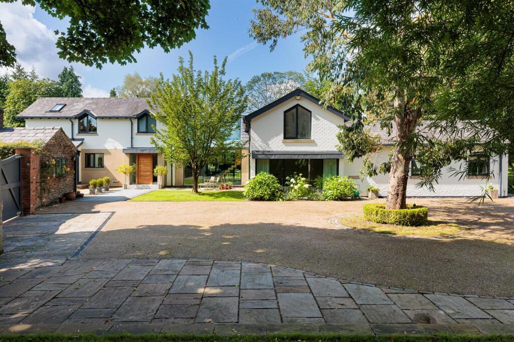
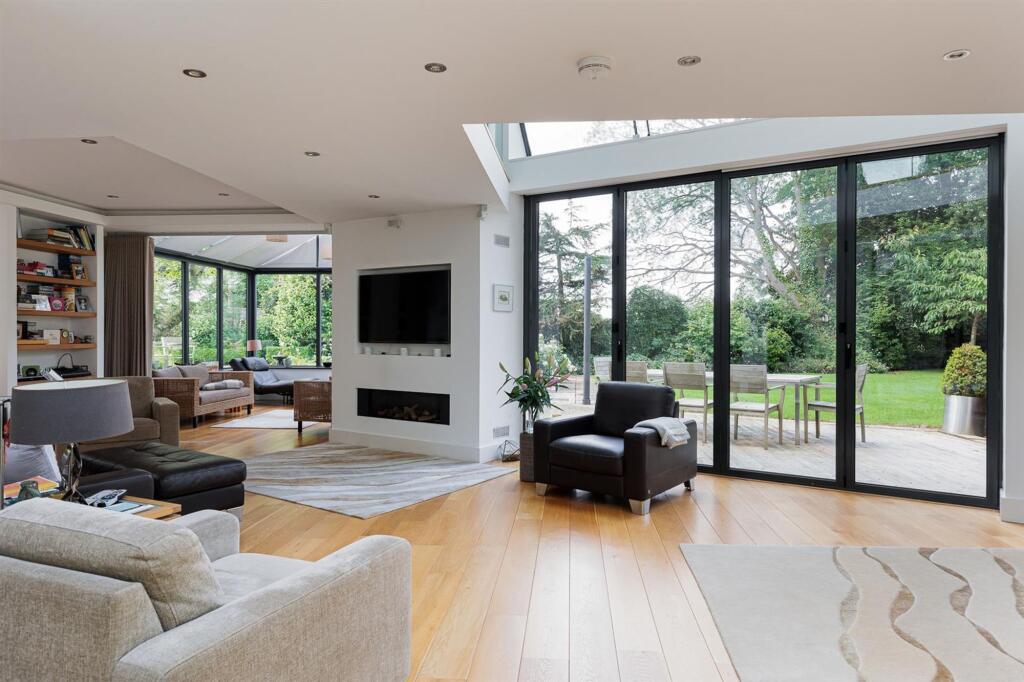
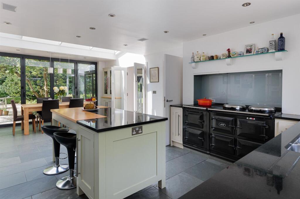
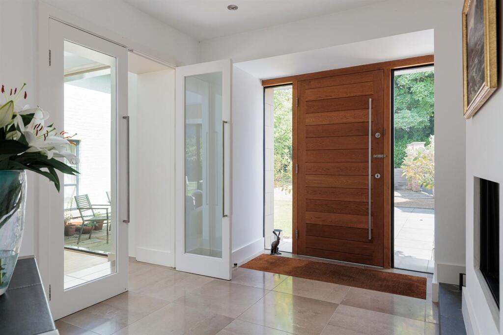
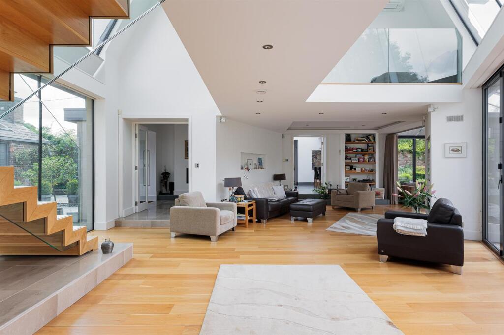
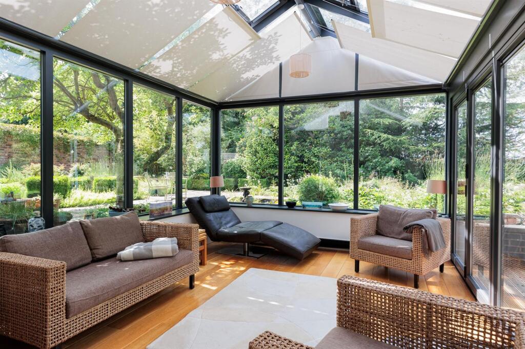
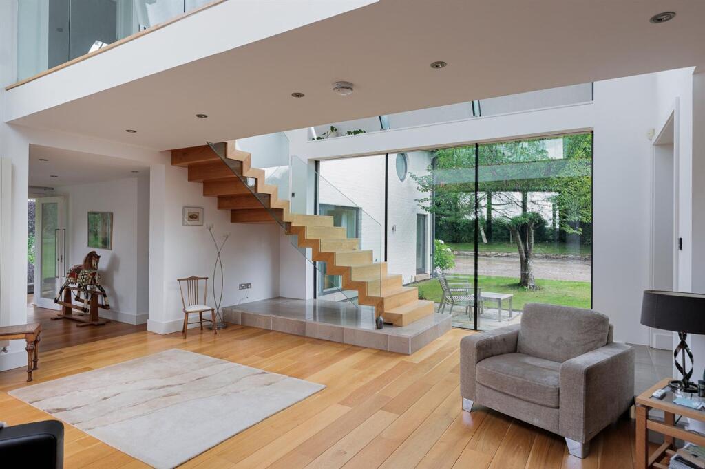
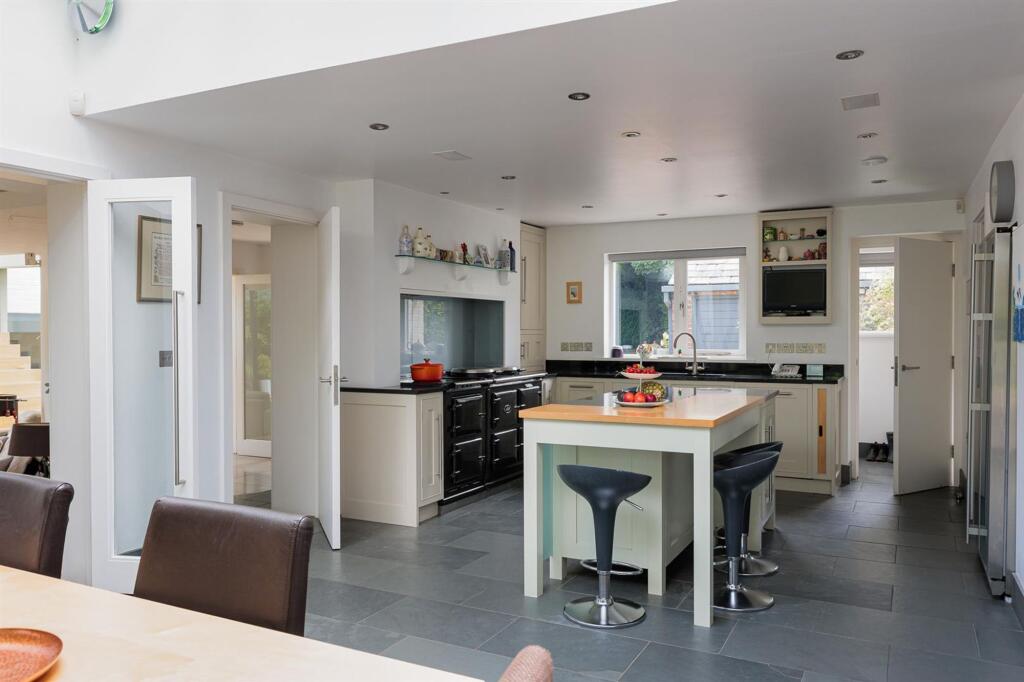
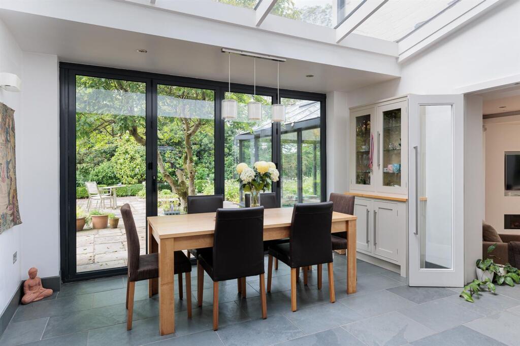
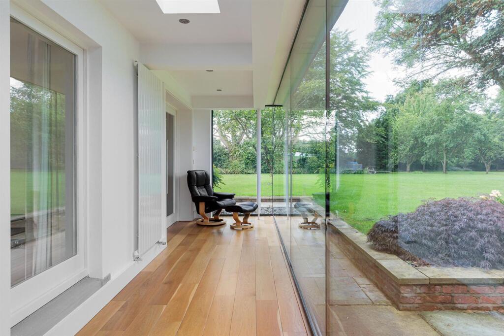
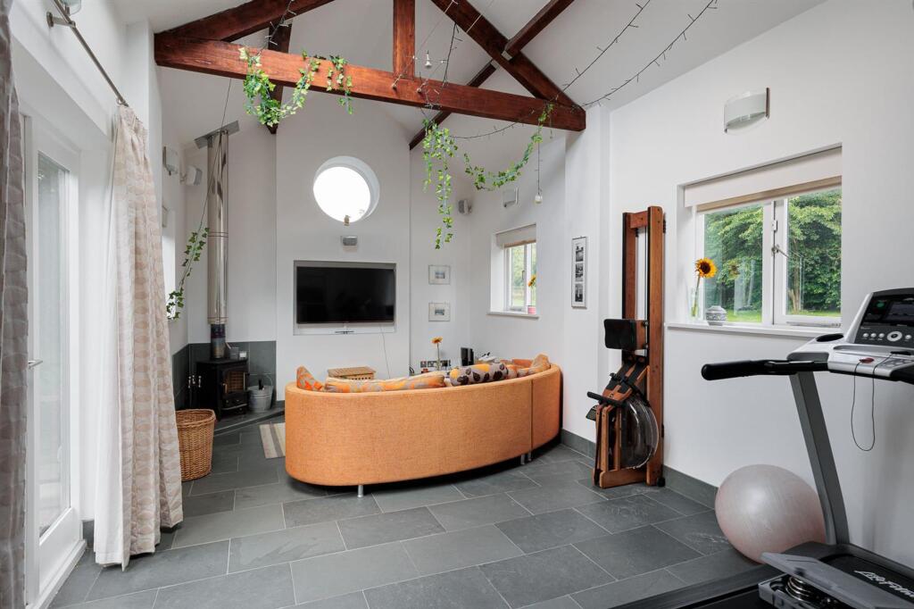
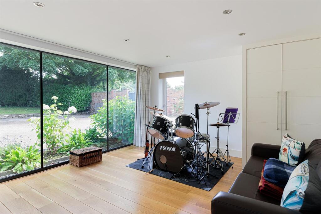
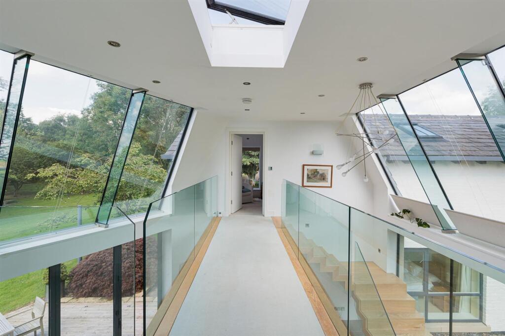
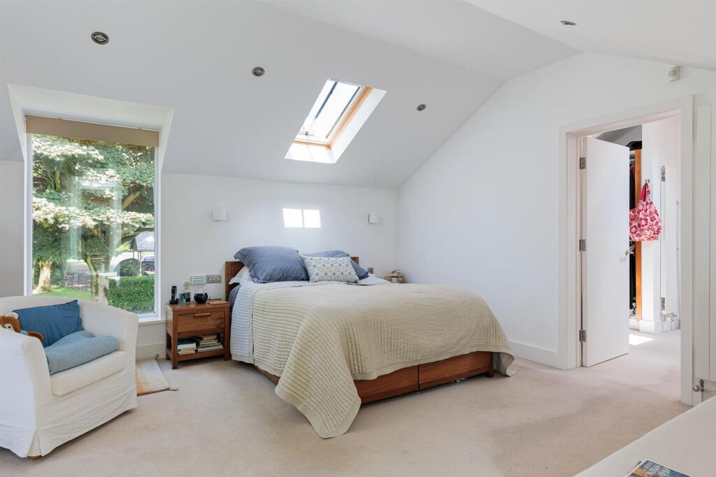
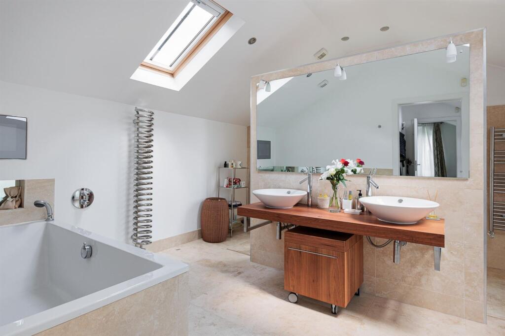
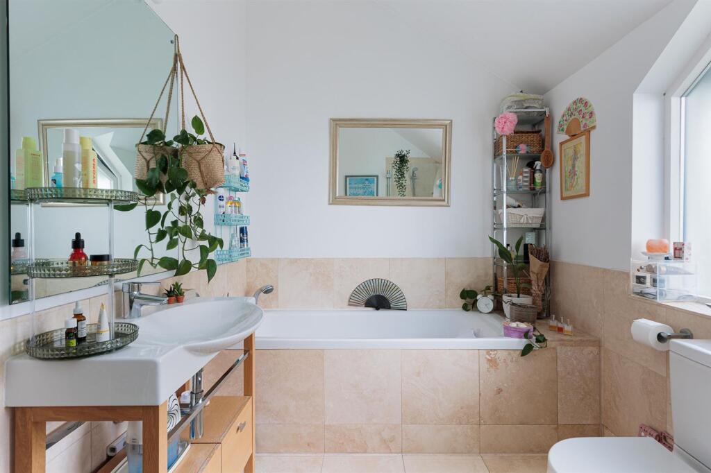
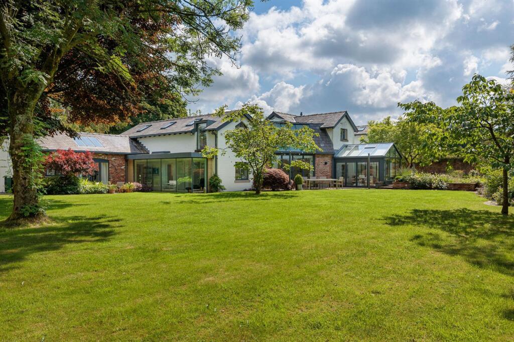
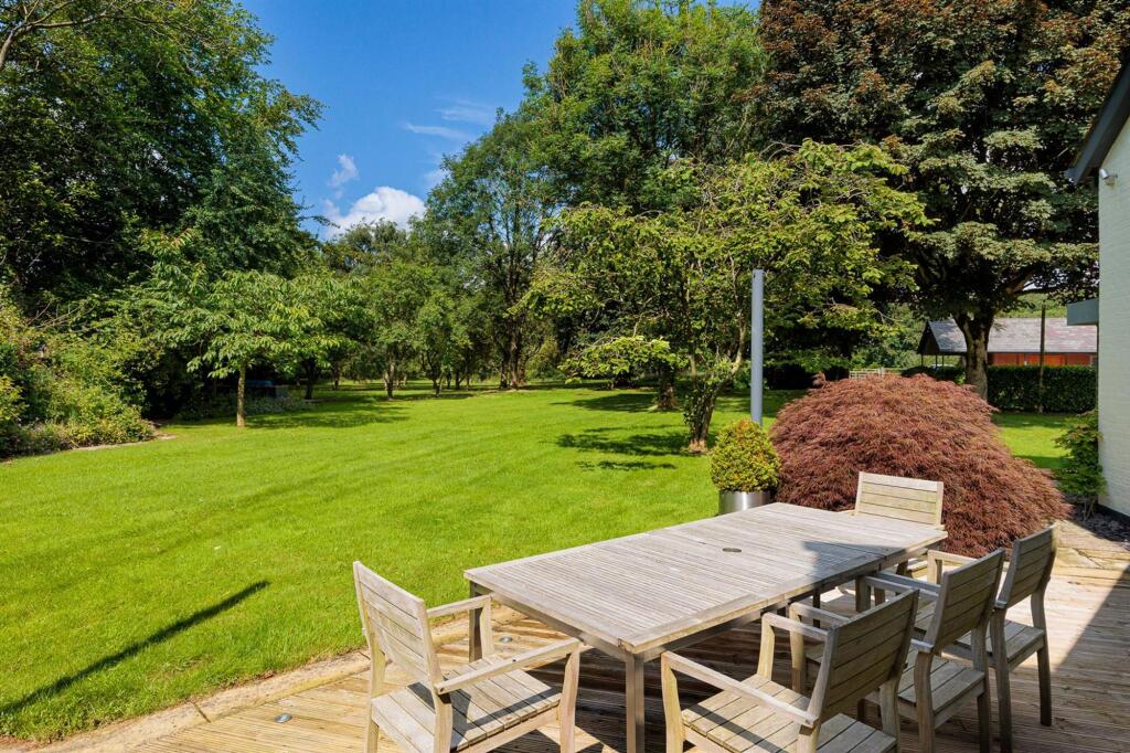
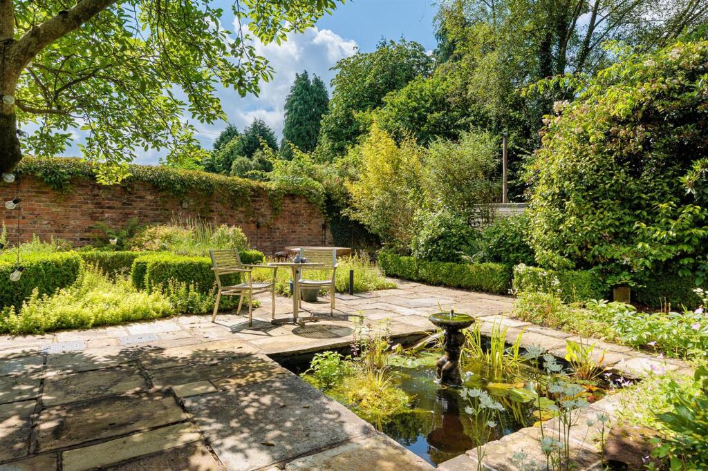
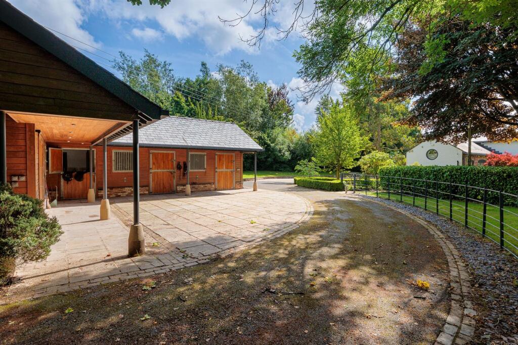
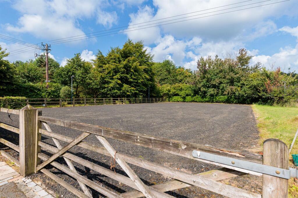
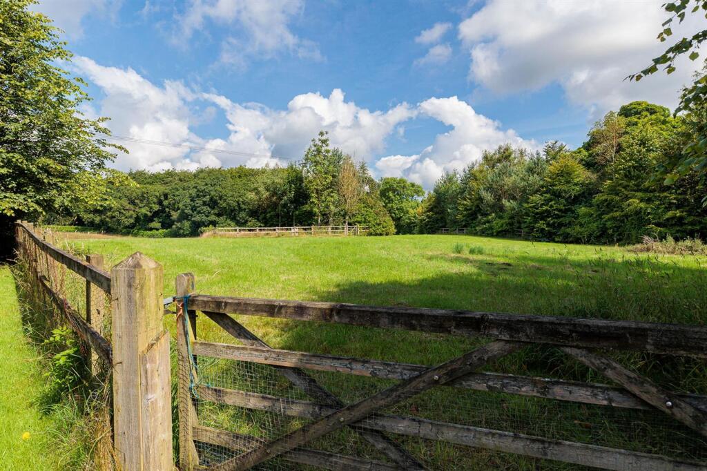
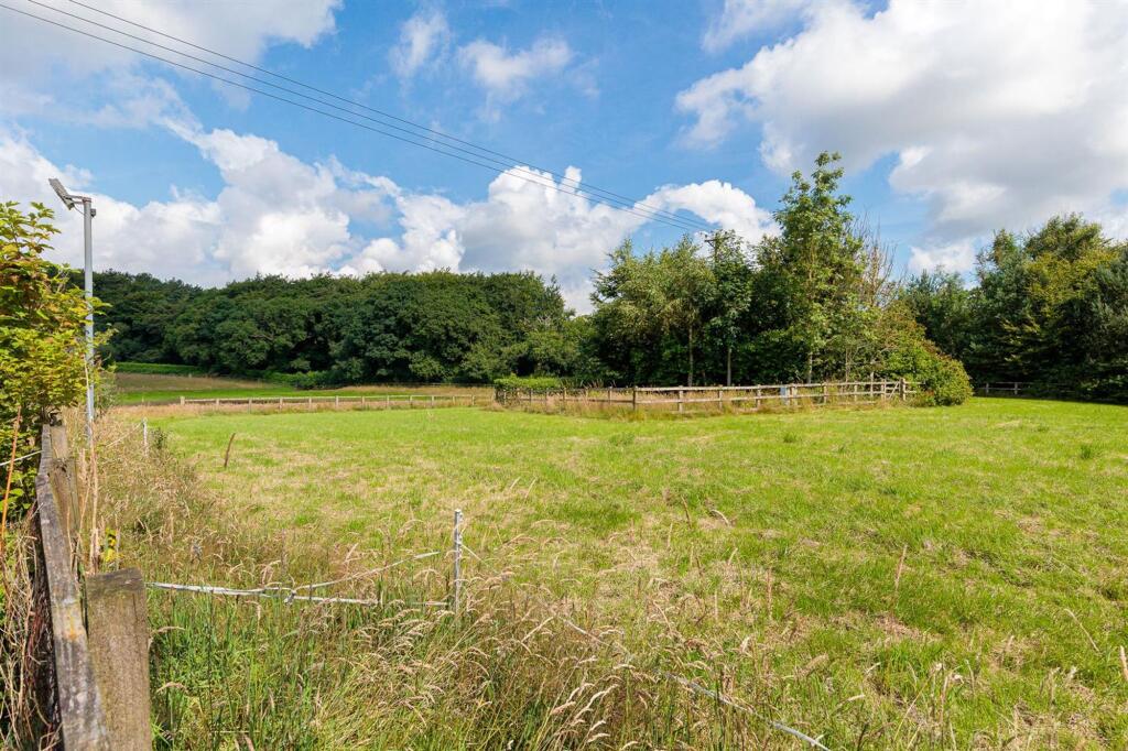
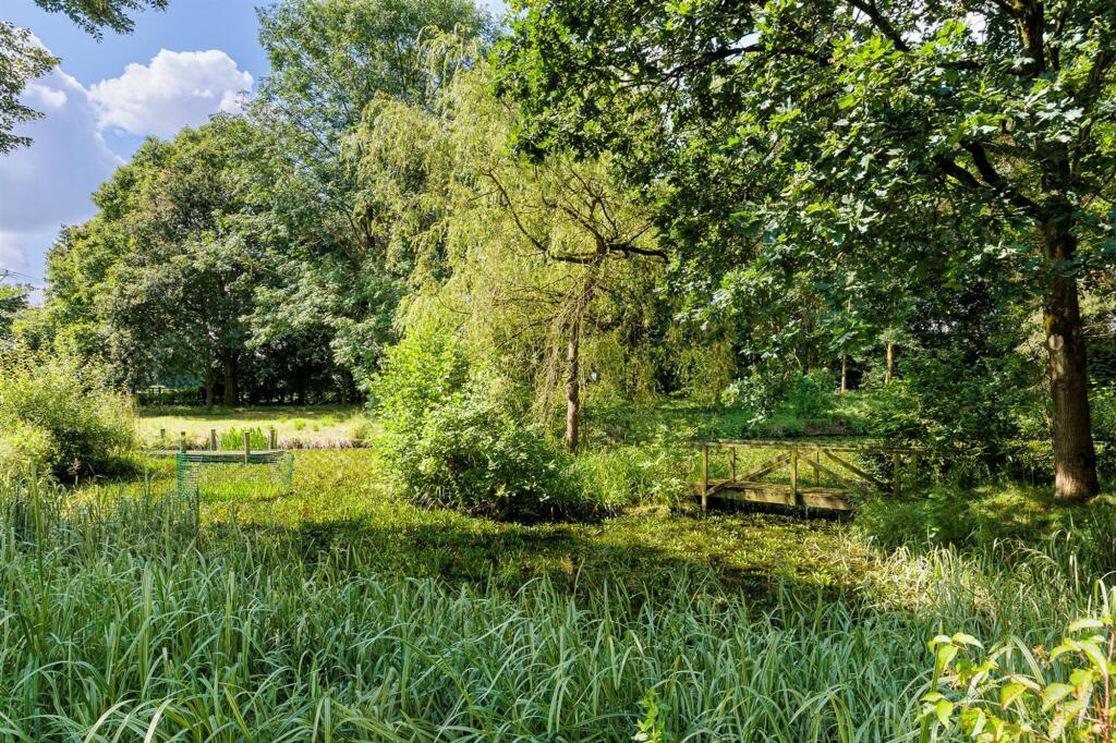
Photo 1 Photo 2 Photo 3 Photo 4 Photo 5 Photo 6 Photo 7 Photo 8 Photo 9 Photo 10 Photo 11 Photo 12 Photo 13 Photo 14 Photo 15 Photo 16 Photo 17 Photo 18 Photo 19 Photo 20 Photo 21 Photo 22 Photo 23 Photo 24
/ 24
Property details
Local average
£1,415,975 (+76.6%)
Street crime
1 incident within 1 mile (Apr 2026)
Key features
- 5 Acres and Equestrian Facilites
- Blend of Character and Contemporary Architecture
- Idyllic Semi-Rural Location
- Five Bedrooms & 5 Bathrooms
- Within Easy Reach of Alderley Edge
Additional details
- Parking
- Yes
- Garden
- Yes
- Listed property
- No
- Restrictions
- No
- Required access
- No
- Rights of way
- No
- Flooded in last 5 years
- No
- Flood defences
- No
Description
EPC Rating: C
Listed by
Alderley Edge
Mosley Jarman
Reference: 89814195
EPC ratings on this postcode
We don't have a matched EPC for this property yet. Below are efficiency scores and details for other addresses on this postcode.
| Address | Current | Potential | Floor area | Age band | Type |
|---|---|---|---|---|---|
| Broad Heath Farm Barn, Broad Heath Farm, Slade Lane | 66 | 76 | 125 m² | 2021 | Bungalow |
| Broad Heath Farm Barn, Broad Heath Farm, Slade Lane, OVER ALDERLEY | 66 | 76 | 125 m² | — | Detached |
| Broadheath House, Slade Lane, Over Alderley | 83 | 86 | 869 m² | 2023 | House |
| Broadheath House, Slade Lane, Over Alderley | 50 | 74 | 298 m² | England and Wales: 1950-1966 | House |
| Broadheath House, Slade Lane, Over Alderley, MACCLESFIELD | 83 | 86 | 869 m² | — | Detached |
| Broadheath House, Slade Lane, Over Alderley, MACCLESFIELD | 50 | 74 | 298 m² | England and Wales: 1950-1966 | Detached |
| Hare Pasture Farm, Slade Lane, Over Alderley | 72 | 81 | 314 m² | England and Wales: 1900-1929 | House |
| Hare Pasture Farm, Slade Lane, Over Alderley | 68 | 71 | 343 m² | England and Wales: 1930-1949 | House |
| Hare Pasture Farm, Slade Lane, Over Alderley, MACCLESFIELD | 72 | 81 | 314 m² | — | Detached |
| Hare Pasture Farm, Slade Lane, Over Alderley, MACCLESFIELD | 68 | 71 | 343 m² | — | Detached |
| Slade Green Farm, Slade Lane, Over Alderley | 51 | 84 | 256 m² | England and Wales: 1930-1949 | House |
| Slade Green Farm, Slade Lane, Over Alderley | 63 | 80 | 256 m² | England and Wales: 1930-1949 | House |
| Slade Green Farm, Slade Lane, Over Alderley, MACCLESFIELD | 51 | 84 | 256 m² | England and Wales: 1930-1949 | Detached |
| Slade Green Farm, Slade Lane, Over Alderley, MACCLESFIELD | 63 | 80 | 256 m² | England and Wales: 1930-1949 | Detached |
| Whitebarn Farm, Slade Lane, Over Alderley | 45 | 76 | 279 m² | England and Wales: 1983-1990 | House |
Flood risk
Zone: 1
Risk: Low
Job (default Low)
Floorplans
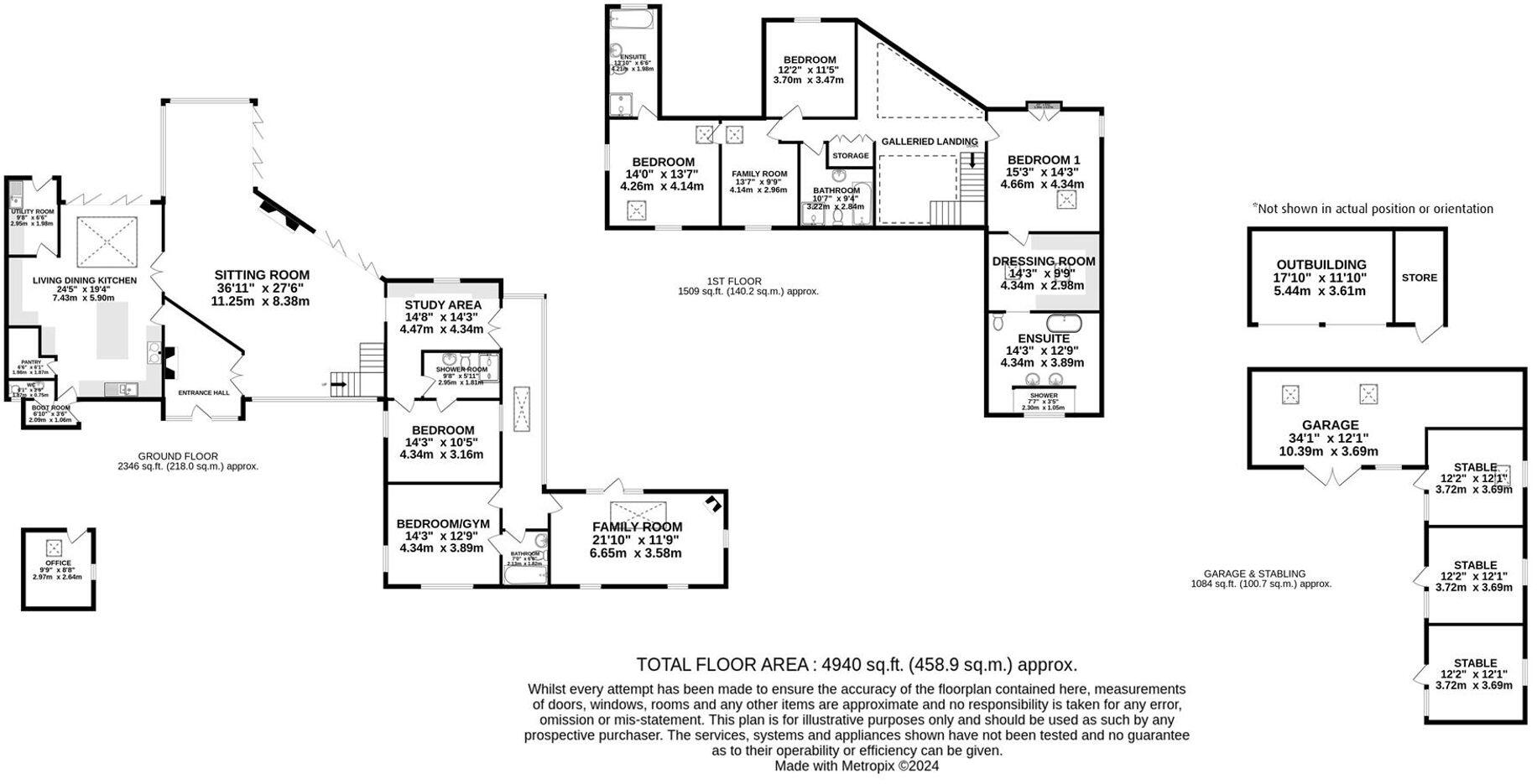
Floorplan 1
EPC Graphs
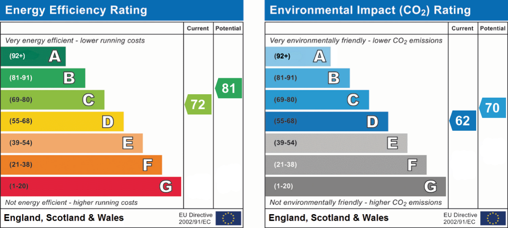
EPC 1
Price history
| Event | Date | Price | % change |
|---|---|---|---|
| Listed for sale | — | £2,500,000 | — |
Source: HM Land Registry Price Paid Data. Crown copyright.
Sold Comparables
Sold comparables data is not available for this property.
Capital growth trend
Land Registry outcode average: last 12 months vs 5y and 10y ago (from sold prices).
House Price Index (HM Land Registry — official index, not sold-price averages): Cheshire East. Series: All dwelling types. As of March 2026.
Rental Range
Estimated market rent for Cheshire East. Low = conservative, Realistic = average, Optimistic = best case.
Based on Local Authority from postcode lookup → Cheshire East.
LHA (30th percentile) floor for East Cheshire: £1,745/mo (Apr 2025 – Mar 2026)
Location
Address
Slade Lane
Nearby
Nearest stations, universities and amenities (distance from property).
| Type | Name | Distance |
|---|---|---|
| Shop | Arthur Burns & Son | 0.2 miles |
| Bus stop | Adders Moss, School Lane / Festival Drive | 0.2 miles |
| Shop | Hartwoods | 0.6 miles |
| Bus stop | Mottram St Andrew, Wilmslow Old Road / Priest Lane | 1.3 miles |
| Train station | Alderley Edge | 2.0 miles |
| Train station | Prestbury | 2.4 miles |
| Hospital | Rosemount Resource Centre | 2.9 miles |
| Hospital | Altrincham Hospital | 9.3 miles |
| University | University of Manchester Fallowfield Campus | 11.0 miles |
| University | Fallowfield Reception and Richmond Amenities Building | 11.0 miles |
Street-level crime
| Category | Count |
|---|---|
| Criminal damage and arson | 1 |
| Total incidents | 1 |
Within 1 mile during Apr 2026. Source: data.police.uk (England & Wales).
Schools nearby
Nearest open schools with Ofsted ratings (England). Closed schools are not shown. Data from Get Information about Schools and Ofsted.
| Name | Type | Distance | Ofsted |
|---|---|---|---|
| Mottram St Andrew Primary Academy | Primary | 1.3 miles | Good — 15 Jul 2015 |
| Nether Alderley Primary School | Primary | 1.5 miles | Good — 1 May 2012 |
| The King's School In Macclesfield | Other | 1.5 miles | — (No rating) |
| Whirley Primary School | Primary | 1.9 miles | Good — 14 Apr 2011 |
| The Fallibroome Academy | Secondary | 1.9 miles | Good — 16 Feb 2023 |
Rental Comparables
Loading rental comparables for this postcode. Refresh in a few minutes.
Rent-driven metrics
Based on Area rent estimate.
- Rent ratio — Monthly rent ÷ purchase price (1% rule). 1%+ = strong, 0.8–1% = okay, <0.8% = weak for cashflow.
- Max investor price — Rent ÷ 0.8%; the price at which rent would be 0.8% of price (Stoke-style target).
- Target investor price — Rent ÷ 1%; the price at which rent would be 1% of price (strong cashflow band).
- Gross yield — Annual rent as % of purchase price (no costs).
Enter House Number
Enter the house number to help us retrieve more accurate pricing history and property data.
Please log in to submit or correct the house number for this listing.
Log in to continue