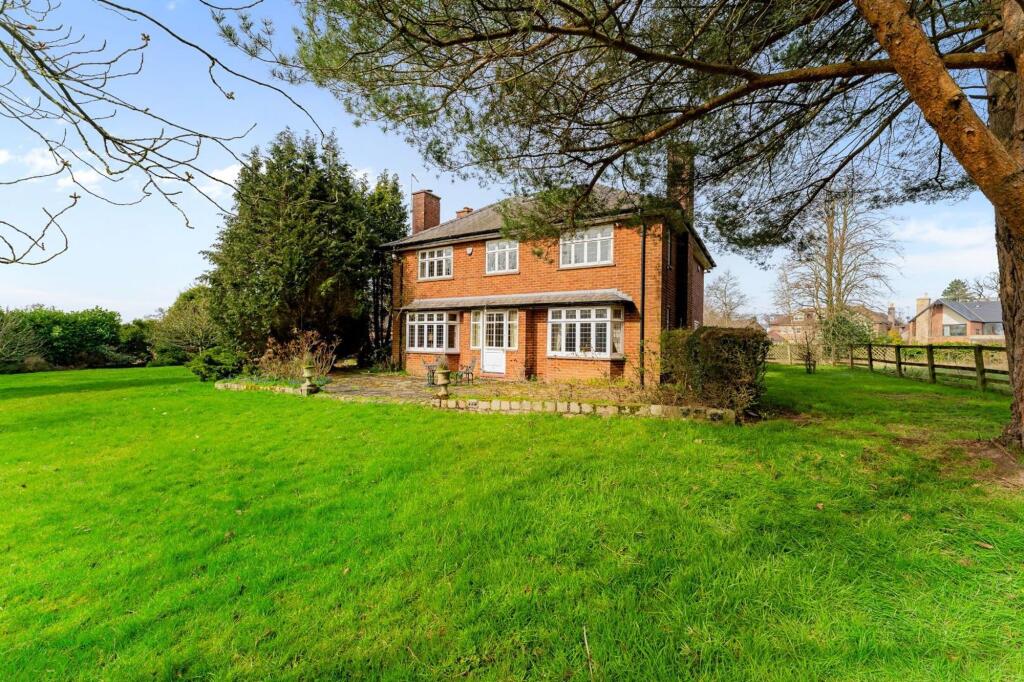
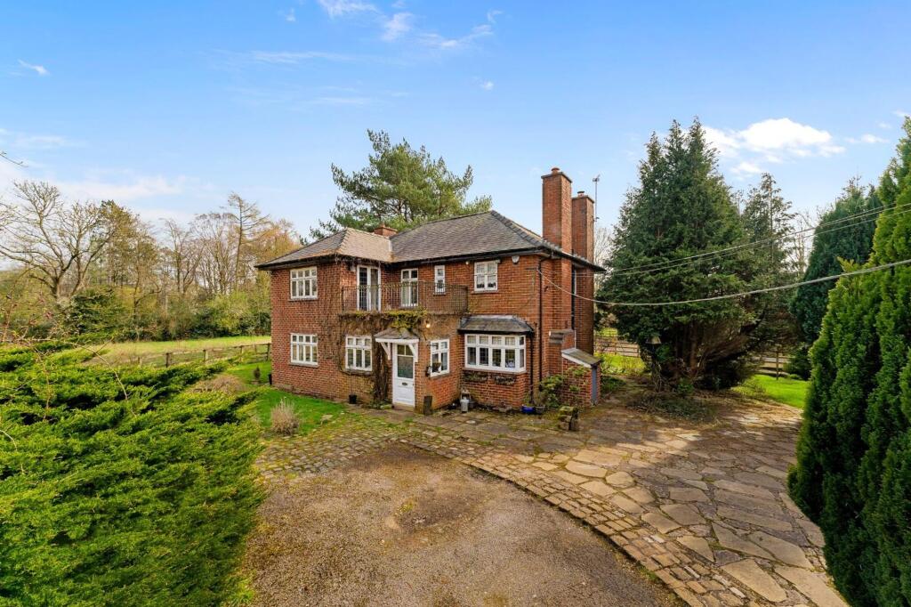
Oaklands Farm
Heybridge Lane, Prestbury, SK10 4ER
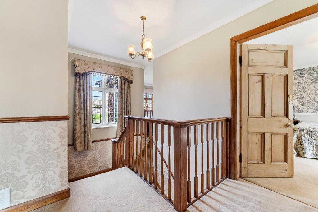
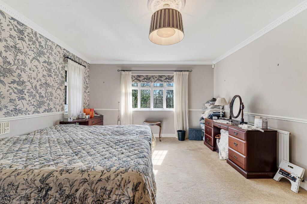
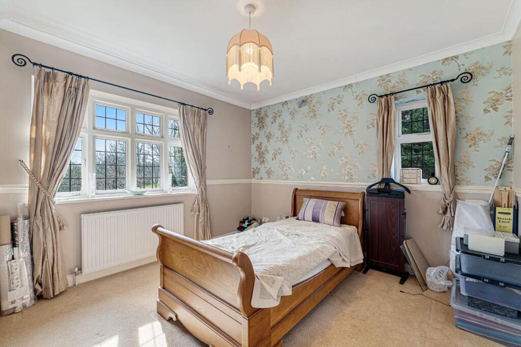
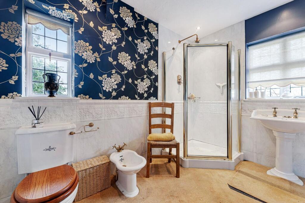
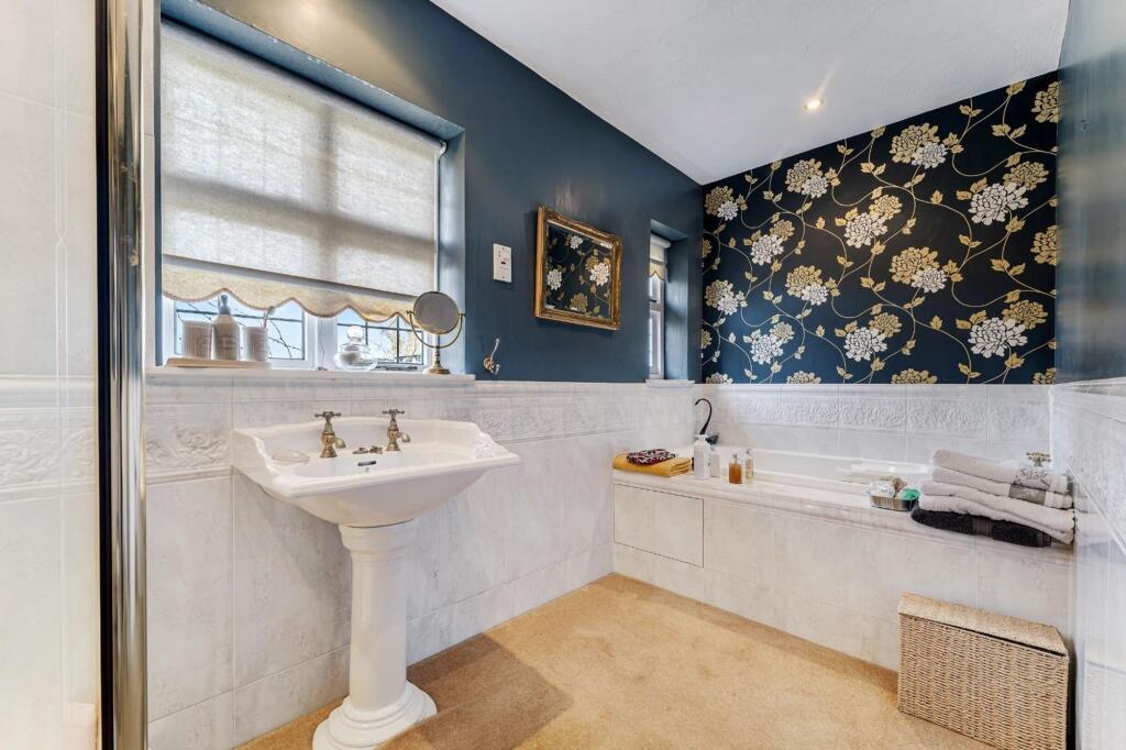
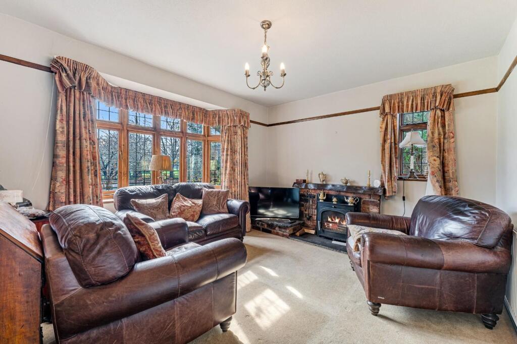
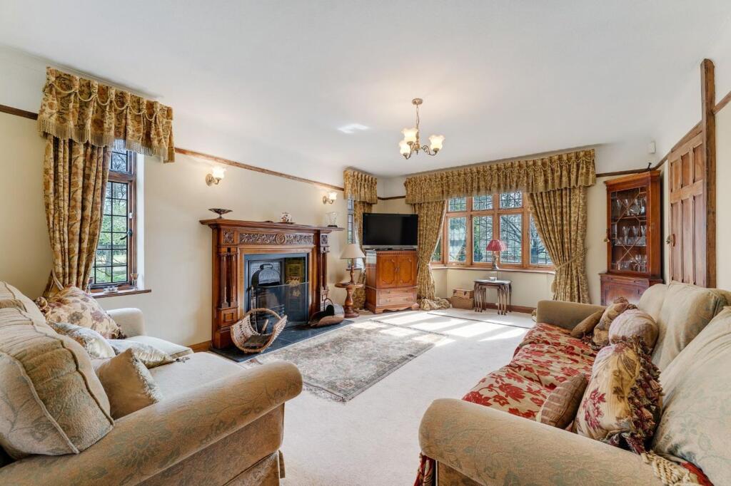
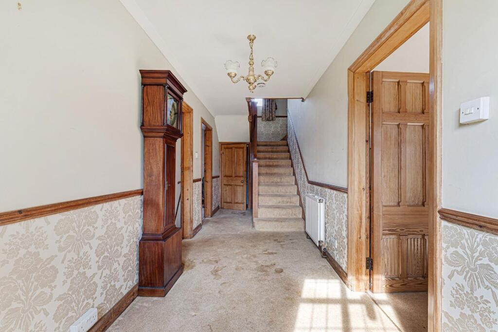
OAKLANDS FARM, 44 HEYBRIDGE LANE24.jpg OAKLANDS FARM, 44 HEYBRIDGE LANE37.jpg OAKLANDS FARM, 44 HEYBRIDGE LANE27.jpg OAKLANDS FARM, 44 HEYBRIDGE LANE39.jpg OAKLANDS FARM, 44 HEYBRIDGE LANE35.jpg OAKLANDS FARM, 44 HEYBRIDGE LANE25.jpg OAKLANDS FARM, 44 HEYBRIDGE LANE13.jpg Oaklands Farm Plot Plan.jpg OAKLANDS FARM, 44 HEYBRIDGE LANE3.jpg OAKLANDS FARM, 44 HEYBRIDGE LANE5.jpg OAKLANDS FARM, 44 HEYBRIDGE LANE7.jpg OAKLANDS FARM, 44 HEYBRIDGE LANE8.jpg OAKLANDS FARM, 44 HEYBRIDGE LANE9.jpg OAKLANDS FARM, 44 HEYBRIDGE LANE10.jpg OAKLANDS FARM, 44 HEYBRIDGE LANE12.jpg OAKLANDS FARM, 44 HEYBRIDGE LANE14.jpg OAKLANDS FARM, 44 HEYBRIDGE LANE15.jpg OAKLANDS FARM, 44 HEYBRIDGE LANE16.jpg OAKLANDS FARM, 44 HEYBRIDGE LANE17.jpg OAKLANDS FARM, 44 HEYBRIDGE LANE20.jpg OAKLANDS FARM, 44 HEYBRIDGE LANE23.jpg OAKLANDS FARM, 44 HEYBRIDGE LANE26.jpg OAKLANDS FARM, 44 HEYBRIDGE LANE30.jpg OAKLANDS FARM, 44 HEYBRIDGE LANE31.jpg OAKLANDS FARM, 44 HEYBRIDGE LANE42.jpg OAKLANDS FARM, 44 HEYBRIDGE LANE43.jpg d72fcc96-fbe0-472b-971a-749259e7a9eb.jpg
/ 27
Property details
Tenure
FREEHOLD
Council tax band
G
Local average
£875,113 (+122.8%)
Deprivation
Decile 10 (32,574 of 33,755)
Street crime
26 incidents within 1 mile (Apr 2026)
Key features
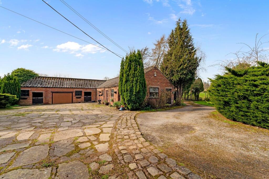
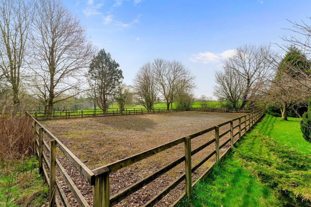
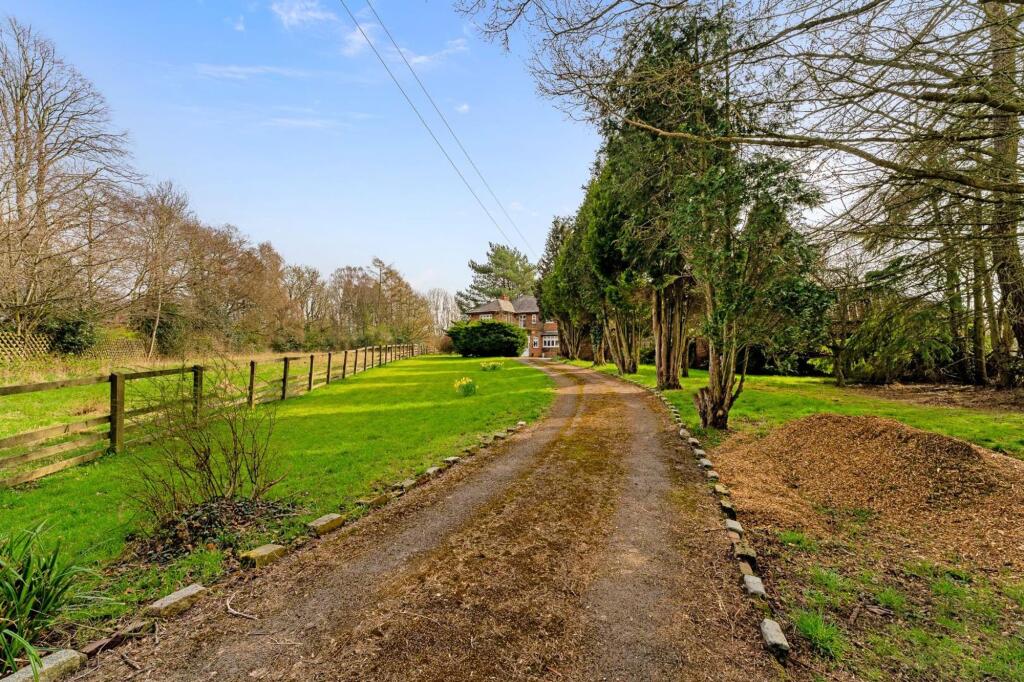
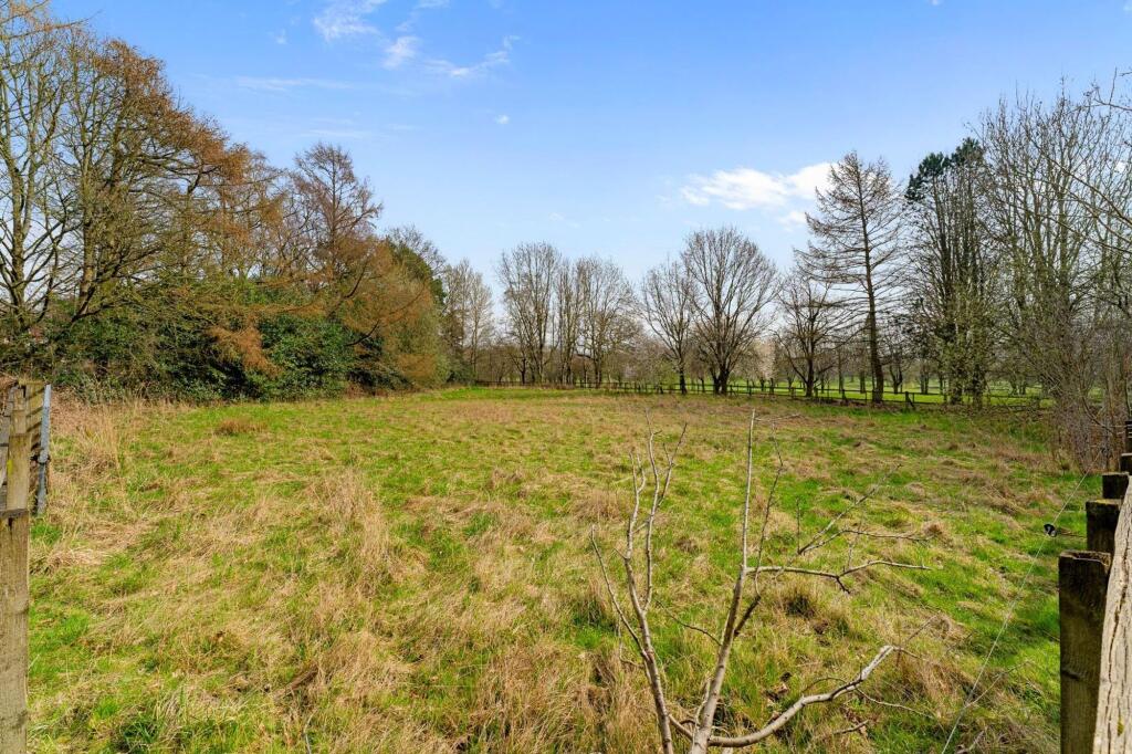
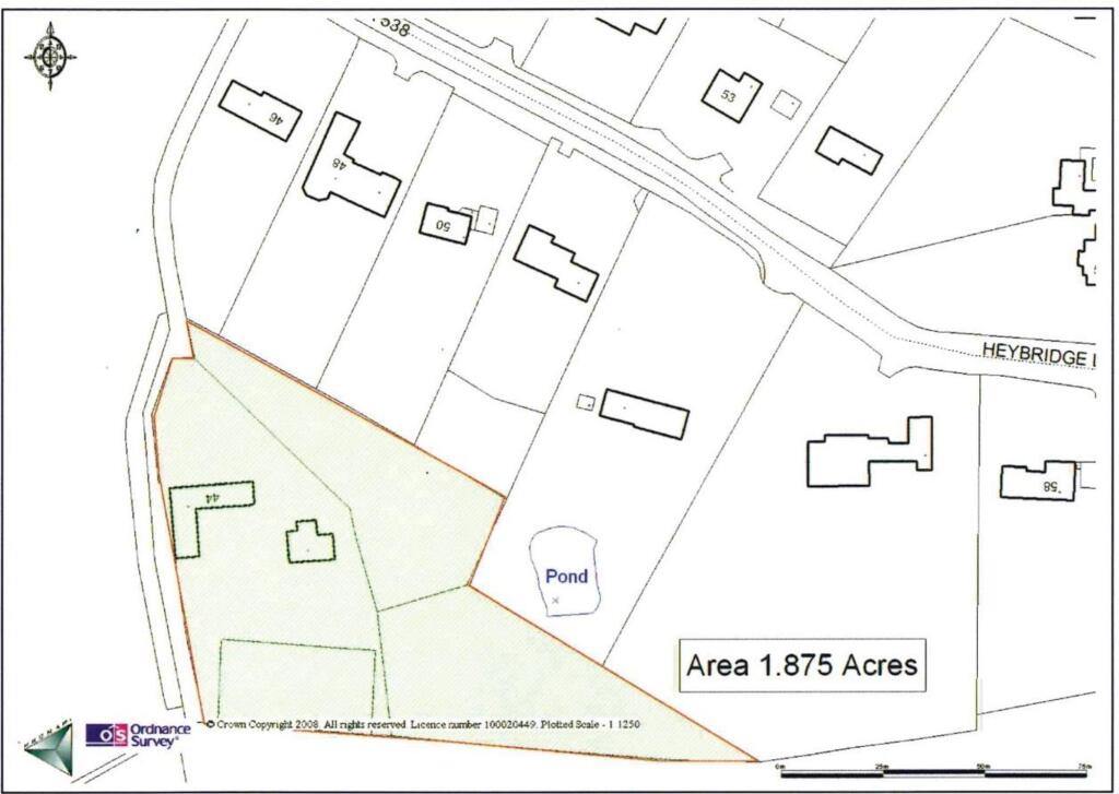
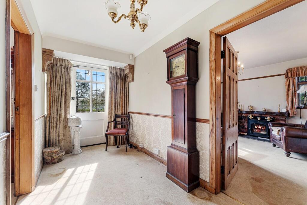
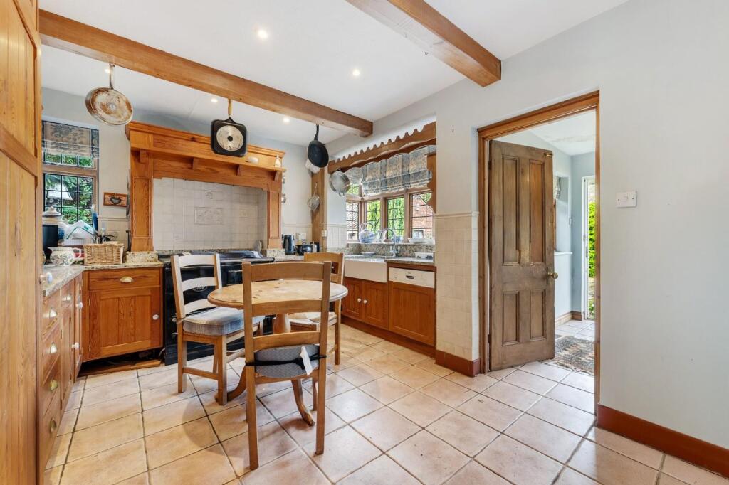
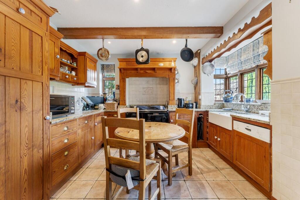
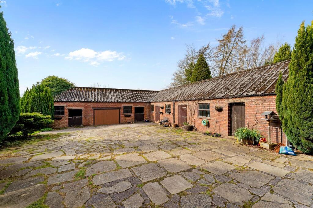
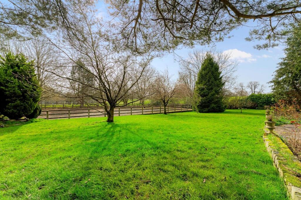
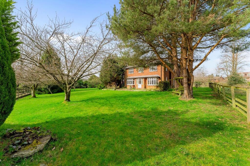
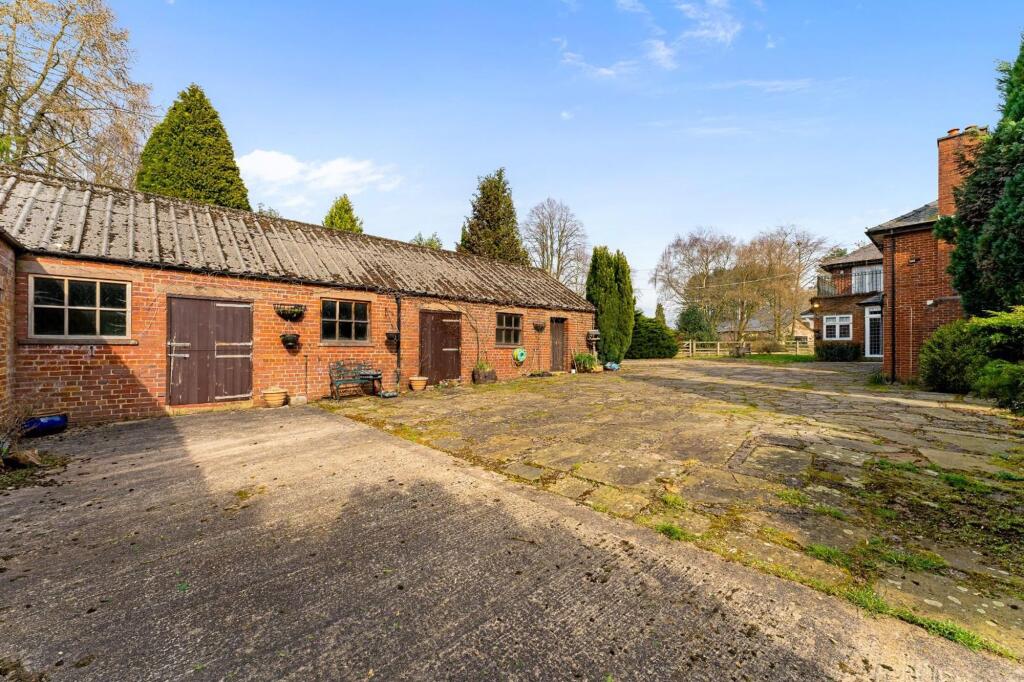
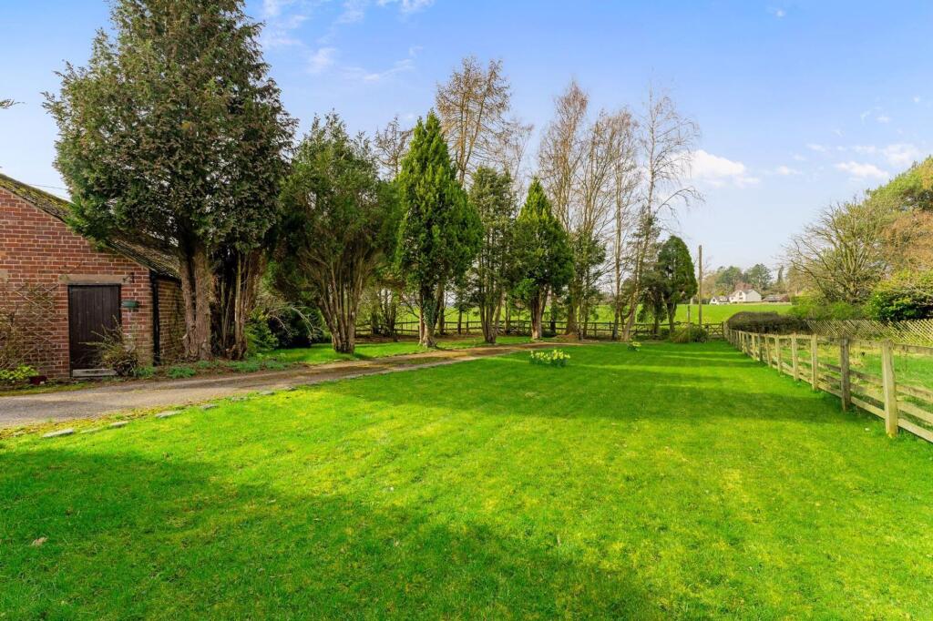
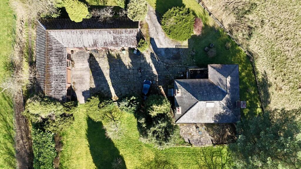
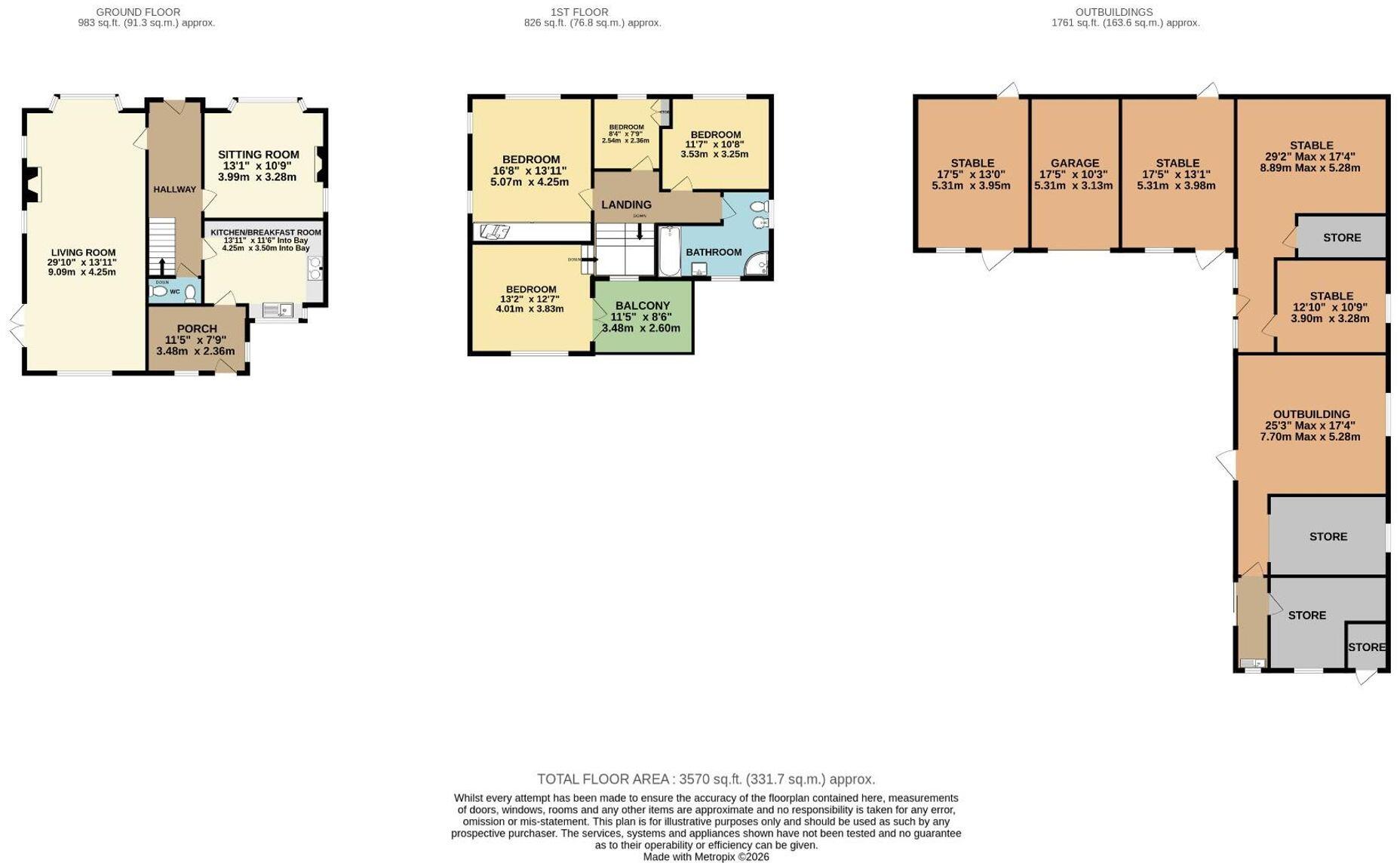
- HOUSE AND OUTBUIDLINGS IN APPROX 1.8 ACRES
- LAND INCLUDES PADDOCKS, MANEGE AND FORMAL GARDENS
- SUBSTANTIAL OUTBUILDINGS AND STABLES
- GLORIOUS VIEWS TOWARDS TYTHERINGTON GOLF COURSE
- TUCKED AWAY IN A MOST SECLUDED SETTING
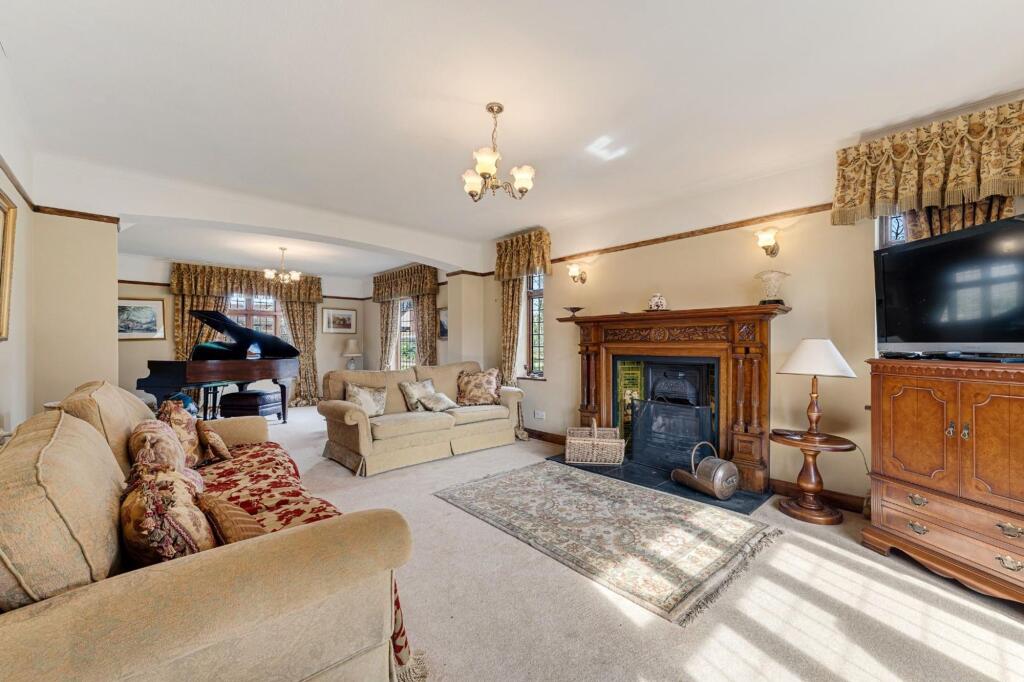
- FOUR BEDROOMS TO THE MAIN HOUSE
- MINUTES FROM THE PICTURESQUE PRESTBURY VILLAGE
- A MOST UNIQUE PURCHASE OPPORTUNITY
Additional details
- Electricity
- Mains supply
- Water
- Mains supply
- Sewerage
- Private supply
- Heating
- Solar, Oil
- Parking
- Yes
- Garden
- Private garden
- Listed property
- No
- Restrictions
- No
- Required access
- No
- Rights of way
- No
- Flooded in last 5 years
- No
- Flood defences
- No
Description
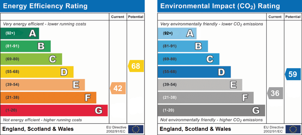
EPC Rating: E
Listed by
Wilmslow
Mosley Jarman
Reference: 89814201
EPC ratings on this postcode
We don't have a matched EPC for this property yet. Below are efficiency scores and details for other addresses on this postcode.
| Address | Current | Potential | Floor area | Age band | Type |
|---|---|---|---|---|---|
| 44 Heybridge Lane, Prestbury, MACCLESFIELD | 42 | 68 | 164 m² | England and Wales: 1900-1929 | Detached |
| 47, Heybridge Lane, Prestbury, MACCLESFIELD | 79 | 83 | 356 m² | England and Wales: 2007-2011 | Detached |
| 48 Heybridge Lane, Prestbury, MACCLESFIELD | 80 | 82 | 488 m² | England and Wales: 2007-2011 | Detached |
| 48, Heybridge Lane, Prestbury, MACCLESFIELD | 78 | 81 | 480 m² | England and Wales: 2007-2011 | Detached |
| 50, Heybridge Lane, Prestbury, MACCLESFIELD | 85 | 89 | 379 m² | — | Detached |
| 50, Heybridge Lane, Prestbury, MACCLESFIELD | 70 | 79 | 158 m² | England and Wales: 1950-1966 | Detached |
| 51 Heybridge Lane, Prestbury, MACCLESFIELD | 75 | 78 | 421 m² | England and Wales: 1983-1990 | Detached |
| 51, Heybridge Lane, Prestbury, MACCLESFIELD | 67 | 75 | 333 m² | England and Wales: 1967-1975 | Detached |
| 53, Heybridge Lane, Prestbury, MACCLESFIELD | 81 | 83 | 509 m² | England and Wales: 1991-1995 | Detached |
| 54, Heybridge Lane, Prestbury | 5 | 37 | 145 m² | England and Wales: 1950-1966 | Detached |
| 55 Heybridge Lane, Prestbury, MACCLESFIELD | 51 | 74 | 175 m² | England and Wales: 1930-1949 | Detached |
| 56 Heybridge Lane, Prestbury, MACCLESFIELD | 63 | 77 | 425 m² | England and Wales: 1900-1929 | Detached |
| 57, Heybridge Lane, Prestbury, MACCLESFIELD | 70 | 75 | 461 m² | England and Wales: 1900-1929 | Detached |
| 57A HEYBRIDGE LANE, PRESTBURY, PRESTBURY | 85 | 88 | 367 m² | — | Detached |
| 59, Heybridge Lane, Prestbury, MACCLESFIELD | 60 | 72 | 288 m² | England and Wales: 1983-1990 | Detached |
Flood risk
Zone: 1
Risk: Low
Job (default Low)
Floorplans
All
EPC Graphs
EPC 1
Price history
| Event | Date | Price | % change |
|---|---|---|---|
| Listed for sale | — | £1,950,000 | — |
Source: HM Land Registry Price Paid Data. Crown copyright.
Sold Comparables
Same street and nearby sales within 0.25 miles (last 5 years). Data from Land Registry Price Paid.
| Address | Price | Date | Type |
|---|---|---|---|
| 56 MEADOW DRIVE, PRESTBURY, MACCLESFIELD, CHESHIRE EAST, SK10 4EZ | £850,000 | 05/09/2025 | Detached |
| 26 HEYBRIDGE LANE, PRESTBURY, MACCLESFIELD, CHESHIRE EAST, SK10 4ES | £3,700,000 | 01/08/2025 | Detached |
| 20 OAKWOOD DRIVE, PRESTBURY, MACCLESFIELD, CHESHIRE EAST, SK10 4HG | £850,000 | 18/07/2025 | Detached |
| 36 HEYBRIDGE LANE, PRESTBURY, MACCLESFIELD, CHESHIRE EAST, SK10 4ES | £975,000 | 14/05/2024 | Detached |
| 56 HEYBRIDGE LANE, PRESTBURY, MACCLESFIELD, CHESHIRE EAST, SK10 4ER | £3,500,000 | 02/11/2023 | Detached |
| 46 MEADOW DRIVE, PRESTBURY, MACCLESFIELD, CHESHIRE EAST, SK10 4EZ | £1,495,000 | 16/01/2023 | Detached |
| 1 YEW TREE WAY, PRESTBURY, MACCLESFIELD, CHESHIRE EAST, SK10 4EX | £2,000,000 | 02/08/2022 | Detached |
| 2 OAKWOOD DRIVE, PRESTBURY, MACCLESFIELD, CHESHIRE EAST, SK10 4HG | £870,000 | 17/06/2022 | Detached |
| 57 HEYBRIDGE LANE, PRESTBURY, MACCLESFIELD, CHESHIRE EAST, SK10 4ER | £1,550,000 | 20/12/2021 | Detached |
| 30 HEYBRIDGE LANE, PRESTBURY, MACCLESFIELD, CHESHIRE EAST, SK10 4ES | £1,050,000 | 19/11/2021 | Detached |
| 60 HEYBRIDGE LANE, PRESTBURY, MACCLESFIELD, CHESHIRE EAST, SK10 4ER | £890,000 | 17/11/2021 | Detached |
| 22 MEADOW DRIVE, PRESTBURY, MACCLESFIELD, CHESHIRE EAST, SK10 4EZ | £650,000 | 11/10/2021 | Detached |
| 44 MEADOW DRIVE, PRESTBURY, MACCLESFIELD, CHESHIRE EAST, SK10 4EZ | £730,000 | 29/09/2021 | Detached |
| 49 HEYBRIDGE LANE, PRESTBURY, MACCLESFIELD, CHESHIRE EAST, SK10 4ER | £1,800,000 | 16/09/2021 | Detached |
| RUSTLINGS, 6 YEW TREE WAY, PRESTBURY, MACCLESFIELD, CHESHIRE EAST, SK10 4EX | £799,000 | 13/08/2021 | Detached |
Area average: £1,447,267 (15 sales)
Capital growth trend
Land Registry outcode average: last 12 months vs 5y and 10y ago (from sold prices).
House Price Index (HM Land Registry — official index, not sold-price averages): Cheshire East. Series: Detached. As of March 2026.
Rental Range
Estimated market rent for Cheshire East. Low = conservative, Realistic = average, Optimistic = best case.
Based on Local Authority from postcode lookup → Cheshire East.
LHA (30th percentile) floor for East Cheshire: £1,745/mo (Apr 2025 – Mar 2026)
Location
Address
Manchester Road
Nearby
Nearest stations, universities and amenities (distance from property).
| Type | Name | Distance |
|---|---|---|
| Bus stop | Tytherington, Dorchester Way / Tytherington Club | 0.4 miles |
| Bus stop | Tytherington, Dorchester Way / Carnoustie Drive | 0.5 miles |
| Train station | Prestbury | 0.6 miles |
| Shop | Dress Cheshire | 0.6 miles |
| Shop | Gents of Prestbury | 0.6 miles |
| Hospital | Rosemount Resource Centre | 1.9 miles |
| Train station | Macclesfield | 2.0 miles |
| Hospital | Corbar hall | 9.1 miles |
| University | University of Derby, Buxton | 9.3 miles |
| University | University of Manchester Fallowfield Campus | 11.3 miles |
Street-level crime
| Category | Count |
|---|---|
| Violence and sexual offences | 13 |
| Anti-social behaviour | 6 |
| Criminal damage and arson | 2 |
| Other theft | 2 |
| Drugs | 1 |
| Public order | 1 |
| Robbery | 1 |
| Total incidents | 26 |
Within 1 mile during Apr 2026. Source: data.police.uk (England & Wales).
Schools nearby
Nearest open schools with Ofsted ratings (England). Closed schools are not shown. Data from Get Information about Schools and Ofsted.
| Name | Type | Distance | Ofsted |
|---|---|---|---|
| Prestbury CofE Primary School | Primary | 0.7 miles | Good — 12 May 2020 |
| Bollington Cross CofE Primary School | Primary | 0.8 miles | Good — 20 Mar 2023 |
| Marlborough Primary School | Primary | 0.9 miles | Good — 11 Oct 2012 |
| Dean Valley Community Primary School | Primary | 1.1 miles | Good — 1 Nov 2012 |
| Bollinbrook CofE (A) Primary School | Primary | 1.2 miles | Good — 16 Oct 2023 |
Rental Comparables
Residential lets from OpenRent and Rightmove for the area (same bedroom count). Use to validate rent estimates. Student lets are excluded.
| Title | Rent | Beds | Distance | As seen on |
|---|---|---|---|---|
| 4 Bed Detached House, The Drive, SK10 | £3,200/mo | 4 | 1.03 miles | OpenRent |
Average rent: £3,200/mo (1 listing)
Rent-driven metrics
Based on OpenRent comparables.
- Rent ratio — Monthly rent ÷ purchase price (1% rule). 1%+ = strong, 0.8–1% = okay, <0.8% = weak for cashflow.
- Max investor price — Rent ÷ 0.8%; the price at which rent would be 0.8% of price (Stoke-style target).
- Target investor price — Rent ÷ 1%; the price at which rent would be 1% of price (strong cashflow band).
- Gross yield — Annual rent as % of purchase price (no costs).
- Cost-to-rent — Price ÷ annual rent (from OpenRent comparables). Under 14× = strong, 14–16× = acceptable, 17×+ = compressed.
- Cashflow — Rent minus mortgage, 10% maintenance, £25/mo compliance. Assumes 75% LTV, 3.95% APR (5yr fixed), 25yr term.
- ROI — Annual profit ÷ cash in (deposit + 4% purchase costs).
Enter House Number
Enter the house number to help us retrieve more accurate pricing history and property data.
Please log in to submit or correct the house number for this listing.
Log in to continue