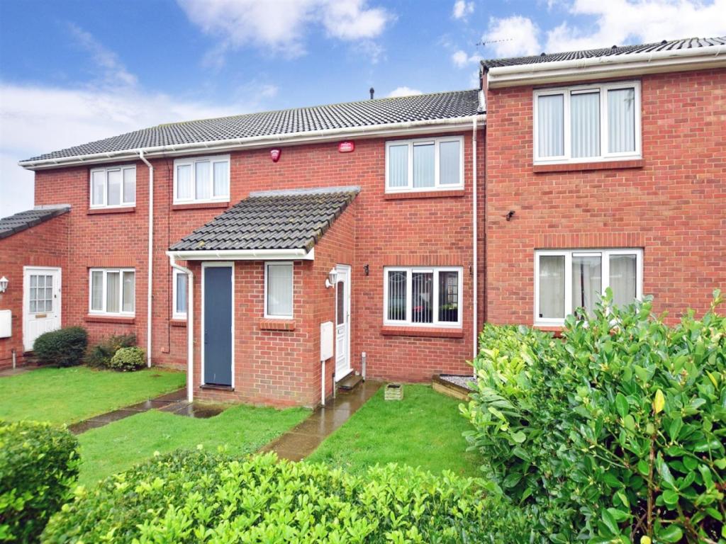
6 NORTHBOURNE WAY
MARGATE, CLIFTONVILLE, KENT CT9 3NS
£895 pcm
Property details
Floor area
70 m²
Deprivation
Decile 6 (17,796 of 33,755)
Street crime
96 incidents within 1 mile (Apr 2026)
Key features
- Well Presented Property
- Sought After Location
- Walking distance To Beach
- Garage En-Bloc
- Pets Considered
- Call Now To View
Additional details
- Parking
- Garage, Yes
- Garden
- Private garden, Yes
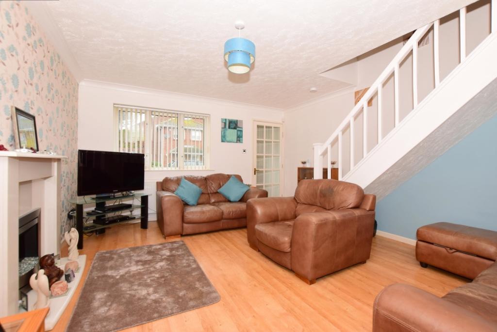
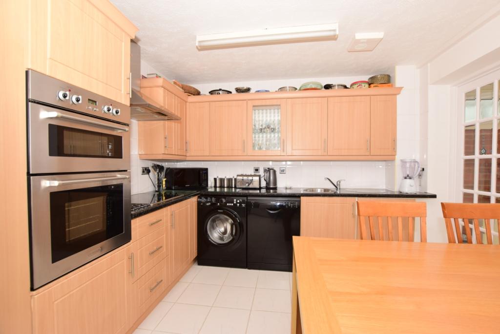
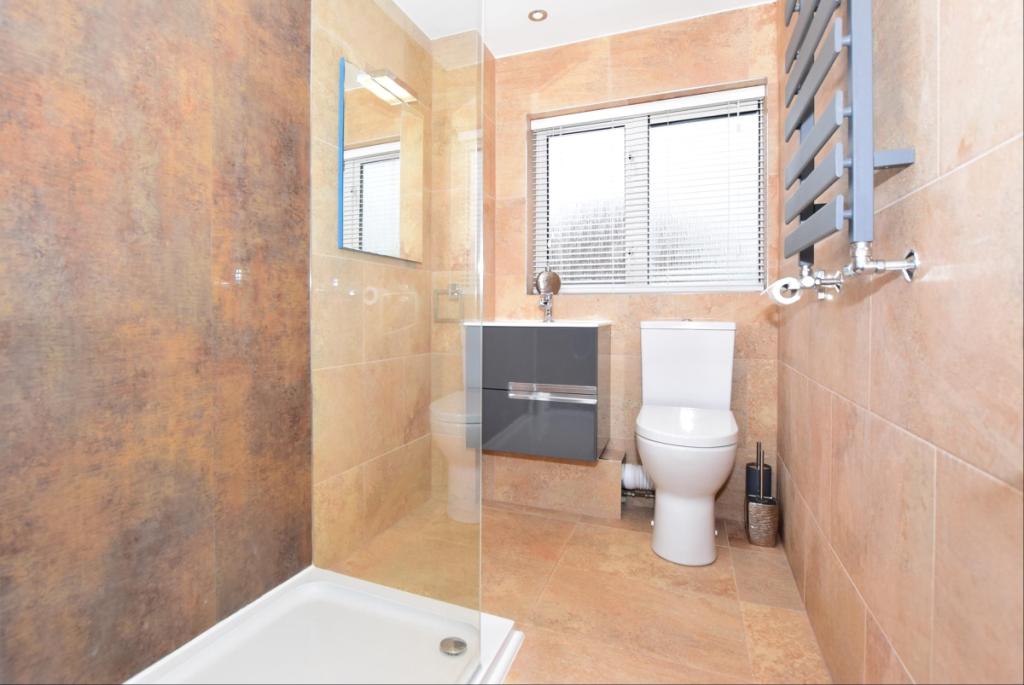
Description
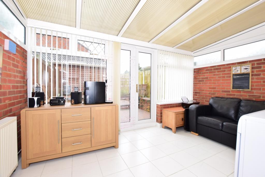
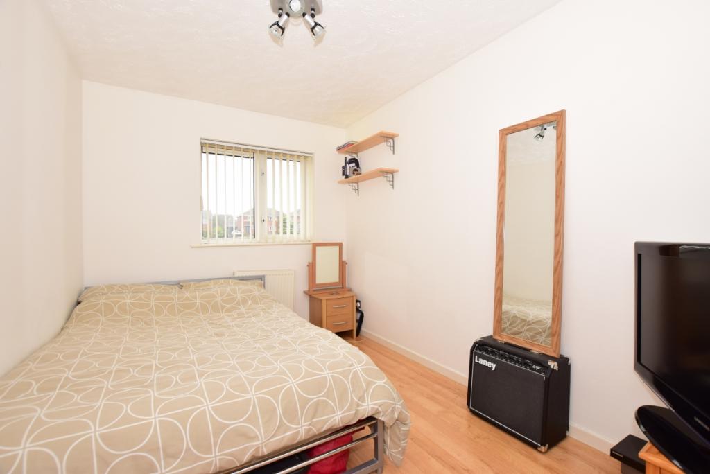
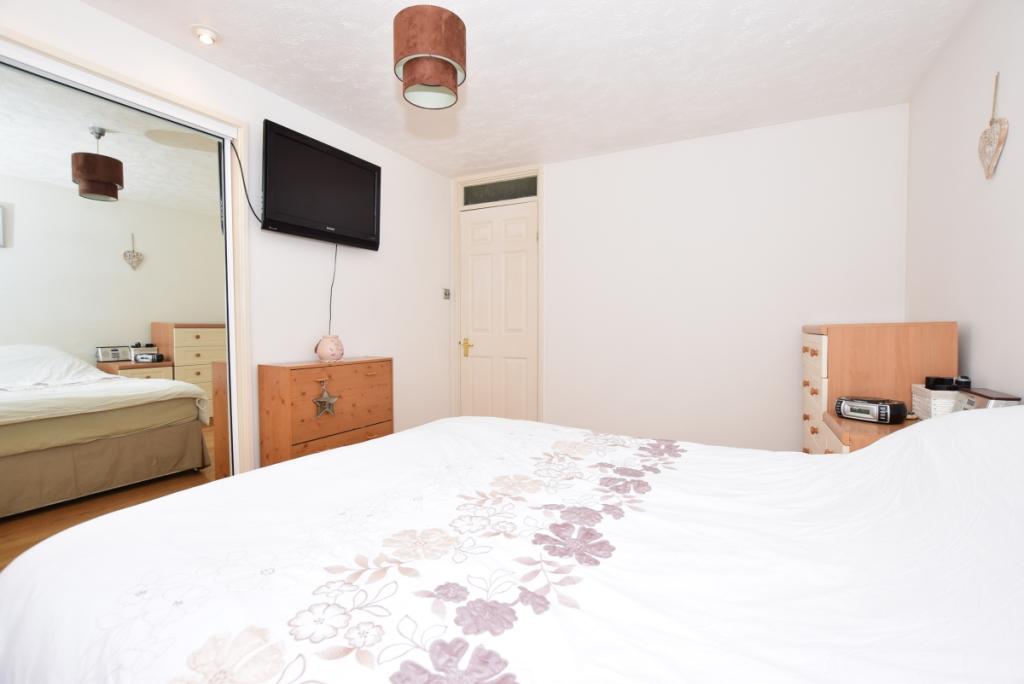
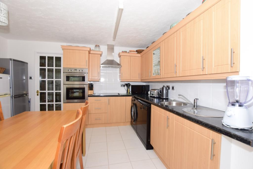
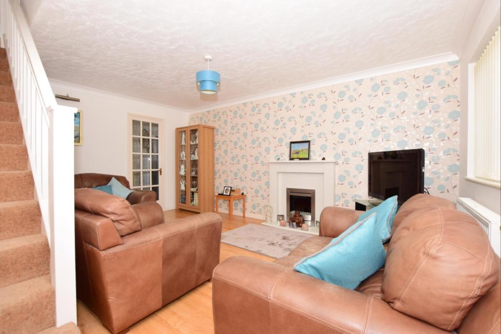
Offering spacious living accommodations with a large lounge, kitchen/diner and conservatory as well as two double bedrooms and a first floor shower room, this property has all a tenant could need.
Decorated neutrally and immaculately throughout the property will be ready for immediate occupation and with the added benefit of pets being considered, it really could make a great family home.
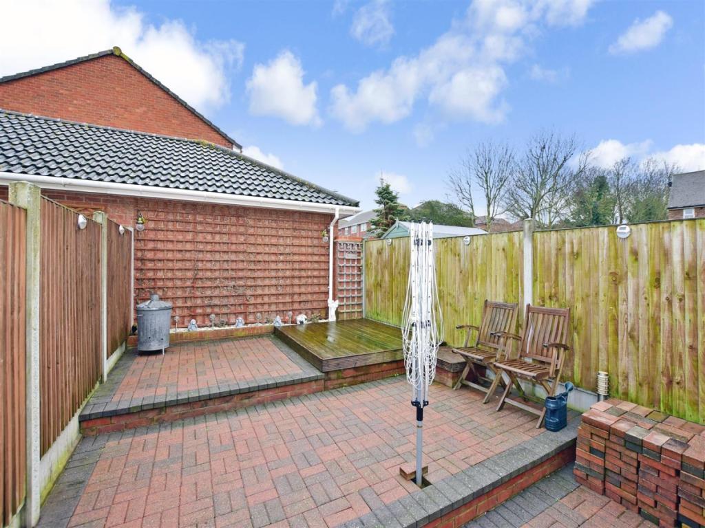
The property also benefits from a garage en-block which allows for a parking space in front this also as well as a private rear garden which is block paved for easy maintenance.
Call us now to arrange your viewing!
Listed by
Ramsgate
Arun Estates
Reference: 81451853
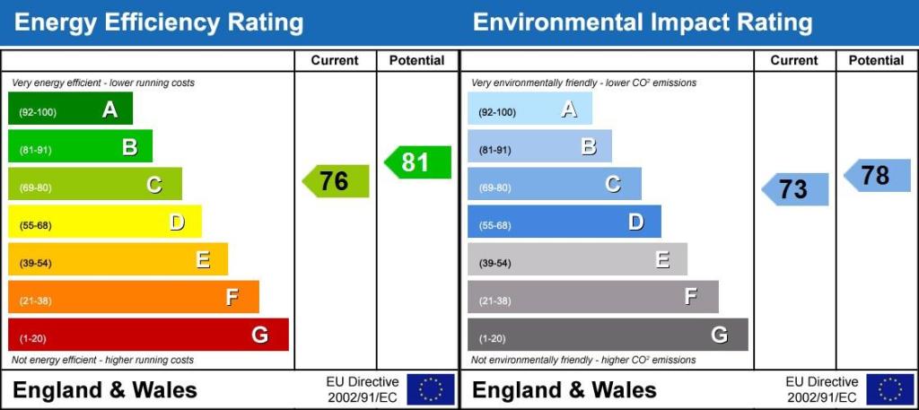
EPC Rating & Upgrade Cost
Fetching EPC data… Refresh this page in a moment.
Flood risk
Zone: 1
Risk: Low
Job (default Low)
Floorplans
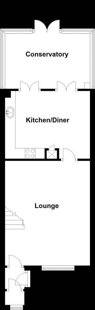
Floor Plan Ground
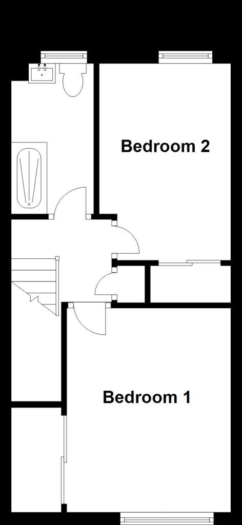
Floor Plan First
EPC Graphs
Energy Performanc...
Rental Range
Estimated market rent for Thanet. Low = conservative, Realistic = average, Optimistic = best case.
Based on Local Authority from postcode lookup → Thanet.
LHA (30th percentile) floor for Thanet: £748/mo (Apr 2025 – Mar 2026)
Location
Nearby
Nearest stations, universities and amenities (distance from property).
| Type | Name | Distance |
|---|---|---|
| Bus stop | Cranbrook Close | 0.1 miles |
| Bus stop | Hadlow Drive | 0.2 miles |
| Shop | Co-op Food | 0.2 miles |
| Shop | Summerfield Stores | 0.2 miles |
| Hospital | Queen Elizabeth The Queen Mother Hospital | 1.6 miles |
| Train station | Broadstairs | 1.7 miles |
| Train station | Margate | 2.2 miles |
| Hospital | Victoria Hospital | 11.5 miles |
Street-level crime
| Category | Count |
|---|---|
| Violence and sexual offences | 43 |
| Anti-social behaviour | 22 |
| Criminal damage and arson | 8 |
| Drugs | 5 |
| Other theft | 5 |
| Other crime | 4 |
| Public order | 3 |
| Bicycle theft | 2 |
| Vehicle crime | 2 |
| Possession of weapons | 1 |
| Shoplifting | 1 |
| Total incidents | 96 |
Within 1 mile during Apr 2026. Source: data.police.uk (England & Wales).
Schools nearby
Nearest open schools with Ofsted ratings (England). Closed schools are not shown. Data from Get Information about Schools and Ofsted.
| Name | Type | Distance | Ofsted |
|---|---|---|---|
| Palm Bay Primary School | Primary | 0.4 miles | Good — 13 Nov 2014 |
| St Anthony's School | Other | 0.6 miles | Good — 4 Sep 2015 |
| Northdown Primary School | Primary | 0.7 miles | Good — 19 Jan 2022 |
| Cliftonville Primary School | Primary | 0.8 miles | Good — 17 Jul 2024 |
| Callis Grange Nursery and Infant School | Primary | 0.9 miles | Good — 15 Jun 2022 |
Rental Comparables
Rental comparables are temporarily unavailable while listing-site fetches are paused. Try again later.