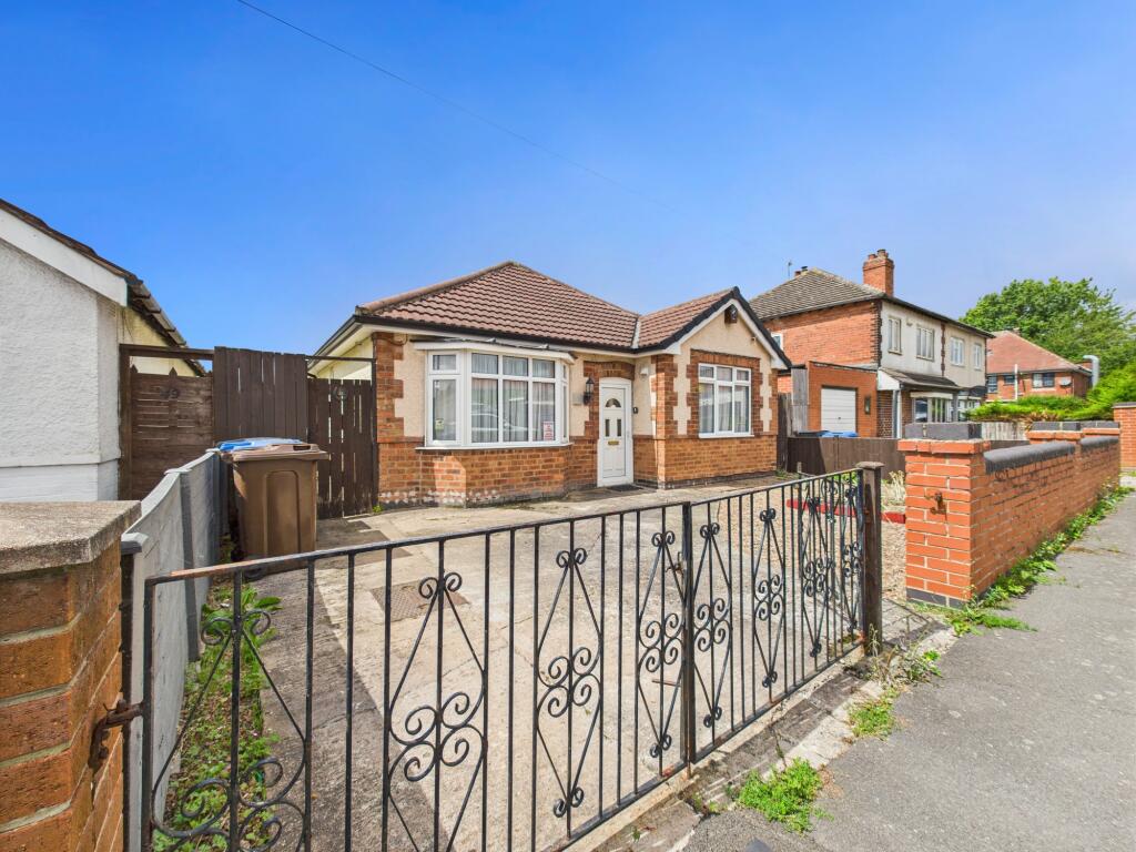
51 HILLCREST ROAD
DERBY, DERBY, CITY OF DERBY DE21 6FJ
Property details
Tenure
FREEHOLD
Floor area
67 m²
Council tax band
B
EPC rating
D
Year built
England and Wales: 1930-1949
Last sold
£132,000 May 2004
Price per m²
£2,687/m²
Local average
£330,851 (-45.6%)
Deprivation
Decile 4 (13,244 of 33,755)
Street crime
341 incidents within 1 mile (Apr 2026)
Key features
- Traditional Detached Bungalow Requiring Some Modernisation/Improvement
- Off Road Parking And Good Size Rear Garden
- No Upward Chain
- EPC Rating D, Standard Construction
- Council Tax Band B, Freehold
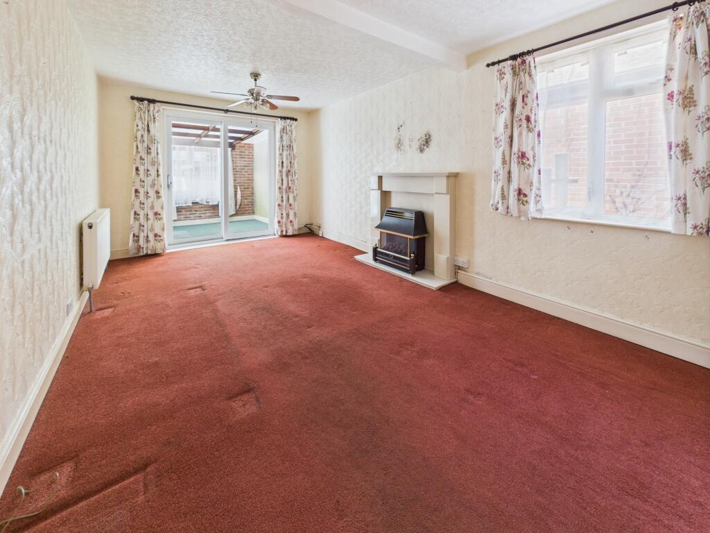
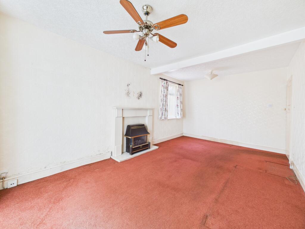
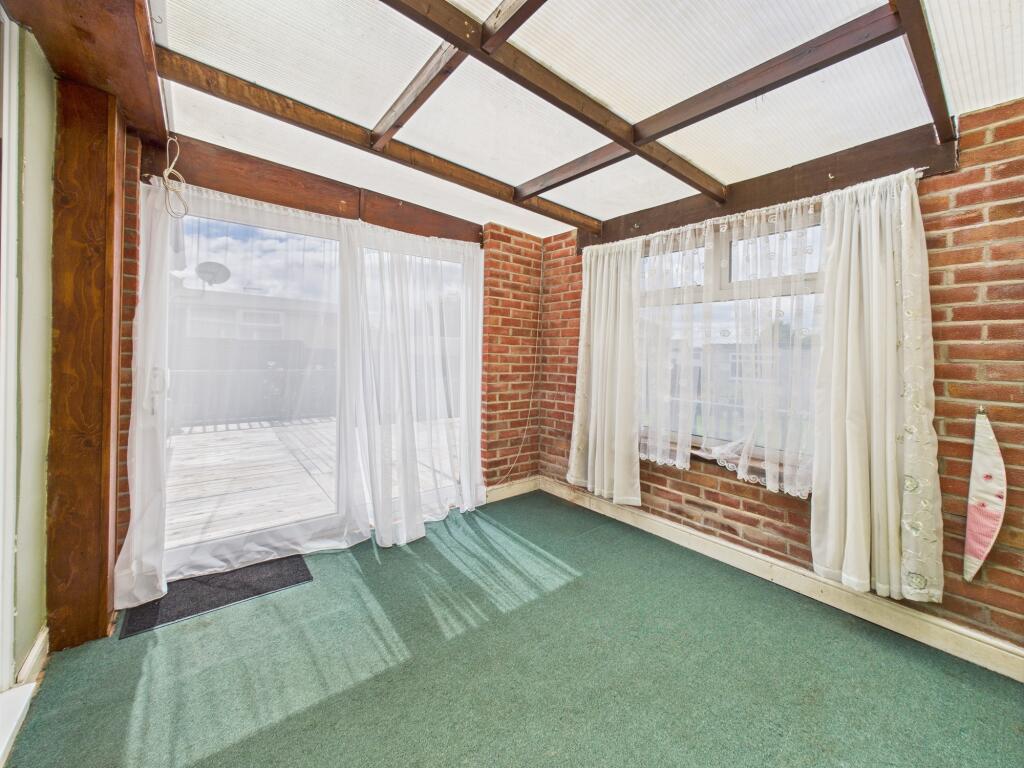
- Lounge, Sun Lounge/Lean To
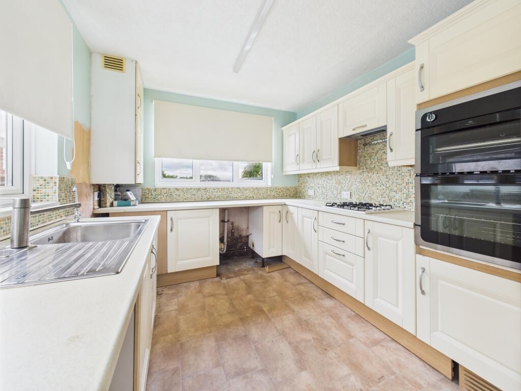
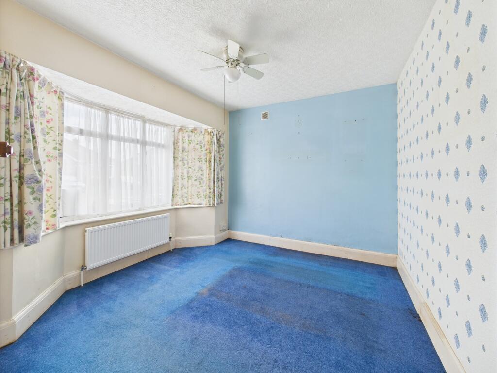
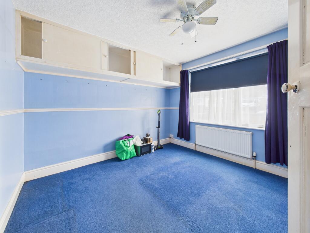
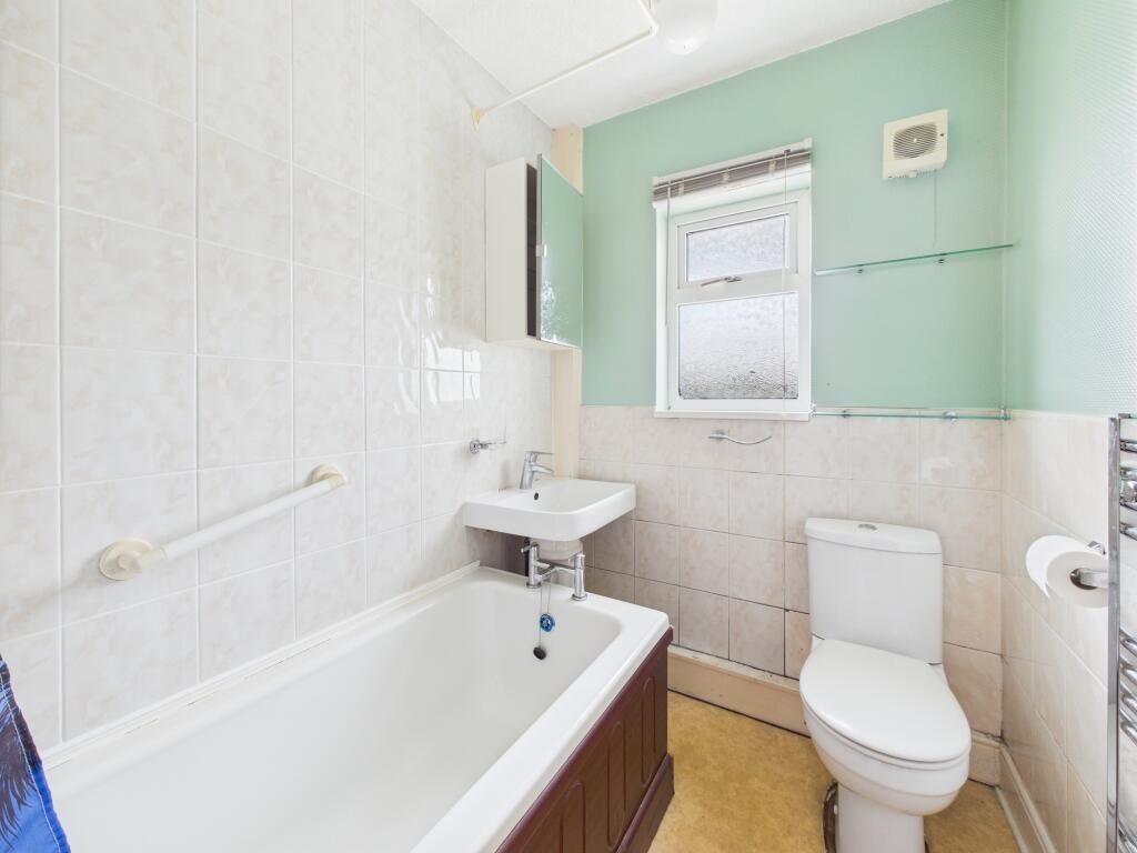
- Kitchen, Two Bedrooms And Study/Nursery
- Shower Room
- Gas Central Heating And Double Glazing
- Close To Local Amenities
Additional details
- Parking
- Yes
- Garden
- Yes
Description
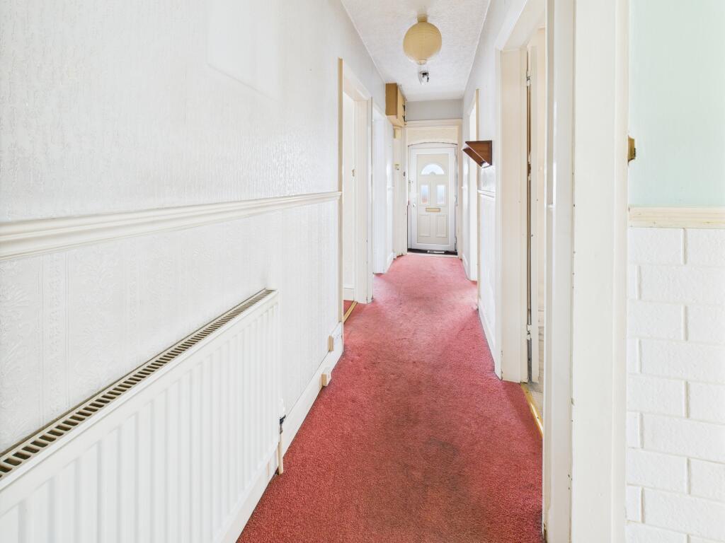
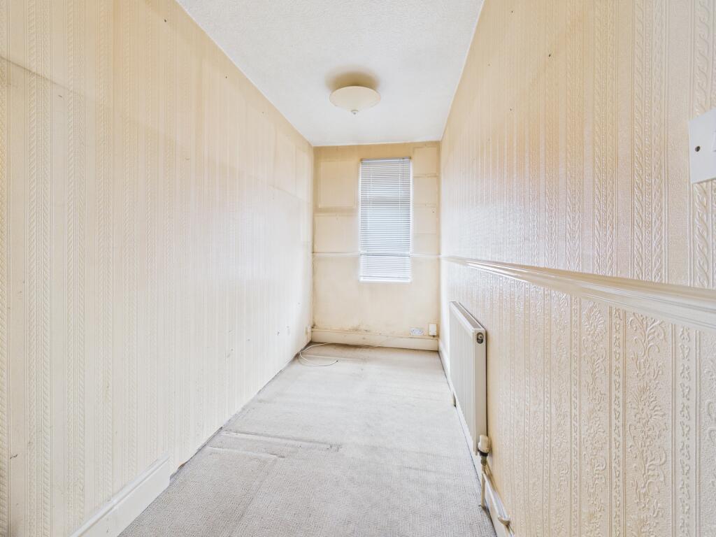
The accommodation benefits from double glazing and gas central heating, and briefly comprises: a spacious reception hallway, lounge, sun lounge/lean-to, kitchen, two bedrooms, a study/nursery, and a shower room.
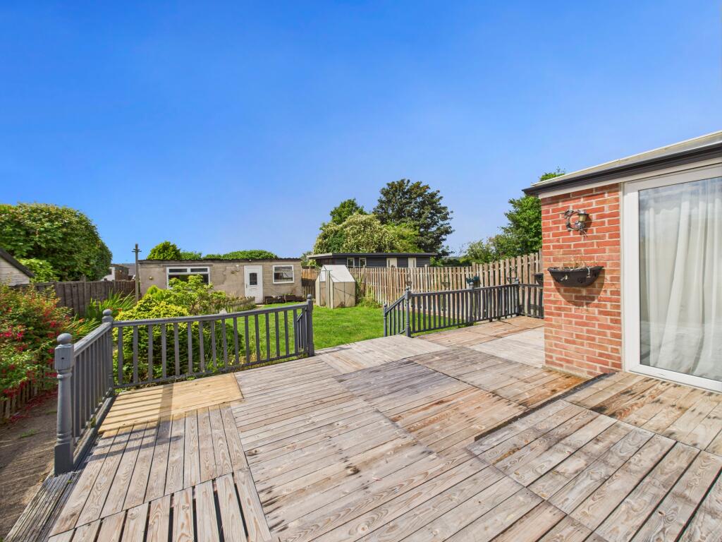
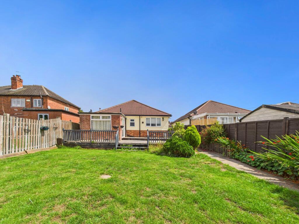
Externally, the property enjoys gardens to both the front and rear, along with off-road parking. A useful workshop with power and lighting is located at the rear of the garden, ideal for storage or hobbies.
Hillcrest Road is ideally positioned for easy access to local shops, schools, public transport, and a wide range of amenities within Chaddesden. It also boasts excellent transport links via the A52, A50, and M1 motorway, with East Midlands Airport easily accessible.
Listed by
Chaddesden
Hannells Estate Agents
Reference: 165383435
EPC Rating & Upgrade Cost
Current rating: D
Potential rating: C
Inspection date: 30/07/2025
Expiry date: 29/07/2035
Est. upgrade cost to C: £25,880
Recommendations
- 50 mm internal or external wall insulation (£7,500 - £11,000)
- Floor insulation (suspended floor) (£5,000 - £10,000)
- Low energy lighting for all fixed outlets (£120 - £140)
- Solar photovoltaic panels, 2.5 kWp (£8,000 - £10,000)
Flood risk
Zone: 1
Risk: Low
Job (default Low)
Floorplans
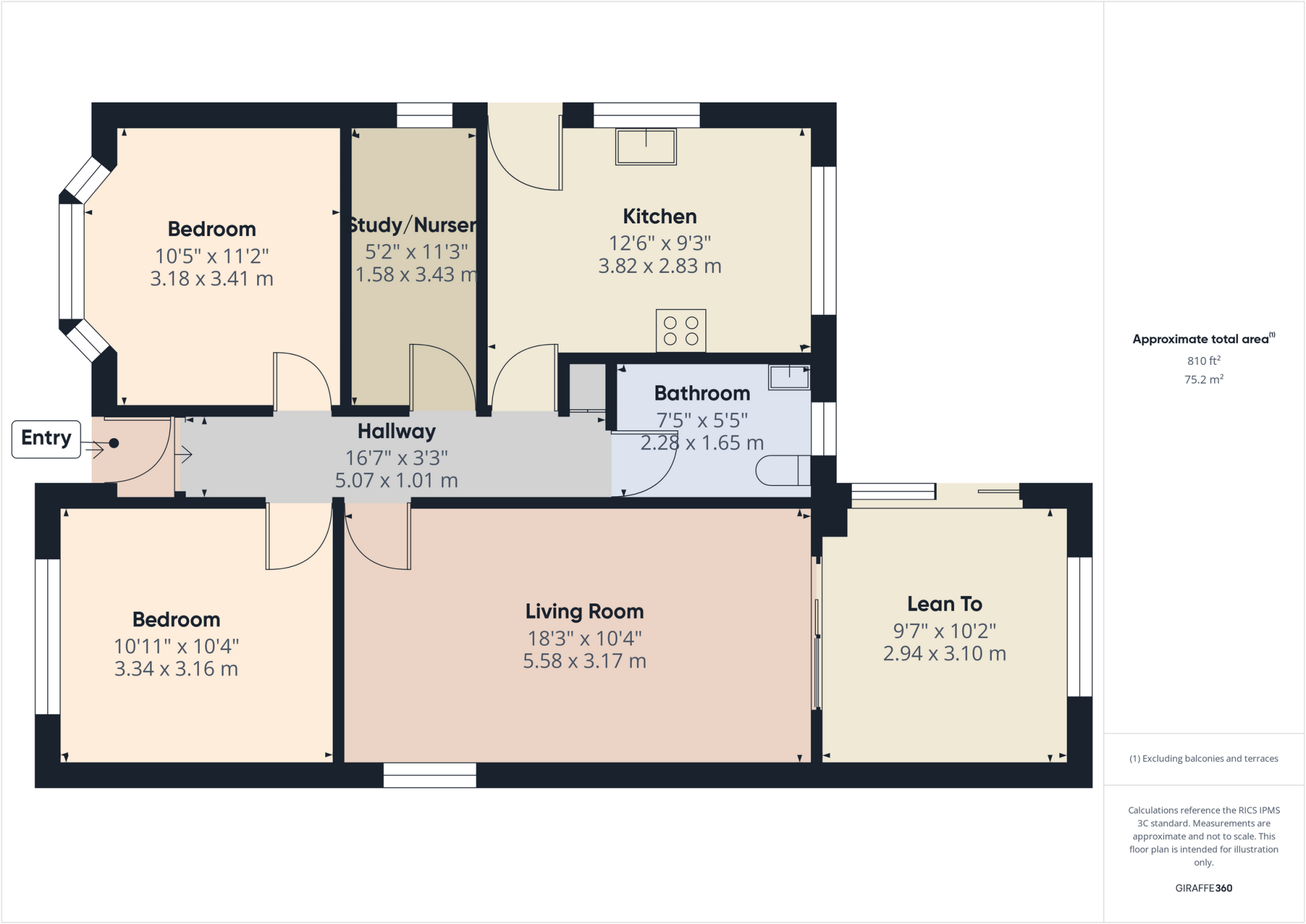
Floor plan
EPC Graphs
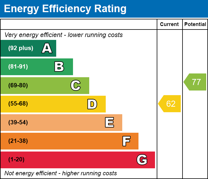
EE
FENSA Certificates
This property has 2 FENSA certificate(s) on record, indicating window/door installations by FENSA-approved installers.
FENSA Certificate #13582698
Property Details
Street: 51 Hillcrest Road
Town: DERBY
Postcode: DE21 6FJ
Installation Details
Items: 1 door
Certificate Issued: 27/05/2019
Work Completed: 23/05/2019
This certificate data was retrieved from FENSA's database
FENSA Certificate #2184234
Property Details
Street: 51 Hillcrest Road
Town: Chaddesden
Postcode: DE21 6FJ
Installation Details
Items: 1 door
Certificate Issued: 02/11/2004
Work Completed: 05/10/2004
This certificate data was retrieved from FENSA's database
What is FENSA? FENSA (Fenestration Self-Assessment Scheme) is a government-authorised scheme that monitors building regulation compliance for replacement windows and doors. Certificates indicate that work was completed by FENSA-approved installers.
Price history
| Event | Date | Price | % change |
|---|---|---|---|
| Listed for sale | — | £180,000 | +36.4% |
| Sold | 07/05/2004 (22 years ago) | £132,000 | — |
Source: HM Land Registry Price Paid Data. Crown copyright.
Sold Comparables
Same street and nearby sales within 0.25 miles (last 5 years). Data from Land Registry Price Paid.
| Address | Price | Date | Type |
|---|---|---|---|
| Same street 37 HILLCREST ROAD, DERBY, CITY OF DERBY, DE21 6FJ | £160,000 | 15/12/2023 | Semi-detached |
| Same street 45 HILLCREST ROAD, DERBY, CITY OF DERBY, DE21 6FJ | £216,000 | 15/02/2023 | Semi-detached |
| 46 HILLCREST ROAD, DERBY, CITY OF DERBY, DE21 6FH | £174,000 | 21/01/2022 | Detached |
| 2A ROE FARM LANE, DERBY, CITY OF DERBY, DE21 6ET | £120,000 | 08/12/2021 | Detached |
| Same street 21 HILLCREST ROAD, DERBY, CITY OF DERBY, DE21 6FJ | £167,500 | 19/11/2021 | Detached |
| Same street 43 HILLCREST ROAD, DERBY, CITY OF DERBY, DE21 6FJ | £169,950 | 13/08/2021 | Detached |
| 93 WILTSHIRE ROAD, DERBY, CITY OF DERBY, DE21 6FB | £187,500 | 30/07/2021 | Detached |
| 12 HILLCREST ROAD, DERBY, CITY OF DERBY, DE21 6FH | £165,000 | 17/06/2021 | Detached |
Street average: £178,363 (4 sales)
Area average: £161,625 (4 sales)
Capital growth trend
Land Registry outcode average: last 12 months vs 5y and 10y ago (from sold prices).
House Price Index (HM Land Registry — official index, not sold-price averages): City of Derby. Series: Detached. As of March 2026.
Rental Range
Estimated market rent for Derby. Low = conservative, Realistic = average, Optimistic = best case.
Based on Local Authority from postcode lookup → Derby.
LHA (30th percentile) floor for Derby: £593/mo (Apr 2025 – Mar 2026)
Location
Nearby
Nearest stations, universities and amenities (distance from property).
| Type | Name | Distance |
|---|---|---|
| Shop | Hilltop Stores | 0.0 miles |
| Bus stop | Cardigan Street | 0.1 miles |
| Shop | Coral | 0.1 miles |
| Bus stop | Blue Boy | 0.1 miles |
| Train station | Derby | 1.1 miles |
| University | Institute for Innovation in Sustainable Engineering (University of Derby) | 1.3 miles |
| University | Lonsdale House | 1.3 miles |
| Hospital | Florence Nightingale Community Hospital | 1.3 miles |
| Hospital | Cygnet Hospital Derby | 1.6 miles |
| Train station | Spondon | 2.2 miles |
Street-level crime
| Category | Count |
|---|---|
| Violence and sexual offences | 134 |
| Public order | 41 |
| Criminal damage and arson | 37 |
| Anti-social behaviour | 33 |
| Drugs | 22 |
| Shoplifting | 18 |
| Other theft | 17 |
| Vehicle crime | 14 |
| Burglary | 9 |
| Other crime | 6 |
| Possession of weapons | 5 |
| Bicycle theft | 3 |
| Robbery | 1 |
| Theft from the person | 1 |
| Total incidents | 341 |
Within 1 mile during Apr 2026. Source: data.police.uk (England & Wales).
Schools nearby
Nearest open schools with Ofsted ratings (England). Closed schools are not shown. Data from Get Information about Schools and Ofsted.
| Name | Type | Distance | Ofsted |
|---|---|---|---|
| Derwent Primary School | Primary | 0.3 miles | Good — 11 Oct 2021 |
| Roe Farm Primary School | Primary | 0.5 miles | Good — 9 Jul 2024 |
| Beaufort Community Primary School | Primary | 0.5 miles | Requires improvement — 10 Dec 2023 |
| St Giles' Spencer Academy | Other | 0.6 miles | Outstanding — 11 Jan 2017 |
| St Alban's Catholic Voluntary Academy | Primary | 0.6 miles | Good — 11 Oct 2013 |
Rental Comparables
Residential lets from OpenRent and Rightmove for the area (same bedroom count). Use to validate rent estimates. Student lets are excluded.
| Title | Rent | Beds | Distance | As seen on |
|---|---|---|---|---|
| 2 Bed Flat, Beaufort Gardens, DE21 | £795/mo | 2 | 0.21 miles | OpenRent |
| 2 Bed Terraced House, Nottingham Road, DE21 | £850/mo | 2 | 0.35 miles | OpenRent |
| 2 Bed Flat, Chester Green, DE21 | £975/mo | 2 | 0.83 miles | OpenRent |
| 2 Bed Flat, St. Marys Chambers, DE1 | £850/mo | 2 | 1.15 miles | OpenRent |
| 2 Bed Flat, King's Crescent Apartments, DE1 | £895/mo | 2 | 1.2 miles | OpenRent |
| 2 Bed Penthouse, King's Crescent Apartments, DE1 | £975/mo | 2 | 1.2 miles | OpenRent |
Average rent: £890/mo (6 listings)
Rent-driven metrics
Based on OpenRent comparables.
- Rent ratio — Monthly rent ÷ purchase price (1% rule). 1%+ = strong, 0.8–1% = okay, <0.8% = weak for cashflow.
- Max investor price — Rent ÷ 0.8%; the price at which rent would be 0.8% of price (Stoke-style target).
- Target investor price — Rent ÷ 1%; the price at which rent would be 1% of price (strong cashflow band).
- Gross yield — Annual rent as % of purchase price (no costs).
- Cost-to-rent — Price ÷ annual rent (from OpenRent comparables). Under 14× = strong, 14–16× = acceptable, 17×+ = compressed.
- Cashflow — Rent minus mortgage, 10% maintenance, £25/mo compliance. Assumes 75% LTV, 3.95% APR (5yr fixed), 25yr term.
- ROI — Annual profit ÷ cash in (deposit + 4% purchase costs).