41 ARCHER STREET
WALLSEND, TYNE AND WEAR NE28 7DL
£80,000
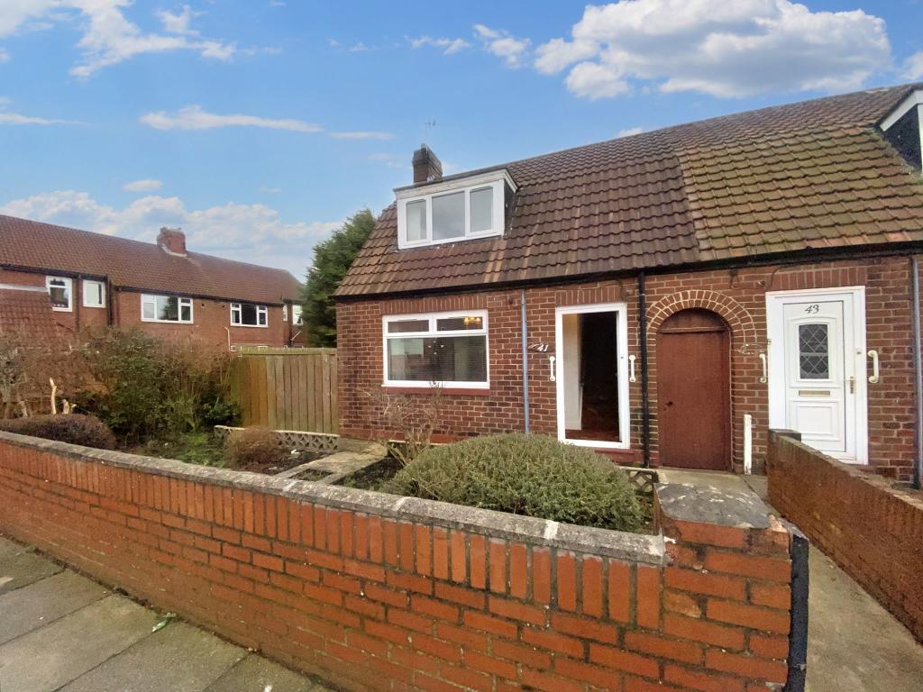
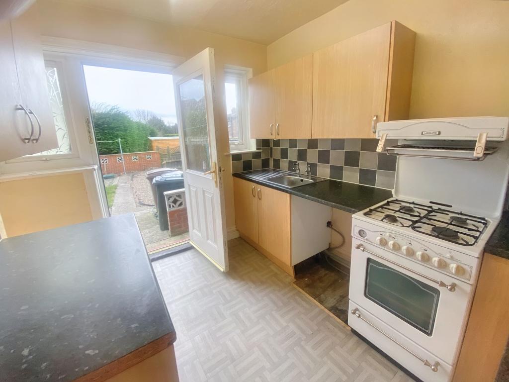
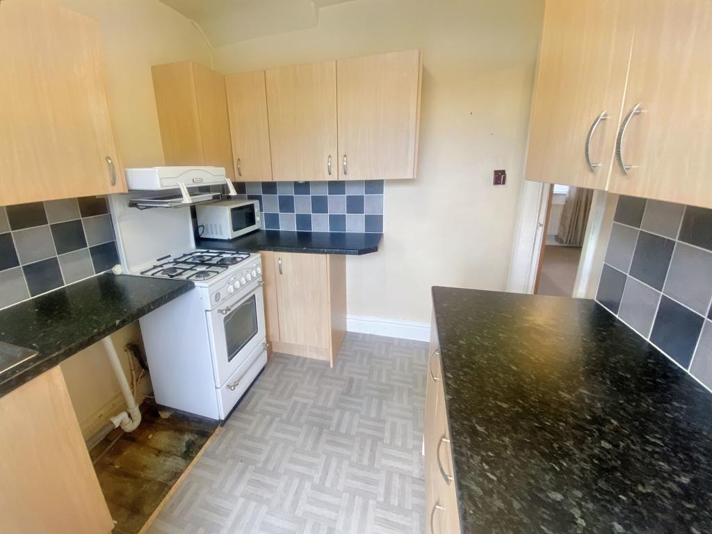
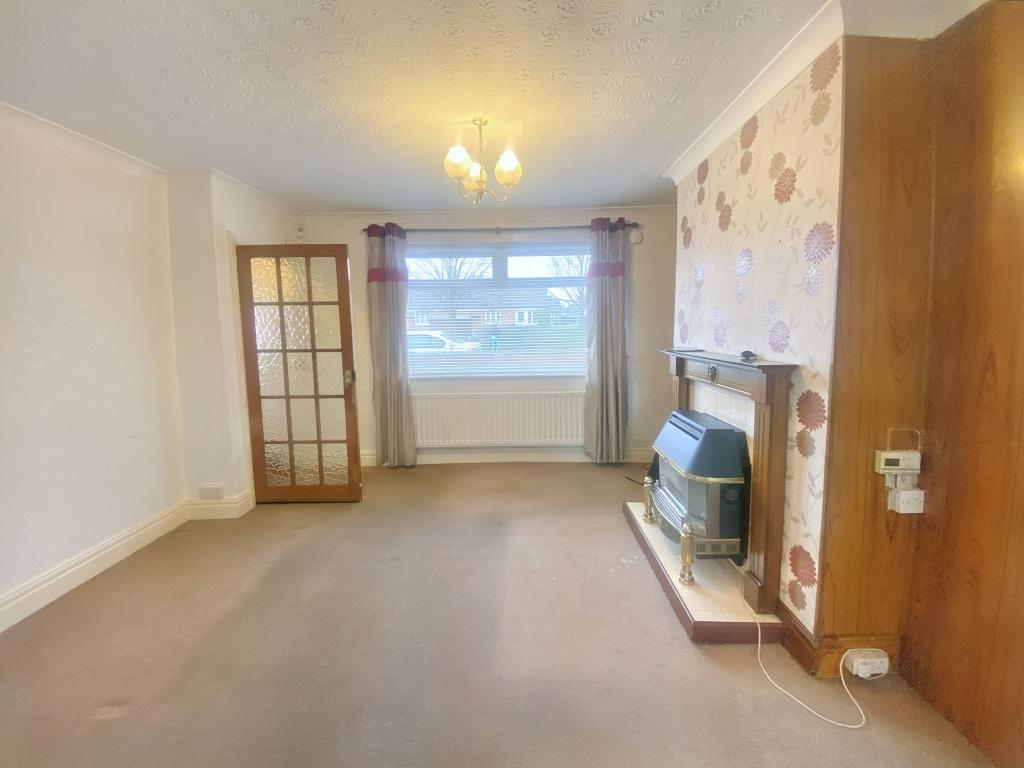
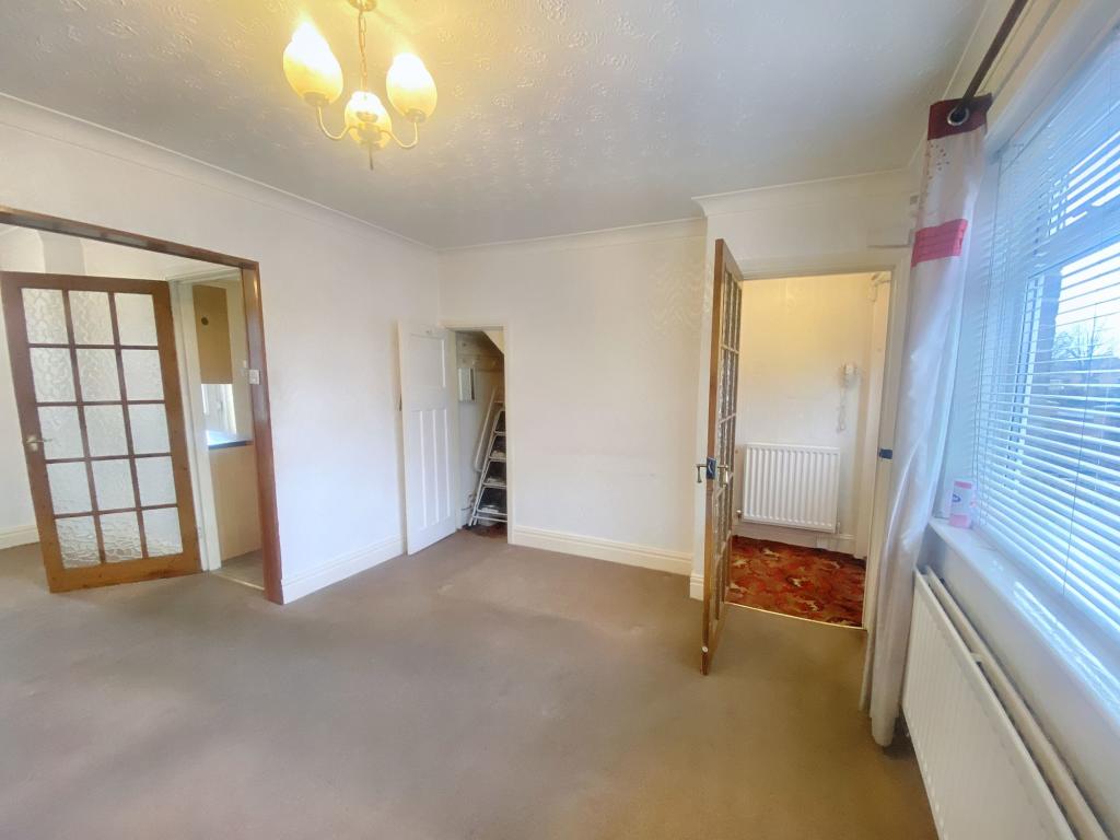
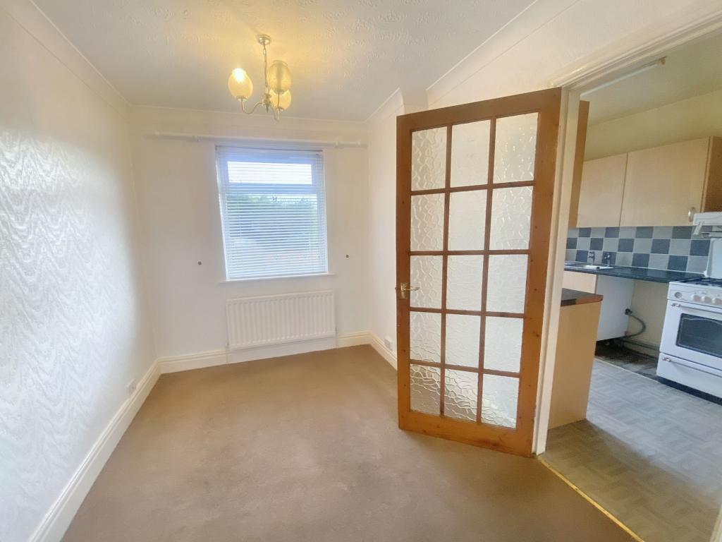
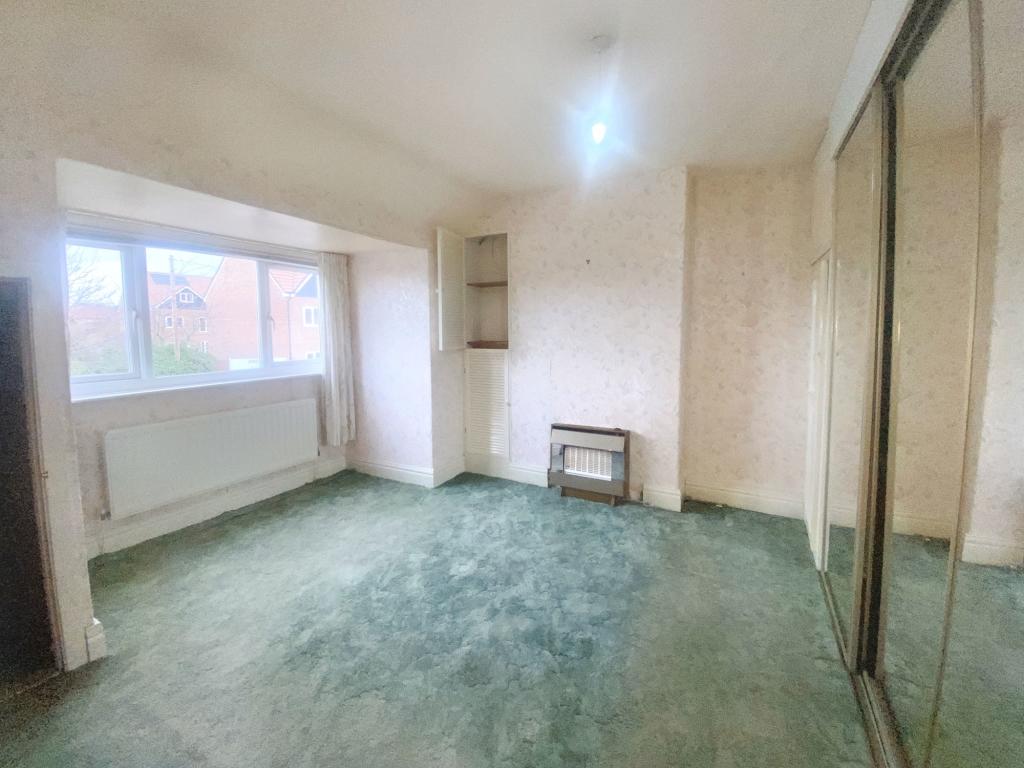
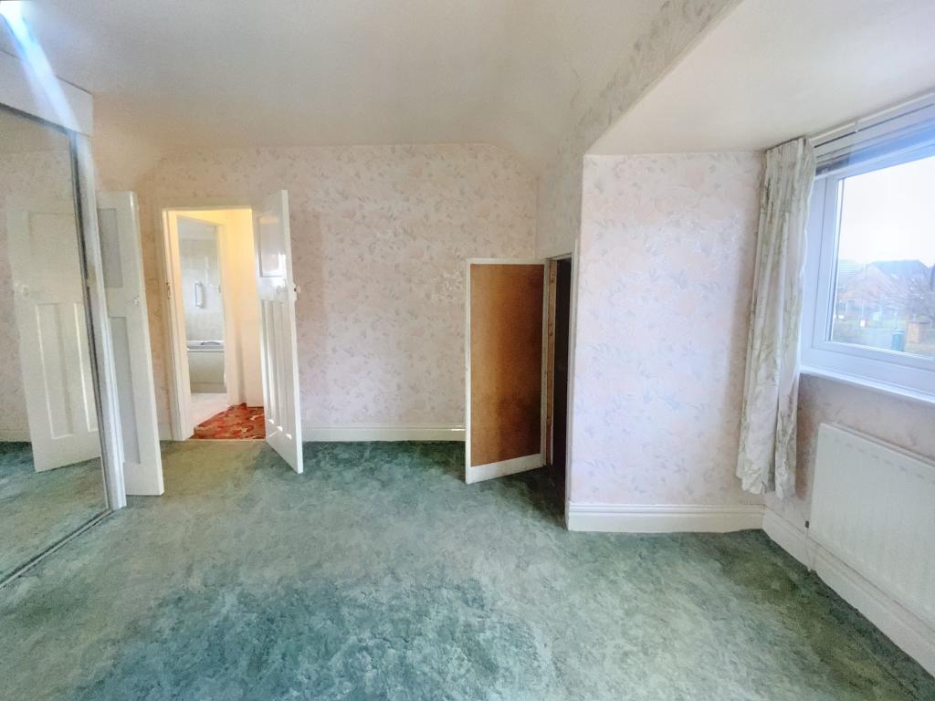
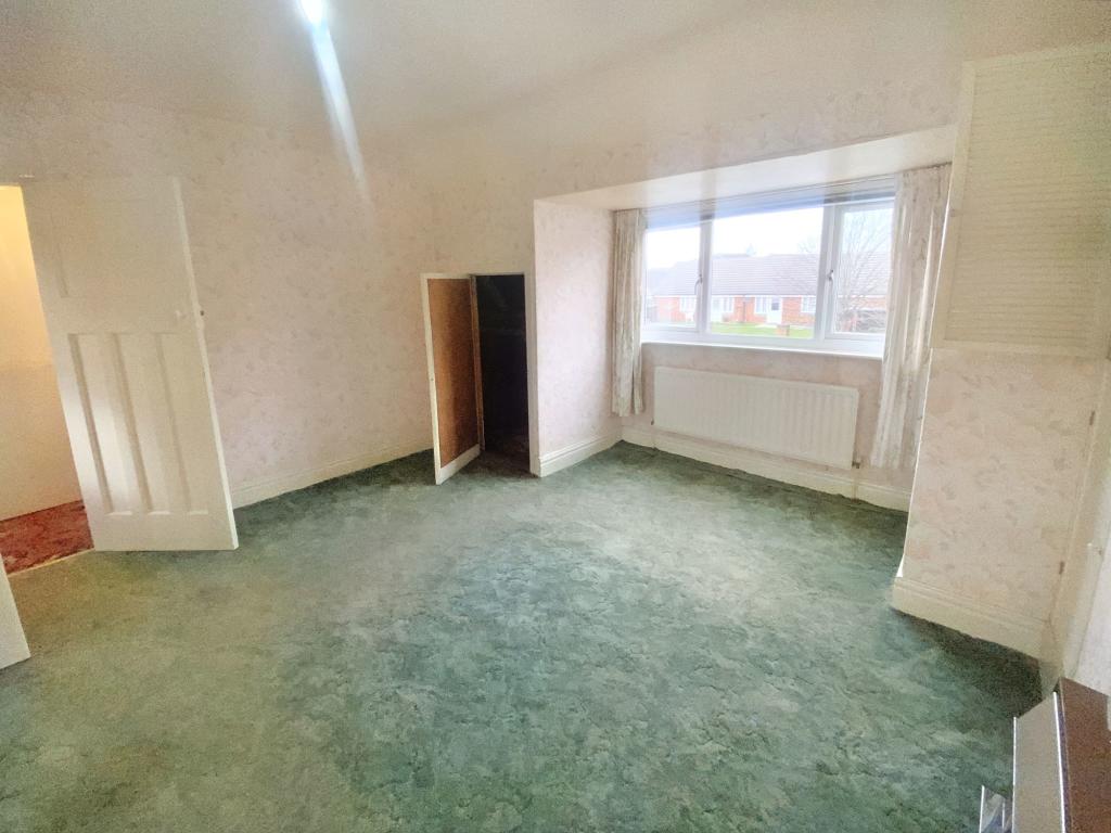
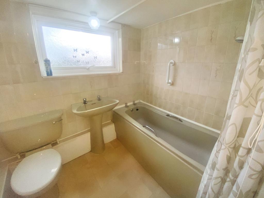
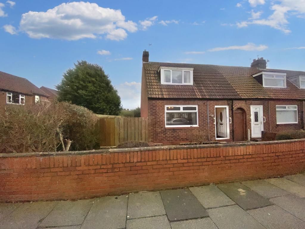
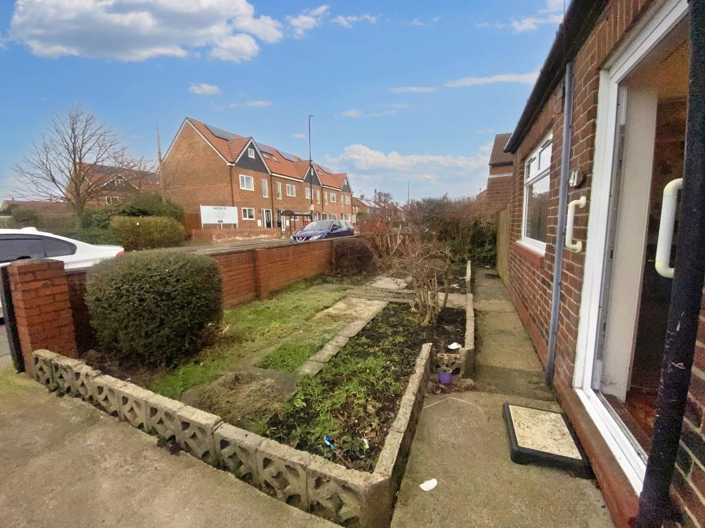
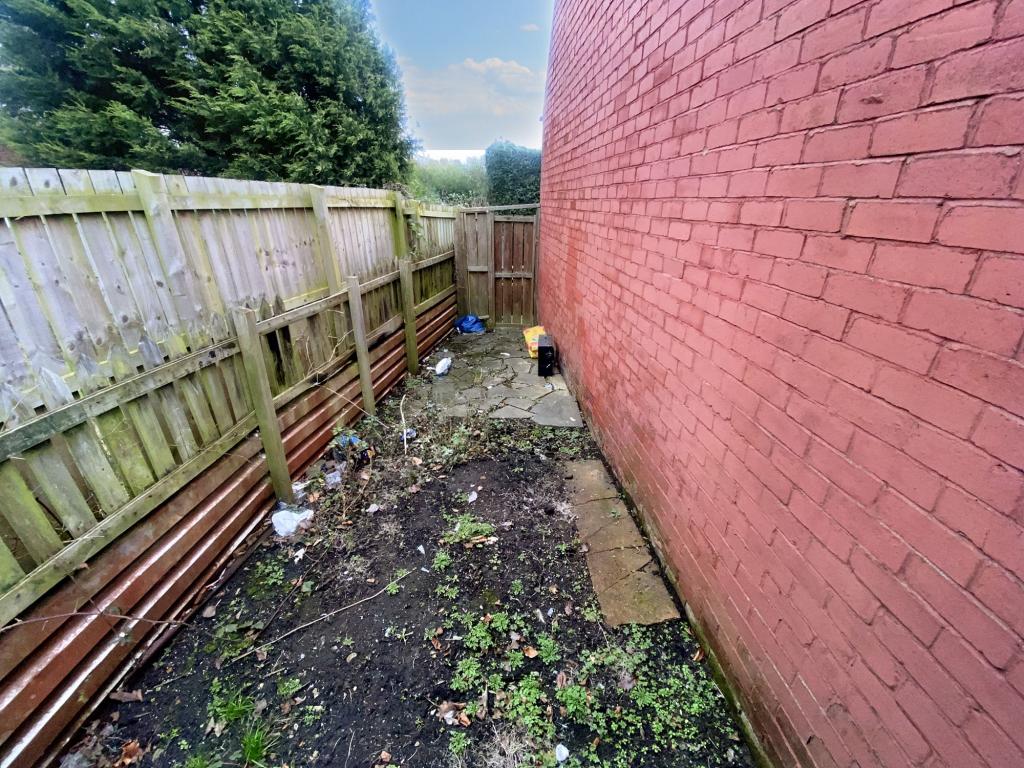
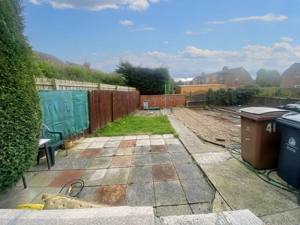
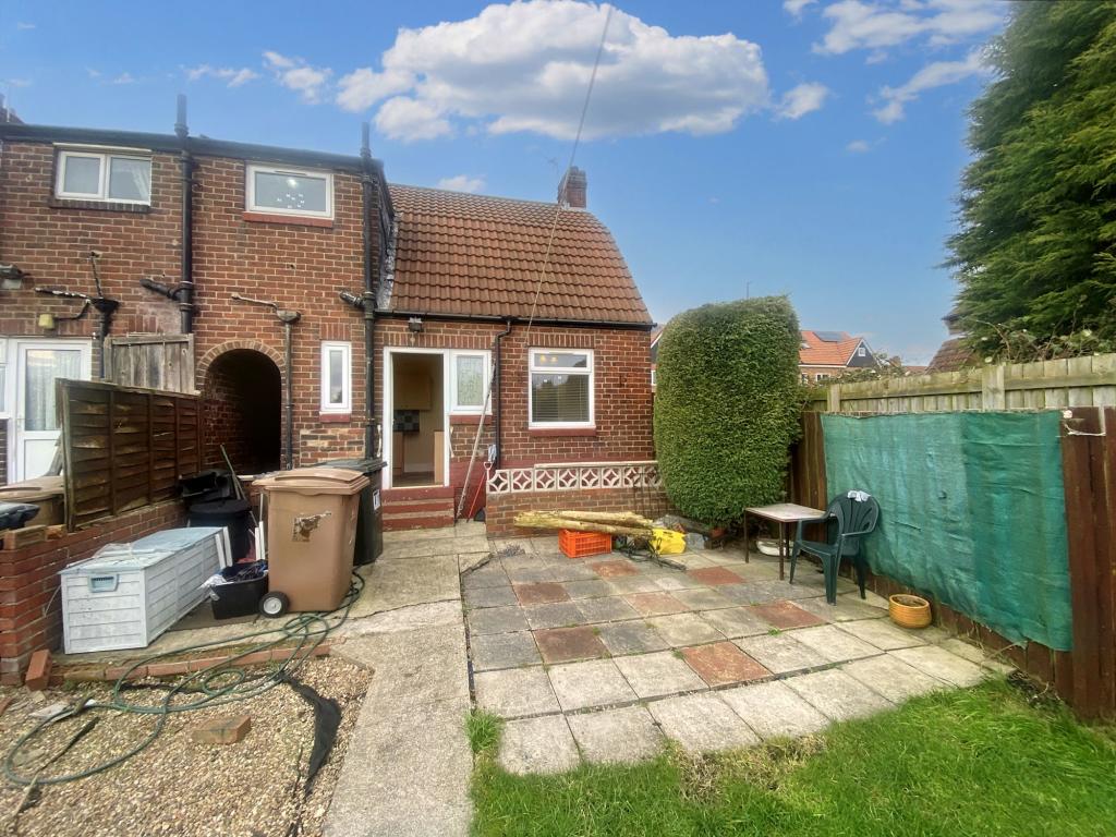
Photo 1 Photo 2 Photo 3 Photo 4 Photo 5 Photo 6 Photo 7 Photo 8 Photo 9 Photo 10 Photo 11 Photo 12 Photo 13 Photo 14 Photo 15
/ 15
Property details
Tenure
LEASEHOLD
Floor area
60 m²
Council tax band
A
Last sold
£80,000 Aug 2023
Local average
£333,681 (-76%)
Deprivation
Decile 3 (7,522 of 33,755)
Street crime
273 incidents within 1 mile (Apr 2026)
Key features
- No Upper Chain & Vacant Possession.
- One Bedroom Bungalow.
- Front, Side & Rear Gardens.
- Double Glazed & Central Heating.
- EPC - F
Additional details
- Heating
- Gas
- Parking
- On street
- Garden
- Yes
Description
Unique dorma style, one bedroom bungalow, with potential to extend. The property briefly comprises of entrance hall, open plan lounge and dining area, fitted kitchen. To the first floor the bedroom is spacious with a dorma window to the front and plenty of storage space. There is a bathroom. The accommodation features gas central heating via radiators, double glazing.
Externally there is a south facing, low maintenance garden which is mainly paved with additional space to the side. Positioned close to local amenities, schools, with great transport and road links. Essential viewing required.
To arrange a viewing email:-
36-degree Virtual Tour:
Council Tax Band: A
Tenure: Leasehold
Length Of Lease: 911
Listed by
Wallsend
Pattinson Estate Agents
Reference: 131443115
EPC Rating & Upgrade Cost
Fetching EPC data… Refresh this page in a moment.
Flood risk
Zone: 1
Risk: Low
Job (default Low)
Floorplans
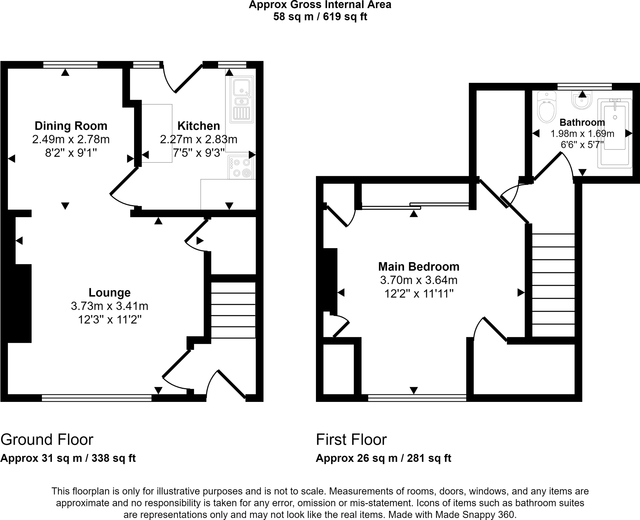
Floor Plan.
EPC Graphs
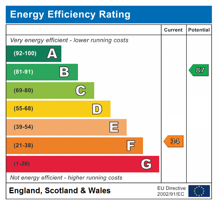
EPC
Price history
| Event | Date | Price | % change |
|---|---|---|---|
| Sold | 25/08/2023 (2 years ago) | £80,000 | — |
Source: HM Land Registry Price Paid Data. Crown copyright.
Sold Comparables
Same street and nearby sales within 0.25 miles (last 5 years). Data from Land Registry Price Paid.
| Address | Price | Date | Type |
|---|---|---|---|
| 42A MCNAMARA ROAD, WALLSEND, NORTH TYNESIDE, TYNE AND WEAR, NE28 7DY | £160,000 | 08/12/2023 | Detached |
| Same street 43 ARCHER STREET, WALLSEND, NORTH TYNESIDE, TYNE AND WEAR, NE28 7DL | £59,000 | 05/04/2023 | Terraced |
| THE PLANTATION CHURCHILL STREET, WALLSEND, NORTH TYNESIDE, TYNE AND WEAR, NE28 7TB | £400,000 | 28/10/2022 | Detached |
Street average: £59,000 (1 sale)
Area average: £280,000 (2 sales)
Capital growth trend
Land Registry outcode average: last 12 months vs 5y and 10y ago (from sold prices).
House Price Index (HM Land Registry — official index, not sold-price averages): North Tyneside. Series: Detached. As of March 2026.
Rental Range
Estimated market rent for North Tyneside. Low = conservative, Realistic = average, Optimistic = best case.
Based on Local Authority from postcode lookup → North Tyneside.
LHA (30th percentile) floor for Tyneside: £489/mo (Apr 2025 – Mar 2026)
Location
Nearby
Nearest stations, universities and amenities (distance from property).
| Type | Name | Distance |
|---|---|---|
| Bus stop | ARCHER STREET-EDWARD ROAD-E/B | 0.0 miles |
| Shop | Lifestyle Express | 0.0 miles |
| Bus stop | ARCHER STREET-SHAKESPEARE STREET-W/B | 0.1 miles |
| Shop | Diane's Mini Market | 0.1 miles |
| Train station | Hadrian Road | 0.5 miles |
| Train station | Howdon | 0.5 miles |
| Hospital | Sir GB Hunter Memorial Hospital | 1.0 miles |
| Hospital | Palmer Community Hospital | 1.3 miles |
| University | Northumbria University Coach Lane Campus | 2.6 miles |
| University | Henderson Hall | 2.6 miles |
Street-level crime
| Category | Count |
|---|---|
| Violence and sexual offences | 91 |
| Anti-social behaviour | 57 |
| Criminal damage and arson | 28 |
| Other theft | 20 |
| Public order | 19 |
| Shoplifting | 19 |
| Burglary | 10 |
| Drugs | 10 |
| Vehicle crime | 6 |
| Other crime | 5 |
| Theft from the person | 3 |
| Bicycle theft | 2 |
| Robbery | 2 |
| Possession of weapons | 1 |
| Total incidents | 273 |
Within 1 mile during Apr 2026. Source: data.police.uk (England & Wales).
Schools nearby
Nearest open schools with Ofsted ratings (England). Closed schools are not shown. Data from Get Information about Schools and Ofsted.
| Name | Type | Distance | Ofsted |
|---|---|---|---|
| Stephenson Memorial Primary School | Primary | 0.4 miles | Good — 12 Dec 2018 |
| Denbigh Community Primary School | Primary | 0.4 miles | Outstanding — 1 Nov 2013 |
| Wallsend St Peter's CofE Primary School | Primary | 0.4 miles | — (No rating) |
| Churchill Community College | Secondary | 0.5 miles | Inadequate — 26 Mar 2024 |
| St Aidan's Catholic Primary School, Wallsend | Primary | 0.5 miles | Good — 2 Oct 2014 |
Rental Comparables
Residential lets from OpenRent and Rightmove for the area (same bedroom count). Use to validate rent estimates. Student lets are excluded.
| Title | Rent | Beds | Distance | As seen on |
|---|---|---|---|---|
| Studio Flat, Tynemouth Road, NE28 | £550/mo | 1 | 0.67 miles | OpenRent |
| 1 Bed Flat, High Street East, NE28 | £550/mo | 1 | 0.72 miles | OpenRent |
Average rent: £550/mo (2 listings)
Rent-driven metrics
Based on OpenRent comparables.
- Rent ratio — Monthly rent ÷ purchase price (1% rule). 1%+ = strong, 0.8–1% = okay, <0.8% = weak for cashflow.
- Max investor price — Rent ÷ 0.8%; the price at which rent would be 0.8% of price (Stoke-style target).
- Target investor price — Rent ÷ 1%; the price at which rent would be 1% of price (strong cashflow band).
- Gross yield — Annual rent as % of purchase price (no costs).
- Cost-to-rent — Price ÷ annual rent (from OpenRent comparables). Under 14× = strong, 14–16× = acceptable, 17×+ = compressed.
- Cashflow — Rent minus mortgage, 10% maintenance, £25/mo compliance. Assumes 75% LTV, 3.95% APR (5yr fixed), 25yr term.
- ROI — Annual profit ÷ cash in (deposit + 4% purchase costs).