Sneyd Street
Stoke-on-Trent, ST6, ST6 2NY
£825 pcm
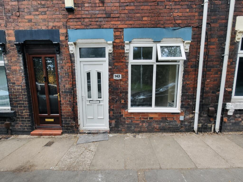
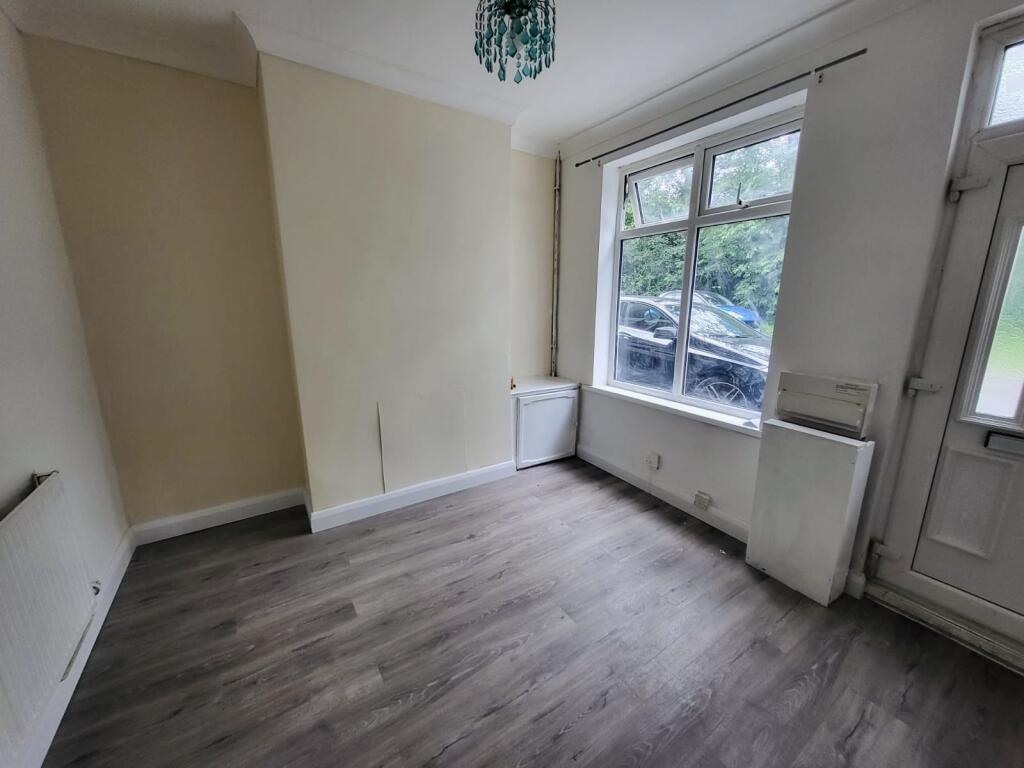
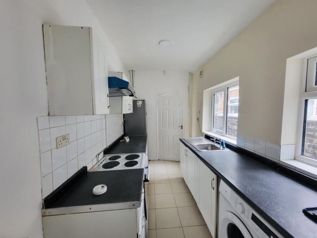
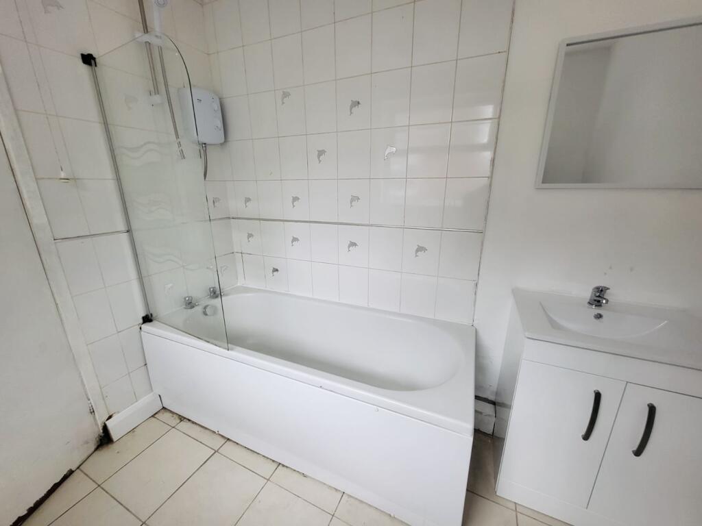
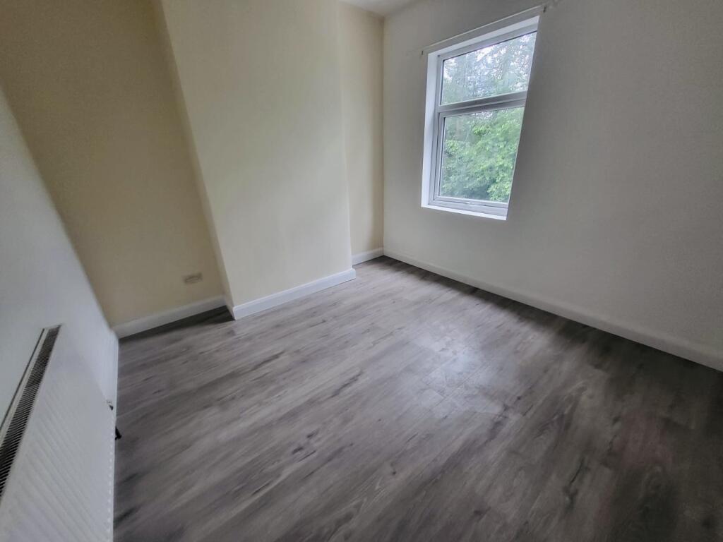
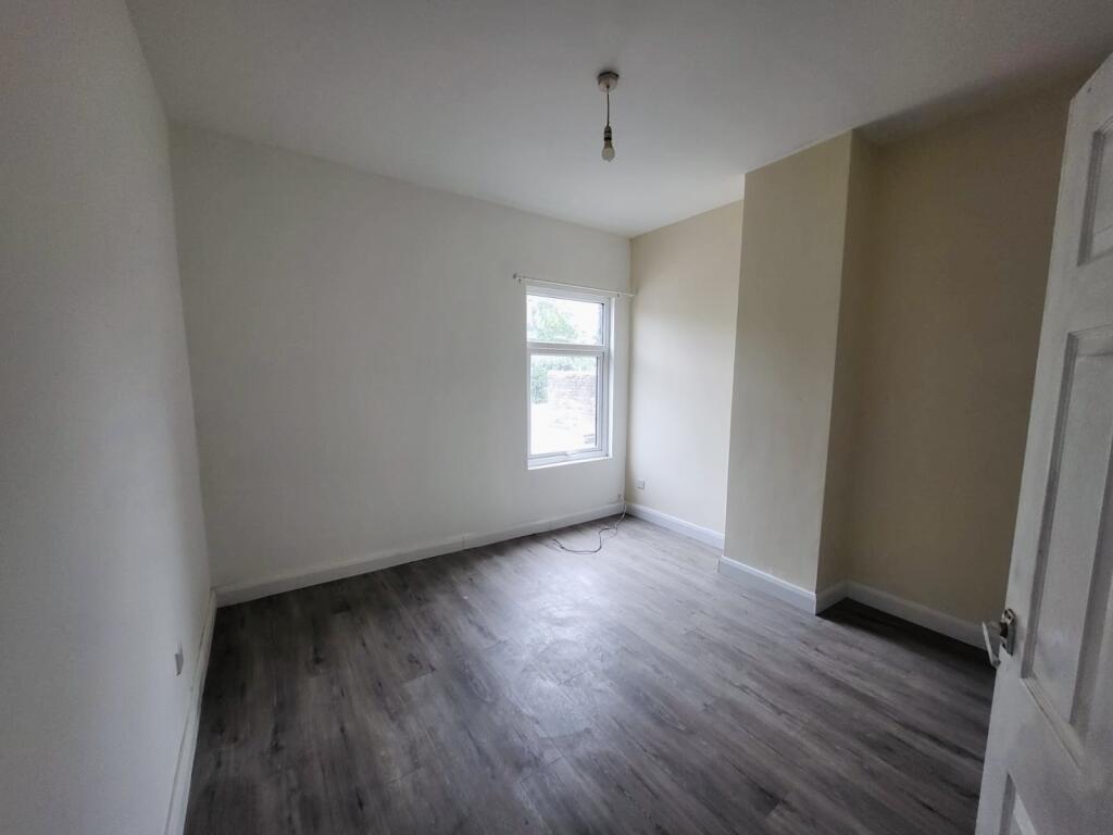
Photo 1 Photo 2 Photo 3 Photo 4 Photo 5 Photo 6
/ 6
Property details
Deprivation
Decile 1 (1,186 of 33,755)
Street crime
549 incidents within 1 mile (Apr 2026)
Key features
- Available Now
- Two Bedrooms
- Recently Redecorated Throughout
- Two Reception Rooms
- Family bathroom
Additional details
- Garden
- Yes
Description
Two-Bedroom Terraced Home – Cobridge, Stoke-on-Trent
This well-presented two-bedroom terraced property in the popular area of Cobridge offers comfortable and modern living, ideal for professionals, couples, or small families.
Recently redecorated throughout, the home boasts a fresh, neutral finish ready for immediate occupation.
The property benefits from full double glazing and gas central heating, ensuring warmth and energy efficiency all year round.
The accommodation comprises a welcoming living area, a well-proportioned kitchen, two good-sized bedrooms, and a family bathroom.
To the rear, you’ll find a private enclosed yard.
Conveniently located close to local amenities, transport links, and schools, this property offers both comfort and practicality.
Key Features:
Two bedrooms
Recently redecorated
Gas central heating
Double glazed throughout
Sought-after residential location
Early viewing is highly recommended to fully appreciate what this property has to offer. Council Tax Band: Holding Deposit: £190.00
Listed by
Newcastle Under Lyme
Countrywide UK Lettings - Connells
Reference: 90025311
EPC ratings on this postcode
We don't have a matched EPC for this property yet. Below are efficiency scores and details for other addresses on this postcode.
| Address | Current | Potential | Floor area | Age band | Type |
|---|---|---|---|---|---|
| 125, Sneyd Street, STOKE-ON-TRENT | 50 | 75 | 76 m² | England and Wales: before 1900 | Terraced |
| 127 Sneyd Street, STOKE-ON-TRENT | 68 | 86 | 75 m² | England and Wales: 1900-1929 | Terraced |
| 129 Sneyd Street, STOKE-ON-TRENT | 62 | 80 | 64 m² | England and Wales: 1900-1929 | Terraced |
| 131 Sneyd Street, STOKE-ON-TRENT | 61 | 83 | 66 m² | England and Wales: 1930-1949 | Terraced |
| 135 Sneyd Street, STOKE-ON-TRENT | 75 | 87 | 77 m² | England and Wales: 1900-1929 | Terraced |
| 135, Sneyd Street, STOKE-ON-TRENT | 62 | 88 | 66 m² | England and Wales: before 1900 | Terraced |
| 137, Sneyd Street, STOKE-ON-TRENT | 57 | 80 | 67 m² | England and Wales: 1900-1929 | Terraced |
| 139, Sneyd Street, STOKE-ON-TRENT | 70 | 89 | 64 m² | England and Wales: before 1900 | Terraced |
| 139, Sneyd Street, STOKE-ON-TRENT | 54 | 78 | 65 m² | England and Wales: 1900-1929 | Terraced |
| 143 Sneyd Street, STOKE-ON-TRENT | 76 | 81 | 68 m² | England and Wales: 1900-1929 | Terraced |
| 143, Sneyd Street, STOKE-ON-TRENT | 67 | 87 | 67 m² | England and Wales: before 1900 | Terraced |
| 145 Sneyd Street, STOKE-ON-TRENT | 48 | 87 | 65 m² | England and Wales: 1900-1929 | Terraced |
| 151 Sneyd Street, STOKE-ON-TRENT | 71 | 89 | 66 m² | England and Wales: before 1900 | Terraced |
| 155 SNEYD STREET, STOKE-ON-TRENT, STOKE-ON-TRENT | 67 | 87 | 66 m² | England and Wales: 1900-1929 | Terraced |
| 157 SNEYD STREET, STOKE-ON-TRENT, STOKE-ON-TRENT | 52 | 85 | 62 m² | England and Wales: 1900-1929 | Terraced |
Flood risk
Zone: 1
Risk: Low
Job (default Low)
Rental Range
Estimated market rent for Stoke-on-Trent. Low = conservative, Realistic = average, Optimistic = best case.
Based on Local Authority from postcode lookup → Stoke-on-Trent.
LHA (30th percentile) floor for Staffordshire North: £479/mo (Apr 2025 – Mar 2026)
Location
Address
Sneyd Street
Nearby
Nearest stations, universities and amenities (distance from property).
| Type | Name | Distance |
|---|---|---|
| Shop | Beverley's News | 0.3 miles |
| Bus stop | Unknown | 0.3 miles |
| Shop | Costcutter | 0.4 miles |
| Hospital | Haywood Hospital Walk-in Centre | 1.4 miles |
| Train station | Longport | 1.6 miles |
| Train station | Stoke-on-Trent | 2.0 miles |
| University | University of Staffordshire Stoke Campus | 2.0 miles |
| Hospital | Royal Stoke University Hospital | 2.7 miles |
| University | Buxton & Leek College | 8.1 miles |
Street-level crime
| Category | Count |
|---|---|
| Violence and sexual offences | 144 |
| Anti-social behaviour | 124 |
| Shoplifting | 69 |
| Public order | 55 |
| Other theft | 29 |
| Vehicle crime | 29 |
| Criminal damage and arson | 25 |
| Burglary | 21 |
| Drugs | 14 |
| Robbery | 13 |
| Other crime | 8 |
| Possession of weapons | 8 |
| Bicycle theft | 7 |
| Theft from the person | 3 |
| Total incidents | 549 |
Within 1 mile during Apr 2026. Source: data.police.uk (England & Wales).
Schools nearby
Nearest open schools with Ofsted ratings (England). Closed schools are not shown. Data from Get Information about Schools and Ofsted.
| Name | Type | Distance | Ofsted |
|---|---|---|---|
| Sneyd Academy | Primary | 0.2 miles | Good — 1 Aug 2023 |
| Forest Park Primary School | Primary | 0.3 miles | Good — 4 Jul 2013 |
| North Road Academy | Other | 0.4 miles | Requires improvement — 2 Apr 2023 |
| St Peter's Catholic Academy | Primary | 0.4 miles | — (Inspected (no overall grade)) |
| Hamilton Academy | Primary | 0.5 miles | Good — 23 Oct 2014 |
Rental Comparables
Residential lets from OpenRent and Rightmove for the area (same bedroom count). Use to validate rent estimates. Student lets are excluded.
Average rent: £733/mo (36 listings)
Enter House Number
Enter the house number to help us retrieve more accurate pricing history and property data.
Please log in to submit or correct the house number for this listing.
Log in to continue