22 BUCCLEUCH ROAD
STOKE-ON-TRENT, STOKE-ON-TRENT ST3 4RF
£750 pcm
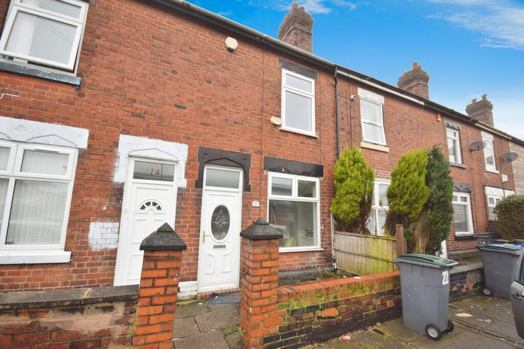
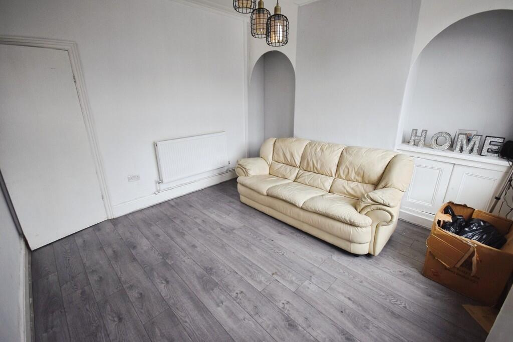
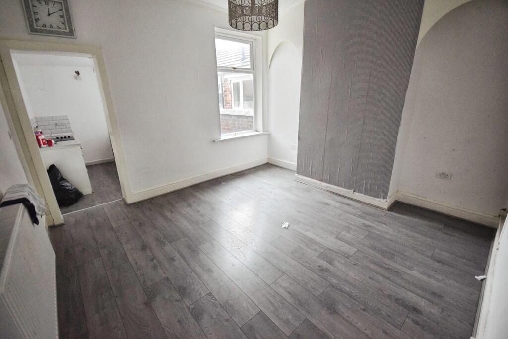
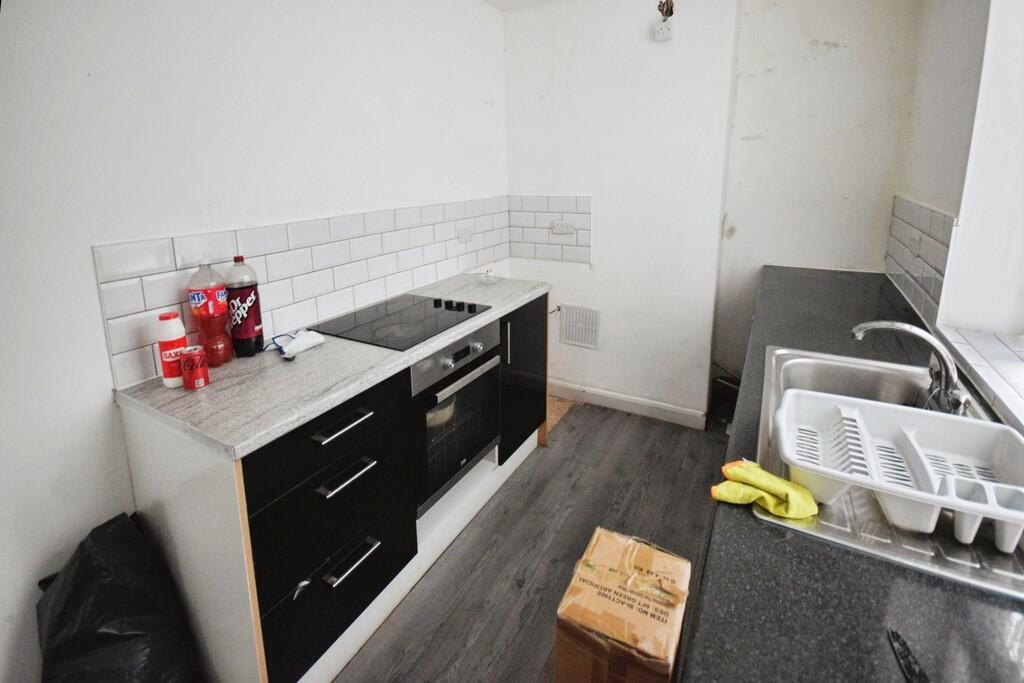
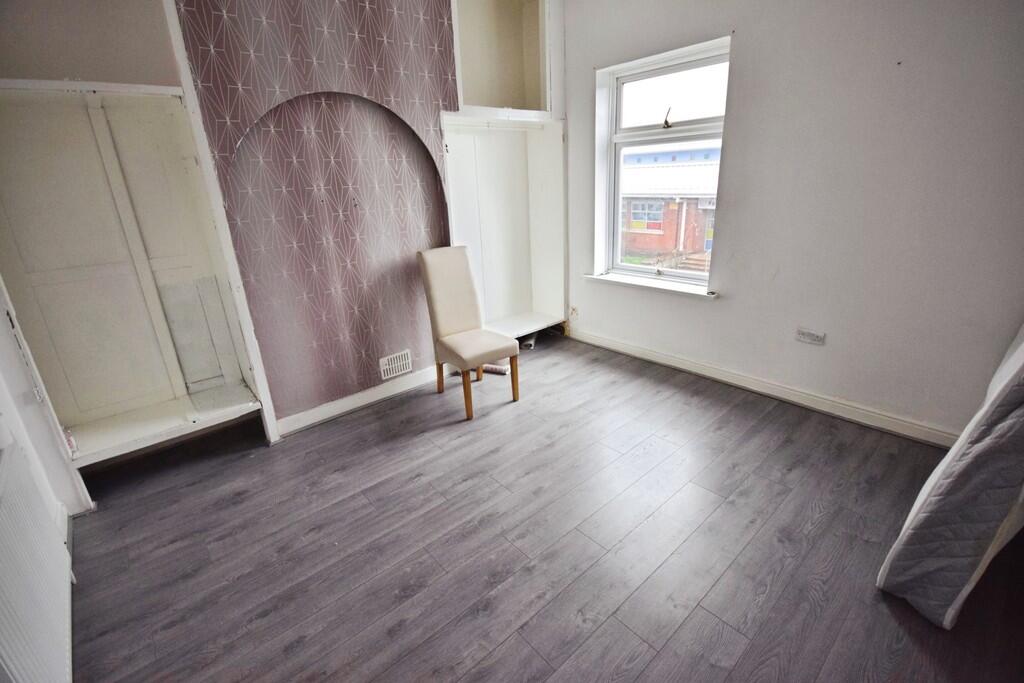
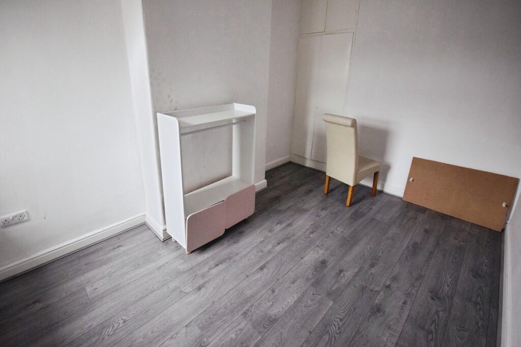
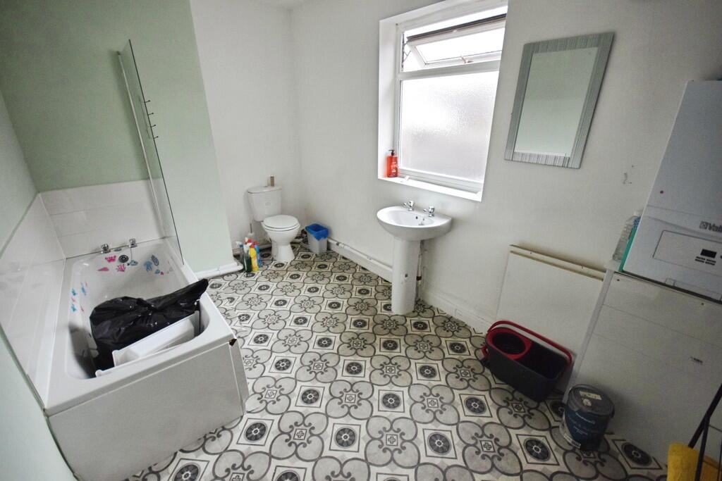
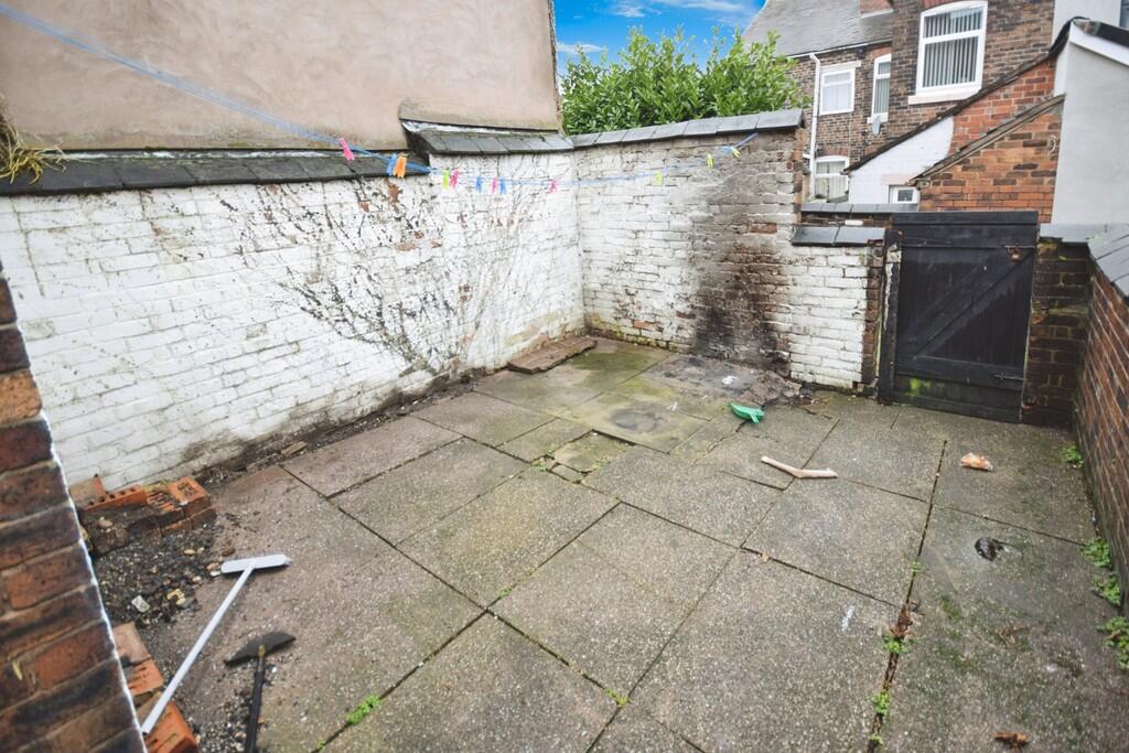
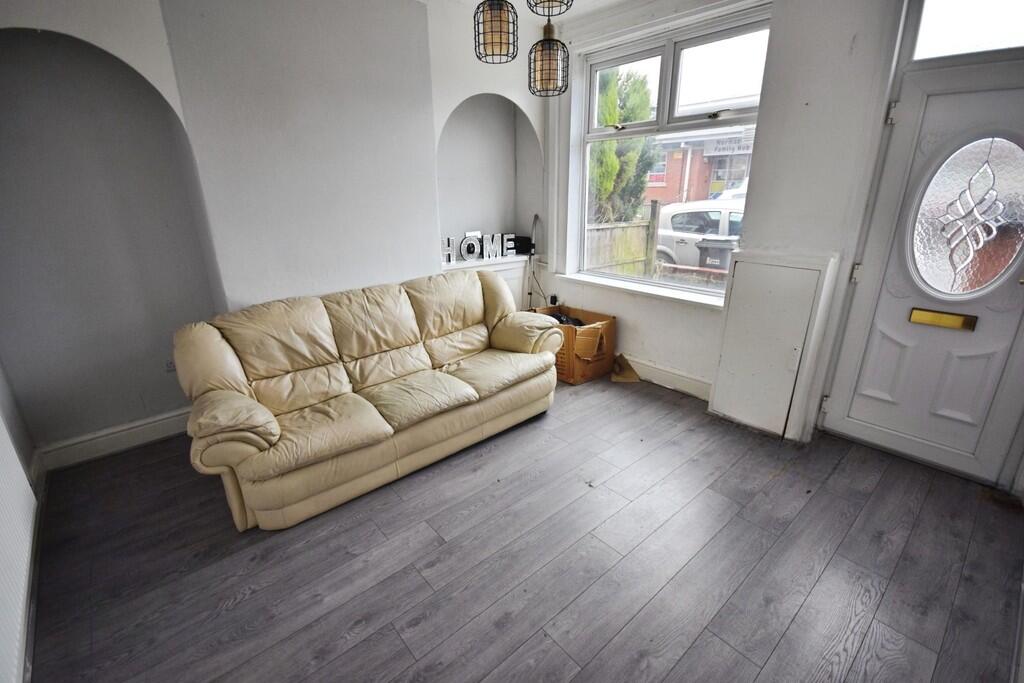
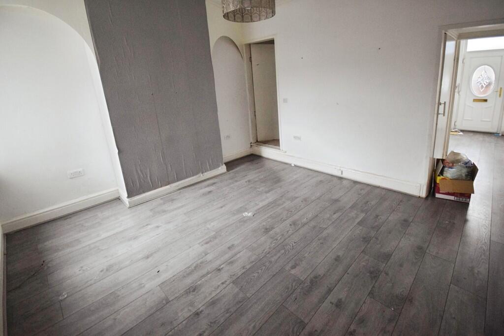
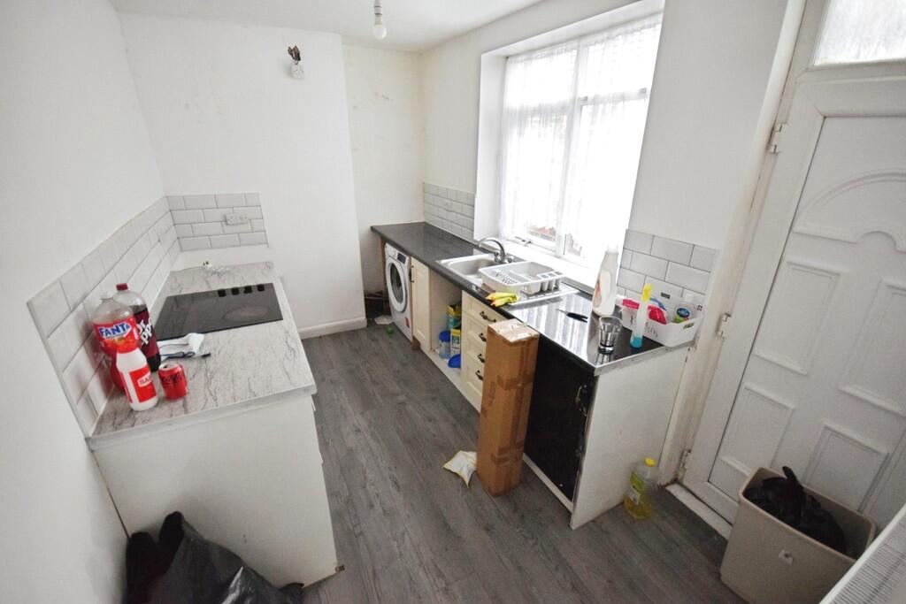
Photo 1 Photo 2 Photo 3 Photo 4 Photo 5 Photo 6 Photo 7 Photo 8 Photo 9 Photo 10 Photo 11
/ 11
Property details
Floor area
81 m²
Council tax band
A
EPC rating
D
Year built
England and Wales: before 1900
Deprivation
Decile 1 (2,414 of 33,755)
Street crime
316 incidents within 1 mile (May 2026)
Key features
- Mid terraced house
- 2 Reception rooms
- Kitchen
- 2 Double bedrooms
- Bathroom
- Rear garden
- Close to Longton town centre
Additional details
- Garden
- Yes
Description
FRONT RECEPTION ROOM Laminate floor, double glazed window to front, radiator.
REAR RECEPTION ROOM Laminate floor, double glazed window to rear, radiator.
KITCHEN Range of base cupboards with working surface, sink unit, oven and hob. double glazed window and door to rear
BEDROOM 1 Laminate floor, double glazed window to front, radiator.
BEDROOM 2 Laminate floor, double glazed window to rear, radiator.
BATHROOM Panelled bath, Wc, wash hand basin, double glazed window to rear, radiator
OURSIDE ** Garden area to rear
Listed by
Stoke On Trent
The Property Franchise Group
Reference: 171097400
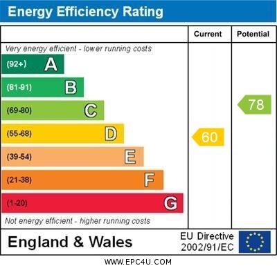
EPC Rating & Upgrade Cost
Current rating: D
Potential rating: C
Inspection date: 12/02/2023
Expiry date: 11/02/2033
Current heating cost: £809/year
Potential heating cost: £662/year
Est. upgrade cost to C: £19,500
Recommendations
- 50 mm internal or external wall insulation (£4,000 - £14,000)
- Floor insulation (suspended floor) (£800 - £1,200)
- Solar water heating (£4,000 - £6,000)
- Solar photovoltaic panels, 2.5 kWp (£3,500 - £5,500)
Flood risk
Zone: 1
Risk: Low
Job (default Low)
EPC Graphs
EPC 1
Rental Range
Estimated market rent for Stoke-on-Trent. Low = conservative, Realistic = average, Optimistic = best case.
Based on Local Authority from postcode lookup → Stoke-on-Trent.
LHA (30th percentile) floor for Staffordshire North: £479/mo (Apr 2025 – Mar 2026)
Location
Nearby
Nearest stations, universities and amenities (distance from property).
| Type | Name | Distance |
|---|---|---|
| Shop | Prime Express | 0.0 miles |
| Shop | Cappers | 0.1 miles |
| Bus stop | The Dunrobin | 0.2 miles |
| Bus stop | St James' Church | 0.4 miles |
| Train station | Longton | 0.8 miles |
| Train station | Caverswall Road | 2.5 miles |
| Hospital | Royal Stoke University Hospital | 4.0 miles |
| Hospital | North Staffordshire Nuffield Hospital | 4.1 miles |
| University | Keele University | 6.2 miles |
| University | Buxton & Leek College | 9.7 miles |
Street-level crime
| Category | Count |
|---|---|
| Violence and sexual offences | 116 |
| Anti-social behaviour | 66 |
| Public order | 37 |
| Other theft | 24 |
| Shoplifting | 17 |
| Criminal damage and arson | 14 |
| Burglary | 13 |
| Drugs | 7 |
| Vehicle crime | 7 |
| Robbery | 5 |
| Bicycle theft | 4 |
| Possession of weapons | 3 |
| Other crime | 2 |
| Theft from the person | 1 |
| Total incidents | 316 |
Within 1 mile during May 2026. Source: data.police.uk (England & Wales).
Schools nearby
Nearest open schools with Ofsted ratings (England). Closed schools are not shown. Data from Get Information about Schools and Ofsted.
| Name | Type | Distance | Ofsted |
|---|---|---|---|
| Alexandra Infants' School | Primary | 0.3 miles | Requires improvement — 22 Jan 2023 |
| Belgrave St Bartholomew's Academy | Primary | 0.3 miles | Outstanding — 5 May 2017 |
| Intuition Holistic Education | Other | 0.4 miles | Good — 17 Jan 2023 |
| Alexandra Junior School | Primary | 0.5 miles | Good — 15 Jan 2023 |
| St Gregory's Catholic Academy | Primary | 0.6 miles | Outstanding — 12 Jan 2017 |
Rental Comparables
Residential lets from OpenRent and Rightmove for the area (same bedroom count). Use to validate rent estimates. Student lets are excluded.
| Title | Rent | Beds | Distance | As seen on |
|---|---|---|---|---|
| Buccleuch Road, Dresdon, Stoke-on-Trent | £750/mo | 2 | 0 miles | Rightmove |
| Uttoxeter Road, Stoke-on-trent | £750/mo | 2 | 0.25 miles | Rightmove |
| Belgrave Road,Dresden, Stoke-on-Trent | £725/mo | 2 | 0.27 miles | Rightmove |
| Tatton Street, Stoke-on-Trent, ST3 | £725/mo | 2 | 0.3 miles | Rightmove |
| Ayreshire Grove, Lightwood | £900/mo | 2 | 0.37 miles | Rightmove |
| Althrop Grove, Longton, Stoke-on-Trent | £825/mo | 2 | 0.46 miles | Rightmove |
| Thirlmere Grove, Weston Coyney | £950/mo | 2 | 0.47 miles | Rightmove |
| The Strand, Stoke-On-Trent, Staffordshire, ST3 | £550/mo | — | 0.58 miles | Rightmove |
| The Strand, Stoke-On-Trent, Staffordshire, ST3 | £795/mo | 2 | 0.58 miles | Rightmove |
| Greendock Street, Stoke-on-trent | £750/mo | 2 | 0.75 miles | Rightmove |
| Cornwall Street, Stoke-On-Trent | £750/mo | 2 | 0.85 miles | Rightmove |
| Priorfield Close, Longton, Stoke-On-Trent, ST3 | £900/mo | 2 | 0.9 miles | Rightmove |
| Harington Drive, Stoke-On-Trent, ST3 | £950/mo | 2 | 0.98 miles | Rightmove |
Average rent: £794/mo (13 listings)