Seven Sisters Lane
Ollerton, WA16, WA16 8RL
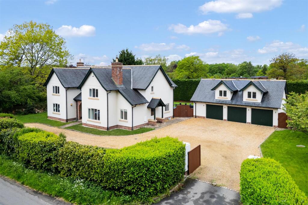
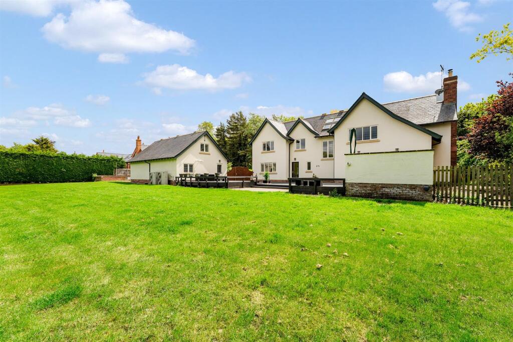
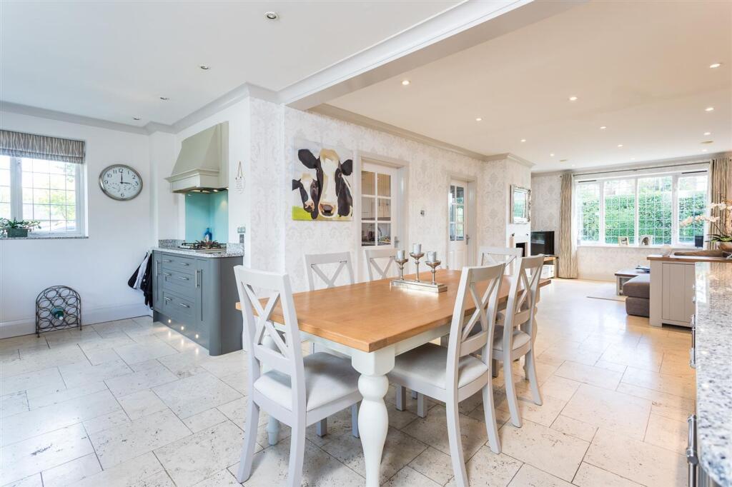
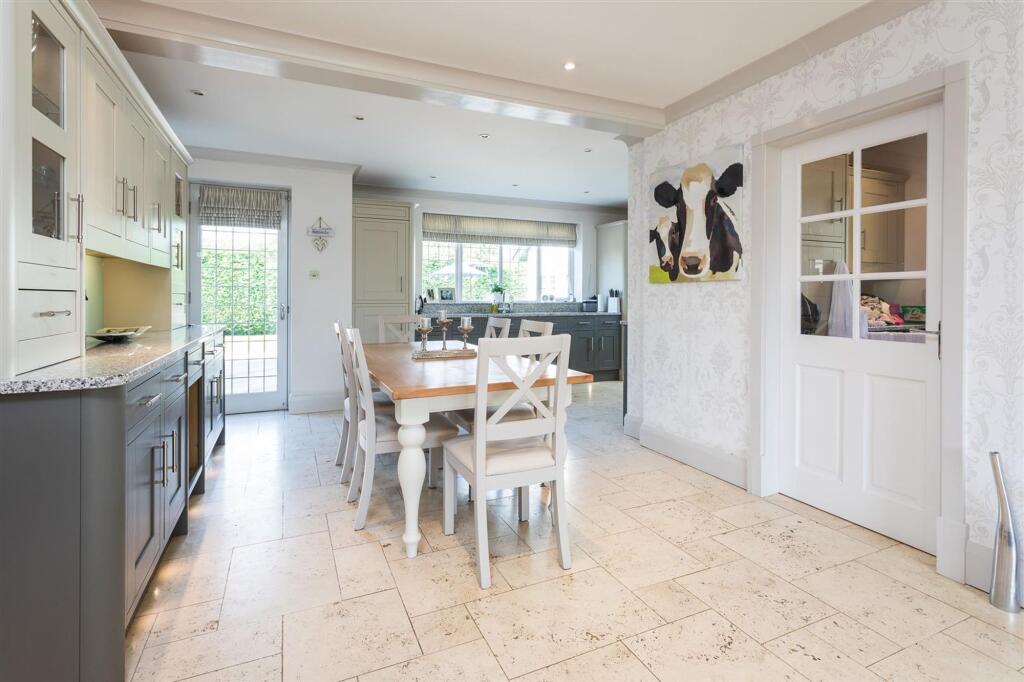
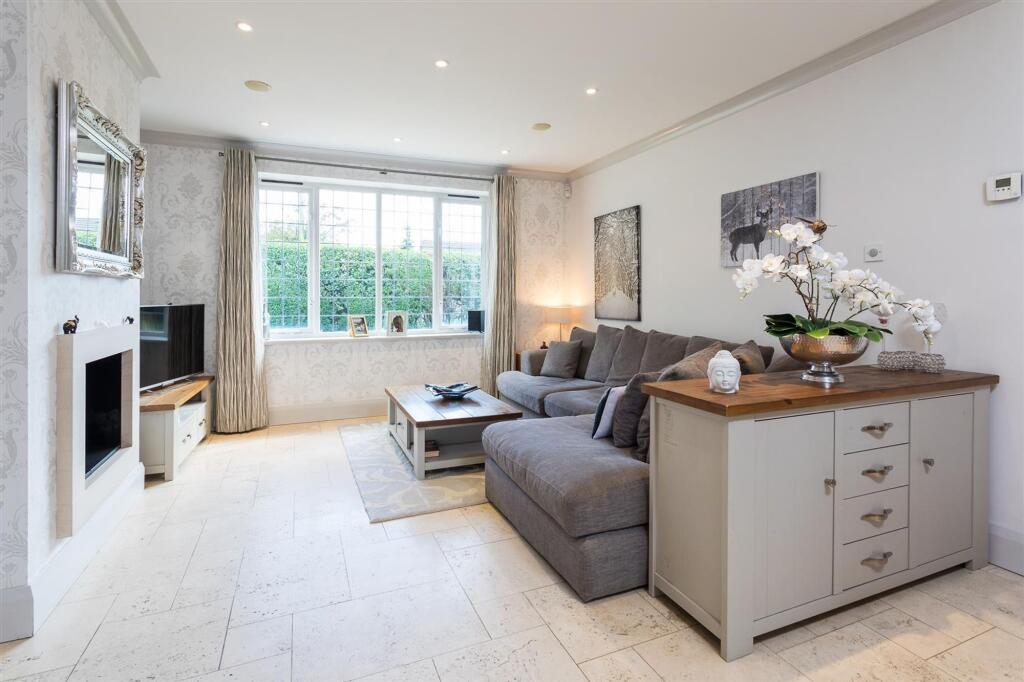
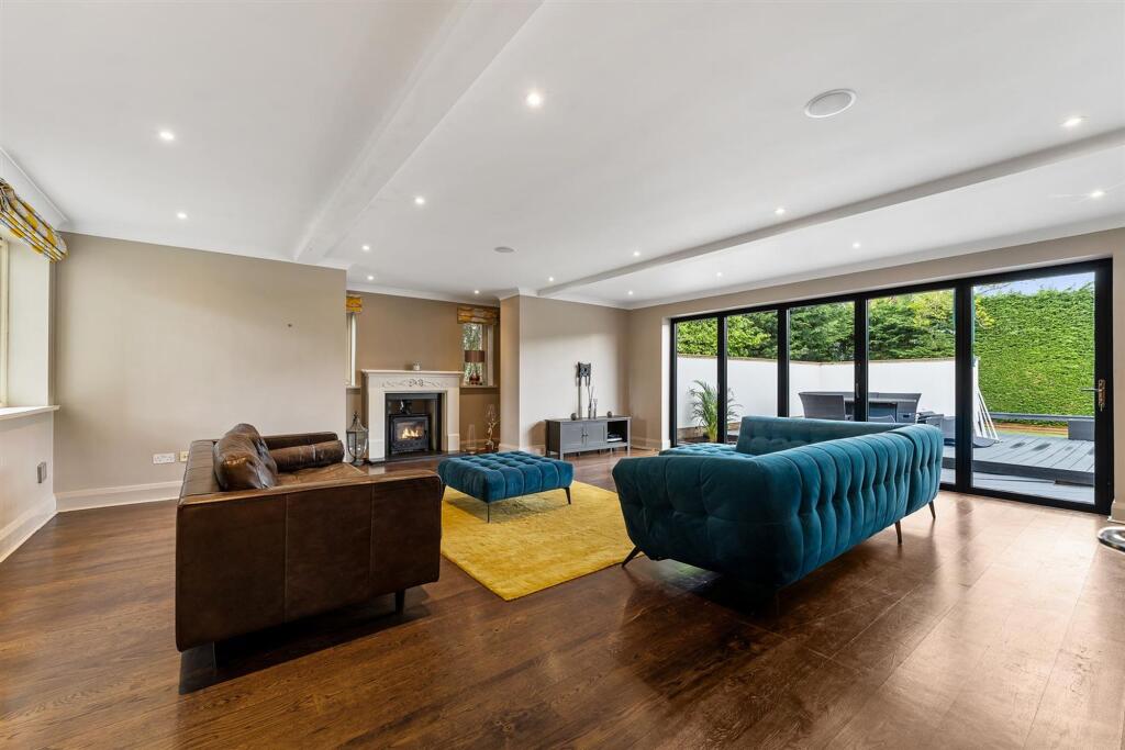
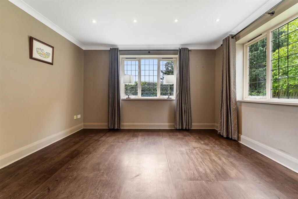
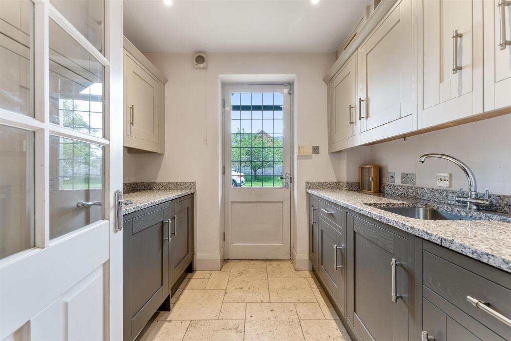
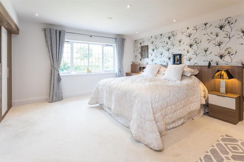
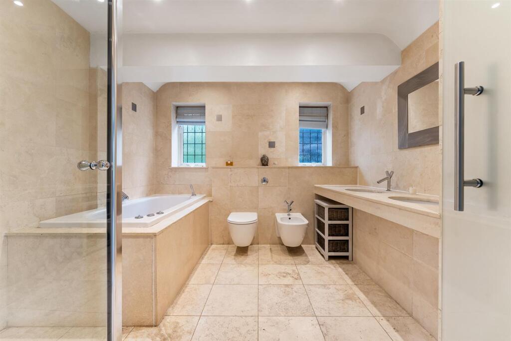
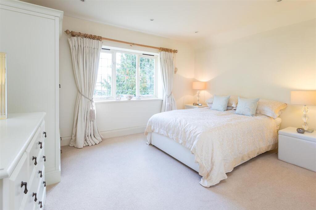
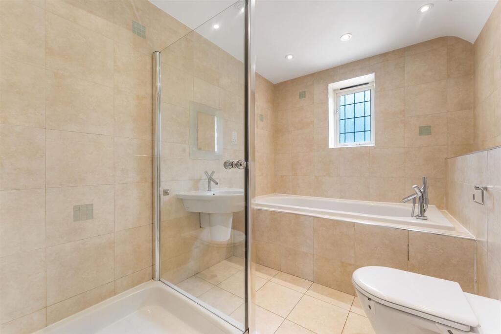
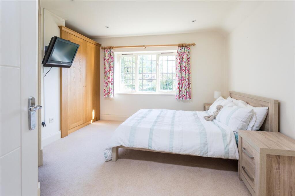
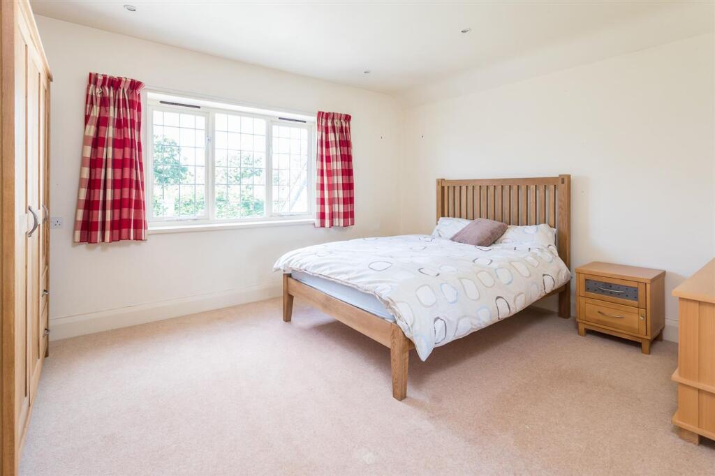
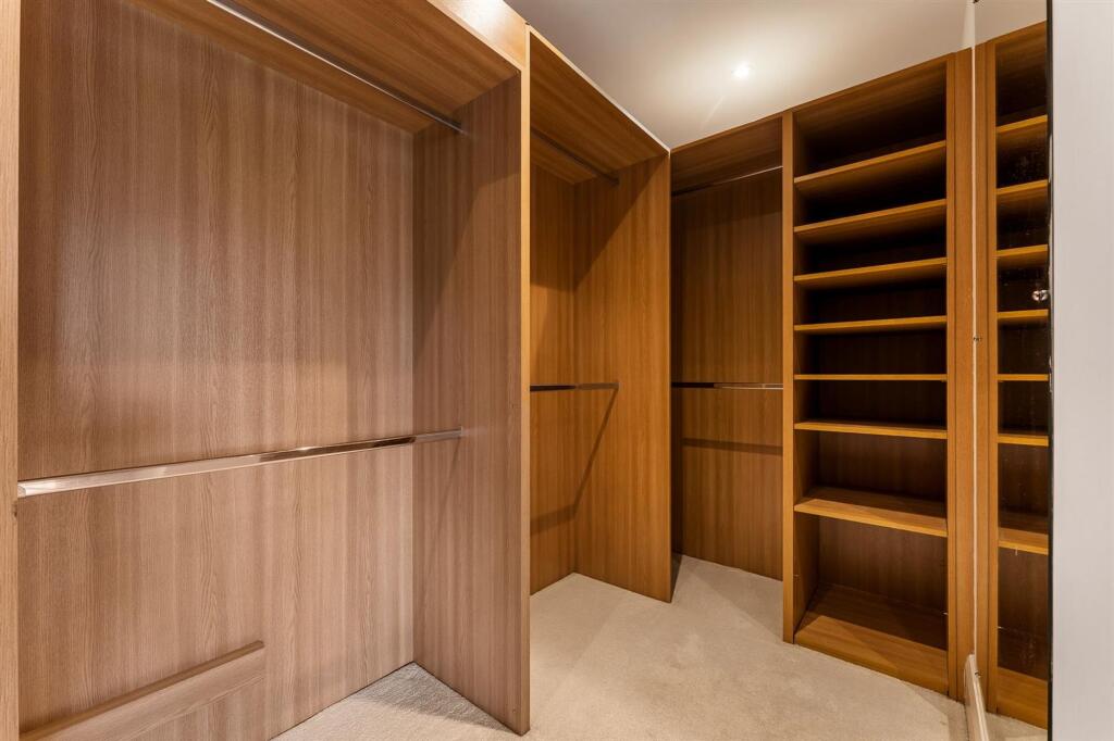
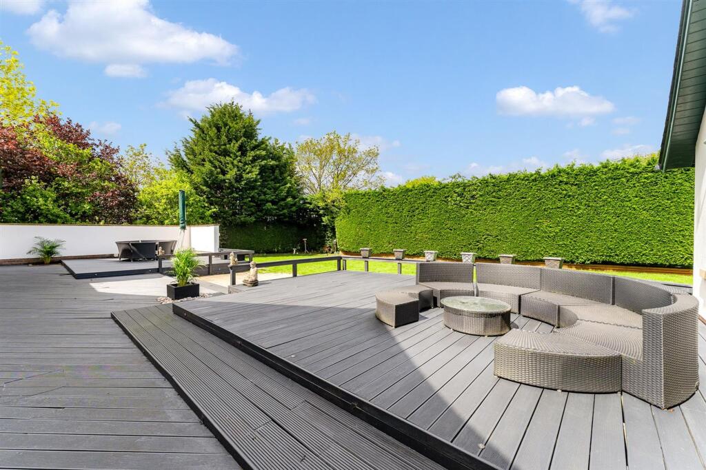
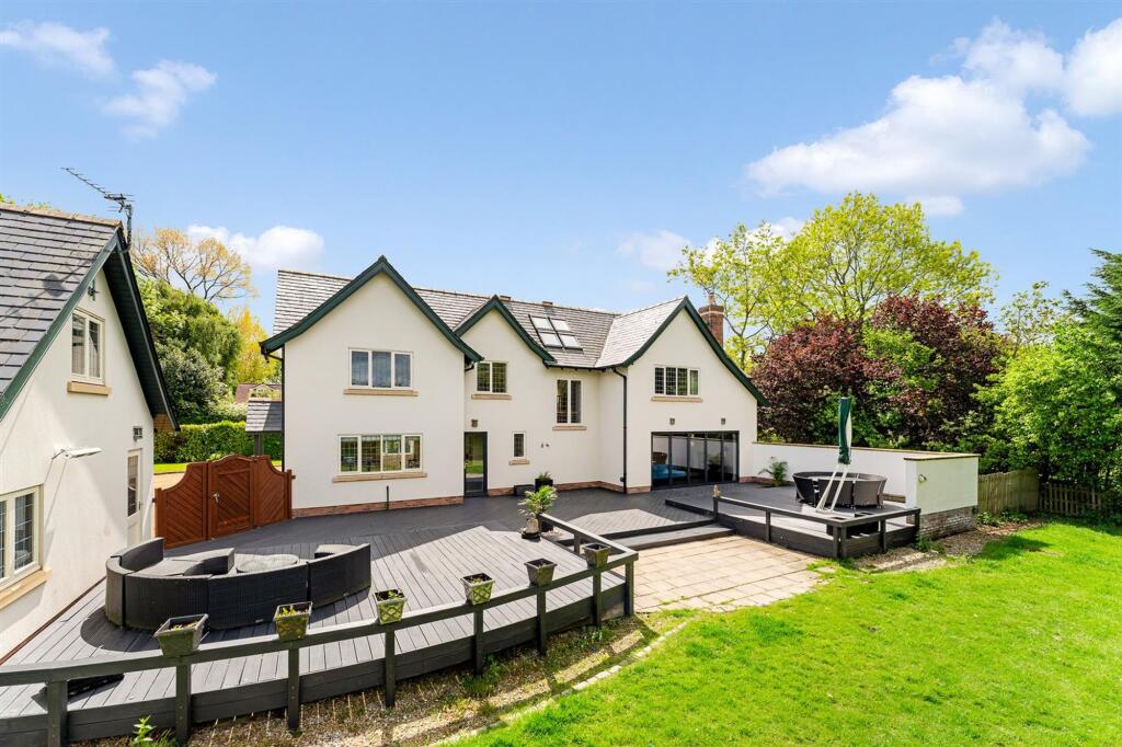
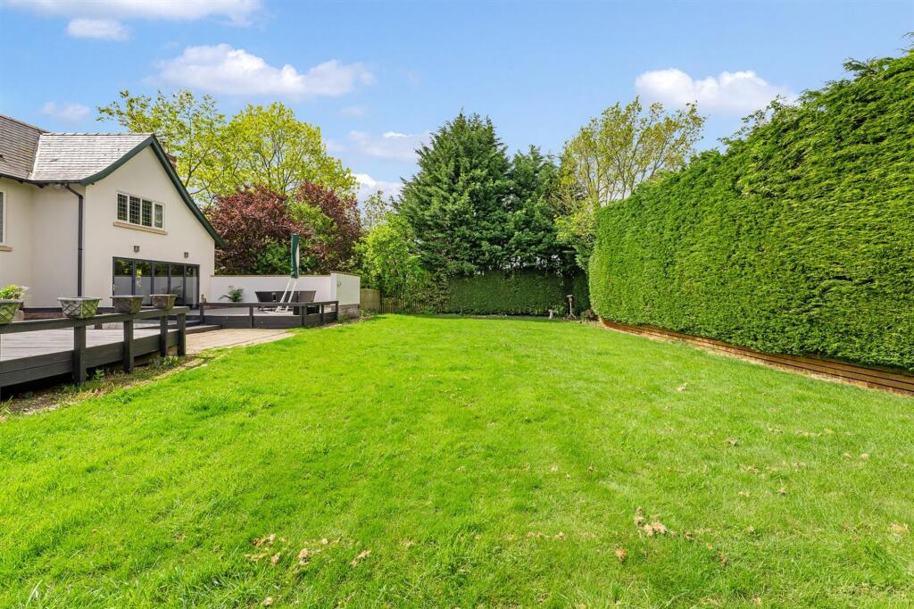
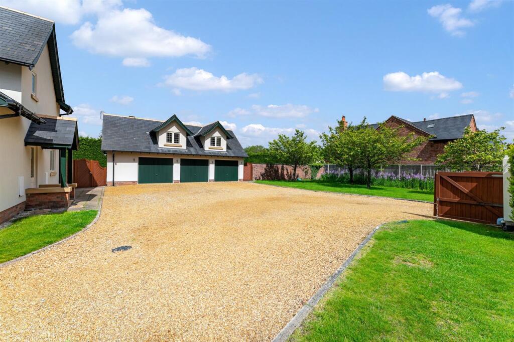
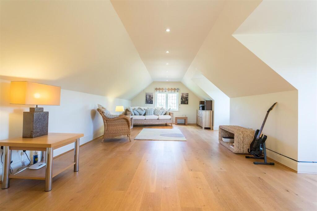
Photo 1 Photo 2 Photo 3 Photo 4 Photo 5 Photo 6 Photo 7 Photo 8 Photo 9 Photo 10 Photo 11 Photo 12 Photo 13 Photo 14 Photo 15 Photo 16 Photo 17 Photo 18 Photo 19 Photo 20
/ 20
Property details
Local average
£827,200 (+68.6%)
Deprivation
Decile 6 (18,873 of 33,755)
Street crime
1 incident within 1 mile (Apr 2026)
Key features
- Impressive individual country house.
- Constructed in 2002.
- High quality fittings throughout.
- Well balanced family accommodation to over 4,000 sq ft.
- Wonderful semi-rural location.
Additional details
- Parking
- Yes
- Garden
- Yes
- Listed property
- No
- Restrictions
- No
- Required access
- No
- Rights of way
- No
- Flooded in last 5 years
- No
- Flood defences
- No
Description
EPC Rating: E
Listed by
Alderley Edge
Mosley Jarman
Reference: 89814888
EPC ratings on this postcode
We don't have a matched EPC for this property yet. Below are efficiency scores and details for other addresses on this postcode.
| Address | Current | Potential | Floor area | Age band | Type |
|---|---|---|---|---|---|
| 1 Nursery View, Seven Sisters Lane, Ollerton | 44 | 52 | 75 m² | England and Wales: before 1900 | House |
| 1 Ollerton Oak Grove, Seven Sisters Lane, Ollerton | 86 | 97 | 92 m² | 2021 | House |
| 1 Ollerton Oak Grove, Seven Sisters Lane, Ollerton, Knutsford | 86 | 97 | 92 m² | — | Detached |
| 2 Ollerton Oak Grove, Seven Sisters Lane, Ollerton | 87 | 96 | 110 m² | 2021 | House |
| 2 Ollerton Oak Grove, Seven Sisters Lane, Ollerton, Knutsford | 87 | 96 | 110 m² | — | Detached |
| MANOR LEA, SEVEN SISTERS LANE, OLLERTON | 49 | 60 | 202 m² | England and Wales: 1950-1966 | House |
| MANOR LEA, SEVEN SISTERS LANE, OLLERTON | 17 | 68 | 223 m² | England and Wales: 1950-1966 | House |
| Manor Lea, Seven Sisters Lane, Ollerton | 9 | 35 | 202 m² | England and Wales: 1967-1975 | Bungalow |
| Manor Lea, Seven Sisters Lane, Ollerton, KNUTSFORD | 9 | 35 | 202 m² | England and Wales: 1967-1975 | Detached |
| MANOR LEA, SEVEN SISTERS LANE, OLLERTON, OLLERTON | 49 | 60 | 202 m² | England and Wales: 1950-1966 | Detached |
| MANOR LEA, SEVEN SISTERS LANE, OLLERTON, OLLERTON | 17 | 68 | 223 m² | England and Wales: 1950-1966 | Detached |
| Marston, Seven Sisters Lane, Ollerton | 48 | 54 | 295 m² | England and Wales: 2003-2006 | House |
| Marston, Seven Sisters Lane, Ollerton | 40 | 52 | 328 m² | England and Wales: 1996-2002 | House |
| Marston, Seven Sisters Lane, Ollerton, KNUTSFORD | 48 | 54 | 295 m² | England and Wales: 2003-2006 | Detached |
| Marston, Seven Sisters Lane, Ollerton, KNUTSFORD | 40 | 52 | 328 m² | England and Wales: 1996-2002 | Detached |
Flood risk
Zone: 1
Risk: Low
Job (default Low)
Floorplans
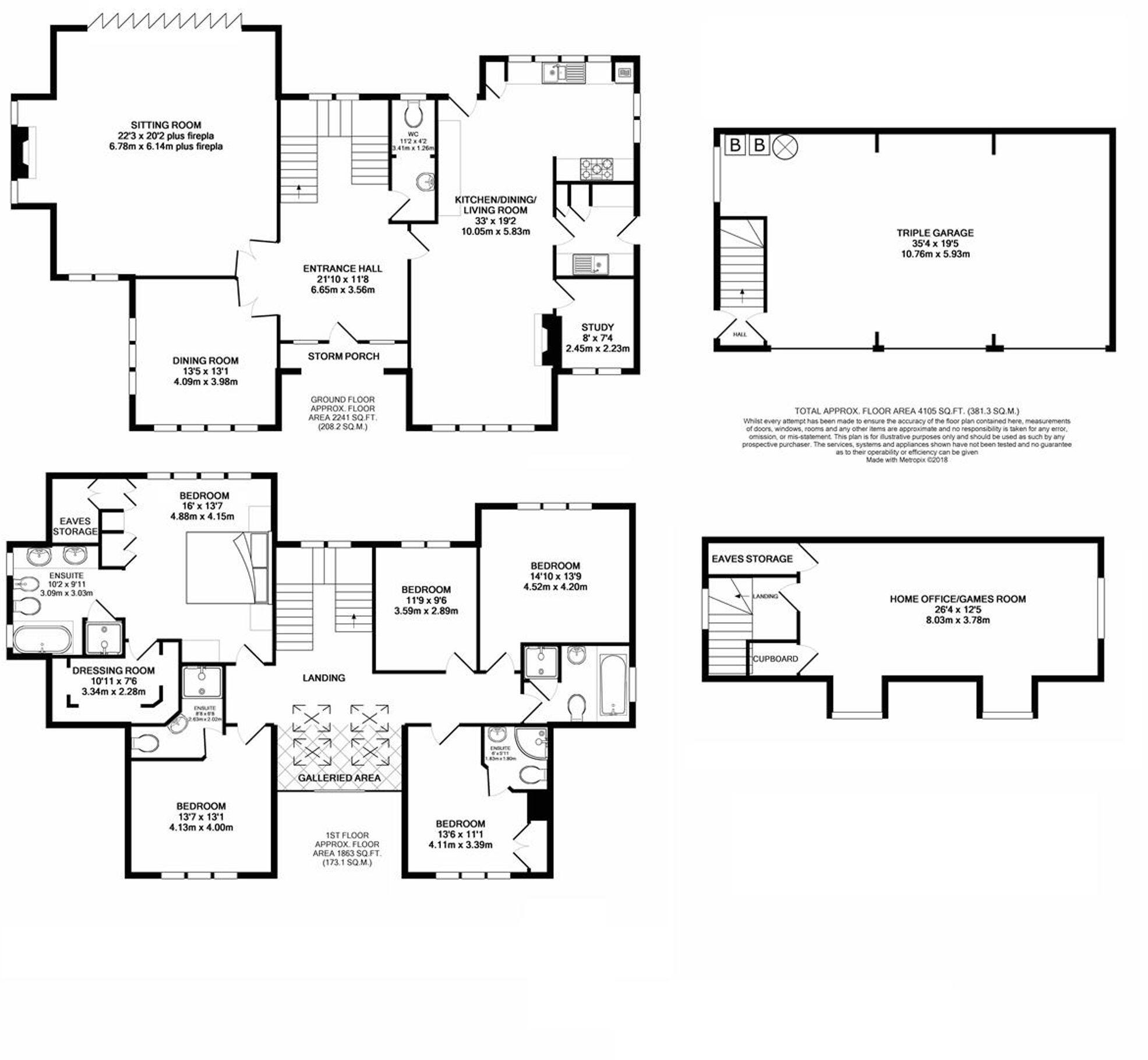
Floorplan 1
EPC Graphs
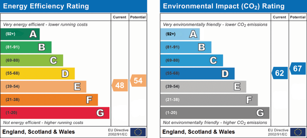
EPC 1
Price history
| Event | Date | Price | % change |
|---|---|---|---|
| Listed for sale | — | £1,395,000 | — |
Source: HM Land Registry Price Paid Data. Crown copyright.
Sold Comparables
Same street and nearby sales within 0.25 miles (last 5 years). Data from Land Registry Price Paid.
| Address | Price | Date | Type |
|---|---|---|---|
| Same street TALL GABLES SEVEN SISTERS LANE, OLLERTON, KNUTSFORD, CHESHIRE EAST, WA16 8RL | £1,030,000 | 08/05/2025 | Detached |
| Same street BLACKWOOD HOUSE SEVEN SISTERS LANE, OLLERTON, KNUTSFORD, CHESHIRE EAST, WA16 8RL | £1,275,000 | 19/07/2024 | Detached |
Street average: £1,152,500 (2 sales)
Capital growth trend
Land Registry outcode average: last 12 months vs 5y and 10y ago (from sold prices).
House Price Index (HM Land Registry — official index, not sold-price averages): Cheshire East. Series: All dwelling types. As of March 2026.
Rental Range
Estimated market rent for Cheshire East. Low = conservative, Realistic = average, Optimistic = best case.
Based on Local Authority from postcode lookup → Cheshire East.
LHA (30th percentile) floor for East Lancs: £793/mo (Apr 2025 – Mar 2026)
Location
Address
Seven Sisters Lane
Nearby
Nearest stations, universities and amenities (distance from property).
| Type | Name | Distance |
|---|---|---|
| Bus stop | Ollerton, Chelford Road / Seven Sisters Lane | 0.1 miles |
| Shop | Asda Express | 1.3 miles |
| Shop | Unknown | 1.6 miles |
| Train station | Knutsford | 1.7 miles |
| Train station | Chelford | 2.6 miles |
| Hospital | Altrincham Hospital | 6.8 miles |
| Hospital | Altrincham Health and Wellbeing Centre | 7.0 miles |
Street-level crime
| Category | Count |
|---|---|
| Violence and sexual offences | 1 |
| Total incidents | 1 |
Within 1 mile during Apr 2026. Source: data.police.uk (England & Wales).
Schools nearby
Nearest open schools with Ofsted ratings (England). Closed schools are not shown. Data from Get Information about Schools and Ofsted.
| Name | Type | Distance | Ofsted |
|---|---|---|---|
| St Vincent De Paul Catholic Primary School | Primary | 1.4 miles | Good — 6 Jun 2013 |
| Adelaide Heath Academy | Other | 1.5 miles | Good — 24 Jul 2024 |
| Manor Park Primary School and Nursery | Primary | 1.6 miles | Good — 13 Sep 2023 |
| Bexton Primary School | Primary | 1.7 miles | Good — 5 Mar 2018 |
| Egerton Primary School | Primary | 2.0 miles | Good — 13 Feb 2023 |
Rental Comparables
Loading rental comparables for this postcode. Refresh in a few minutes.
Rent-driven metrics
Based on Area rent estimate.
- Rent ratio — Monthly rent ÷ purchase price (1% rule). 1%+ = strong, 0.8–1% = okay, <0.8% = weak for cashflow.
- Max investor price — Rent ÷ 0.8%; the price at which rent would be 0.8% of price (Stoke-style target).
- Target investor price — Rent ÷ 1%; the price at which rent would be 1% of price (strong cashflow band).
- Gross yield — Annual rent as % of purchase price (no costs).
Enter House Number
Enter the house number to help us retrieve more accurate pricing history and property data.
Please log in to submit or correct the house number for this listing.
Log in to continue