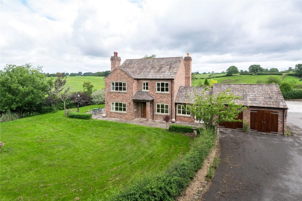
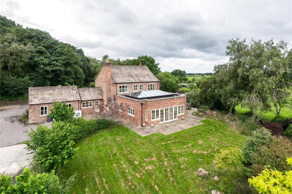
Marton Lane
Gawsworth, Macclesfield, Cheshire, SK11, SK11 9EU
Property details
Tenure
FREEHOLD
Council tax band
F
Local average
£576,512 (+59.6%)
Deprivation
Decile 8 (26,718 of 33,755)
Street crime
0 incidents within 1 mile (May 2026)
Additional details
- Electricity
- Mains supply
- Water
- Mains supply
- Sewerage
- Private supply
- Heating
- Solar, Air source heat pump, Underfloor heating
- Parking
- Garage, Driveway
- Listed property
- No
- Restrictions
- Yes
- Required access
- No
Description
The property is subject to an agricultural occupancy condition.
Listed by
Alderley Edge
Jackson-Stops & Staff
Reference: 171598949
EPC ratings on this postcode
We don't have a matched EPC for this property yet. Below are efficiency scores and details for other addresses on this postcode.
| Address | Current | Potential | Floor area | Age band | Type |
|---|---|---|---|---|---|
| Ashwood, Marton Lane, Gawsworth | 72 | 92 | 197 m² | England and Wales: 1930-1949 | House |
| Ashwood, Marton Lane, Gawsworth | 64 | 68 | 155 m² | England and Wales: 1930-1949 | House |
| Ashwood, Marton Lane, Gawsworth, MACCLESFIELD | 72 | 92 | 197 m² | England and Wales: 1930-1949 | Detached |
| Ashwood, Marton Lane, Gawsworth, MACCLESFIELD | 64 | 68 | 155 m² | England and Wales: 1930-1949 | Detached |
| Lane Ends Farm, Marton Lane, Gawsworth | 6 | 69 | 139 m² | England and Wales: before 1900 | House |
| Lane Ends Farm, Marton Lane, Gawsworth, MACCLESFIELD | 64 | 70 | 138 m² | England and Wales: before 1900 | Detached |
| Lane Ends Farm, Marton Lane, Gawsworth, MACCLESFIELD | 6 | 69 | 139 m² | England and Wales: before 1900 | Detached |
| New Venture Farm, Marton Lane, Gawsworth | 78 | 84 | 288 m² | England and Wales: 2012 onwards | House |
| New Venture Farm, Marton Lane, Gawsworth | 73 | 73 | 165 m² | — | House |
| New Venture Farm, Marton Lane, Gawsworth, MACCLESFIELD | 78 | 84 | 288 m² | England and Wales: 2012 onwards | Detached |
| New Venture Farm, Marton Lane, Gawsworth, MACCLESFIELD | 73 | 73 | 165 m² | — | Detached |
| Parkmount, Marton Lane, Gawsworth | 15 | 79 | 100 m² | England and Wales: 1930-1949 | House |
| Parkmount, Marton Lane, Gawsworth, MACCLESFIELD | 15 | 79 | 100 m² | England and Wales: 1930-1949 | Detached |
| Poachers Cottage, Marton Lane, Gawsworth | 55 | 67 | 152 m² | England and Wales: 1930-1949 | House |
| Poachers Cottage, Marton Lane, Gawsworth, MACCLESFIELD | 55 | 67 | 167 m² | — | Detached |
Flood risk
Zone: 1
Risk: Low
Job (default Low)
EPC Graphs
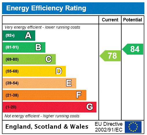
EPC Rating Graph
Price history
| Event | Date | Price | % change |
|---|---|---|---|
| Listed for sale | — | £920,000 | — |
Source: HM Land Registry Price Paid Data. Crown copyright.
Sold Comparables
Same street and nearby sales within 0.25 miles (last 5 years). Data from Land Registry Price Paid.
| Address | Price | Date | Type |
|---|---|---|---|
| 6 EDGEWAY, HENBURY, MACCLESFIELD, CHESHIRE EAST, SK11 9PA | £665,000 | 09/01/2026 | Detached |
| 30 CHAPEL CROFT, CHELFORD, MACCLESFIELD, CHESHIRE EAST, SK11 9SU | £567,000 | 10/12/2025 | Detached |
| 19 TOWNFIELD PLACE, CHELFORD, MACCLESFIELD, CHESHIRE EAST, SK11 9GG | £392,000 | 28/11/2025 | Detached |
| 5 WOODFIN CROFT, CHELFORD, MACCLESFIELD, CHESHIRE EAST, SK11 9SN | £740,000 | 25/11/2025 | Detached |
| 24B DIXON DRIVE, CHELFORD, MACCLESFIELD, CHESHIRE EAST, SK11 9BU | £550,000 | 24/11/2025 | Detached |
| 22 DIXON DRIVE, CHELFORD, MACCLESFIELD, CHESHIRE EAST, SK11 9BU | £691,000 | 12/11/2025 | Detached |
| 11 BURNT ACRE, CHELFORD, MACCLESFIELD, CHESHIRE EAST, SK11 9SS | £475,000 | 06/10/2025 | Detached |
| WEST VIEW CONGLETON ROAD, GAWSWORTH, MACCLESFIELD, CHESHIRE EAST, SK11 9RR | £400,000 | 12/09/2025 | Detached |
| ST. JAMES CHURCH LANE, GAWSWORTH, MACCLESFIELD, CHESHIRE EAST, SK11 9QY | £600,000 | 13/06/2025 | Detached |
| GORSEY KNOWL COTTAGE CHAPEL LANE, LOWER WITHINGTON, MACCLESFIELD, CHESHIRE EAST, SK11 9DE | £2,214,000 | 25/04/2025 | Detached |
| DICKLOW COB FARM DICKLOW COB, LOWER WITHINGTON, MACCLESFIELD, CHESHIRE EAST, SK11 9EA | £1,850,000 | 27/03/2025 | Detached |
| CLAY HILL FARM WHITECROFT HEATH ROAD, LOWER WITHINGTON, MACCLESFIELD, CHESHIRE EAST, SK11 9DF | £1,300,000 | 14/01/2025 | Detached |
| 20 SOUTH VIEW AVENUE, GAWSWORTH, MACCLESFIELD, CHESHIRE EAST, SK11 9RZ | £700,000 | 06/11/2024 | Detached |
| 28 CHURCH LANE, HENBURY, MACCLESFIELD, CHESHIRE EAST, SK11 9NN | £705,000 | 30/08/2024 | Detached |
| 4 HEYS GREEN DRIVE, HENBURY, MACCLESFIELD, CHESHIRE EAST, SK11 9GD | £1,210,000 | 06/08/2024 | Detached |
| 8 SOUTH VIEW AVENUE, GAWSWORTH, MACCLESFIELD, CHESHIRE EAST, SK11 9RZ | £700,000 | 17/06/2024 | Detached |
| 9 HEYS GREEN DRIVE, HENBURY, MACCLESFIELD, CHESHIRE EAST, SK11 9GD | £1,195,000 | 06/06/2024 | Detached |
| KEEPERS COTTAGE WHITECROFT HEATH ROAD, LOWER WITHINGTON, MACCLESFIELD, CHESHIRE EAST, SK11 9DF | £2,100,000 | 30/05/2024 | Detached |
| BEECH COTTAGE CHURCH LANE, HENBURY, MACCLESFIELD, CHESHIRE EAST, SK11 9NN | £480,000 | 11/03/2024 | Detached |
| 39 ASHCROFT DRIVE, CHELFORD, MACCLESFIELD, CHESHIRE EAST, SK11 9GF | £474,995 | 22/12/2023 | Detached |
Area average: £900,450 (20 sales)
Capital growth trend
Land Registry outcode average: last 12 months vs 5y and 10y ago (from sold prices).
House Price Index (HM Land Registry — official index, not sold-price averages): Cheshire East. Series: Detached. As of April 2026.
Rental Range
Estimated market rent for Cheshire East. Low = conservative, Realistic = average, Optimistic = best case.
Based on Local Authority from postcode lookup → Cheshire East.
LHA (30th percentile) floor for East Cheshire: £1,745/mo (Apr 2025 – Mar 2026)
Location
Address
Marton Lane
Nearby
Nearest stations, universities and amenities (distance from property).
| Type | Name | Distance |
|---|---|---|
| Bus stop | Gawsworth, Dark lane / South View Avenue | 0.4 miles |
| Bus stop | Gawsworth, Congleton Road / Methodist Church | 0.5 miles |
| Shop | Anne White | 1.8 miles |
| Shop | Bargain Booze | 1.8 miles |
| Hospital | Rosemount Resource Centre | 2.5 miles |
| Hospital | Macclesfield District General Hospital | 2.7 miles |
| Train station | Macclesfield | 3.2 miles |
| Train station | Prestbury | 4.5 miles |
| University | Tovell Building, Buxton & Leek College | 10.8 miles |
| University | Buxton & Leek College | 10.8 miles |
Street-level crime
| Category | Count |
|---|---|
| Total incidents | 0 |
Within 1 mile during May 2026. Source: data.police.uk (England & Wales).
Schools nearby
Nearest open schools with Ofsted ratings (England). Closed schools are not shown. Data from Get Information about Schools and Ofsted.
| Name | Type | Distance | Ofsted |
|---|---|---|---|
| Gawsworth Primary School | Primary | 0.7 miles | Good — 27 Feb 2012 |
| Ivy Bank Primary School | Primary | 1.8 miles | Good — 27 Mar 2018 |
| Eden School | Other | 1.9 miles | Good — 10 Mar 2024 |
| Broken Cross Primary Academy and Nursery | Primary | 2.0 miles | Good — 17 Jun 2019 |
| Marton and District CofE Aided Primary School | Primary | 2.1 miles | Good — 18 Jul 2017 |
Rental Comparables
Residential lets from OpenRent and Rightmove for the area (same bedroom count). Use to validate rent estimates. Student lets are excluded.
| Title | Rent | Beds | Distance | As seen on |
|---|---|---|---|---|
| Siddington, Macclesfield, Cheshire | £2,750/mo | 4 | 3.08 miles | Rightmove |
Average rent: £2,750/mo (1 listing)
Rent-driven metrics
Based on OpenRent comparables.
- Rent ratio — Monthly rent ÷ purchase price (1% rule). 1%+ = strong, 0.8–1% = okay, <0.8% = weak for cashflow.
- Max investor price — Rent ÷ 0.8%; the price at which rent would be 0.8% of price (Stoke-style target).
- Target investor price — Rent ÷ 1%; the price at which rent would be 1% of price (strong cashflow band).
- Gross yield — Annual rent as % of purchase price (no costs).
- Cost-to-rent — Price ÷ annual rent (from OpenRent comparables). Under 14× = strong, 14–16× = acceptable, 17×+ = compressed.
- Cashflow — Rent minus mortgage, 10% maintenance, £25/mo compliance. Assumes 75% LTV, 3.95% APR (5yr fixed), 25yr term.
- ROI — Annual profit ÷ cash in (deposit + 4% purchase costs).
Enter House Number
Enter the house number to help us retrieve more accurate pricing history and property data.
Please log in to submit or correct the house number for this listing.
Log in to continue