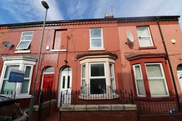
27 WRENBURY STREET
LIVERPOOL, MERSEYSIDE L7 2PU
Property details
Floor area
78 m²
Deprivation
Decile 1 (2,756 of 33,755)
Street crime
645 incidents within 1 mile (Apr 2026)
Description
Abode are delighted to bring this, two-bedroom partly furnished house for let. perfect for small family or couples seeking a welcoming home.
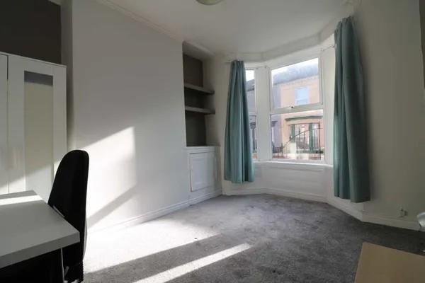
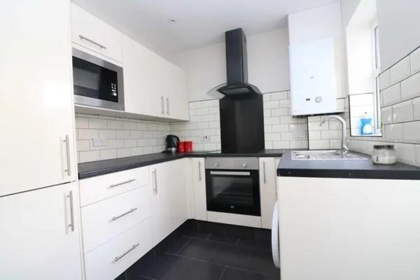
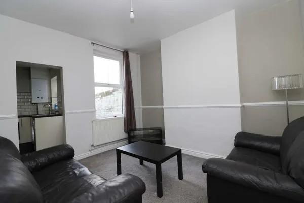
To the ground floor there are two reception rooms, living aera with leather sofa and coffee table, dining room with table and chairs & kitchen with built in appliances including fridge freezer, oven & hob and washing machine
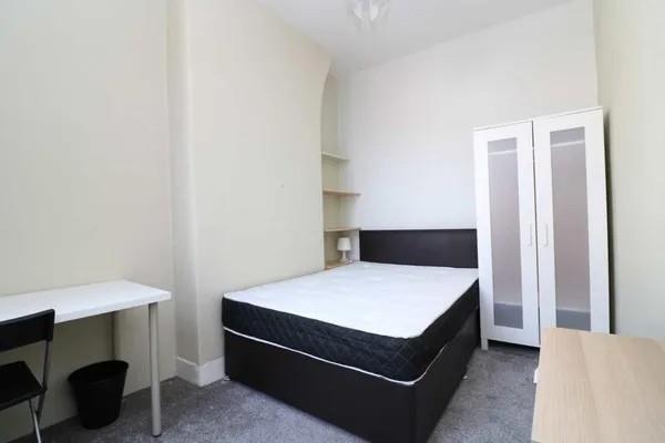
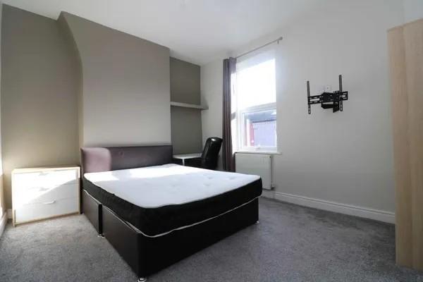
To the top floor their 2 bedrooms both include double beds and mattress's and wardrobes and family bathroom.
The property is situated in a friendly neighbourhood, with local amenities and parks nearby, making it an ideal location for families.
Do not miss the chance to make this house your home.
Listed by
Allerton
Abode Group (NW) Ltd
Reference: 173562296
EPC Rating & Upgrade Cost
Fetching EPC data… Refresh this page in a moment.
Flood risk
Zone: 1
Risk: Low
Job (default Low)
Rental Range
Estimated market rent for Liverpool. Low = conservative, Realistic = average, Optimistic = best case.
Based on Local Authority from postcode lookup → Liverpool.
LHA (30th percentile) floor for Greater Liverpool: £593/mo (Apr 2025 – Mar 2026)
Location
Nearby
Nearest stations, universities and amenities (distance from property).
| Type | Name | Distance |
|---|---|---|
| Bus stop | HOLT ROAD/EDGE LANE | 0.1 miles |
| Bus stop | Unknown | 0.1 miles |
| Shop | Unknown | 0.3 miles |
| Shop | H garage | 0.3 miles |
| Train station | Edge Hill | 0.5 miles |
| University | University of Liverpool | 0.8 miles |
| Train station | Wavertree Technology Park | 1.0 miles |
| Hospital | Rathbone Hospital | 1.3 miles |
| Hospital | Greenbank Drive Surgery | 1.5 miles |
Street-level crime
| Category | Count |
|---|---|
| Violence and sexual offences | 286 |
| Public order | 69 |
| Drugs | 55 |
| Other theft | 46 |
| Criminal damage and arson | 45 |
| Shoplifting | 34 |
| Anti-social behaviour | 30 |
| Burglary | 21 |
| Other crime | 15 |
| Possession of weapons | 13 |
| Vehicle crime | 13 |
| Robbery | 10 |
| Bicycle theft | 5 |
| Theft from the person | 3 |
| Total incidents | 645 |
Within 1 mile during Apr 2026. Source: data.police.uk (England & Wales).
Schools nearby
Nearest open schools with Ofsted ratings (England). Closed schools are not shown. Data from Get Information about Schools and Ofsted.
| Name | Type | Distance | Ofsted |
|---|---|---|---|
| Kensington Primary School | Primary | 0.1 miles | Good — 13 May 2024 |
| Harmonize Academy AP Free School | Other | 0.2 miles | Outstanding — 27 Apr 2015 |
| Marydale Lodge Sch | Other | 0.3 miles | — (No rating) |
| St Sebastian's Catholic Primary School and Nursery | Primary | 0.4 miles | — (Inspected (no overall grade)) |
| New Park Primary School | Primary | 0.5 miles | Outstanding — 27 Jan 2015 |
Rental Comparables
Rental listings exist nearby, but none matched the 2-bedroom count for this property.