Goldenhill Road
Fenton, ST4, ST4 3DL
£595 pcm
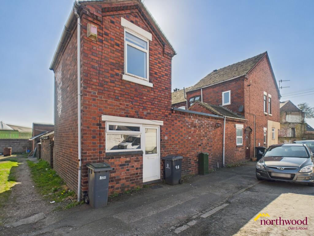
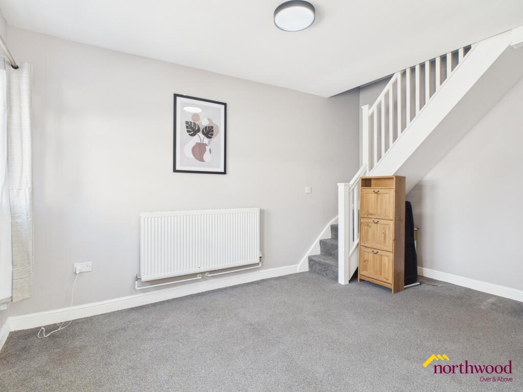
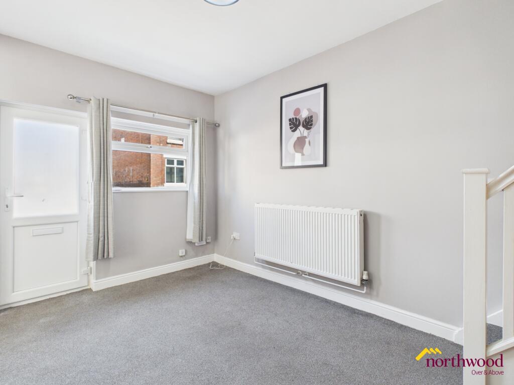
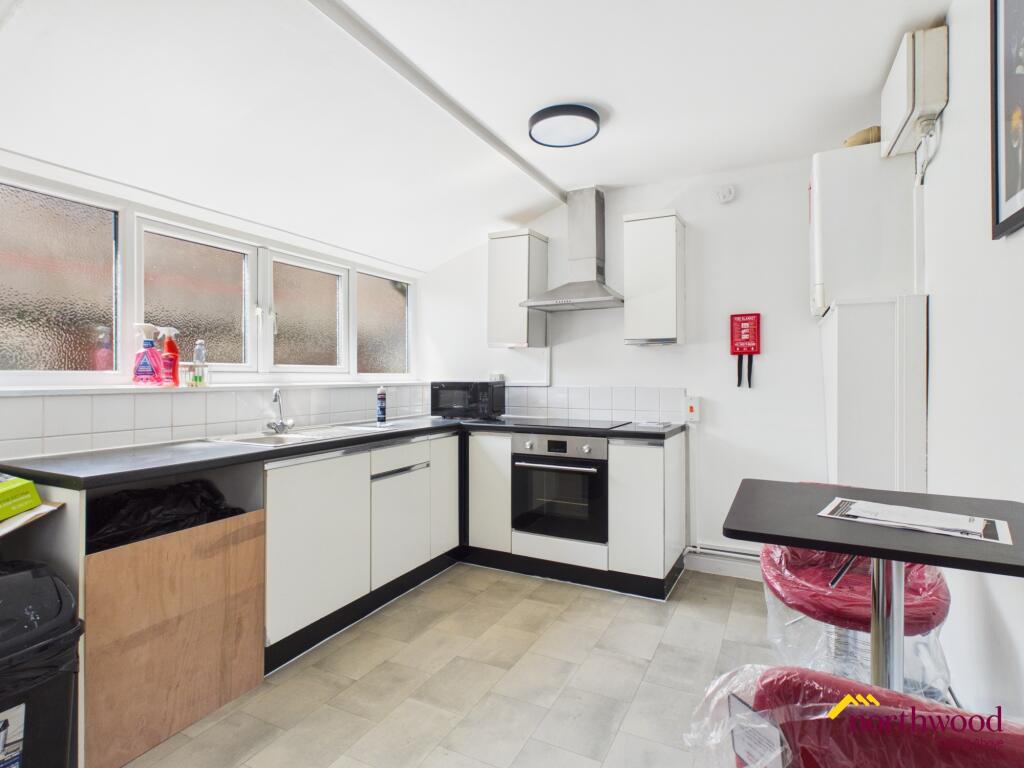
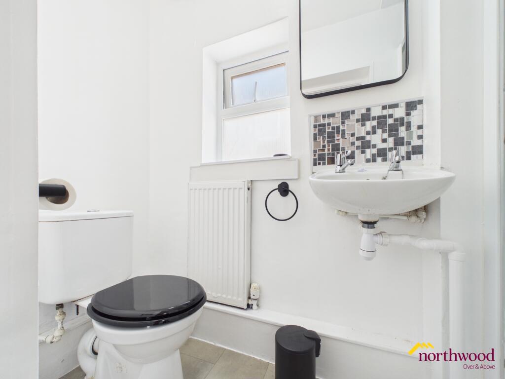
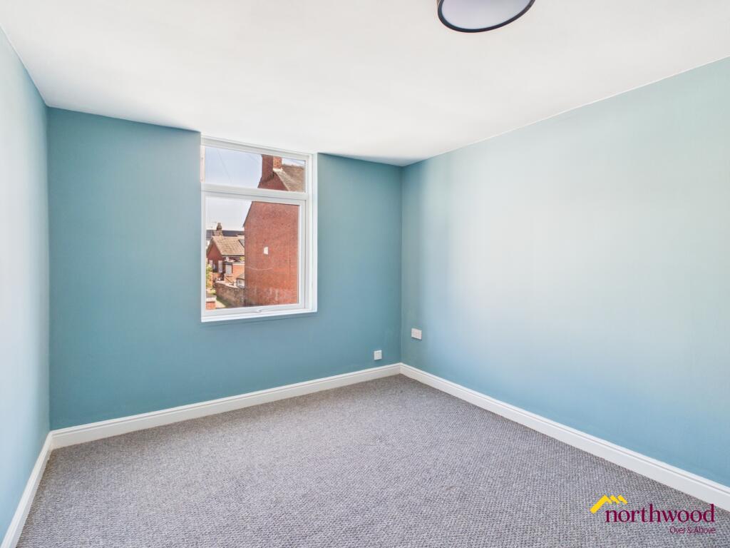
Photo 1 Photo 2 Photo 3 Photo 4 Photo 5 Photo 6
/ 6
Property details
Council tax band
A
Deprivation
Decile 2 (5,489 of 33,755)
Street crime
338 incidents within 1 mile (Apr 2026)
Additional details
- Heating
- Gas central
- Parking
- On street
- Listed property
- No
Description
Local area
Fenton in Staffordshire is a vibrant locale featuring a range of local amenities and transport links. Residents benefit from access to shops, services, and green open spaces, with further leisure and cultural opportunities available in the wider Staffordshire area. The location supports a convenient lifestyle, making it well-suited to those looking for balance between urban facilities and a sense of community. EPC rating: E.
Listed by
Stoke-on-Trent
The Property Franchise Group
Reference: 89011005
EPC ratings on this postcode
We don't have a matched EPC for this property yet. Below are efficiency scores and details for other addresses on this postcode.
| Address | Current | Potential | Floor area | Age band | Type |
|---|---|---|---|---|---|
| 1 Goldenhill Road, STOKE-ON-TRENT | 66 | 82 | 109 m² | England and Wales: 1900-1929 | Terraced |
| 1, Goldenhill Road, STOKE-ON-TRENT | 30 | 74 | 111 m² | England and Wales: 1900-1929 | Terraced |
| 11 Goldenhill Road, STOKE-ON-TRENT | 66 | 80 | 100 m² | England and Wales: 1900-1929 | Terraced |
| 13 Goldenhill Road, STOKE-ON-TRENT | 66 | 84 | 88 m² | England and Wales: 1900-1929 | Terraced |
| 13, Goldenhill Road, STOKE-ON-TRENT | 54 | 77 | 102 m² | England and Wales: 1900-1929 | Terraced |
| 13, Goldenhill Road, STOKE-ON-TRENT | 34 | 77 | 102 m² | England and Wales: 1900-1929 | Terraced |
| 15, Goldenhill Road, STOKE-ON-TRENT | 52 | 80 | 80 m² | England and Wales: 1900-1929 | Terraced |
| 15, Goldenhill Road, STOKE-ON-TRENT | 43 | 82 | 70 m² | England and Wales: 1983-1990 | Terraced |
| 17, Goldenhill Road, STOKE-ON-TRENT | 65 | 81 | 74 m² | England and Wales: 1900-1929 | Terraced |
| 19, Goldenhill Road, STOKE-ON-TRENT | 64 | 86 | 66 m² | England and Wales: before 1900 | Terraced |
| 21, Goldenhill Road, STOKE-ON-TRENT | 54 | 84 | 70 m² | England and Wales: 1930-1949 | Terraced |
| 27, Goldenhill Road, STOKE-ON-TRENT | 46 | 88 | 67 m² | England and Wales: 1900-1929 | Terraced |
| 3 Goldenhill Road, STOKE-ON-TRENT | 71 | 79 | 83 m² | England and Wales: 1900-1929 | Terraced |
| 3, Goldenhill Road, STOKE-ON-TRENT | 64 | 86 | 82 m² | England and Wales: before 1900 | Terraced |
| 3, Goldenhill Road, STOKE-ON-TRENT | 62 | 84 | 87 m² | England and Wales: before 1900 | Terraced |
Flood risk
Zone: 1
Risk: Low
Job (default Low)
Floorplans
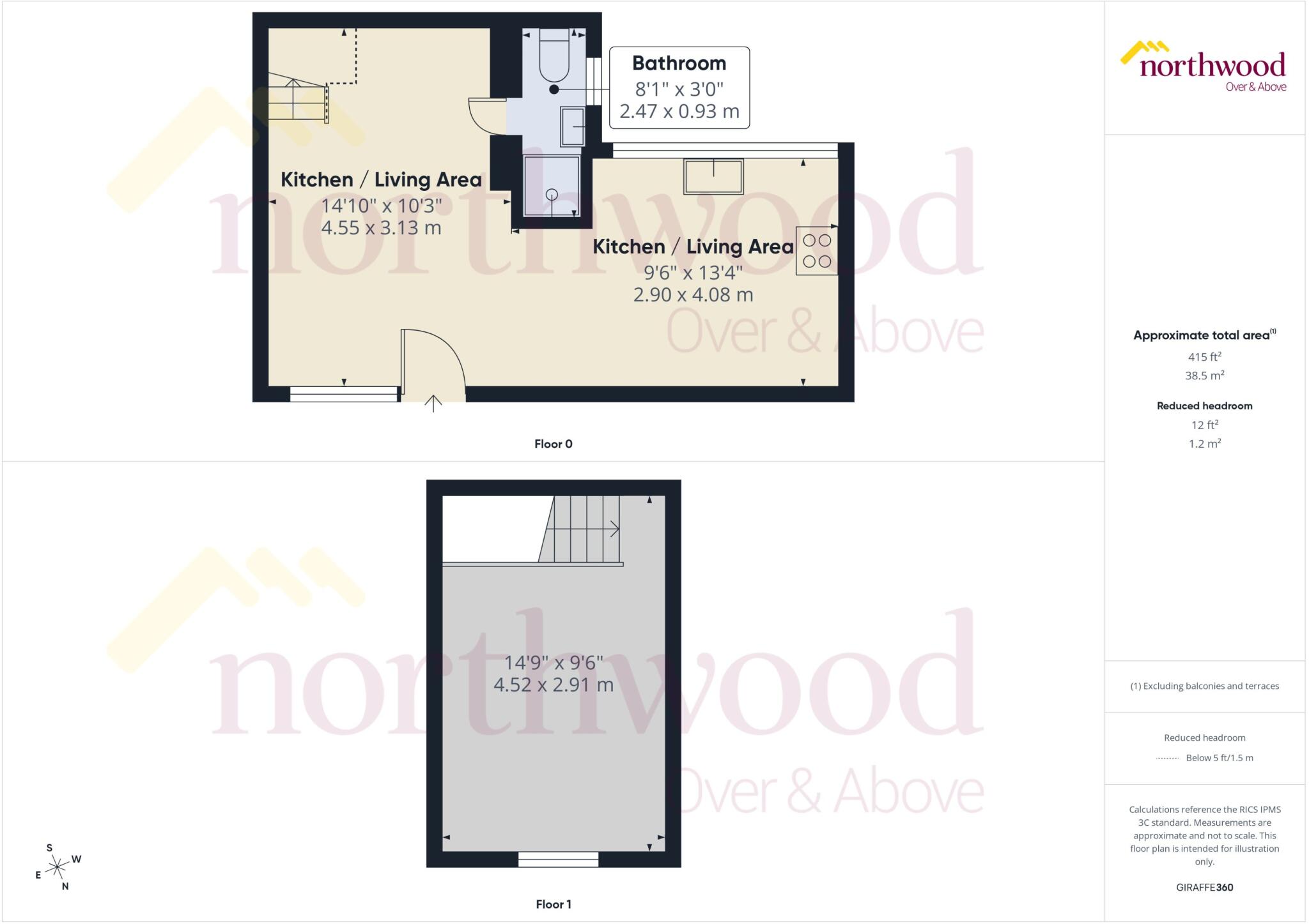
Floorplan
EPC Graphs

EPC Certificate
Rental Range
Estimated market rent for Stoke-on-Trent. Low = conservative, Realistic = average, Optimistic = best case.
Based on Local Authority from postcode lookup → Stoke-on-Trent.
LHA (30th percentile) floor for Staffordshire North: £424/mo (Apr 2025 – Mar 2026)
Location
Address
Sandford Hill, Longton, Stoke-on-Trent, England, ST4 3DN, United Kingdom
Nearby
Nearest stations, universities and amenities (distance from property).
| Type | Name | Distance |
|---|---|---|
| Train station | Longton | 0.2 miles |
| Shop | Wrights Pies | 0.3 miles |
| Shop | R A B Fabrics | 0.3 miles |
| Bus stop | Unknown | 0.3 miles |
| Bus stop | St James' Church | 0.7 miles |
| Train station | Stoke-on-Trent | 2.0 miles |
| Hospital | Royal Stoke University Hospital | 3.2 miles |
| Hospital | North Staffordshire Nuffield Hospital | 3.5 miles |
| University | Keele University | 5.5 miles |
| University | Buxton & Leek College | 9.3 miles |
Street-level crime
| Category | Count |
|---|---|
| Violence and sexual offences | 120 |
| Anti-social behaviour | 53 |
| Shoplifting | 35 |
| Public order | 26 |
| Vehicle crime | 21 |
| Criminal damage and arson | 20 |
| Other theft | 18 |
| Other crime | 13 |
| Drugs | 10 |
| Burglary | 8 |
| Robbery | 7 |
| Possession of weapons | 3 |
| Bicycle theft | 2 |
| Theft from the person | 2 |
| Total incidents | 338 |
Within 1 mile during Apr 2026. Source: data.police.uk (England & Wales).
Schools nearby
Nearest open schools with Ofsted ratings (England). Closed schools are not shown. Data from Get Information about Schools and Ofsted.
| Name | Type | Distance | Ofsted |
|---|---|---|---|
| Co-Op Academy Clarice Cliff | Primary | 0.2 miles | Requires improvement — 18 Jan 2024 |
| Gladstone Primary Academy | Primary | 0.5 miles | Good — 18 Apr 2013 |
| St Thomas More Catholic Academy | Secondary | 0.5 miles | Good — 8 Jun 2017 |
| Sandford Hill Primary School | Primary | 0.6 miles | Good — 15 Nov 2023 |
| St Gregory's Catholic Academy | Primary | 0.7 miles | Outstanding — 12 Jan 2017 |
Rental Comparables
Residential lets from OpenRent and Rightmove for the area (same bedroom count). Use to validate rent estimates. Student lets are excluded.
Average rent: £620/mo (45 listings)
Enter House Number
Enter the house number to help us retrieve more accurate pricing history and property data.
Please log in to submit or correct the house number for this listing.
Log in to continue