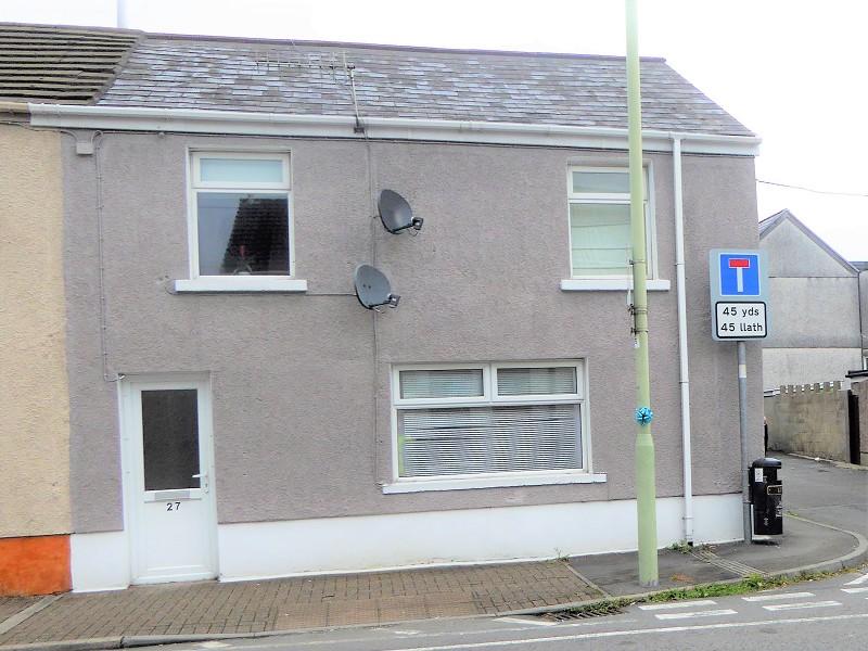
27 CASTLE STREET
MAESTEG, BRIDGEND CF34 9YH
£72,995
Property details
Floor area
65 m²
EPC rating
C
Year built
England and Wales: 1900-1929
Last sold
£67,500 Nov 2020
Price per m²
£1,123/m²
Local average
£102,000 (-28.4%)
Street crime
107 incidents within 1 mile (Apr 2026)
Key features
- *IDEAL FIRST TIME BUY*
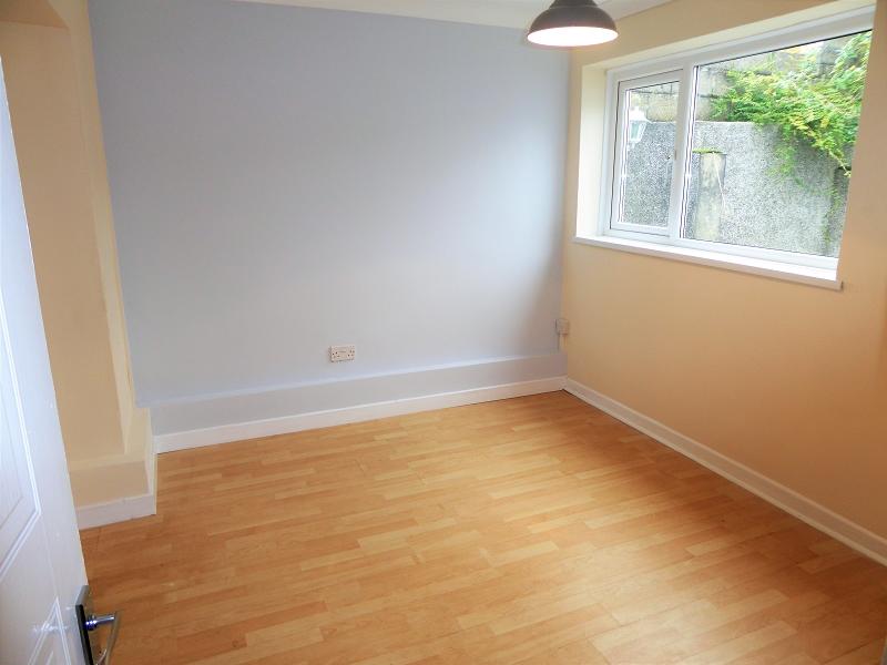
- Spacious Accommodation
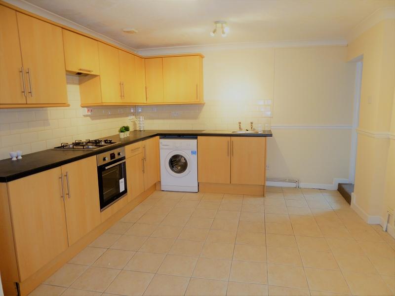
- Fitted Kitchen
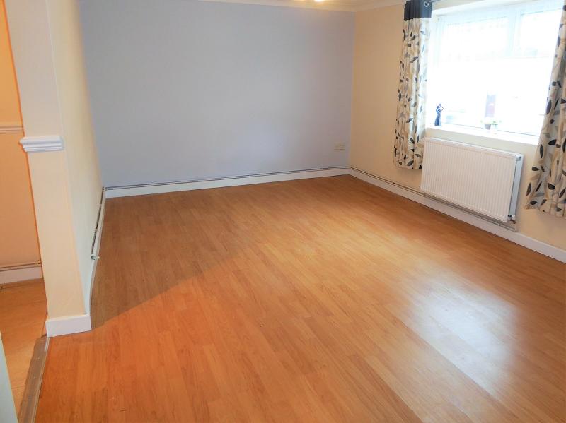
- Open-Plan Lounge Diner
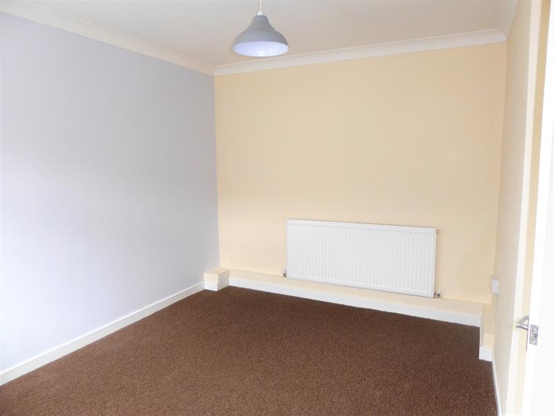
- 2 Double Bedroom Ground Floor Flat
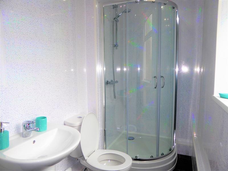
- Shower Room
- Walking Distance Of Maesteg Town Centre
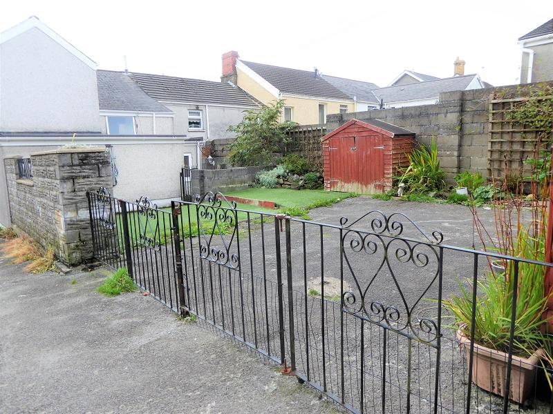
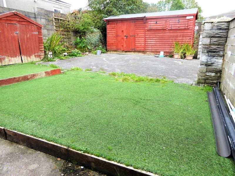
- Hard Standing Parking & Garden To Rear
- No Ongoing Chain
- *LEASEHOLD*
Additional details
- Parking
- Yes
- Garden
- Yes
Description
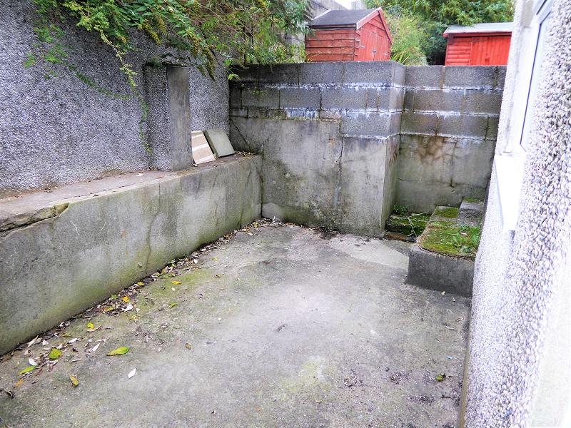
Spacious two double bedroom ground floor flat located in Maesteg within walking distance to the Town Centre with all its facilities and amenities, local rail link, and easy access to local schools. The property is offered for sale inclusive of Upvc double glazing and gas central heating. The property offers spacious open-plan living accommodation. Comprises: - Open-Plan Lounge; Dining Area; Kitchen; Shower Room; Master Bedroom and One Further Double Bedroom. Outside: Rear: Generous size rear garden with hard standing parking via double wrought iron gates.
Listed by
Bridgend
Gareth L. Edwards
Reference: 76932172
EPC Rating & Upgrade Cost
Current rating: C
Potential rating: C
Inspection date: 16/10/2017
Expiry date: 15/10/2027
Current heating cost: £460/year
Potential heating cost: £333/year
Recommendations
- 50 mm internal or external wall insulation (14,000)
- Floor insulation (solid floor) (6,000)
- Low energy lighting for all fixed outlets (30)
Flood risk
Zone: 1
Risk: Low
Job (default Low)
EPC Graphs
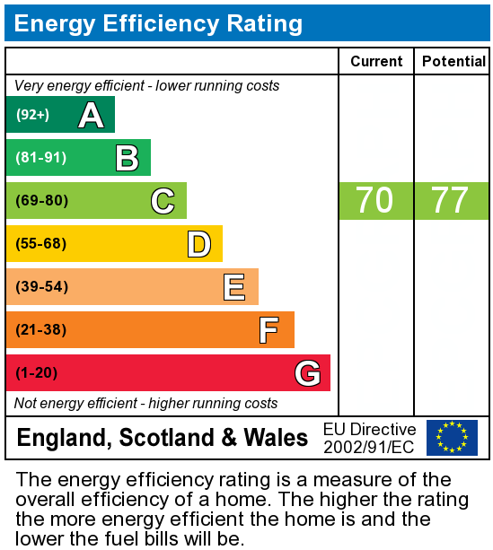
EPC Graph
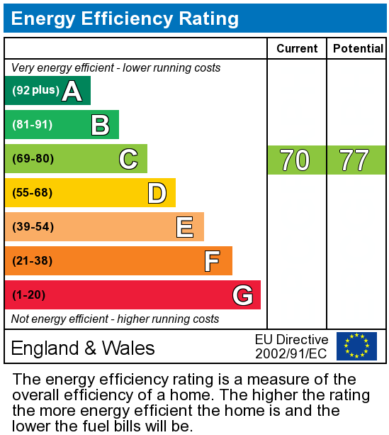
EPC 2
Price history
35% since 2010
| Event | Date | Price | % change |
|---|---|---|---|
| Sold | 20/11/2020 (5 years ago) | £67,500 | +35% |
| Sold | 18/02/2010 (16 years ago) | £50,000 | — |
Source: HM Land Registry Price Paid Data. Crown copyright.
Sold Comparables
Same street and nearby sales within 0.25 miles (last 5 years). Data from Land Registry Price Paid.
| Address | Price | Date | Type |
|---|---|---|---|
| Same street 44 CASTLE STREET, MAESTEG, BRIDGEND, CF34 9YH | £125,000 | 09/05/2025 | Terraced |
| Same street 16 CASTLE STREET, MAESTEG, BRIDGEND, CF34 9YH | £160,000 | 25/10/2024 | Semi-detached |
| Same street 18 CASTLE STREET, MAESTEG, BRIDGEND, CF34 9YH | £140,000 | 31/05/2024 | Semi-detached |
| Same street 26 CASTLE STREET, MAESTEG, BRIDGEND, CF34 9YH | £88,000 | 23/06/2023 | Terraced |
| Same street 8 CASTLE STREET, MAESTEG, BRIDGEND, CF34 9YH | £180,000 | 21/03/2023 | Detached |
| Same street 10 CASTLE STREET, MAESTEG, BRIDGEND, CF34 9YH | £82,500 | 16/11/2022 | Terraced |
| 13 LEWIS ROAD, MAESTEG, BRIDGEND, CF34 0AA | £73,000 | 24/06/2022 | Flat |
| Same street 47 - 48 CASTLE STREET, MAESTEG, BRIDGEND, CF34 9YH | £160,000 | 09/06/2022 | Other |
| Same street 35 CASTLE STREET, MAESTEG, BRIDGEND, CF34 9YH | £67,000 | 17/03/2022 | Terraced |
Street average: £125,313 (8 sales)
Area average: £73,000 (1 sale)
Capital growth trend
House Price Index (HM Land Registry — official index, not sold-price averages): Bridgend. Series: Flats and maisonettes. As of March 2026.
Rental Range
Estimated market rent for Bridgend. Low = conservative, Realistic = average, Optimistic = best case.
Based on Local Authority from postcode lookup → Bridgend.
Location
Nearby
Nearest stations, universities and amenities (distance from property).
| Type | Name | Distance |
|---|---|---|
| Bus stop | Unknown | 0.0 miles |
| Shop | Unknown | 0.1 miles |
| Train station | Maesteg | 0.1 miles |
| Train station | Maesteg Ewenny Road | 0.3 miles |
| University | Union School of Theology | 7.3 miles |
| Hospital | Porthcawl Medical Centre | 8.6 miles |
| Hospital | Priory Hospital Ty Cwm Rhondda | 8.8 miles |
| University | Swansea University | 11.9 miles |
Street-level crime
| Category | Count |
|---|---|
| Violence and sexual offences | 39 |
| Shoplifting | 19 |
| Public order | 17 |
| Anti-social behaviour | 13 |
| Criminal damage and arson | 8 |
| Other theft | 5 |
| Other crime | 2 |
| Vehicle crime | 2 |
| Burglary | 1 |
| Robbery | 1 |
| Total incidents | 107 |
Within 1 mile during Apr 2026. Source: data.police.uk (England & Wales).
Schools nearby
Nearest open schools with Ofsted ratings (England). Closed schools are not shown. Data from Get Information about Schools and Ofsted.
| Name | Type | Distance | Ofsted |
|---|---|---|---|
| St Mary's & St Patrick's Catholic Primary School | Other | 0.2 miles | — (No rating) |
| Maesteg School | Other | 0.2 miles | — (No rating) |
| Plasnewydd Primary School | Other | 0.3 miles | — (No rating) |
| YGG Cynwyd Sant | Other | 0.5 miles | — (No rating) |
| Garth Primary School | Other | 0.8 miles | — (No rating) |
Rental Comparables
Rental listings exist nearby, but none matched the 2-bedroom count for this property.
Rent-driven metrics
Based on Area rent estimate.
- Rent ratio — Monthly rent ÷ purchase price (1% rule). 1%+ = strong, 0.8–1% = okay, <0.8% = weak for cashflow.
- Max investor price — Rent ÷ 0.8%; the price at which rent would be 0.8% of price (Stoke-style target).
- Target investor price — Rent ÷ 1%; the price at which rent would be 1% of price (strong cashflow band).
- Gross yield — Annual rent as % of purchase price (no costs).