Flat 307
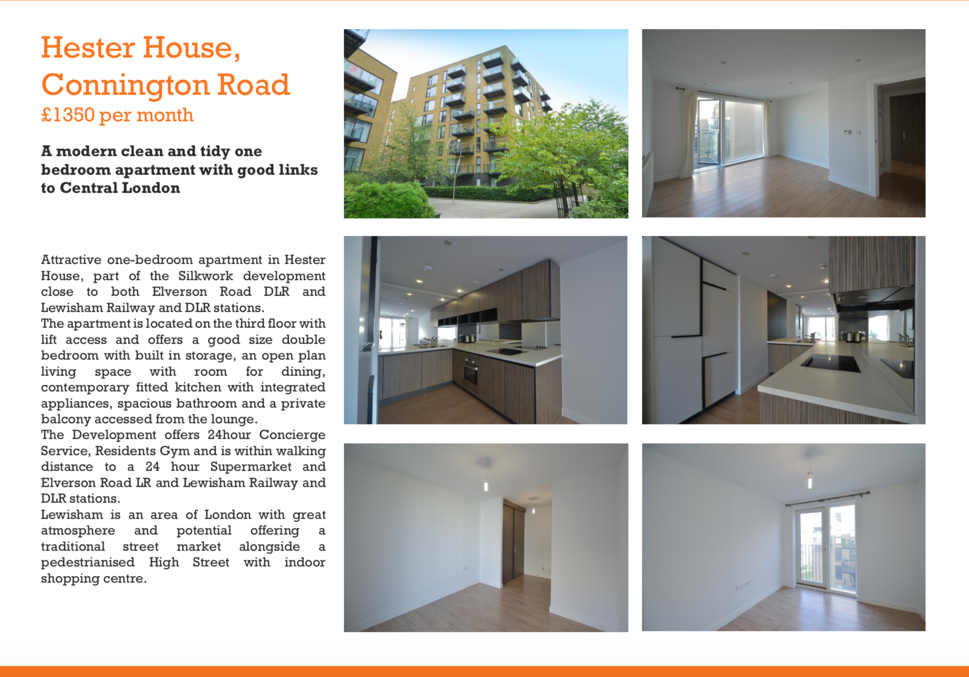
HESTER HOUSE, 72 - 78, CONINGTON ROAD, LONDON, GREATER LONDON SE13 7FL
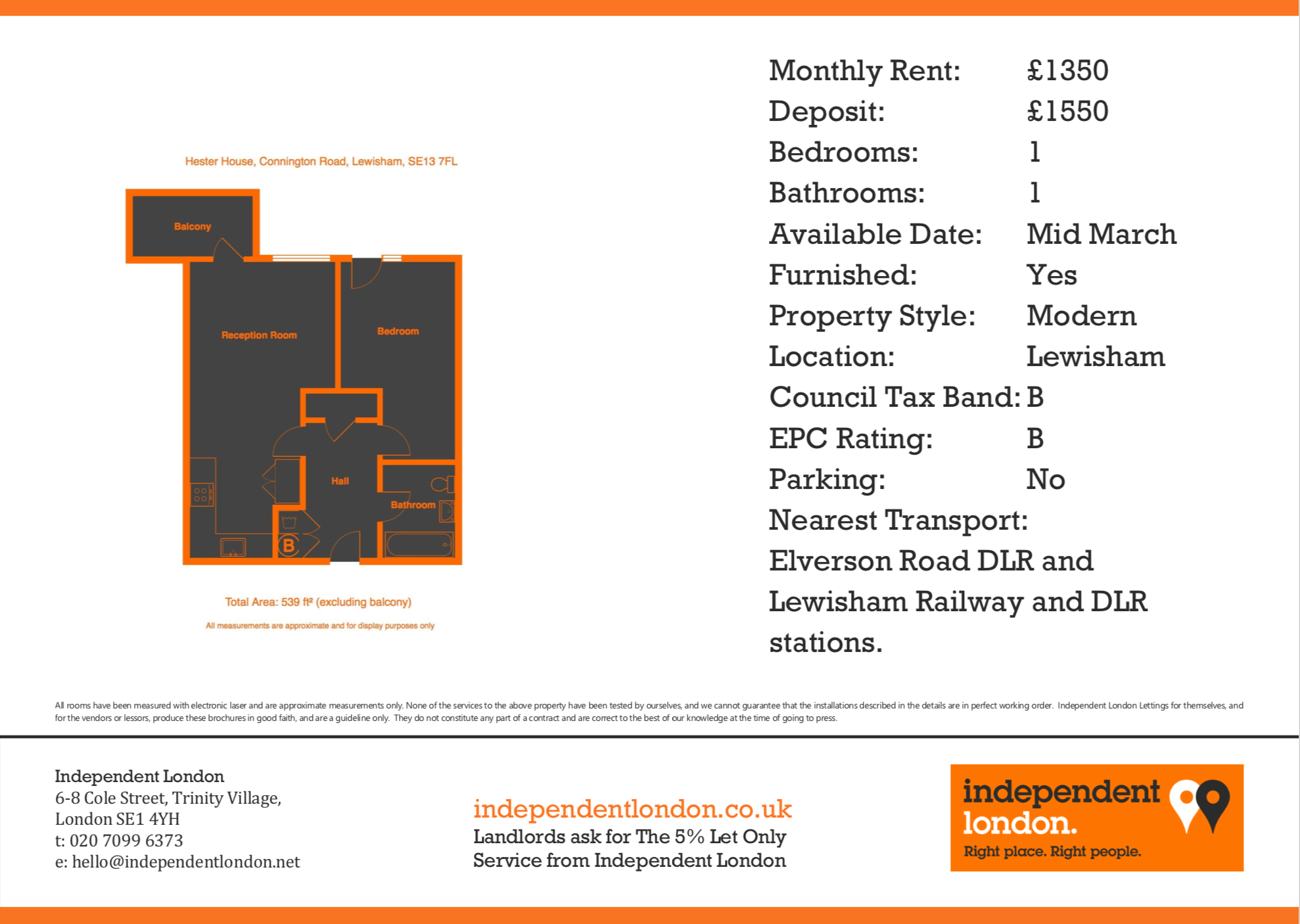
£1,350 pcm
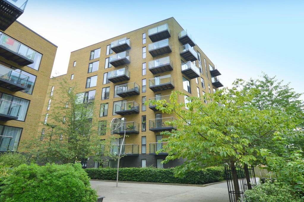
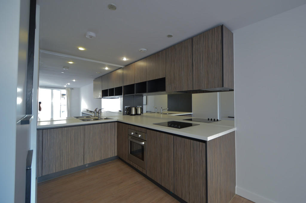
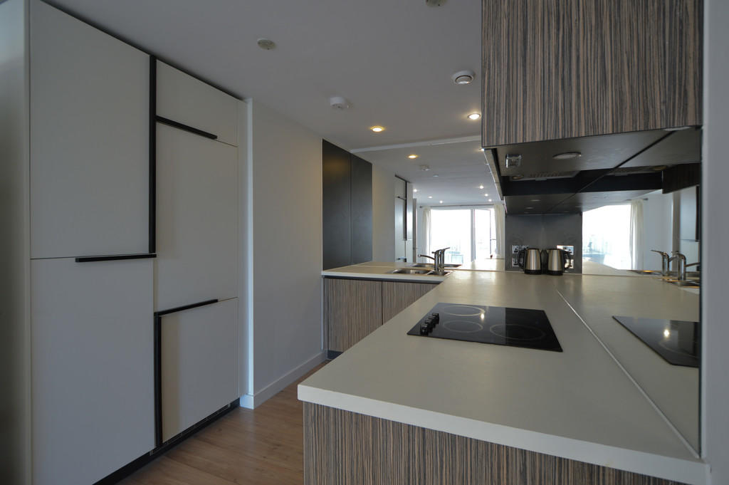
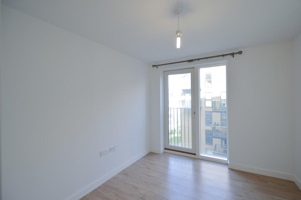
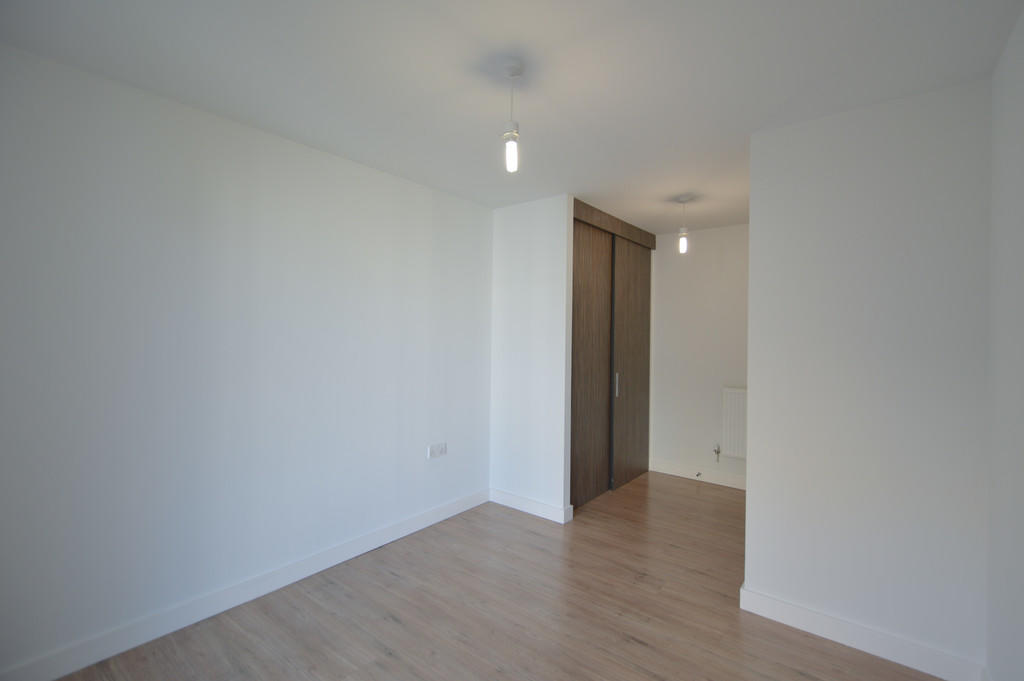
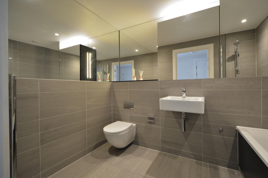
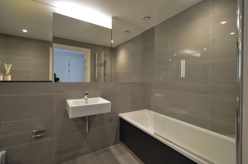
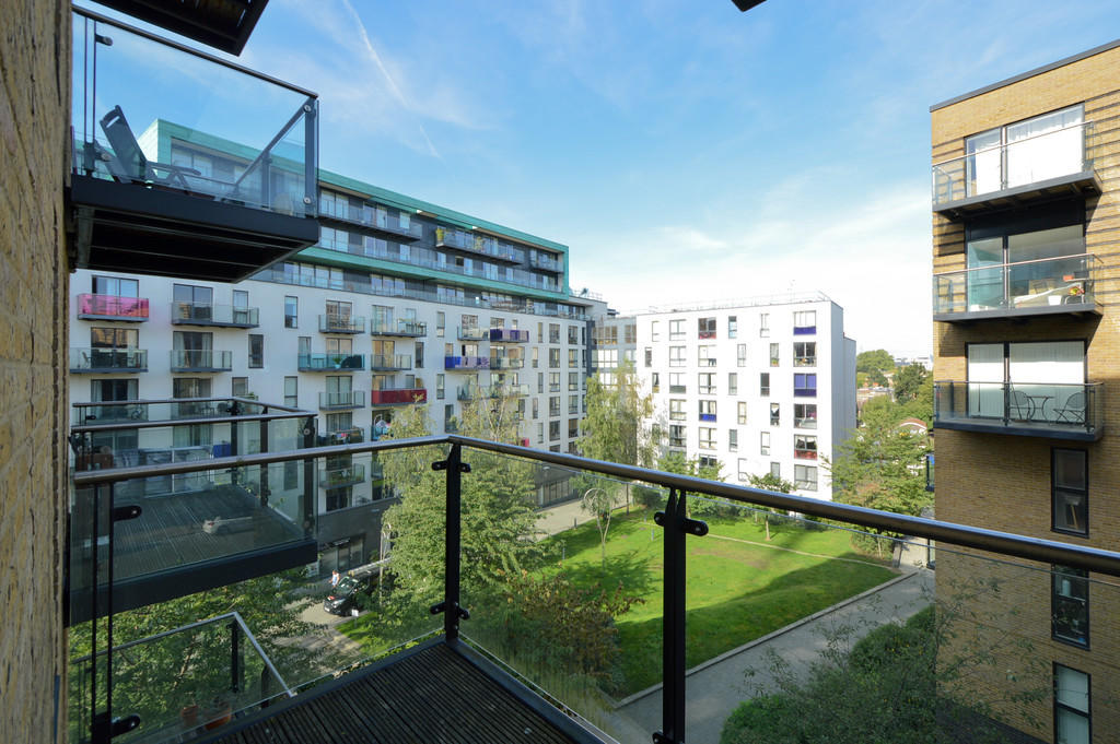
Photo 1 Photo 2 Photo 3 Photo 4 Photo 5 Photo 6 Photo 7 Photo 8
/ 8
Property details
Floor area
50 m²
Year built
England and Wales: 2003-2006
Street crime
1007 incidents within 1 mile (Apr 2026)
Key features
- Deposit £1550
- Available in March 2022
- Furnished or Unfurnished
- Concierge
- Close to DLR and Rail
- EPC Rating B
- Council Tax Band B
- Borough of Lewisham
- Lift Access
- Balcony
Description
The apartment is located on the third floor with lift access and offers a good size double bedroom with built in storage, an open plan living space with room for dining, contemporary fitted kitchen with integrated appliances, spacious bathroom and a private balcony accessed from the lounge.
The Development offers 24 hour Concierge Service, Residents Gym and is within walking distance to a 24 hour Supermarket and Elverson Road DLR and Lewisham Railway and DLR stations.
Affordable one beds are becoming harder to find so this property is well worth considering.
Viewing is by appointment only and email enquiries are an essential first step in the process of arranging a viewing so please enquire online before you call.
Available in Mid March
EPC Rating B
Council Tax Band B
Listed by
London
Independent London
Reference: 120364391
EPC ratings on this postcode
We don't have a matched EPC for this property yet. Below are efficiency scores and details for other addresses on this postcode.
| Address | Current | Potential | Floor area | Age band | Type |
|---|---|---|---|---|---|
| Flat 001, Hester House 72-78, Conington Road, LONDON | 82 | 82 | 56 m² | England and Wales: 2007-2011 | Flat |
| Flat 002, Hester House 72-78, Conington Road, LONDON | 82 | 82 | 35 m² | England and Wales: 2003-2006 | Flat |
| Flat 003, Hester House 72-78, Conington Road, LONDON | 83 | 83 | 66 m² | England and Wales: 2007-2011 | Flat |
| Flat 004, Hester House 72-78, Conington Road, LONDON | 82 | 82 | 52 m² | England and Wales: 2007-2011 | Flat |
| Flat 005, Hester House 72-78, Conington Road, LONDON | 82 | 82 | 48 m² | England and Wales: 2007-2011 | Flat |
| Flat 006, Hester House 72-78, Conington Road, LONDON | 82 | 82 | 60 m² | England and Wales: 2012 onwards | Flat |
| FLAT 101, HESTER HOUSE 72-78, CONINGTON ROAD, LONDON | 82 | 82 | 46 m² | England and Wales: 2007-2011 | Flat |
| Flat 102, Hester House 72-78, Conington Road, LONDON | 83 | 83 | 71 m² | England and Wales: 2007-2011 | Flat |
| Flat 103, Hester House 72-78, Conington Road, LONDON | 79 | 96 | 44 m² | England and Wales: 2012 onwards | Terraced |
| Flat 104, Hester House 72-78, Conington Road, LONDON | 82 | 82 | 54 m² | England and Wales: 2007-2011 | Flat |
| Flat 105, Hester House 72-78, Conington Road, LONDON | 81 | 81 | 35 m² | England and Wales: 1996-2002 | Flat |
| FLAT 106, HESTER HOUSE 72-78, CONINGTON ROAD, LONDON | 84 | 84 | 77 m² | England and Wales: 2007-2011 | Flat |
| Flat 107, Hester House 72-78, Conington Road, LONDON | 83 | 83 | 60 m² | England and Wales: 2007-2011 | Flat |
| Flat 108, Hester House 72-78, Conington Road, LONDON | 83 | 83 | 49 m² | England and Wales: 2007-2011 | Flat |
| Flat 109, Hester House 72-78, Conington Road, LONDON | 79 | 79 | 31 m² | England and Wales: 2003-2006 | Flat |
Flood risk
Zone: 1
Risk: Low
Job (default Low)
Floorplans
Floorplan 1
Floorplan 2
EPC Graphs
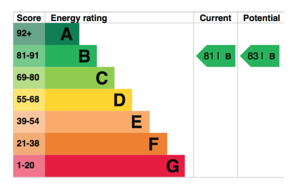
EPC B Rating
Rental Range
Estimated market rent for Lewisham. Low = conservative, Realistic = average, Optimistic = best case.
Based on Local Authority from postcode lookup → Lewisham.
LHA (30th percentile) floor for Cambridge: £898/mo (Apr 2025 – Mar 2026)
Location
Address
Rossett Way
Nearby
Nearest stations, universities and amenities (distance from property).
| Type | Name | Distance |
|---|---|---|
| Shop | Grab-a-bite | 0.0 miles |
| Shop | Unknown | 0.0 miles |
| Bus stop | Blackheath Rise | 0.1 miles |
| Train station | Elverson Road | 0.1 miles |
| Train station | Lewisham | 0.1 miles |
| University | University of Greenwich | 1.1 miles |
| Hospital | Dental Hospital | 3.4 miles |
| Hospital | King's College Hospital Emergency Department | 3.4 miles |
| University | Northeastern University London | 3.6 miles |
Street-level crime
| Category | Count |
|---|---|
| Violence and sexual offences | 281 |
| Anti-social behaviour | 196 |
| Shoplifting | 142 |
| Public order | 63 |
| Other theft | 55 |
| Criminal damage and arson | 53 |
| Vehicle crime | 51 |
| Theft from the person | 44 |
| Drugs | 43 |
| Burglary | 27 |
| Robbery | 26 |
| Bicycle theft | 11 |
| Possession of weapons | 9 |
| Other crime | 6 |
| Total incidents | 1007 |
Within 1 mile during Apr 2026. Source: data.police.uk (England & Wales).
Schools nearby
Nearest open schools with Ofsted ratings (England). Closed schools are not shown. Data from Get Information about Schools and Ofsted.
| Name | Type | Distance | Ofsted |
|---|---|---|---|
| Morden Mount Primary School | Primary | 0.2 miles | Good — 28 Nov 2023 |
| Urban Mission School | Other | 0.3 miles | Good — 5 Oct 2022 |
| Prendergast Vale School | Other | 0.3 miles | Good — 5 Mar 2018 |
| St Stephen's CofE Primary School | Primary | 0.5 miles | Good — 21 Sep 2022 |
| Ashmead Primary School | Primary | 0.5 miles | Good — 12 Nov 2012 |
Rental Comparables
Rental listings exist nearby, but none matched the 1-bedroom count for this property.
Enter House Number
Enter the house number to help us retrieve more accurate pricing history and property data.
Please log in to submit or correct the house number for this listing.
Log in to continue