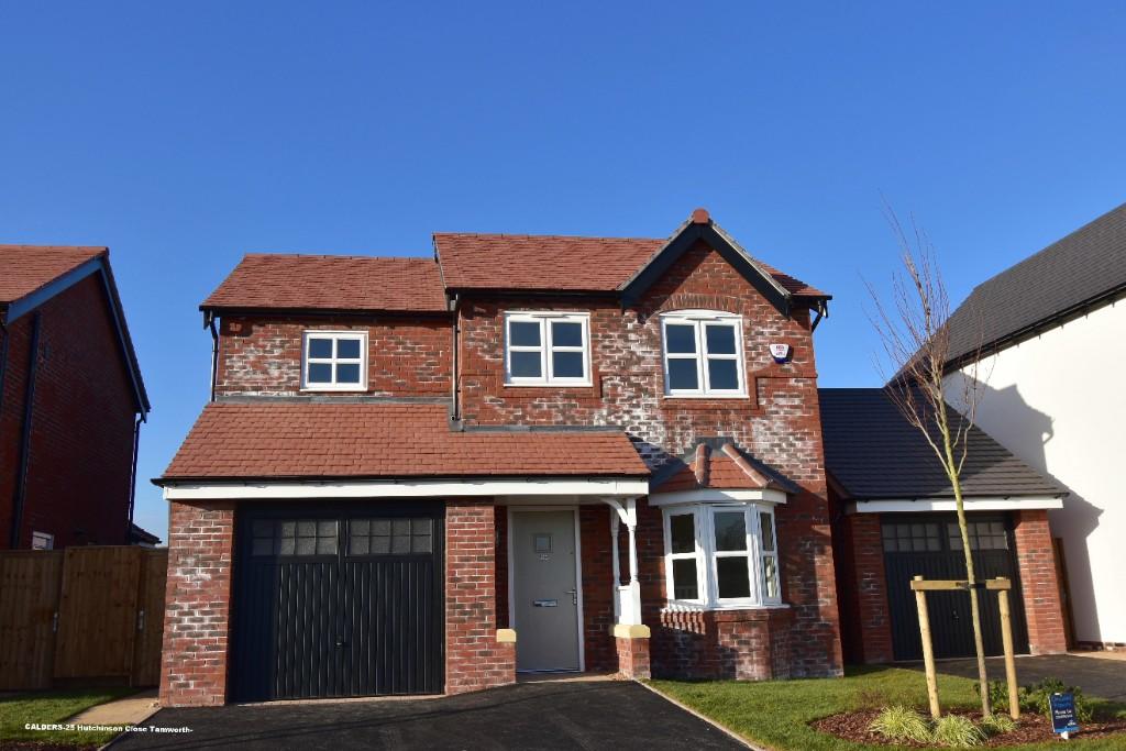
25 HUTCHINSON CLOSE
TAMWORTH, STAFFORDSHIRE B79 0FW
£1,350 pcm
Property details
Floor area
99 m²
Street crime
57 incidents within 1 mile (Apr 2026)
Key features
- ENTRANCE HALL
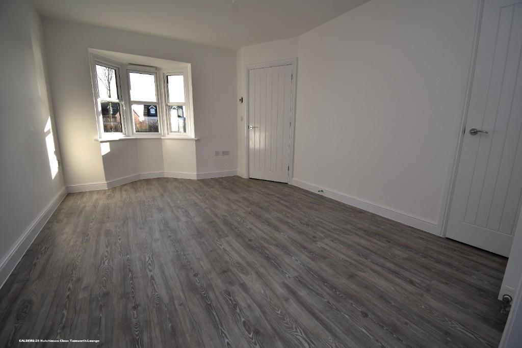
- LARGE LOUNGE WITH BAY WINDOW
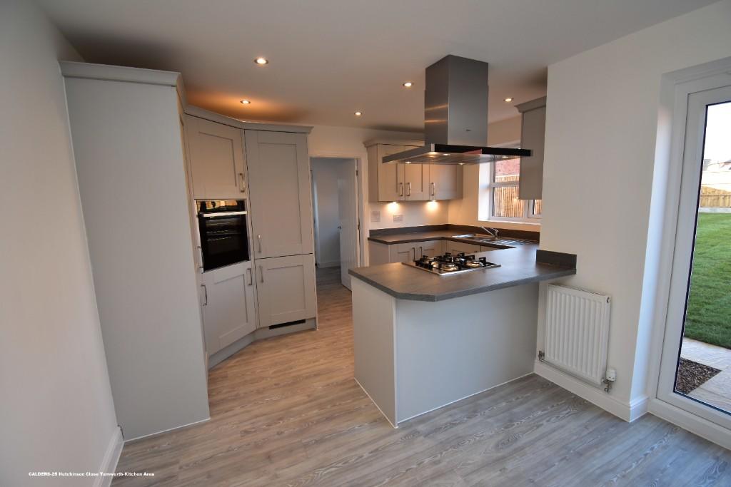
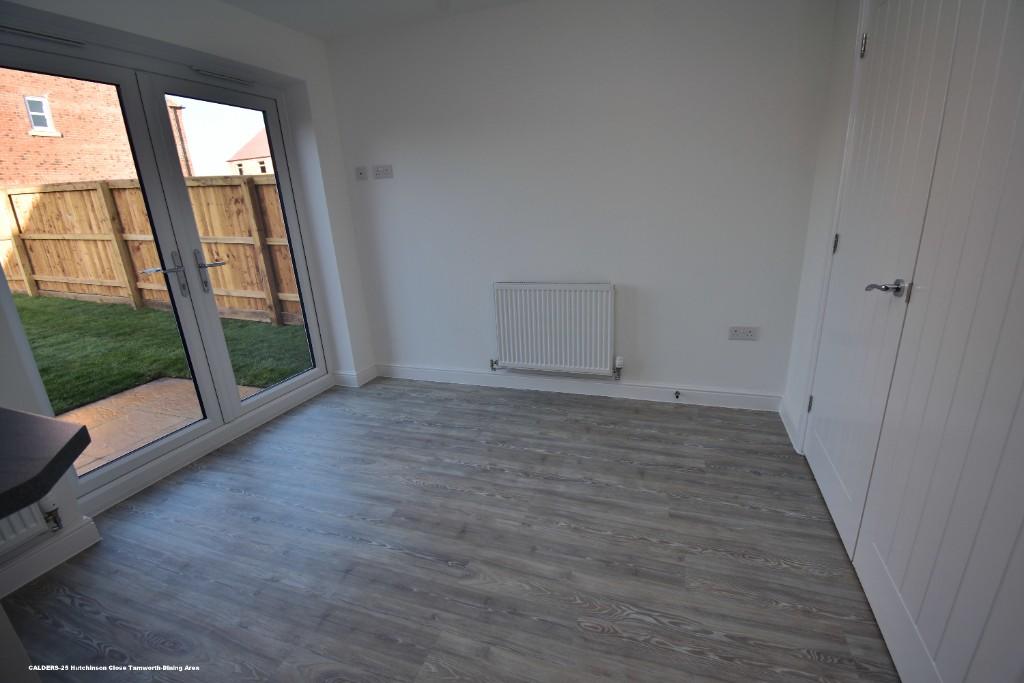
- FULL WIDTH KITCHEN DINING ROOM WITH TWO SETS OF FRENCH DOORS
- KITCHEN WITH INTEGRATED APPLIANCES
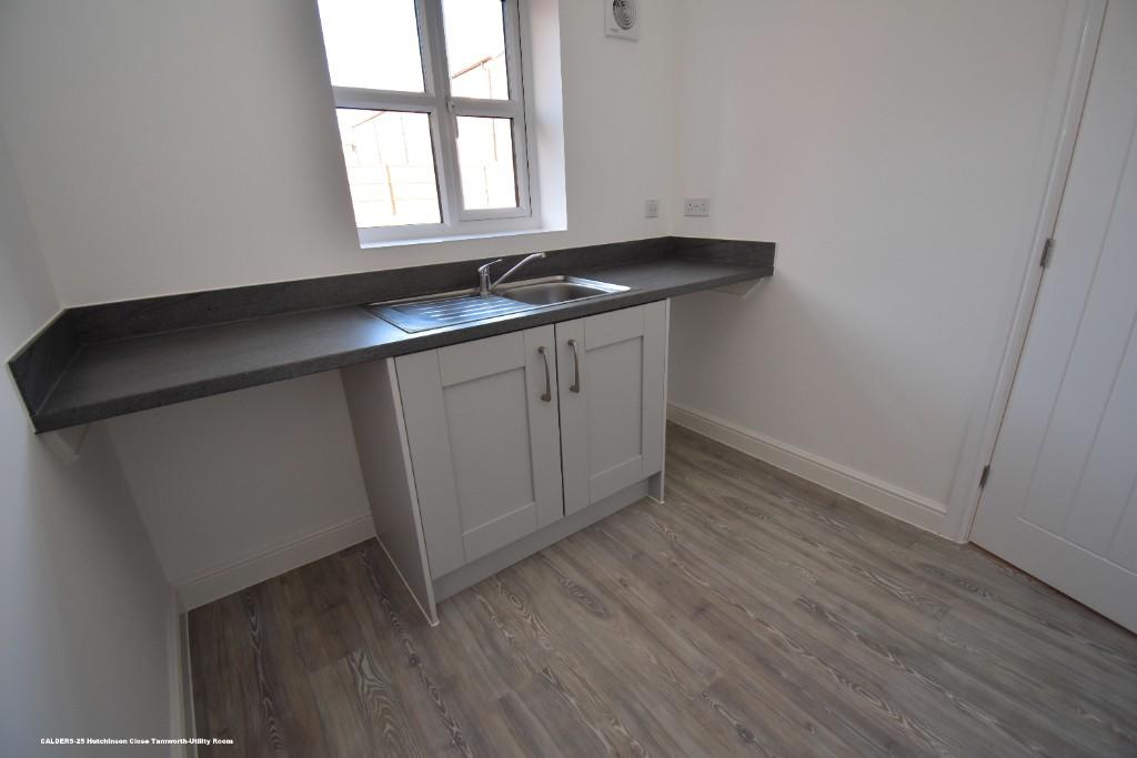
- UTILITY ROOM
- GUESTS CLOAKS
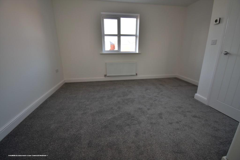
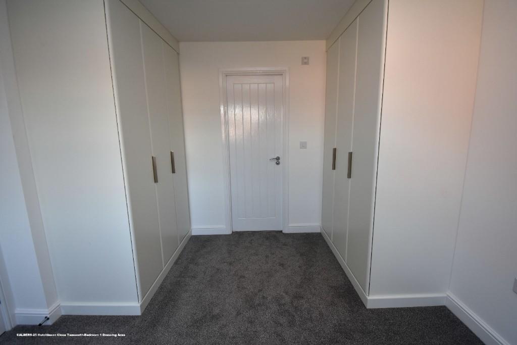
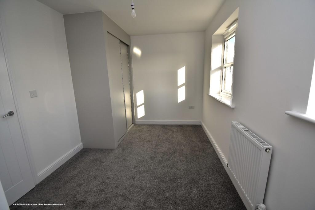
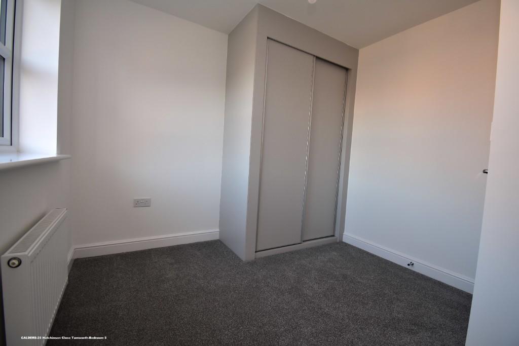
- THREE GENEROUS BEDROOMS WITH FITTED WARDROBES
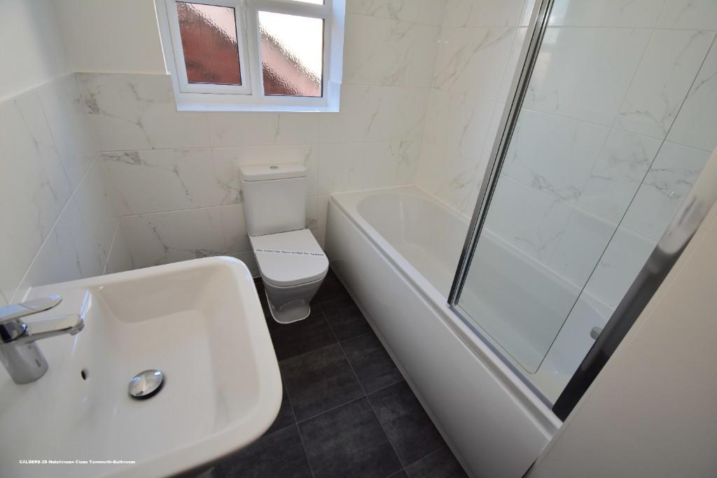
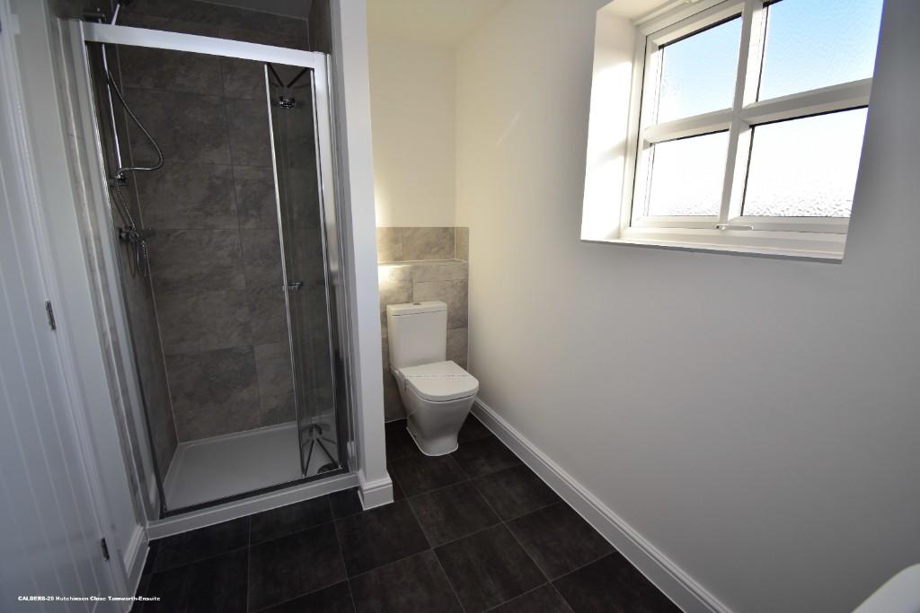
- ONE ENSUITE PLUS FAMILY BATHROOM
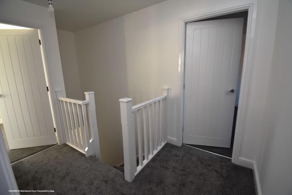
- GENEROUS LANDING
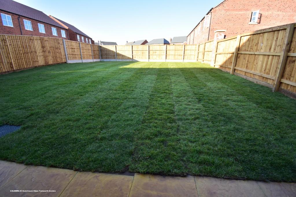
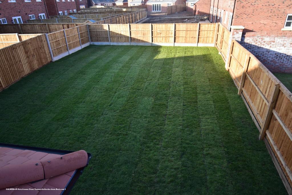
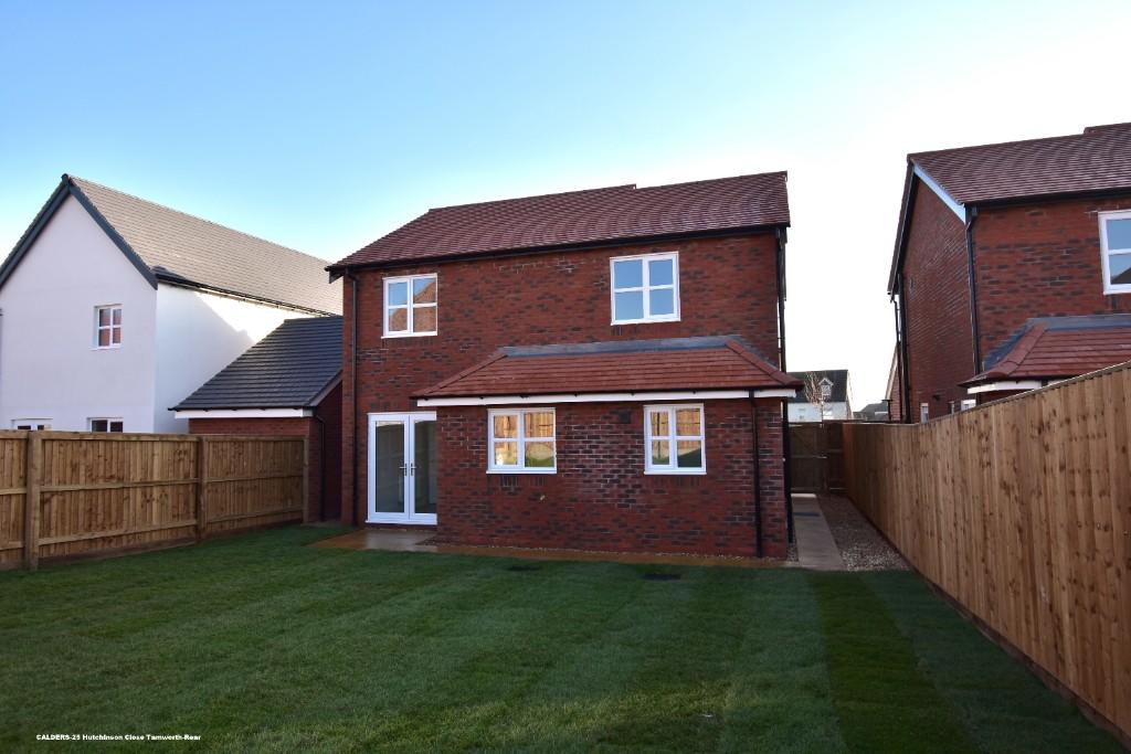
- GENEROUS ENCLOSED REAR GARDEN
Additional details
- Heating
- Gas central
- Parking
- Garage, Driveway
- Garden
- Front garden, Enclosed garden
Description
COUNCIL TAX BAND TBC
NO PETS PREFERRED
Listed by
Tamworth
Calders Residential
Reference: 131795369
EPC Rating & Upgrade Cost
Fetching EPC data… Refresh this page in a moment.
Flood risk
Zone: 1
Risk: Low
Job (default Low)
Floorplans
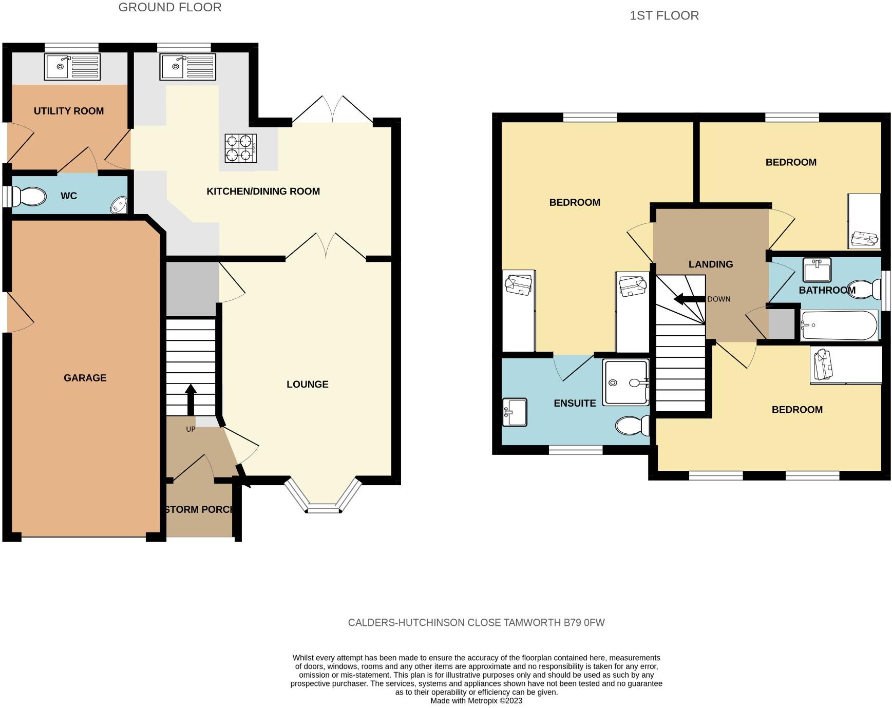
FLOOR PLAN
EPC Graphs
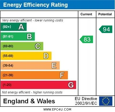
EPC GRAPH
Rental Range
Estimated market rent for West Midlands. Low = conservative, Realistic = average, Optimistic = best case.
Based on Postcode area B → West Midlands.
LHA (30th percentile) floor for Mid Staffs: £738/mo (Apr 2025 – Mar 2026)
Location
Nearby
Nearest stations, universities and amenities (distance from property).
| Type | Name | Distance |
|---|---|---|
| Shop | The Co-operative Food | 0.2 miles |
| Bus stop | Browns Lane | 0.2 miles |
| Shop | Kangs | 0.4 miles |
| Train station | Tamworth | 0.8 miles |
| Train station | Mallard Halt | 1.5 miles |
| Hospital | Sir Robert Peel Community Hospital | 2.6 miles |
| Hospital | Samuel Johnson Community Hospital | 6.2 miles |
| University | Maryvale Institute | 11.2 miles |
Street-level crime
| Category | Count |
|---|---|
| Violence and sexual offences | 22 |
| Anti-social behaviour | 13 |
| Criminal damage and arson | 5 |
| Vehicle crime | 4 |
| Drugs | 3 |
| Public order | 3 |
| Robbery | 2 |
| Burglary | 1 |
| Other crime | 1 |
| Other theft | 1 |
| Possession of weapons | 1 |
| Shoplifting | 1 |
| Total incidents | 57 |
Within 1 mile during Apr 2026. Source: data.police.uk (England & Wales).
Schools nearby
Nearest open schools with Ofsted ratings (England). Closed schools are not shown. Data from Get Information about Schools and Ofsted.
| Name | Type | Distance | Ofsted |
|---|---|---|---|
| Anker Valley Primary Academy | Primary | 0.1 miles | Good — 11 Feb 2024 |
| Ashcroft Infants' School | Primary | 0.3 miles | Good — 25 Jan 2022 |
| Flax Hill Junior Academy | Primary | 0.6 miles | Good — 23 Apr 2012 |
| St Leonard's CofE (A) Primary School | Primary | 0.6 miles | Good — 22 Sep 2022 |
| Landau Forte Academy, QEMS | Secondary | 0.7 miles | Good — 10 Nov 2022 |
Rental Comparables
Residential lets from OpenRent and Rightmove for the area (same bedroom count). Use to validate rent estimates. Student lets are excluded.
| Title | Rent | Beds | Distance | As seen on |
|---|---|---|---|---|
| 3 Bed Semi-Detached House, Queens Way, B79 | £1,150/mo | 3 | 0.73 miles | OpenRent |
| 3 Bed Terraced House, Dent Street, B79 | £1,100/mo | 3 | 1.06 miles | OpenRent |
| 3 Bed Terraced House, Ludgate, B79 | £950/mo | 3 | 1.12 miles | OpenRent |
Average rent: £1,067/mo (3 listings)