15
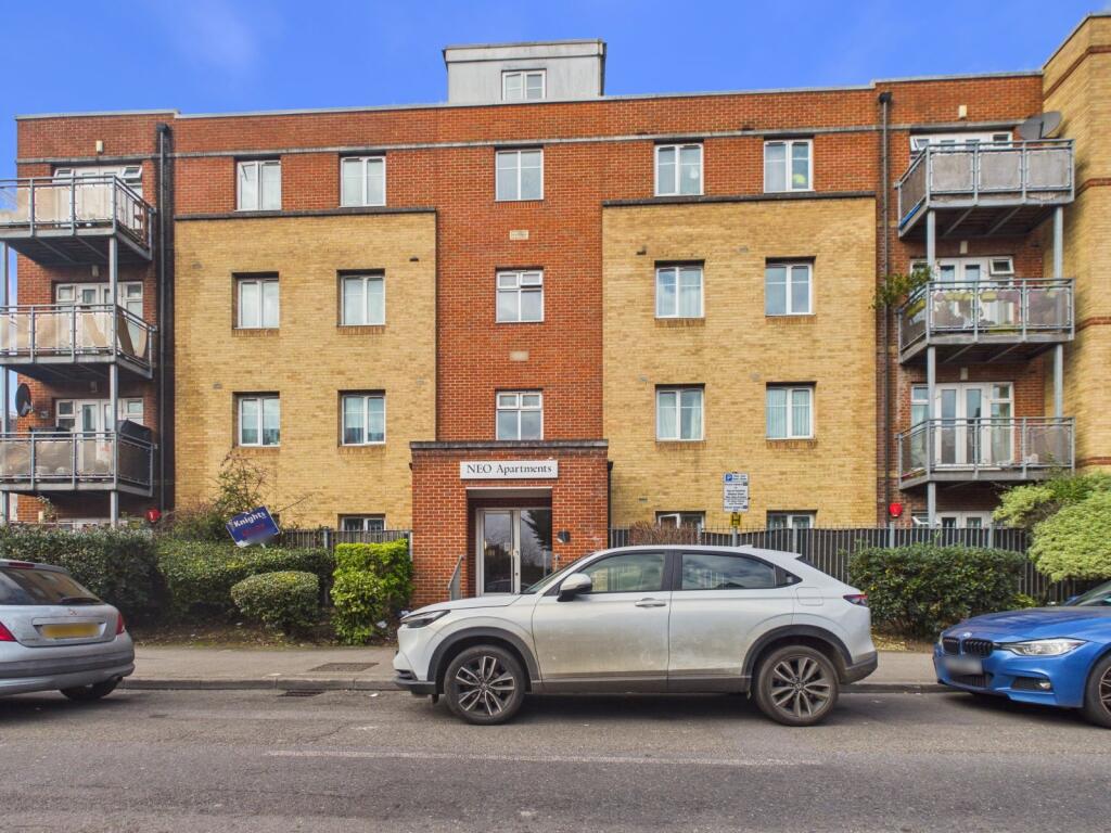
NEO APARTMENTS, 1 - 9, WEXHAM ROAD, SLOUGH, SLOUGH, SLOUGH SL1 1UG
Property details
Tenure
LEASEHOLD
Floor area
63 m²
Council tax band
C
EPC rating
C
Year built
England and Wales: 2003-2006
Last sold
£224,995 May 2005
Price per m²
£4,444/m²
Local average
£230,228 (+21.6%)
Street crime
578 incidents within 1 mile (Apr 2026)
Key features
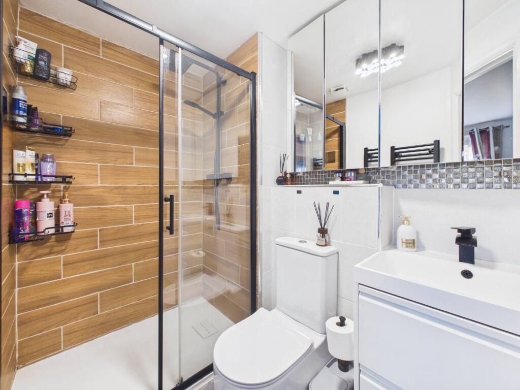
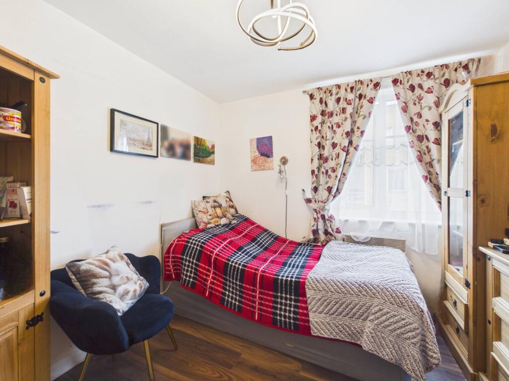
- A three bedroom apartment
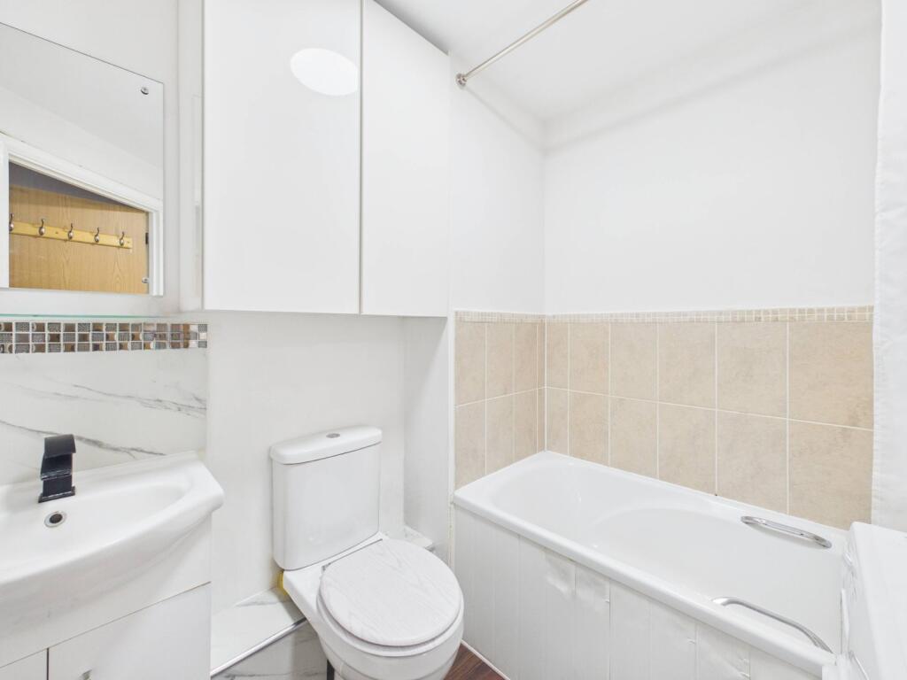
- Two bathrooms (ensuite to master)
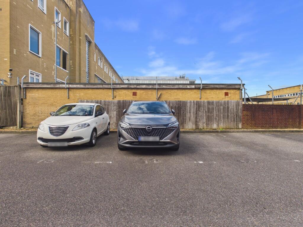
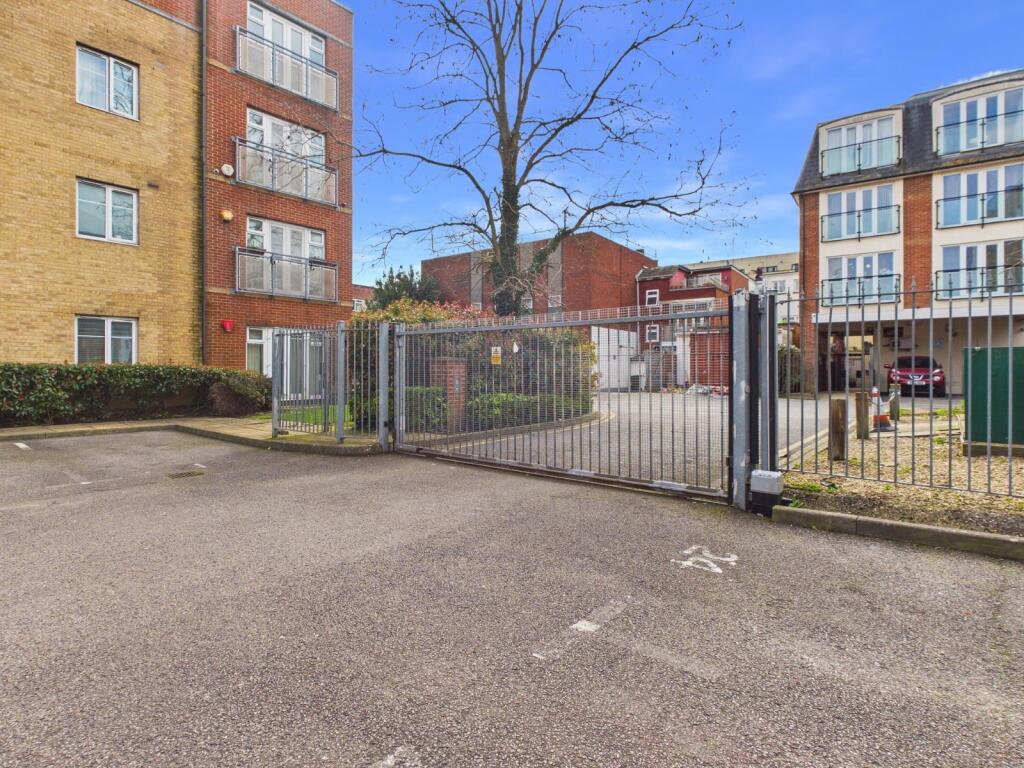
- Gated allocated parking space
- No upper chain
- Walking distance of Town Centre
- Ideal first time buy or investment
Additional details
- Parking
- Yes
Description
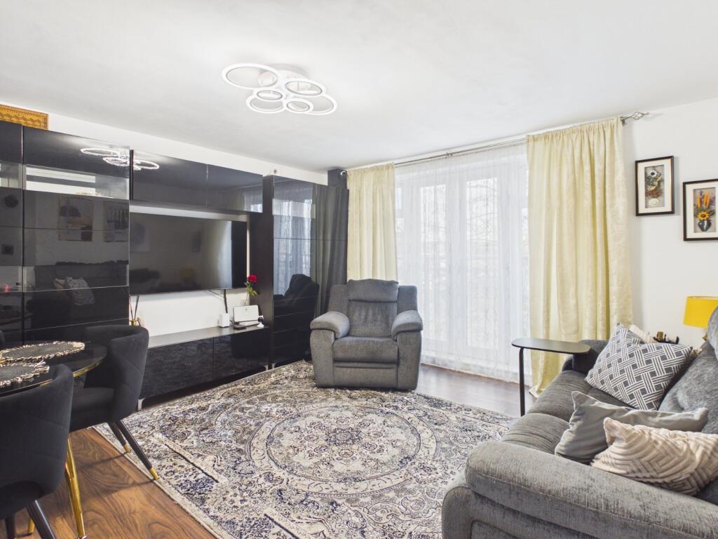
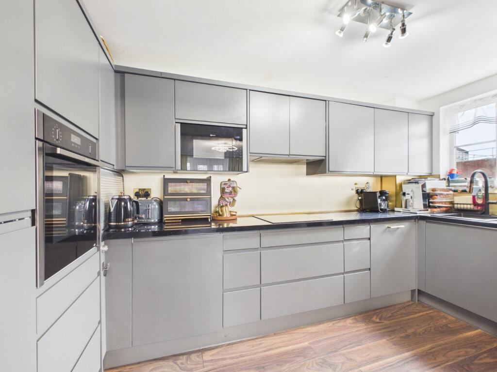
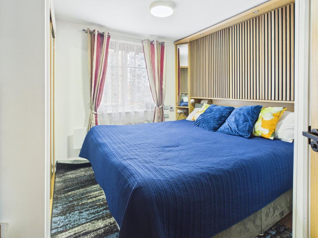
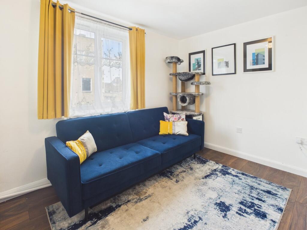
The property is well suited to first time buyers and investors alike, offering a principal bedroom with en-suite shower room, two further bedrooms, a spacious open plan kitchen and living area, and a modern family bathroom. Additional benefits include a gated allocated parking space and the advantage of no onward chain.
A three bedroom apartment, two bathrooms (ensuite to master), gated allocated parking space, no upper chain, walking distance of Town Centre, ideal first time buy or investment Council Tax Band: C EER: C
Listed by
Slough
The Frost Partnership
Reference: 172924661
EPC Rating & Upgrade Cost
Current rating: C
Potential rating: B
Inspection date: 23/02/2021
Expiry date: 22/02/2031
Est. upgrade cost to C: £1,500
Recommendations
- High heat retention storage heaters (£1,200 - £1,800)
Flood risk
Zone: 1
Risk: Low
Job (default Low)
Floorplans
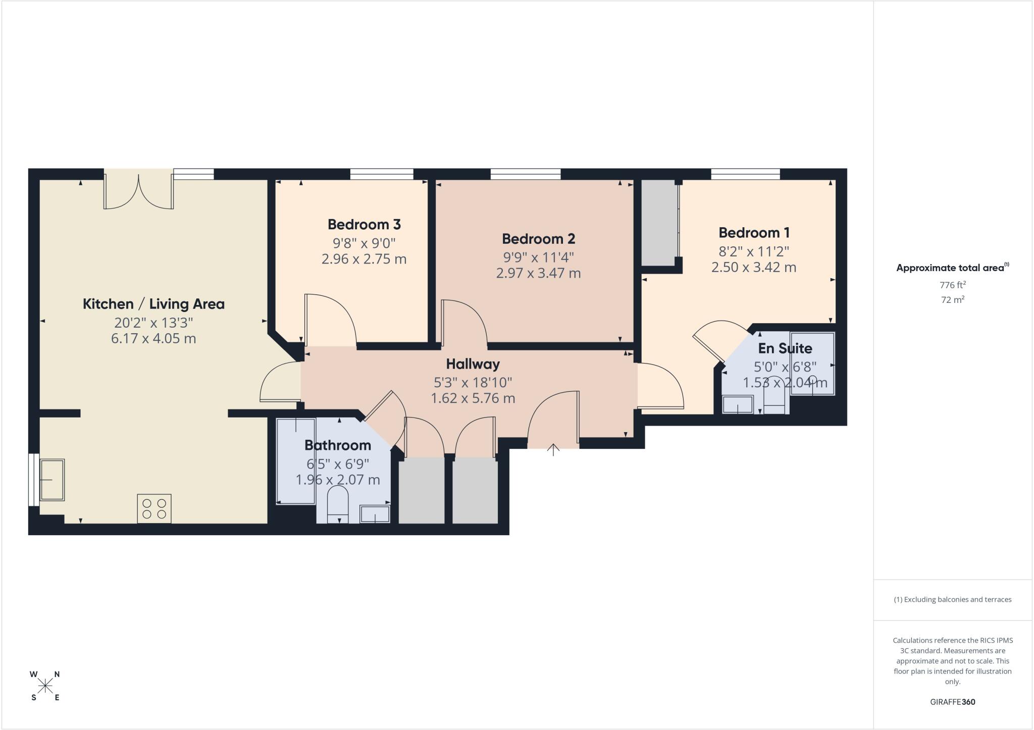
Floorplan
EPC Graphs
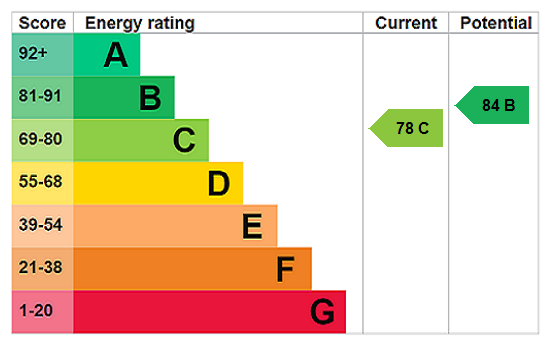
EPC Rating Graph
Price history
| Event | Date | Price | % change |
|---|---|---|---|
| Sold | 31/05/2005 (21 years ago) | £224,995 | — |
Source: HM Land Registry Price Paid Data. Crown copyright.
Sold Comparables
Same street and nearby sales within 0.25 miles (last 5 years). Data from Land Registry Price Paid.
| Address | Price | Date | Type |
|---|---|---|---|
| MILFORD COURT 11 WEXHAM ROAD, SLOUGH, SL1 1UE | £123,000 | 15/12/2025 | Flat |
| CROWN HOUSE FLAT 6 GROVE PARADE, SLOUGH, SL1 1AQ | £179,950 | 02/05/2025 | Flat |
| MILFORD COURT 18 WEXHAM ROAD, SLOUGH, SL1 1UE | £100,000 | 08/09/2023 | Flat |
| Same street NEO APARTMENTS, 1 - 9 22 WEXHAM ROAD, SLOUGH, SL1 1UG | £246,000 | 05/04/2023 | Flat |
Street average: £246,000 (1 sale)
Area average: £134,317 (3 sales)
Capital growth trend
Land Registry outcode average: last 12 months vs 5y and 10y ago (from sold prices).
House Price Index (HM Land Registry — official index, not sold-price averages): Slough. Series: Flats and maisonettes. As of March 2026.
Rental Range
Estimated market rent for Slough. Low = conservative, Realistic = average, Optimistic = best case.
Based on Local Authority from postcode lookup → Slough.
LHA (30th percentile) floor for East Thames Valley: £1,446/mo (Apr 2025 – Mar 2026)
Location
Nearby
Nearest stations, universities and amenities (distance from property).
| Type | Name | Distance |
|---|---|---|
| Shop | Hair & Beauty salon | 0.0 miles |
| Shop | Nutri Point | 0.0 miles |
| Bus stop | Wexham Road | 0.1 miles |
| Bus stop | Sorting Office | 0.1 miles |
| Train station | Slough | 0.4 miles |
| Train station | Windsor and Eton Riverside | 1.7 miles |
| University | Royal Holloway University | 5.7 miles |
| University | Royal Holloway | 5.8 miles |
| Hospital | Hounslow Medical Centre | 9.3 miles |
Street-level crime
| Category | Count |
|---|---|
| Violence and sexual offences | 227 |
| Anti-social behaviour | 56 |
| Public order | 48 |
| Criminal damage and arson | 39 |
| Drugs | 37 |
| Shoplifting | 37 |
| Other theft | 35 |
| Vehicle crime | 31 |
| Burglary | 20 |
| Robbery | 13 |
| Other crime | 11 |
| Bicycle theft | 10 |
| Possession of weapons | 9 |
| Theft from the person | 5 |
| Total incidents | 578 |
Within 1 mile during Apr 2026. Source: data.police.uk (England & Wales).
Schools nearby
Nearest open schools with Ofsted ratings (England). Closed schools are not shown. Data from Get Information about Schools and Ofsted.
| Name | Type | Distance | Ofsted |
|---|---|---|---|
| St Mary's Church of England Primary School | Primary | 0.2 miles | Good — 24 Feb 2016 |
| Upton Court Grammar School | Secondary | 0.4 miles | Outstanding — 23 Jan 2023 |
| St Bernard's Preparatory School | Other | 0.4 miles | — (No rating) |
| Long Close School | Other | 0.4 miles | — (No rating) |
| St Bernard's Catholic Grammar School | Secondary | 0.5 miles | Outstanding — 14 Jan 2024 |
Rental Comparables
Rental listings exist nearby, but none matched the 3-bedroom count for this property.
Rent-driven metrics
Based on Area rent estimate.
- Rent ratio — Monthly rent ÷ purchase price (1% rule). 1%+ = strong, 0.8–1% = okay, <0.8% = weak for cashflow.
- Max investor price — Rent ÷ 0.8%; the price at which rent would be 0.8% of price (Stoke-style target).
- Target investor price — Rent ÷ 1%; the price at which rent would be 1% of price (strong cashflow band).
- Gross yield — Annual rent as % of purchase price (no costs).