28 WORTON WAY
ISLEWORTH, ISLEWORTH, GREATER LONDON TW7 4AT
£1,395 pcm
Property details
Deprivation
Decile 4 (13,326 of 33,755)
Street crime
706 incidents within 1 mile (Apr 2026)
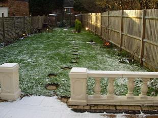
Key features
- 4 Bedrooms
- Very Spacious
- Close to Shopping Centre
- Quiet Residential Area
- Garage
Additional details
- Parking
- Yes
- Garden
- Yes
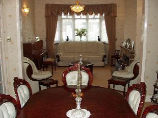
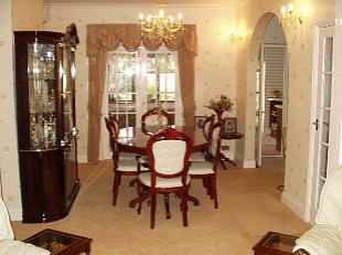
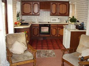
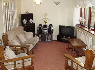
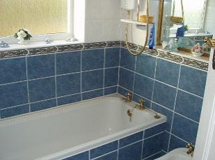
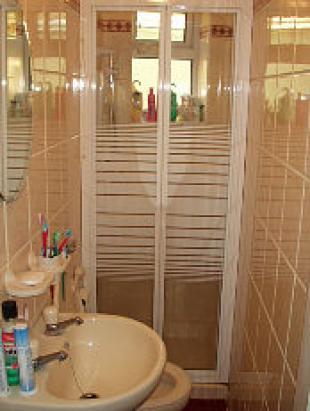
Description
The accommodation is situated close to local shops, schools and parks as well as being a short walk away from Hounslow High Street and the Shopping Centre. Transport options include local buses and Hounslow East Tube Station (Piccadilly line) between them they provide access to many areas including Heathrow, Richmond, Chiswick and Central London. Available UNFURNISHED.
Local Buses approx. 5 min.
Hounslow East Tube approx. 7 mins.
Listed by
Chiswick
Express Property Services
Reference: 1372707
EPC Rating & Upgrade Cost
Fetching EPC data… Refresh this page in a moment.
Flood risk
Zone: 1
Risk: Low
Job (default Low)
Rental Range
Estimated market rent for Hounslow. Low = conservative, Realistic = average, Optimistic = best case.
Based on Local Authority from postcode lookup → Hounslow.
LHA (30th percentile) floor for Outer West London: £1,795/mo (Apr 2025 – Mar 2026)
Location
Nearby
Nearest stations, universities and amenities (distance from property).
| Type | Name | Distance |
|---|---|---|
| Bus stop | Worton Way | 0.2 miles |
| Bus stop | Worton Gardens | 0.2 miles |
| Train station | Hounslow East | 0.2 miles |
| Shop | Western Plumbing and Heating Merchants | 0.2 miles |
| Shop | TryUs | 0.2 miles |
| Train station | Osterley | 0.5 miles |
| Hospital | Hounslow Medical Centre | 1.1 miles |
| University | University of West London | 3.2 miles |
| University | University of West London - Hellenic Institute Of Maritime Studies | 3.2 miles |
| Hospital | Bridge Lane Health Centre | 8.0 miles |
Street-level crime
| Category | Count |
|---|---|
| Violence and sexual offences | 182 |
| Anti-social behaviour | 139 |
| Shoplifting | 96 |
| Public order | 46 |
| Criminal damage and arson | 38 |
| Other theft | 38 |
| Drugs | 36 |
| Theft from the person | 34 |
| Vehicle crime | 33 |
| Burglary | 29 |
| Bicycle theft | 12 |
| Robbery | 12 |
| Other crime | 9 |
| Possession of weapons | 2 |
| Total incidents | 706 |
Within 1 mile during Apr 2026. Source: data.police.uk (England & Wales).
Schools nearby
Nearest open schools with Ofsted ratings (England). Closed schools are not shown. Data from Get Information about Schools and Ofsted.
| Name | Type | Distance | Ofsted |
|---|---|---|---|
| Spring Grove Primary School | Primary | 0.1 miles | Good — 16 Jul 2024 |
| Ashton House School | Other | 0.3 miles | — (No rating) |
| Great Oaks Charitable Trust T/A Great Oaks College | Other | 0.4 miles | — (No rating) |
| Kingsley Academy | Secondary | 0.4 miles | Good — 13 Nov 2019 |
| Oaklands School | Other | 0.4 miles | Outstanding — 15 Jul 2019 |
Rental Comparables
Residential lets from OpenRent and Rightmove for the area (same bedroom count). Use to validate rent estimates. Student lets are excluded.
| Title | Rent | Beds | Distance | As seen on |
|---|---|---|---|---|
| 4 Bed Semi-Detached House, The Drive, TW3 | £3,550/mo | 4 | 0.1 miles | OpenRent |
| 4 Bed Terraced House, Kingsley Road, TW3 | £2,500/mo | 4 | 0.24 miles | OpenRent |
| 4 Bed Semi-Detached House, Kingsley Road, TW3 | £2,850/mo | 4 | 0.42 miles | OpenRent |
Average rent: £2,967/mo (3 listings)