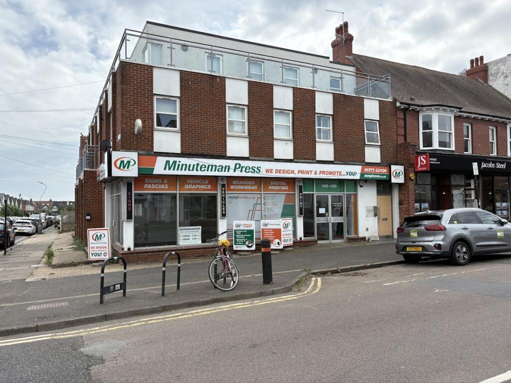
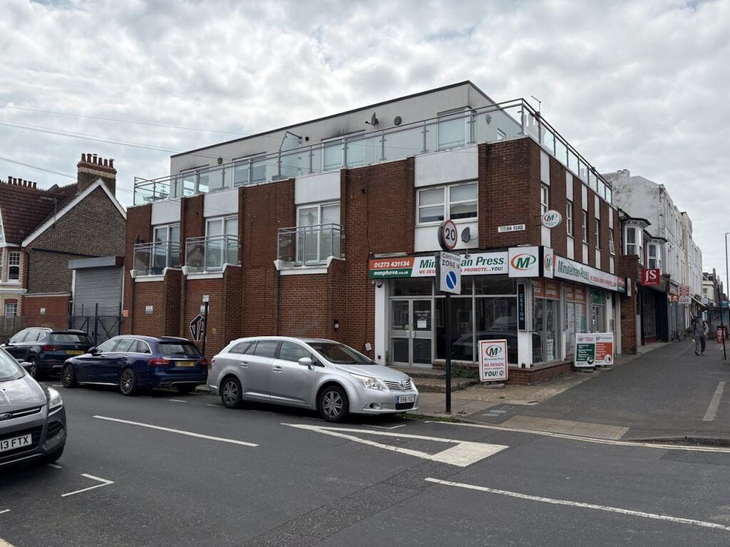
FLAT 4
186 - 188, PORTLAND ROAD, HOVE, BRIGHTON AND HOVE BN3 5QN
£1,667 pcm
Property details
Tenure
LEASEHOLD
Floor area
42 m²
Year built
England and Wales: 2007-2011
Last sold
£180,000 Aug 2011
Price per m²
£40/m²
Local average
£423,846 (-99.6%)
Deprivation
Decile 8 (23,982 of 33,755)
Street crime
442 incidents within 1 mile (Apr 2026)
Key features
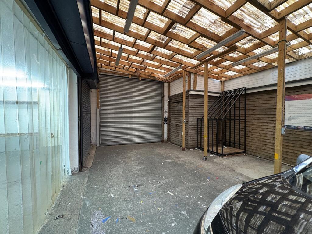
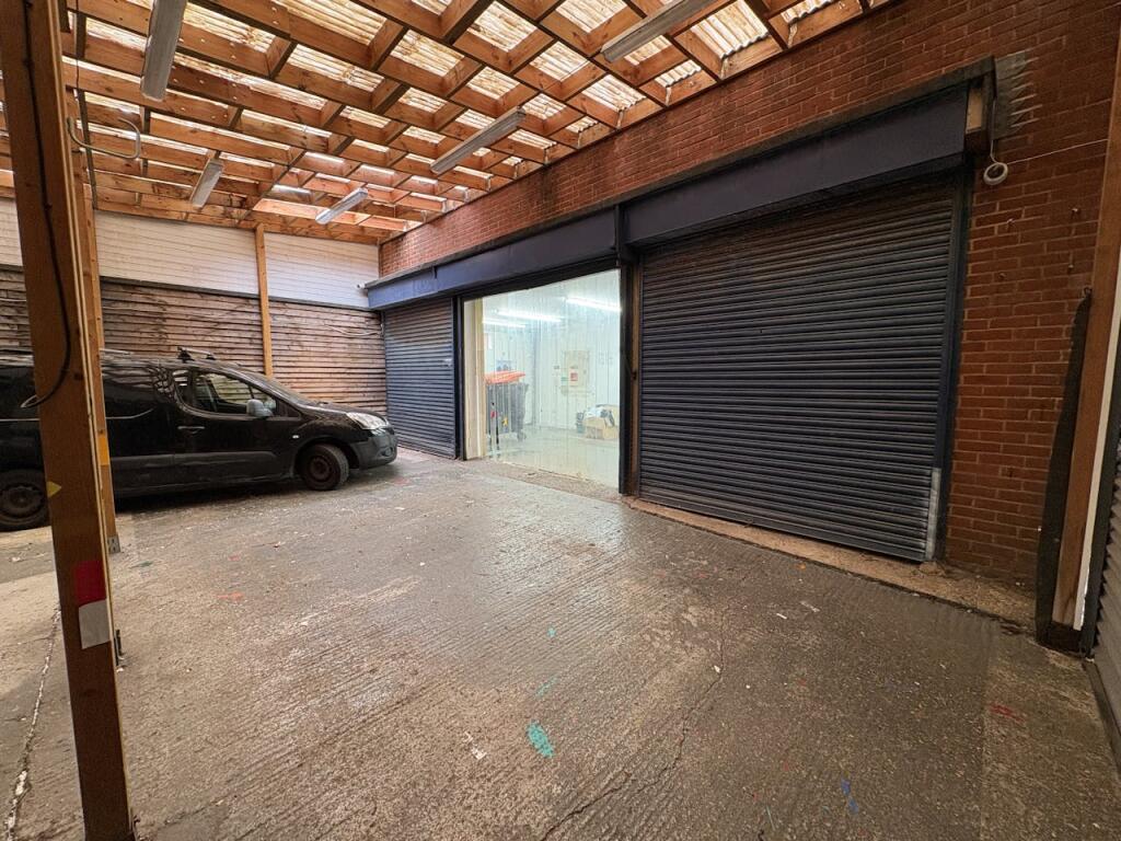
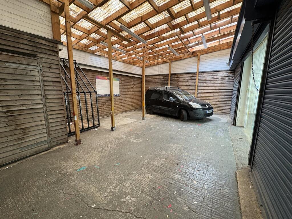
- Large E Class premises
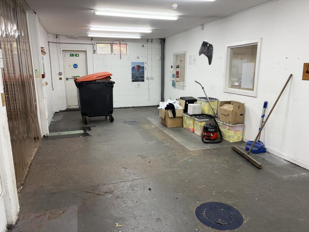
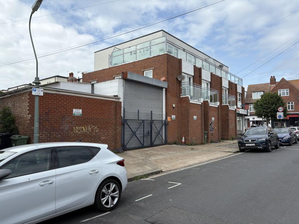
- Enclosed yard with roller shutter access
- Close to Aldrington and Portslade Station
Additional details
- Garden
- Yes
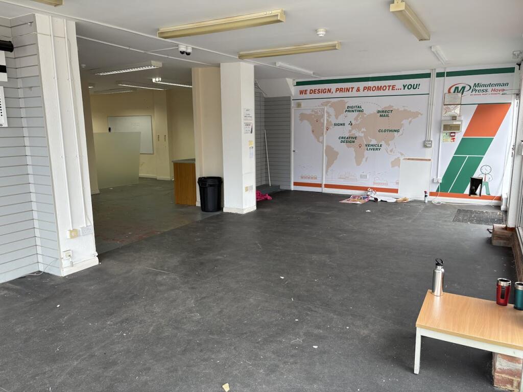
Description
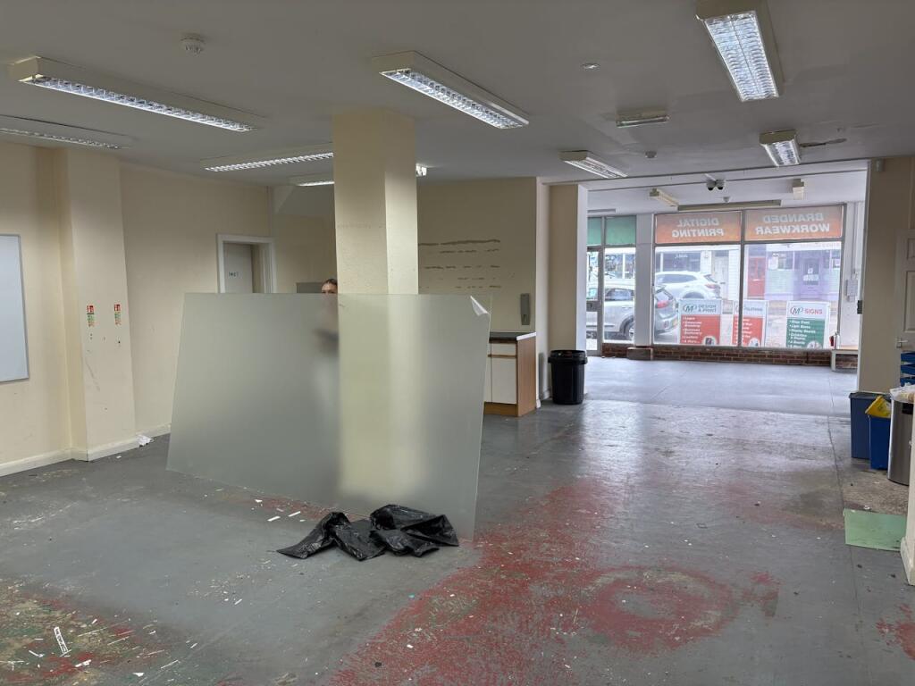
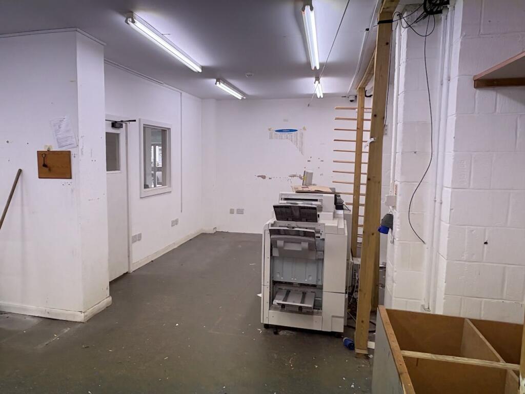
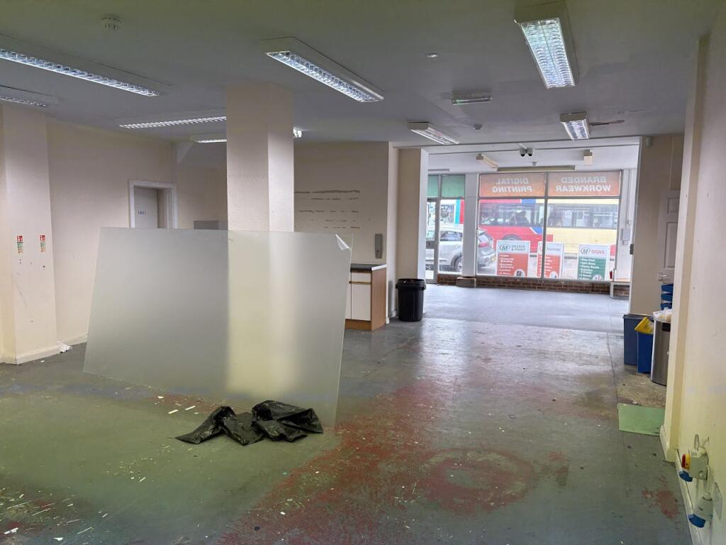
A chance to occupy this large E class premises within Portland Road, one of the main commercial thoroughfares of Hove. The premises benefits from a 44ft return frontage and is configured as mostly open plan with front reception area and main trading space behind, alongside w/c facilities. To the rear is an enclosed yard with roller shutter access from both the property and Titian Road.
Location
Situated on the southern side of Portland Road, Hove. Aldrington and Portslade Station are close by, and local traders include Ackerman Music, The Stoneham, Quaff Wine, Danny’s Restaurant, Kamsons Pharmacy and Hove Dental Clinic.
Terms
Available by way of a lease assignment with the property held on an effective full repairing and insuring lease for term of 12 years dated June 2021, expiring June 2033. The current passing rent is £20,000 per annum exclusive. There is a tenant only break dated 2 June 2029.
Listed by
East Sussex
GRAVES SON AND PILCHER LLP
Reference: 168421040
EPC Rating & Upgrade Cost
Fetching EPC data… Refresh this page in a moment.
Flood risk
Zone: 1
Risk: Low
Job (default Low)
Price history
| Event | Date | Price | % change |
|---|---|---|---|
| Sold | 30/08/2011 (14 years ago) | £180,000 | — |
Source: HM Land Registry Price Paid Data. Crown copyright.
Sold Comparables
Same street and nearby sales within 0.25 miles (last 5 years). Data from Land Registry Price Paid.
| Address | Price | Date | Type |
|---|---|---|---|
| 178A PORTLAND ROAD, HOVE, BRIGHTON AND HOVE, BN3 5QN | £365,000 | 31/03/2025 | Other |
| 190 PORTLAND ROAD, HOVE, BRIGHTON AND HOVE, BN3 5QN | £110,000 | 18/05/2022 | Other |
| 179 GARAGES TO THE NORTH OF PORTLAND ROAD, HOVE, BRIGHTON AND HOVE, BN3 5QJ | £50,000 | 22/09/2021 | Other |
Area average: £175,000 (3 sales)
Capital growth trend
Land Registry outcode average: last 12 months vs 5y and 10y ago (from sold prices).
House Price Index (HM Land Registry — official index, not sold-price averages): Brighton and Hove. Series: All dwelling types. As of March 2026.
Rental Range
Estimated market rent for Brighton and Hove. Low = conservative, Realistic = average, Optimistic = best case.
Based on Local Authority from postcode lookup → Brighton and Hove.
LHA (30th percentile) floor for Brighton and Hove: Apr 2025 – Mar 2026
Location
Nearby
Nearest stations, universities and amenities (distance from property).
| Type | Name | Distance |
|---|---|---|
| Bus stop | Scott Road | 0.0 miles |
| Shop | Unknown | 0.0 miles |
| Hospital | Aldrington House | 0.3 miles |
| Train station | Aldrington | 0.3 miles |
| Hospital | Nevill Hospital | 0.6 miles |
| Train station | Hove | 0.8 miles |
| University | University of Brighton Phoenix Halls | 2.4 miles |
| University | University of Brighton Moulesecoomb Campus | 3.0 miles |
Street-level crime
| Category | Count |
|---|---|
| Violence and sexual offences | 130 |
| Anti-social behaviour | 91 |
| Shoplifting | 64 |
| Public order | 38 |
| Criminal damage and arson | 29 |
| Other theft | 28 |
| Vehicle crime | 20 |
| Burglary | 12 |
| Other crime | 9 |
| Drugs | 6 |
| Robbery | 6 |
| Bicycle theft | 5 |
| Possession of weapons | 4 |
| Total incidents | 442 |
Within 1 mile during Apr 2026. Source: data.police.uk (England & Wales).
Schools nearby
Nearest open schools with Ofsted ratings (England). Closed schools are not shown. Data from Get Information about Schools and Ofsted.
| Name | Type | Distance | Ofsted |
|---|---|---|---|
| The Lioncare School | Other | 0.2 miles | Good — 14 Nov 2021 |
| Hove Junior School | Primary | 0.2 miles | Good — 8 Dec 2011 |
| West Hove Infant School | Primary | 0.2 miles | — (Inspected (no overall grade)) |
| St Christopher's School | Other | 0.3 miles | — (No rating) |
| Brighton and Hove Clinic School | Other | 0.4 miles | Outstanding — 18 Jun 2024 |
Rental Comparables
Residential lets from OpenRent and Rightmove for the area. Bedroom counts vary — use the Beds column to compare like-for-like lets. Student lets are excluded.
| Title | Rent | Beds | Distance | As seen on |
|---|---|---|---|---|
| 2 Bed Flat, Hove, BN3 | £3,500/mo | 2 | 0.8 miles | OpenRent |
| 2 Bed Flat, The Priory, BN3 | £1,450/mo | 2 | 0.8 miles | OpenRent |
| 2 Bed Flat, Eaton Gardens, BN3 | £4,000/mo | 2 | 0.8 miles | OpenRent |
| 2 Bed Flat, Parking Incl & Pet Friendly, BN3 | £1,975/mo | 2 | 0.89 miles | OpenRent |
Average rent: £2,731/mo (4 listings)
Rent-driven metrics
Based on OpenRent comparables.
- Rent ratio — Monthly rent ÷ purchase price (1% rule). 1%+ = strong, 0.8–1% = okay, <0.8% = weak for cashflow.
- Max investor price — Rent ÷ 0.8%; the price at which rent would be 0.8% of price (Stoke-style target).
- Target investor price — Rent ÷ 1%; the price at which rent would be 1% of price (strong cashflow band).
- Gross yield — Annual rent as % of purchase price (no costs).
- Cost-to-rent — Price ÷ annual rent (from OpenRent comparables). Under 14× = strong, 14–16× = acceptable, 17×+ = compressed.
- Cashflow — Rent minus mortgage, 10% maintenance, £25/mo compliance. Assumes 75% LTV, 3.95% APR (5yr fixed), 25yr term.
- ROI — Annual profit ÷ cash in (deposit + 4% purchase costs).