FLAT 13
THE BREWERY 1881, 30, SOUTH STREET, BRIGHTON, PORTSLADE, BRIGHTON AND HOVE BN41 2AQ
£1,100 pcm

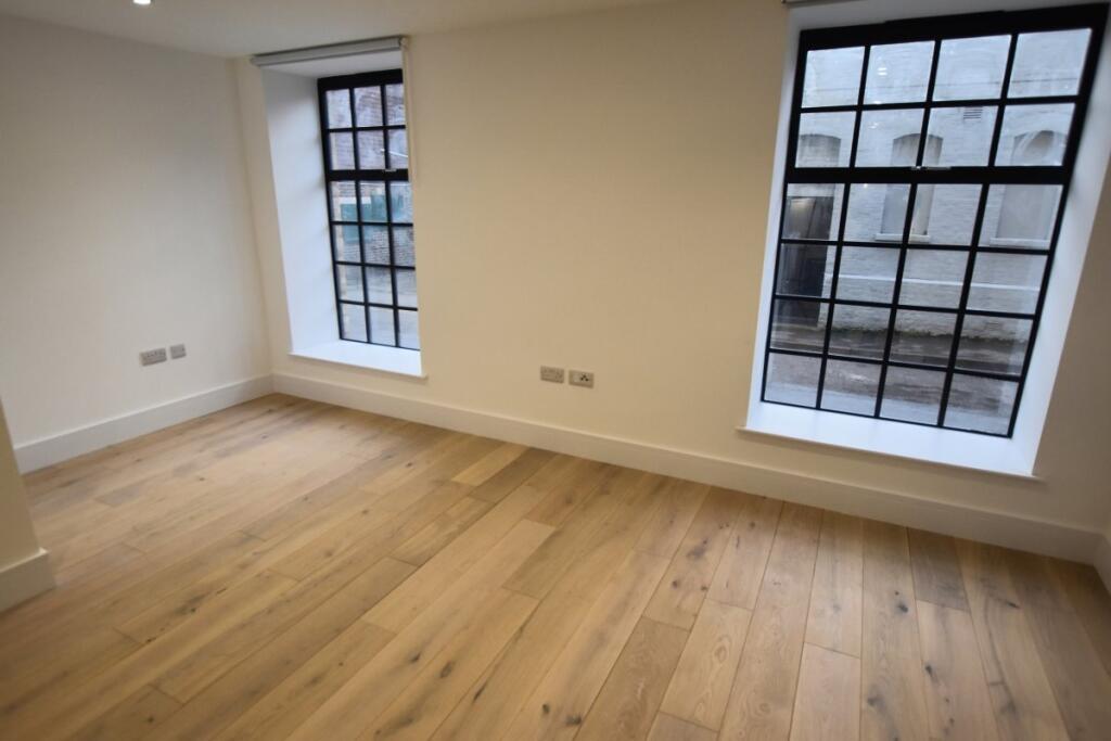

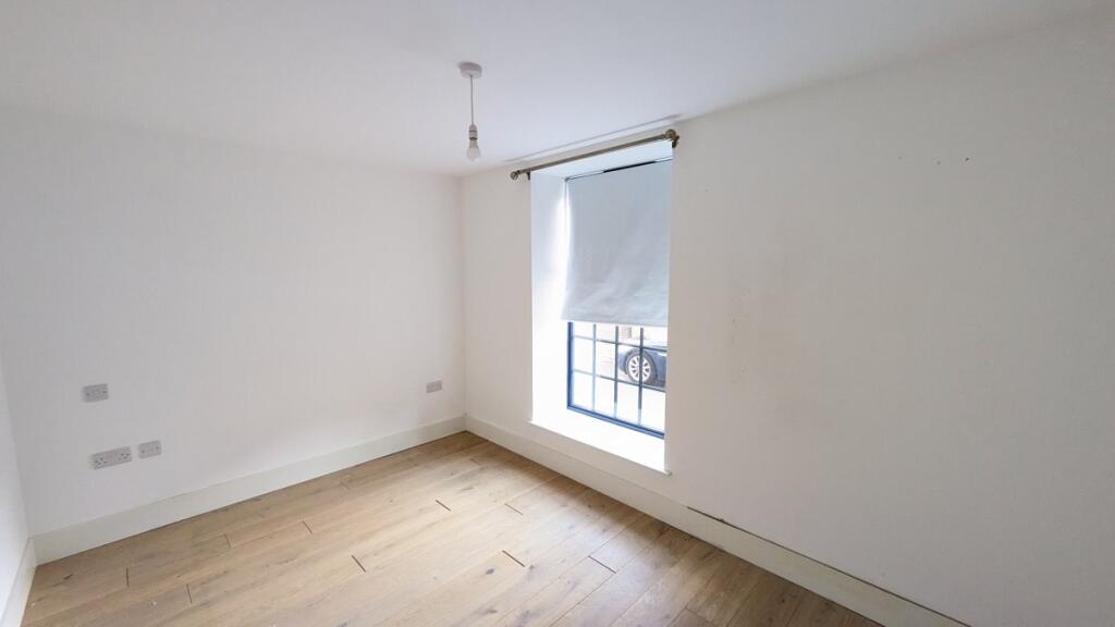
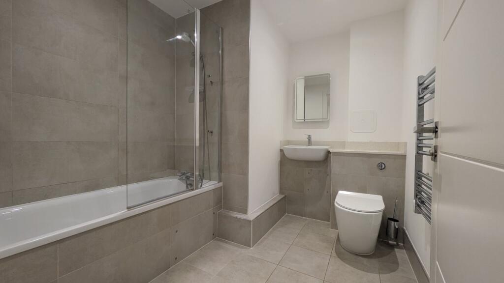
Photo 1 Photo 2 Photo 3 Photo 4 Photo 5
/ 5
Property details
Floor area
43 m²
Council tax band
B
Street crime
284 incidents within 1 mile (Apr 2026)
Key features
- Stunning Brand New 1 Bed Apartment
- Spacious Open Plan Living
- Modern Kitchen
- Contemporary Bathroom Suite
- Iconic Portslade Village Location
- Available November
- Unfurnished
- Energy Rating C
- Council Tax Band B
Additional details
- Electricity
- Mains supply
- Water
- Mains supply
- Sewerage
- Mains supply
- Heating
- Gas central
- Listed property
- No
- Flooded in last 5 years
- No
- Flood defences
- No
Description
* A holding deposit of £253 is payable to secure this property
* A damage deposit of £1269 will be payable, along with the first rent payment, prior to moving in
Listed by
Shoreham-By-Sea
Oakley Residential
Reference: 168471146
EPC Rating & Upgrade Cost
Fetching EPC data… Refresh this page in a moment.
Flood risk
Zone: 1
Risk: Low
Job (default Low)
Floorplans
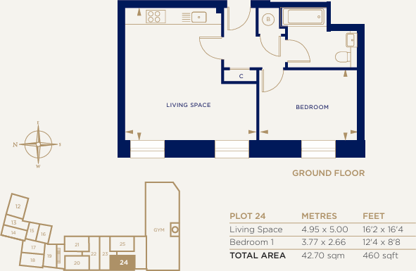
Floor Plan
EPC Graphs
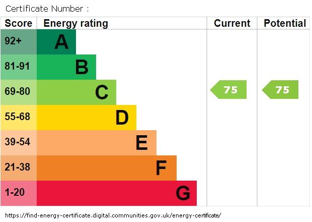
EPC graph
Rental Range
Estimated market rent for South East. Low = conservative, Realistic = average, Optimistic = best case.
Based on Postcode area BN → South East.
LHA (30th percentile) floor for Crawley & Reigate: £858/mo (Apr 2025 – Mar 2026)
Location
Address
South Street
Nearby
Nearest stations, universities and amenities (distance from property).
| Type | Name | Distance |
|---|---|---|
| Bus stop | Portslade Old Village | 0.0 miles |
| Shop | Unknown | 0.2 miles |
| Train station | Fishersgate | 0.6 miles |
| Hospital | Portslade Health Centre | 0.7 miles |
| Train station | Portslade | 0.8 miles |
| Hospital | Nevill Hospital | 1.2 miles |
| University | University of Brighton Phoenix Halls | 4.0 miles |
| University | University of Brighton Moulesecoomb Campus | 4.4 miles |
Street-level crime
| Category | Count |
|---|---|
| Anti-social behaviour | 87 |
| Violence and sexual offences | 71 |
| Shoplifting | 30 |
| Criminal damage and arson | 26 |
| Public order | 19 |
| Other theft | 16 |
| Vehicle crime | 12 |
| Other crime | 8 |
| Drugs | 5 |
| Burglary | 4 |
| Robbery | 3 |
| Bicycle theft | 2 |
| Possession of weapons | 1 |
| Total incidents | 284 |
Within 1 mile during Apr 2026. Source: data.police.uk (England & Wales).
Schools nearby
Nearest open schools with Ofsted ratings (England). Closed schools are not shown. Data from Get Information about Schools and Ofsted.
| Name | Type | Distance | Ofsted |
|---|---|---|---|
| Peter Gladwin Primary School | Primary | 0.1 miles | Good — 18 Mar 2015 |
| Hill Park School | Other | 0.2 miles | Outstanding — 20 Jul 2022 |
| St Nicolas CofE Primary School | Primary | 0.3 miles | Good — 12 Jan 2023 |
| Brackenbury Primary School | Primary | 0.3 miles | Good — 8 May 2022 |
| Portslade Aldridge Community Academy | Secondary | 0.6 miles | Good — 9 Dec 2016 |
Rental Comparables
Rental listings exist nearby, but none matched the 1-bedroom count for this property.