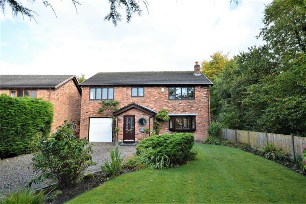
The Swallows
CANN LANE SOUTH, WARRINGTON, APPLETON, WARRINGTON WA4 5NJ
£825,000
Property details
Tenure
FREEHOLD
Floor area
243 m²
Year built
England and Wales: 1983-1990
Last sold
£795,000 Mar 2023
Price per m²
£3,395/m²
Local average
£603,790 (+36.6%)
Deprivation
Decile 10 (32,729 of 33,755)
Street crime
18 incidents within 1 mile (Apr 2026)
Key features
- SOUGHT AFTER LOCATION
- BEAUTIFULLY PRESENTED
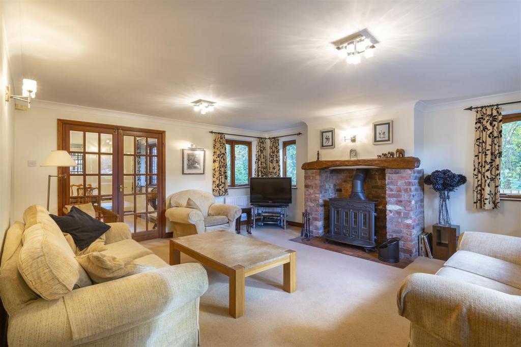
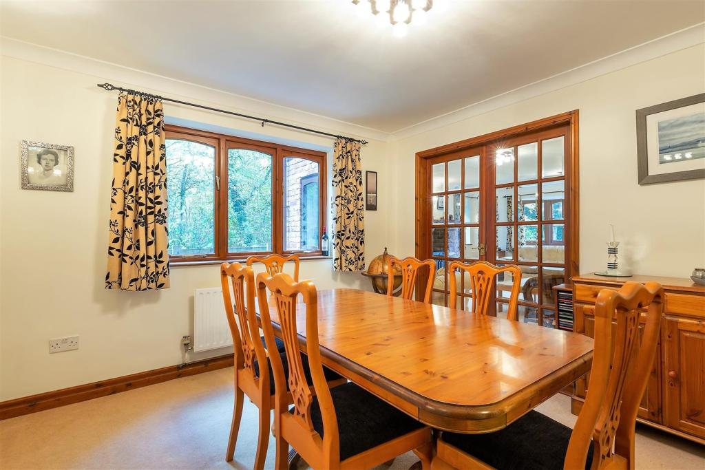
- THREE RECEPTION ROOMS
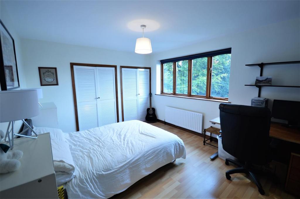
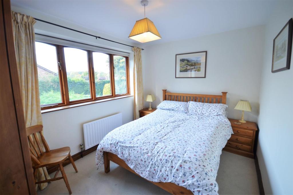
- FIVE DOUBLE BEDROOMS
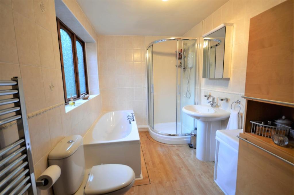
- THREE BATH/SHOWER ROOMS
- FAMILY DINING KITCHEN
- UTILITY ROOM & CLOAKROOM WC
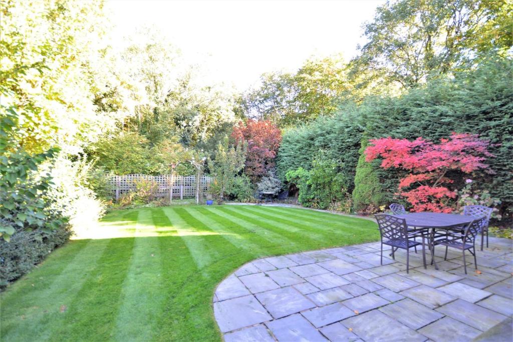
- BACKING ONTO WOODLAND
Additional details
- Parking
- Yes
- Garden
- Yes
Description
****
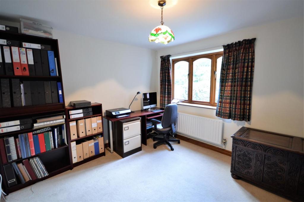
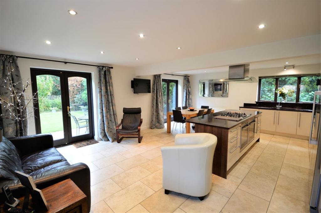
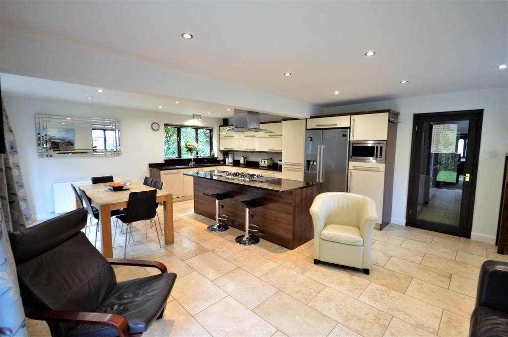
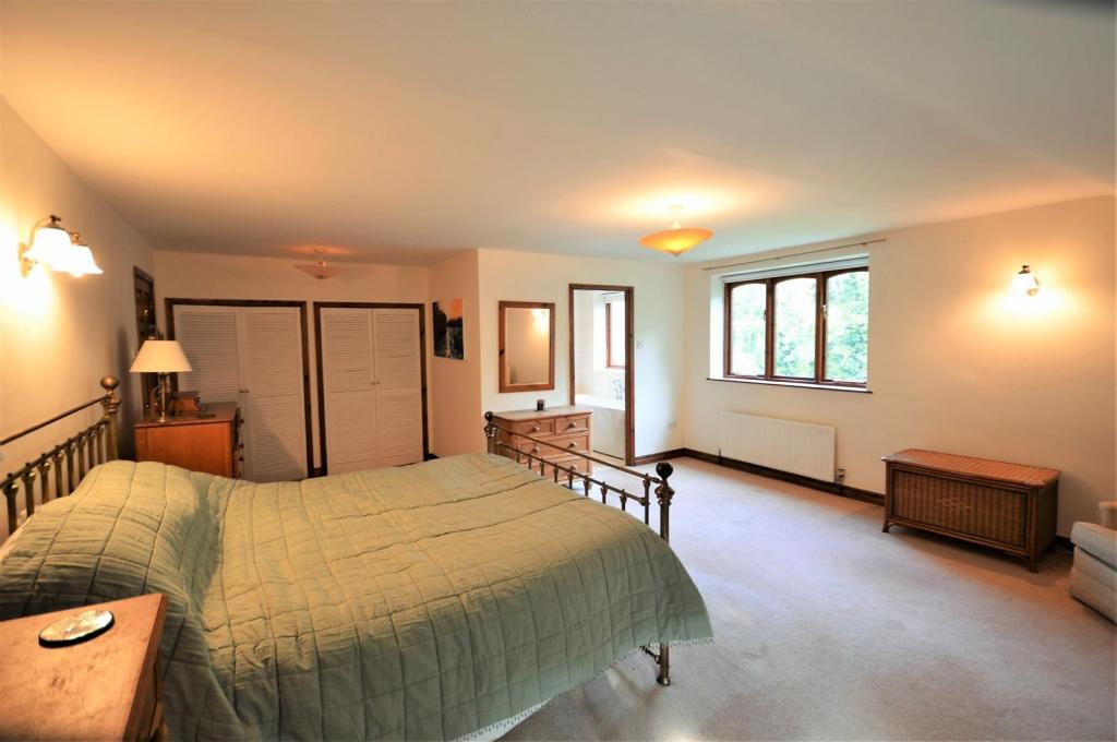
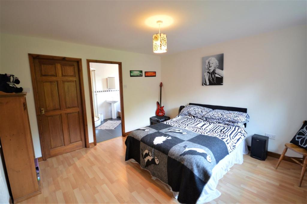
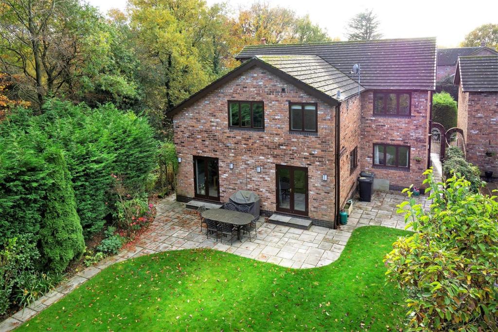
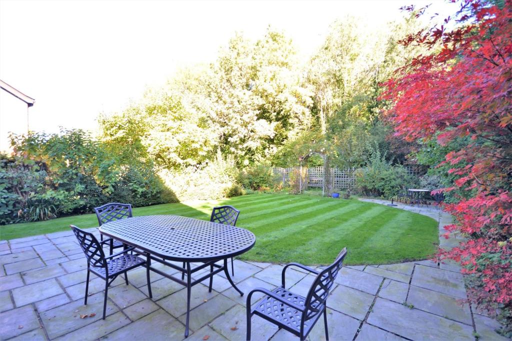
The Swallows is located on one of the areas sought after roads and is approached over a driveway providing ample off road parking for several vehicles, lawn to the side with an arrange of plants and shrubs. The house is accessed through the porch into the hallway which provides access to the lounge with multi fuel burner, dining room, home office, utility room, cloakroom WC and family dining kitchen to the rear with under floor heating and two sets of French doors leading out onto the rear garden. To the first floor the master bedroom has a en-suite bathroom and bedroom two is served by an en-suite shower room, then there are a further three bedrooms and a family bathroom. This wonderful property is presented to a very high standard throughout and the garden to the rear is well established with an abundance of plants, trees and shrubs and backs woodland .
Listed by
Stockton Heath
Gascoigne Halman - Connells
Reference: 121517717
EPC ratings on this postcode
We don't have a matched EPC for this property yet. Below are efficiency scores and details for other addresses on this postcode.
| Address | Current | Potential | Floor area | Age band | Type |
|---|---|---|---|---|---|
| Boyne House, Cann Lane South, Appleton, WARRINGTON | 69 | 77 | 304 m² | England and Wales: 1983-1990 | Detached |
| Cann Lane Farm, Cann Lane South, Appleton, WARRINGTON | 28 | 75 | 100 m² | England and Wales: 1950-1966 | Detached |
| Hawthorn Cottage, Cann Lane South, Appleton, WARRINGTON | 49 | 69 | 275 m² | England and Wales: 1976-1982 | Detached |
| Layfield House, Cann Lane South, Appleton, WARRINGTON | 67 | 80 | 358 m² | England and Wales: 1983-1990 | Detached |
| Linton, Cann Lane South, Appleton, WARRINGTON | 73 | 80 | 259 m² | England and Wales: 1983-1990 | Detached |
| Oak Tree Cottage, Cann Lane South, Appleton, WARRINGTON | 78 | 84 | 223 m² | England and Wales: 2007-2011 | Detached |
| Russets, Cann Lane South, Appleton, WARRINGTON | 74 | 81 | 264 m² | England and Wales: 1983-1990 | Detached |
| THE SWALLOWS, CANN LANE SOUTH, APPLETON, WARRINGTON | 70 | 78 | 243 m² | England and Wales: 1983-1990 | Detached |
Flood risk
Zone: 1
Risk: Low
Job (default Low)
Floorplans
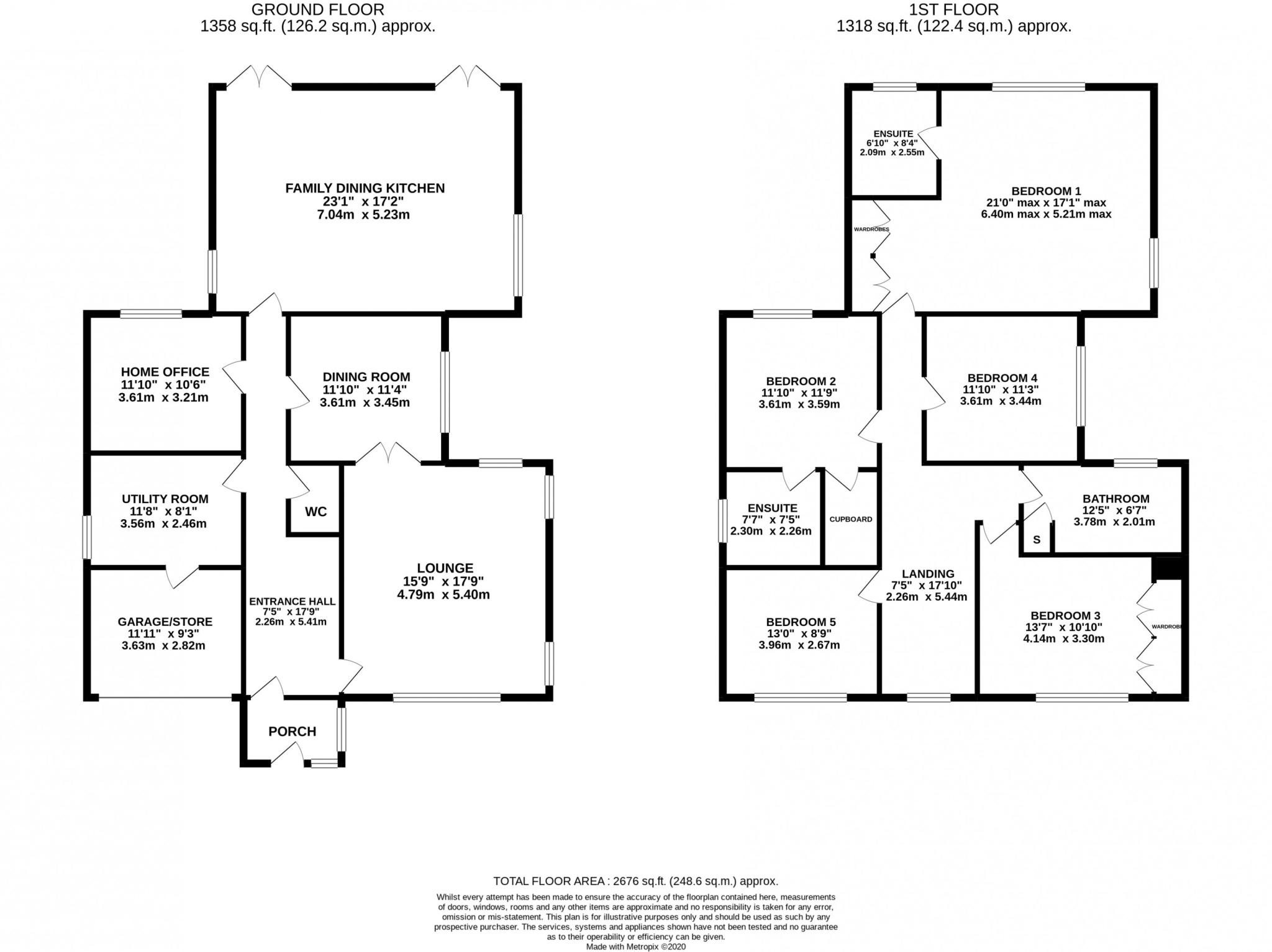
floorplan
EPC Graphs
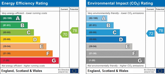
epc
Price history
| Event | Date | Price | % change |
|---|---|---|---|
| Sold | 31/03/2023 (3 years ago) | £795,000 | — |
Source: HM Land Registry Price Paid Data. Crown copyright.
Sold Comparables
Same street and nearby sales within 0.25 miles (last 5 years). Data from Land Registry Price Paid.
| Address | Price | Date | Type |
|---|---|---|---|
| Same street RUSSETS CANN LANE SOUTH, APPLETON, WARRINGTON, WA4 5NJ | £945,000 | 15/11/2023 | Detached |
| 17 WOODBRIDGE CLOSE, APPLETON, WARRINGTON, WA4 5RD | £720,000 | 19/10/2023 | Detached |
| 18 PIPPIN VALE, APPLETON, WARRINGTON, WA4 5HE | £420,000 | 28/06/2023 | Detached |
| 77 BRAEBURN DRIVE, APPLETON, WARRINGTON, WA4 5AA | £560,995 | 26/05/2023 | Detached |
| 68 BRAEBURN DRIVE, APPLETON, WARRINGTON, WA4 5AA | £537,995 | 04/05/2023 | Detached |
| 69 BRAEBURN DRIVE, APPLETON, WARRINGTON, WA4 5AA | £447,995 | 23/12/2022 | Detached |
| 1 BRAEBURN DRIVE, APPLETON, WARRINGTON, WA4 5AA | £610,000 | 16/12/2022 | Detached |
| 3 BRAEBURN DRIVE, APPLETON, WARRINGTON, WA4 5AA | £510,000 | 16/12/2022 | Detached |
| 7 SHOCKLEY DRIVE, APPLETON, WARRINGTON, WA4 5RP | £335,995 | 09/12/2022 | Detached |
| 15 SHOCKLEY DRIVE, APPLETON, WARRINGTON, WA4 5RP | £483,995 | 25/11/2022 | Detached |
| 11 SHOCKLEY DRIVE, APPLETON, WARRINGTON, WA4 5RP | £483,995 | 25/11/2022 | Detached |
| 8 LAMBOURNE CRESCENT, APPLETON, WARRINGTON, WA4 5RE | £373,995 | 25/11/2022 | Detached |
| 9 SHOCKLEY DRIVE, APPLETON, WARRINGTON, WA4 5RP | £446,995 | 25/11/2022 | Detached |
| 4 SHOCKLEY DRIVE, APPLETON, WARRINGTON, WA4 5RP | £483,995 | 24/11/2022 | Detached |
| 10 SHOCKLEY DRIVE, APPLETON, WARRINGTON, WA4 5RP | £429,995 | 18/11/2022 | Detached |
| 12 SHOCKLEY DRIVE, APPLETON, WARRINGTON, WA4 5RP | £323,995 | 28/10/2022 | Detached |
| 11 LAMBOURNE CRESCENT, APPLETON, WARRINGTON, WA4 5RE | £348,995 | 23/09/2022 | Detached |
| 15 LAMBOURNE CRESCENT, APPLETON, WARRINGTON, WA4 5RE | £349,995 | 22/09/2022 | Detached |
| 21 LAMBOURNE CRESCENT, APPLETON, WARRINGTON, WA4 5RE | £348,995 | 26/08/2022 | Detached |
| 36 GALA CLOSE, APPLETON, WARRINGTON, WA4 5BF | £520,000 | 30/06/2022 | Detached |
| 32 GALA CLOSE, APPLETON, WARRINGTON, WA4 5BF | £505,000 | 30/06/2022 | Detached |
Street average: £945,000 (1 sale)
Area average: £462,147 (20 sales)
Capital growth trend
Land Registry outcode average: last 12 months vs 5y and 10y ago (from sold prices).
House Price Index (HM Land Registry — official index, not sold-price averages): Warrington. Series: Detached. As of March 2026.
Rental Range
Estimated market rent for Warrington. Low = conservative, Realistic = average, Optimistic = best case.
Based on Local Authority from postcode lookup → Warrington.
LHA (30th percentile) floor for North Cheshire: £997/mo (Apr 2025 – Mar 2026)
Location
Address
Cann Lane South
Nearby
Nearest stations, universities and amenities (distance from property).
| Type | Name | Distance |
|---|---|---|
| Bus stop | Stoneacre Gardens | 0.2 miles |
| Shop | Aspect | 0.4 miles |
| Shop | Co-op Food | 0.4 miles |
| Hospital | Spire Cheshire Hospital | 1.0 miles |
| Train station | Warrington Bank Quay | 3.0 miles |
| Train station | Warrington Central | 3.2 miles |
| Hospital | Warrington Hospital | 3.6 miles |
| University | University of Chester - Warrington Campus | 4.6 miles |
Street-level crime
| Category | Count |
|---|---|
| Vehicle crime | 6 |
| Anti-social behaviour | 4 |
| Violence and sexual offences | 4 |
| Drugs | 2 |
| Burglary | 1 |
| Public order | 1 |
| Total incidents | 18 |
Within 1 mile during Apr 2026. Source: data.police.uk (England & Wales).
Schools nearby
Nearest open schools with Ofsted ratings (England). Closed schools are not shown. Data from Get Information about Schools and Ofsted.
| Name | Type | Distance | Ofsted |
|---|---|---|---|
| Stretton St Matthew's CofE Primary School | Primary | 0.7 miles | Outstanding — 21 May 2015 |
| Grappenhall Heys Community Primary School | Primary | 0.8 miles | Outstanding — 18 Jun 2015 |
| Appleton Thorn Primary School | Primary | 0.9 miles | Outstanding — 7 Dec 2010 |
| Broomfields Junior School | Primary | 1.0 miles | Good — 26 Jun 2024 |
| Bridgewater High School | Secondary | 1.1 miles | Good — 21 Nov 2022 |
Rental Comparables
Loading rental comparables for this postcode. Refresh in a few minutes.
Rent-driven metrics
Based on Area rent estimate.
- Rent ratio — Monthly rent ÷ purchase price (1% rule). 1%+ = strong, 0.8–1% = okay, <0.8% = weak for cashflow.
- Max investor price — Rent ÷ 0.8%; the price at which rent would be 0.8% of price (Stoke-style target).
- Target investor price — Rent ÷ 1%; the price at which rent would be 1% of price (strong cashflow band).
- Gross yield — Annual rent as % of purchase price (no costs).
Enter House Number
Enter the house number to help us retrieve more accurate pricing history and property data.
Please log in to submit or correct the house number for this listing.
Log in to continue