7 THURNCOURT ROAD
LEICESTER, LEICESTER LE5 2NN
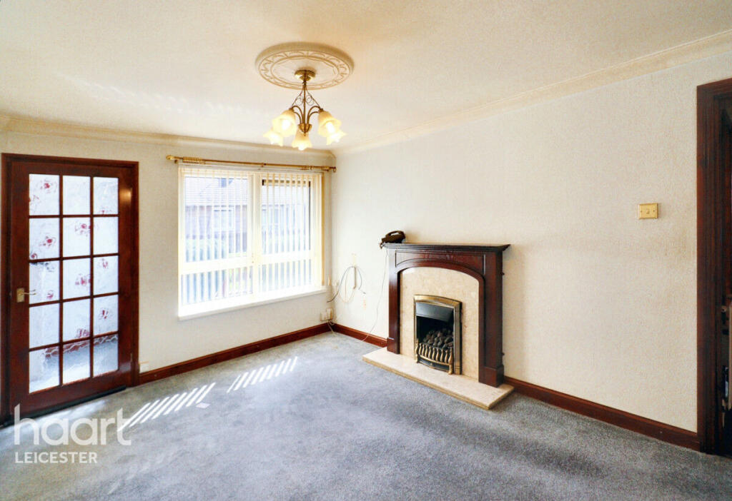
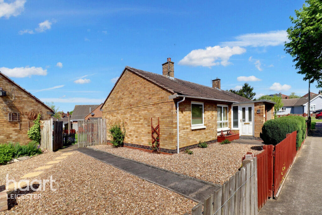
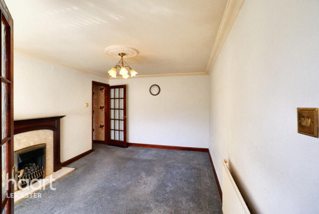
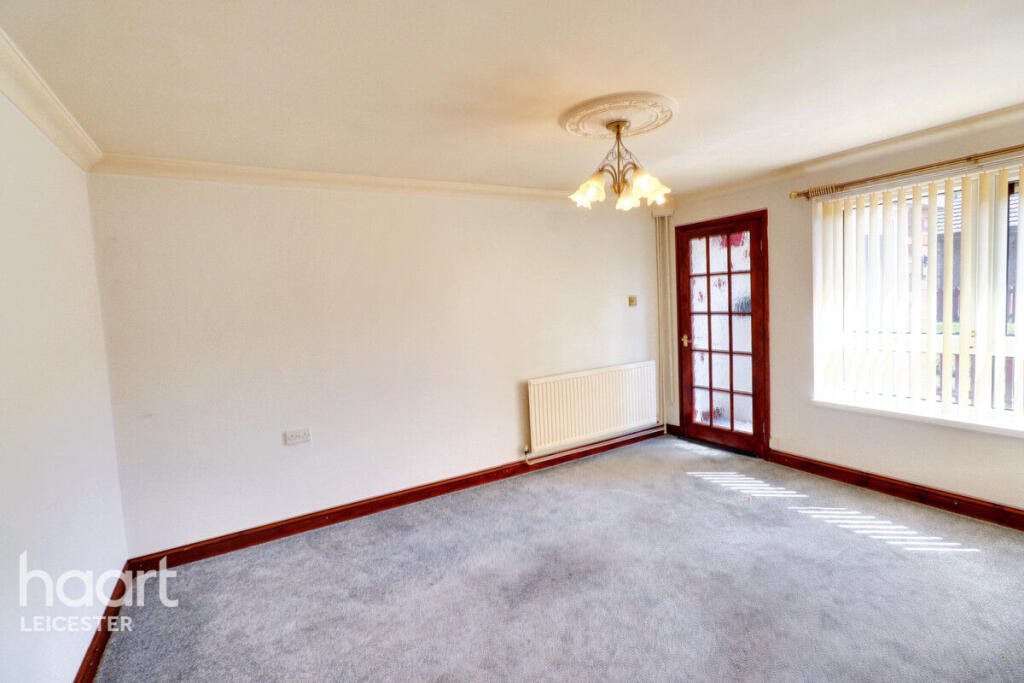
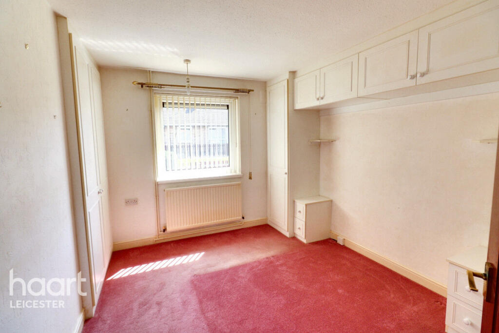
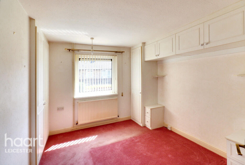
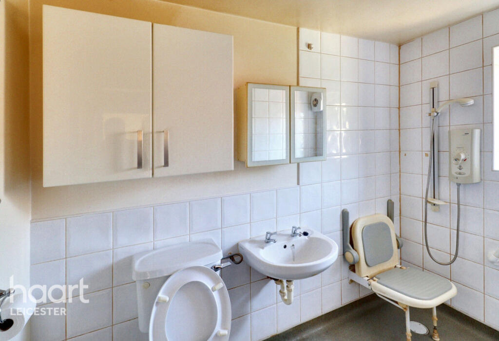
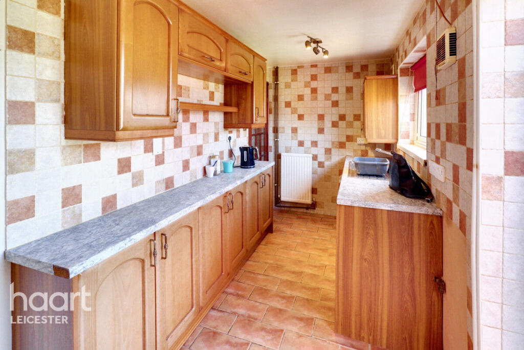
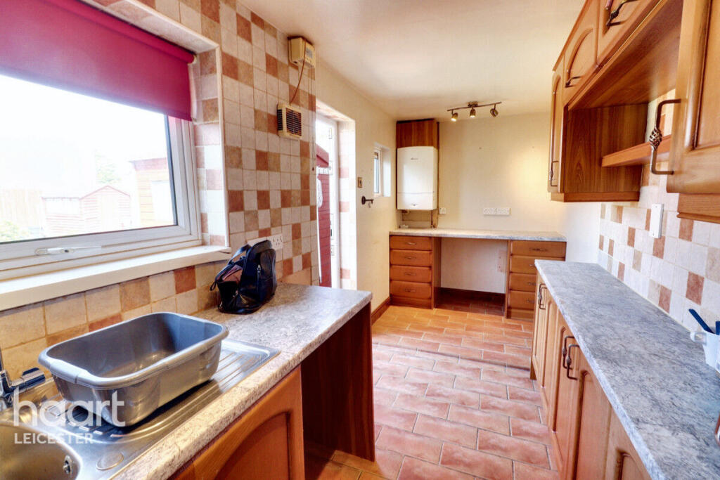
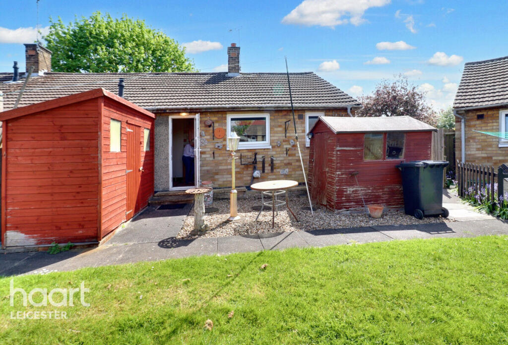
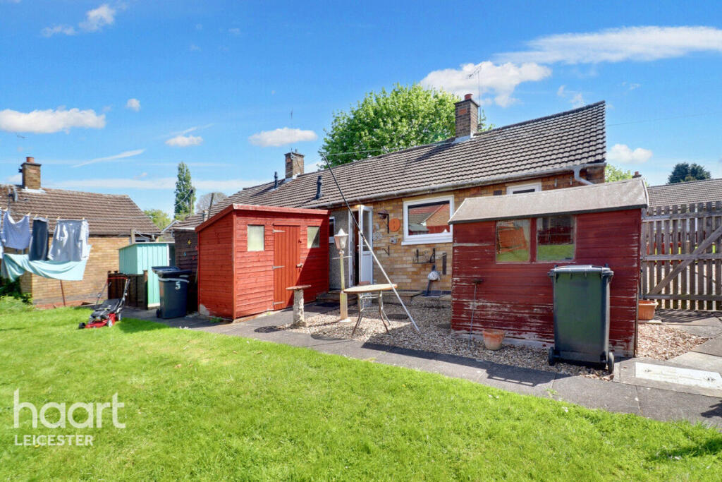
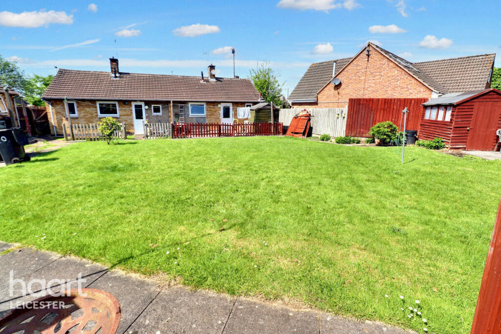
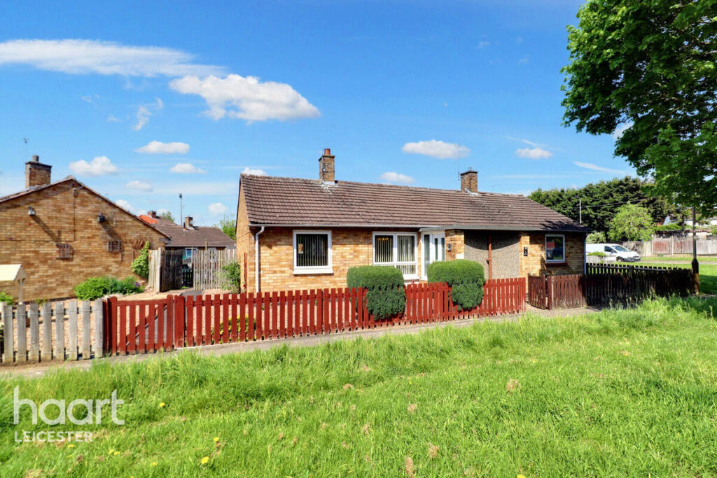
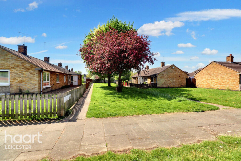
Photo 1 Photo 2 Photo 3 Photo 4 Photo 5 Photo 6 Photo 7 Photo 8 Photo 9 Photo 10 Photo 11 Photo 12 Photo 13 Photo 14
/ 14
Property details
Tenure
FREEHOLD
Floor area
39 m²
Council tax band
A
Year built
England and Wales: 1967-1975
Last sold
£148,000 Dec 2025
Price per m²
£3,846/m²
Local average
£377,737 (-60.3%)
Deprivation
Decile 4 (11,255 of 33,755)
Street crime
261 incidents within 1 mile (Apr 2026)
Key features
- Semi-detached
- Bungalow
- No Chain
- Wet Room
- Private & Communal Gardens
- A Must See
Description
Inside, the accommodation comprises a welcoming lounge, a functional kitchen, a spacious double bedroom, and a modern wet room for added convenience.
Externally, the property enjoys the benefits of both private and communal gardens – ideal for relaxing outdoors or socialising with neighbours. The location offers easy access to local amenities, shops, and transport links, making everyday living effortless.
A superb chance to secure a lovely home in a desirable area – early viewing is highly recommended.
Listed by
Leicester
Spicerhaart
Reference: 161373047
EPC Rating & Upgrade Cost
Fetching EPC data… Refresh this page in a moment.
Flood risk
Zone: 2
Risk: In flood risk area
Environment Agency Flood Risk Areas (APSFR)
Floorplans
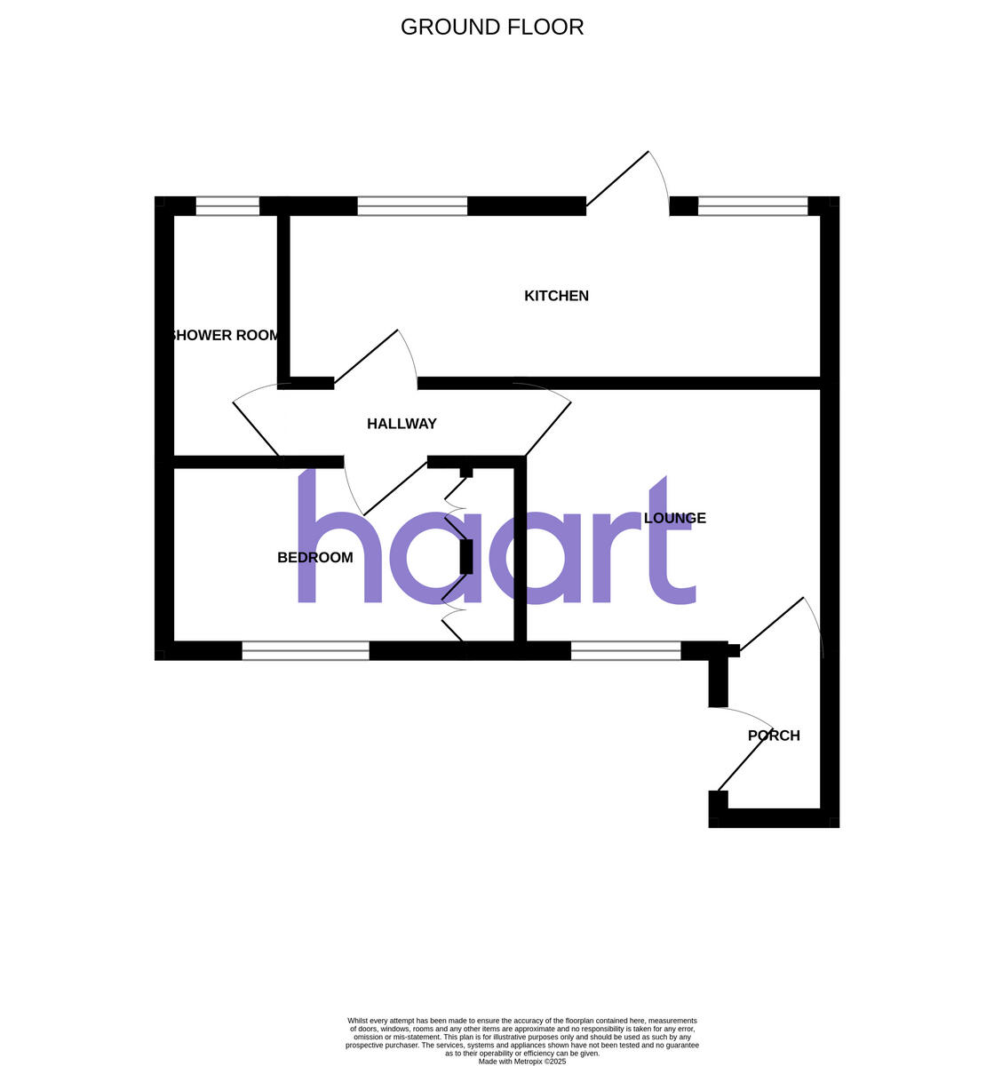
Floorplan 1
EPC Graphs
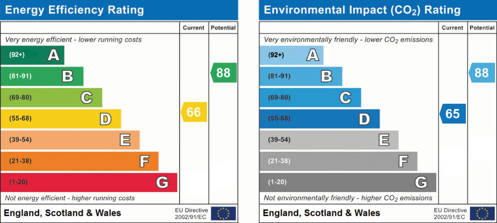
EPC 1
Price history
| Event | Date | Price | % change |
|---|---|---|---|
| Sold | 19/12/2025 (5 months ago) | £148,000 | — |
Source: HM Land Registry Price Paid Data. Crown copyright.
Sold Comparables
Same street and nearby sales within 0.25 miles (last 5 years). Data from Land Registry Price Paid.
| Address | Price | Date | Type |
|---|---|---|---|
| 34 RADIANT ROAD, LEICESTER, LE5 2HR | £302,500 | 19/12/2025 | Detached |
| 227 SCRAPTOFT LANE, LEICESTER, LE5 2HT | £358,000 | 30/06/2025 | Detached |
| Same street 51 THURNCOURT ROAD, LEICESTER, LE5 2NN | £375,500 | 22/03/2023 | Detached |
| Same street 73 THURNCOURT ROAD, LEICESTER, LE5 2NN | £235,000 | 10/12/2022 | Detached |
| 111 AVERIL ROAD, LEICESTER, LE5 2DE | £332,000 | 28/10/2022 | Detached |
| 211 SCRAPTOFT LANE, LEICESTER, LE5 2HS | £325,000 | 30/09/2022 | Detached |
| 44 THURNCOURT ROAD, LEICESTER, LE5 2NF | £410,000 | 30/09/2022 | Detached |
| 63 OCEAN ROAD, LEICESTER, LE5 2ER | £300,000 | 25/08/2022 | Detached |
| 2 OCEAN ROAD, LEICESTER, LE5 2EQ | £375,000 | 12/08/2022 | Detached |
| 83 OCEAN ROAD, LEICESTER, LE5 2ET | £300,000 | 22/07/2022 | Detached |
| 71 OCEAN ROAD, LEICESTER, LE5 2ER | £125,000 | 08/06/2022 | Detached |
| 2A THURNCOURT ROAD, LEICESTER, LE5 2NF | £200,000 | 14/09/2021 | Detached |
| 243 SCRAPTOFT LANE, LEICESTER, LE5 2HT | £346,000 | 03/09/2021 | Detached |
| 54 SEXTANT ROAD, LEICESTER, LE5 2JA | £240,000 | 30/07/2021 | Detached |
Street average: £305,250 (2 sales)
Area average: £301,125 (12 sales)
Capital growth trend
Land Registry outcode average: last 12 months vs 5y and 10y ago (from sold prices).
House Price Index (HM Land Registry — official index, not sold-price averages): Leicester. Series: Detached. As of March 2026.
Rental Range
Estimated market rent for Leicester. Low = conservative, Realistic = average, Optimistic = best case.
Based on Local Authority from postcode lookup → Leicester.
LHA (30th percentile) floor for Leicester: £539/mo (Apr 2025 – Mar 2026)
Location
Nearby
Nearest stations, universities and amenities (distance from property).
| Type | Name | Distance |
|---|---|---|
| Shop | Unknown | 0.1 miles |
| Hospital | Leicester Nuffield Hospital | 0.3 miles |
| Bus stop | Havencrest Drive | 0.4 miles |
| Shop | The Co-operative Food | 0.5 miles |
| Bus stop | Wigley Road | 0.5 miles |
| University | University of Leicester | 2.4 miles |
| Train station | Leicester | 2.5 miles |
| Train station | Unknown | 2.9 miles |
| Hospital | Main Entrance | 4.9 miles |
Street-level crime
| Category | Count |
|---|---|
| Violence and sexual offences | 114 |
| Criminal damage and arson | 32 |
| Public order | 31 |
| Anti-social behaviour | 21 |
| Shoplifting | 14 |
| Vehicle crime | 14 |
| Drugs | 9 |
| Other theft | 7 |
| Bicycle theft | 5 |
| Other crime | 4 |
| Burglary | 3 |
| Robbery | 3 |
| Possession of weapons | 2 |
| Theft from the person | 2 |
| Total incidents | 261 |
Within 1 mile during Apr 2026. Source: data.police.uk (England & Wales).
Schools nearby
Nearest open schools with Ofsted ratings (England). Closed schools are not shown. Data from Get Information about Schools and Ofsted.
| Name | Type | Distance | Ofsted |
|---|---|---|---|
| Thurnby Mead Primary Academy | Primary | 0.3 miles | Good — 18 Oct 2012 |
| St Josephs Catholic Academy | Primary | 0.3 miles | Good — 30 Jun 2022 |
| Humberstone Junior School | Primary | 0.6 miles | Outstanding — 4 Dec 2023 |
| Humberstone Infant Academy | Primary | 0.6 miles | Good — 14 Mar 2019 |
| Scraptoft Valley Primary School | Primary | 0.6 miles | Good — 20 Nov 2022 |
Rental Comparables
Rental listings exist nearby, but none matched the 1-bedroom count for this property.
Rent-driven metrics
Based on Area rent estimate.
- Rent ratio — Monthly rent ÷ purchase price (1% rule). 1%+ = strong, 0.8–1% = okay, <0.8% = weak for cashflow.
- Max investor price — Rent ÷ 0.8%; the price at which rent would be 0.8% of price (Stoke-style target).
- Target investor price — Rent ÷ 1%; the price at which rent would be 1% of price (strong cashflow band).
- Gross yield — Annual rent as % of purchase price (no costs).