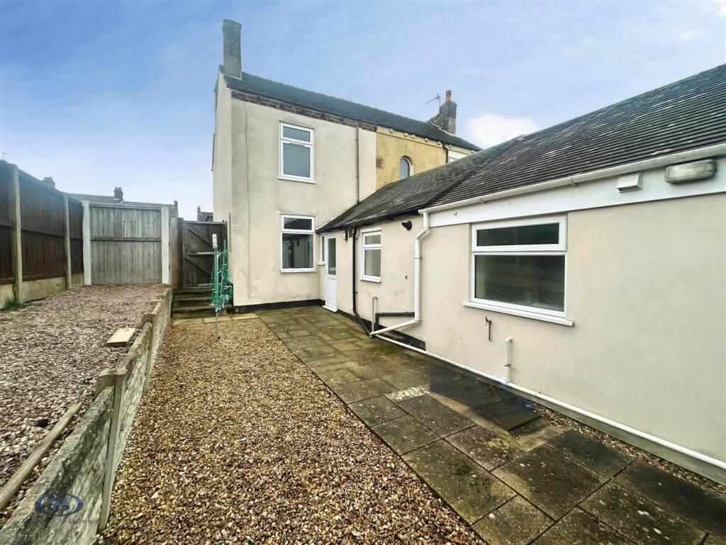
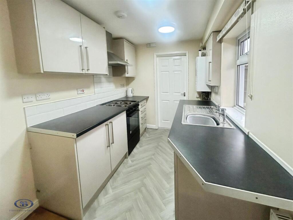
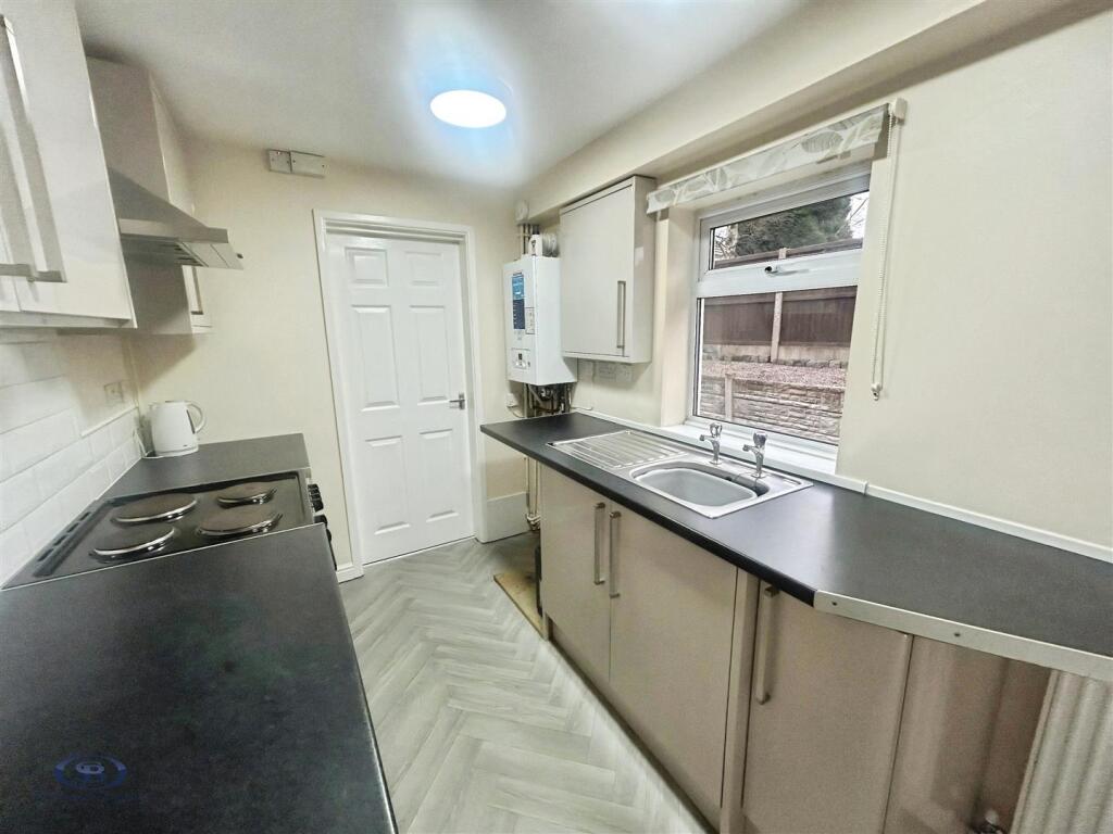
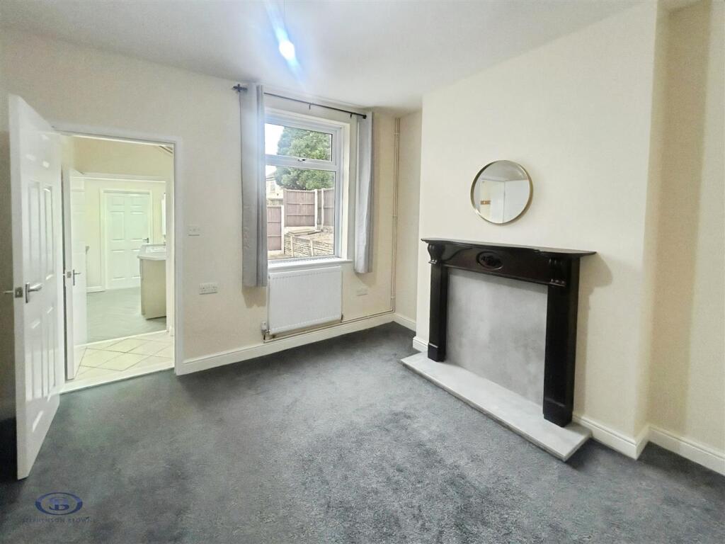
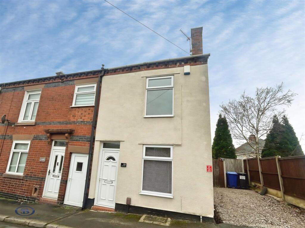
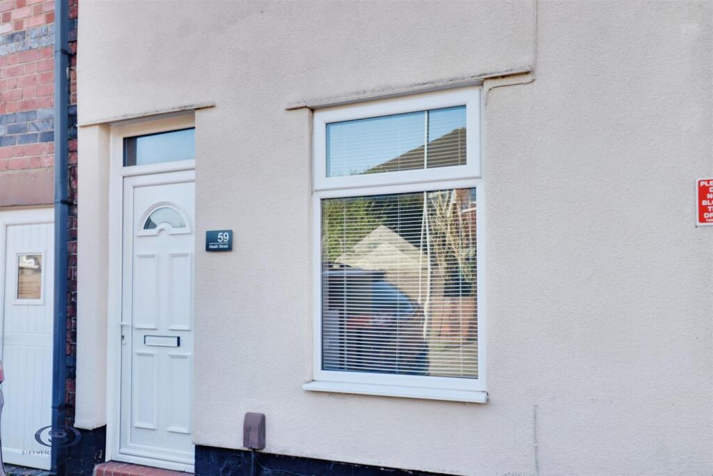
Heath Street
Chesterton, Newcastle, ST5 7PY
£795 pcm
user_edited_photo-06082059_user-edited-1d433f6b-84 1c469639-3.jpg c2563eba-4.jpg 46e6c3cf-2.jpg user_edited_photo-7379d3e0_user-edited-9bdbd23b-3e user_edited_photo-fbc8a7c5_user-edited-6def5586-b7 fa44ffa3-5.jpg d46b0cc6-10.jpg 38d50c9b-11.jpg 94ade70a-8.jpg 7a86533a-9.jpg bfddf111-IMG_1672-IMG_1674.jpg 8e9c3f26-IMG_1714-IMG_1716.jpg user_edited_photo-8e908043_user-edited-6fc086dd-87
/ 14
Property details
Council tax band
A
Deprivation
Decile 3 (7,390 of 33,755)
Street crime
171 incidents within 1 mile (Apr 2026)
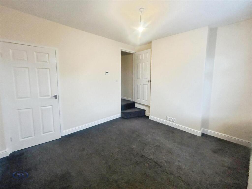
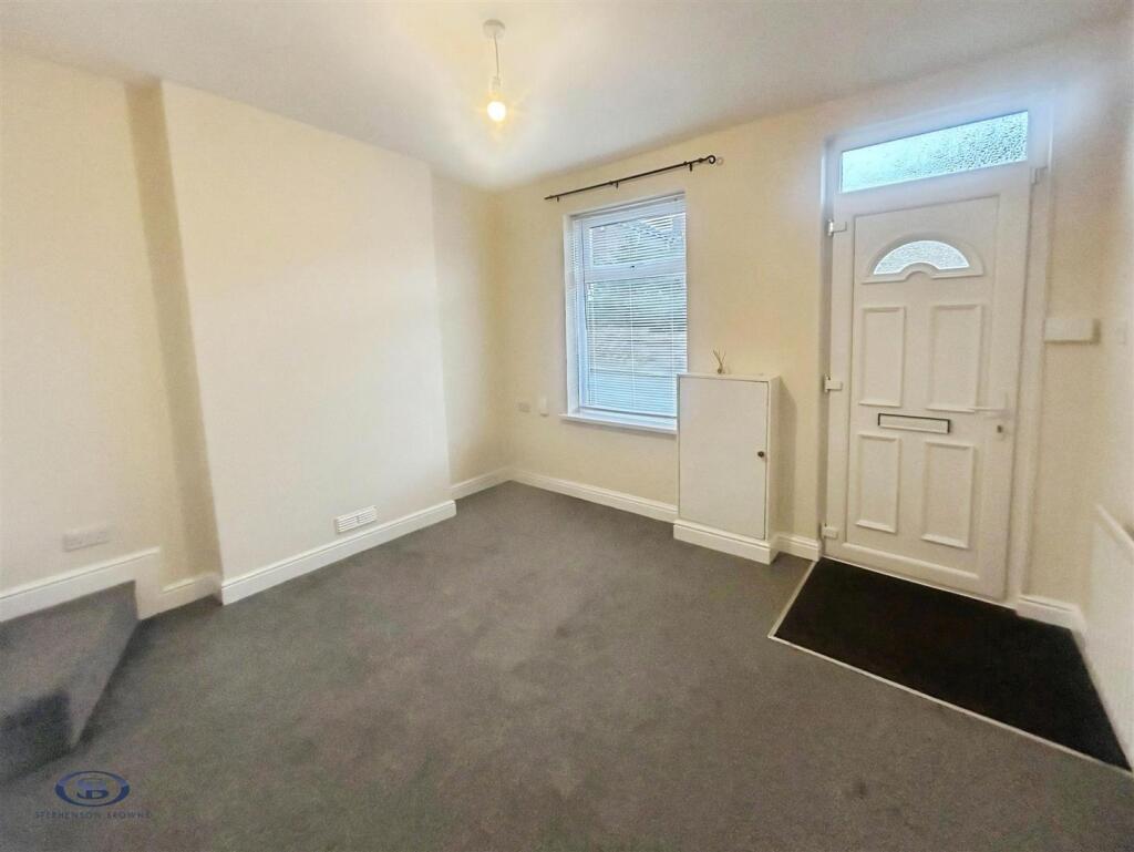
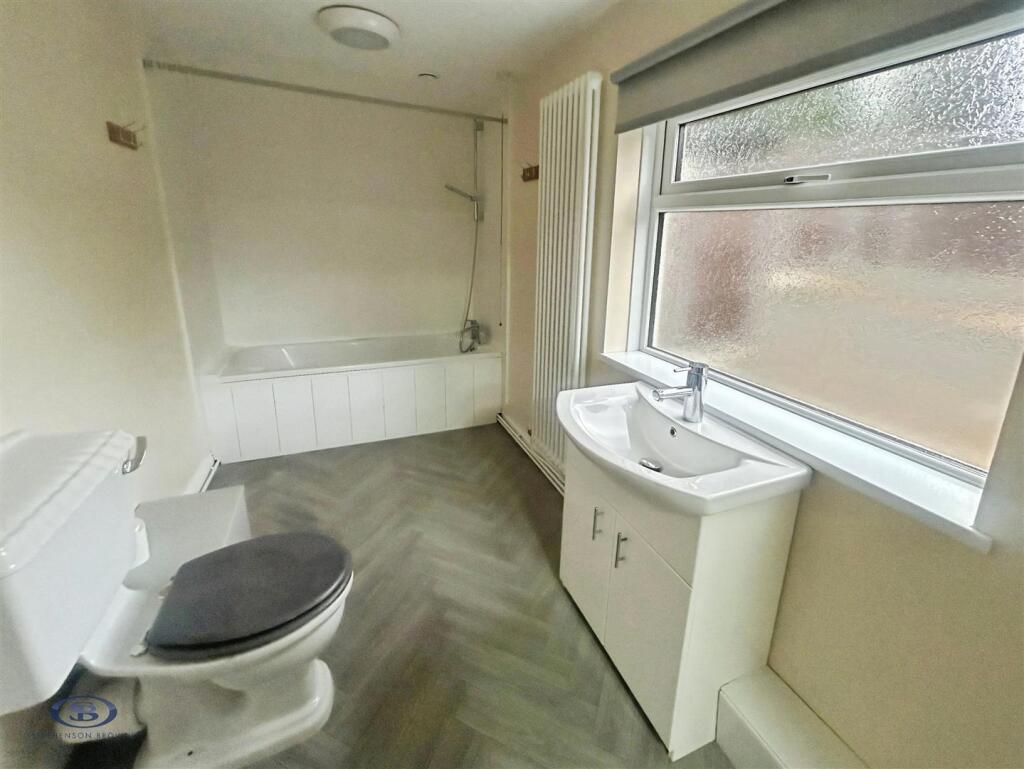
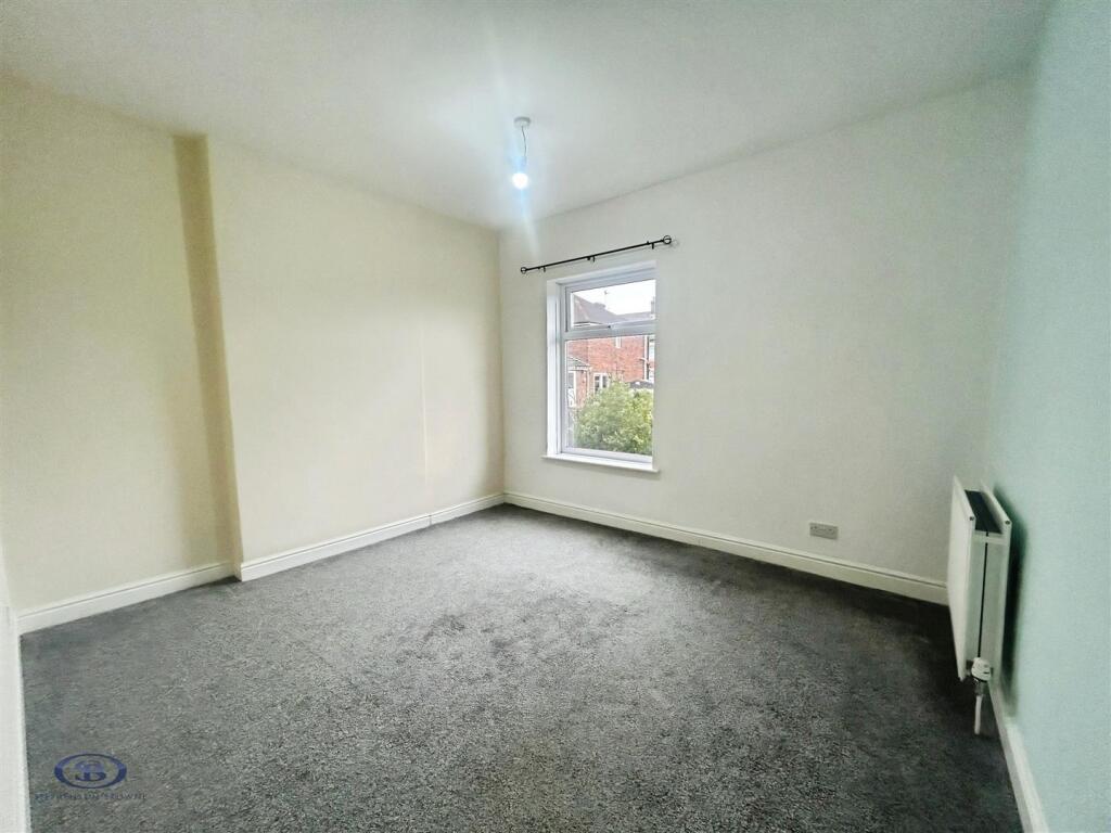
Key features
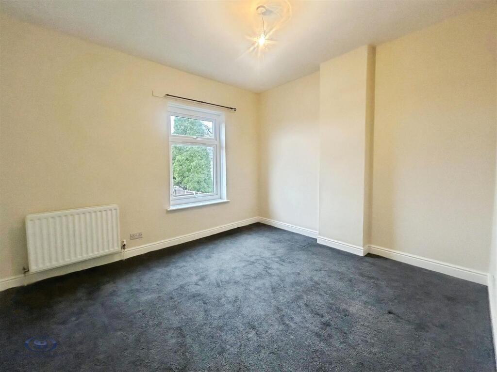
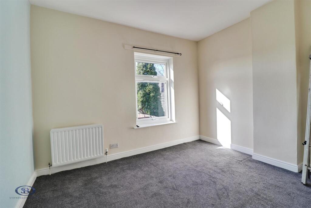
- Two Double Bedrooms
- Freshly Decorated Throughout
- New Carpets and Flooring
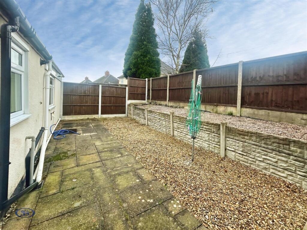
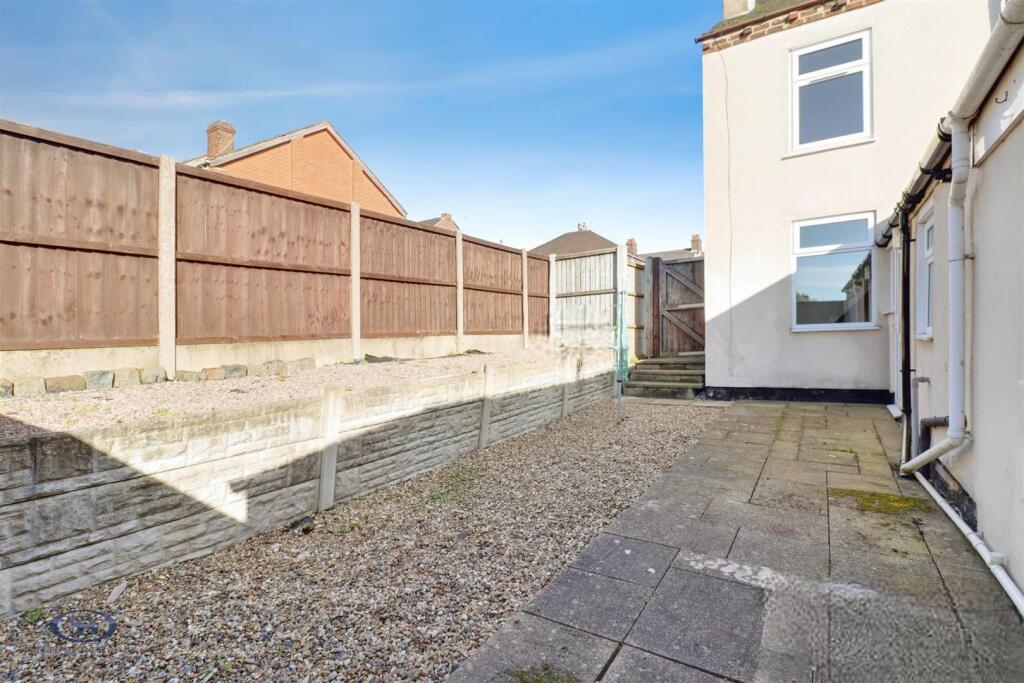
- Generous Outdoor Space
- Downstairs Bathroom
- Convenient Location
Description
Important Information - Whilst we endeavor to ensure accuracy of our lettings descriptions, it is the responsibility of the viewer to ask anymore specific questions in any area of importance before making a formal application. Services are not tested prior to move in. All tenancies are available initially for a minimum term which will be confirmed by property by the agent. With the exception of shared accommodation, the tenant is responsible for the council tax, water, gas and electric plus TV/media where applicable - please note we can not confirm the cost of these as they are different from person to person usage. Rent is paid one month in advance at all times. No cash alternative deposit scheme is offered.
Listed by
Newcastle Under Lyme
Stephenson Browne Ltd
Reference: 172408181
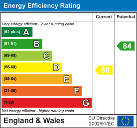
EPC ratings on this postcode
We don't have a matched EPC for this property yet. Below are efficiency scores and details for other addresses on this postcode.
| Address | Current | Potential | Floor area | Age band | Type |
|---|---|---|---|---|---|
| 1, Heath Street, Chesterton, NEWCASTLE | 56 | 87 | 66 m² | England and Wales: 1900-1929 | Terraced |
| 13, Heath Street, Chesterton, NEWCASTLE | 57 | 78 | 112 m² | England and Wales: 1900-1929 | Terraced |
| 15, Heath Street, Chesterton, NEWCASTLE | 57 | 78 | 74 m² | England and Wales: 1900-1929 | Terraced |
| 17 Heath Street, Chesterton, NEWCASTLE | 74 | 87 | 70 m² | England and Wales: before 1900 | Terraced |
| 19, Heath Street, Chesterton, NEWCASTLE | 65 | 81 | 90 m² | England and Wales: 1900-1929 | Terraced |
| 21, Heath Street, Chesterton, NEWCASTLE | 66 | 86 | 83 m² | England and Wales: 1900-1929 | Terraced |
| 21, Heath Street, Chesterton, NEWCASTLE | 50 | 86 | 71 m² | England and Wales: 1900-1929 | Terraced |
| 21, Heath Street, Chesterton, NEWCASTLE | 50 | 84 | 71 m² | England and Wales: 1900-1929 | Terraced |
| 23, Heath Street, Chesterton, NEWCASTLE | 84 | 88 | 48 m² | England and Wales: 1983-1990 | Terraced |
| 23, Heath Street, Chesterton, NEWCASTLE | 106 | 114 | 49 m² | England and Wales: 1976-1982 | Detached |
| 23, Heath Street, Chesterton, NEWCASTLE | 83 | 89 | 41 m² | England and Wales: 1996-2002 | Terraced |
| 25 Heath Street, Chesterton, NEWCASTLE | 84 | 91 | 48 m² | England and Wales: 1991-1995 | Terraced |
| 25, Heath Street, Chesterton, NEWCASTLE | 82 | 87 | 40 m² | England and Wales: 1996-2002 | Terraced |
| 26 Heath Street, Chesterton, NEWCASTLE | 55 | 79 | 77 m² | England and Wales: 1900-1929 | Detached |
| 27, Heath Street, Chesterton, NEWCASTLE | 66 | 87 | 51 m² | England and Wales: 1950-1966 | Terraced |
Flood risk
Zone: 1
Risk: Low
Job (default Low)
Floorplans
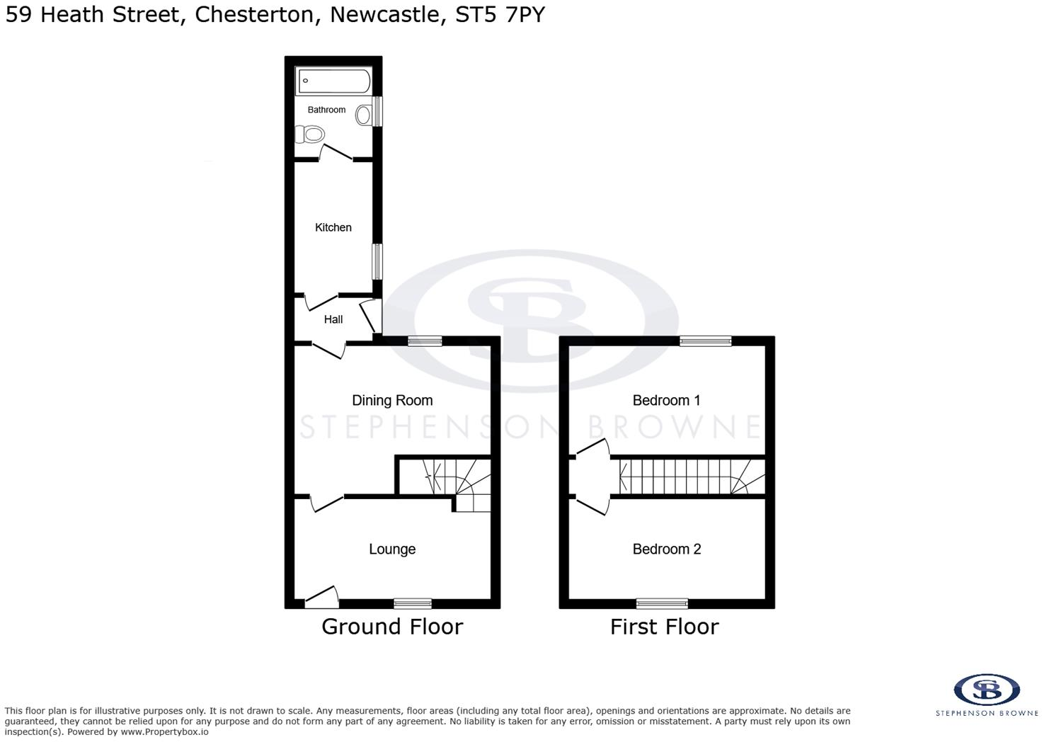
png-2D 2520Plan 25201-dd0f9c92-45c2-49f7-b5f0-c774
EPC Graphs
EE Rating
Rental Range
Estimated market rent for Newcastle-under-Lyme. Low = conservative, Realistic = average, Optimistic = best case.
Based on Local Authority from postcode lookup → Newcastle-under-Lyme.
LHA (30th percentile) floor for Staffordshire North: £479/mo (Apr 2025 – Mar 2026)
Location
Address
Heath Street
Nearby
Nearest stations, universities and amenities (distance from property).
| Type | Name | Distance |
|---|---|---|
| Bus stop | Heath Street | 0.0 miles |
| Bus stop | Bamber Place | 0.1 miles |
| Shop | Samsung Support Centre | 0.3 miles |
| Shop | Meelie Mobile | 0.3 miles |
| Train station | Apedale Road | 0.9 miles |
| Train station | Silverdale | 1.0 miles |
| Hospital | Haywood Hospital Walk-in Centre | 2.6 miles |
| Hospital | Royal Stoke University Hospital | 2.6 miles |
| University | Keele University | 2.7 miles |
| University | University of Staffordshire Stoke Campus | 3.2 miles |
Street-level crime
| Category | Count |
|---|---|
| Violence and sexual offences | 76 |
| Anti-social behaviour | 25 |
| Criminal damage and arson | 18 |
| Public order | 15 |
| Other crime | 10 |
| Shoplifting | 8 |
| Other theft | 7 |
| Burglary | 6 |
| Vehicle crime | 3 |
| Drugs | 2 |
| Bicycle theft | 1 |
| Total incidents | 171 |
Within 1 mile during Apr 2026. Source: data.police.uk (England & Wales).
Schools nearby
Nearest open schools with Ofsted ratings (England). Closed schools are not shown. Data from Get Information about Schools and Ofsted.
| Name | Type | Distance | Ofsted |
|---|---|---|---|
| Churchfields Primary School | Primary | 0.1 miles | Outstanding — 15 Sep 2015 |
| Chesterton Primary School | Primary | 0.4 miles | Good — 8 Jul 2021 |
| Sun Academy Bradwell | Primary | 0.4 miles | Good — 11 Sep 2018 |
| Chesterton Community Sports College | Secondary | 0.4 miles | Good — 13 Nov 2022 |
| Bursley Academy | Primary | 0.7 miles | Requires improvement — 18 Mar 2024 |
Rental Comparables
Residential lets from OpenRent and Rightmove for the area (same bedroom count). Use to validate rent estimates. Student lets are excluded.
Average rent: £842/mo (54 listings)
Enter House Number
Enter the house number to help us retrieve more accurate pricing history and property data.
Please log in to submit or correct the house number for this listing.
Log in to continue