8A
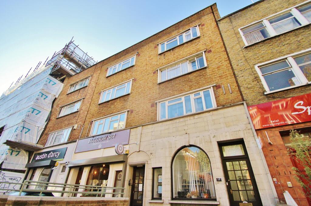
SHEPHERDS BUSH ROAD, LONDON, GREATER LONDON W6 7PJ
£2,350 pcm
Property details
Floor area
53 m²
Council tax band
D
EPC rating
C
Year built
England and Wales: 1930-1949
Deprivation
Decile 2 (5,063 of 33,755)
Street crime
1452 incidents within 1 mile (Apr 2026)
Key features
- UNDER OFFER
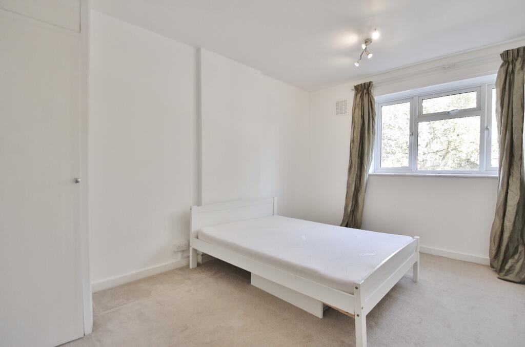
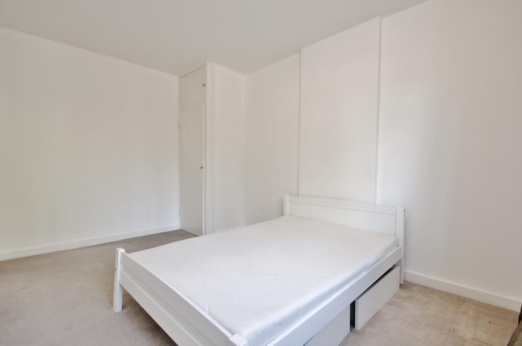
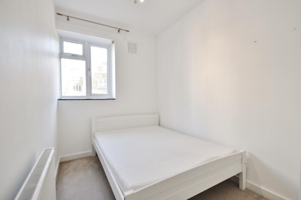
- Two Bedrooms
- Reception
- Separate Kitchen
- Balcony
- Triple Glazing
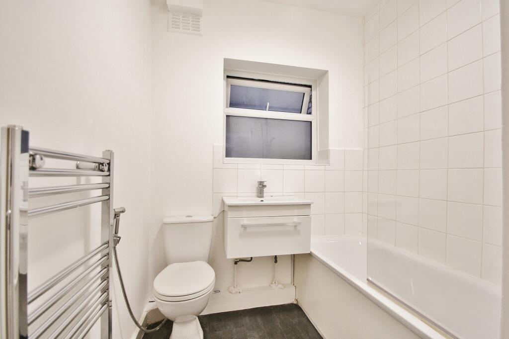
- Bathroom
- Furnished
- Plenty of Storage
- Great Location
Description
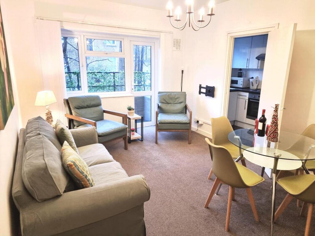
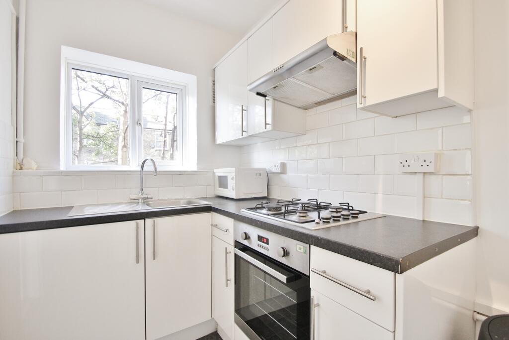
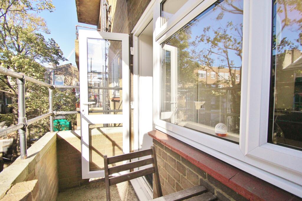
Latymers are pleased to market this lovely two double bedroom apartment located within a short distance of Shepherd Bush Station offering Central line and Hammersmith and City tube lines. The property comes furnished and benefits from a large living space with the balcony, modern integrated kitchen, triple glazing, two double bedrooms and a lovely bathroom.
Shepherds Bush road is located within walking distance of local transport links and the amenities of Westfield Shopping Centre. Hammersmith and Holland Park are a short walk away.
- Rent: £2350 per calander month
- Security Deposit: £2710 (five weeks)
- Tenancy Length: 12 months minimum
- Council Tax Band: D (Hammersmith & Fulham Borough)
- EPC Band: D
Listed by
London
Latymers Estate Agents
Reference: 164271845
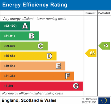
EPC Rating & Upgrade Cost
Current rating: C
Potential rating: C
Inspection date: 20/06/2025
Expiry date: 19/06/2035
Est. upgrade cost to C: £9,250
Recommendations
- 50 mm internal or external wall insulation (£7,500 - £11,000)
Flood risk
Zone: 1
Risk: Low
Job (default Low)
Floorplans
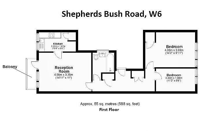
Floor Plan 1
EPC Graphs
EPC
Rental Range
Estimated market rent for Hammersmith and Fulham. Low = conservative, Realistic = average, Optimistic = best case.
Based on Local Authority from postcode lookup → Hammersmith and Fulham.
LHA (30th percentile) floor for Inner West London: £1,621/mo (Apr 2025 – Mar 2026)
Location
Nearby
Nearest stations, universities and amenities (distance from property).
| Type | Name | Distance |
|---|---|---|
| Shop | Central Bikes | 0.0 miles |
| Shop | Unknown | 0.0 miles |
| Bus stop | Goldhawk Road | 0.1 miles |
| Train station | Goldhawk Road | 0.2 miles |
| Train station | Shepherd's Bush | 0.2 miles |
| University | Scale Space White City | 0.9 miles |
| University | Kennet West Skills Centre | 1.9 miles |
| Hospital | Bridge Lane Health Centre | 3.1 miles |
| Hospital | The Portland Hospital | 3.7 miles |
Street-level crime
| Category | Count |
|---|---|
| Anti-social behaviour | 335 |
| Violence and sexual offences | 311 |
| Shoplifting | 264 |
| Public order | 112 |
| Other theft | 108 |
| Vehicle crime | 94 |
| Drugs | 55 |
| Theft from the person | 38 |
| Burglary | 36 |
| Criminal damage and arson | 36 |
| Robbery | 20 |
| Bicycle theft | 18 |
| Other crime | 16 |
| Possession of weapons | 9 |
| Total incidents | 1452 |
Within 1 mile during Apr 2026. Source: data.police.uk (England & Wales).
Schools nearby
Nearest open schools with Ofsted ratings (England). Closed schools are not shown. Data from Get Information about Schools and Ofsted.
| Name | Type | Distance | Ofsted |
|---|---|---|---|
| Addison Primary School | Primary | 0.2 miles | Good — 4 Nov 2011 |
| Flora Gardens Primary School | Primary | 0.2 miles | Good — 1 Aug 2022 |
| London Vocational Ballet School | Other | 0.3 miles | Good — 26 Sep 2023 |
| Miles Coverdale Primary School | Primary | 0.3 miles | Outstanding — 3 Jun 2024 |
| St Mary's Catholic Primary School | Primary | 0.3 miles | Good — 11 Dec 2014 |
Rental Comparables
Rental comparables are temporarily unavailable while listing-site fetches are paused. Try again later.