Carrwood
Hale Barns, WA15, WA15 0ER
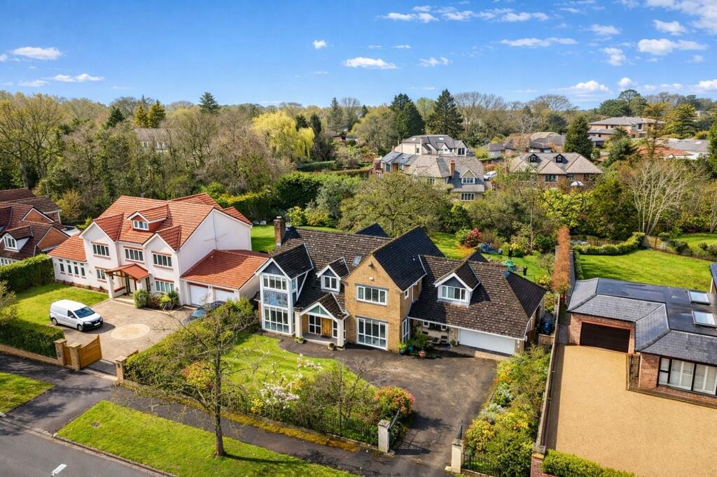
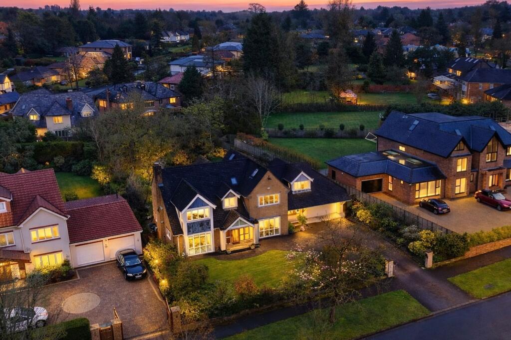
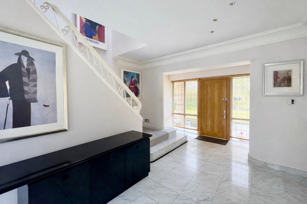
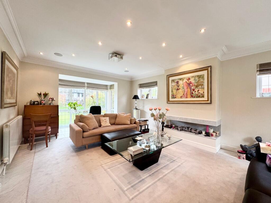
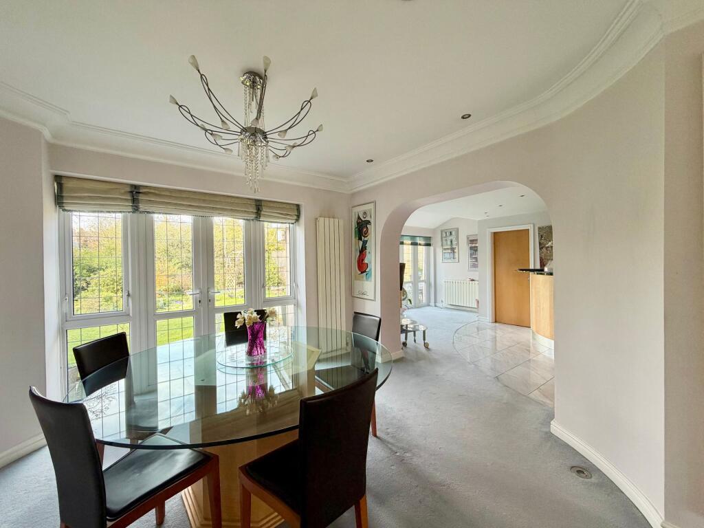
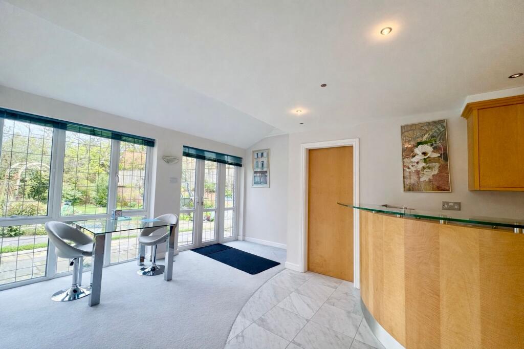
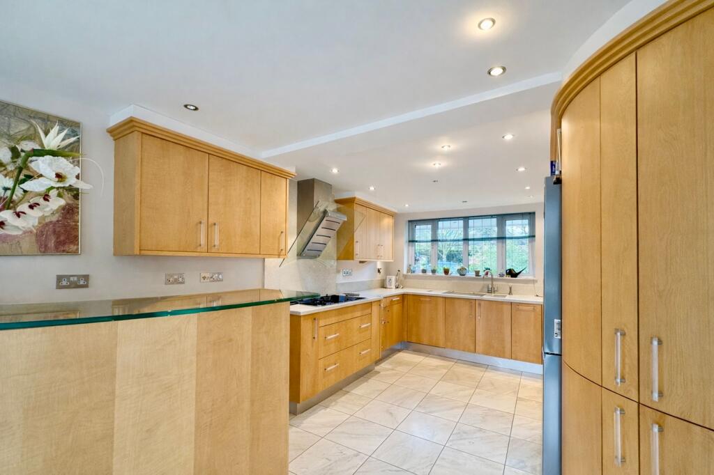
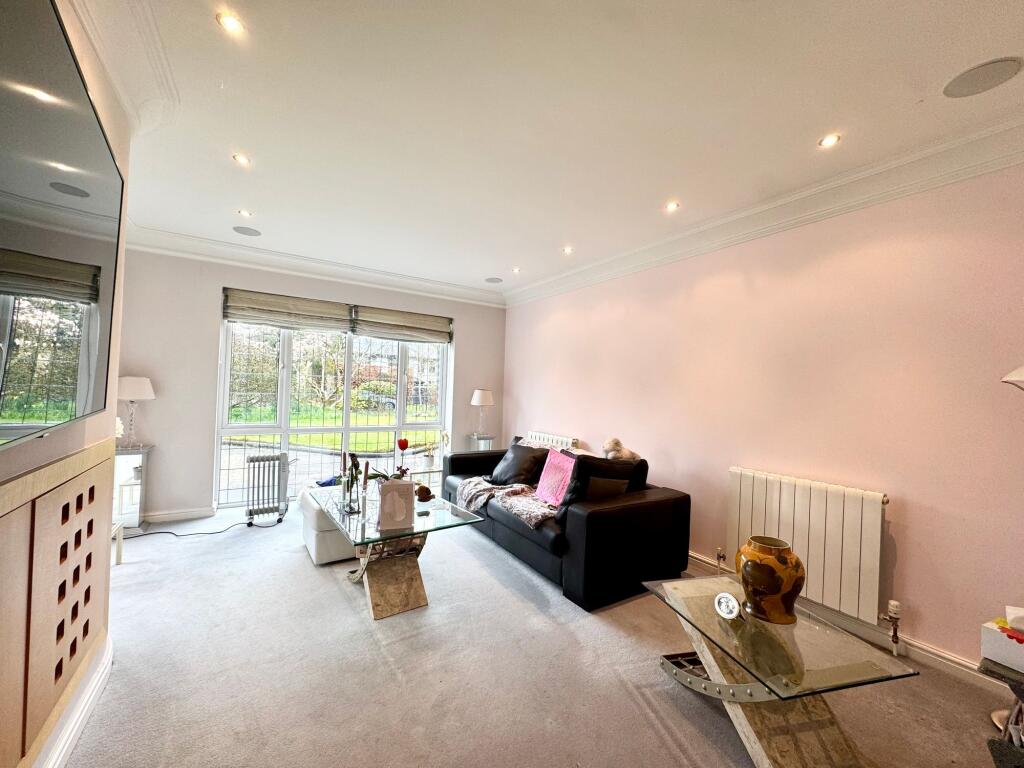
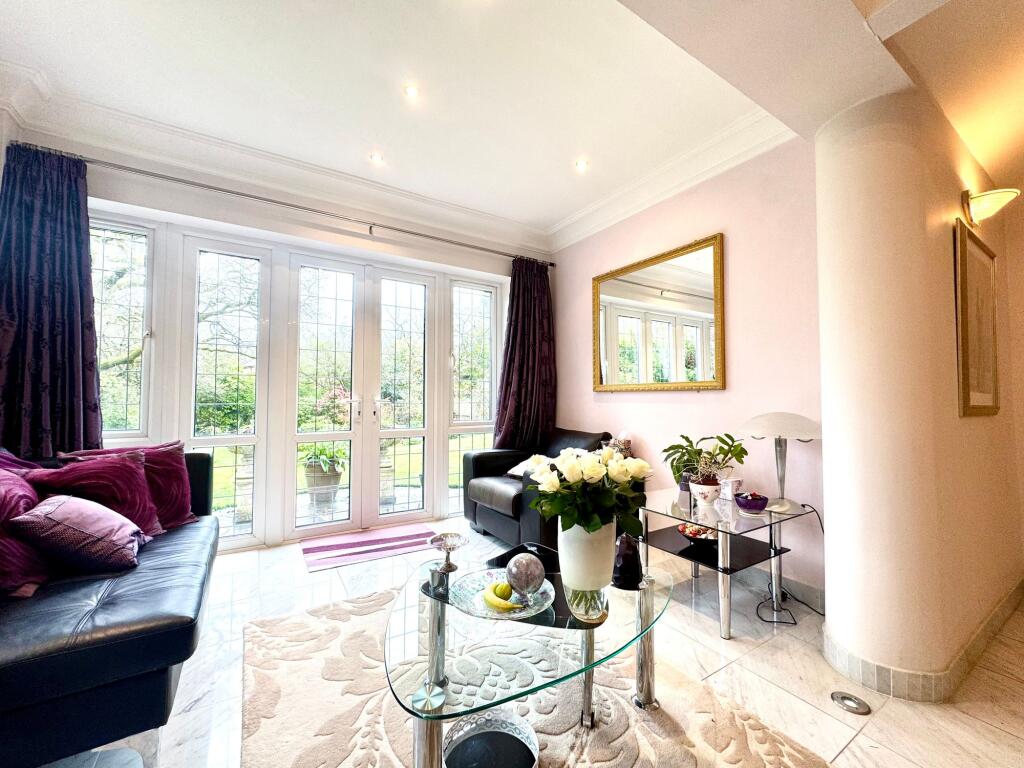
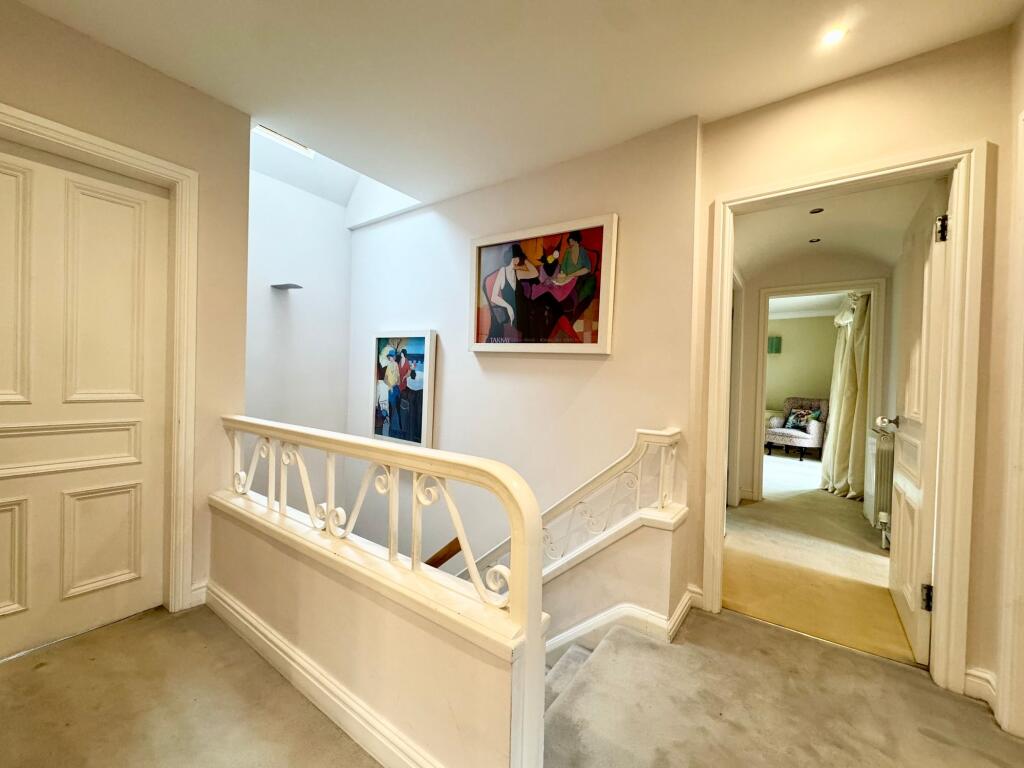
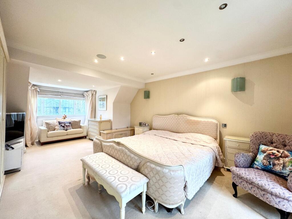
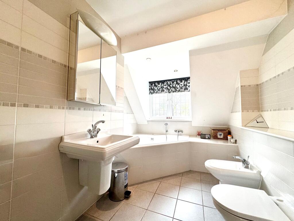
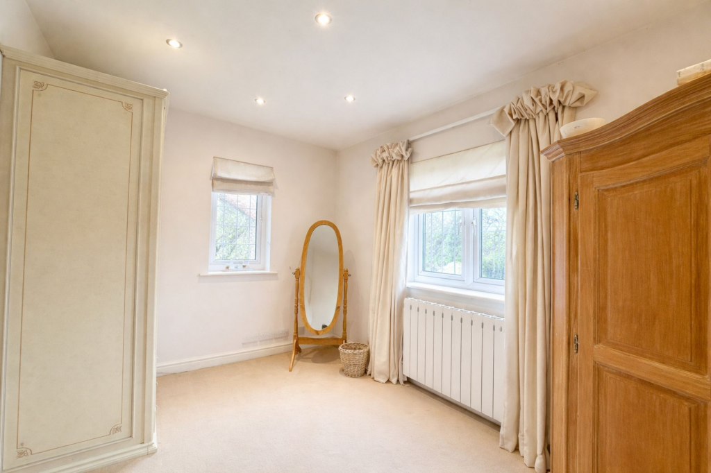
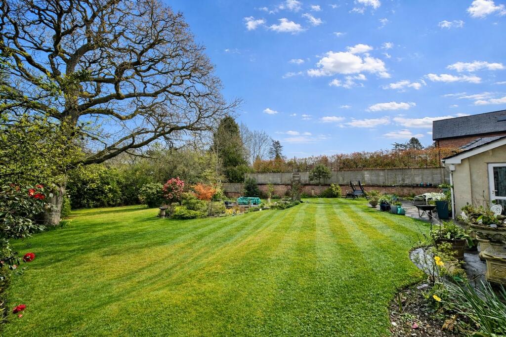
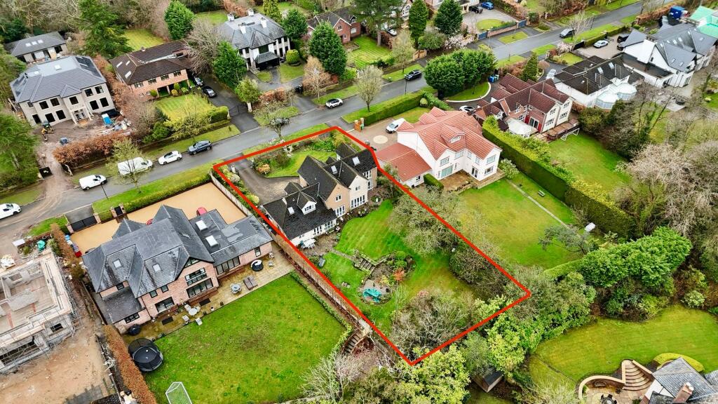
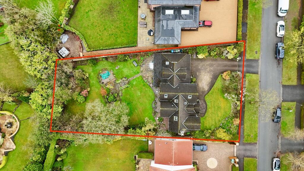
Photo 1 Photo 2 Photo 3 Photo 4 Photo 5 Photo 6 Photo 7 Photo 8 Photo 9 Photo 10 Photo 11 Photo 12 Photo 13 Photo 14 Photo 15 Photo 16
/ 16
Property details
Council tax band
H
Local average
£1,078,458 (+43.7%)
Deprivation
Decile 10 (30,819 of 33,755)
Street crime
0 incidents within 1 mile (May 2026)
Key features
- Great Location
- Five Bedrooms
- Three Bedrooms
- 0.34 Acre Plot
- Mature Gardens
- Double Garage
- Prestigious Address
- Detached Property
- Scope to Extend & Develop
Additional details
- Parking
- Yes
- Garden
- Private garden
- Listed property
- No
- Restrictions
- No
- Required access
- No
- Rights of way
- No
- Flooded in last 5 years
- No
- Flood defences
- No
Description
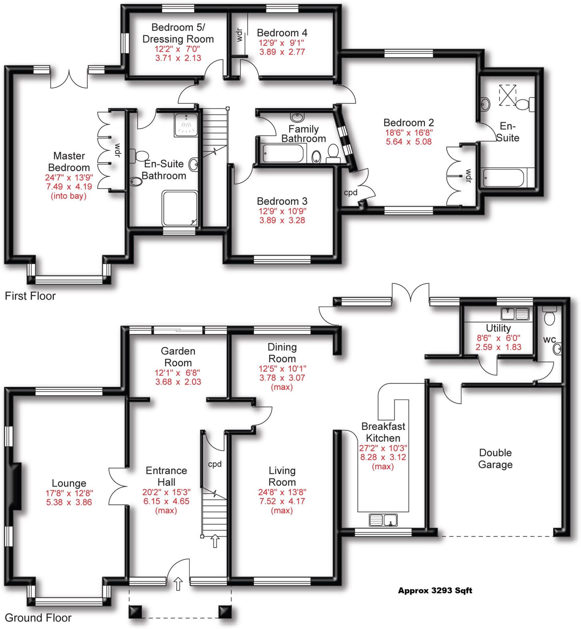
To the ground floor there is an impressive entrance hall, lounge, living room, breakfast kitchen, WC, utility room and double garage. To the first floor there are five bedrooms, three bathrooms, two of which are en suite.
Externally to the rear of the property is a stunning mature garden ideal for families and outdoor entertaining. To the front is a large driveway with ample off road parking.
If you are looking for a family detached property then this location is hard to beat, the property is ready to move into but also offers huge future potential. EPC - C
EPC Rating: C
Listed by
Hale
HIBBERT HOMES HALE LTD
Reference: 174156038
EPC ratings on this postcode
We don't have a matched EPC for this property yet. Below are efficiency scores and details for other addresses on this postcode.
| Address | Current | Potential | Floor area | Age band | Type |
|---|---|---|---|---|---|
| 65 Carrwood, Hale Barns, ALTRINCHAM | 76 | 81 | 509 m² | England and Wales: 1950-1966 | Detached |
| 67, Carrwood, Hale Barns, ALTRINCHAM | 77 | 80 | 575 m² | England and Wales: 1930-1949 | Detached |
| 69 CARRWOOD, HALE BARNS, HALE BARNS | 43 | 66 | 229 m² | — | Detached |
| 75 Carrwood, Hale Barns, ALTRINCHAM | 71 | 77 | 310 m² | England and Wales: 1976-1982 | Detached |
| 77 CARRWOOD, HALE BARNS, HALE BARNS | 82 | 85 | 435 m² | England and Wales: 2012 onwards | Detached |
| 79 Carrwood, Hale Barns, ALTRINCHAM | 63 | 80 | 291 m² | England and Wales: 1967-1975 | Detached |
Flood risk
Zone: 1
Risk: Low
Job (default Low)
Floorplans
All
Price history
| Event | Date | Price | % change |
|---|---|---|---|
| Listed for sale | — | £1,550,000 | — |
Source: HM Land Registry Price Paid Data. Crown copyright.
Sold Comparables
Same street and nearby sales within 0.25 miles (last 5 years). Data from Land Registry Price Paid.
| Address | Price | Date | Type |
|---|---|---|---|
| 47 CARRWOOD, HALE BARNS, ALTRINCHAM, TRAFFORD, GREATER MANCHESTER, WA15 0EN | £5,472,000 | 09/12/2025 | Detached |
| 20 HASLEMERE AVENUE, HALE BARNS, ALTRINCHAM, TRAFFORD, GREATER MANCHESTER, WA15 0AU | £842,000 | 02/12/2025 | Detached |
| 49 CARRWOOD, HALE BARNS, ALTRINCHAM, TRAFFORD, GREATER MANCHESTER, WA15 0EN | £1,950,000 | 21/07/2025 | Detached |
| 45 CARRWOOD, HALE BARNS, ALTRINCHAM, TRAFFORD, GREATER MANCHESTER, WA15 0EN | £2,304,375 | 14/11/2023 | Detached |
| 17 GORSE BANK ROAD, HALE BARNS, ALTRINCHAM, TRAFFORD, GREATER MANCHESTER, WA15 0BE | £1,930,000 | 27/10/2023 | Detached |
| 28 GORSE BANK ROAD, HALE BARNS, ALTRINCHAM, TRAFFORD, GREATER MANCHESTER, WA15 0AS | £925,000 | 17/10/2023 | Detached |
| 33 GORSE BANK ROAD, HALE BARNS, ALTRINCHAM, TRAFFORD, GREATER MANCHESTER, WA15 0BD | £500,000 | 25/04/2023 | Detached |
| 38 CARRWOOD, HALE BARNS, ALTRINCHAM, TRAFFORD, GREATER MANCHESTER, WA15 0EW | £2,560,000 | 29/11/2022 | Detached |
| 4 DOBB HEDGE CLOSE, HALE BARNS, ALTRINCHAM, TRAFFORD, GREATER MANCHESTER, WA15 0AT | £4,420,000 | 14/11/2022 | Detached |
| 3 RIVERMEAD AVENUE, HALE BARNS, ALTRINCHAM, TRAFFORD, GREATER MANCHESTER, WA15 0AN | £1,010,000 | 09/08/2022 | Detached |
| 38 GORSE BANK ROAD, HALE BARNS, ALTRINCHAM, TRAFFORD, GREATER MANCHESTER, WA15 0AS | £860,000 | 12/07/2022 | Detached |
| 3 HASLEMERE AVENUE, HALE BARNS, ALTRINCHAM, TRAFFORD, GREATER MANCHESTER, WA15 0AU | £722,500 | 10/06/2022 | Detached |
| 7 RIVERMEAD AVENUE, HALE BARNS, ALTRINCHAM, TRAFFORD, GREATER MANCHESTER, WA15 0AN | £1,237,500 | 29/04/2022 | Detached |
| 82 CARRWOOD, HALE BARNS, ALTRINCHAM, TRAFFORD, GREATER MANCHESTER, WA15 0ES | £1,405,000 | 18/02/2022 | Detached |
| 47 CARRWOOD, HALE BARNS, ALTRINCHAM, TRAFFORD, GREATER MANCHESTER, WA15 0EN | £2,200,000 | 21/10/2021 | Detached |
Area average: £1,889,225 (15 sales)
Capital growth trend
Land Registry outcode average: last 12 months vs 5y and 10y ago (from sold prices).
House Price Index (HM Land Registry — official index, not sold-price averages): Trafford. Series: Detached. As of April 2026.
Rental Range
Estimated market rent for Trafford. Low = conservative, Realistic = average, Optimistic = best case.
Based on Local Authority from postcode lookup → Trafford.
LHA (30th percentile) floor for North Cumbria: £738/mo (Apr 2025 – Mar 2026)
Location
Address
Carrwood
Nearby
Nearest stations, universities and amenities (distance from property).
| Type | Name | Distance |
|---|---|---|
| Bus stop | Warburton Green, Chapel Lane / opposite Chapel Drive | 0.3 miles |
| Bus stop | Warburton Green, Chapel Lane / near Chapel Drive | 0.3 miles |
| Hospital | The Priory Hospital Altrincham | 0.6 miles |
| Shop | A P Hynes & Co | 0.6 miles |
| Shop | Fired Earth | 0.6 miles |
| Train station | Ashley | 1.1 miles |
| Train station | Hale | 1.8 miles |
| Hospital | Wythenshawe Hospital | 2.2 miles |
| University | University Academy 92 | 6.9 miles |
| University | Fallowfield Reception and Richmond Amenities Building | 7.2 miles |
Street-level crime
| Category | Count |
|---|---|
| Total incidents | 0 |
Within 1 mile during May 2026. Source: data.police.uk (England & Wales).
Schools nearby
Nearest open schools with Ofsted ratings (England). Closed schools are not shown. Data from Get Information about Schools and Ofsted.
| Name | Type | Distance | Ofsted |
|---|---|---|---|
| Elmridge Primary School | Primary | 0.5 miles | Good — 18 Jan 2024 |
| St Ambrose Prep School | Other | 0.6 miles | — (No rating) |
| Saint Ambrose College | Secondary | 0.7 miles | Good — 16 Mar 2020 |
| Well Green Primary School | Primary | 1.1 miles | Good — 9 Dec 2021 |
| Altrincham College | Secondary | 1.6 miles | Good — 6 Jul 2022 |
Rental Comparables
Residential lets from OpenRent and Rightmove for the area (same bedroom count). Use to validate rent estimates. Student lets are excluded.
| Title | Rent | Beds | Distance | As seen on |
|---|---|---|---|---|
| 5 Bed Detached House, Weygates Drive, WA15 | £8,300/mo | 5 | 0.24 miles | OpenRent |
Average rent: £8,300/mo (1 listing)
Rent-driven metrics
Based on OpenRent comparables.
- Rent ratio — Monthly rent ÷ purchase price (1% rule). 1%+ = strong, 0.8–1% = okay, <0.8% = weak for cashflow.
- Max investor price — Rent ÷ 0.8%; the price at which rent would be 0.8% of price (Stoke-style target).
- Target investor price — Rent ÷ 1%; the price at which rent would be 1% of price (strong cashflow band).
- Gross yield — Annual rent as % of purchase price (no costs).
- Cost-to-rent — Price ÷ annual rent (from OpenRent comparables). Under 14× = strong, 14–16× = acceptable, 17×+ = compressed.
- Cashflow — Rent minus mortgage, 10% maintenance, £25/mo compliance. Assumes 75% LTV, 3.95% APR (5yr fixed), 25yr term.
- ROI — Annual profit ÷ cash in (deposit + 4% purchase costs).
Enter House Number
Enter the house number to help us retrieve more accurate pricing history and property data.
Please log in to submit or correct the house number for this listing.
Log in to continue