40 ST AGNES WAY
IPSWICH, KESGRAVE, SUFFOLK IP5 1JZ
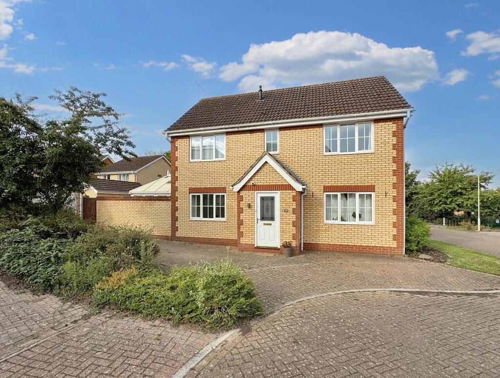
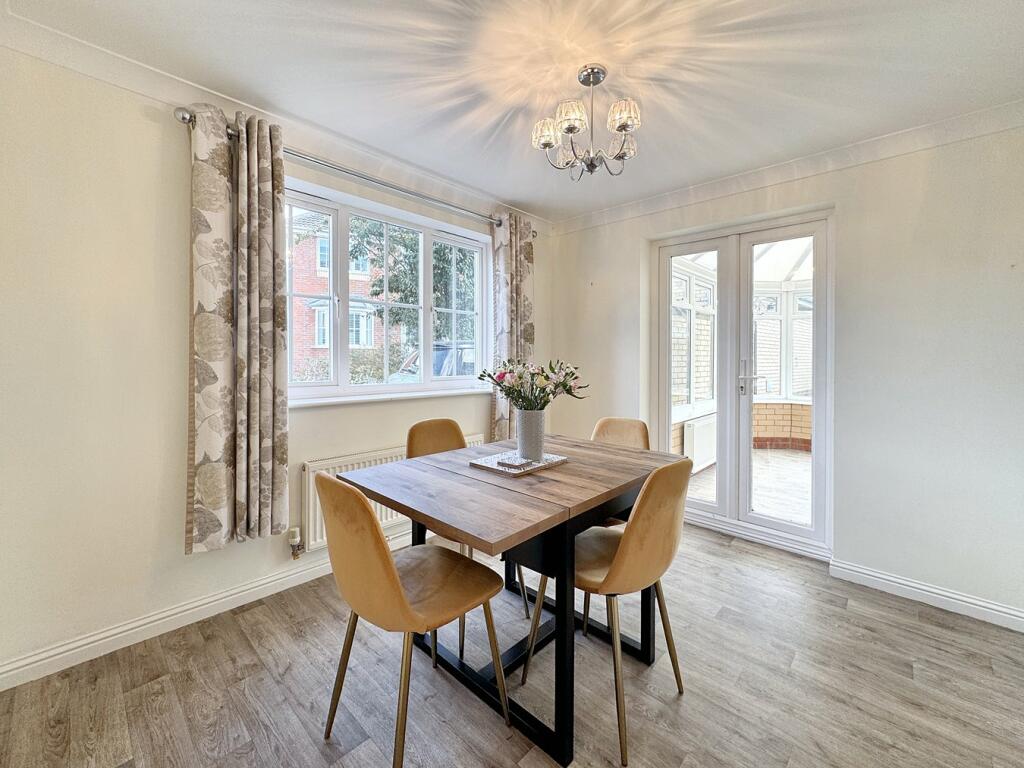
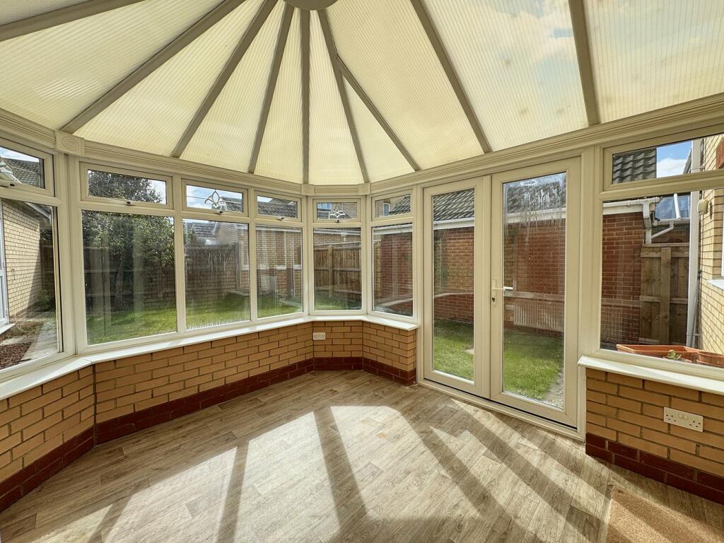
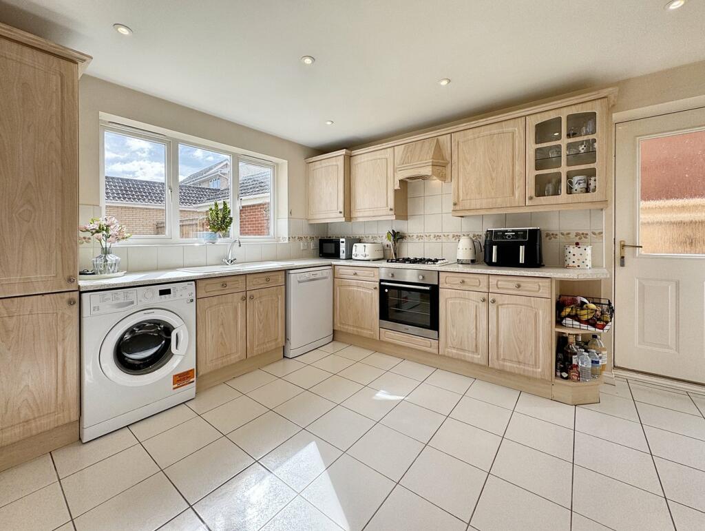
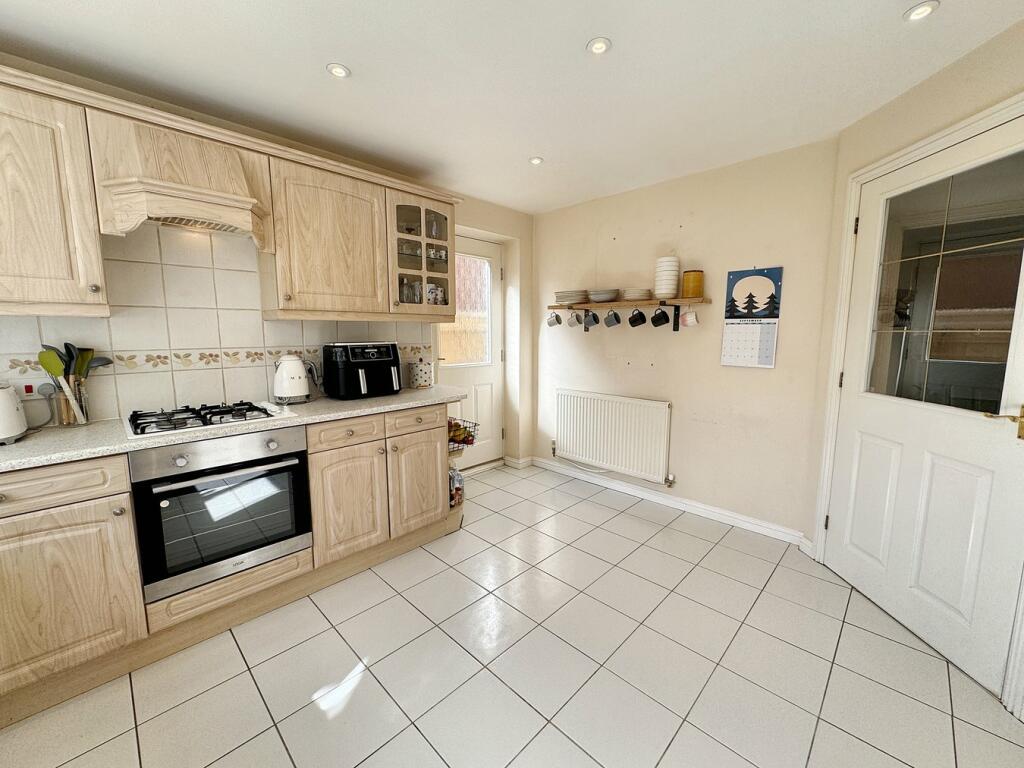
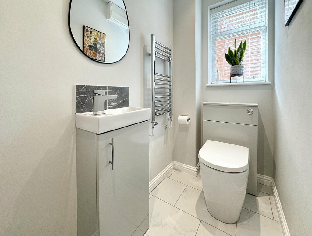
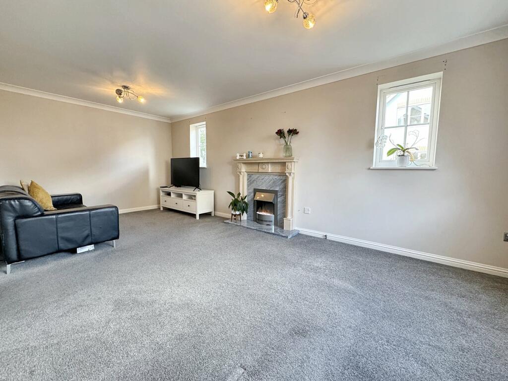
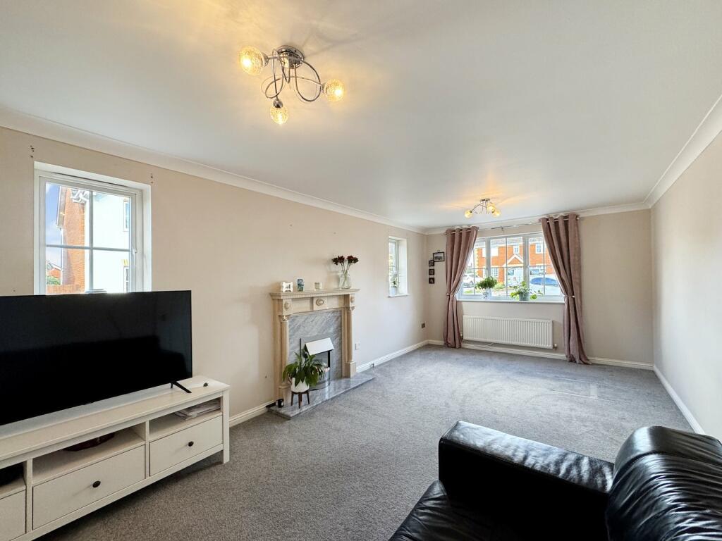
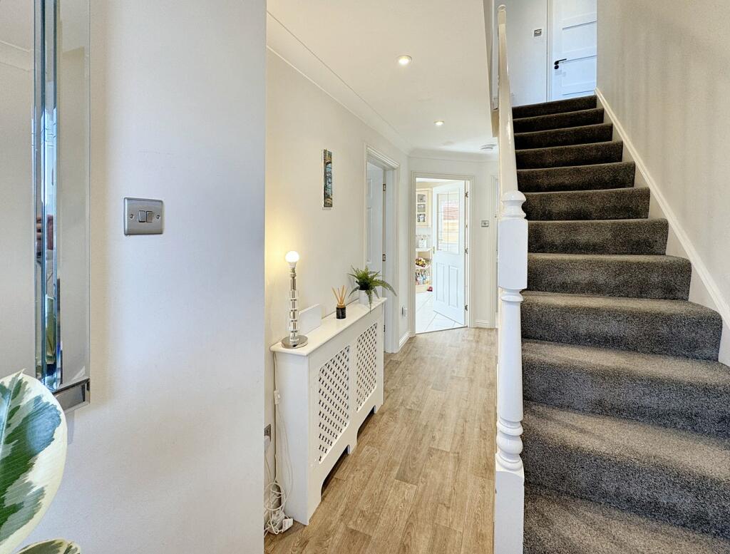
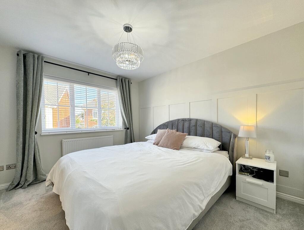
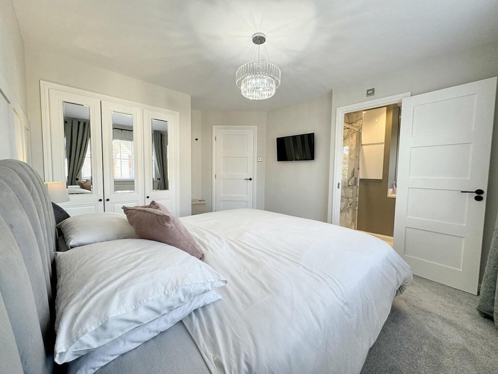
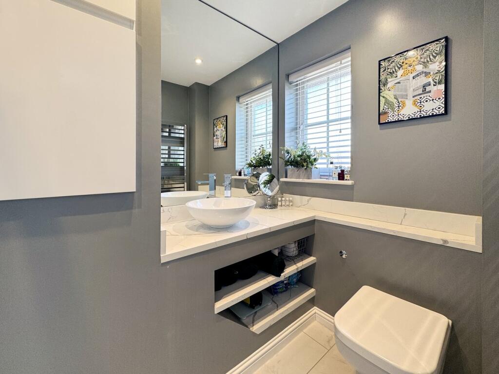
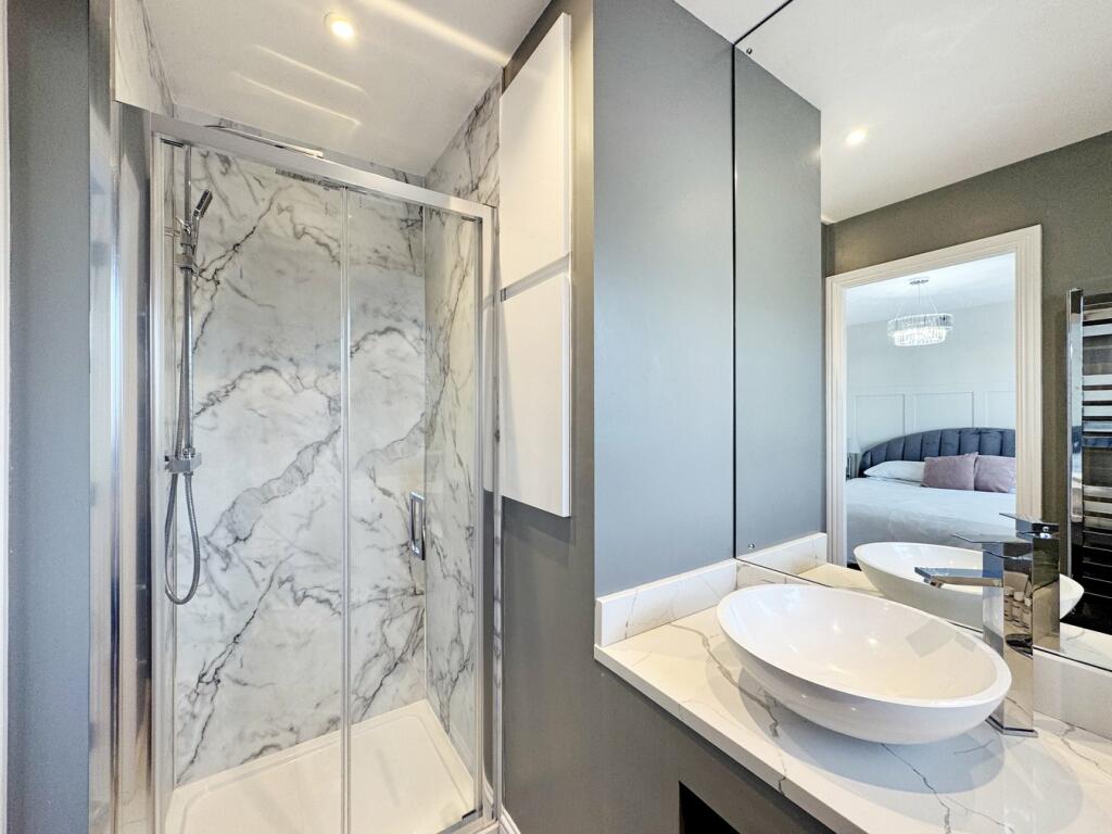
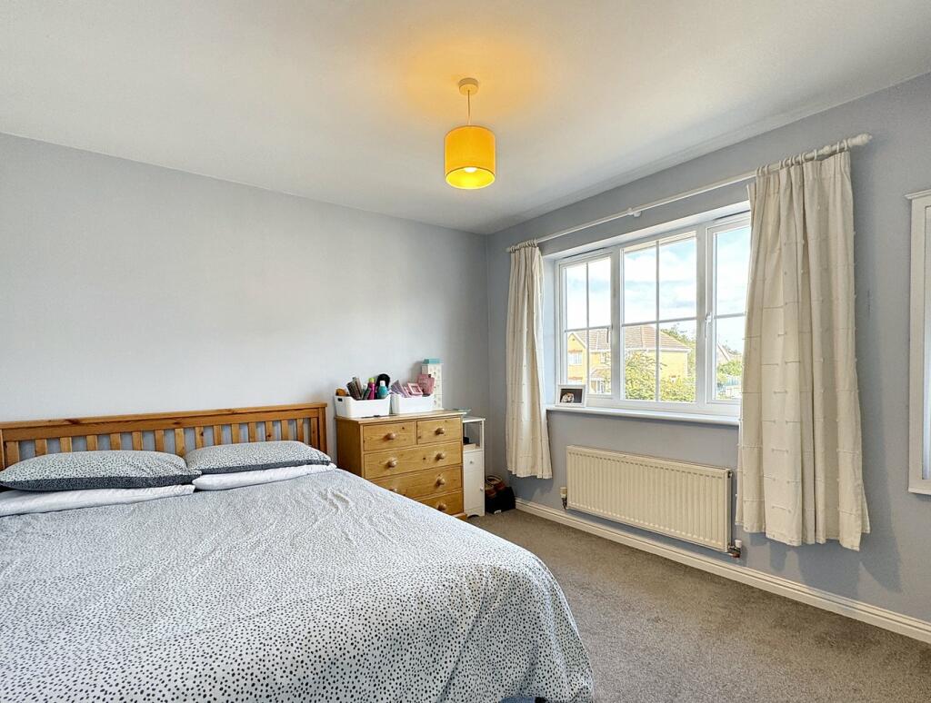
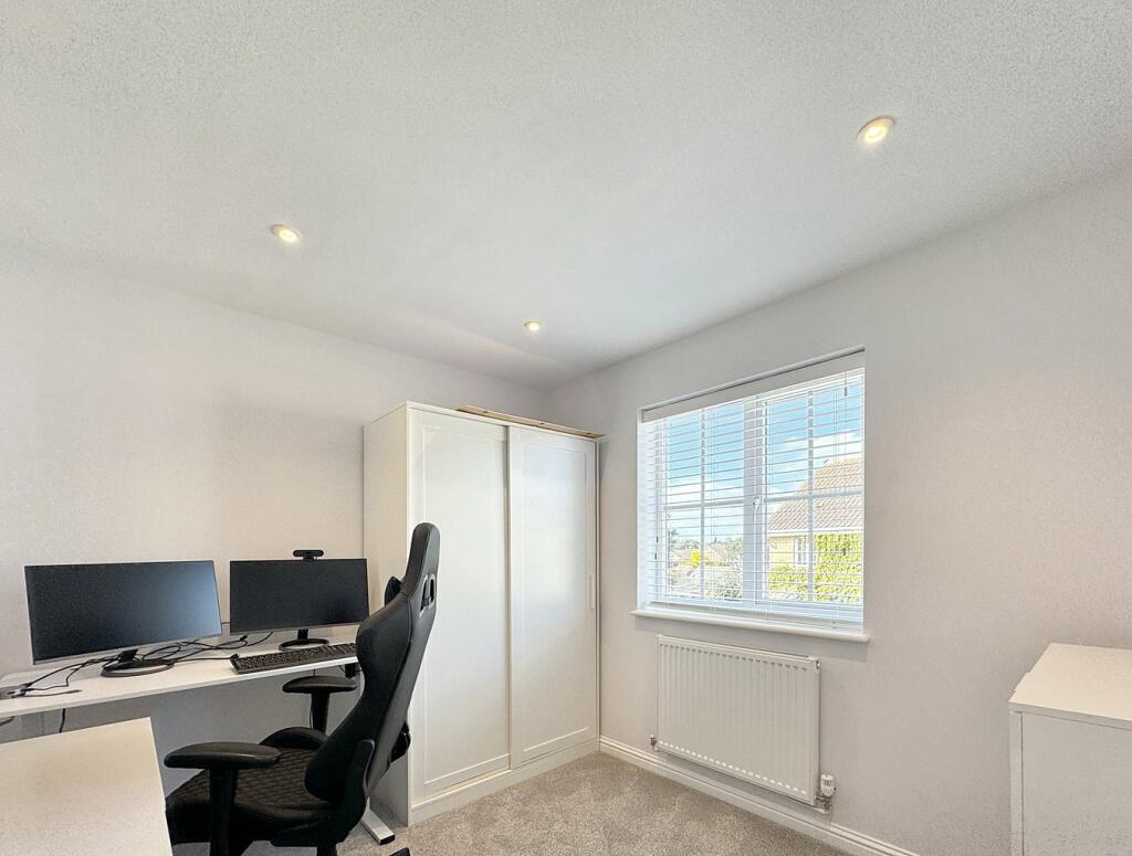
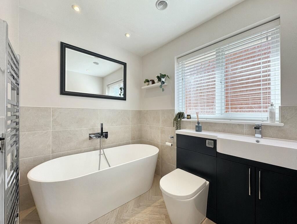
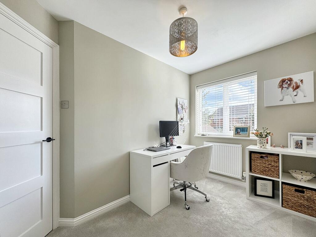
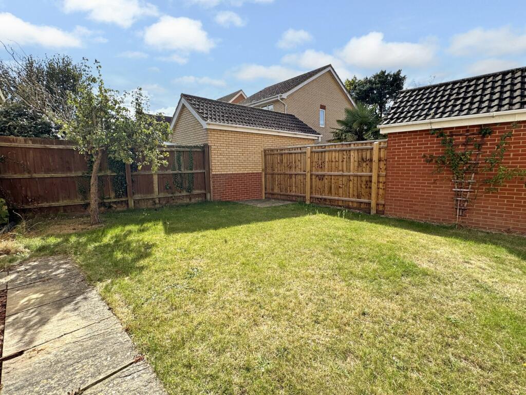
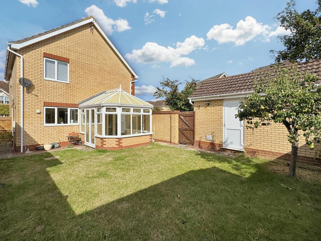
Photo 1 Photo 2 Photo 3 Photo 4 Photo 5 Photo 6 Photo 7 Photo 8 Photo 9 Photo 10 Photo 11 Photo 12 Photo 13 Photo 14 Photo 15 Photo 16 Photo 17 Photo 18 Photo 19
/ 19
Property details
Tenure
FREEHOLD
Last sold
£420,000 Mar 2025
Local average
£415,754 (+1%)
Deprivation
Decile 9 (28,534 of 33,755)
Street crime
29 incidents within 1 mile (Mar 2026)
Key features
- Four bedroom detached family home
- Sitting room and separate dining room
- Conservatory
- En-suite to bedroom one
- Upstairs family bathroom and downstairs cloakroom
- South facing garden
- Garage with personnel door and power and light connected
- Off road parking for multiple vehicles
- Close to local schools, shops and amenities
- Easy access to A12/A14
Additional details
- Parking
- Yes
- Garden
- Yes
Description
Listed by
Martlesham
Marks & Mann Ltd
Reference: 152621051
EPC Rating & Upgrade Cost
Fetching EPC data… Refresh this page in a moment.
Flood risk
Zone: 1
Risk: Low
Job (default Low)
Floorplans
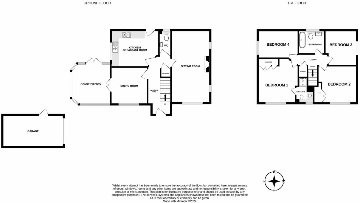
Floorplan 1
EPC Graphs
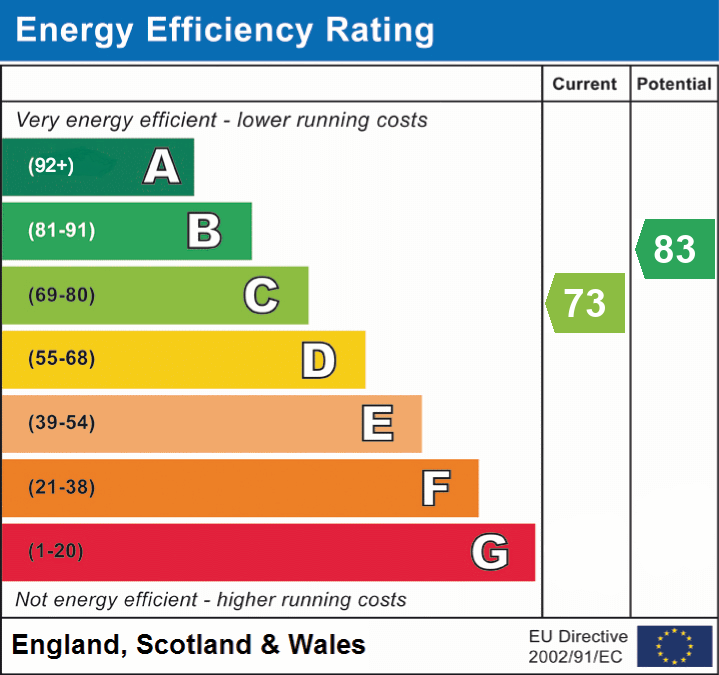
EPC 1
FENSA Certificates
This property has 1 FENSA certificate(s) on record, indicating window/door installations by FENSA-approved installers.
FENSA Certificate #16959137 Recent
Property Details
Street: 40 St. Agnes Way
Town: Kesgrave
Postcode: IP5 1JZ
Installation Details
Items: 2 doors
Certificate Issued: 14/09/2025
Work Completed: 05/09/2025
This certificate data was retrieved from FENSA's database
What is FENSA? FENSA (Fenestration Self-Assessment Scheme) is a government-authorised scheme that monitors building regulation compliance for replacement windows and doors. Certificates indicate that work was completed by FENSA-approved installers.
Price history
1% since 2022
| Event | Date | Price | % change |
|---|---|---|---|
| Sold | 24/03/2025 (1 year ago) | £420,000 | +1.2% |
| Sold | 02/12/2022 (3 years ago) | £415,000 | — |
Source: HM Land Registry Price Paid Data. Crown copyright.
Sold Comparables
Same street and nearby sales within 0.25 miles (last 5 years). Data from Land Registry Price Paid.
| Address | Price | Date | Type |
|---|---|---|---|
| Same street 35 ST AGNES WAY, KESGRAVE, IPSWICH, EAST SUFFOLK, SUFFOLK, IP5 1JZ | £440,000 | 05/12/2023 | Detached |
| 3 THE BACKS, KESGRAVE, IPSWICH, EAST SUFFOLK, SUFFOLK, IP5 1BW | £510,000 | 01/12/2023 | Detached |
| Same street 52 ST AGNES WAY, KESGRAVE, IPSWICH, EAST SUFFOLK, SUFFOLK, IP5 1JZ | £330,000 | 29/11/2023 | Detached |
| Same street 8 ST AGNES WAY, KESGRAVE, IPSWICH, EAST SUFFOLK, SUFFOLK, IP5 1JZ | £328,500 | 24/05/2022 | Semi-detached |
| 85 PENZANCE ROAD, KESGRAVE, IPSWICH, EAST SUFFOLK, SUFFOLK, IP5 1LE | £325,000 | 14/12/2021 | Detached |
| 30 MENDIP DRIVE, RUSHMERE ST ANDREW, IPSWICH, EAST SUFFOLK, SUFFOLK, IP5 1AU | £465,000 | 02/08/2021 | Detached |
| 98 PENZANCE ROAD, KESGRAVE, IPSWICH, EAST SUFFOLK, SUFFOLK, IP5 1LE | £420,000 | 30/06/2021 | Detached |
Street average: £366,167 (3 sales)
Area average: £430,000 (4 sales)
Capital growth trend
Land Registry outcode average: last 12 months vs 5y and 10y ago (from sold prices).
House Price Index (HM Land Registry — official index, not sold-price averages): East Suffolk. Series: Detached. As of February 2026.
Rental Range
Estimated market rent for East Suffolk. Low = conservative, Realistic = average, Optimistic = best case.
Based on Local Authority from postcode lookup → East Suffolk.
LHA (30th percentile) floor for Ipswich: £1,097/mo (Apr 2025 – Mar 2026)
Location
Nearby
Nearest stations, universities and amenities (distance from property).
| Type | Name | Distance |
|---|---|---|
| Bus stop | Brendon Drive | 0.1 miles |
| Shop | Hair Ministry | 0.4 miles |
| Shop | Vince & Co Hair & Beauty | 0.7 miles |
| Hospital | Nuffield Hospital Ipswich | 0.8 miles |
| Hospital | Ipswich Hospital | 1.0 miles |
| Train station | Derby Road | 1.8 miles |
| University | University of Suffolk (DigiTech Centre) | 2.7 miles |
| Train station | Westerfield | 2.8 miles |
Street-level crime
| Category | Count |
|---|---|
| Violence and sexual offences | 18 |
| Other theft | 4 |
| Shoplifting | 3 |
| Anti-social behaviour | 2 |
| Criminal damage and arson | 1 |
| Public order | 1 |
| Total incidents | 29 |
Within 1 mile during Mar 2026. Source: data.police.uk (England & Wales).
Schools nearby
Nearest open schools with Ofsted ratings (England). Closed schools are not shown. Data from Get Information about Schools and Ofsted.
| Name | Type | Distance | Ofsted |
|---|---|---|---|
| Heath Primary School, Kesgrave | Primary | 0.6 miles | Good — 22 Jun 2023 |
| Broke Hall Community Primary School | Primary | 0.8 miles | Good — 24 Jul 2023 |
| Cedarwood Primary School | Primary | 0.9 miles | Good — 6 Sep 2013 |
| St Alban's Catholic High School | Secondary | 1.0 miles | Good — 23 Feb 2020 |
| Kesgrave High School | Secondary | 1.1 miles | Good — 2 Feb 2023 |
Rental Comparables
Residential lets from OpenRent and Rightmove for the area (same bedroom count). Use to validate rent estimates. Student lets are excluded.
| Title | Rent | Beds | Distance | As seen on |
|---|---|---|---|---|
| 4 Bed Terraced House, Spindler Close, IP5 | £1,395/mo | 4 | 1.11 miles | OpenRent |
Average rent: £1,395/mo (1 listing)
Rent-driven metrics
Based on OpenRent comparables.
- Rent ratio — Monthly rent ÷ purchase price (1% rule). 1%+ = strong, 0.8–1% = okay, <0.8% = weak for cashflow.
- Max investor price — Rent ÷ 0.8%; the price at which rent would be 0.8% of price (Stoke-style target).
- Target investor price — Rent ÷ 1%; the price at which rent would be 1% of price (strong cashflow band).
- Gross yield — Annual rent as % of purchase price (no costs).
- Cost-to-rent — Price ÷ annual rent (from OpenRent comparables). Under 14× = strong, 14–16× = acceptable, 17×+ = compressed.
- Cashflow — Rent minus mortgage, 10% maintenance, £25/mo compliance. Assumes 75% LTV, 3.95% APR (5yr fixed), 25yr term.
- ROI — Annual profit ÷ cash in (deposit + 4% purchase costs).