Whitchurch
Shropshire, SY13, SY13 1RL
POA
Property details
Council tax band
TBC
Local average
£536,750 (+179.5%)
Deprivation
Decile 5 (14,062 of 33,755)
Street crime
54 incidents within 1 mile (May 2026)
Additional details
- Parking
- Yes
Description
Listed by
Shrewsbury
Berrys
Reference: 164583929
EPC ratings on this postcode
We don't have a matched EPC for this property yet. Below are efficiency scores and details for other addresses on this postcode.
| Address | Current | Potential | Floor area | Age band | Type |
|---|---|---|---|---|---|
| 1 The Sidings, Station Road | 83 | 94 | 89 m² | — | House |
| 1 The Sidings, Station Road, WHITCHURCH | 83 | 94 | 89 m² | — | Detached |
| 2 The Sidings, Station Road | 83 | 94 | 89 m² | — | House |
| 2 The Sidings, Station Road, WHITCHURCH | 83 | 94 | 89 m² | — | Detached |
| 3 The Sidings, Station Road | 83 | 94 | 89 m² | — | House |
| 3 The Sidings, Station Road, WHITCHURCH | 83 | 94 | 89 m² | — | Detached |
| 4 The Sidings, Station Road | 83 | 94 | 89 m² | — | House |
| 4 The Sidings, Station Road, WHITCHURCH | 83 | 94 | 89 m² | — | Detached |
| 5 The Sidings, Station Road | 82 | 94 | 89 m² | — | House |
| 5 The Sidings, Station Road, WHITCHURCH | 82 | 94 | 89 m² | — | Detached |
| 6 The Sidings, Station Road | 83 | 94 | 89 m² | — | House |
| 6 The Sidings, Station Road | 82 | 94 | 89 m² | — | House |
| 6 The Sidings, Station Road, WHITCHURCH | 82 | 94 | 89 m² | — | Detached |
| 6 The Sidings, Station Road, WHITCHURCH | 83 | 94 | 89 m² | — | Detached |
| Tudorholme, Station Road | 49 | 59 | 108 m² | England and Wales: 1900-1929 | Bungalow |
Flood risk
Zone: 1
Risk: Low
Job (default Low)
Price history
No sales history found for this property in Land Registry Price Paid data.
Sold Comparables
Sold comparables data is not available for this property.
Capital growth trend
Land Registry outcode average: last 12 months vs 5y and 10y ago (from sold prices).
House Price Index (HM Land Registry — official index, not sold-price averages): Shropshire. Series: All dwelling types. As of April 2026.
Rental Range
Estimated market rent for Shropshire. Low = conservative, Realistic = average, Optimistic = best case.
Based on Local Authority from postcode lookup → Shropshire.
LHA (30th percentile) floor for Wigan: Apr 2025 – Mar 2026
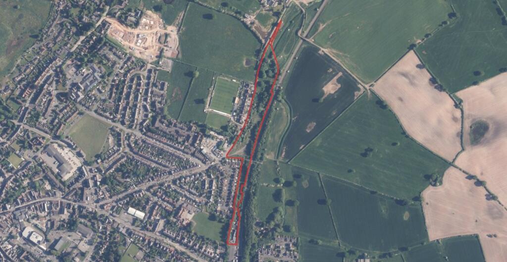
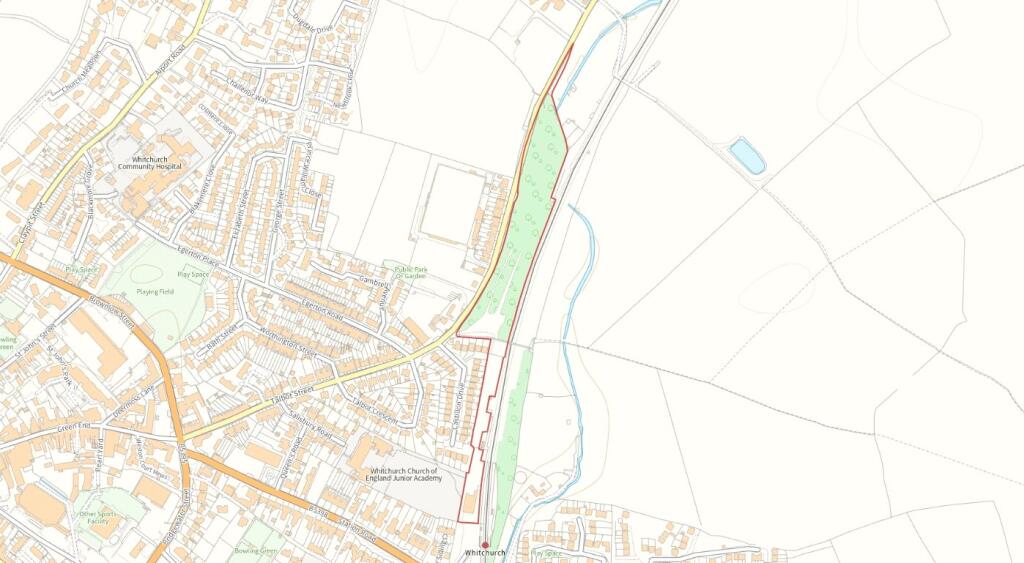
Location
Address
The Sidings
Nearby
Nearest stations, universities and amenities (distance from property).
| Type | Name | Distance |
|---|---|---|
| Bus stop | Railway Station | 0.0 miles |
| Train station | Whitchurch | 0.0 miles |
| Shop | B&M | 0.1 miles |
| Shop | Trevanion Auctioneers & Valuers | 0.1 miles |
| Bus stop | Whitchurch, Brownlow Street / Smithfield Shopping Centre | 0.4 miles |
| Hospital | Whitchurch Community Hospital | 0.4 miles |
| Train station | Prees | 4.8 miles |
| Hospital | Penley Hospital | 8.3 miles |
Street-level crime
| Category | Count |
|---|---|
| Violence and sexual offences | 35 |
| Shoplifting | 5 |
| Criminal damage and arson | 3 |
| Other theft | 3 |
| Public order | 3 |
| Burglary | 2 |
| Other crime | 2 |
| Possession of weapons | 1 |
| Total incidents | 54 |
Within 1 mile during May 2026. Source: data.police.uk (England & Wales).
Schools nearby
Nearest open schools with Ofsted ratings (England). Closed schools are not shown. Data from Get Information about Schools and Ofsted.
| Name | Type | Distance | Ofsted |
|---|---|---|---|
| Whitchurch CofE Junior Academy | Primary | 0.1 miles | Good — 18 Sep 2023 |
| Whitchurch CofE Infant and Nursery Academy | Primary | 0.1 miles | Good — 1 Jul 2013 |
| Physis Academy | Other | 0.5 miles | Good — 18 Jan 2024 |
| Sir John Talbot's School | Secondary | 0.7 miles | Good — 30 Jan 2024 |
| Tilstock CofE Primary and Nursery | Primary | 2.2 miles | Good — 16 Jun 2022 |
Rental Comparables
Loading rental comparables for this postcode. Refresh in a few minutes.
Rent-driven metrics
Based on Area rent estimate.
- Rent ratio — Monthly rent ÷ purchase price (1% rule). 1%+ = strong, 0.8–1% = okay, <0.8% = weak for cashflow.
- Max investor price — Rent ÷ 0.8%; the price at which rent would be 0.8% of price (Stoke-style target).
- Target investor price — Rent ÷ 1%; the price at which rent would be 1% of price (strong cashflow band).
- Gross yield — Annual rent as % of purchase price (no costs).
Enter House Number
Enter the house number to help us retrieve more accurate pricing history and property data.
Please log in to submit or correct the house number for this listing.
Log in to continue