135 ASHFORD STREET
STOKE-ON-TRENT, STOKE-ON-TRENT ST4 2EL
£450 pcm
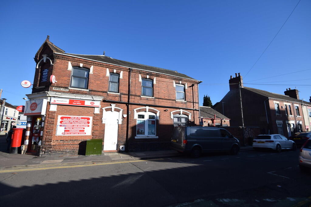
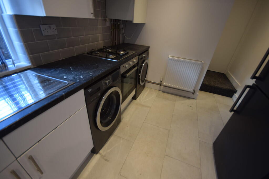
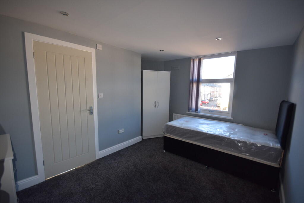
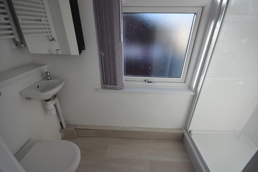
Photo 1 Photo 2 Photo 3 Photo 4
/ 4
Property details
Floor area
107 m²
Council tax band
A
EPC rating
D
Year built
England and Wales: before 1900
Deprivation
Decile 2 (6,234 of 33,755)
Street crime
514 incidents within 1 mile (Apr 2026)
Key features
- Furnished Room
- Bills Included
- En Suite Shower Room
- Shared Kitchen
- Walking Distance from University
- Walking Distance from Hanley
Description
Listed by
Stoke On Trent
The Property Franchise Group
Reference: 90196146
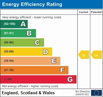
EPC Rating & Upgrade Cost
Current rating: D
Potential rating: B
Inspection date: 25/10/2018
Expiry date: 24/10/2028
Current heating cost: £758/year
Potential heating cost: £501/year
Recommendations
- 50 mm internal or external wall insulation (14,000)
- Floor insulation (suspended floor) (1,200)
- Solar water heating (6,000)
- Solar photovoltaic panels, 2.5 kWp (8,000)
Flood risk
Zone: 1
Risk: Low
Job (default Low)
EPC Graphs
EPC 1
Rental Range
Estimated market rent for Stoke-on-Trent. Low = conservative, Realistic = average, Optimistic = best case.
Based on Local Authority from postcode lookup → Stoke-on-Trent.
LHA (30th percentile) floor for Staffordshire North: £424/mo (Apr 2025 – Mar 2026)
Location
Nearby
Nearest stations, universities and amenities (distance from property).
| Type | Name | Distance |
|---|---|---|
| Shop | Zeen Bakery & Convenience Store | 0.1 miles |
| Shop | Your Local Shop | 0.1 miles |
| Bus stop | Seaford Street | 0.1 miles |
| Bus stop | Film Theatre | 0.1 miles |
| Train station | Stoke-on-Trent | 0.2 miles |
| University | University of Staffordshire Stoke Campus | 0.3 miles |
| Hospital | Royal Stoke University Hospital | 1.5 miles |
| Train station | Longton | 2.2 miles |
| Hospital | North Staffordshire Nuffield Hospital | 2.4 miles |
| University | Buxton & Leek College | 9.3 miles |
Street-level crime
| Category | Count |
|---|---|
| Violence and sexual offences | 143 |
| Anti-social behaviour | 99 |
| Shoplifting | 57 |
| Public order | 50 |
| Criminal damage and arson | 38 |
| Other theft | 31 |
| Vehicle crime | 29 |
| Burglary | 18 |
| Drugs | 18 |
| Other crime | 12 |
| Possession of weapons | 9 |
| Bicycle theft | 6 |
| Robbery | 4 |
| Total incidents | 514 |
Within 1 mile during Apr 2026. Source: data.police.uk (England & Wales).
Schools nearby
Nearest open schools with Ofsted ratings (England). Closed schools are not shown. Data from Get Information about Schools and Ofsted.
| Name | Type | Distance | Ofsted |
|---|---|---|---|
| Excellence Girls Academy | Other | 0.1 miles | Good — 16 Jun 2024 |
| Staffordshire University | Other | 0.1 miles | — (No rating) |
| City of Stoke-On-Trent Sixth Form College | Other | 0.3 miles | — (No rating) |
| Stoke-on-Trent College | Other | 0.3 miles | — (No rating) |
| The Registry | Other | 0.3 miles | — (No rating) |
Rental Comparables
Residential lets from OpenRent and Rightmove for the area (same bedroom count). Use to validate rent estimates. Student lets are excluded.
Average rent: £622/mo (41 listings)