47 WALSALL ROAD
WEST BROMWICH, WEST MIDLANDS B71 3HE
£175,000
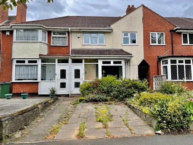
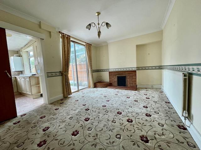
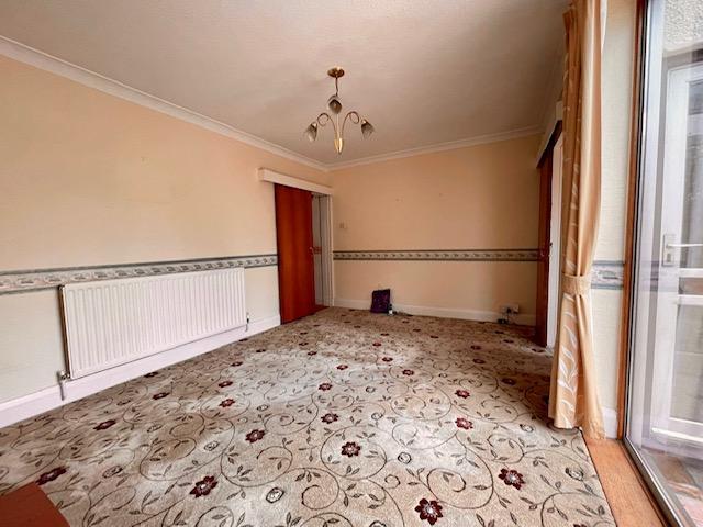
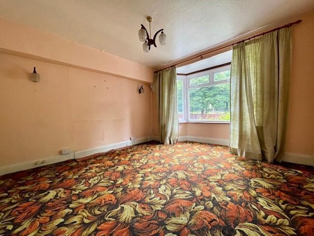
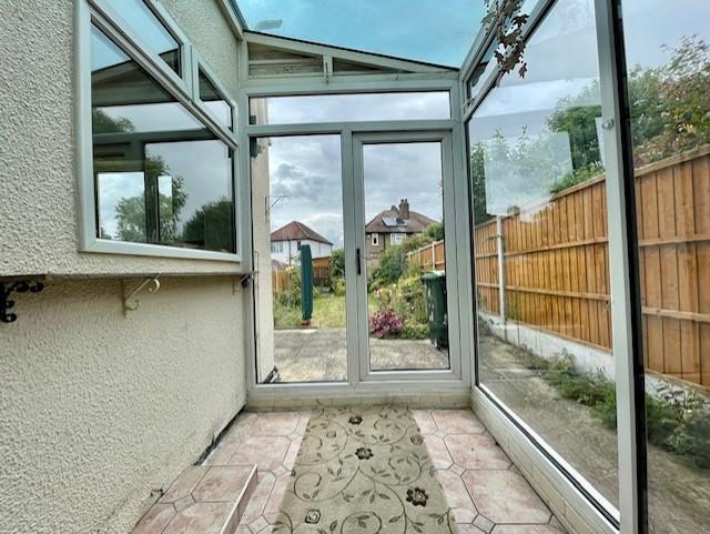
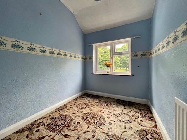
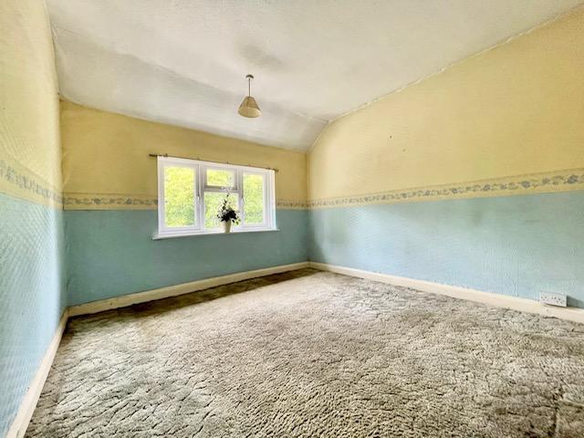

Photo 1 Photo 2 Photo 3 Photo 4 Photo 5 Photo 6 Photo 7 Photo 8 Photo 9 Photo 10
/ 10
Property details
Tenure
FREEHOLD
Floor area
82 m²
Council tax band
TBC
EPC rating
D
Year built
England and Wales: 1930-1949
Last sold
£200,000 Sep 2023
Price per m²
£2,134/m²
Local average
£210,403 (-16.8%)
Deprivation
Decile 5 (14,463 of 33,755)
Street crime
247 incidents within 1 mile (Apr 2026)
Key features
- OFF ROAD PARKING
- LARGE REAR GARDEN
- TWO RECEPTION ROOMS
- IDEAL FOR FIRST TIME BUYERS/INVESTORS
- CLOSE TO LOCAL AMENITIES
- NO UPWARD CHAIN
- EXCELLENT FOR COMMUTER ROUTES
- POPULAR LOCATION
- THREE BEDROOMS
- FREEHOLD
Additional details
- Parking
- Yes
- Garden
- Yes
Description
Listed by
West Bromwich
Bartrams Sales and Lettings
Reference: 124632053
EPC Rating & Upgrade Cost
Current rating: D
Potential rating: B
Inspection date: 06/07/2022
Expiry date: 05/07/2032
Current heating cost: £564/year
Potential heating cost: £394/year
Est. upgrade cost to C: £19,530
Recommendations
- 50 mm internal or external wall insulation (£4,000 - £14,000)
- Floor insulation (suspended floor) (£800 - £1,200)
- Low energy lighting for all fixed outlets (£30)
- Solar water heating (£4,000 - £6,000)
- Solar photovoltaic panels, 2.5 kWp (£3,500 - £5,500)
Flood risk
Zone: 2
Risk: In flood risk area
Environment Agency Flood Risk Areas (APSFR)
Price history
| Event | Date | Price | % change |
|---|---|---|---|
| Sold | 08/09/2023 (2 years ago) | £200,000 | — |
Source: HM Land Registry Price Paid Data. Crown copyright.
Sold Comparables
Same street and nearby sales within 0.25 miles (last 5 years). Data from Land Registry Price Paid.
| Address | Price | Date | Type |
|---|---|---|---|
| 198 ALL SAINTS WAY, WEST BROMWICH, SANDWELL, WEST MIDLANDS, B71 1RR | £365,000 | 18/08/2025 | Terraced |
| 17 THURSFIELD ROAD, WEST BROMWICH, SANDWELL, WEST MIDLANDS, B71 3HZ | £212,000 | 07/02/2025 | Terraced |
| 153 VICARAGE ROAD, WEST BROMWICH, SANDWELL, WEST MIDLANDS, B71 1AE | £207,000 | 28/07/2023 | Terraced |
| 4 THURSFIELD ROAD, WEST BROMWICH, SANDWELL, WEST MIDLANDS, B71 3HY | £212,000 | 28/09/2022 | Terraced |
| 123 VICARAGE ROAD, WEST BROMWICH, SANDWELL, WEST MIDLANDS, B71 1AE | £225,000 | 19/08/2022 | Terraced |
| 113 WALSALL ROAD, WEST BROMWICH, SANDWELL, WEST MIDLANDS, B71 3HH | £190,000 | 08/07/2022 | Terraced |
| 71 ALTON GROVE, WEST BROMWICH, SANDWELL, WEST MIDLANDS, B71 3JJ | £280,000 | 30/05/2022 | Terraced |
| 188 VICARAGE ROAD, WEST BROMWICH, SANDWELL, WEST MIDLANDS, B71 1AF | £80,000 | 13/05/2022 | Terraced |
| 97 WALSALL ROAD, WEST BROMWICH, SANDWELL, WEST MIDLANDS, B71 3HH | £165,000 | 28/04/2022 | Terraced |
| 121 VICARAGE ROAD, WEST BROMWICH, SANDWELL, WEST MIDLANDS, B71 1AE | £215,000 | 07/02/2022 | Terraced |
| 85 HEATH LANE, WEST BROMWICH, SANDWELL, WEST MIDLANDS, B71 2BN | £200,000 | 26/11/2021 | Terraced |
| 182 VICARAGE ROAD, WEST BROMWICH, SANDWELL, WEST MIDLANDS, B71 1AF | £150,000 | 05/11/2021 | Terraced |
| 135 VICARAGE ROAD, WEST BROMWICH, SANDWELL, WEST MIDLANDS, B71 1AE | £187,000 | 15/10/2021 | Terraced |
| 184 VICARAGE ROAD, WEST BROMWICH, SANDWELL, WEST MIDLANDS, B71 1AF | £155,000 | 30/09/2021 | Terraced |
| 43B HEATH LANE, WEST BROMWICH, SANDWELL, WEST MIDLANDS, B71 2BN | £200,000 | 20/09/2021 | Terraced |
| Same street 59 WALSALL ROAD, WEST BROMWICH, SANDWELL, WEST MIDLANDS, B71 3HE | £153,500 | 05/08/2021 | Terraced |
| 1 STANLEY ROAD, WEST BROMWICH, SANDWELL, WEST MIDLANDS, B71 3JH | £172,000 | 12/07/2021 | Terraced |
| 79 HOLLYHEDGE ROAD, WEST BROMWICH, SANDWELL, WEST MIDLANDS, B71 3BS | £292,000 | 12/07/2021 | Terraced |
| 48 NEWTON STREET, WEST BROMWICH, SANDWELL, WEST MIDLANDS, B71 3RQ | £275,000 | 25/06/2021 | Terraced |
Street average: £153,500 (1 sale)
Area average: £210,111 (18 sales)
Capital growth trend
Land Registry outcode average: last 12 months vs 5y and 10y ago (from sold prices).
House Price Index (HM Land Registry — official index, not sold-price averages): Sandwell. Series: Terraced. As of March 2026.
Rental Range
Estimated market rent for Sandwell. Low = conservative, Realistic = average, Optimistic = best case.
Based on Local Authority from postcode lookup → Sandwell.
LHA (30th percentile) floor for Black Country: £748/mo (Apr 2025 – Mar 2026)
Location
Nearby
Nearest stations, universities and amenities (distance from property).
| Type | Name | Distance |
|---|---|---|
| Bus stop | Walsall Rd / Heath Lane | 0.0 miles |
| Bus stop | Walsall Rd / Lyndhurst Rd | 0.1 miles |
| Hospital | Heath Lane Hospital | 0.2 miles |
| Shop | Pennyhill | 0.3 miles |
| Shop | Your Co-op Food | 0.3 miles |
| Hospital | Hallam Street Hospital | 0.7 miles |
| Train station | Tame Bridge Parkway | 1.1 miles |
| Train station | Bescot Stadium | 1.8 miles |
| University | University of Wolverhampton, Walsall Campus | 2.5 miles |
| University | Hamcam Student Living Hamstead Campus | 2.6 miles |
Street-level crime
| Category | Count |
|---|---|
| Violence and sexual offences | 133 |
| Criminal damage and arson | 27 |
| Vehicle crime | 18 |
| Other theft | 17 |
| Other crime | 10 |
| Public order | 10 |
| Burglary | 7 |
| Drugs | 6 |
| Possession of weapons | 6 |
| Anti-social behaviour | 4 |
| Robbery | 4 |
| Theft from the person | 3 |
| Bicycle theft | 1 |
| Shoplifting | 1 |
| Total incidents | 247 |
Within 1 mile during Apr 2026. Source: data.police.uk (England & Wales).
Schools nearby
Nearest open schools with Ofsted ratings (England). Closed schools are not shown. Data from Get Information about Schools and Ofsted.
| Name | Type | Distance | Ofsted |
|---|---|---|---|
| St Mary Magdalene CofE Voluntary Controlled Primary School | Primary | 0.3 miles | — (Inspected (no overall grade)) |
| Pennyhill Primary School | Primary | 0.4 miles | Good — 11 May 2022 |
| The Phoenix Collegiate | Secondary | 0.4 miles | Good — 30 Mar 2023 |
| Sandwell Community School | Other | 0.4 miles | Good — 1 Jul 2014 |
| All Saints CofE Primary School | Primary | 0.5 miles | Good — 30 Jun 2024 |
Rental Comparables
Residential lets from OpenRent and Rightmove for the area (same bedroom count). Use to validate rent estimates. Student lets are excluded.
| Title | Rent | Beds | Distance | As seen on |
|---|---|---|---|---|
| 3 Bed Semi-Detached House, Hollyhedge Road, B71 | £1,150/mo | 3 | 0.27 miles | OpenRent |
| 3 Bed Semi-Detached House, Jubilee St, B71 | £1,150/mo | 3 | 0.28 miles | OpenRent |
| 3 Bed Detached House, Marsh Lane, B71 | £1,100/mo | 3 | 0.31 miles | OpenRent |
| 3 Bed Terraced House, Vicarage Road, B71 | £1,100/mo | 3 | 0.34 miles | OpenRent |
| 3 Bed Flat, Parsonage Street, B71 | £1,300/mo | 3 | 0.43 miles | OpenRent |
| 3 Bed Semi-Detached House, Farm End Close, B71 | £1,350/mo | 3 | 0.74 miles | OpenRent |
Average rent: £1,192/mo (6 listings)
Rent-driven metrics
Based on OpenRent comparables.
- Rent ratio — Monthly rent ÷ purchase price (1% rule). 1%+ = strong, 0.8–1% = okay, <0.8% = weak for cashflow.
- Max investor price — Rent ÷ 0.8%; the price at which rent would be 0.8% of price (Stoke-style target).
- Target investor price — Rent ÷ 1%; the price at which rent would be 1% of price (strong cashflow band).
- Gross yield — Annual rent as % of purchase price (no costs).
- Cost-to-rent — Price ÷ annual rent (from OpenRent comparables). Under 14× = strong, 14–16× = acceptable, 17×+ = compressed.
- Cashflow — Rent minus mortgage, 10% maintenance, £25/mo compliance. Assumes 75% LTV, 3.95% APR (5yr fixed), 25yr term.
- ROI — Annual profit ÷ cash in (deposit + 4% purchase costs).