FLAT 7
LITTLE FORREST MANSION, BATH ROAD, BOURNEMOUTH, BOURNEMOUTH, CHRISTCHURCH AND POOLE BH1 2ES
£433 pcm
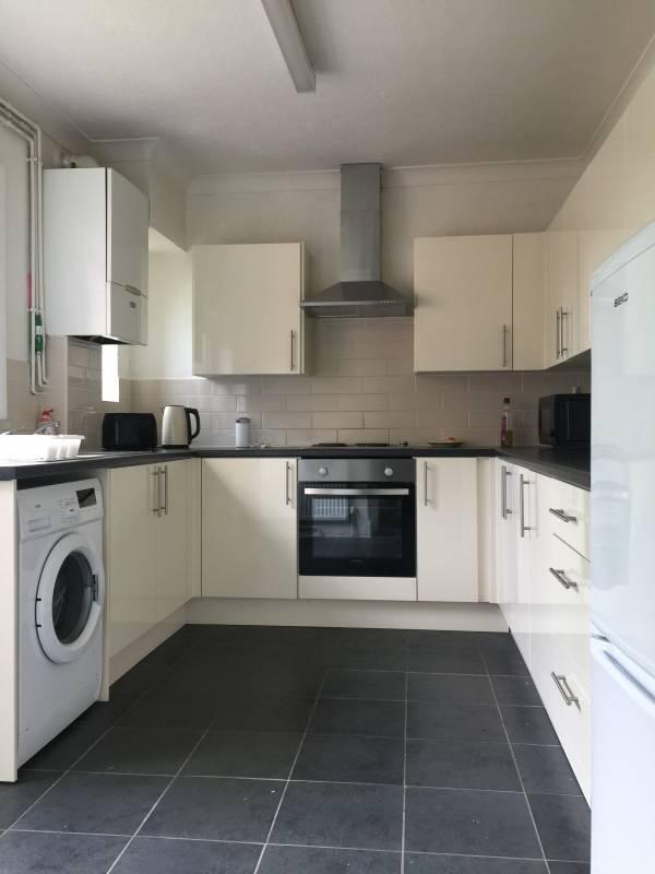
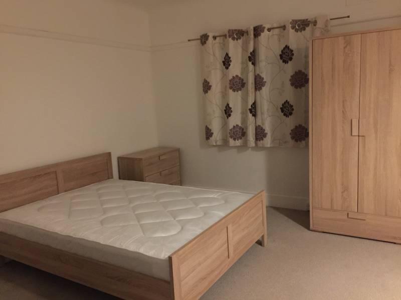
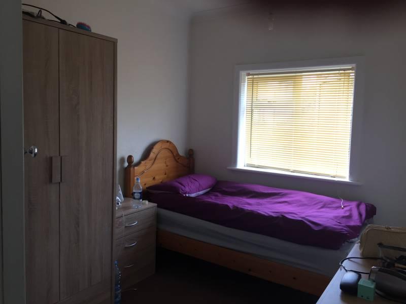
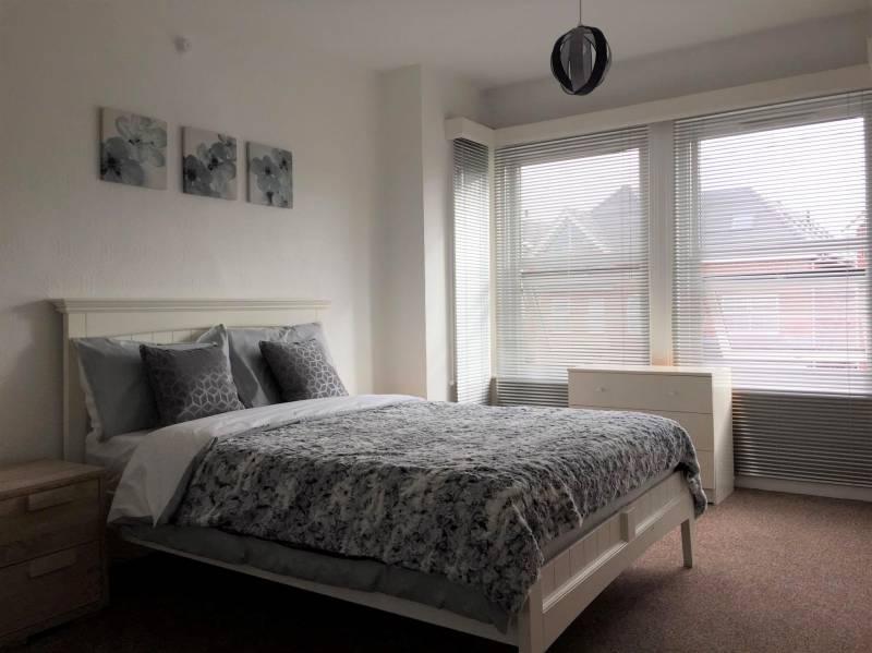
Photo 1 Photo 2 Photo 3 Photo 4
/ 4
Property details
Floor area
93 m²
Street crime
589 incidents within 1 mile (Apr 2026)
Key features
- Central Heating
- Close to the beach
- Close to the townce centre and shopping
Description
It is very close to train station, Town centre, shopping centre, bus station and beach.
Rent includes bills and broadband internet
Minimum term is 6 months.
Listed by
Bournemouth
Quinn & Co
Reference: 75174563
EPC Rating & Upgrade Cost
Fetching EPC data… Refresh this page in a moment.
Flood risk
Zone: 1
Risk: Low
Job (default Low)
Rental Range
Estimated market rent for Bournemouth, Christchurch and Poole. Low = conservative, Realistic = average, Optimistic = best case.
Based on Local Authority from postcode lookup → Bournemouth, Christchurch and Poole.
LHA (30th percentile) floor for Salisbury: £1,247/mo (Apr 2025 – Mar 2026)
Location
Address
19 Bath Road
Nearby
Nearest stations, universities and amenities (distance from property).
| Type | Name | Distance |
|---|---|---|
| Bus stop | Top of Bath Hill | 0.0 miles |
| Shop | Asda Express | 0.1 miles |
| Shop | Westover Beauty | 0.1 miles |
| University | Bournemouth University (Lansdowne Campus) | 0.4 miles |
| Train station | Bournemouth | 0.6 miles |
| Hospital | Nuffield Health Bournemouth Hospital | 0.7 miles |
| Hospital | Dorset HealthCare | 1.4 miles |
| Train station | Pokesdown | 2.1 miles |
Street-level crime
| Category | Count |
|---|---|
| Anti-social behaviour | 198 |
| Violence and sexual offences | 171 |
| Other theft | 38 |
| Shoplifting | 34 |
| Criminal damage and arson | 32 |
| Public order | 28 |
| Drugs | 26 |
| Vehicle crime | 22 |
| Burglary | 13 |
| Robbery | 10 |
| Possession of weapons | 6 |
| Bicycle theft | 5 |
| Other crime | 3 |
| Theft from the person | 3 |
| Total incidents | 589 |
Within 1 mile during Apr 2026. Source: data.police.uk (England & Wales).
Schools nearby
Nearest open schools with Ofsted ratings (England). Closed schools are not shown. Data from Get Information about Schools and Ofsted.
| Name | Type | Distance | Ofsted |
|---|---|---|---|
| Livingstone Academy Bournemouth | Other | 0.3 miles | Good — 20 May 2024 |
| Kings Bournemouth | Other | 0.6 miles | Good — 6 Mar 2023 |
| St Michael's Church of England Primary School | Primary | 0.8 miles | — (Inspected (no overall grade)) |
| Malmesbury Park Primary School | Primary | 0.9 miles | Good — 11 May 2022 |
| Bethany Church of England Junior School | Primary | 1.1 miles | Good — 18 May 2022 |
Rental Comparables
Loading rental comparables for this postcode. Refresh in a few minutes.